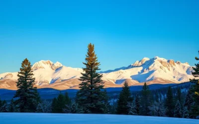
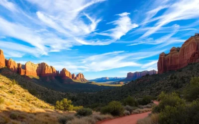
Nestled in northern Arizona, near the Utah border, lies a hidden gem that’s waiting to be explored. The Vermilion Cliffs National Monument is a 294,000-acre protected area that boasts some of the most striking geological formations in the United States.
This national monument is a nature lover’s paradise, featuring towering red cliffs, winding slot canyons, and striped sandstone spires that will leave you in awe. As you explore this incredible destination, you’ll have the opportunity to experience the beauty and landscapes that make Vermilion Cliffs a must-visit area for hiking and photography enthusiasts alike.
Whether you’re looking for an unforgettable experience or simply want to connect with nature, Vermilion Cliffs National Monument is a place where you can escape the ordinary and discover the extraordinary.
Discovering the Hidden Gem of Northern Arizona
Tucked away in northern Arizona, Vermilion Cliffs National Monument is a treasure waiting to be discovered. This stunning monument is a part of the Colorado Plateau and boasts a diverse landscape of towering red cliffs and striped sandstone spires. The unique geological formations were created over 180 million years through erosion and changes in the plateau.

You will be amazed by the natural beauty of this hidden gem, which is situated between Kanab, Utah, and Page, Arizona. The monument spans over 112,500 acres, offering a serene and unspoiled environment that is perfect for exploration.
Location and Overview of Vermilion Cliffs National Monument
Vermilion Cliffs National Monument is located in the far northern reaches of Arizona, straddling the border with Utah. The monument is part of the larger Colorado Plateau and features a diverse landscape of towering vermilion-colored cliffs that rise dramatically from the desert floor.
| Feature | Description |
|---|---|
| Location | Northern Arizona, USA |
| Size | 112,500 acres |
| Geological Features | Towering red cliffs, striped sandstone spires |
| Management | Bureau of Land Management (BLM) |
The monument was established in 2000 to protect its exceptional geological, paleontological, archaeological, and biological resources. Unlike more crowded national parks in the area, Vermilion Cliffs offers visitors a chance to experience the raw beauty of the American Southwest without the crowds.
Geological Wonders of Vermilion Cliffs
As you step into Vermilion Cliffs National Monument, you’re immediately struck by the sheer scale and beauty of its geological wonders. The monument is a testament to the incredible forces that have shaped our planet over millions of years.
Towering Red Cliffs and Striped Sandstone Spires
The towering red cliffs and striped sandstone spires are a sight to behold, standing out dramatically against the desert landscape. These formations were created from Navajo Sandstone deposited during the Jurassic period, approximately 180-190 million years ago. The sandstone has been sculpted into spectacular formations, including towering spires and balanced rocks.

Winding Slot Canyons and The Wave Rock Formation
The monument is also home to numerous slot canyons, narrow passages carved through the sandstone by flash floods. One of the most famous geological features is The Wave, a sandstone formation with undulating lines and spectacular color variations that was shaped by water and wind over 15 million years. Buckskin Gulch, considered the longest and deepest slot canyon in the United States, is another notable feature.
| Geological Feature | Description | Formation Period |
|---|---|---|
| Towering Red Cliffs | Created from Navajo Sandstone | Jurassic period, 180-190 million years ago |
| The Wave | Sandstone formation with undulating lines | Shaped over 15 million years |
| Buckskin Gulch | Longest and deepest slot canyon in the US | Carved by flash floods |
Exploring The Wave at Coyote Buttes North

As you venture into Coyote Buttes North, the breathtaking sight of The Wave awaits, a true marvel within Vermilion Cliffs National Monument.
What Makes The Wave So Special
The Wave is renowned for its mesmerizing sandstone formations, featuring swirling patterns of red, yellow, pink, and white that create a wave-like appearance. Only 64 people per day are allowed to visit this fragile ecosystem, making it one of the most sought-after hiking permits in America.
Permit Process and Planning Your Visit
To visit The Wave, you’ll need to enter a permit lottery either four months in advance online or apply for the next-day lottery in person at the Kanab Visitor Center. The application fee is $9, and the permit costs $7 per person or dog.
Hiking to The Wave – What to Expect
The hike to The Wave is approximately 6.4-6.7 miles round trip with 400 feet of elevation gain across unmarked desert terrain. It requires good navigation skills and physical preparation. The best times to visit are during spring (March-May) and fall (September-November) when temperatures are moderate.
Once you reach The Wave, you’ll be rewarded with one of the most photographed landscapes in the American Southwest, where the sandstone has been eroded into smooth, undulating forms that appear like ocean waves frozen in stone.
White Pocket: A Photographer’s Paradise

Tucked away in the vast expanse of Vermilion Cliffs National Monument is White Pocket, a photographer’s dream destination. This secluded spot is renowned for its breathtaking rock formations and sandstone landscapes that rival those of The Wave.
A Secluded Rock Formation Without Permits
White Pocket is often described as the “best-kept secret” of Vermilion Cliffs National Monument. It offers equally stunning sandstone formations as The Wave but without the competitive permit system. This geological wonderland features bizarre white and cream-colored rock formations with swirling patterns, creating a surreal landscape.
Getting to White Pocket – Transportation Options
Unlike The Wave, accessing White Pocket requires a high-clearance 4WD vehicle due to the remote sandy road. Visitors can opt for guided tours, which typically cost between $150-250 per person, eliminating navigation stress and providing expert knowledge on the area’s geology and best photography spots.
Photographers love White Pocket for its otherworldly formations that change throughout the day as light and shadows play across the surfaces. Sunrise and sunset offer the most dramatic lighting conditions, making it a paradise for capturing stunning images.
Paria Canyon-Vermilion Cliffs Wilderness Adventure
Embark on an unforgettable adventure through the Paria Canyon-Vermilion Cliffs Wilderness, a hidden gem within the Vermilion Cliffs National Monument. This wilderness area is renowned for its stunning slot canyons, offering hikers an incredible journey through narrow passages and towering walls in Buckskin Gulch and Paria Canyon.
Explore Buckskin Gulch and Paria Canyon Slot Canyons
The Paria Canyon-Vermilion Cliffs Wilderness encompasses 112,500 acres of spectacular slot canyon country. Buckskin Gulch, a crown jewel, is the longest and deepest slot canyon in the country, with walls soaring up to 500 feet high. Hiking through these narrow passages is an otherworldly experience, navigating between towering walls of striated sandstone that filter sunlight into dramatic beams and shadows.

Backpacking and Camping in the Wilderness
For serious adventurers, the complete Paria Canyon backpacking trip covers 38 miles with 1,130 feet of elevation drop, typically completed over 4 days and 3 nights. To preserve the environment, access is limited, with only 20 overnight permits issued per day at a cost of $5 per person per day. Camping regulations require staying at least 200 feet from water sources and prohibit campfires.
| Trip Details | Information |
|---|---|
| Distance | 38 miles |
| Elevation Drop | 1,130 feet |
| Duration | 4 days, 3 nights |
| Permit Cost | $5 per person per day |
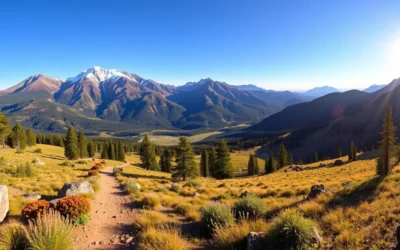
Top Hiking Trails in Vermilion Cliffs National Monument
For those who love the outdoors, Vermilion Cliffs National Monument provides some of the most diverse hiking trails in the American Southwest. You’ll find everything from easy walks to challenging backcountry adventures that showcase the monument’s unique natural beauty.

Wire Pass Trail to Buckskin Gulch
The Wire Pass Trail to Buckskin Gulch is a favorite among hikers, offering a relatively short 3.4-mile round trip hike that provides quick access to one of the most impressive slot canyons in the world. This trail is ideal for those who want to experience the beauty of Vermilion Cliffs National Monument without committing to a multi-day trek.
Cathedral Wash Trail
The Cathedral Wash Trail presents a moderately challenging 3-mile round trip adventure through a rocky canyon with high sandstone walls. Hikers may encounter occasional scrambling and potential water crossings after rainfall, making it a thrilling experience for those who enjoy exploring rugged terrain.
Spencer Trail for Panoramic Views
For those seeking panoramic vistas, the Spencer Trail delivers with its challenging 2.2-mile round trip climb that gains over 1,600 feet of elevation. The breathtaking views of the Colorado River, Marble Canyon, and the expansive Vermilion Cliffs make this hike a rewarding experience for adventurous hikers.
| Trail Name | Distance | Difficulty | Notable Features |
|---|---|---|---|
| Wire Pass Trail to Buckskin Gulch | 3.4 miles round trip | Moderate | Slot canyon, unique rock formations |
| Cathedral Wash Trail | 3 miles round trip | Moderately challenging | Rocky canyon, sandstone walls, potential water crossings |
| Spencer Trail | 2.2 miles round trip | Challenging | Panoramic views of Colorado River and Marble Canyon |
Scenic Drives Through Vermilion Cliffs National Monument, Arizona: Best Things to Do – Top Picks
Experience the breathtaking beauty of Vermilion Cliffs National Monument through its scenic drives. These drives offer a leisurely way to explore the monument’s unique landscape and hidden gems.

Honeymoon Trail Scenic Drive
The Honeymoon Trail Scenic Drive is a 20-mile route that follows a historic path used by Mormon couples in the late 19th century. This drive takes you through Coyote Buttes North, offering stunning views of the monument’s signature red cliffs and striped sandstone spires.
House Rock Valley Road
House Rock Valley Road is an unpaved route that provides access to many of the monument’s major attractions, including The Wave, Buckskin Gulch, and White Pocket trailheads. While it can be challenging, the scenic views and unique geological features make it a worthwhile drive.
When planning your scenic drive, be sure to check road conditions, as many roads within the monument can become impassable during wet weather.
Wildlife Viewing Opportunities
As you explore the Vermilion Cliffs National Monument, you’ll discover a rich tapestry of wildlife, from majestic birds to agile desert dwellers. The monument is a critical habitat for a diverse range of species, making it an ideal location for wildlife viewing.
The area is home to over 20 species of raptors, including the California condor, and rare plants like Welsh’s milkweed, showcasing the beauty and importance of the Colorado Plateau.
California Condor Reintroduction Program
The Vermilion Cliffs National Monument has played a crucial role in the California Condor Recovery Program since 1996. This program has given wildlife enthusiasts the rare opportunity to spot North America’s largest land bird with its impressive 9.5-foot wingspan. The best place to observe these majestic birds is at the Navajo Bridge near Lees Ferry.
- The condors can often be seen perched on the bridge’s understructure or soaring on thermal updrafts along the cliffs.
- This reintroduction program has been instrumental in the conservation of the California condor.
Desert Bighorn Sheep and Other Native Species
In addition to the California condor, the monument is home to numerous other wildlife species. Desert bighorn sheep can be spotted navigating the steep cliff faces and canyons, particularly during the early morning or late afternoon. Other native species include pronghorn antelope, mule deer, coyotes, and kit foxes.
- Birdwatchers will appreciate the diversity of avian species, with over 20 types of raptors, including golden eagles and peregrine falcons.
- The best times for wildlife viewing are during the cooler hours of early morning and late afternoon.
Best Photography Spots and Tips
If you’re a photography enthusiast, Vermilion Cliffs National Monument is a must-visit destination, with its stunning vistas and diverse geological features. The monument offers a wide range of photography opportunities, from capturing vast panoramas to intimate details of the unique rock formations.
Capturing the Colorful Landscapes
The Vermilion Cliffs National Monument is renowned for its vibrant and dynamic landscapes. The Wave in Coyote Buttes North is a highly sought-after photography location, with its undulating sandstone formations illuminated by midday light. You can also capture dramatic shadows during morning and late afternoon, emphasizing the wave-like forms. Additionally, White Pocket offers equally impressive photography opportunities without the need for permits, featuring unique white and cream-colored formations that are particularly stunning during the golden hour.
- Vermilion Cliffs National Monument offers dramatic and colorful landscapes.
- The Wave in Coyote Buttes North is a coveted photography location.
- White Pocket features unique formations without permit restrictions.
Recommended Equipment and Timing
To make the most of your photography experience, it’s essential to have the right equipment. A sturdy tripod is necessary for low-light conditions, while a wide-angle lens is ideal for capturing vast landscapes. A polarizing filter can enhance the vibrant rock colors, and a neutral density filter is useful for long exposures of water features. Plan to stay multiple days to capture the changing light and different photographic opportunities from sunrise to sunset.

Permits and Planning Your Visit
The Vermilion Cliffs National Monument permit process can be complex, but it’s crucial for preserving the area. To ensure a successful visit, it’s essential to understand the different permit systems and plan accordingly.
Understanding the Different Permit Systems
Vermilion Cliffs National Monument has various permit systems in place for different areas. For instance, to visit The Wave in Coyote Buttes North, you’ll need to enter a permit lottery either online four months in advance or in person at the Kanab Visitor Center the day before your visit. The permit system opens at 12 pm Mountain Time, three months before the hike month, and the application fee is $9, with a permit cost of $7 per person.
Coyote Buttes South also requires permits, although it’s less competitive than The Wave. For overnight backpacking in Paria Canyon, permits are limited to 20 people per day and can be reserved up to three months in advance at a cost of $5 per person per day through the BLM website.
Reservation Tips and Alternative Options
To increase your chances of securing a permit, be flexible with your dates and consider visiting during weekdays or off-season months (November-February). If you’re unable to secure permits for the most restricted areas, consider alternatives like White Pocket, which offers stunning scenery without requiring permits, or the Wire Pass to Buckskin Gulch day hike, which only requires a $6 day-use fee.
Having backup plans is crucial in case you don’t win the permit lottery. Researching alternative trails and being prepared to adjust your itinerary will help ensure a successful and enjoyable trip to Vermilion Cliffs National Monument.

Best Time to Visit Vermilion Cliffs
The best time to visit Vermilion Cliffs National Monument depends on your preferences and what you want to experience. The monument is open year-round, but the conditions vary significantly with the seasons.
Seasonal Considerations and Weather Patterns
Spring (March-May) and fall (September-November) are considered the best times to visit. During these periods, the weather is pleasant, with mild temperatures and fewer crowds. Spring brings blooming wildflowers and lush vegetation, adding vibrant colors to the landscape. Fall offers comfortable temperatures and beautiful autumn colors, making it ideal for hiking and exploration.
Avoiding Crowds and Extreme Temperatures
To avoid crowds, consider visiting on weekdays instead of weekends. If you must visit during peak season, arrive at trailheads early in the morning or plan to explore less-visited areas. Summer months can be extremely hot, with temperatures often exceeding 100°F, while winters can be cold, especially at higher elevations. Here’s a summary of what to expect:
- Spring: Mild temperatures (60-80°F), occasional wildflower blooms, and generally stable weather.
- Fall: Comfortable temperatures, stable weather, and beautiful autumn colors.
- Summer: Extreme heat (often over 100°F), requiring early morning or evening activities.
- Winter: Cold temperatures, potential snowfall, and some road closures, but also unique landscapes and solitude.
Where to Stay Near Vermilion Cliffs

Vermilion Cliffs National Monument doesn’t have accommodations within its boundaries, but nearby towns offer great options. You can stay in Kanab, Utah, or Page, Arizona, which provide a range of lodging choices.
Lodging Options in Kanab, Page, and Marble Canyon
Kanab, located about 40 miles northeast of the monument, is a charming town with numerous hotels, motels, and vacation rentals. Page, Arizona, situated about 50 miles north, offers a wide range of accommodations from budget motels to upscale hotels. For a more intimate experience, consider Marble Canyon Lodge or Cliff Dwellers Lodge, located near the eastern edge of the monument.
Camping and Glamping Experiences
Camping enthusiasts can find developed campgrounds near the monument, such as Stateline Campground and Lees Ferry Campground. For a luxury outdoor experience, Under Canvas Lake Powell-Grand Staircase offers glamping accommodations less than an hour from the monument, with safari-style tents featuring real beds and private bathrooms.
Guided Tours and Experiences

Enhance your adventure at Vermilion Cliffs National Monument with a guided tour. Expert guides provide valuable insights into the monument’s unique geology, history, and wildlife, ensuring a memorable experience.
Joining a guided tour can significantly enhance your visit by providing expert knowledge, handling logistics, and accessing remote areas safely.
Photography Tours and Workshops
For photography enthusiasts, Vermilion Cliffs offers specialized tours and workshops. Professional photographers lead small groups to optimal shooting locations, offering technical advice and sharing insider knowledge on capturing the monument’s unique landscapes.
Off-Road Adventures to Remote Locations
Experience the thrill of off-road adventures to remote locations like White Pocket. These guided tours provide access to areas that require high-clearance 4WD vehicles and expert navigation, ensuring a safe and exhilarating experience.
Nearby Attractions Worth Visiting
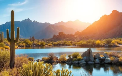
Beyond the breathtaking landscapes of Vermilion Cliffs National Monument, the region offers a plethora of nearby attractions that enhance your Arizona adventure. The area is rich in natural wonders, each with its unique charm and characteristics.
Grand Staircase-Escalante National Monument
Grand Staircase-Escalante National Monument borders Vermilion Cliffs to the north and east, offering similar stunning landscapes with fewer visitors. Unique features include the Escalante River canyons, Calf Creek Falls, and the surreal landscapes of Devil’s Garden. For a luxurious experience, consider staying at Under Canvas Lake Powell – Grand Staircase, a safari-inspired glamping resort located less than an hour from the monument.
| Attraction | Distance from Vermilion Cliffs | Key Features |
|---|---|---|
| Grand Staircase-Escalante National Monument | Borders Vermilion Cliffs | Escalante River canyons, Calf Creek Falls, Devil’s Garden |
| Lake Powell | 30 minutes east | Boating, swimming, azure waters against red rock canyons |
| Antelope Canyon | Near Page, Arizona | Slot canyon, light beams, magical effects |
Lake Powell and Antelope Canyon
Lake Powell, just 30 minutes east of the monument, provides a striking contrast to the desert landscapes with its azure waters set against red rock canyons. It’s perfect for boating, swimming, and other water-based activities. Antelope Canyon near Page is one of the most photographed slot canyons in the world, where light beams create magical effects as they penetrate the narrow, twisting passages.
Essential Tips for a Successful Visit
Preparation is crucial for a safe and enjoyable experience at Vermilion Cliffs National Monument. To make the most of your visit, it’s essential to be aware of the monument’s unique challenges and take necessary precautions.
What to Pack and Prepare
When hiking in Vermilion Cliffs National Monument, it’s vital to come prepared. You should pack at least one gallon of water per person per day, navigation tools, sun protection, and appropriate footwear. Consider bringing extra water, a detailed paper map, a compass, and a GPS device with extra batteries. Wear sturdy hiking boots with good ankle support and traction for the sandy, rocky terrain.
| Item | Description |
|---|---|
| Water | At least 1 gallon per person per day |
| Navigation Tools | Map, compass, GPS device |
| Sun Protection | Sunscreen (SPF50+), hat, sunglasses |
| Footwear | Sturdy hiking boots |
Safety Considerations in the Desert Environment
Be aware of the desert environment’s potential hazards, including extreme temperatures and flash floods. Check the weather forecast before heading out and avoid entering slot canyons if rain is forecasted. Plan your outdoor activities early in the day or later in the evening to avoid peak heat. Let someone know your detailed plans, including your expected return time and the trails you intend to hike.
Conclusion
As you conclude your journey through Vermilion Cliffs National Monument, the breathtaking landscapes leave a lasting impression. This natural wonder in northern Arizona offers a diverse range of experiences, from hiking through the Paria Canyon-Vermilion Cliffs Wilderness to exploring the famous Wave rock formation.
The monument’s unique geological features, including towering red rock cliffs and winding slot canyons, make it a photographer’s paradise. With its rich nature and diverse trails, Vermilion Cliffs National Monument is suitable for various interests and abilities.
As you plan your visit, remember that flexibility and preparation are key to a successful trip. The monument’s remote location and permit requirements help preserve its pristine condition, providing a sense of discovery that’s increasingly rare in today’s heavily trafficked national parks. Whether you’re hiking through Buckskin Gulch or watching the sunset paint the cliffs with golden light, your experience at Vermilion Cliffs National Monument will be unforgettable.
This hidden gem is an excellent addition to a broader Southwest road trip itinerary, complementing other natural attractions like Grand Staircase-Escalante and the Grand Canyon. By respecting this fragile desert environment, you’ll help preserve these incredible landscapes for future generations.
—
The above is subject to change.
Check back often to TRAVEL.COM for the latest travel tips and deals.