✓ Accommodations ✓ Flights ✓ Rental Cars ✓ Tours & Activities
Navigating Los Angeles can be a daunting task, given its sprawling landscape and complex transportation network. However, the city’s multimodal transportation infrastructure makes it a regional, national, and international hub for passenger and freight traffic.
You’ll find that LA offers more than just car dependency; it has an extensive rail system, buses, and alternative transport methods to help you get around the city and its surrounding area efficiently.
Understanding your options is key to a smooth experience in this vast metropolitan area. This guide will walk you through the various mobility options available, ensuring you’re well-equipped to navigate Los Angeles like a pro.
Understanding LA’s Transportation Landscape
Navigating Los Angeles requires understanding its multifaceted transportation network. The city’s sprawl and diverse population have led to the development of a complex transportation system that caters to various needs.
The Myth vs. Reality of Car Dependency
Los Angeles is often associated with car dependency, but the reality is more nuanced. While cars remain a dominant mode of transport, the city offers a range of alternatives. The perception that LA is entirely car-dependent overlooks the significant investments in public transit and other mobility options.
In fact, the Los Angeles County Metropolitan Transportation Authority (Metro) operates an extensive network that includes rail and bus services, providing residents and visitors with viable alternatives to driving.
Overview of Available Transportation Options
Los Angeles offers a diverse range of transportation options beyond private vehicles. The Metro Rail system is a key component, with multiple lines connecting various parts of the county. Additionally, comprehensive bus networks cover neighborhoods throughout LA.
| Transport Mode | Description | Operator |
|---|---|---|
| Metro Rail | Extensive rail network | Metro |
| Bus Services | Comprehensive bus networks | Metro, LADOT |
| Rideshare | On-demand transport | Uber, Lyft |
| Micromobility | Bike shares and electric scooters | Various providers |

The Los Angeles Department of Transportation (LADOT) operates DASH buses, providing convenient local service within specific neighborhoods. Rideshare companies like Uber and Lyft offer on-demand transportation, supplementing the public transit network. Furthermore, micromobility options, including bike shares and electric scooters, provide flexible transportation for short trips in many Los Angeles neighborhoods.
Metro Rail System: LA’s Expanding Subway and Light Rail
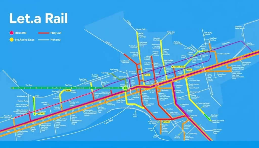
As you explore Los Angeles, you’ll find that its Metro Rail System offers a convenient and efficient way to get around. The system includes several lines that connect various parts of the city, making it easier for you to reach your destination without relying on a car.
A Line: From Azusa to Long Beach
The A Line is a significant part of LA’s Metro Rail System, stretching from Azusa to Long Beach. It provides a vital connection between the San Gabriel Valley and the South Bay, passing through several key destinations.
B Line: North Hollywood to Downtown
The B Line runs from North Hollywood to Downtown LA, serving as a crucial link between the San Fernando Valley and the city’s central business district. This line is particularly useful for commuters traveling to and from work.
C Line: Redondo Beach to Norwalk
The C Line connects Redondo Beach to Norwalk, offering a light rail service that covers several important areas in LA County. It’s an essential route for those traveling to the beach or to major employment centers.
D Line: Wilshire/Western to Downtown
The D Line operates from Wilshire/Western to Downtown LA, enhancing the connectivity within the city. This line is vital for accessing major cultural and educational institutions.
E Line: Santa Monica to East LA
The E Line, formerly known as the Expo Line, spans 22 miles from Santa Monica to East Los Angeles, providing a direct light rail connection between the beach and Downtown LA. Key destinations along this line include USC, Exposition Park, Culver City, and the Santa Monica Pier. The E Line runs through diverse neighborhoods, offering access to major employment centers, educational institutions, and cultural attractions. Trains typically run every 12 minutes during peak hours, making the E Line a reliable alternative to driving on the congested I-10 freeway.
With its comprehensive network, LA’s Metro Rail System is an indispensable part of Los Angeles‘ transportation infrastructure. It continues to expand, offering more convenient travel options for residents and visitors alike.
Bus Services in Los Angeles
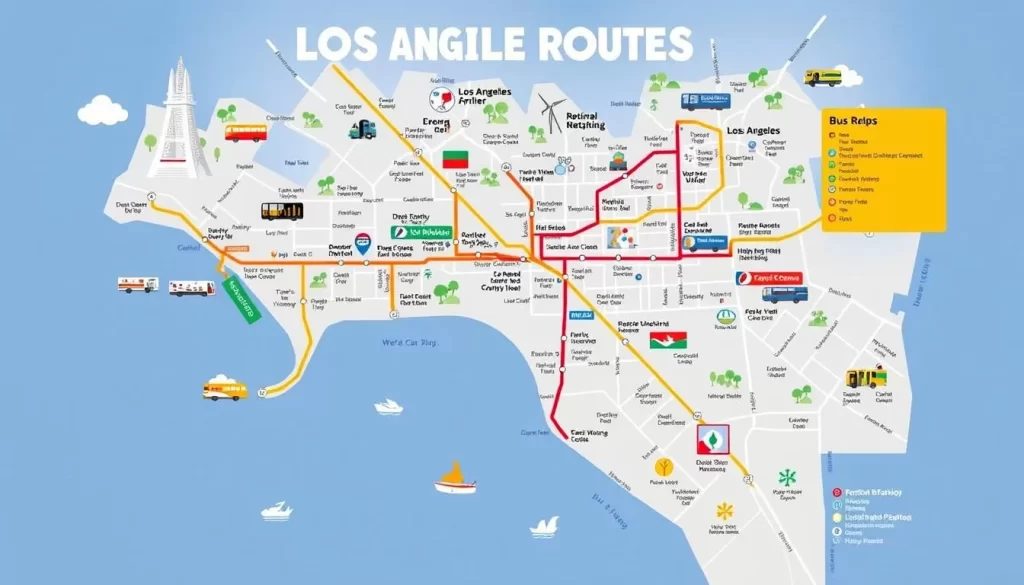
Los Angeles boasts an extensive network of bus services that cater to the diverse needs of its residents and visitors. The city’s bus system is a crucial part of its public transportation infrastructure, providing an efficient way to navigate LA without a car.
Metro Bus System
The Metro Bus System is a comprehensive network that covers a wide area of Los Angeles, connecting various neighborhoods and communities. With numerous routes and frequent services, it offers a reliable option for daily commutes and occasional travel. The Metro Bus System is designed to be user-friendly, with clear signage and accessible facilities.
DASH: Downtown Area Short Hop
DASH is a convenient bus service that operates in the Downtown LA area, providing a short-hop solution for those moving within the downtown vicinity. This service is particularly useful for tourists and locals alike who need to navigate the bustling streets of Downtown LA. DASH buses are easily identifiable, and their routes cover key areas of interest.
Commuter Express and Other Municipal Services
LADOT’s Commuter Express provides efficient service to and from Downtown LA during morning and afternoon rush hours, making limited stops to minimize travel time. The service operates on a zone-based fare system with five zones, with pricing determined by the distance traveled. Commuter Express routes connect distant communities from the San Fernando Valley to San Pedro, serving areas that might otherwise have limited transit options. Additionally, several municipal bus lines operate independently within Los Angeles County, including Long Beach Transit, Santa Monica’s Big Blue Bus, and Culver CityBus. These services often provide more localized routes within their respective communities while still connecting to the broader Metro network.
By utilizing these bus services, you can efficiently navigate Los Angeles, enjoying the city’s diverse attractions without the need for a personal vehicle. Whether you’re commuting to work or exploring LA’s many neighborhoods, the bus network offers a convenient and relatively affordable option.
TAP Card: Your Key to LA Public Transit
The TAP Card is your gateway to exploring Los Angeles using its extensive public transit system. With the TAP Card, you can seamlessly travel across LA on various Metro services and other participating transit agencies.
How to Purchase and Load Your TAP Card
Acquiring a TAP Card is straightforward. You can purchase TAP Cards at Metro Rail stations, online, or at various retail locations throughout Los Angeles County. Once you have your card, you can load it with the desired fare amount or a pass. The TAP Card is versatile, allowing you to reload it as needed, making it a convenient option for both regular commuters and occasional travelers.
Understanding Fares and Transfers
Fares on LA’s public transit system are designed to be affordable and flexible. A standard one-way fare on Metro is $1.75, which includes free transfers to other Metro services for up to two hours from the time you first tap your card. Additionally, Metro offers reduced fares for seniors, Medicare recipients, and customers with disabilities. The Fare Capping program ensures you never pay more than $5 in a day or $18 in a seven-day period, with rides becoming free once you reach these caps.
With the TAP Card, you can take advantage of various fare programs, including the GoPass for K-12 and community college students, and the LIFE program for low-income riders, making public transportation in Los Angeles accessible to a wide range of users.
Los Angeles, California: Public Transportation & Getting Around the Airport
Getting to your final destination from LAX is easier than you think, thanks to the numerous public transportation options available. Los Angeles International Airport is a major transportation hub, serving millions of passengers each year.
LAX FlyAway Bus Service
The LAX FlyAway Bus is a convenient option for travelers heading to various parts of Los Angeles. It offers direct service to several locations, including Union Station, Van Nuys, and Westwood. You can check the schedules and fares on the official LAX FlyAway website.
Connecting to Metro from LAX
For those using public transportation, LAX is connected to the Metro Rail system via the FlyAway Bus to Union Station or by taking a shuttle to the Aviation/LAX Station on the Metro Rail C Line. From there, you can easily transfer to other Metro lines to reach your destination across Los Angeles.
Other Airport Transportation Options
Beyond the FlyAway Bus and Metro connection, LAX offers a range of other transportation options. These include authorized taxis available at designated stands outside each terminal, with fares based on distance and time. Rideshare services like Uber and Lyft operate from the LAX-it lot, accessible via a free shuttle from all terminals. Additionally, many hotels offer shuttle services from the airport, and rental car facilities are available via dedicated shuttles.
| Transportation Option | Description | Fare/Availability |
|---|---|---|
| LAX FlyAway Bus | Direct bus service to various locations in LA | Fares vary by destination; check official website |
| Metro Rail Connection | Connects to Metro Rail system via FlyAway or shuttle | Metro fare applies; TAP card recommended |
| Taxis | Available at designated stands outside terminals | Fare based on distance and time |
| Rideshare Services | Uber and Lyft operate from LAX-it lot | Fare varies; check service apps |
With these options, you can choose the most convenient way to get around Los Angeles from LAX, making your travel experience smoother and more enjoyable.
Navigating LA’s Freeway System
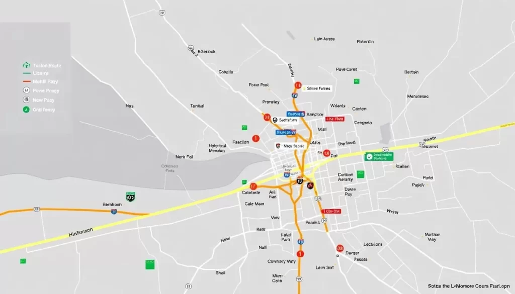
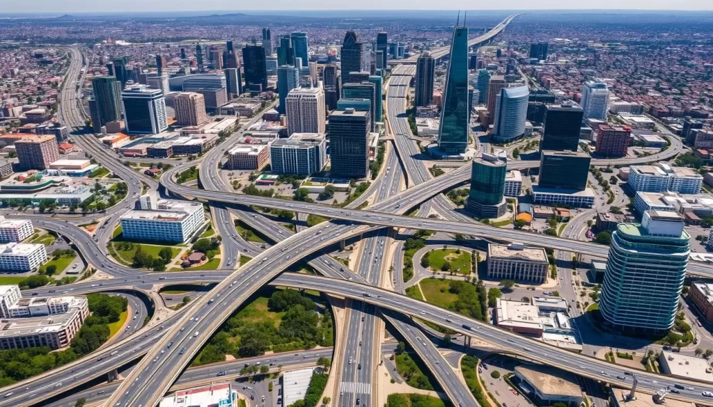
Understanding the intricacies of LA’s freeway system is crucial for anyone looking to explore the city or commute efficiently. Los Angeles, known for its car culture, has a complex network of freeways that can be challenging to navigate without the right knowledge.
Major Freeways and Their Destinations
LA’s freeway system includes several major routes that connect different parts of the city and its surroundings. The I-5, I-10, and US-101 are among the most significant freeways, facilitating travel to various destinations within and beyond Los Angeles. For instance, the I-5 is a key route for those heading north towards Sacramento or south towards San Diego, while the I-10 connects LA to other major cities like San Bernardino and Phoenix. Understanding the directions and destinations served by these freeways can help you plan your route more effectively.
The I-405, another critical freeway, runs through the Sepulveda Pass, connecting the San Fernando Valley to West LA. This route is notorious for its congestion, particularly during peak hours. Familiarizing yourself with these major freeways and their intersections can significantly improve your navigation of LA.
Understanding Rush Hour and Traffic Patterns
Rush hour in Los Angeles typically occurs on weekdays from 5 am to 10 am and 3 pm to 7 pm, although traffic can be heavy beyond these hours, especially on Fridays. During morning rush hour, traffic generally flows towards Downtown LA and major employment centers, while the afternoon rush hour sees the reverse pattern as commuters head home.
- Los Angeles rush hour typically occurs weekdays from 5-10 am and 3-7 pm, though heavy traffic can extend beyond these hours, especially on Fridays.
- Morning rush hour generally flows toward Downtown and major employment centers, while afternoon rush hour sees the reverse pattern as commuters head home.
- Traffic congestion can be unpredictable and may occur at almost any time, particularly before major holidays, during special events, or even on weekends.
- The I-405 through the Sepulveda Pass between the San Fernando Valley and West LA is notoriously congested, often experiencing heavy traffic in both directions throughout the day.
- Using navigation apps with real-time traffic data can help you identify the least congested routes and estimate accurate travel times during peak periods.
Being aware of these patterns and using the right tools can make a significant difference in your travel time and overall experience navigating LA’s freeways.
Street Navigation and Layout in Los Angeles
Los Angeles’ street navigation is a blend of grid systems and arterial routes, making it relatively easy to get around the city. Understanding the layout is crucial for both residents and visitors to navigate efficiently.
Understanding the Grid System
The grid system in Los Angeles provides a foundational structure for navigating the city. Major east-west routes include Roscoe, Victory, Ventura, Hollywood, Sunset, Santa Monica, Beverly, Wilshire, Olympic, Pico, Venice, Washington, Adams, Jefferson, Exposition, Obama Boulevard, and Martin Luther King Jr Boulevard, and Century Boulevard. These routes help in traversing the city horizontally. The grid system, while not uniform throughout, offers a logical method for understanding the city’s layout.
Major Boulevards and Arterial Streets
Los Angeles features numerous major boulevards that serve as primary arterial routes. Key east-west boulevards include Wilshire Boulevard, Santa Monica Boulevard, Sunset Boulevard, and Venice Boulevard. Wilshire Boulevard is particularly significant, stretching 15.8 miles from Downtown through Koreatown, Miracle Mile, Beverly Hills, and ending in Santa Monica. North-south arterials include La Cienega Boulevard, Fairfax Avenue, Western Avenue, Vermont Avenue, and Crenshaw Boulevard. These boulevards have become cultural landmarks and often provide alternatives to congested freeways, typically featuring synchronized traffic signals to improve traffic flow during peak travel times.
| Major East-West Routes | Major North-South Routes |
|---|---|
| Wilshire Boulevard | La Cienega Boulevard |
| Santa Monica Boulevard | Crenshaw Boulevard |
| Sunset Boulevard | Fairfax Avenue |
| Venice Boulevard | Western Avenue |
Ride-Sharing and Taxi Services
Whether you’re a local or just visiting Los Angeles, understanding the ride-sharing and taxi services available can greatly enhance your mobility.
Uber and Lyft Coverage Areas
Uber and Lyft are widely available across Los Angeles, offering services in various areas, including Downtown LA, Hollywood, and beyond. These ride-sharing services provide a convenient way to navigate the city without the need for a personal vehicle.
Both Uber and Lyft operate in major areas of Los Angeles, ensuring that you can get a ride when you need it. Their services are particularly useful for shorter trips or when public transportation isn’t an option.
Traditional Taxi Services
Traditional taxi services continue to be a viable option in Los Angeles. Several authorized companies operate in the area, including LA Yellow Cab, Bell Cab, and United Independent Taxi.
- Taxis can be hailed on the street in busy areas like Downtown, Hollywood, and tourist destinations, though pre-arranging by phone or app is more reliable in residential neighborhoods.
- Unlike ride-sharing services, taxis can pick up passengers directly at LAX terminals, providing a convenient option for airport transportation.
- Taxi fares in Los Angeles are regulated by the city and include a base fare plus charges for distance and time, with higher rates during late-night hours.
- While typically more expensive than ride-sharing services, taxis offer advantages including the ability to pay with cash and no surge pricing during peak demand periods.
Exploring LA on Foot
Los Angeles, a city often associated with cars, has a surprising number of pedestrian-friendly areas to explore on foot. As you wander through the city’s diverse neighborhoods, you’ll discover unique landscapes, architecture, and cultural attractions that showcase the best of LA.
Pedestrian-Friendly Neighborhoods
Downtown Los Angeles and Mid-City West are two neighborhoods in Los Angeles ranked as “walker’s paradise” by Walkscore, with scores of 90 or above. These areas offer a walkable environment with a mix of shops, restaurants, and entertainment options. You can spend your time strolling through the historic core of Downtown LA, exploring the vibrant streets, and enjoying the local cuisine.
Walking Tours and Scenic Routes
Los Angeles offers numerous scenic walking routes that highlight the city’s diverse landscapes and cultural attractions. Some popular options include:
- The Hollywood Walk of Fame, where you can see iconic landmarks like the TCL Chinese Theatre and the Capitol Records Building.
- Self-guided walking tours in Downtown LA’s historic core, featuring architectural treasures like the Bradbury Building.
- Coastal paths along Santa Monica and Venice Beach, offering miles of oceanfront walking with spectacular views.
- Urban hiking trails like the Griffith Park paths and Runyon Canyon, providing nature experiences within the city limits.

These walking tours and scenic routes give you a unique way to experience the area and make the most of your time in Los Angeles.
Cycling in Los Angeles
You can experience Los Angeles from a new perspective by cycling through its diverse neighborhoods. The city’s bike infrastructure is expanding, making it easier for residents and visitors to navigate LA on two wheels.

Bike Lanes and Paths
Los Angeles has been developing its bike infrastructure, including dedicated bike lanes and extensive paths. The Los Angeles River bicycle path is a notable example, stretching from Burbank to Long Beach with a brief interruption in downtown. This path offers a scenic route for cyclists to explore the city.
The Los Angeles River bicycle path is a significant asset for cyclists, providing a relatively flat and scenic route through the city. As LA continues to expand its bike infrastructure, more cyclists are taking to the streets.
Bike Sharing Programs
Metro Bike Share offers convenient short-term bicycle rentals throughout central Los Angeles, with stations in Downtown, Central LA, and the Westside. The system features traditional pedal bikes and electric-assist bikes that can be rented through the Metro Bike Share app or at station kiosks.
- Metro Bike Share offers flexible pricing options, including single rides, day passes, and monthly memberships, with discounts available for Metro TAP card holders.
- Private dockless bike and scooter companies like Lime and Bird also operate throughout Los Angeles, offering flexible pickup and drop-off anywhere within service areas.
- These bike sharing programs provide an excellent option for short trips, tourism, and last-mile connections to public transit.
Intercity Travel Options
Traveling from Los Angeles to other parts of California or neighboring states is easier than you think, thanks to multiple intercity travel options. Whether you’re heading to San Francisco, Las Vegas, or San Diego, you have several convenient choices.
Amtrak and Metrolink Services
You can rely on Amtrak for comfortable and relatively fast travel to various destinations. Amtrak’s services from Los Angeles Union Station connect you to cities across the United States. For regional travel, Metrolink commuter rail services offer an efficient way to reach surrounding cities and counties. With multiple lines radiating from Los Angeles, you can easily plan a day trip or a longer journey.
Long-Distance Bus Services
For a more budget-friendly option, consider using long-distance bus services. Companies like Greyhound, FlixBus, and Megabus operate from Los Angeles, connecting you to numerous cities. Greyhound’s main terminal is located in southeast Downtown LA, with a secondary terminal in North Hollywood, offering routes to destinations like San Diego, Las Vegas, and San Francisco. FlixBus provides modern coaches with amenities such as Wi-Fi and power outlets, making your journey more comfortable. You can also find international bus services to Mexican destinations, operated by carriers like Tufesa and Intercalifornias from terminals in Downtown LA and East Los Angeles.
Neighborhood-Specific Transportation Guide
From the beaches to the mountains, LA’s neighborhoods have unique transportation needs, and the city responds with a variety of solutions. Understanding these neighborhood-specific options can greatly enhance your travel experience in Los Angeles.
Downtown LA and Hollywood
In Downtown LA and Hollywood, you’re well-connected by the Metro Rail system. The Metro B Line subway connects North Hollywood to Downtown, making it easy to explore these vibrant areas. You can also use the Metro J Line bus, which provides bus rapid transit service. For shorter trips, consider using ride-sharing services or taxis.
Santa Monica and Venice Beach
If you’re heading to the beach, Santa Monica and Venice are accessible via the Expo Line, which connects to Downtown LA. The E Line also extends to Santa Monica, providing a convenient way to enjoy the coast. Locally, you can use the Big Blue Bus service, which covers Santa Monica and surrounding areas. Don’t forget to explore these areas on foot or by bike, as they’re very pedestrian-friendly.
San Fernando Valley
The San Fernando Valley is served by the Metro G Line, a bus rapid transit system that operates on an exclusive busway between Chatsworth and North Hollywood. This service runs 24/7 and includes 17 stations. You can also use local bus services and ride-sharing options to get around the Valley.
Long Beach and South Bay
Long Beach is connected to Downtown Los Angeles via the Metro A Line, offering frequent light rail service. Locally, Long Beach Transit operates an extensive bus network, and you can also use the AquaLink water taxi during summer months. In the South Bay, the Metro C Line provides service along the I-105 freeway, with Beach Cities Transit and Torrance Transit offering local bus services. This area of Los Angeles is well-served by various transportation options, making it easy to navigate without a car.
By understanding these neighborhood-specific transportation options, you can more easily explore the diverse city of Los Angeles and its many attractions.
Transportation for Visitors with Disabilities
Los Angeles is committed to providing accessible transportation options for all visitors, including those with disabilities. The city’s public transportation system is designed to be inclusive, with various features and services that cater to the needs of visitors with disabilities. Whether you’re traveling by Metro Rail, bus, or other specialized services, LA ensures that you have a convenient and accessible way to explore the city.
Accessibility on Metro Rail and Buses
Metro Rail and buses in Los Angeles are equipped with accessibility features to facilitate easy travel for visitors with disabilities. These features include wheelchair-accessible vehicles, priority seating, and audio announcements. The Metro Rail system has accessible stations with elevators and tactile signage, ensuring that all visitors can navigate the system comfortably.
Specialized Transportation Services
For visitors who require more personalized transportation assistance, Los Angeles offers specialized services. Access Services provides paratransit options for individuals whose disabilities prevent them from using regular bus or rail services. Additionally, Cityride, operated by LADOT, offers transportation assistance to seniors and persons with disabilities, providing fare value for taxi rides or Dial-A-Ride services.
| Service | Description | Eligibility |
|---|---|---|
| Access Services | Paratransit options for individuals unable to use regular transit services | Individuals with disabilities |
| Cityride | Transportation assistance for seniors and persons with disabilities | Seniors and persons with disabilities |
With LADOT transit services spanning 46 routes and serving nearly 30 million passengers a year, you can rely on the city’s transportation network to get you where you need to go. The city’s commitment to accessibility ensures that all visitors can enjoy the many attractions and experiences that Los Angeles has to offer.
Budget-Friendly Transportation Tips
Navigating Los Angeles without breaking the bank is easier than you think, thanks to various budget-friendly transportation options. Whether you’re a local or just visiting, understanding how to use the city’s transportation system efficiently can save you a significant amount of money and time.
Day Passes and Multi-Day Options
For visitors and frequent travelers, day passes and multi-day options are a cost-effective way to explore Los Angeles. The Metro Day Pass allows unlimited rides on Metro buses and trains for a day, making it an ideal choice for those who plan to travel extensively within a short time frame. You can purchase these passes using your TAP card, making it a convenient way to travel around the city.
Multi-day passes offer even more savings for longer stays, providing an economical solution for travelers who need to navigate Los Angeles over several days.
Free and Low-Cost Transportation Alternatives
Los Angeles also offers several free and low-cost transportation alternatives. For instance, DASH buses operated by LADOT are currently free to ride, providing complimentary transportation within neighborhoods throughout Los Angeles. The Metro Micro service offers on-demand shared rides within specific zones for just $1 per ride, making it an affordable way to travel short distances.
Many tourist areas offer free or low-cost shuttle services. For example, the Downtown LA DASH Observatory Bus connects to Griffith Observatory and the Greek Theatre. Additionally, walking is not only free but often the most efficient way to explore dense neighborhoods like Downtown LA, Hollywood, and Venice Beach. Bike sharing programs are another economical option, with single rides typically costing $1-3 plus per-minute charges.
Transportation Apps and Digital Tools

Navigating Los Angeles has become more manageable with the help of various transportation apps and digital tools. These innovative solutions have transformed the way you travel across the city, making your trip more efficient and reducing travel time.
Metro Trip Planner and Official Apps
The Metro Trip Planner is a valuable online tool for planning your Los Angeles itineraries. In conjunction with Google Maps, the Trip Planner generates detailed instructions on how to get to and from your destination. Metro has also compiled a list of Rider Apps to help plan your route, take your trip, and pay for it all seamlessly.
Third-Party Navigation Apps
Several third-party navigation apps are available to help you navigate Los Angeles. Some of the most popular options include:
- Google Maps: Offers comprehensive public transit directions, including real-time arrival information, walking directions to stops, and integration with rideshare services.
- Waze: Provides crowd-sourced traffic information and navigation, helping drivers find the fastest routes through Los Angeles traffic and avoid congestion.
- Citymapper: Specializes in urban transportation, combining public transit, walking, cycling, and rideshare options to find optimal routes across Los Angeles.
- Moovit: Offers detailed public transit information with real-time updates and community-reported service conditions for a more accurate travel experience.
- Uber and Lyft: Not only provide rideshare services but also integrate public transportation options in many areas, allowing you to compare travel times and costs.
By utilizing these transportation apps and digital tools, you can navigate Los Angeles in a more efficient way, saving you time and reducing stress caused by traffic.
Conclusion: Mastering LA’s Transportation System
Mastering the art of getting around LA is simpler than you think, with a multitude of options available. Despite its reputation as a car-dependent city, Los Angeles offers a comprehensive public transport network that continues to expand and improve.
The key to navigating this vast city lies in understanding the integration between Metro Rail, bus services, and alternative transportation options like cycling and walking. The TAP card system unifies fare payment across multiple transit agencies, making it easier for you to navigate between different services throughout Los Angeles County.
To maximize your time in LA, strategically use transportation apps and digital tools to find the most efficient routes and avoid delays. While a car may still be convenient for certain itineraries, many visitors and residents find that Los Angeles can be successfully navigated using public transport, especially when staying near transit corridors.
By embracing the various transportation options available, you can enjoy all that LA has to offer, every day, in a convenient and efficient way. Los Angeles’ transit system is designed to make your travel experience smooth, whether you’re commuting or exploring the city on a leisurely day out.
The above is subject to change.
Check back often to TRAVEL.COM for the latest travel tips and deals.
