✓ Accommodations✓ Flights✓ Rental Cars
Standing tall at 14,505 feet, the highest peak in the contiguous United States is a thrilling adventure waiting to happen. You don’t need mountaineering skills to conquer this giant, but preparation is key.
As you plan your trip, you’ll want to know the best trails to take, how to secure a permit, and what to expect at the summit. Whether you’re looking for a challenging day hike or a multi-day camping trip, understanding the elevation and trail conditions is crucial.
You’re about to embark on an unforgettable journey to the Mount Whitney Range, exploring its majestic landscapes and experiencing the thrill of standing at the highest point in the lower 48 states.
Discovering the Mount Whitney Range
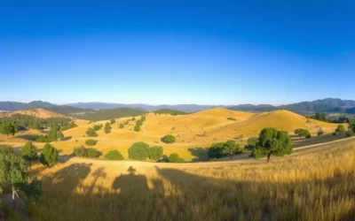
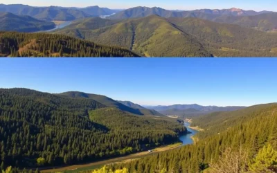
Nestled in the Sierra Nevada, the Mount Whitney Range offers breathtaking landscapes and exciting adventures. As you explore this magnificent range, you’ll discover a diverse array of geological features that have been shaped over millions of years.
The Highest Peak in the Contiguous United States
Mount Whitney stands tall as the highest peak in the contiguous United States, with an elevation of 14,505 feet. The Mount Whitney Trail from Whitney Portal allows hikers to tackle the trek in a day or overnight camping trip. This challenging trail spans 21.5 miles round-trip, with a significant elevation gain of 6,200 feet.

Geography and Notable Features of the Range
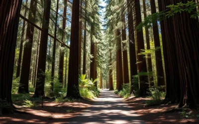
The Mount Whitney Range is situated on the boundary between California’s Inyo and Tulare counties. The range boasts several notable peaks, including Keeler Needle and Crooks Peak, creating a dramatic skyline. As you hike through the range, you’ll encounter diverse ecosystems that change with elevation, from lower pine forests to barren alpine terrain above the tree line. The geography includes several lakes, such as Lone Pine Lake and Consultation Lake, offering scenic beauty and valuable water sources. The range’s eastern slope rises dramatically from the Owens Valley floor at about 4,000 feet to the summit, creating one of the most significant mountain elevation changes in the United States, covering numerous miles of varied terrain.
Planning Your Visit to Mount Whitney
As you prepare for your adventure to the highest peak in the contiguous United States, understanding the logistics of your trip is crucial. Mount Whitney, located in California, is a destination that attracts many hikers and adventurers each year.
Best Time to Visit Mount Whitney
The best time to visit Mount Whitney is during the summer months when the weather is warmer and the trail is clearer. However, this is also the peak season, so you can expect more crowds. If you’re looking for a more serene experience, consider visiting during the shoulder season, though be prepared for potentially challenging weather conditions.
How to Get to Whitney Portal
To start your Mount Whitney adventure, you’ll need to get to Whitney Portal, the main trailhead. Whitney Portal is located 13 miles west of Lone Pine, California, and the drive involves navigating a winding mountain road that climbs about 4,000 feet.
From Los Angeles, it’s about a 3.5-hour drive (225 miles), and from Las Vegas, it’s also about 3.5-4 hours (235 miles). If you’re flying, the nearest airports are Los Angeles International Airport (LAX) and Las Vegas McCarran International Airport (LAS), from where you can rent a car for the remainder of your journey.
At Whitney Portal, you’ll find amenities such as a store, campground, and parking area. It’s advisable to arrive early in the day, especially during peak season, to secure parking.
Ensuring your vehicle is in good condition is crucial due to the uphill roads and potential for changing weather conditions. With proper planning, your trip to Whitney Portal will be a memorable start to your Mount Whitney adventure.
Understanding the Mount Whitney Permit System
Before you start your Mount Whitney adventure, it’s essential to grasp the permit requirements. The Mount Whitney permit system is designed to manage the high volume of hikers attempting to reach the summit, ensuring a safe and enjoyable experience for all people involved.
Day Use vs. Overnight Permits
When planning your hike, you must decide whether you prefer a day hike or an overnight camping trip. The permit system differentiates between day use and overnight permits. Day use permits allow you to hike to the summit and back within a day, while overnight permits enable you to camp along the trail. Understanding the differences is crucial for planning your trip.
| Permit Type | Description | Quota Season |
|---|---|---|
| Day Use Permit | Hike to summit and back in one day | May 1 to November 1 |
| Overnight Permit | Camp along the trail | May 1 to November 1 |
How to Apply for the Permit Lottery
To secure a permit, you must apply through the lottery system available on recreation.gov. The application period typically opens in February, and the lottery drawing takes place in late March. It’s crucial to plan ahead and apply early, as the number of permits is limited.
To increase your chances of getting a permit, be flexible with your dates and consider alternative routes or times of the year.
Alternative Ways to Secure a Permit
If you’re unsuccessful in the lottery, there are still options to obtain a permit for the Whitney zone. You can check recreation.gov for cancellations, join hiking groups on social media to find potential hiking partners, or consider hiking during the non-quota season.
- Check for cancellations on recreation.gov up until the day before your desired hike.
- Join hiking groups on Facebook or Reddit to connect with other hikers.
- Consider hiking during the non-quota season (November 2 to April 30).

Choosing Your Route Up Mount Whitney
Aspiring to conquer Mount Whitney requires deciding on the most suitable route for your adventure. The mountain offers several trails catering to different skill levels and preferences, ensuring that there’s an appropriate path for every climber.
Mount Whitney Trail – The Main Route
The Mount Whitney Trail is the most popular route to the summit, spanning approximately 22 miles round trip. This trail is well-marked and well-maintained, making it accessible to hikers with moderate experience. The trailhead is located at Whitney Portal, and the path takes you through diverse landscapes, including forests and alpine meadows, before reaching the summit. Proper preparation and physical conditioning are essential due to the trail’s demanding nature and potential altitude sickness.
Mountaineers Route – For Experienced Climbers
For experienced climbers, the Mountaineers Route offers a more challenging ascent. This route involves technical climbing and is not recommended for novice climbers. It requires advanced mountaineering skills and appropriate equipment. The route provides a thrilling experience with its rugged terrain and spectacular views.
Other Approaches to the Summit
Beyond the standard routes, climbers can consider alternative approaches to the summit. For instance, the High Sierra Trail is a 72-mile journey starting from Sequoia National Park, culminating at Whitney Portal. Another option is the John Muir Trail, which spans 211 miles from Yosemite Valley to Mount Whitney, offering an immersive wilderness experience over several days or even weeks. You can also access Mount Whitney via the Pacific Crest Trail, which can be combined with a side trip to reach the summit. These alternative routes require meticulous planning, including arranging for transportation and food caches, but reward climbers with a comprehensive Sierra Nevada experience.
| Trail Name | Distance | Duration |
|---|---|---|
| Mount Whitney Trail | 22 miles (round trip) | 1-2 days |
| High Sierra Trail | 72 miles | 7-10 days |
| John Muir Trail | 211 miles | 3-4 weeks |
Day Hiking vs. Overnight Camping on Mount Whitney
Whether you’re a seasoned hiker or just starting out, Mount Whitney’s challenging terrain requires careful consideration of your itinerary, including whether to camp or hike through in one day. The decision between day hiking and overnight camping affects not only your experience but also your preparation and physical exertion.
The 22-Mile Day Hike Challenge
Tackling the Mount Whitney Trail in one day is a significant undertaking, requiring early morning starts and a high level of physical fitness. The 22-mile round trip pushes hikers to their limits, with the trail ascending to over 14,000 feet. While this option allows you to complete the hike in a single day, it demands careful planning and a good understanding of your capabilities.

Popular Camping Locations on the Trail
For those opting to camp, several established campsites are available along the Mount Whitney Trail. Trail Camp, at 12,000 feet and 6 miles from the trailhead, is a popular choice, despite its rocky and barren terrain. Other options include Outpost Camp at 10,400 feet, which offers more shelter, and Lone Pine Lake, a scenic spot at 9,900 feet. When camping, it’s essential to use bear canisters and pack out waste to minimize environmental impact. Spending the night at one of these camps can help break up the hike and allow for a more leisurely summit attempt. Setting up your tent at one of these camp sites requires careful consideration of the weather and available shelter.
Training for Mount Whitney: Physical Preparation
As you prepare to tackle Mount Whitney, the highest peak in the contiguous United States, a well-structured training plan is essential. To successfully summit, you need to be in top physical condition and acclimatized to the high altitude.
Recommended Training Hikes and Exercises
To build your endurance, incorporate cardiovascular exercises such as hiking, running, or cycling into your routine. Aim for hikes with significant elevation gain to simulate the 14,505-foot climb. Strength training is also crucial, focusing on your legs, core, and back to handle the heavy backpack and challenging terrain.
- Engage in regular cardio workouts, gradually increasing intensity and duration.
- Incorporate strength training exercises 2-3 times a week.
- Practice hiking with a loaded backpack to build specific strength.

Altitude Acclimatization Strategies
Acclimatization is crucial to prevent altitude sickness. Plan to spend at least one night at moderate elevation (8,000-10,000 feet) before attempting the summit. An effective strategy includes staying at Horseshoe Meadows Campground (10,000 feet) and taking a day hike to Cottonwood Pass (11,200 feet).
- Stay hydrated by drinking plenty of water consistently.
- Avoid alcohol and sleeping medications to help your body adjust.
- Eat carbohydrate-rich foods to support your body’s adjustment to altitude.
- Plan a gradual ascent with overnight stops at progressively higher elevations if possible.
By following these training and acclimatization strategies, you’ll be well-prepared for your Mount Whitney adventure, ensuring a safe and successful summit attempt within the time frame you’ve allocated for your climb.
Essential Gear for Mount Whitney Range, California: Best Things to Do – Top Picks
When preparing for your Mount Whitney adventure, it’s crucial to pack the right gear to ensure a safe and enjoyable experience. The extreme conditions on Mount Whitney demand a thoughtful approach to gear selection, from clothing to safety equipment.
Clothing and Layering Systems
A versatile clothing system is vital for adapting to Mount Whitney’s unpredictable weather. Layering allows you to adjust your clothing to suit the conditions, from the warmth of the valley to the freezing temperatures at the summit. Include a base layer for moisture-wicking, an insulating mid-layer, and a waterproof outer layer. Don’t forget a hat, gloves, and extra socks.
Hiking Equipment and Safety Gear
Your hiking equipment should include sturdy hiking boots, trekking poles for added stability, and a first-aid kit. Safety gear such as a headlamp, map, and compass are also essential. Consider the use of a personal locator beacon (PLB) or satellite phone, especially if you’re venturing into the backcountry.

Food and Water Planning
Proper nutrition and hydration are critical for a successful Mount Whitney expedition. Hydration is key; plan to consume about 6 liters of water throughout your journey, drinking small amounts frequently. For food, include easily digestible, high-calorie options like energy bars, trail mix, and jerky. Aim to consume 200-300 calories per hour to maintain energy levels and prevent altitude-related symptoms. Consider refilling your water at reliable sources like streams near Trail Camp. On a day hike, be prepared with enough supplies to last your journey.
- Carry 3-4 liters of water and refill at reliable sources.
- Eat high-calorie foods every 1.5-2 hours.
- Use electrolyte tablets or powders to replace lost minerals.
Navigating the Mount Whitney Trail
As you embark on the Mount Whitney Trail, you’ll encounter diverse landscapes that challenge and inspire you. The trail is a 22-mile journey that takes you from the lush surroundings of Whitney Portal to the rugged terrain of the highest peak in the contiguous United States.
From Whitney Portal to Lone Pine Lake
The initial stretch of the trail from Whitney Portal to Lone Pine Lake is a gentle introduction to the hike ahead. You’ll traverse through alpine meadows and alongside the creek, with the scenery gradually becoming more dramatic as you ascend. This section is approximately 6 miles round trip, making it a great spot for a picnic or a short rest.

Trail Camp and the 99 Switchbacks
As you continue beyond Lone Pine Lake, the trail becomes steeper and more challenging, leading you to Trail Camp. From here, the infamous 99 switchbacks begin, testing your endurance as you climb higher. The switchbacks are a relentless ascent, but they ultimately lead you to Trail Crest at 13,780 feet, where the winds can be fierce and the views are breathtaking.
Trail Crest to the Summit
From Trail Crest, it’s another 1.9 miles to the summit at 14,496 feet. The trail traverses along the western side of the ridge, with dramatic drop-offs and relatively level terrain that offers some respite. As you near the summit, the terrain becomes increasingly rocky, but the sight of the stone summit hut signals your imminent success. You’ll pass the junction with the John Muir Trail, where many hikers leave their heavy packs before making the final push to the top.
Camping in the Whitney Zone
When venturing into the Mount Whitney Range, it’s essential to know the camping regulations and options available. The Whitney Zone offers several campsites that cater to different needs and preferences of hikers.
Outpost Camp vs. Trail Camp
The Whitney Zone has several camping areas, including Outpost Camp and Trail Camp, each with its unique features. Outpost Camp is located near Whitney Portal and serves as a convenient starting point for many hikers. Trail Camp, on the other hand, is situated higher up on the trail and is a popular overnight stop for those ascending to the summit.
When deciding between these camps, consider your hiking schedule and personal preferences. Trail Camp is a more rugged option, closer to the trail, while Outpost Camp offers more amenities and a gentler environment.
Bear Canisters and WAG Bags: What You Need to Know
Camping in the Whitney Zone comes with specific regulations to protect both you and the environment. One crucial rule is the use of bear canisters for all food and scented items. Although bears are not the primary concern at higher elevations, rodents and birds can still damage your gear. You can rent bear canisters at the Eastern Sierra Interagency Visitor Center or the Whitney Portal Store for approximately $2-5 per day.
Additionally, hikers must pack out all human waste using WAG bags. These bags are designed to contain and gel waste, making it easier to dispose of properly. When setting up camp, it’s also recommended to leave tent flaps open and backpacks loosely packed to deter curious wildlife.
Weather and Safety Considerations
When venturing into the Mount Whitney Range, understanding the weather and safety considerations is crucial for a successful and enjoyable experience. The mountain’s extreme conditions can pose significant risks to hikers, making preparation and awareness key to a safe adventure.
Understanding Mountain Weather Patterns
Mountain weather on Mount Whitney can change rapidly, with conditions deteriorating quickly. It’s essential to monitor forecasts and be prepared for sudden changes in weather. Understanding that weather patterns can vary significantly with altitude, hikers should be aware of potential storms and temperature drops.
Dealing with Altitude Sickness
Altitude sickness is a significant concern for many hikers on Mount Whitney due to its high elevation. Symptoms can include headaches, nausea, and fatigue. To mitigate these effects, it’s recommended to ascend gradually, allowing your body to acclimate to the higher altitude. Staying hydrated and being aware of your body’s response to the elevation can help prevent severe altitude sickness.
Emergency Preparedness and Communication
In case of an emergency, having the right equipment and knowledge is vital. Carrying a satellite communication device or personal locator beacon is highly recommended, as cell phone service is unreliable on the mountain. Your emergency kit should include essentials like a space blanket, extra food and water, a first aid kit, and warm layers to help you survive an unexpected night on the mountain.
| Emergency Item | Purpose |
|---|---|
| Satellite Communication Device | To call for help in case of an emergency |
| Space Blanket | To stay warm in cold conditions |
| First Aid Kit | To treat injuries and altitude sickness symptoms |

Before your trip, inform someone about your itinerary and expected return time. In an emergency, be prepared to provide clear information about your location and condition. Remember, self-sufficiency and good decision-making are your best defenses in challenging conditions.
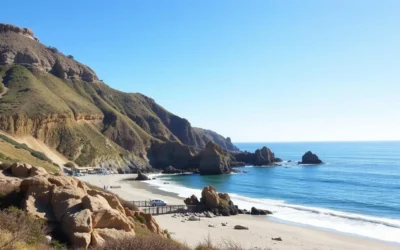
Best Viewpoints and Photography Spots
As you ascend to the summit of Mount Whitney, you’ll be treated to breathtaking views that will leave you in awe. The mountain offers numerous photography opportunities, with stunning vistas at every turn.
Sunrise at Trail Crest
One of the most spectacular viewpoints is at Trail Crest, where you can witness a breathtaking sunrise. The early morning light casts a golden glow on the surrounding peaks, creating a perfect setting for capturing memorable photos. To make the most of this moment, be sure to arrive early and have your camera equipment ready.
Summit Panoramas and Photo Tips
The summit of Mount Whitney offers 360-degree panoramas that showcase the Sierra Nevada range in all its glory. To capture the best photos, consider using a wide-angle lens to encompass the expansive vistas, as well as a mid-range zoom for detailed shots of distant peaks. Don’t miss the iconic summit hut and the official USGS summit marker, which make for great photo opportunities.
Here are some additional photo tips for capturing the summit:
- Take advantage of the morning light, which generally provides clearer air and more dramatic shadows.
- Consider bracketing your exposures to capture both the bright sky and darker foreground details.
- Use a tripod to stabilize your camera, especially in low light conditions.
| Photography Tip | Description |
|---|---|
| Wide-angle lens | Capture expansive vistas and panoramic views |
| Mid-range zoom | Take detailed shots of distant peaks and landscapes |
| Bracketing exposures | Capture both bright sky and darker foreground details |
Beyond the Summit: Other Activities in the Area
Beyond the thrill of conquering Mount Whitney lies a region rich in natural beauty, history, and recreational opportunities. The area surrounding Mount Whitney offers a diverse range of experiences that cater to different interests and fitness levels.
Exploring Lone Pine and Alabama Hills
The charming town of Lone Pine and the nearby Alabama Hills recreation area are must-visit destinations. The Alabama Hills, with their unique rock formations, offer a perfect setting for a day trip with plenty of opportunities for hiking, rock climbing, and photography.

Day Trips to Nearby Attractions
There are several worthwhile day trips from the Lone Pine area, covering varying distances in miles. You can visit the Ancient Bristlecone Pine Forest in the White Mountains, about 1.5 hours from Lone Pine, home to the oldest living trees on Earth. Alternatively, explore the sobering Manzanar National Historic Site, just north of Lone Pine, or relax at one of the natural hot springs in the Owens Valley, making the most of your time in the area. Planning your trip in advance will help you make the most of your way around these attractions.
Other options include visiting Horseshoe Meadows, located about 20 miles south of Whitney Portal, or taking an epic “High-Low” expedition to Death Valley National Park, just 100 miles east of Mount Whitney.
Where to Stay Near Mount Whitney
Whether you’re looking for a cozy hotel or a campsite under the stars, the Mount Whitney area has something for everyone. From budget-friendly options to more luxurious stays, you’ll find a range of choices to suit your needs.
Accommodations in Lone Pine

Lone Pine offers a variety of hotels and accommodations that cater to different budgets. You can find comfortable lodging with amenities that make your stay enjoyable. For those looking for a more authentic experience, there are also options for camping and other outdoor activities.
Some popular choices include hotels that offer comfortable rooms and amenities like pools and restaurants. Be sure to book in advance, especially during peak season, to ensure availability.
Whitney Portal Campground and Other Camping Options

For those who prefer camping, Whitney Portal Campground is a convenient option located right at the trailhead. The campground offers 43 reservable sites with amenities like picnic tables, fire rings, and bear boxes. Reservations become available six months in advance through recreation.gov and tend to fill quickly, especially for summer weekends.
Other camping options in the area include Horseshoe Meadows Campground at 10,000 feet, which is ideal for acclimatization. You can also consider Portagee Joe Campground and Tuttle Creek Campground near Lone Pine for lower-elevation alternatives. Dispersed camping is available in certain areas of the Inyo National Forest, offering free options for self-sufficient campers.
The High-Low Expedition: From Whitney to Death Valley
Experience the ultimate elevation contrast by traveling from the highest peak in the contiguous United States to the lowest point in North America. This journey takes you through diverse landscapes, from the rugged mountains of the Sierra Nevada to the surreal salt flats of Death Valley.
Planning the Ultimate California Elevation Experience
To make the most of your trip, plan carefully, considering the time of year and weather conditions. The journey involves significant elevation changes, so it’s essential to be prepared for the challenges of high altitude and extreme temperatures.
Badwater Basin: North America’s Lowest Point
Badwater Basin, situated in Death Valley National Park, is a remarkable destination that sits 282 feet below sea level. The vast salt flat stretches across 200 square miles, creating a surreal landscape. Visitors can walk out onto the salt flats via a boardwalk near the parking area, though the actual lowest point lies about 3.5 miles away.
The extreme temperatures at Badwater Basin create a challenging environment, best visited during the milder seasons or early in the morning. This location offers extraordinary photography opportunities, particularly during sunrise or sunset when the light accentuates the salt formations.
Conclusion
Your Mount Whitney journey is a unique blend of challenge and reward, with breathtaking views and a sense of accomplishment. As you plan your trip, whether it’s a day hike or an overnight adventure, remember that the mountain demands respect and preparation. The experience you gain will be unforgettable, from the summit to the scenic way up. With various hikes available, you’ll find your own meaningful way to connect with this iconic landmark. Proper planning ensures a successful and enjoyable adventure.
The above is subject to change.
Check back often to TRAVEL.COM for the latest travel tips and deals.