
Williamsburg
Featured
0
Location
City / Location
Williamsburg
State or Province
Virginia
Country
United States
Population
14954
Do you have a question or just want to share information with other users regarding this location? Visit this area's Users Group.
For places to visit in this area, check out the following categories:
+ Map this area using Google
+ Geolocate = Towns currently around me
+ Submit a new local listing
+ To report an update to this Listing, please click on the "Send Inquiry" button above.
| RADIUS SEARCH: | MI. | KM. | |
|---|---|---|---|
| ✔ | What's Nearby | 45 | 72 |
| ✔ | Places to Eat / Drink | 45 | 72 |
| + Wineries, Breweries, Pubs | 45 | 72 | |
| ✔ | Places to Stay | 45 | 72 |
| + Campgrounds & RV Parks | 45 | 72 | |
| ✔ | Outdoors | 45 | 72 |
| + Parks, Trails, Beaches | 45 | 72 | |
| ✔ | Golf | 45 | 72 |
| ✔ | Entertainment | 45 | 72 |
| ✔ | Museums & Galleries | 45 | 72 |
| ✔ | Religious Sites | 45 | 72 |
| ✔ | Health | 60 | 96 |
| ✔ | Getting Around | 60 | 96 |
| ✔ | Airports | 60 | 96 |
| ✔ | Cities, Towns, Villages | 60 | 96 |
+ Map this area using Google
+ Geolocate = Towns currently around me
+ Submit a new local listing
+ To report an update to this Listing, please click on the "Send Inquiry" button above.
Williamsburg is a city in the U.S. state of Virginia. Located on the Virginia Peninsula, Williamsburg is in the northern part of the Hampton Roads metropolitan area. It is bordered by James City County and York County.
Williamsburg was founded in 1632 as Middle Plantation, a fortified settlement on high ground between the James and York rivers. The city served as the capital of the Colony and Commonwealth of Virginia from 1699 to 1780 and was the center of political events in Virginia leading to the American Revolution.
The College of William & Mary, established in 1693, is the second-oldest institution of higher education in the United States and the only one of the nine colonial colleges located in the South; its alumni include three U.S. Presidents as well as many other important figures in the nation's early history.
The city's tourism-based economy is driven by Colonial Williamsburg, the restored Historic Area of the city. Along with nearby Jamestown and Yorktown, Williamsburg forms part of the Historic Triangle, which attracts more than four million tourists each year. Modern Williamsburg is also a college town, inhabited in large part by William & Mary students and staff.
HISTORY
Prior to the arrival of the English colonists at Jamestown in the Colony of Virginia in 1607, the area which became Williamsburg was within the territory of the Powhatan Confederacy. By the 1630s, English settlements had grown to dominate the lower (eastern) portion of the Virginia Peninsula, and the Powhatan tribes had abandoned their nearby villages.
Between 1630 and 1633, after the war that followed the Indian Massacre of 1622, the English colonists constructed a defensive palisade across the peninsula and a settlement named Middle Plantation as a primary guard station along the palisade. Jamestown was the original capital of Virginia Colony, but was burned down during the events of Bacon's Rebellion in 1676.
GEOGRAPHY
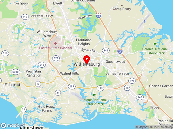
Williamsburg is spread upon a ridge on the Virginia Peninsula between the James and York Rivers. Queen's Creek and College Creek partly encircle the city. James City County is located to the west and south of Williamsburg, while York County is to the north and east. As with all cities in Virginia, Williamsburg is legally independent of both counties.
The city is located on the I-64 corridor, 45 miles (72 km) southeast of Richmond and approximately 37 miles (60 km) northwest of Norfolk. It is in the northwest corner of Hampton Roads, which is the 37th largest metropolitan area in the United States with a total population of 1,576,370.
Within Hampton Roads, the city of Norfolk is recognized as the central business district, while the Virginia Beach seaside resort district and Williamsburg are primarily centers of tourism.
CLIMATE
Williamsburg is located in the humid subtropical climate zone, with cool to mild winters, and hot, humid summers.
Due to the inland location, winters are slightly cooler and spring days slightly warmer than in Norfolk, though lows average 3.2 °F (1.8 °C) cooler here due to the substantial urban build-up to the southeast. Snowfall averages 5.1 inches (13 cm) per season, and the summer months tend to be slightly wetter.
TOURISM
The tourist volume of Colonial Williamsburg has attracted many other related businesses to the area. Notable among these was Anheuser-Busch, which established large operations in James City County and York County just outside the city.
The company operates a large brewery there. The company also used to operate two theme parks near the brewery, Busch Gardens Williamsburg, and Water Country USA; however, both properties were sold to private investors following Anheuser-Busch's takeover by foreign brewer InBev in 2010.
Williamsburg is perhaps best known for its tourist and historical points of interest, the centerpiece of which is Colonial Williamsburg, which is essentially a living history museum, depicting the lifestyles and culture of the 18th century colonial period in American history.
Major points of interest in this historic district include the Virginia's first capitol building, the Governor's Palace, Bruton Parish Church (the oldest continually operating church in the United States), the Peyton Randolph House (home of Peyton Randolph, the first President of Continental Congress and rumored to be haunted) and The College of William & Mary.
Other highlights in the city include The Williamsburg Winery (Virginia's largest winery), the Williamsburg Botanical Garden, the National Center for State Courts and the Virginia Musical Museum.
Also located in Williamsburg are two major theme parks, Busch Gardens Williamsburg and Water Country USA, as well as Go-Karts Plus action park and 2 miniature golf courses. The 200-acre (0.81 km2) Williamsburg Pottery Factory shopping complex visited by 3 million people annually is located at nearby Lightfoot, Virginia.
BIKING
The city is increasingly bicycle-friendly, having built 48 miles of bicycle facilities in the area since 1992. Upon completion, the Virginia Capital Trail will provide a paved off-road path to Richmond for bicyclists and pedestrians via the Colonial Parkway.
ROADS & HIGHWAYS
Williamsburg is located adjacent to Interstate 64 and U.S. Route 60, which connect the city with Richmond to the northwest and Norfolk to the southeast. State Route 199, officially named the Humelsine Parkway after a former Colonial Williamsburg president, surrounds the city in a semicircle.
State Route 5 links the city with the James River Plantations along the north shore of the James River, Interstate 295 and Richmond. State Route 31 provides a route to Jamestown and the toll-free Jamestown Ferry. The Colonial Parkway provides a bucolic low-speed link to Jamestown and Yorktown, passing under Colonial Williamsburg in a tunnel. With the exception of buses, commercial vehicles are not allowed on the Parkway.
BUSES
The community's public bus system, Williamsburg Area Transit Authority (WATA), has its central hub at the transportation center. A network of disabled-accessible transit bus routes serve the city, James City County, and most portions of York County adjacent to the Williamsburg area.
The routes operated by WATA include a loop around the William & Mary campus while classes are in session. The system also provides paratransit services and operates replica trolley buses at the Yorktown Riverfront attraction. WATA connects with the much larger Hampton Roads Transit (HRT) bus system at Lee Hall in northwestern Newport News and at the Williamsburg Transportation Center.
Intercity bus services are provided by Greyhound.
RAILWAYS
Amtrak serves Williamsburg with three trains a day stopping at the Amtrak Station. The line runs west along the Virginia Peninsula to Richmond and points beyond.
AIRPORTS
The primary airport for the Virginia Peninsula is the Newport News/Williamsburg International Airport in Newport News, a twenty-minute drive from Williamsburg.
Norfolk International Airport and Richmond International Airport also serve passengers from the city.
Williamsburg was founded in 1632 as Middle Plantation, a fortified settlement on high ground between the James and York rivers. The city served as the capital of the Colony and Commonwealth of Virginia from 1699 to 1780 and was the center of political events in Virginia leading to the American Revolution.
The College of William & Mary, established in 1693, is the second-oldest institution of higher education in the United States and the only one of the nine colonial colleges located in the South; its alumni include three U.S. Presidents as well as many other important figures in the nation's early history.
The city's tourism-based economy is driven by Colonial Williamsburg, the restored Historic Area of the city. Along with nearby Jamestown and Yorktown, Williamsburg forms part of the Historic Triangle, which attracts more than four million tourists each year. Modern Williamsburg is also a college town, inhabited in large part by William & Mary students and staff.
HISTORY
Prior to the arrival of the English colonists at Jamestown in the Colony of Virginia in 1607, the area which became Williamsburg was within the territory of the Powhatan Confederacy. By the 1630s, English settlements had grown to dominate the lower (eastern) portion of the Virginia Peninsula, and the Powhatan tribes had abandoned their nearby villages.
Between 1630 and 1633, after the war that followed the Indian Massacre of 1622, the English colonists constructed a defensive palisade across the peninsula and a settlement named Middle Plantation as a primary guard station along the palisade. Jamestown was the original capital of Virginia Colony, but was burned down during the events of Bacon's Rebellion in 1676.
GEOGRAPHY
Williamsburg is spread upon a ridge on the Virginia Peninsula between the James and York Rivers. Queen's Creek and College Creek partly encircle the city. James City County is located to the west and south of Williamsburg, while York County is to the north and east. As with all cities in Virginia, Williamsburg is legally independent of both counties.
The city is located on the I-64 corridor, 45 miles (72 km) southeast of Richmond and approximately 37 miles (60 km) northwest of Norfolk. It is in the northwest corner of Hampton Roads, which is the 37th largest metropolitan area in the United States with a total population of 1,576,370.
Within Hampton Roads, the city of Norfolk is recognized as the central business district, while the Virginia Beach seaside resort district and Williamsburg are primarily centers of tourism.
CLIMATE
Williamsburg is located in the humid subtropical climate zone, with cool to mild winters, and hot, humid summers.
Due to the inland location, winters are slightly cooler and spring days slightly warmer than in Norfolk, though lows average 3.2 °F (1.8 °C) cooler here due to the substantial urban build-up to the southeast. Snowfall averages 5.1 inches (13 cm) per season, and the summer months tend to be slightly wetter.
TOURISM
The tourist volume of Colonial Williamsburg has attracted many other related businesses to the area. Notable among these was Anheuser-Busch, which established large operations in James City County and York County just outside the city.
The company operates a large brewery there. The company also used to operate two theme parks near the brewery, Busch Gardens Williamsburg, and Water Country USA; however, both properties were sold to private investors following Anheuser-Busch's takeover by foreign brewer InBev in 2010.
Williamsburg is perhaps best known for its tourist and historical points of interest, the centerpiece of which is Colonial Williamsburg, which is essentially a living history museum, depicting the lifestyles and culture of the 18th century colonial period in American history.
Major points of interest in this historic district include the Virginia's first capitol building, the Governor's Palace, Bruton Parish Church (the oldest continually operating church in the United States), the Peyton Randolph House (home of Peyton Randolph, the first President of Continental Congress and rumored to be haunted) and The College of William & Mary.
Other highlights in the city include The Williamsburg Winery (Virginia's largest winery), the Williamsburg Botanical Garden, the National Center for State Courts and the Virginia Musical Museum.
Also located in Williamsburg are two major theme parks, Busch Gardens Williamsburg and Water Country USA, as well as Go-Karts Plus action park and 2 miniature golf courses. The 200-acre (0.81 km2) Williamsburg Pottery Factory shopping complex visited by 3 million people annually is located at nearby Lightfoot, Virginia.
BIKING
The city is increasingly bicycle-friendly, having built 48 miles of bicycle facilities in the area since 1992. Upon completion, the Virginia Capital Trail will provide a paved off-road path to Richmond for bicyclists and pedestrians via the Colonial Parkway.
ROADS & HIGHWAYS
Williamsburg is located adjacent to Interstate 64 and U.S. Route 60, which connect the city with Richmond to the northwest and Norfolk to the southeast. State Route 199, officially named the Humelsine Parkway after a former Colonial Williamsburg president, surrounds the city in a semicircle.
State Route 5 links the city with the James River Plantations along the north shore of the James River, Interstate 295 and Richmond. State Route 31 provides a route to Jamestown and the toll-free Jamestown Ferry. The Colonial Parkway provides a bucolic low-speed link to Jamestown and Yorktown, passing under Colonial Williamsburg in a tunnel. With the exception of buses, commercial vehicles are not allowed on the Parkway.
BUSES
The community's public bus system, Williamsburg Area Transit Authority (WATA), has its central hub at the transportation center. A network of disabled-accessible transit bus routes serve the city, James City County, and most portions of York County adjacent to the Williamsburg area.
The routes operated by WATA include a loop around the William & Mary campus while classes are in session. The system also provides paratransit services and operates replica trolley buses at the Yorktown Riverfront attraction. WATA connects with the much larger Hampton Roads Transit (HRT) bus system at Lee Hall in northwestern Newport News and at the Williamsburg Transportation Center.
Intercity bus services are provided by Greyhound.
RAILWAYS
Amtrak serves Williamsburg with three trains a day stopping at the Amtrak Station. The line runs west along the Virginia Peninsula to Richmond and points beyond.
AIRPORTS
The primary airport for the Virginia Peninsula is the Newport News/Williamsburg International Airport in Newport News, a twenty-minute drive from Williamsburg.
Norfolk International Airport and Richmond International Airport also serve passengers from the city.
Map
User reviews
There are no user reviews for this listing.
Already have an account? Log in now or Create an account
{{#ratings}}
{{title}}
{{#ownerCreatedBlock}}
{{/ownerCreatedBlock}}
{{#category}}
{{#editor}}
{{/editor}}
{{#user}}
{{/user}}
{{/ratings}}
-
{{#owner}}
-
{{#url}}
{{#avatarSrc}}
{{name}} {{/url}} {{^url}} {{#avatar}} {{& avatar}} {{/avatar}} {{name}} {{/url}} - {{/owner}} {{#created}}
- {{created}} {{/created}}
Category: {{category.title}}
{{/category}}
{{#fields}}
{{#showLabel}}
{{/fields}}
{{label}}:
{{/showLabel}}
{{& text}}