
Saint Croix
Featured
0
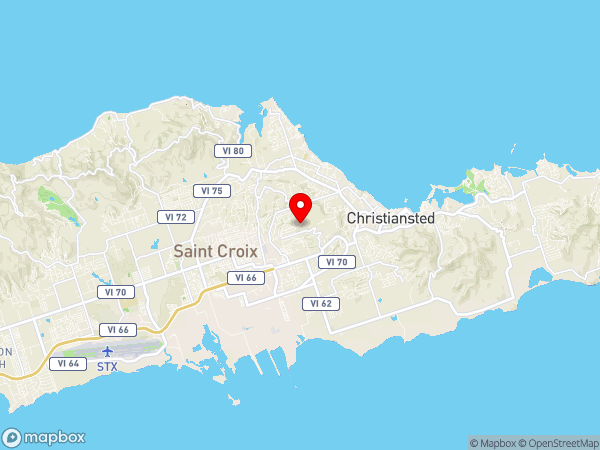
Location
City / Location
Saint Croix
Island
Saint Croix
State or Province
United States Virgin Islands
Country
United States
Population
50601
Do you have a question or just want to share information with other users regarding this location? Visit this area's Users Group.
For places to visit in this area, check out the following categories:
+ Map this area using Google
+ Geolocate = Towns currently around me
+ Submit a new local listing
+ To report an update to this Listing, please click on the "Send Inquiry" button above.
| RADIUS SEARCH: | MI. | KM. | |
|---|---|---|---|
| ✔ | What's Nearby | 45 | 72 |
| ✔ | Places to Eat / Drink | 45 | 72 |
| + Wineries, Breweries, Pubs | 45 | 72 | |
| ✔ | Places to Stay | 45 | 72 |
| + Campgrounds & RV Parks | 45 | 72 | |
| ✔ | Outdoors | 45 | 72 |
| + Parks, Trails, Beaches | 45 | 72 | |
| ✔ | Golf | 45 | 72 |
| ✔ | Entertainment | 45 | 72 |
| ✔ | Museums & Galleries | 45 | 72 |
| ✔ | Religious Sites | 45 | 72 |
| ✔ | Health | 60 | 96 |
| ✔ | Getting Around | 60 | 96 |
| ✔ | Airports | 60 | 96 |
| ✔ | Cities, Towns, Villages | 60 | 96 |
+ Map this area using Google
+ Geolocate = Towns currently around me
+ Submit a new local listing
+ To report an update to this Listing, please click on the "Send Inquiry" button above.
Saint Croix is an island in the Caribbean Sea, and a county and constituent district of the United States Virgin Islands (USVI), an unincorporated territory of the United States. St. Croix is the largest of the islands in the territory. However, the territory's capital, Charlotte Amalie, is located on Saint Thomas.
The island's highest point is Mount Eagle, at 355 meters (1,165 ft). St. Croix's nickname is "Twin City", for its two towns, Frederiksted on the western end and Christiansted on the northeast part of the island.
English is the dominant language on St. Croix and has been the official language since 1917, when the Danish West Indies were purchased by the United States.
The island's indigenous name is unknown. Its modern name is derived from the French Sainte-Croix, itself a translation of the Spanish name Isla de la Santa Cruz (meaning "island of the Holy Cross"), given by Columbus in 1493.
Saint Croix lies at the easternmost point in the United States of America at Saint Croix's Point Udall. The island has an area of 214.66 km2 (82.88 sq mi). The terrain is rugged, though not extremely so. The highest point on the island, Mount Eagle, is 1,165 feet (355 m) high. Most of the east end is quite hilly and steep, as is the north side from Christiansted west. From the north-side hills, a fairly even plain slopes down to the south coast; this was cultivated as the prime sugar land on the island.
CLIMATE
The trade wind blows more or less along the length of the island. The hills of the western part of the island receive a good deal more rain than the east end; annual rainfall is on the whole extremely variable, averaging perhaps 40 inches (1,000 mm) a year. The east end of the island is a dry desert range with a substantial amount of cactus, while the west end has lush vegetation and palm trees.
The island has multiple ecosystems in a small geographic area. Fairly severe and extended drought has always been a problem, particularly considering the lack of fresh ground water and lack of freshwater streams or rivers on the island. The island has a desalination plant, but most residential homes and businesses have built-in cisterns used to collect rainwater.
ROADS & HIGHWAYS
Cars drive on the left hand side of the road, but nearly all the automobiles on the island have left side steering columns. This has proven difficult for new residents and visitors from right-hand traffic locales such as the mainland United States, the French and Dutch West Indies, the Dominican Republic, and Puerto Rico. Roads are generally in poor shape, with numerous potholes.
There is a public bus service called Virgin Islands Transit, also known as VITRAN, operated by the Virgin Islands Department of Public Works.
In addition to taxis and buses, St. Croix has shared taxis, locally known as "taxi buses" (also found on the other U.S. Virgin Islands). Taxi buses are full-sized vans running a route from Frederiksted to Christiansted. Taxi buses are privately owned and operated; they do not follow a regular schedule, and there are no pre-specified stops. People simply wait by the side of the road until a taxi bus approaches, then flag the driver down by waving.
FERRIES
Ferry service to St. Thomas was restarted in April 2017. The QE IV Ferry makes one trip per day departing from Gallows Bay, Christiansted to Charlotte Amalie, St. Thomas. The journey takes 2.5 hours.
AIRPORTS
The Henry E. Rohlsen International Airport serves St. Croix with regular flights from the U.S. mainland, Puerto Rico, and the Eastern Caribbean. Seaplanes, operated by Seaborne Airlines, make the trip from St. Croix to St. Thomas, departing and arriving in Christiansted Harbor.
Although St. Croix is a U.S. territory, the U.S. Virgin Islands are maintained as a free port in a separate customs zone. Therefore, travelers to and from the contiguous United States and Puerto Rico must clear U.S. customs but do not need to present a passport, and only need proof of U.S. citizenship or nationality. The immigration status of non-U.S. citizens may be verified during this process.
POINTS OF INTEREST
Frederiksted maintains its Victorian era architecture and original seven street by seven street city design and is host to several historic structures. Among them are St. Patrick's Catholic Church built in the 1840s and its primary school, the Customs House, the 19th Century Apothecary, and many other buildings; some of which due to hurricanes past have fallen into very scenic ruins.
Frederiksted operates at a more relaxed pace than most of the island, and is more lively during Carnival in January and whenever visiting cruise ships are in port.
Salt River Bay National Historical Park and Ecological Preserve contains the only known site where members of a Columbus expedition set foot on what is now United States territory. It also preserves upland watersheds, mangrove forests, and estuarine and marine environments that support threatened and endangered species.
The site is marked by Fort Salé, a remaining earthworks fortification from the French period of occupation, about 1617. The park also preserves prehistoric and colonial-era archeological sites including the only existent example of a ball court in the Caribbean. This is one of two sites on the island for bioluminescent bays (the other being Altona Lagoon).
Fort Christiansværn built in 1749 and other buildings are maintained by the National Park Service as the Christiansted National Historic Site.
Buck Island Reef National Monument preserves a 176 acres (71 ha) island just north of St. Croix and the surrounding reefs. This is a popular destination for snorkelers.
Buck Island maintains a U.S. Coast Guard weather station and is also home to a student monitored lemon shark breeding ground. Green Cay (pronounced green key) is a small island located southwest of Buck Island; it is managed by the US Fish and Wildlife Service. It hosts a nearby reef popular among scuba divers and snorkelists—Tamarind Reef.
WATER SPORTS
The waters surrounding St. Croix are warm year-round, with temperatures ranging from 25 °C (77 °F) – 30 °C (86 °F), making it a popular destination for watersports including scuba diving, snorkeling, kayaking, paddleboarding, surfing, kite surfing, parasailing, jet skiing, fishing, and sailing. Two of the island's most popular underwater sites for scuba divers are the Frederiksted Pier and the drop-off into deep water at Salt River Bay National Historical Park and Ecological Preserve.
Frederiksted is known for reef diving and access to wreck diving. The western side of the island has calm waters that allow snorkeling with access from the beach. Paddleboarding is popular near Frederiksted for the same reason.
The Frederiksted Pier attracts scuba divers and snorkellers, as well as those who simply jump off it. The shallow water and sandy bottom around the pier are ideal for recreational diving by novice scuba divers in PADI Discover Scuba Diving programs (also called resort diving), for extended shore diving, night diving, and for underwater photography, especially of its abundant seahorse population.
A few hundred meters off the northern coast of the island, from Salt River to Cane Bay, the bottom drops suddenly into a deep trench, where coral reefs, abundant tropical fish, and migrant sea turtles may be observed. Kayaking is popular in the Salt River area as well.
The town of Christiansted, a short distance from Buck Island and Green Cay, is a former capital of the Danish West Indies. It lies just east of the northern underwater drop-off and is protected by a reef.
BIO-LUMINESCENT BAYS
There are two bio-luminescent bays or bio bays on St. Croix. The most widely known and visited is located at Salt River Bay National Historical Park and Ecological Preserve. A second bio bay can be found at Altona Lagoon. Bio bays are extremely rare with "only seven-year-round lagoons known to exist in the Caribbean".
PROTECTED AREAS
Buck Island Reef National Monument,managed by the National Park Service (a federal agency)
Christiansted National Historic Site, managed by the National Park Service (a federal agency)
Green Cay National Wildlife Refuge, managed by the US Fish and Wildlife Service (a federal agency)
Salt River Bay National Historical Park and Ecological Preserve, co-managed by the Territory of the Virgin Islands and the National Park Service (a federal agency)
Sandy Point National Wildlife Refuge, managed by the US Fish and Wildlife Service (a federal agency)
Point Udall
St. Croix East End Marine Park: managed by the Government of the Virgin Islands through the Department of Planning and Natural Resources' Division of Coastal Zone Management
Map
User reviews
There are no user reviews for this listing.
Already have an account? Log in now or Create an account
{{#ratings}}
{{title}}
{{#ownerCreatedBlock}}
{{/ownerCreatedBlock}}
{{#category}}
{{#editor}}
{{/editor}}
{{#user}}
{{/user}}
{{/ratings}}
-
{{#owner}}
-
{{#url}}
{{#avatarSrc}}
{{name}} {{/url}} {{^url}} {{#avatar}} {{& avatar}} {{/avatar}} {{name}} {{/url}} - {{/owner}} {{#created}}
- {{created}} {{/created}}
Category: {{category.title}}
{{/category}}
{{#fields}}
{{#showLabel}}
{{/fields}}
{{label}}:
{{/showLabel}}
{{& text}}