
Hawaii Kai
0
Location
City / Location
Hawaii Kai
Neighborhood
Hawaii Kai
County or District
Honolulu County
Island
Oahu
State or Province
Hawaii
Country
United States
Do you have a question or just want to share information with other users regarding this location? Visit this area's Users Group.
For places to visit in this area, check out the following categories:
+ Map this area using Google
+ Geolocate = Towns currently around me
+ Submit a new local listing
+ To report an update to this Listing, please click on the "Send Inquiry" button above.
| RADIUS SEARCH: | MI. | KM. | |
|---|---|---|---|
| ✔ | What's Nearby | 45 | 72 |
| ✔ | Places to Eat / Drink | 45 | 72 |
| + Wineries, Breweries, Pubs | 45 | 72 | |
| ✔ | Places to Stay | 45 | 72 |
| + Campgrounds & RV Parks | 45 | 72 | |
| ✔ | Outdoors | 45 | 72 |
| + Parks, Trails, Beaches | 45 | 72 | |
| ✔ | Golf | 45 | 72 |
| ✔ | Entertainment | 45 | 72 |
| ✔ | Museums & Galleries | 45 | 72 |
| ✔ | Religious Sites | 45 | 72 |
| ✔ | Health | 60 | 96 |
| ✔ | Getting Around | 60 | 96 |
| ✔ | Airports | 60 | 96 |
| ✔ | Cities, Towns, Villages | 60 | 96 |
+ Map this area using Google
+ Geolocate = Towns currently around me
+ Submit a new local listing
+ To report an update to this Listing, please click on the "Send Inquiry" button above.
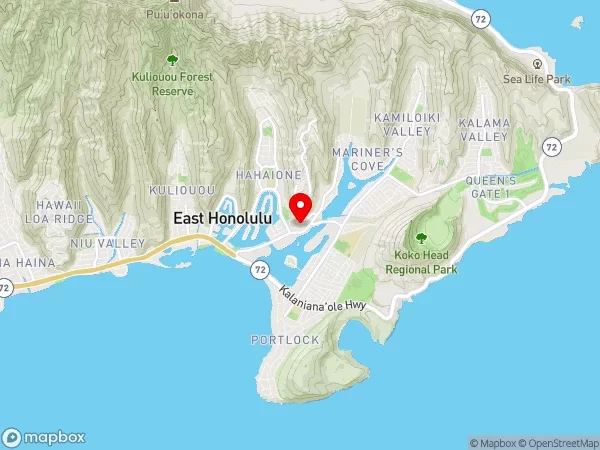
Maunalua (Hawaii Kai) is a largely residential area located in the City & County of Honolulu, in the East Honolulu CDP, on the island of Oʻahu. Maunalua, (Hawaii Kai) is the largest of several communities at the eastern end of the island.
The area was largely developed by Henry J. Kaiser around the ancient Maunalua fishpond and wetlands area known as Kuapā (meaning "fishpond wall"). The Hawaiʻi Kai or Koko Marina was dredged from Kuapā Pond starting around 1959. Dredging not only transformed the shallow coastal inlet and wetlands into a marine embayment, but was accompanied by considerable filling and clearing of the pond margins.
In 1961, Kaiser-Aetna entered into a lease agreement with the land owner, the Bernice Pauahi Bishop Estate, to develop the 521 acre (2.11 km2) fishpond into residential tracts with a marina and channels separated by fingers of land and islands upon which house lots and commercial properties would be laid out and developed.
Nearly all of the low-lying lands surrounding the marina have since been developed, and neighborhoods now extend back into the several valleys and up the separating ridges.
Immediately west of Maunalua (Hawaii Kai) along Kalanianaʻole Highway (State Rte. 72) is the East Honolulu neighborhood of Kuliʻouʻou. Eastward from Hawaiʻi Kai (Maunalua) on the same highway is the Koko Head area, an area now mostly included within Koko Head Park. South of Hawaii Kai is Maunalua Bay, and north are the Koʻolau mountains. Eventually the road crosses over to the windward side near Makapuʻu Point.
Hawaii Kai is located approximately 12 miles east of the Central Business District (CBD) of Honolulu. Hawaii Kai is a city district or neighborhood in Hawaii Kai, Hawaii, United States.
Map
User reviews
There are no user reviews for this listing.
Already have an account? Log in now or Create an account
{{#ratings}}
{{title}}
{{#ownerCreatedBlock}}
{{/ownerCreatedBlock}}
{{#category}}
{{#editor}}
{{/editor}}
{{#user}}
{{/user}}
{{/ratings}}
-
{{#owner}}
-
{{#url}}
{{#avatarSrc}}
{{name}} {{/url}} {{^url}} {{#avatar}} {{& avatar}} {{/avatar}} {{name}} {{/url}} - {{/owner}} {{#created}}
- {{created}} {{/created}}
Category: {{category.title}}
{{/category}}
{{#fields}}
{{#showLabel}}
{{/fields}}
{{label}}:
{{/showLabel}}
{{& text}}