Hotels by Trip.com
Flights by Trip.com
Standing at 4,327 meters (14,197 feet), Mount Belford ranks as Colorado’s 14th highest peak. Yet here’s something most visitors never learn until they arrive: this fourteener shares a ridge connection with Mount Oxford that creates one of the state’s most accessible double-peak ascents. On any given summer day, hikers complete both summits in a single trip. This unique feature makes the area far more than a one-peak destination.
The mountain sits within the Collegiate Peaks Wilderness. This protected area draws adventurers seeking authentic alpine experiences. Beyond the challenging hike, the region offers diverse activities and stunning natural beauty.
Whether you’re an experienced mountaineer or a first-time fourteener climber, this guide covers everything you need. We’ll explore route options, timing strategies, and hidden gems in the surrounding area.
Getting There & Planning Your Journey

Mount Belford sits in Chaffee County, near the town of Buena Vista. The closest major airports provide convenient access for travelers.
Nearest Airports
- Denver International Airport (DEN) – 201 km (125 miles), approximately 2.5 hours drive
- Colorado Springs Airport (COS) – 161 km (100 miles), approximately 2 hours drive
- Aspen-Pitkin County Airport (ASE) – 97 km (60 miles), approximately 1.5 hours drive
From Buena Vista, take County Road 390 west toward Clear Creek. This dirt road extends approximately 11 km (7 miles) to the Missouri Gulch Trailhead. The road conditions vary throughout the season.
Standard passenger vehicles can typically navigate County Road 390 during dry conditions. However, high-clearance vehicles perform better. After heavy rain or snow, four-wheel drive becomes essential.
The final stretch of road 390 can be rough. Many visitors park at lower elevation pullouts and walk the remaining distance. This adds miles to your hike but protects your vehicle.
Pro Tip: Arrive at the trailhead before dawn. Parking fills quickly during peak summer months. Early starts also help you avoid afternoon thunderstorms common in the area.
Best Time to Visit & Weather Tips

Timing your visit to Mount Belford requires understanding Colorado’s mountain weather patterns. The hiking season typically runs from late June through September. Outside these months, winter conditions make the trail significantly more challenging.
Recommended Months
- July – Peak wildflower season, most stable weather
- August – Warmest temperatures, long daylight hours
- September – Fewer crowds, autumn colors, crisp conditions
- Late June – Early season access, possible snow patches
Months to Avoid
- October through May – Heavy snow, avalanche danger
- April and May – Unpredictable spring storms
- Late October – Early winter storms arrive
Weather on Mount Belford changes rapidly. Morning sunshine can transform into afternoon thunderstorms within hours. This pattern occurs almost daily during summer months.
Lightning Safety: Afternoon thunderstorms typically develop between 12:00 PM and 4:00 PM. Plan to reach the summit by 11:00 AM and descend before storms arrive. Lightning strikes pose serious risks above treeline.
Temperature varies dramatically with elevation gain. Trailhead temperatures might reach 21°C (70°F) while summit conditions hover near 4°C (40°F). Wind chill at the summit can drop temperatures further.
| Month | Average Trailhead Temp | Average Summit Temp | Precipitation | Trail Conditions |
| June | 13°C (55°F) | 2°C (35°F) | Moderate | Snow patches likely |
| July | 18°C (65°F) | 7°C (45°F) | High (afternoon storms) | Mostly clear |
| August | 17°C (63°F) | 6°C (43°F) | Moderate | Best conditions |
| September | 12°C (54°F) | 1°C (34°F) | Low | Early snow possible |
Getting Around Locally
The Mount Belford area requires personal transportation. Public transit doesn’t serve the trailhead or surrounding wilderness. Most visitors base themselves in Buena Vista or nearby communities.
Check 30,000+ Local Sightseeing Tours Worldwide
✓ Numerous languages and currencies are available
Rental cars provide the most flexibility for exploring the region. Book vehicles in advance during peak summer season. High-clearance SUVs offer advantages on dirt roads leading to trailheads.
From your lodging, daily trips to different peaks and attractions become feasible. The Missouri Gulch Trailhead sits approximately 30 minutes from Buena Vista. Other nearby fourteeners like Missouri Mountain require similar drive times.
County Road 390 remains the primary route to Mount Belford. Pay attention to road conditions. Local gas stations and outdoor shops in Buena Vista provide current trail and road reports.
Navigation Note: Cell phone service becomes unreliable beyond Buena Vista. Download offline maps before heading to trailheads. GPS devices work well in the area.
Where to Stay

Buena Vista serves as the primary base for Mount Belford adventures. This small mountain town offers diverse lodging options. Accommodations range from budget motels to upscale mountain resorts.
Hotels & Motels
Several chain hotels operate in Buena Vista. These properties provide reliable amenities including hot showers, Wi-Fi, and breakfast options.
Expect to pay between $120-200 per night during summer. Book several weeks ahead for weekend stays.
Vacation Rentals
Private cabins and homes offer more space for groups. Many properties feature full kitchens and mountain views.
Rental homes accommodate 4-8 people comfortably. Prices range from $150-400 nightly depending on size and amenities.
Camping Options
Several campgrounds operate near Buena Vista. The Collegiate Peaks Wilderness allows dispersed camping with proper permits.
Developed campgrounds charge $20-35 per site. Dispersed camping in national forest areas remains free.
Leadville and Salida provide alternative lodging bases. Both towns sit within one hour of the trailhead. Leadville offers higher elevation acclimatization before your hike.
For budget-conscious travelers, camping near the Missouri Gulch Trailhead cuts accommodation costs. However, facilities are minimal. Bring all necessary supplies and pack out all waste.
Dining & Local Cuisine

Buena Vista’s dining scene caters to outdoor enthusiasts. Restaurants emphasize hearty portions and fresh ingredients. Many establishments open early to serve hikers heading to nearby trails.
Breakfast spots fill quickly on summer mornings. Local cafes serve substantial meals designed to fuel long days on the trail. Expect large portions of eggs, potatoes, and pancakes.
Recommended Meal Types
- Pre-hike breakfasts with high protein and carbohydrates
- Post-hike burgers and craft beer selections
- Mexican cuisine featuring Colorado green chile
- Pizza restaurants for group celebrations
- Coffee shops with grab-and-go options
Local Specialties
- Bison burgers from regional ranches
- Colorado lamb dishes
- Trout from nearby streams
- Craft beers from local breweries
- Breakfast burritos with green chile sauce
Pack substantial trail food for your hike. Convenience stores in Buena Vista stock energy bars, nuts, and dried fruit. Grocery stores offer sandwich materials and snack items.
Water sources exist along the Missouri Gulch Trail, but filtration is essential. Bring at least 3 liters of water capacity per person. Hydration becomes critical at high elevation.
Attractions, Sightseeing & Activities

Mount Belford itself dominates the attraction list. This fourteener challenges hikers while remaining accessible to those with proper preparation. The standard route via Missouri Gulch draws the most visitors.
Hiking Mount Belford
The Missouri Gulch Trail serves as the primary route to Mount Belford’s summit. This path begins at the Missouri Gulch Trailhead at approximately 2,896 m (9,500 feet) elevation. The round-trip distance covers about 14.5 km (9 miles) with 1,402 m (4,600 feet) of elevation gain.
Trail conditions vary by season and recent weather. Early summer hikes may encounter snow patches above treeline. Late summer typically offers the most stable trail surface.
Route Highlight: The trail climbs steadily through aspen and pine forests before emerging above treeline. Once past the trees, sweeping views of the Collegiate Peaks open up. The final approach follows a rocky ridge to the summit.
Most hikers complete the ascent in 4-6 hours. Descent takes 2-4 hours. Total trip time typically ranges from 7-10 hours depending on fitness level and weather conditions.
Mount Belford and Oxford Combination
Mount Oxford sits adjacent to Mount Belford along a connecting ridge. Many hikers tackle both peaks in a single day. This combination adds approximately 2.4 km (1.5 miles) and 457 m (1,500 feet) of elevation gain to your trip.
The Belford-Oxford traverse ranks among Colorado’s most popular 14er combinations. The ridge walk between peaks offers spectacular views. However, the additional elevation gain and distance challenge even fit hikers.
Important Consideration: Adding Mount Oxford to your itinerary increases exposure time to weather. Start earlier if attempting both peaks. Return to treeline before afternoon storms develop.
Missouri Mountain Alternative
Missouri Mountain provides another fourteener option from the same trailhead area. This peak sees fewer crowds than Belford but demands similar fitness levels. The route requires navigation skills and stamina.
Experienced hikers sometimes attempt all three peaks (Belford, Oxford, and Missouri) in one day. This “triple crown” covers over 24 km (15 miles) with massive elevation gain. Only attempt this combination if you possess excellent fitness and mountain experience.
Museums, Cultural Spots & Festivals

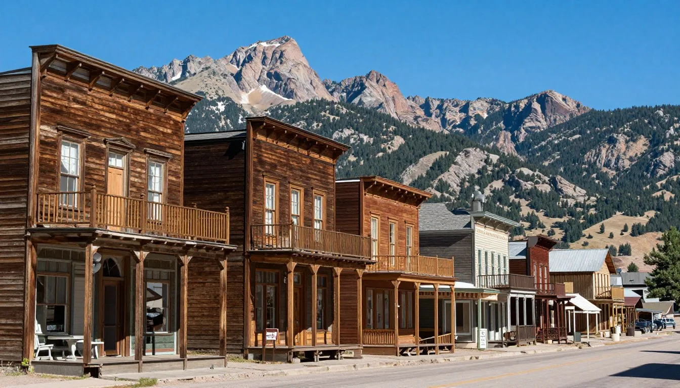
The region surrounding Mount Belford holds rich mining history. Several museums in nearby towns preserve this heritage. Buena Vista’s downtown historic district showcases Victorian-era architecture from the mining boom.
The Buena Vista Heritage Museum documents local history through photographs and artifacts. Exhibits cover mining operations, railroad history, and early settlers. The museum operates seasonally from May through September.
Leadville, located 48 km (30 miles) north, contains extensive mining history sites. The National Mining Hall of Fame and Museum presents comprehensive exhibits. Walking tours of historic Leadville reveal preserved buildings from the 1880s silver rush.
Annual Events Near Mount Belford
- Buena Vista Bike Fest (June) – Mountain biking celebration with races and demos
- Gold Rush Days (August) – Historical reenactment and mining heritage festival
- Autumn Color Festival (September) – Celebration of fall foliage with art shows
- FIBArk Whitewater Festival (June) – Oldest whitewater festival in America
The Colorado Fourteeners Initiative maintains a visitor center in Golden, Colorado. While not near Mount Belford, this organization provides valuable resources for fourteener hiking. They conduct trail maintenance and education programs throughout the Collegiate Peaks.
Nature & Outdoor Experiences

The Collegiate Peaks Wilderness encompasses 168,000 acres of pristine mountain terrain. This protected area contains eight fourteeners and countless trails. Mount Belford represents just one destination within this vast wilderness.
Wildlife Viewing
The area around Mount Belford supports diverse wildlife populations. Elk herds frequently graze in valleys near the Missouri Gulch Trail. Early morning and evening hours provide the best viewing opportunities.
Mountain goats inhabit the high peaks above treeline. These sure-footed animals often appear on rocky summits. Marmots and pikas live in boulder fields throughout the alpine zone.
Common Wildlife
- Elk in valley meadows and forest edges
- Mule deer throughout forested areas
- Mountain goats above treeline
- Marmots in rocky talus fields
- Pikas among boulder fields
- Various hawk and eagle species
Viewing Tips
- Carry binoculars for distant observation
- Remain quiet and move slowly
- Never approach or feed wildlife
- Watch for animals at dawn and dusk
- Keep safe distances from all species
- Store food properly to avoid attracting animals
Wildflower Season
July brings peak wildflower displays to alpine meadows. The Missouri Gulch Trail passes through extensive flower fields below treeline. Columbine, paintbrush, and alpine sunflowers create colorful displays.
Different elevations bloom at different times. Lower meadows peak in early July. Higher alpine areas reach full bloom in late July and early August.
Water Activities

Clear Creek flows through the valley below Mount Belford. This waterway provides fishing opportunities for trout species. Colorado fishing licenses are required for anglers.
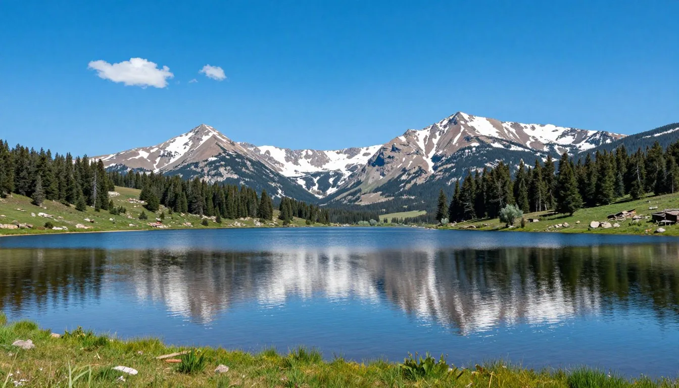
Cottonwood Lake, located nearby, offers kayaking and stand-up paddleboarding. The high-elevation lake sits at 2,896 m (9,500 feet). Water temperatures remain cold even in summer.
The Arkansas River, accessible from Buena Vista, ranks among Colorado’s premier whitewater destinations. Commercial rafting companies operate trips ranging from gentle floats to challenging Class IV rapids.
Safety, Etiquette & Local Customs

Mountain safety requires preparation and awareness. Altitude sickness affects many visitors to Colorado’s high peaks. Symptoms include headache, nausea, and fatigue.
Altitude Awareness: Mount Belford’s summit sits above 4,267 m (14,000 feet). Spend at least one day at moderate elevation before attempting the hike. Consider staying in Leadville (elevation 3,094 m/10,152 feet) for better acclimatization.
Essential Safety Practices
- Start hiking before sunrise to avoid afternoon lightning
- Carry the “Ten Essentials” including navigation, sun protection, and first aid
- Bring extra layers – temperatures drop significantly with altitude
- Pack more water than you think necessary
- Turn back if weather deteriorates or you feel unwell
- Inform someone of your hiking plans and expected return time
Leave No Trace Principles
The Collegiate Peaks Wilderness operates under strict conservation guidelines. All visitors must follow Leave No Trace principles to protect the fragile alpine environment.
Pack It In, Pack It Out
Carry all trash back to trailhead facilities. This includes food wrappers, orange peels, and toilet paper.
- Use designated toilet facilities when available
- Bury human waste 15-20 cm deep, 61 m from water
- Pack out all toilet paper and hygiene products
- Never leave food scraps or biodegradables
Respect Wildlife
Observe animals from safe distances. Never feed wildlife or attempt to touch wild creatures.
- Store food in bear-resistant containers
- Keep dogs leashed on all trails
- Avoid nesting areas and young animals
- Make noise when hiking to avoid surprising wildlife
Stay on Trail
Cutting switchbacks causes erosion and damages fragile alpine plants. Stick to established paths.
- Walk through mud puddles, not around them
- Use trekking poles carefully to avoid damaging vegetation
- Camp in established sites when possible
- Keep campsites at least 61 m from water sources
Minimize Campfire Impact
Fires are generally discouraged above treeline. Use camp stoves for cooking instead.
- Check current fire restrictions before your trip
- Use established fire rings if fires are permitted
- Keep fires small and fully extinguish them
- Never leave fires unattended
Trail Etiquette
Hikers ascending the trail have right-of-way over those descending. Step aside to let uphill hikers pass without breaking their rhythm.
Groups should hike in single file on narrow trails. Large groups sometimes split into smaller parties to reduce impact and congestion.
Mountain biking is not permitted in designated Wilderness areas. However, bikes are allowed on some approach roads and trails outside wilderness boundaries.
Visitor Comments About Mount Belford
“The views from the summit absolutely took my breath away. We started at 4:30 AM and reached the top by 10:00 AM. The ridge walk was challenging but manageable. Afternoon storms rolled in just as we got back below treeline. Perfect timing made all the difference.”
“I added Mount Oxford to my Belford hike and don’t regret it one bit. The extra effort paid off with incredible ridge views. The trail was well-marked and easier to follow than I expected. My advice: bring more water than you think you need. The dry air and elevation had me drinking constantly.”
“This was my first fourteener, and Mount Belford proved to be an excellent choice. The trail gains elevation steadily without any extremely steep sections. I spent two nights in Buena Vista beforehand to acclimatize. That preparation definitely helped. The wildflowers in mid-July were stunning beyond description.”
Additional Nearby Destinations

The Collegiate Peaks region contains numerous destinations worth exploring. Several fourteeners sit within short driving distance of Mount Belford.
Mount Harvard and Mount Columbia
These two fourteeners form another popular combination hike. Mount Harvard stands as Colorado’s third-highest peak at 4,395 m (14,420 feet). The North Cottonwood Creek approach provides access to both summits.
This route demands more experience than Mount Belford. Navigation skills become essential above treeline. The round trip covers approximately 21 km (13 miles).
Mount Princeton
Located south of Buena Vista, Mount Princeton offers hot springs at its base. The Princeton Hot Springs Resort provides relaxation after challenging hikes. The mountain itself presents a moderate fourteener climb.
Several trail routes lead to Princeton’s summit. The standard route from the resort covers approximately 11 km (7 miles) round trip.
Buena Vista River Park
This in-town recreation area features kayaking, tubing, and fishing along the Arkansas River. The park provides easy access to whitewater activities. Rental equipment is available from local outfitters.
St. Elmo Ghost Town
This preserved mining town sits 26 km (16 miles) southwest of Buena Vista. Historic buildings remain standing along the main street. The site offers glimpses into Colorado’s mining heritage.
St. Elmo serves as a trailhead for several backcountry routes. The drive follows scenic County Road 162 through Chalk Creek Canyon.
Day Trip Options
- Cottonwood Hot Springs – Natural mineral springs with pools
- Monarch Pass – Continental Divide crossing with tram rides
- Collegiate Peaks Scenic Byway – 92 km drive through mountain valleys
- Turquoise Lake – High-altitude fishing and paddling near Leadville
Practical Travel Tips
What to Pack
Proper gear makes the difference between enjoyable and miserable mountain experiences. Colorado weather changes rapidly at high elevation.
Essential Clothing
- Moisture-wicking base layers
- Insulating mid-layer (fleece or down)
- Waterproof rain jacket
- Sun hat and warm beanie
- Hiking boots with ankle support
- Extra socks and gloves
Required Equipment
- Headlamp with extra batteries
- Navigation tools and map
- First aid supplies
- Water purification system
- High-calorie snacks and lunch
- Trekking poles for stability
Permits and Regulations
The Collegiate Peaks Wilderness does not require permits for day hiking. Overnight camping requires following wilderness regulations but no advance permits.
Parking at the Missouri Gulch Trailhead is free. The lot accommodates approximately 20 vehicles. Overflow parking occurs along the dirt road approach.
Dogs are allowed on Mount Belford trails but must remain leashed. Pack out all pet waste. Consider leaving dogs at home due to difficult terrain and altitude.
Physical Preparation
Mount Belford challenges even fit hikers. The elevation gain and high-altitude environment stress cardiovascular systems. Prepare for several weeks before your trip.
Training Recommendation: Build endurance with regular long hikes carrying a weighted pack. Include elevation gain in your training hikes. Cardiovascular exercise like running or cycling helps prepare for altitude demands.
Money and Services
Buena Vista provides full services including gas stations, grocery stores, and outdoor equipment shops. ATMs are available throughout town. Most businesses accept credit cards.
Check 30,000+ Local Sightseeing Tours Worldwide
✓ Numerous languages and currencies are available
Cell phone coverage exists in Buena Vista but becomes spotty on County Road 390. Expect no signal at the trailhead or on the mountain. Download maps and information before departing.
Emergency Contacts
Important Numbers:
- Emergency Services: 911
- Chaffee County Search and Rescue: Non-emergency coordination through 911
- San Isabel National Forest Ranger District: (719) 553-1400
- Weather Information: Check NOAA forecasts before departure
Best Practices
Arrive in Colorado at least one day before attempting Mount Belford. Use this time to acclimate to elevation. Gentle hiking at moderate elevations helps your body adjust.
Hydrate consistently starting several days before your hike. Altitude increases dehydration risk. Drink more water than normal throughout your visit.
Know your limits and be willing to turn around. Summit fever causes poor decisions. The mountain will be there for future attempts if conditions aren’t favorable.
Your Adventure Awaits in the Collegiate Peaks
Mount Belford offers more than a summit. It provides a gateway to understanding Colorado’s high country. The combination of accessible routes and genuine wilderness creates perfect conditions for memorable mountain experiences.
From the challenging ridge walk to the stunning wildflower meadows, every aspect of this fourteener rewards preparation and effort. Whether you summit Belford alone or tackle the Oxford combination, you’ll join thousands who’ve discovered why this peak remains a Colorado favorite.
The surrounding area extends your adventure beyond a single day hike. Hot springs, historic towns, and additional peaks fill itineraries for weeks. Each visit reveals new aspects of this remarkable mountain region.
Start planning your Mount Belford journey today. The peaks await your arrival.