Hotels by Trip.com
Flights by Trip.com
Did you know that Ophir Pass Road climbs to 3,536 m (11,600 ft), making it one of Colorado’s highest mountain passes accessible by vehicle? This stunning route connects the historic mining town of Ophir with Silverton, winding through the San Juan Mountains with jaw-dropping views at every turn.
The pass offers an unforgettable alpine adventure. You’ll drive past abandoned mining structures, wildflower meadows, and towering peaks. Whether you’re an experienced off-road driver or a first-time mountain pass explorer, this guide provides everything you need to plan your trip.
Getting There & Planning Your Journey
Planning your trip to Ophir Pass Road Colorado starts with choosing the right airport. Most visitors fly into Montrose Regional Airport (MTJ), located about 113 km (70 miles) north of the pass. This airport offers rental vehicles and connects to major U.S. cities.
Telluride Regional Airport (TEX) sits closer at just 32 km (20 miles) away. However, flights here are more limited and often more expensive. Denver International Airport (DEN) is another option, though it requires a 531 km (330 mile) drive through mountain terrain.
The pass is accessible from two main starting points. From the west, you’ll begin in the town of Ophir, located just off Highway 145. From the east, the route starts near Silverton on Highway 550. Both approaches offer stunning scenery but present different challenges.

Vehicle Requirements: High-clearance 4WD vehicles are strongly recommended for Ophir Pass Road. The route features rocky sections, steep grades, and narrow shelf roads that standard passenger vehicles cannot safely navigate.
Best Time to Visit & Weather Tips
Timing your visit to Ophir Pass is critical for safety and enjoyment. The pass typically opens in late June or early July, depending on snowmelt conditions. It remains accessible through September before winter snow closes the route again.
July and August offer the most reliable conditions. Temperatures at the pass range from 10°C to 21°C (50°F to 70°F) during the day. Wildflowers peak during this time, painting the alpine meadows in brilliant colors. However, afternoon thunderstorms are common, bringing lightning and slick road conditions.
September provides crisp weather and fewer crowds. Aspen trees turn golden, creating spectacular photo opportunities. Morning temperatures can dip near freezing, so pack warm layers. Early October sees the first significant snowfall, making the pass impassable.
Best Months to Visit
- July – Peak wildflower season, warm weather
- August – Most stable conditions, full accessibility
- September – Fall colors, fewer tourists
Months to Avoid
- October through May – Snow and ice closure
- June – Unpredictable conditions, lingering snow
- Afternoon hours in summer – Thunderstorm risk
Weather Alert: Mountain weather changes rapidly. Check conditions before departing and start your drive early in the day to avoid afternoon storms. Turn back if threatening weather develops.
Check 30,000+ Local Sightseeing Tours Worldwide
✓ Numerous languages and currencies are available
Notable Annual Festivals
The San Juan region celebrates its mining heritage and mountain culture through several annual events. While Ophir Pass itself doesn’t host festivals, nearby communities offer excellent reasons to extend your visit.
The Telluride Bluegrass Festival takes place each June in Telluride. This four-day music celebration draws thousands of visitors. Contact the festival organizers at (970) 728-6363 for ticket information and camping details.
Silverton’s Hardrockers Holidays occur throughout August. This month-long celebration features mining competitions, historical reenactments, and local craft fairs. The Silverton Chamber of Commerce can provide details at (970) 387-5654.
The Telluride Film Festival in September transforms the mountain town into a cinema lover’s paradise. Independent films premiere against the backdrop of stunning fall colors. For festival schedules, contact (510) 665-9494.
Getting Around Locally
Navigating Ophir Pass requires careful vehicle selection and driving skill. The road is a narrow dirt and rock trail with tight switchbacks and exposed shelf sections. Traffic moves slowly, averaging 16-24 km/h (10-15 mph) in most sections.
Most rental car companies prohibit taking standard vehicles on unpaved roads. Specialized rental agencies in Telluride and Silverton offer high-clearance 4WD vehicles specifically for mountain pass driving. Reserve these vehicles well in advance during summer months.

The drive typically takes two to three hours one-way, not including photo stops. Many visitors combine the pass with a loop route connecting Highway 145 and Highway 550. This creates a full-day adventure exploring multiple high-elevation areas.
Cell phone service is extremely limited or nonexistent on most of the pass. Download offline maps before departing. Carry a physical map as backup. GPS devices can be unreliable in the steep mountain terrain.
Where to Stay
Accommodation options near Ophir Pass range from luxury resorts to rustic campgrounds. Your choice depends on budget, desired amenities, and how close you want to stay to the pass itself.
Telluride offers the widest selection of lodging. The Mountain Lodge provides comfortable rooms with easy access to the pass starting point. Contact them at (970) 728-3000 for current rates and availability.
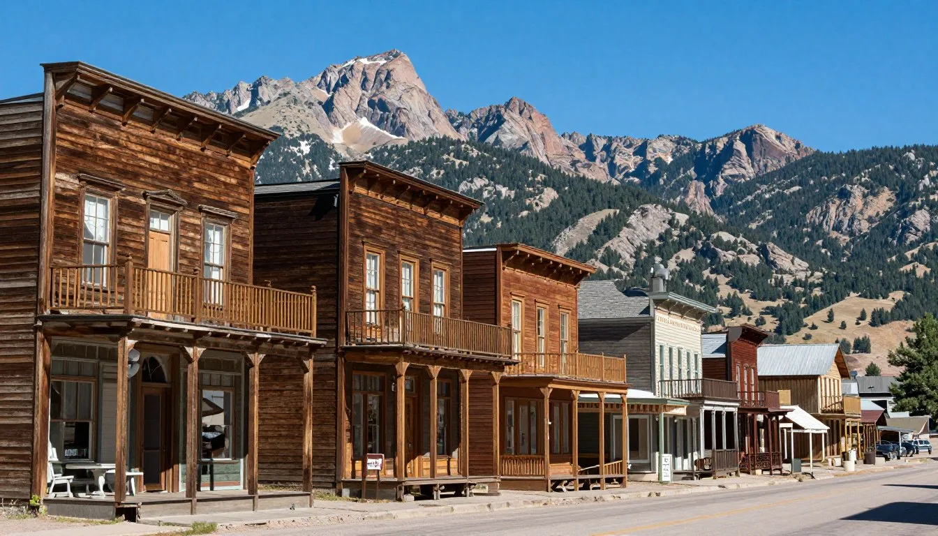
The town of Ophir itself has limited lodging options. However, vacation rentals and small inns provide an authentic mountain experience. Staying here puts you right at the western trailhead.
Silverton caters to budget-conscious travelers with historic hotels and hostels. The town’s Victorian-era buildings offer unique character. For camping enthusiasts, South Mineral Campground sits near the eastern approach. Reserve sites through the Forest Service at (970) 387-5654.

- Telluride luxury hotels and condos – Premium amenities, dining options
- Ophir vacation rentals – Intimate settings, mountain authenticity
- Silverton budget hotels – Historic charm, affordable rates
- National Forest campgrounds – Primitive camping, nature immersion
Dining & Local Cuisine
The mountain communities surrounding Ophir Pass offer diverse dining experiences. Telluride restaurants range from upscale establishments to casual cafes. Many feature locally sourced ingredients and craft beverages.
Pack a substantial lunch before driving the pass. No services exist along the route itself. Water, snacks, and energy bars are essential. The thin air at high elevation increases calorie and hydration needs.
Silverton’s dining scene reflects its mining heritage with hearty, no-frills meals. Local brewpubs serve craft beers alongside burgers and sandwiches. These establishments provide perfect post-drive relaxation spots.
Telluride’s farmers market operates Thursday afternoons in summer. Local vendors sell fresh produce, baked goods, and artisan products. This is an excellent opportunity to gather picnic supplies before your mountain adventure.
Attractions, Sightseeing & Activities
Ophir Pass Road itself is the main attraction, but the surrounding area offers numerous activities. The historic mining ruins along the route provide glimpses into Colorado’s silver boom era. Several abandoned structures sit just off the road, safe to photograph but not enter.
Photography opportunities are endless throughout the drive. The switchbacks on the eastern side create dramatic foreground elements with mountain peaks beyond. Early morning and late afternoon light produce the most striking images.

Wildlife viewing is excellent throughout the San Juan Mountains. Marmots sun themselves on rocks near the summit. Bighorn sheep sometimes appear on the higher slopes. Elk frequent meadows during morning and evening hours.
The pass serves as a trailhead for several hiking routes. Day hikes to alpine lakes and peaks begin from various points along the road. These trails range from moderate to strenuous difficulty.
Photography
Capture stunning mountain vistas, mining ruins, and wildflower meadows. Golden hour provides optimal lighting conditions.
Wildlife Viewing
Spot marmots, bighorn sheep, and elk in their natural habitat. Bring binoculars for distant observations.
Hiking
Access alpine trails leading to high-elevation lakes and peaks. Prepare for thin air and rapid weather changes.
Museums, Cultural Spots & Festivals
The mining history of the San Juan region comes alive in local museums. Silverton’s Mining Heritage Center displays original equipment and tells stories of miners who worked these mountains. The museum offers guided tours during summer months.
Telluride’s historic downtown is itself a living museum. Victorian-era buildings line main streets, housing galleries, shops, and restaurants. Walking tours explain the town’s transformation from rough mining camp to ski resort.
The Durango & Silverton Narrow Gauge Railroad offers historical transportation experiences. While not directly on the pass route, this steam train provides context for how miners and supplies reached these remote locations.

Nature & Outdoor Experiences
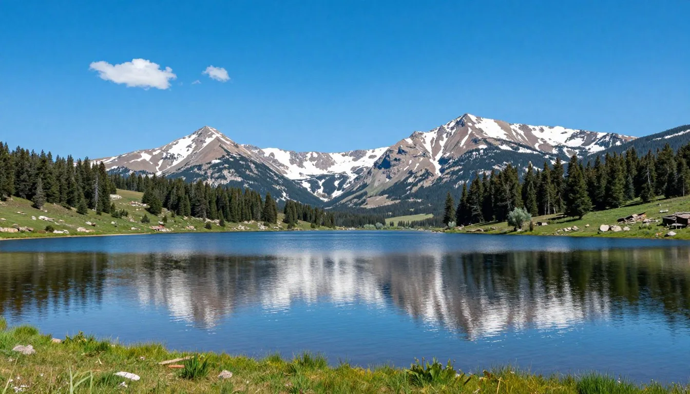
The natural environment around Ophir Pass is among Colorado’s most spectacular. Alpine tundra above treeline hosts delicate wildflowers adapted to harsh conditions. July brings peak blooming periods when entire mountainsides explode with color.
Aspen groves line lower elevations of the route. These trees create natural tunnels over the road in some sections. Fall transforms them into golden cathedrals that contrast beautifully against evergreen forests.

Several alpine lakes sit within hiking distance of the pass. These crystal-clear waters reflect surrounding peaks and provide peaceful rest spots. Most lakes remain cold throughout summer, making swimming brief but refreshing.
Bear Creek tumbles down the eastern side of the pass. This cascading stream creates numerous small waterfalls visible from the road. During peak runoff in early summer, the water volume is particularly impressive.
- Wildflower identification – Over 200 alpine species bloom here
- Fall foliage viewing – Aspen groves peak late September
- Alpine lake hiking – Crystal-clear mountain waters
- Waterfall photography – Numerous cascades along route
- Mountain peak identification – San Juan range geology
Safety, Etiquette & Local Customs
Safety is paramount when driving Ophir Pass. Vehicle clearance matters significantly. The minimum recommended clearance is 229 mm (9 inches), though higher is better. Sharp rocks can damage oil pans and undercarriage components on lower vehicles.
Downhill traffic yields to uphill traffic on narrow sections. This is both courtesy and necessity, as uphill momentum is difficult to regain on steep grades. Pull into wider spots to allow passing when safe.
Critical Safety Information: Always check current road conditions before attempting the pass. The Forest Service provides updates at (970) 247-2755. Never attempt the drive during or immediately after heavy rain or if snow is forecast.
Lightning presents serious danger above treeline. If thunderstorms threaten, descend immediately to lower elevations. Avoid being the highest object on exposed ridges or summits. Wait in your vehicle if caught in a storm.

Leave no trace principles are essential in this fragile alpine environment. Pack out all trash, even biodegradable items. Stay on established roads and trails to prevent erosion. Do not disturb mining artifacts, which are protected historical resources.
Essential Safety Gear
- First aid kit and emergency supplies
- Extra food, water, and warm clothing
- Spare tire and tire repair kit
- Physical maps and compass
- Flashlight and extra batteries
Driving Etiquette
- Yield to uphill traffic on narrow sections
- Use pullouts for passing opportunities
- Keep speeds appropriate for conditions
- Respect private property boundaries
- Share the trail with hikers and cyclists
Visitor Comments About Ophir Pass Road
“The views from Ophir Pass absolutely took my breath away. We drove it in our rented 4WD and felt completely safe the entire time. The wildflowers in July were incredible. Every turn revealed another stunning vista. Just make sure your vehicle has good clearance and start early to avoid afternoon storms. This was definitely the highlight of our Colorado vacation.”
“Coming from the UK, I wasn’t prepared for how rugged and beautiful American mountain passes could be. Ophir Pass exceeded all expectations. The road is challenging but manageable with proper preparation. We saw mining ruins, wildflowers, and even a family of marmots near the summit. The town of Ophir at the base was charming and gave us great local advice before we started.”
“This pass connects you to Colorado’s mining history in a way no museum can match. Driving where miners once traveled by mule was humbling. The shelf road sections got my heart racing, but the views made every moment worthwhile. We combined this with a visit to Silverton and made it a perfect day loop. Just respect the mountain and check conditions before you go.”
Additional Nearby Destinations
The San Juan Mountain region offers numerous additional adventures beyond Ophir Pass. These destinations combine easily with your pass drive to create multi-day itineraries.
Black Bear Pass sits just north and presents one of Colorado’s most challenging drives. This route is for experienced drivers only, featuring steep grades and tight switchbacks. The views down to Bridal Veil Falls are legendary.
Mesa Verde National Park lies 177 km (110 miles) southwest. These ancient cliff dwellings showcase Ancestral Puebloan culture from centuries past. Plan a full day to tour the archaeological sites properly.

Durango combines Old West charm with modern amenities. The historic downtown features excellent restaurants, breweries, and shops. The narrow gauge railroad departs from here daily during summer months.
Ouray, nicknamed the “Switzerland of America,” sits in a natural amphitheater of peaks. Hot springs, ice climbing, and via ferrata routes make this town worth at least a day’s exploration.
Black Bear Pass
Expert-level 4WD route with extreme exposure. Features Bridal Veil Falls, Colorado’s tallest free-falling waterfall at 110 m (365 ft).
Mesa Verde
Ancient cliff dwellings and archaeological sites. UNESCO World Heritage Site showcasing Puebloan history from 600 to 1300 AD.
Ouray
Victorian mining town with natural hot springs. Ice climbing capital in winter, via ferrata routes in summer months.
Practical Travel Tips
Successful Ophir Pass trips require thorough preparation. Start with a full fuel tank, as gas stations are sparse in the San Juan Mountains. The nearest stations to the pass are in Telluride and Silverton.
Elevation affects both vehicles and people. The pass summit sits at 3,536 m (11,600 ft), where air contains 40% less oxygen than sea level. Allow time to acclimate if you’re coming from lower elevations. Symptoms of altitude sickness include headache, nausea, and fatigue.
Visitor Information: The Telluride Visitor Center provides current pass conditions, weather forecasts, and trail maps. Contact them at (970) 728-4431 or visit their office at 398 W. Colorado Avenue before your drive.
Bring layers of clothing regardless of the season. Temperature drops significantly with elevation gain. A pleasant 21°C (70°F) day in town can mean 7°C (45°F) temperatures with wind at the pass summit.
Download offline maps before losing cell service. Popular navigation apps like Google Maps allow you to save map sections for offline use. The OnX Offroad app provides detailed topographic maps specifically designed for backcountry navigation.
- Fuel up completely before starting – No services on the pass route
- Check clearance requirements – 229 mm (9 inches) minimum recommended
- Start early morning – Afternoon thunderstorms are common and dangerous
- Pack emergency supplies – Food, water, warm clothes, first aid kit
- Download offline maps – Cell service is nonexistent on most of the pass
- Allow acclimation time – High altitude affects everyone differently
- Verify current conditions – Call Forest Service or visitor centers before departing
Your San Juan Adventure Awaits
Ophir Pass Road offers one of Colorado’s most rewarding mountain experiences. The combination of mining history, alpine beauty, and driving challenge creates memories that last a lifetime. Every switchback reveals new perspectives on the San Juan range.
Whether you’re drawn by wildflowers, photography, or simply the adventure of high mountain driving, this pass delivers. The route demands respect and preparation, but rewards those efforts with unmatched natural splendor.
The mountain is calling. Pack your vehicle, check the conditions, and point your wheels toward the high country. Ophir Pass awaits with its timeless beauty and unforgettable vistas.