Hotels by Trip.com
Flights by Trip.com
Did you know that Paradox Canyon conceals one of Colorado’s most remarkable geological mysteries? Scientists estimate these ancient rock formations took over 300 million years to create. The canyon walls tell stories of prehistoric oceans and dramatic earth shifts. This remote area remains surprisingly unknown to most travelers.
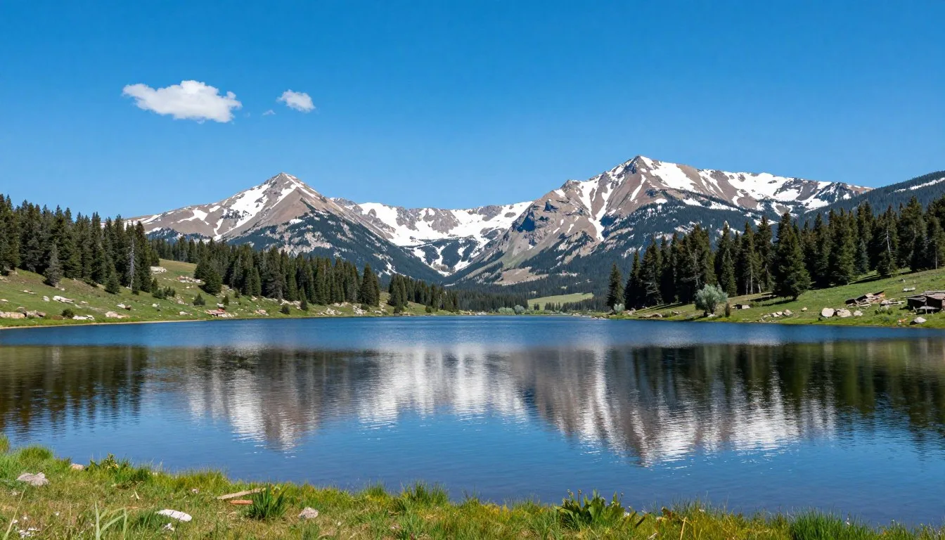
Paradox Canyon sits in western Colorado’s rugged backcountry. The region offers extraordinary red rock scenery and genuine wilderness experiences. Unlike crowded national parks, this area maintains its untouched character. Visitors discover stunning vistas, ancient petroglyphs, and challenging trail routes.
This comprehensive guide reveals everything you need to know. We cover practical travel logistics, seasonal recommendations, and hidden gems. You’ll find essential trail information, lodging options, and local dining spots. Whether you seek outdoor adventure or cultural exploration, Paradox Canyon delivers unforgettable experiences.
Getting There & Planning Your Journey

Reaching Paradox Canyon requires planning and preparation. The area sits approximately 64 km (40 miles) southwest of Grand Junction, Colorado. Most visitors access the region through established highway routes and backcountry roads. The journey rewards travelers with spectacular scenery throughout.
Closest Airports
Grand Junction Regional Airport (GJT) serves as the primary gateway. This airport sits just 80 km (50 miles) northeast of the area. Multiple daily flights connect to Denver and other major cities. Rental vehicles are readily available at the airport terminal.
Montrose Regional Airport (MTJ) offers an alternative option. Located 105 km (65 miles) southeast, it provides seasonal service. Denver International Airport (DEN) sits 400 km (250 miles) away. Many visitors combine their trip with other Colorado destinations.
Road Access and Navigation
State Highway 90 provides the main access route. From Naturita, travelers head northwest on this paved road. The Paradox Trail and surrounding routes require high-clearance vehicles. Four-wheel drive becomes essential during wet conditions or winter months.
The road conditions vary significantly throughout the area. Paved sections transition to well-maintained gravel roads. Some trail access points require navigating rough, rocky terrain. Cell phone service remains limited across most of the region.
Important Note: Always check current road conditions before departure. Spring snowmelt and summer thunderstorms can make routes temporarily impassable. Local weather patterns change rapidly in this high-desert environment.
For current road conditions and area access information, contact the Bureau of Land Management Uncompahgre Field Office at +1 (970) 240-5300.
Best Time to Visit & Weather Tips

Best Time to Visit Paradox Canyon Colorado
Spring and fall offer the most pleasant conditions. April through June brings moderate temperatures and blooming wildflowers. The weather remains comfortable for extended hiking and exploration. September through October provides stunning autumn colors and crisp mountain air.
Check 30,000+ Local Sightseeing Tours Worldwide
✓ Numerous languages and currencies are available
Summer temperatures frequently exceed 32°C (90°F) in the canyon. Early morning starts become essential for trail activities during this season. Afternoon thunderstorms develop regularly from July through August. These storms create spectacular lightning displays but pose significant safety risks.
Winter transforms the area into a quiet wonderland. Snow covers higher elevations from November through March. Many backcountry roads become impassable during this period. However, experienced winter travelers find solitude and unique photographic opportunities.
Best Months
- April to June: Wildflower season, moderate temperatures
- September to October: Fall colors, fewer crowds
- Late March: Spring awakening, bird migration
- Early November: First snow, dramatic contrasts
Months to Avoid
- July to August: Extreme heat, thunderstorm risk
- December to February: Heavy snow, road closures
- Late June: Peak heat before monsoon relief
- March: Unpredictable conditions, mud season
Notable Annual Festivals
The region hosts several cultural events throughout the year. The Naturita Paradox Days celebration occurs each June. This small-town festival features local crafts, food vendors, and community activities. Contact the Naturita Chamber of Commerce at +1 (970) 865-2867 for specific dates.
Nearby Nucla celebrates its Mining Days festival in August. The event honors the area’s rich mining heritage. Visitors enjoy historical demonstrations, live music, and traditional food. The Norwood Bronc & Bull Bash takes place in July. This authentic rodeo draws competitors from across the region.
Getting Around Locally
Personal vehicles remain essential for exploring Paradox Canyon Colorado. No public transportation serves this remote area. Visitors must rely on their own transportation for all activities. Planning fuel stops becomes crucial in this sparsely populated region.
The nearest fuel stations are in Naturita and Nucla. These small towns sit approximately 32 km (20 miles) from trail access points. Carrying extra fuel is recommended for extended backcountry exploration. Many adventurers bring portable gas cans for safety.
Vehicle Requirements
Standard passenger cars work fine on Highway 90. However, accessing the Paradox Trail requires different capabilities. High-clearance vehicles handle the rocky road sections better. Four-wheel drive becomes necessary during wet conditions.
Some side routes demand serious off-road capability. Rock obstacles, steep grades, and loose surfaces challenge vehicles. Proper tire pressure adjustment improves traction significantly. Many experienced travelers reduce pressure to 20-25 PSI for rough sections.
GPS devices often fail in the canyon depths. Paper maps and compass provide reliable backup navigation. Download offline maps before entering the area. Cell phone coverage exists only in valley settlements.
Where to Stay

Lodging options near Paradox Canyon range from rustic to comfortable. Most accommodations are located in nearby communities. Naturita and Nucla offer the closest services and rooms. Visitors should book accommodations well in advance during peak seasons.
Hotels and Motels
The Rimrock Inn in Naturita provides basic, clean accommodations. This family-owned establishment offers reasonable rates and friendly service. Rooms include standard amenities and convenient parking. For reservations, contact them at +1 (970) 865-2201.
Nucla features several small motels serving travelers. The Nucla Motel offers comfortable rooms with modern updates. Continental breakfast comes included with most room rates. These properties fill quickly during summer weekends and hunting seasons.
Camping and RV Options
Dispersed camping is permitted on BLM land throughout the area. Adventurous travelers find numerous primitive campsites along backcountry roads. These sites offer no facilities but provide unmatched solitude. Visitors must practice Leave No Trace principles strictly.
The Paradox Trail corridor includes several established camping areas. These primitive sites accommodate tents and small RVs. No hookups or facilities exist at these locations. Bring all necessary water, supplies, and equipment for self-sufficient camping.
Nearby Bedrock Store offers basic RV camping with limited hookups. This quirky establishment provides a genuine Old West atmosphere. The property includes a small store with essential supplies. Sites are first-come, first-served with minimal advance booking.
Camping Tip: Summer nights remain surprisingly cool at elevation. Temperatures often drop to 10°C (50°F) even after hot days. Bring appropriate sleeping bags and warm layers regardless of season.
Dining & Local Cuisine
Dining options near Paradox Canyon are limited but authentic. Small-town establishments serve hearty, homestyle meals. Most restaurants focus on traditional American fare. Visitors should plan meals around limited operating hours and seasonal closures.
Local Restaurants
The Paradox Valley Store serves as a local gathering spot. This combination store and cafe offers breakfast and lunch items. Their burgers and sandwiches satisfy hungry hikers after trail adventures. The atmosphere reflects genuine rural Colorado character.
Naturita features several small restaurants and cafes. The Good Eats Cafe provides classic American breakfast and lunch. Their portions are generous and prices remain reasonable. Service is friendly with a distinctly local flavor.
Nucla’s dining scene includes pizza, Mexican food, and home cooking. The Pizza and Pour House offers casual dining with craft beer. Their pizza uses fresh ingredients and creative topping combinations. This spot becomes a community hub during evenings and weekends.
Provisions and Supplies
Stock up on groceries and supplies before heading into backcountry areas. Naturita has a small grocery store with basic provisions. Selection is limited compared to city supermarkets. Fresh produce and specialty items can be scarce.
Many visitors shop in Grand Junction before their trip. This approach ensures access to wider selection and better prices. Bringing a cooler with ice extends fresh food viability. Plan meals carefully for multi-day camping adventures.
Attractions, Sightseeing & Activities

The Paradox Trail
The Paradox Trail represents the area’s premier attraction. This challenging route stretches approximately 65 km (40 miles) through spectacular canyon country. The trail follows an old wagon road used by pioneers. Modern adventurers navigate the same rugged terrain those settlers encountered.
The trail difficulty rating ranges from moderate to challenging. Rocky sections demand careful vehicle navigation and driving skill. Some areas require spotting and precise wheel placement. The entire route takes most travelers 4-6 hours to complete.
Spectacular views reward those who tackle this route. Towering red rock formations frame the narrow canyon passages. Ancient geological layers reveal millions of years of earth history. The scenery changes dramatically around each bend in the road.
Red Canyon Section
The Red Canyon section showcases the most dramatic rock formations. Vertical walls tower 300 m (1,000 feet) above the road. The intense red and orange coloring creates incredible photographic opportunities. This mile-long stretch leaves lasting impressions on all visitors.
Several pullouts allow safe stopping for photographs and exploration. Short hikes lead to overlook points with commanding views. The rock surfaces display interesting erosion patterns and desert varnish. Geology enthusiasts spend hours examining exposed rock layers.
Paradox Valley Boulder Field
The boulder field contains remarkable prehistoric petroglyphs. Ancient peoples carved these symbols into rock surfaces centuries ago. The artwork depicts animals, geometric patterns, and mysterious symbols. These cultural treasures connect modern visitors to ancient inhabitants.
A short hike from the road reaches the petroglyph sites. The trail covers approximately 0.8 km (0.5 mile) with minimal elevation gain. Interpretive information helps visitors understand the artwork’s significance. Remember that touching or defacing petroglyphs is illegal and disrespectful.
Cultural Heritage Protection: Federal law protects all archaeological sites and artifacts. Photograph petroglyphs but never touch, chalk, or alter them. Stay on designated paths to prevent site degradation.
Museums, Cultural Spots & Festivals
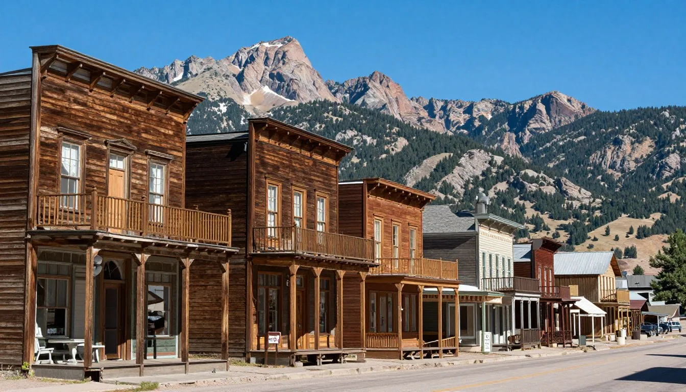
The Paradox Canyon area offers limited but meaningful cultural attractions. Most historical and cultural sites are found in surrounding communities. These venues provide context about the region’s mining heritage and pioneer history.
Naturita Community Center
The Naturita Community Center hosts rotating exhibits about local history. Displays feature mining equipment, pioneer artifacts, and historical photographs. The center serves as a gathering place for community events. Hours vary, so call ahead to confirm availability.
Historical Mining Sites
Abandoned mining structures dot the landscape throughout the region. These remnants tell stories of Colorado’s uranium boom era. Many sites are visible from roads but should not be entered. Unstable structures and environmental hazards make exploration dangerous.
Self-guided tours allow respectful viewing from safe distances. The decaying buildings create hauntingly beautiful photographic subjects. These structures represent significant chapters in Colorado’s economic history. Preservation efforts struggle against the harsh climate and passage of time.
Nature & Outdoor Experiences

Hiking and Trail Exploration
Numerous hiking opportunities exist beyond the main Paradox Trail. Side canyons invite exploration for properly equipped adventurers. Most routes follow informal paths created by previous travelers. Topographic maps and navigation skills become essential for these adventures.
Day hikes range from easy walks to strenuous canyon climbs. Short nature walks explore desert ecosystems and unique plant communities. Longer treks lead to remote overlooks and hidden water sources. The area sees few visitors, ensuring genuine wilderness solitude.
Trail conditions vary significantly throughout the year. Spring runoff can create temporary waterfalls and stream crossings. Summer heat makes afternoon hiking uncomfortable and potentially dangerous. Fall and spring offer ideal temperatures for extended outdoor activities.
Rock Climbing
The canyon walls attract rock climbers seeking unique challenges. Sandstone formations offer various climbing routes and difficulties. The rock quality varies, requiring careful route selection and testing. Experienced climbers find numerous opportunities for first ascents.
Climbing here demands self-sufficiency and strong technical skills. No established climbing areas exist with fixed protection. Climbers must place all protection and anchor systems. The remote location means rescue would be extremely difficult.
Wildlife Viewing
The Paradox Canyon area supports diverse wildlife populations. Mule deer commonly graze in meadows during morning and evening hours. Desert bighorn sheep inhabit the highest cliff faces. Lucky visitors might spot these impressive animals navigating impossible terrain.
Bird species include golden eagles, red-tailed hawks, and numerous songbirds. Ravens and turkey vultures soar on thermal currents above canyons. Spring migration brings colorful warblers and other neotropical species. Patient observers with binoculars discover remarkable avian diversity.

Photography Opportunities
Photographers find endless subjects throughout the region. Dramatic landscapes change character with shifting light conditions. Sunrise and sunset create extraordinary color displays on rock faces. The clear, dry air produces crisp, vivid images.
Astrophotography thrives in this dark-sky environment. Minimal light pollution allows stunning night sky images. The Milky Way appears brilliantly across the summer sky. Long-exposure photography captures star trails above distinctive rock formations.
For current trail conditions, seasonal closures, and outdoor recreation updates, contact the Paradox Ranger District at +1 (970) 865-2231.
Safety, Etiquette & Local Customs

Essential Safety Considerations
Remote wilderness travel demands serious preparation and caution. Cell phone coverage remains absent throughout most of the area. Emergency response times can extend to several hours. Visitors must prepare for complete self-sufficiency during their adventures.
Water carries critical importance in this arid environment. Dehydration occurs rapidly under the intense sun and low humidity. Carry at least 4 liters per person for day trips. Add extra reserves for vehicle emergencies or unexpected delays.
Flash flooding poses a real danger during monsoon season. Never camp in dry washes or narrow canyon bottoms. Weather conditions miles away can send deadly walls of water. Monitor weather forecasts and watch for darkening clouds.
- Inform someone of your detailed travel plans and expected return time
- Carry comprehensive first aid supplies and know how to use them
- Bring paper maps, compass, and GPS device with fresh batteries
- Pack emergency shelter, extra food, and warm clothing layers
- Carry vehicle recovery equipment including shovel, tow strap, and tire repair
Wildlife Safety
Rattlesnakes inhabit rocky areas throughout the region. Watch where you place hands and feet while hiking. Snakes typically avoid human contact if given opportunity to escape. Never attempt to handle or harass any snake species.
Mountain lions live throughout the canyon country. Attacks remain extremely rare but do occur occasionally. Make noise while hiking to avoid surprising wildlife. Keep children close and never let them wander alone. If you encounter a lion, make yourself appear large and back away slowly.
Environmental Ethics
Leave No Trace principles are essential in this fragile environment. Pack out all trash, including micro-trash like bottle caps. Human waste must be buried in cat holes 15 cm (6 inches) deep. Choose durable surfaces for camping to minimize impact.
Avoid creating new roads, trails, or campsites. Use existing disturbed areas whenever possible. Desert soils recover very slowly from damage. Tire tracks can remain visible for decades in this environment.
Local Customs and Courtesy
Rural Colorado communities value courtesy and self-reliance. Wave to passing vehicles on backcountry roads. Offer assistance if you encounter stranded travelers. Small-town residents appreciate respectful, friendly visitors.
Private property boundaries must be respected absolutely. Many parcels exist throughout public lands creating a checkerboard pattern. Obtain permission before crossing private land. Trespassing damages relationships between landowners and recreationists.
Visitor Comments About Paradox Canyon Colorado
“The Paradox Trail exceeded all expectations with its stunning red rock scenery and challenging routes. We spent three days exploring various sections and barely scratched the surface. The solitude and natural beauty create an experience impossible to find in crowded national parks. Proper preparation proved essential, but the rewards were absolutely worth the effort.”
“Visiting during spring wildflower season transformed the harsh desert into a colorful paradise. The ancient petroglyphs near the boulder field provided a profound connection to the area’s first inhabitants. Local residents in Naturita offered helpful advice and genuine Western hospitality. This remains one of Colorado’s best-kept secrets for authentic wilderness experiences.”
“The dramatic geology and complete isolation create an otherworldly atmosphere throughout Paradox Canyon. Photography opportunities appear around every corner with constantly changing light conditions. We encountered more wildlife in three days than during weeks in more popular destinations. The challenging road conditions filtered out casual tourists, preserving the area’s wild character.”
Additional Nearby Destinations

Paradox Canyon serves as an excellent base for exploring southwestern Colorado. Several remarkable destinations lie within reasonable driving distance. These areas complement the Paradox experience with different landscapes and attractions.
Colorado National Monument
This spectacular park sits just 95 km (59 miles) northeast near Grand Junction. Towering monoliths and sheer-walled canyons create dramatic scenery. Paved roads make the area accessible to all vehicles. Numerous hiking trails explore the varied terrain and geological wonders.
The Rim Rock Drive offers 37 km (23 miles) of stunning overlooks. Visitors view Independence Monument, the Coke Ovens, and numerous other formations. The park remains open year-round with facilities and ranger programs. Entrance fees apply and support park preservation efforts.
Gateway Canyons
The Gateway area lies 48 km (30 miles) northwest of Paradox Canyon. This region features stunning red rock scenery and luxury accommodations. The Gateway Canyons Resort offers upscale lodging and dining options. Numerous outdoor activities include hiking, horseback riding, and scenic flights.
Telluride and Ridgway
These mountain towns sit approximately 105 km (65 miles) southeast. Telluride offers world-class skiing, festivals, and Victorian architecture. The stunning Box Canyon Falls thunders through downtown. Ridgway provides more affordable lodging with access to similar attractions.
Check 30,000+ Local Sightseeing Tours Worldwide
✓ Numerous languages and currencies are available
The drive between Paradox Valley and these towns crosses diverse landscapes. Highway 145 winds through aspen forests and alpine meadows. The contrast between desert canyons and mountain peaks amazes travelers.
Moab, Utah
Although across the state line, Moab sits just 120 km (75 miles) west. This outdoor recreation mecca offers endless adventure opportunities. Arches and Canyonlands National Parks attract visitors from worldwide. The town provides extensive services, lodging, and dining options.
Practical Travel Tips
What to Pack
Proper equipment transforms potential disasters into manageable situations. Pack clothing in layers to adjust for temperature changes. Morning temperatures often start at 10°C (50°F) before climbing to 27°C (80°F). Synthetic or wool fabrics perform better than cotton in this climate.
- Sun protection: wide-brimmed hat, sunglasses, SPF 50+ sunscreen
- Navigation tools: detailed maps, compass, GPS with extra batteries
- Emergency supplies: first aid kit, space blanket, fire starter, headlamp
- Vehicle recovery: shovel, tow strap, tire repair kit, extra fuel
- Communication: satellite messenger or personal locator beacon
Money and Services
Limited ATM access exists in the region. Naturita has one ATM at the local bank. Credit cards are accepted at most businesses but not universally. Carrying adequate cash prevents payment problems at small establishments.
Gas stations close early in small towns. Fill up whenever possible rather than waiting until empty. Fuel prices typically run higher than in larger cities. The remote location and limited competition affect pricing.
Communication
Cell phone service works only in valley towns and high points. Most of the backcountry remains completely without coverage. Download offline maps before entering remote areas. Consider renting or purchasing a satellite communication device for emergencies.
Two-way radios help groups stay connected during trail exploration. FRS/GMRS radios work well for vehicle-to-vehicle communication. The open terrain allows surprisingly long-range radio contact between parties.
Seasonal Considerations
Spring conditions can change rapidly with late-season storms. Roads turn muddy and impassable after rain or snowmelt. Patience becomes necessary as conditions improve within days. The wildflower displays reward those who time visits correctly.
Summer demands early morning starts for hiking activities. Afternoon temperatures become dangerously hot for strenuous exercise. Monsoon thunderstorms develop regularly after noon during July and August. These storms bring lightning danger and flash flood potential.
Fall offers the most stable weather conditions. Temperatures moderate into comfortable ranges for all activities. Autumn colors transform aspen groves in higher elevations. The region sees fewer visitors after school sessions resume.
For comprehensive trip planning assistance, current conditions, and personalized recommendations, contact the Grand Junction Visitor Center at +1 (970) 244-1480.
Location Map
Your Adventure Awaits in Colorado’s Hidden Canyon
Paradox Canyon stands ready to reward adventurous travelers with unforgettable experiences. The dramatic red rock landscapes create scenery found nowhere else. Ancient petroglyphs connect visitors to cultures that thrived here centuries ago. The challenging Paradox Trail tests skills while delivering spectacular views.
This remarkable destination remains refreshingly undiscovered by mass tourism. The solitude and authentic wilderness character feel increasingly rare. Whether you seek outdoor adventure, geological wonders, or peaceful escape, Paradox Canyon delivers. Start planning your journey to this extraordinary corner of Colorado today.