Hotels by Trip.com
Flights by Trip.com
Hidden within northwestern Colorado lies a geological marvel that holds over 3 trillion cubic feet of natural gas reserves. The Piceance Basin is one of North America’s most significant energy-producing areas. Yet beyond its industrial importance, this vast upland region offers visitors an unexpected wilderness experience. Few travelers realize this remote basin spans over 5,180 square kilometers (2,000 square miles) of dramatic high-desert terrain.
The Piceance Basin Uplands stretch across Rio Blanco and Garfield counties. This area remains largely undiscovered by mainstream tourism. Rugged mesas, deep canyons, and expansive sagebrush valleys create a landscape of raw beauty. The region sits at elevations ranging from 1,829 to 2,743 meters (6,000 to 9,000 feet). This creates diverse ecosystems rarely found elsewhere in Colorado.
Most visitors come seeking solitude and authentic western experiences. The basin offers world-class wildlife viewing, geological wonders, and outdoor recreation. Getting here requires intentional planning. The rewards are immense for those willing to venture off Colorado’s beaten path.
Getting There & Planning Your Journey

Reaching the Piceance Basin Uplands requires careful planning. The area sits in one of Colorado’s most remote corners. The nearest major airports provide several access options.
Closest Airports
Grand Junction Regional Airport (GJT) serves as the primary gateway. This airport sits approximately 113 kilometers (70 miles) southwest of the basin. Multiple daily flights connect Grand Junction to Denver, Salt Lake City, and other western hubs. Rental cars are essential and readily available at the airport.
Garfield County Regional Airport (RIL) in Rifle offers another option. This smaller facility sits just 64 kilometers (40 miles) from the southern basin edge. Limited commercial service operates seasonally. However, the airport provides convenient access for visitors focused on the southern Piceance area.
Eagle County Regional Airport (EGE) near Vail lies 145 kilometers (90 miles) southeast. This airport works well for visitors combining basin exploration with mountain resort experiences. The scenic drive through the Colorado River valley adds memorable vistas to your journey.
Ground Transportation
A high-clearance vehicle is strongly recommended. Many basin roads remain unpaved. Some areas require four-wheel drive, especially after rain or snow. Highway 13 and Highway 64 provide paved access to the region’s perimeter. Interior exploration requires venturing onto county roads and BLM routes.
From Grand Junction, take Interstate 70 east to Rifle, then head north on Highway 13. The drive takes approximately 90 minutes to reach the southern basin areas. For western access, Highway 64 runs from Rangely into the heart of the region.
Planning Tip: Download offline maps before your trip. Cell phone service is extremely limited throughout the Piceance Basin. GPS devices and paper maps serve as essential backups.
Best Time to Visit & Weather Tips
Best Time to Visit Piceance Basin Uplands Colorado
The Piceance Basin experiences dramatic seasonal variations. Your visit timing significantly impacts your experience. Each season offers distinct advantages and challenges.
Late May through June represents the ideal window for most visitors. Spring wildflowers blanket the hillsides. Wildlife becomes highly active as animals emerge from winter. Temperatures range from 15°C to 24°C (59°F to 75°F) during daytime. Nights remain cool at 2°C to 7°C (35°F to 45°F). This period offers comfortable conditions for hiking and photography.
Check 30,000+ Local Sightseeing Tours Worldwide
✓ Numerous languages and currencies are available
September through mid-October provides another excellent visiting period. Fall colors transform aspen groves in higher elevations. Elk rut season creates exceptional wildlife viewing opportunities. Daytime temperatures hover between 13°C and 21°C (55°F and 70°F). Cooler nights average 0°C to 5°C (32°F to 41°F).
July and August bring hot conditions to the basin. Daytime highs frequently exceed 32°C (90°F) in lower elevations. These months work best for early morning and evening activities. Afternoon thunderstorms develop regularly. Always monitor weather forecasts and start hikes early.
Seasons to Avoid or Plan Carefully
November through April presents significant challenges. Heavy snow closes many roads. Temperatures drop well below freezing. Winter lows reach -18°C to -7°C (0°F to 20°F). Only experienced winter adventurers with proper equipment should visit during these months. Always check road conditions before attempting winter travel.
April brings unpredictable conditions. Spring storms alternate with pleasant days. Roads become impassable mud tracks after rain or snowmelt. This shoulder season requires flexible plans and backup options.
Weather Safety: The basin’s high elevation means weather changes rapidly. Always pack layers, rain gear, and emergency supplies. Summer afternoon thunderstorms can be severe with lightning danger.
Notable Annual Festivals
The Piceance Basin’s remote nature means few organized festivals occur within the area itself. However, surrounding communities host events worth timing your visit around.
Meeker Sheepdog Championship Trials take place each September in nearby Meeker. This event showcases working border collies herding sheep. The trials represent one of the oldest continuous sheepdog competitions in North America. Contact the Meeker Chamber of Commerce at +1 (970) 878-5510 for specific dates.
Rangely Outdoor Museum Heritage Days occur in July. This celebration highlights the area’s pioneering history and energy development. Western heritage activities, demonstrations, and local culture take center stage. Call +1 (970) 675-8476 for current year scheduling.
Rio Blanco County Fair happens each August in Meeker. This traditional county fair features livestock shows, rodeo events, and agricultural exhibits. It provides authentic insight into the region’s ranching culture. For information, contact +1 (970) 878-5510.
Getting Around Locally
Transportation within the Piceance Basin requires self-sufficiency. No public transit systems operate in this remote region. Your personal vehicle becomes your lifeline for exploration.
Most paved highways around the basin perimeter remain accessible year-round. Highway 13 runs north-south along the eastern edge. Highway 64 provides east-west access through the northern part. These routes connect small communities like Meeker, Rangely, and Dinosaur.
Unpaved county roads and BLM routes penetrate deeper into the basin. Road conditions vary dramatically based on recent weather. Spring mud season and summer thunderstorms can make roads impassable. Always carry emergency supplies including water, food, first aid kit, and communication devices.
Gas stations are sparse. Fill your tank at every opportunity. Meeker, Rangely, and Rifle offer the most reliable fuel sources. Some areas require driving 80 kilometers (50 miles) or more between services.
Safety Notice: Many basin roads cross active oil and gas operations. Watch for industrial traffic including large trucks. Respect all posted signs and gates. Never block access roads or equipment.
Cell phone coverage remains extremely limited. Download maps for offline use before entering remote areas. Satellite communication devices provide peace of mind for solo travelers or those venturing far from main roads.
Where to Stay

Lodging options within the Piceance Basin itself are virtually nonexistent. Visitors must base themselves in surrounding communities. Each town offers different amenities and access points to the basin.
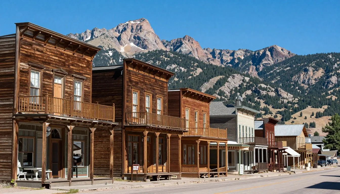
Meeker
Meeker serves as the best base for exploring the eastern Piceance Basin. This historic ranching town offers several comfortable options. The Meeker Hotel provides historic charm with modern amenities. Several motels along Highway 13 offer clean, affordable rooms.
For information and reservations in Meeker, contact the local visitor center at +1 (970) 878-5510.
Rangely
Rangely sits on the western basin edge. This small community caters to energy workers but welcomes tourists. Basic chain hotels and local motels provide comfortable accommodations. The town offers full services including restaurants and fuel.
Rifle
Rifle lies south of the basin along Interstate 70. This larger town offers more lodging choices including national hotel chains. Rifle works well as a base for southern basin exploration. The drive into the Piceance area takes about one hour.
Camping Options
Dispersed camping on BLM land provides the most immersive experience. Numerous suitable sites exist throughout the basin. Choose established sites to minimize impact. Practice Leave No Trace principles rigorously.
White River National Forest borders the eastern basin. Several developed campgrounds operate seasonally at higher elevations. These sites offer basic amenities and stunning mountain views. Sites fill quickly on summer weekends.
Camping Tip: Always camp at least 61 meters (200 feet) from water sources. Pack out all trash. Fire restrictions often apply during dry summer months. Check current regulations before your visit.
Dining & Local Cuisine
Culinary adventures in the Piceance Basin area reflect authentic western ranch culture. Don’t expect gourmet restaurants or trendy cafes. What you’ll find instead are honest, hearty meals that fuel hard-working communities.
Meeker offers the best dining variety near the basin. The Meeker Hotel Restaurant serves classic American fare in a historic setting. Steaks, burgers, and comfort food dominate the menu. Ma Famiglia Restaurant provides Italian dishes that locals love. The café culture here revolves around early morning coffee gatherings where ranchers discuss livestock and weather.
Rangely’s dining scene caters primarily to energy workers. Expect substantial portions and straightforward preparation. Giovanni’s Italian Grill offers pizza and pasta. Cowboy Corral serves breakfast all day alongside standard diner fare. These establishments open early and close relatively early.
In Rifle, chain restaurants line the Interstate 70 corridor. For local flavor, seek out family-owned Mexican restaurants serving authentic southwestern cuisine. BBQ joints provide another popular option in this part of Colorado.
Local Food Culture
The Piceance region’s food culture centers on ranch traditions. Beef dominates menus. Lamb appears frequently given the area’s sheep ranching heritage. Game meats occasionally show up on special menus during hunting seasons.
Breakfast becomes the social meal in these communities. Coffee shops fill with locals exchanging news and stories. Expect strong coffee, biscuits with gravy, and eggs with hash browns.
Dining Tip: Stock up on snacks, water, and lunch supplies before heading into the basin. No restaurants or stores exist in remote areas. Pack a cooler with sandwiches, fruits, and plenty of water for day trips.
Several small grocery stores in Meeker and Rangely offer supplies for self-catering. These stores carry basics but limited fresh produce. Plan your menu around available ingredients or shop in larger towns before arriving.
Attractions, Sightseeing & Activities

The Piceance Basin’s attractions revolve around natural wonders and wildlife encounters. This isn’t a destination for amusement parks or shopping districts. Instead, the basin rewards visitors seeking authentic wilderness experiences.
Wildlife Viewing
The Piceance Basin hosts the largest migratory mule deer herd in North America. Over 100,000 deer migrate through this area seasonally. Spring and fall offer peak viewing opportunities. Dawn and dusk provide the best chances for sightings.
Elk populations thrive in higher elevation areas. Bulls create impressive displays during September’s rutting season. Their bugling calls echo across valleys. Pronghorn antelope race across open flats at speeds exceeding 88 kilometers per hour (55 miles per hour).
Sage grouse perform elaborate mating displays each spring. These charismatic birds gather at traditional lek sites. Watching their dawn courtship dances ranks among North America’s premier wildlife spectacles. Viewing requires respectful distance and minimal disturbance.
Scenic Drives
The Flat Tops Scenic Byway skirts the basin’s eastern edge. This route climbs from Meeker through aspen forests into alpine terrain. Ripple Creek Pass reaches 3,048 meters (10,000 feet) elevation. The views encompass vast basin expanses stretching westward.
County Road 5 north from Meeker penetrates deep into the basin. This unpaved route offers adventurous driving through classic high-desert landscapes. Side roads branch to remote canyons and wildlife areas. High-clearance vehicles are essential.
Hiking & Backpacking
Formal trails are rare within the Piceance Basin proper. Most hiking follows old roads, game trails, and cross-country routes. This appeals to experienced hikers seeking solitude. Navigation skills and map reading become essential.
The surrounding White River National Forest offers established trail systems. Cathedral Bluffs area provides challenging routes with stunning geological formations. Colorful sedimentary layers create natural rainbow patterns.
Hiking Safety: Always inform someone of your plans. Carry twice the water you think you’ll need. The high-desert climate causes rapid dehydration. Summer heat becomes dangerous in exposed areas. Start hikes early in the day.
Museums, Cultural Spots & Festivals

Cultural attractions near the Piceance Basin tell stories of frontier settlement, ranching heritage, and energy development. These modest museums preserve important western history.
White River Museum
Located in Meeker, this museum occupies a former U.S. Army barracks. Exhibits chronicle the region’s military history and the Meeker Massacre of 1879. Displays include Native American artifacts, ranching equipment, and pioneer household items. The museum operates seasonally from April through October.
Rangely Outdoor Museum
This outdoor museum features historic buildings relocated from throughout the region. Visitors explore a one-room schoolhouse, homestead cabin, and blacksmith shop. Energy industry exhibits explain the basin’s oil and gas development. The collection illustrates life in this remote corner of Colorado across different eras.
Canyon Pintado National Historic District
South of Rangely, Highway 139 passes through this remarkable area. Ancient rock art adorns canyon walls. Fremont Culture petroglyphs date back 1,000 years. Interpretive signs explain the images and cultural significance. This open-air gallery makes history accessible to all visitors.
Local Arts
Meeker’s small arts community includes working artists and craftspeople. Several galleries showcase western art, photography, and Native American crafts. The annual Meeker Classic Sheepdog Championship Trials combine working dog demonstrations with cultural celebration.
For current cultural event information, contact the Meeker Chamber at +1 (970) 878-5510.
Nature & Outdoor Experiences

The Piceance Basin’s outdoor experiences emphasize solitude and self-reliance. This landscape rewards those who appreciate subtle beauty over dramatic peaks. The basin’s geology, ecology, and weather patterns create unique environments.
Geology & Landscapes
The Piceance Basin formed over millions of years. Ancient inland seas deposited layers of sediment. These formations now contain vast natural gas reserves. Surface geology displays colorful bands of shale, sandstone, and mudstone.
Cathedral Bluffs showcase spectacular erosion patterns. Towering cliffs rise 610 meters (2,000 feet) above valley floors. The Williams Fork formation exposes different colored layers. Pinks, oranges, whites, and grays create natural artwork.
Badlands topography characterizes much of the basin. Water erosion carved intricate networks of gullies and pinnacles. These formations change appearance dramatically with shifting light. Photographers find endless subjects throughout the day.
Photography Opportunities
The Piceance Basin offers exceptional photography for landscape and wildlife specialists. The sparse human development means minimal light pollution. Night skies reveal incredible star fields. Milky Way photography succeeds spectacularly during new moon periods.
Wildlife photographers find cooperative subjects. Animals here show less fear of humans than in heavily visited areas. Long lenses remain essential for ethical wildlife photography. Maintain minimum distances of 91 meters (300 feet) from elk and deer.
Hunting & Fishing
The Piceance Basin ranks among Colorado’s premier big game hunting areas. Elk and mule deer hunting draws sportsmen from across North America. All hunting requires proper Colorado licenses and tags. Regulations vary by unit and season.
Fishing opportunities exist in streams draining the surrounding mountains. The White River system supports trout populations. Access requires crossing private property in many areas. Respect landowner rights and obtain permission when required.

Seasonal Natural Events
Spring wildflower blooms transform the basin from March through June. Sagebrush buttercup, phlox, and lupine create colorful displays. Timing depends on winter moisture and spring temperatures. Wet years produce spectacular shows.
Autumn brings aspen color changes at higher elevations. Golden leaves contrast beautifully against dark evergreens and red rock formations. Peak color typically occurs late September through early October. The basin’s variety of elevations extends the viewing season.
Safety, Etiquette & Local Customs
Visiting the Piceance Basin safely requires preparation and respect. This remote region demands self-sufficiency. Local customs reflect western ranch culture where independence and neighborliness coexist.
Safety Essentials
Always carry more water than you think necessary. The high-desert climate causes rapid dehydration. Plan for 3.8 liters (one gallon) per person per day minimum. Carry extra for emergencies.
Weather changes rapidly in this region. Summer thunderstorms develop quickly with dangerous lightning. Flash floods can occur in normally dry washes. Never camp in canyon bottoms during monsoon season from July through September.
Wildlife encounters require common sense. Give animals space and never approach. Mountain lions inhabit the area though sightings are rare. If you encounter a lion, make yourself large, maintain eye contact, and back away slowly.
Rattlesnakes become active from April through October. Watch where you place hands and feet when scrambling over rocks. Most snake encounters occur in morning and evening hours. Snakes aren’t aggressive but will defend themselves when threatened.
Emergency Contact: Cell service is virtually nonexistent in most basin areas. Satellite communication devices provide the only reliable emergency contact. Rio Blanco County Sheriff dispatch: +1 (970) 878-9600. Note this number requires cell service or landline access.
Respecting Private Property
Much of the Piceance Basin is privately owned or leased for ranching and energy development. Always respect gates, fences, and no trespassing signs. Leave gates as you found them whether open or closed. Ranchers move livestock along established patterns.
Active oil and gas operations occur throughout the basin. Never interfere with equipment or operations. Watch for heavy truck traffic on rural roads. Industrial vehicles always have right-of-way given their size and stopping limitations.
Check 30,000+ Local Sightseeing Tours Worldwide
✓ Numerous languages and currencies are available
Environmental Ethics
Practice Leave No Trace principles rigorously. Pack out all trash including toilet paper and hygiene products. Bury human waste at least 15 centimeters (6 inches) deep and 61 meters (200 feet) from water sources.
Campfires require caution. Fire restrictions often apply during dry periods. Use established fire rings when available. Never leave fires unattended. Ensure complete extinguishment before leaving.
Local Customs
Ranch communities value courtesy and self-reliance. A friendly wave acknowledges passing vehicles on remote roads. This tradition reflects mutual understanding that help may be far away. If someone appears stranded, stopping to offer assistance is customary.
Small-town businesses operate on local schedules. Many close early or have limited weekend hours. Plan accordingly. Locals appreciate visitors who respect their pace of life.
Visitor Comments About Piceance Basin Uplands Colorado

“The solitude here is profound. We drove for hours seeing more pronghorn than people. The night sky absolutely stunned us with countless stars. This area offers something increasingly rare – true wilderness where you can disconnect completely. The wildlife viewing exceeded our expectations. We watched sage grouse at dawn and elk at sunset on the same day.”
“Don’t come here expecting resort amenities or easy access. The Piceance Basin rewards adventurous spirits willing to explore rough roads and remote areas. We camped for three nights seeing no one else. The landscape feels ancient and powerful. Bring all your own supplies and have a reliable vehicle. This isn’t for everyone, but if you love real wilderness, it’s magical.”
“The geology here fascinated our whole family. Colorful rock layers tell stories millions of years old. We hired a local guide who explained the basin’s formation and showed us incredible fossil sites. The kids loved spotting wildlife and exploring areas where few tourists venture. It’s wonderful that places like this still exist relatively undiscovered.”
Additional Nearby Destinations
The Piceance Basin’s location offers access to several other compelling Colorado destinations. Combining basin exploration with nearby attractions creates a diverse itinerary.
Dinosaur National Monument
Located 97 kilometers (60 miles) northwest of Rangely, this monument straddles the Colorado-Utah border. The Quarry Exhibit Hall displays over 1,500 dinosaur bones still embedded in rock. River rafting through spectacular canyons provides adventure. The monument offers developed campgrounds and visitor facilities.
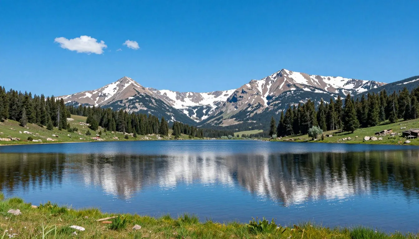
Flat Tops Wilderness
East of Meeker rises Colorado’s second-largest wilderness area. The Flat Tops encompass 954 square kilometers (235,000 acres) of high-elevation plateau terrain. Over 160 lakes dot the landscape. Backcountry hiking and horseback riding attract summer visitors. This area provides stark contrast to the basin’s desert character.
Colorado National Monument
Southwest of the basin near Grand Junction, this monument showcases dramatic red rock canyons. Rim Rock Drive offers accessible viewpoints. Rock climbing and hiking trails provide recreation. The monument sits approximately 113 kilometers (70 miles) from the southern Piceance Basin.
Glenwood Springs
This mountain town lies 121 kilometers (75 miles) south of Meeker. Famous hot springs pools attract visitors year-round. Glenwood Canyon’s dramatic scenery and recreation opportunities provide variety. The town offers excellent dining and lodging options.
Browns Park National Wildlife Refuge
North of the basin along the Green River, Browns Park protects critical waterfowl habitat. This remote refuge sees few visitors. Birdwatching opportunities include sandhill cranes, eagles, and waterfowl. Historic ranches and Butch Cassidy lore add western character.
Practical Travel Tips
Successfully navigating the Piceance Basin requires practical knowledge and careful preparation. These tips help ensure a safe and rewarding visit.
Essential Packing List
- Navigation tools: GPS device, paper maps, compass
- Communication: Satellite messenger or emergency beacon
- Water: Minimum 3.8 liters (1 gallon) per person per day
- Sun protection: Hat, sunglasses, high-SPF sunscreen, long sleeves
- Layered clothing: Temperatures vary dramatically by elevation and time
- First aid kit: Include specific items for remote area emergencies
- Vehicle supplies: Full-size spare tire, jack, basic tools, extra fuel
- Emergency food: High-calorie snacks and emergency rations
Money & Services
ATMs exist in Meeker, Rangely, and Rifle. No banking services operate in remote basin areas. Carry sufficient cash for small purchases. Most businesses accept credit cards but internet connectivity can be unreliable.
Gas stations become sparse once you leave main highways. Always maintain at least half a tank. Plan fuel stops carefully. Some rural stations close early or operate limited hours.
Communication
Cell phone service is virtually nonexistent throughout most of the basin. Don’t rely on phones for navigation or emergency contact. Satellite communication devices provide the only reliable coverage. Download all necessary maps, directions, and information before entering remote areas.
Permits & Regulations
Most Piceance Basin areas managed by BLM require no special permits for day use. Overnight camping regulations vary by location. Check current rules before your trip. Some areas may restrict activities during critical wildlife periods.
Hunting and fishing require Colorado licenses. Regulations differ by zone and season. Purchase licenses online or at sporting goods stores before your trip. Check Colorado Parks and Wildlife regulations at +1 (303) 297-1192.
Photography Etiquette
Wildlife photography demands ethical practices. Never bait or harass animals for photos. Use long lenses to maintain appropriate distances. Never separate mothers from young or disrupt feeding behaviors. Your presence should never alter animal behavior.
Best Resources
White River National Forest Ranger District in Meeker provides current conditions, maps, and regulations. Contact them at +1 (970) 878-3601 before your visit.
BLM Colorado River Valley Field Office in Silt offers information about public lands in the basin area. Reach them at +1 (970) 876-9000.
Pro Tip: Stop at local visitor centers or ranger stations in person when possible. Staff provide current conditions, recent wildlife sightings, and road status. This information often isn’t available online given limited connectivity in the region.
Discover Your Own Piceance Basin Adventure
The Piceance Basin Uplands stand apart from Colorado’s crowded mountain resorts and popular national parks. This vast region offers something increasingly precious: authentic wilderness where nature sets the agenda. Whether you’re watching sage grouse perform ancient courtship rituals, photographing layered rock formations glowing at sunset, or simply experiencing profound silence under star-filled skies, the basin creates memories that last.
Your journey here demands more than typical vacation planning. You’ll need self-reliance, flexibility, and respect for harsh landscapes. The rewards match your effort. Few places remain where you can drive for hours without seeing another person. Fewer still maintain such rich wildlife populations and geological wonders.
The Piceance Basin won’t coddle you with convenient amenities or easy access. Instead, it offers an authentic experience of the American West. Pack carefully, plan thoroughly, and approach this landscape with humility. The basin reveals its secrets to those willing to meet it on its own terms. Your adventure awaits in one of Colorado’s last true frontiers.