
Did you know that Boundary Peak, standing at 4,007 m (13,147 ft), is not only the highest point in Nevada but also technically part of California’s White Mountains that spills just over the state border? This geographic curiosity makes it a unique destination where hikers can stand in Nevada while looking into California, creating one of the most distinctive state highpoints in America. Whether you’re an avid peak-bagger or simply seeking stunning desert mountain vistas, Boundary Peak offers an adventure that combines challenging terrain with breathtaking rewards.
Getting There & Planning Your Journey
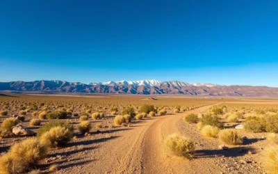
Reaching Boundary Peak requires some planning as it’s located in a remote area of western Nevada. The closest major airports are Reno-Tahoe International Airport (about 250 km or 155 miles away) and Las Vegas McCarran International Airport (about 380 km or 236 miles away).
From Reno, take US-395 south to Coaldale Junction, then Nevada State Route 264 to the town of Dyer. From Las Vegas, take US-95 north to Tonopah, then US-6 west to Coaldale Junction before following the same route to Dyer.
From Dyer, access to the trailheads requires high-clearance vehicles as you’ll need to navigate unpaved roads. The two main trailheads are:
- Queen Canyon Trailhead: Considered the better route with less scree and a more defined trail
- Trail Canyon Trailhead: Shorter but steeper with more loose rock
If you don’t have a suitable vehicle, consider arranging transportation with local guides who offer shuttle services to the trailheads. Plan to arrive in the area a day before your hike to acclimate to the elevation.
Best Time to Visit & Weather Tips

The optimal window for visiting Boundary Peak is from late June through September when trails are typically free of snow and weather conditions are most stable. July and August offer the warmest temperatures but also bring the possibility of afternoon thunderstorms.
| Season | Conditions | Recommendation |
| Late June – Early July | Possible lingering snow patches, wildflowers beginning | Good for experienced hikers with snow travel skills |
| Mid-July – August | Warmest temperatures (10-25°C/50-77°F), afternoon thunderstorms possible | Ideal with early morning starts to avoid storms |
| September | Cooler temperatures, more stable weather, fewer people | Excellent for solitude seekers |
| October | Cold temperatures, possible early snow | For experienced mountaineers only |
| November – May | Winter conditions, deep snow, extreme cold | Not recommended except for winter mountaineering experts |
Weather can change rapidly in mountain environments, so always check the forecast before heading out. Temperatures at the summit can be 10-15°C (18-27°F) cooler than at the trailhead, so pack accordingly even in summer months.
Getting Around Locally

The remote nature of Boundary Peak means public transportation is virtually non-existent in the immediate area. You’ll need your own vehicle—preferably with four-wheel drive and high clearance—to navigate the unpaved roads leading to the trailheads.
Queen Canyon Road, which leads to one of the main trailheads, features deep ruts and large rocks in its final sections. Many visitors with standard vehicles opt to park at the old mining site about 2 miles from the official trailhead and hike the additional distance.
If you’re staying in nearby towns like Dyer or Benton, be prepared for limited services. Fill your gas tank before heading into remote areas, as fuel stations are scarce. Cell service is also spotty or non-existent near the mountain, so download offline maps before your trip.
Where to Stay

Accommodation options near Boundary Peak are limited but sufficient for adventurous travelers. Most visitors choose one of these options:
Camping
The most popular option is camping near the trailhead the night before your hike. This helps with acclimatization and allows for an early start. Dispersed camping is permitted on public lands, with established sites near both Queen Canyon and Trail Canyon trailheads.
Nearby Towns
The small towns of Dyer (Nevada) and Benton (California) offer basic accommodations. In Dyer, check availability at the Boonies Motel. For more options, consider Bishop, California, about 90 minutes away, which has numerous hotels and motels.
RV Camping
RV sites are available in Bishop and Tonopah. The roads to the trailheads are not suitable for RVs, so plan to camp at established campgrounds in the valleys and drive your tow vehicle to the trailhead.
For the best experience, many hikers camp at moderate elevation (around 2,400-2,700 m or 8,000-9,000 ft) the night before their hike to help with acclimatization. This strategy can significantly improve comfort and reduce the risk of altitude-related issues during your summit attempt.
Dining & Local Cuisine

The remote location of Boundary Peak means dining options are limited in the immediate vicinity. The small towns of Dyer, Nevada and Benton, California offer basic food services, but it’s wise to come prepared.
Local Options
- Esmeralda Market in Dyer provides basic groceries and supplies
- Boonies Restaurant in Dyer serves American comfort food
- Benton Hot Springs has a small café with limited hours
Nearby Towns
For more dining options, Bishop, California (about 90 minutes from the trailhead) offers numerous restaurants, cafés, and grocery stores. Tonopah, Nevada (about 2 hours away) also has several dining establishments.
Self-Catering
Most visitors bring their own food, especially if camping. Pack high-energy snacks and meals for your hike. If attempting the summit, prepare a substantial breakfast and pack plenty of trail food. The hike typically takes 6-8 hours round trip, so bring more food than you think you’ll need.
Local culinary specialties in this region include traditional Western fare such as steaks, burgers, and hearty breakfasts. The area’s ranching heritage influences the cuisine, with beef featuring prominently on most menus.
Attractions, Sightseeing & Activities

Summit Hike
The primary activity at Boundary Peak is the summit hike. This challenging trek rewards hikers with stunning panoramic views and the satisfaction of reaching Nevada’s highest point. The hike involves:
- Distance: Approximately 10-12 km (6-7.5 miles) round trip depending on the trailhead
- Elevation gain: About 1,200 m (3,900 ft)
- Difficulty: Moderate to difficult with some Class 2 scrambling
- Duration: 6-8 hours for most hikers
Two main routes lead to the summit:
Queen Canyon Route
The more popular and scenic option with better trail conditions and less scree. The trail follows a ridge with spectacular views before tackling the final summit push.
Trail Canyon Route
Shorter but steeper with more loose rock and scree. This route is more direct but generally considered less enjoyable due to the unstable terrain.
Montgomery Peak Extension
For experienced hikers seeking an additional challenge, Montgomery Peak (4,096 m/13,441 ft) lies just across the California border. The ridge traverse between Boundary and Montgomery involves Class 3 scrambling and adds approximately 3-4 hours to your day.
Photography
The dramatic desert mountain landscape offers exceptional photography opportunities. The summit provides 360-degree views of the White Mountains, Sierra Nevada range, and vast Nevada desert basins. Early morning light creates stunning conditions for landscape photography.
Museums, Cultural Spots & Festivals

While the immediate area around Boundary Peak is wilderness with few cultural attractions, the surrounding region offers interesting historical and cultural sites worth exploring before or after your mountain adventure.
Nearby Cultural Attractions
- Historic mining remnants near Queen Canyon, showcasing the area’s mining heritage
- Esmeralda County Museum in Goldfield (about 2 hours from the trailhead) featuring exhibits on local mining history
- Laws Railroad Museum near Bishop, California, preserving the region’s transportation history
- Ancient Bristlecone Pine Forest in the White Mountains, home to some of the world’s oldest living organisms
Local Events
Seasonal events in nearby communities include:
- Esmeralda County Fair (August) in Goldfield
- Bishop Mule Days Celebration (Memorial Day weekend)
- Eastern Sierra Fall Colors Festival (October) in Bishop
While these cultural attractions aren’t directly at Boundary Peak, they make excellent additions to your trip itinerary when visiting the area. They provide context for the region’s rich history and complement the natural beauty of the mountain landscape.
Nature & Outdoor Experiences

Beyond the summit hike, Boundary Peak and its surroundings offer diverse outdoor experiences for nature enthusiasts.
Wildlife Viewing
The area hosts a variety of desert and mountain wildlife. Lucky visitors might spot:
- Bighorn sheep navigating the rocky slopes
- Golden eagles soaring overhead
- Mule deer in the lower elevations
- Various desert reptiles and small mammals
- Wild horses in the surrounding valleys (as mentioned by hikers in trip reports)
Stargazing
The remote location with minimal light pollution makes Boundary Peak an exceptional stargazing destination. The dark skies reveal the Milky Way and countless stars on clear nights. Many hikers camp specifically to experience the spectacular night sky.
Botanical Interests
The mountain transitions through several ecological zones, offering interesting plant life to observe:
- Desert scrub at lower elevations
- Scattered bristlecone pines along the approach
- Alpine wildflowers during the summer months
- Hardy alpine plants near the summit
Nearby Natural Attractions
If you have additional time, consider exploring:
- Ancient Bristlecone Pine Forest (home to some of the world’s oldest trees)
- Fish Lake Valley Hot Springs for post-hike relaxation
- White Mountain Peak, California’s third-highest mountain
- Boundary Peak Wilderness Area’s backcountry trails
Safety, Etiquette & Local Customs

Visiting Boundary Peak requires proper preparation and respect for the mountain environment. Follow these guidelines for a safe and responsible experience:
Safety Considerations
- Acclimatize properly by spending a night at moderate elevation before your hike
- Start early (before dawn) to avoid afternoon thunderstorms in summer
- Carry plenty of water (at least 3 liters per person) as there are no water sources on the mountain
- Bring sun protection—the high-altitude sun is intense even on cool days
- Pack extra layers as temperatures can drop significantly at higher elevations
- Inform someone of your hiking plans and expected return time
- Carry a paper map and compass as cell service is unreliable
Trail Etiquette
- Follow Leave No Trace principles—pack out all trash
- Stay on established trails to prevent erosion
- Yield to uphill hikers when descending
- Keep noise levels down to preserve the wilderness experience for others
- Respect wildlife by observing from a distance
Local Customs
The surrounding communities are small and rural with traditional Western values. Visitors should:
- Drive slowly through small towns and watch for livestock
- Support local businesses when possible
- Respect private property and ranch lands
- Be self-sufficient as services are limited
Visitor Comments About Boundary Peak
“Boundary Peak exceeded my expectations completely. The Queen Canyon route offered incredible views that made every step worthwhile. The trail was challenging but manageable with proper preparation. Don’t underestimate the final ridge—it looks more intimidating than it actually is. Definitely worth the effort for any serious hiker!”
“We hiked Boundary Peak last September and had perfect weather conditions. The solitude was remarkable—we didn’t see another soul all day. The drive to the trailhead was actually more challenging than expected, so definitely bring a high-clearance vehicle. The summit views of Montgomery Peak and the Sierra Nevada were absolutely spectacular.”
“As someone who’s climbed several state highpoints, Boundary Peak stands out for its desert mountain character. The landscape has a raw, untamed beauty unlike the more popular mountain destinations. I’d recommend spending time acclimatizing—we camped at 8,000 feet the night before and it made a huge difference in our energy levels during the climb.”
Additional Nearby Destinations

While visiting Boundary Peak, consider exploring these nearby attractions to enhance your trip:
Montgomery Peak
Just across the California border, this slightly higher peak (4,096 m/13,441 ft) can be combined with Boundary Peak for experienced hikers. The ridge traverse between the two summits involves some Class 3 scrambling but rewards with outstanding views.
Ancient Bristlecone Pine Forest
Located in the White Mountains about an hour’s drive from the Boundary Peak area, this forest contains some of the oldest living organisms on Earth. The Methuselah Trail takes you past trees that are over 4,000 years old.
Fish Lake Valley Hot Springs
These natural hot springs near Dyer offer a perfect post-hike relaxation opportunity. The primitive pools vary in temperature and provide soothing relief for tired muscles after your mountain adventure.
If you have more time, consider these destinations within a few hours’ drive:
- Bishop, California (90 minutes) – Gateway to the Eastern Sierra with numerous outdoor activities
- Mammoth Lakes (2 hours) – Popular mountain resort town with hiking, fishing, and skiing
- Death Valley National Park (2.5 hours) – Lowest point in North America, contrasting with Boundary Peak’s heights
- Yosemite National Park (3 hours) – World-famous for its spectacular valleys, waterfalls, and granite domes
Practical Travel Tips

Essential Gear
- Sturdy hiking boots with good ankle support
- Trekking poles for the steep, loose sections
- Layered clothing for variable temperatures
- Sun protection (hat, sunglasses, sunscreen)
- Headlamp for early starts or unexpected delays
- First aid kit with blister treatment
- Paper map and compass (don’t rely solely on electronics)
- Emergency shelter (space blanket at minimum)
Planning Resources
For detailed information and current conditions, consult:
- Inyo National Forest Ranger Station in Bishop, California: 760-873-2400
- Humboldt-Toiyabe National Forest White Mountain Ranger Station: 760-873-2500
- Local outdoor shops in Bishop for recent trail reports
Connectivity
Cell service is extremely limited or non-existent in the Boundary Peak area. Download offline maps before your trip and don’t count on being able to make calls from the mountain. Consider bringing a satellite communication device for emergencies if hiking alone.
Permits
No permits are currently required for day hiking Boundary Peak. If camping overnight in the wilderness area, check with the Forest Service for any seasonal fire restrictions or camping regulations.
Your Nevada Summit Awaits
Boundary Peak may not be the tallest mountain in the region, but its unique position as Nevada’s highest point and its stunning desert mountain character make it a rewarding destination for adventurous travelers. The journey to this remote peak offers not just a challenging hike but also an opportunity to experience the raw, untamed beauty of the Great Basin landscape. Whether you’re collecting state highpoints or simply seeking solitude in a remarkable natural setting, Boundary Peak delivers an authentic mountain experience far from the crowds. Pack your gear, prepare thoroughly, and set out to discover this desert mountain gem—where two states meet at the roof of Nevada.
The above is subject to change.
Check back often to TRAVEL.COM for the latest travel tips and deals.


0 Comments