
Hotels by Trip.com
Flights by Trip.com
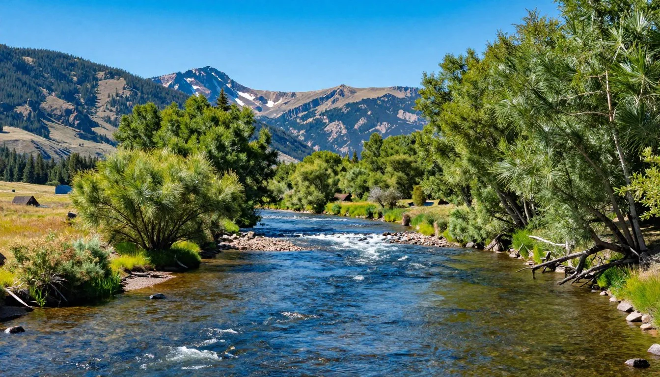
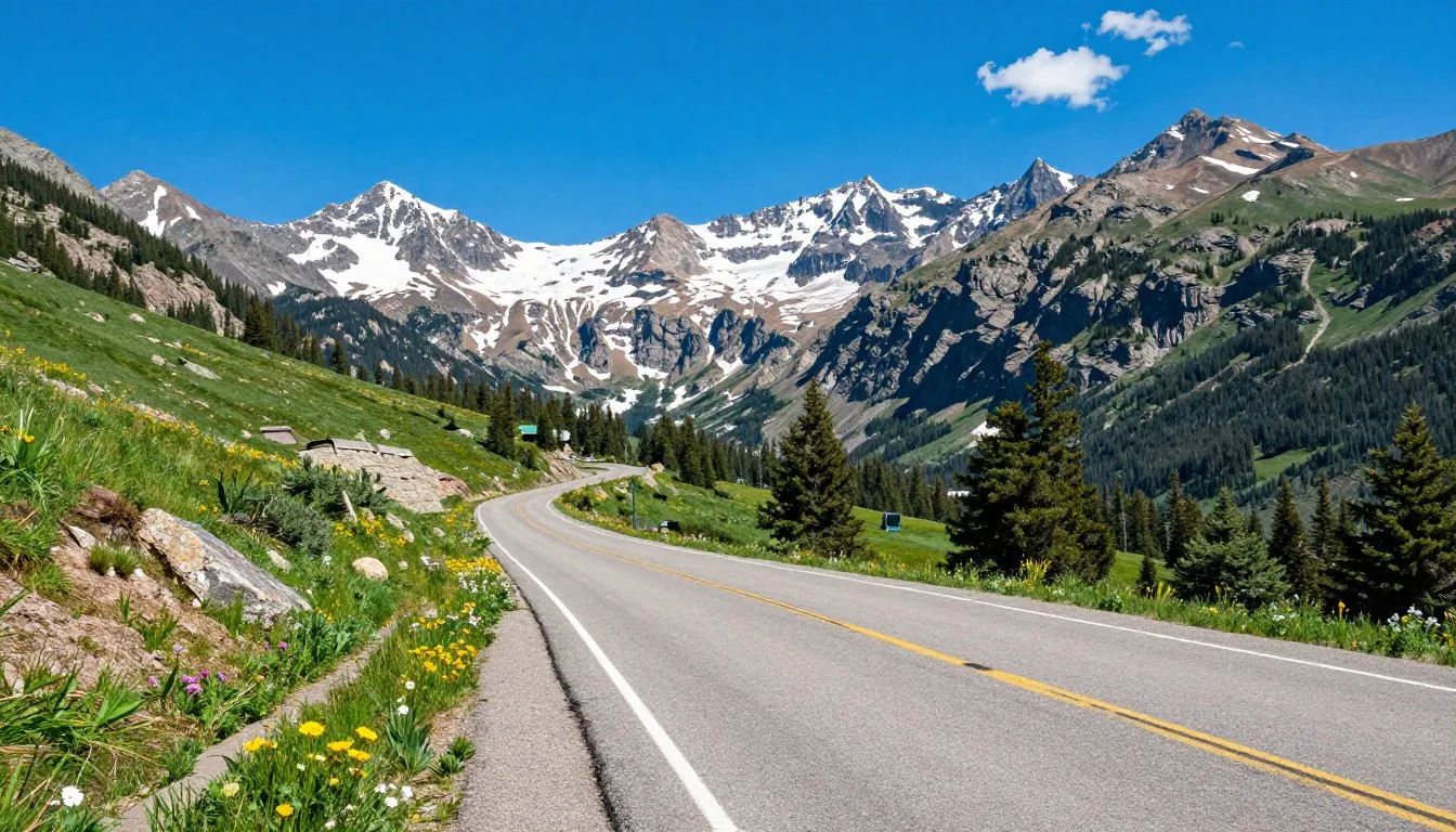
Did you know the Colorado Trail crosses six wilderness areas and eight mountain ranges while traversing 485 miles (780 km) of Colorado’s most spectacular Rocky Mountain terrain? This legendary path between Denver and Durango offers hikers, backpackers, and mountain bikers an unforgettable journey through some of America’s most breathtaking landscapes, with an average elevation of 10,300 feet (3,140 m) and the highest point reaching 13,271 feet (4,045 m). Whether you’re planning a thru-hike, a weekend adventure, or just a day trip, the Colorado Trail delivers an unparalleled outdoor experience that belongs on every nature lover’s bucket list.
Getting There & Planning Your Journey
The Colorado Trail has two main access points: the northern terminus at Waterton Canyon near Denver and the southern terminus at Junction Creek near Durango. Most hikers begin their journey in Denver due to easier logistics, but you can start from either end depending on your preference.
Closest Airports
- Denver International Airport (DEN) – The most convenient option for accessing the northern terminus
- Durango-La Plata County Airport (DRO) – A smaller regional airport near the southern terminus
- Colorado Springs Airport (COS) – Another option with connections to the trail via public transportation
From Denver International Airport, you can take the RTD A Line to downtown Denver, then connect to public transportation or rideshare services to reach Waterton Canyon Trailhead. If flying into Durango, the Junction Creek Trailhead is just a short taxi or rideshare trip from town.
Trail Logistics
The Colorado Trail is divided into 28 segments, each beginning and ending at a trailhead or road crossing. This segmentation makes it easy to plan section hikes or organize resupply points for thru-hikers. Most thru-hikers complete the trail in 4-6 weeks, while section hikers can tackle individual segments over multiple trips.
Best Time to Visit & Weather Tips

The optimal window for hiking the Colorado Trail is relatively narrow due to Colorado’s mountain weather patterns. Understanding the seasonal conditions will help you plan a safe and enjoyable trip.
Recommended Months
- July to mid-September – The ideal time with most snow melted, abundant wildflowers, and relatively stable weather
- Late June – Possible for experienced hikers, but expect significant snow at higher elevations
- Late September – Beautiful fall colors but increasing risk of early snowstorms
Months to Avoid
- October to May – Trail is typically snow-covered and dangerous
- Early June – High elevation sections remain snowbound, making navigation difficult
Weather Tip: Afternoon thunderstorms are common in the Colorado mountains during summer. Plan to be below treeline by noon to avoid lightning danger. Always check weather forecasts before heading out and be prepared for rapid weather changes at high elevations.
Temperature variations can be extreme, with daytime highs reaching 26°C (80°F) and nighttime lows dropping to 4°C (40°F) or below, especially at higher elevations. Pack layers and be prepared for all conditions, even in summer.
Getting Around Locally

Navigating to and between different segments of the Colorado Trail requires some planning, especially for section hikers who need to arrange transportation between trailheads.
Transportation Options
- Personal Vehicle – The most flexible option, but requires arranging shuttles for point-to-point hikes
- Public Transportation – Limited but available in certain areas:
- Summit Stage – Free bus service connecting Breckenridge, Frisco, and Copper Mountain
- RFTA – Bus service in the Roaring Fork Valley near Aspen
- Trail Angels & Shuttles – Local drivers who offer rides to hikers (sometimes for a fee)
- Hitchhiking – Common practice among thru-hikers, but exercise caution
For section hikers, consider hiking out-and-back routes or arranging car shuttles with other hikers. Many trail towns have shuttle services specifically for Colorado Trail hikers, but these should be booked in advance during peak season.
Navigation Tip: The Colorado Trail is well-marked with wooden posts and metal markers displaying the CT logo. Most hikers use the FarOut app (formerly Guthook) or the Colorado Trail Databook for navigation. Cell service is limited on the trail, so download maps before your trip.
Where to Stay

Accommodation options along the Colorado Trail range from wilderness camping to comfortable lodging in trail towns. Your choices will depend on your hiking style and budget.
Camping
Camping is permitted along most of the Colorado Trail, with a few exceptions:
- No camping in the first 6.5 miles of Waterton Canyon
- No camping for 4 miles west of Highway 91 (Copper Mountain property)
- No camping in certain sections of the Collegiate East route near private property
Follow Leave No Trace principles by camping at least 60 m (200 ft) from water sources and the trail. Established campsites are abundant along the route and are your best option to minimize impact.
✓ Check 30,000+ Local Sightseeing Tours Worldwide
Trail Towns & Lodging
Several towns along or near the Colorado Trail offer lodging options for hikers looking to rest and resupply:
Northern Half
- Bailey – Small town with limited services
- Breckenridge – Full-service resort town with numerous lodging options
- Frisco – Excellent resupply point with hotels and hostels
- Copper Mountain – Resort with lodging and restaurants
- Leadville – Historic mining town with budget-friendly options
Southern Half
- Buena Vista – Access via Collegiate East route
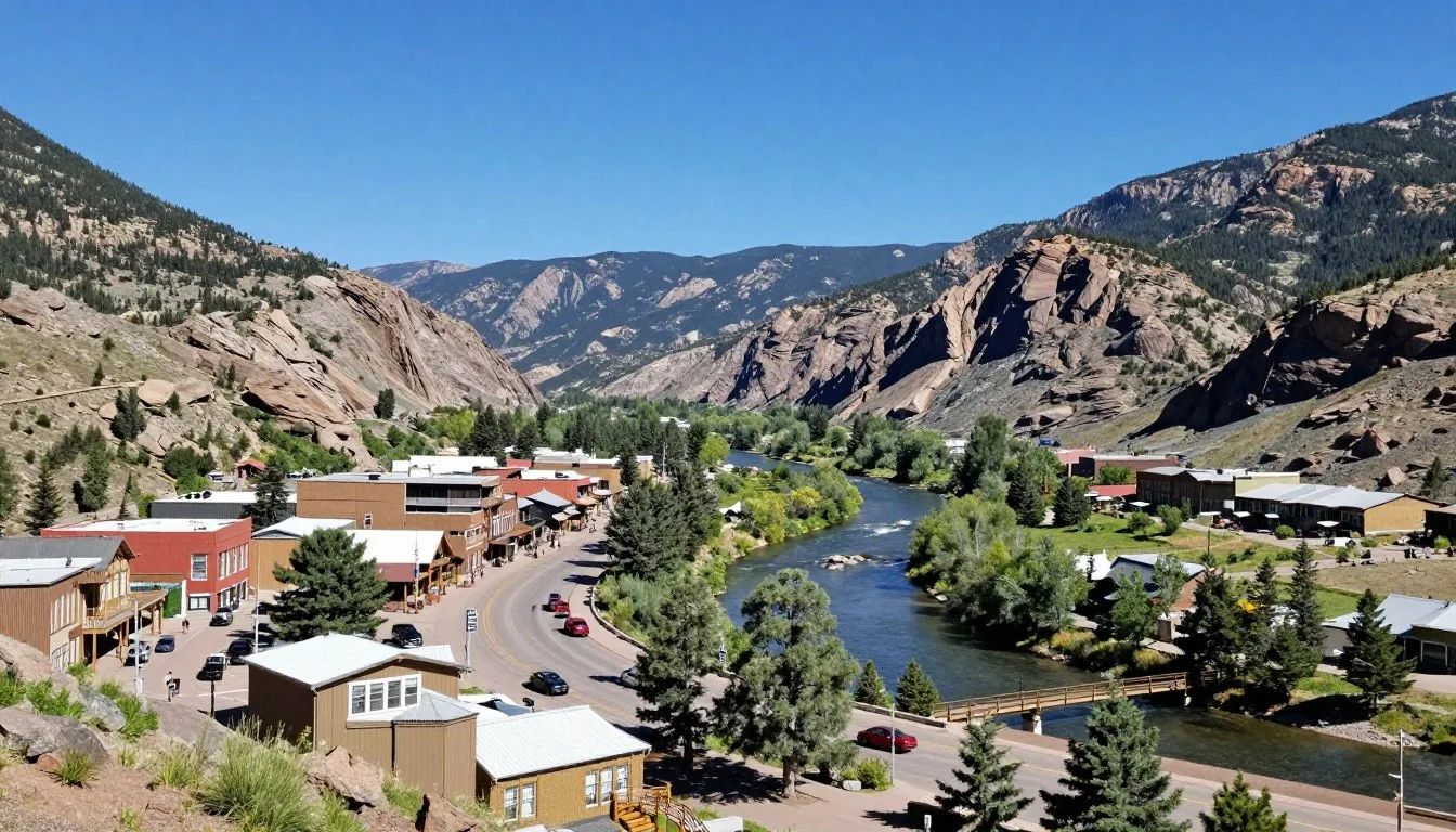
- Salida – Popular resupply town with full services
- Lake City – Quaint mountain town with lodging options
- Silverton – Historic mining town near the trail’s end
- Durango – Full-service city at the southern terminus
Accommodation Tip: During peak hiking season (July-August), trail town accommodations can fill up quickly. Consider making reservations in advance, especially in smaller towns with limited options like Twin Lakes or Silverton.
Dining & Local Cuisine

After burning thousands of calories on the trail, food becomes a top priority for Colorado Trail hikers. Trail towns offer opportunities to refuel with hearty, satisfying meals that showcase Colorado’s culinary offerings.
Trail Town Dining Highlights
- Breckenridge – Wide range of options from casual to fine dining
- Leadville – Try High Mountain Pies for excellent pizza or Tennessee Pass Cafe for hearty breakfasts
- Salida – Boasts a surprisingly diverse food scene with great coffee shops and breweries
- Silverton – Handlebars Food & Saloon offers massive portions perfect for hungry hikers
- Durango – Carver Brewing Company gives thru-hikers who complete the trail a free Colorado Trail Nut Brown Ale
Local Specialties
Colorado cuisine features hearty mountain fare influenced by Western and Southwestern traditions:
- Green Chile – A Colorado staple, often served over burritos
- Trout – Fresh local fish served in many mountain restaurants
- Bison/Elk – Game meats featured in burgers and steaks
- Craft Beer – Colorado is famous for its microbreweries
- Palisade Peaches – If hiking in late summer, don’t miss these sweet Colorado peaches
Dining Tip: Many trail towns are tourist destinations with limited restaurant capacity. During peak season (especially weekends), expect longer waits or consider dining during off-hours. Some restaurants offer “hiker specials” or discounts if you mention you’re hiking the Colorado Trail.
Attractions, Sightseeing & Activities
11 Must-See Highlights of the Colorado Trail

The Colorado Trail offers countless memorable experiences along its 485-mile route. Here are the top highlights you won’t want to miss:
Northern Highlights (Denver to Twin Lakes)
- Georgia Pass (Mile 83) – Your first taste of high alpine terrain with spectacular views of the Continental Divide
- Tenmile Range (Segment 7) – Breathtaking ridge walk above 12,000 feet with panoramic views
- Copper Mountain Alpine Slide (Mile 119) – A fun diversion at this ski resort where the trail passes directly underneath
- Mount Elbert Side Trip (Mile 170) – Summit Colorado’s highest peak at 4,399 m (14,439 ft) via a side trail
- Hope Pass (Collegiate West) – Challenging but rewarding climb to 3,840 m (12,600 ft) with stunning views
Southern Highlights (Twin Lakes to Durango)
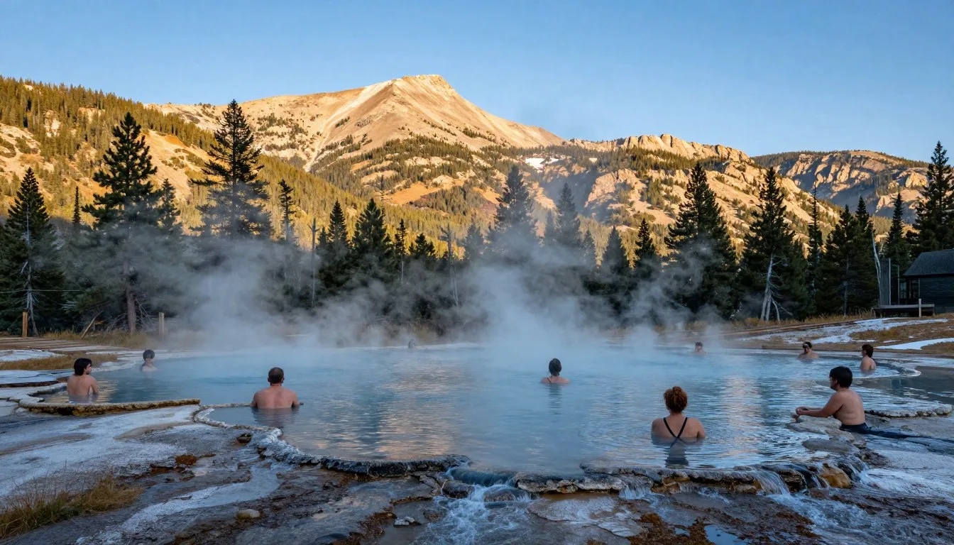
- Mount Princeton Hot Springs (Mile 230) – Perfect place to soak tired muscles if taking the Collegiate East route
- San Luis Peak (Mile 340) – One of the most accessible 14ers from the trail
- Colorado Trail High Point (Mile 373.5) – The trail’s highest point at 4,045 m (13,271 ft) in the San Juan Mountains
- Elk Creek Drainage (Segment 24) – Dramatic descent with stunning views and abandoned mine shafts
- Indian Trail Ridge (Mile 462) – Spectacular knife-edge traverse before the final descent to Durango
- Durango-Silverton Narrow Gauge Railroad (Mile 406.4) – Historic train that can be flagged down at Elk Park for a ride into Silverton
Sightseeing Tip: While the mountains are the main attraction, don’t overlook the diverse ecosystems you’ll pass through. The Colorado Trail traverses six distinct ecological zones, from montane forests to alpine tundra, each with unique flora and fauna.
Museums, Cultural Spots & Festivals

The Colorado Trail passes through areas rich in mining history and mountain culture. Taking time to explore these cultural aspects can add depth to your Colorado Trail experience.
Historical Sites Along the Trail
- Camp Hale (Segment 8) – Historic training grounds of the 10th Mountain Division during World War II
- Mining Ruins – Abandoned mines and equipment throughout the route, especially in the San Juan Mountains
- Alpine Tunnels – Historic railroad engineering feats visible from certain sections
Museums & Cultural Centers in Trail Towns
- Leadville – National Mining Hall of Fame and Museum explores Colorado’s mining heritage
- Salida – SteamPlant Event Center hosts art exhibitions and cultural events
- Silverton – San Juan County Historical Society Mining Heritage Center
- Durango – Durango & Silverton Narrow Gauge Railroad Museum
Seasonal Festivals
If your hike coincides with these events, they’re worth experiencing:
- Leadville Race Series (June-August) – Legendary trail running and mountain biking events
- Salida Art Walk (June) – Downtown art festival
- Silverton Hardrockers Holidays (July) – Mining competitions and heritage celebration
- Durango Cowboy Poetry Gathering (October) – Western heritage celebration
Cultural Tip: The Colorado Trail passes through the ancestral lands of the Ute, Apache, Arapaho, Cheyenne, Pueblo, Shoshone, and other indigenous peoples. Learning about these cultures and their connection to the land can enrich your trail experience.
Nature & Outdoor Experiences

The Colorado Trail traverses some of the most pristine wilderness in the United States, offering unparalleled opportunities to experience the natural world.
Wildlife Viewing
The trail passes through diverse habitats that support abundant wildlife:
- Mammals – Mule deer, elk, bighorn sheep, mountain goats, marmots, pikas, and occasionally moose or black bears
- Birds – Golden eagles, hawks, ptarmigan, Clark’s nutcrackers, and numerous songbirds
- Best Viewing Areas:
- Waterton Canyon – Bighorn sheep
- Collegiate Peaks Wilderness – Mountain goats
- San Juan Mountains – Elk and mule deer
Flora and Ecosystems
The trail passes through six ecological zones, each with distinctive plant communities:
- Montane Forests (2,400-3,000 m) – Ponderosa pine, Douglas fir, aspen groves
- Subalpine Zone (3,000-3,500 m) – Engelmann spruce, subalpine fir, meadows
- Alpine Tundra (above 3,500 m) – Low-growing plants adapted to harsh conditions
Wildflower displays peak in July and early August, with columbine (Colorado’s state flower), Indian paintbrush, lupine, and countless other species creating spectacular alpine gardens.
Outdoor Activities Beyond Hiking
- Fishing – Many alpine lakes and streams along the trail offer trout fishing (Colorado fishing license required)
- Photography – Endless opportunities for landscape and wildlife photography
- Peak Bagging – Access to numerous 14ers (mountains over 14,000 feet) via side trails
- Mountain Biking – Approximately 2/3 of the trail is open to mountain bikes
Nature Tip: Practice Leave No Trace principles to preserve the trail’s natural beauty. Pack out all trash, stay on established trails, and maintain at least 100 m (300 ft) distance from wildlife. Be especially cautious with food storage in bear country.
Safety, Etiquette & Local Customs

The Colorado Trail traverses remote wilderness and high mountains where preparation and proper etiquette are essential for safety and preserving the trail experience for all.
Safety Considerations
- Altitude – Acclimatize properly before attempting high sections; symptoms of altitude sickness include headache, nausea, and dizziness
- Weather – Be off exposed ridges by noon to avoid afternoon thunderstorms; carry rain gear year-round
- Water – Filter all water sources; carry capacity for dry stretches (especially segments 2, 16-19)
- Wildlife – Store food properly in bear country; give large animals plenty of space
- Navigation – Carry maps/GPS and know how to use them; cell service is limited
Trail Etiquette
- Right of Way – Hikers traveling uphill have the right of way; step aside for horses
- Camping – Use established sites when possible; camp at least 60 m (200 ft) from water sources
- Waste Disposal – Pack out all trash; bury human waste 15-20 cm (6-8 inches) deep at least 60 m (200 ft) from water
- Fire Safety – Check current fire restrictions; use established fire rings only
Local Customs & Culture
Understanding local customs enhances your experience and interactions:
- Trail Magic – Random acts of kindness for hikers; express gratitude if you receive it
- Trail Names – Many thru-hikers adopt nicknames on the trail
- Trail Towns – Respect local businesses; clean up before entering stores/restaurants
- Hitchhiking – Common practice for reaching trail towns but use good judgment
Emergency Preparedness: Cell service is unreliable on most of the trail. Consider carrying a satellite communication device for emergencies. Know the closest exit points and have a plan for emergency evacuation if needed.
Visitor Comments About Colorado Trail
“The Colorado Trail exceeded all my expectations. The variety of landscapes is incredible – from forests to alpine meadows to rocky peaks. My favorite section was the San Juan Mountains where the views seemed endless. Be prepared for afternoon thunderstorms and bring layers – the weather changes quickly at high elevations!”
“I section-hiked the Colorado Trail over three summers and found the Collegiate West route to be the most challenging but rewarding part. The wildflowers in July were spectacular, especially near Hope Pass. Don’t underestimate the difficulty of hiking at altitude – take your time to acclimate before tackling the higher sections.”
“As an older hiker, I appreciated how the trail is divided into manageable segments. I particularly enjoyed the trail towns along the way – Leadville and Salida were highlights with great food and friendly locals. The Colorado Trail Foundation does an amazing job maintaining the trail. Bring good rain gear and start early each day to avoid afternoon storms!”
Additional Nearby Destinations

While the Colorado Trail itself offers weeks of adventure, there are several remarkable destinations nearby that are worth exploring before or after your trail journey.
National Parks & Monuments
- Rocky Mountain National Park – Just north of the trail’s Denver terminus, offering spectacular alpine scenery and wildlife viewing
- Black Canyon of the Gunnison National Park – Dramatic steep-walled canyon near Montrose
- Mesa Verde National Park – Ancient Puebloan cliff dwellings near Durango
- Great Sand Dunes National Park – North America’s tallest sand dunes, accessible from Salida
- Browns Canyon National Monument – Whitewater rafting and hiking near Buena Vista
Scenic Byways
- San Juan Skyway – 380 km (236-mile) loop through the San Juan Mountains
- Top of the Rockies – High-elevation drive between Leadville and Aspen
- Collegiate Peaks Scenic Byway – Parallels the Collegiate sections of the trail
Other Outdoor Adventures
- Arkansas River – World-class whitewater rafting near Buena Vista and Salida
- Ice Lakes Basin – Spectacular day hike near Silverton with turquoise alpine lakes
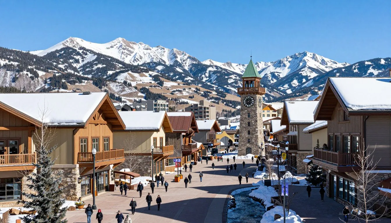
- Crested Butte – “Wildflower Capital of Colorado” with excellent mountain biking
- Telluride – Picturesque former mining town with hiking and festivals
Travel Tip: Many of these destinations are seasonal, with limited access during winter months. If planning to combine the Colorado Trail with visits to these areas, summer and early fall offer the best conditions for most attractions.
Practical Travel Tips

Essential Gear
Whether day hiking or thru-hiking, these items are crucial for the Colorado Trail:
- Sun Protection – UV exposure is intense at high elevations; bring sunscreen, sunglasses, and a wide-brimmed hat
- Rain Gear – Afternoon thunderstorms are common; a waterproof jacket and pants are essential
- Layers – Temperature swings of 15-20°C (30-40°F) in a single day are normal
- Water Treatment – Filter or purifier for all water sources
- Navigation – Maps, compass, and/or GPS device with downloaded maps
- First Aid Kit – Include blister treatment and altitude sickness medication
Permits & Regulations
- Trail Permits – No permits required for hiking the Colorado Trail
- Wilderness Areas – Self-registration at wilderness boundaries
- Campfires – Often restricted during dry periods; check current regulations
- Bear Canisters – Increasingly recommended in certain areas
Resupply Strategy
For long-distance hikers, planning resupply points is crucial:
- Major Resupply Towns – Breckenridge, Leadville, Twin Lakes, Salida, Lake City, Silverton
- Mail Drops – Some locations accept packages for hikers (call ahead to confirm)
- Longest Stretches – Plan for up to 5-6 days between certain resupply points
Budget Considerations
- Trail Towns – Most are tourist destinations with higher prices
- Accommodation – Budget $80-150 per night for hotels in trail towns
- Meals – Restaurant meals typically $15-30
- Shuttles – $1-2 per mile for private shuttles between trailheads
Insider Tip: The Colorado Trail Foundation publishes the definitive Colorado Trail Databook and Guidebook, essential resources for planning your trip. A portion of proceeds supports trail maintenance and improvements.
Embrace the Adventure of a Lifetime
The Colorado Trail offers more than just a hiking experience—it’s a journey through some of America’s most spectacular wilderness, a chance to challenge yourself physically and mentally, and an opportunity to connect with a community of like-minded adventurers. Whether you tackle the entire 485-mile route or explore a few choice segments, the trail rewards you with unforgettable vistas, serene forests, and the simple joy of moving through mountain landscapes under your own power. As you plan your Colorado Trail adventure, remember that the journey itself—with all its challenges and unexpected moments of beauty—is the true destination. The mountains are calling, and the Colorado Trail awaits your footsteps.
Related Posts
Waunita Hot Springs, Colorado: Best Things to Do – Top Picks
Uncompahgre River, Colorado: Best Things to Do – Top Picks

Uncompahgre Peak, Colorado: Best Things to Do – Top Picks
Vapor Caves Glenwood Springs, Colorado: Best Things to Do – Top Picks
Vail Ski Resort, Colorado: Best Things to Do – Top Picks
Vail Pass Road, Colorado: Best Things to Do – Top Picks
Coming Soon: Clickable Maps