Hotels by Trip.com
Flights by Trip.com
Few people know that Medicine Bow Mountains contains over 75 alpine lakes hidden within its rugged terrain, making it one of Colorado’s most underrated mountain destinations. While crowds flock to Rocky Mountain National Park, these ancient peaks offer pristine wilderness experiences with a fraction of the visitors.
The Medicine Bow range stretches across southeastern Wyoming and northern Colorado. This stunning wilderness provides access to some of the most spectacular alpine scenery in the American West.
Whether you’re seeking challenging summit hikes, peaceful lakeside camping, or simply want to experience authentic Rocky Mountain wilderness, Medicine Bow Mountains delivers unforgettable adventures. This comprehensive guide reveals the best things to do in this remarkable destination.
Getting There & Planning Your Journey

The Medicine Bow Mountains sit conveniently between two major transportation hubs. Denver International Airport lies approximately 209 km (130 miles) south, offering the widest selection of flights and rental car options.
Alternatively, Cheyenne Regional Airport sits 121 km (75 miles) east of the range. This smaller facility provides a quieter arrival experience with easier navigation.
From Denver, take Interstate 25 north to Fort Collins, then continue on Highway 287 through Laramie. The entire drive takes about three hours through changing landscapes of plains and foothills.
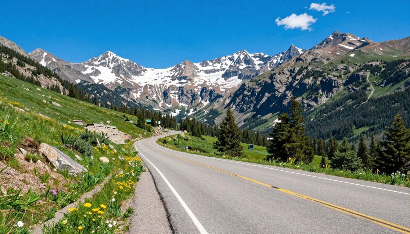
Highway 130, known as the Snowy Range Scenic Byway, provides the primary access route into the heart of Medicine Bow National Forest. This spectacular road crosses the range between Centennial and Saratoga, offering breathtaking views at every turn.
The byway climbs to 3,291 m (10,800 feet) at the summit, passing numerous trailheads and campgrounds. Plan extra time for photo stops and wildlife viewing along this remarkable route.
For trip planning assistance and current road conditions, contact the Medicine Bow-Routt National Forest headquarters:
The range also provides access through several smaller roads branching from Highway 130. Each offers unique perspectives and connects to different wilderness areas within the national forest.
Best Time to Visit Medicine Bow Mountains
Understanding seasonal patterns helps you maximize your Medicine Bow Mountains experience. Each season transforms this alpine landscape dramatically.
Summer Season (Late June – September)
Summer represents the peak visiting time for Medicine Bow. Highway 130 typically opens in late June, though the exact date varies yearly depending on snow conditions.
Temperatures range from 15-24°C (59-75°F) during daytime at lower elevations. Alpine areas remain considerably cooler, often between 10-18°C (50-64°F) even during peak summer.
Check 30,000+ Local Sightseeing Tours Worldwide
✓ Numerous languages and currencies are available
Afternoon thunderstorms develop frequently during summer months. Plan hiking for morning hours and descend from exposed peaks by early afternoon to avoid lightning danger.
Wildflowers reach their spectacular peak in July and early August. Alpine meadows burst with color as thousands of species bloom across the landscape.
Fall Season (September – October)
Autumn brings stunning golden aspen displays throughout lower elevation forests. Late September through early October offers the most vibrant colors.
Temperatures cool significantly, ranging from 5-15°C (41-59°F) during daytime. Nights drop below freezing regularly, requiring proper camping gear.
Snow can arrive any time after mid-September in alpine areas. Check forecasts carefully and prepare for rapidly changing conditions.
Winter Season (November – May)
Highway 130 closes completely during winter, typically from late October through late June. This closure makes most of the range inaccessible except by snowmobile or backcountry skiing.
Winter temperatures plunge well below freezing. Alpine areas experience extreme cold with averages of -15°C to -5°C (5-23°F).
Spring Season (May – June)
Spring arrives slowly in Medicine Bow. Lower elevations begin thawing in May, but alpine areas retain deep snow well into June.
This season brings muddy trails and swollen streams from snowmelt. Most visitors find better conditions by waiting until late June or early July.
Best Time to Visit: July through September offers the most reliable conditions. Late June can work well if highway 130 opens early. September provides fewer crowds and spectacular fall colors but requires preparation for colder temperatures.
Times to Avoid: Late October through June when highway 130 remains closed and most facilities shut down. Spring (May-June) brings muddy conditions and limited access despite warming temperatures.
Getting Around Locally
A personal vehicle provides essential transportation for exploring Medicine Bow Mountains. Public transportation options don’t exist within the national forest area.
The Snowy Range Scenic Byway serves as the main artery through the range. This well-maintained highway connects numerous trailheads, campgrounds, and recreation areas.
Most secondary forest roads remain unpaved but accessible to standard vehicles during dry conditions. Four-wheel drive becomes necessary for more remote areas and after rain.
Parking areas at popular trailheads fill quickly on summer weekends. Arrive before 8:00 AM to secure spots at destinations like Medicine Bow Peak or Mirror Lake.
Cell phone coverage exists sporadically near Highway 130 but disappears completely in backcountry areas. Download offline maps before departing and carry paper backups.
Gas stations operate in Centennial, Saratoga, and Laramie but not within the national forest itself. Fill your tank before entering the mountains and carry extra fuel for extended trips.
Where to Stay

Camping Options
Medicine Bow National Forest operates numerous developed campgrounds throughout the range. These facilities provide the most authentic mountain experience while keeping you close to hiking trails and natural attractions.
Mirror Lake Campground sits adjacent to one of the range’s most beautiful alpine lakes. The facility offers 12 sites with picnic tables and fire rings at 3,200 m (10,500 feet) elevation.
Brooklyn Lake Campground provides similar amenities at a slightly lower elevation. This popular spot fills quickly during summer weekends due to excellent fishing opportunities.
Dispersed camping is permitted throughout most national forest lands. This free option allows you to camp anywhere at least 30 m (100 feet) from water sources and established trails.
Most developed campgrounds operate on first-come, first-served basis. Some accept reservations through Recreation.gov during peak summer months.
Lodging in Nearby Towns
Centennial serves as the closest town to the Snowy Range area. This tiny community offers a few cabins and the historic Old Corral Hotel and Steakhouse.
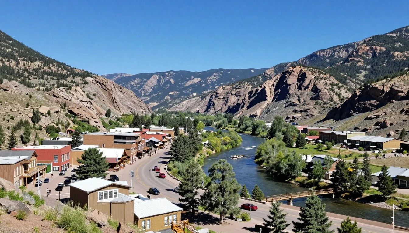
Saratoga, located on the west side of the range, provides more extensive lodging options. The town features several motels, inns, and vacation rentals within 48 km (30 miles) of mountain access.
Laramie offers the widest selection of accommodations. This college town sits about 56 km (35 miles) east of the mountains and includes major hotel chains, independent motels, and numerous vacation rentals.
For lodging reservations and information in Saratoga:
Many visitors also consider staying in Walden, Colorado, which provides access to the southern portions of Medicine Bow and connects to Colorado State Forest State Park.
Dining & Local Cuisine
Dining options near Medicine Bow Mountains reflect the area’s rural character. Most visitors should plan to bring their own food supplies or eat before entering the mountains.
The Old Corral Hotel in Centennial serves as the only restaurant directly on the Snowy Range Scenic Byway. This historic establishment offers hearty steaks, burgers, and traditional American fare.
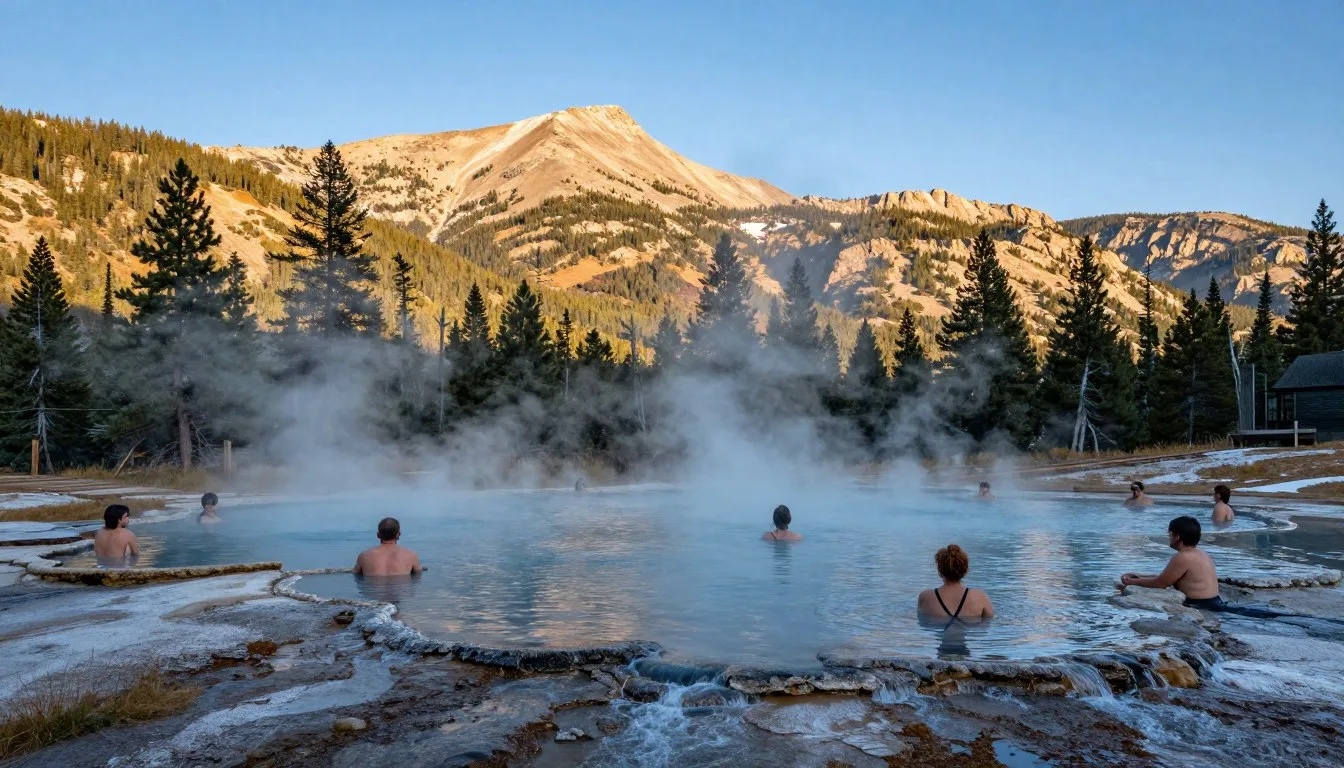
Saratoga features several dining options including casual cafes, pizza restaurants, and upscale establishments. The town’s hot springs resort area includes restaurants serving contemporary Western cuisine.
Laramie provides the most diverse food scene with dozens of restaurants. Options range from quick-service chains to local favorites serving everything from Mexican food to Asian cuisine.
Stock up on groceries and camping supplies in Laramie before heading into the mountains. The town has several supermarkets and outdoor equipment stores.
Pack plenty of high-energy snacks and meals for day hikes. No food services exist along trails, and reaching lower elevations can take several hours from remote areas.
Water sources exist throughout the mountains, but always treat or filter water before drinking. Giardia and other pathogens occur naturally in mountain streams and lakes.
Attractions, Sightseeing & Activities

Medicine Bow Peak
Medicine Bow Peak rises to 3,661 m (12,013 feet), claiming the title as the highest point in the Medicine Bow Mountains. This iconic summit attracts thousands of hikers annually.
The standard route begins at Lewis Lake Trailhead along Highway 130. This well-maintained trail climbs 792 m (2,600 feet) over 4.8 km (3 miles) to reach the summit.
Expect the round-trip hike to take 5-7 hours depending on your fitness level and acclimatization. Start early to avoid afternoon thunderstorms that develop regularly during summer.
The summit provides breathtaking 360-degree views extending across Wyoming and Colorado. On clear days, you can see Longs Peak in Rocky Mountain National Park over 161 km (100 miles) south.
Snowy Range Scenic Byway
Highway 130 earned designation as a National Scenic Byway for good reason. This spectacular 45 km (28-mile) route crosses the heart of the Snowy Range through constantly changing landscapes.
The road climbs from sagebrush valleys through dense forests before emerging above treeline. Multiple pullouts allow you to stop and photograph stunning vistas.
Libby Flats Observation Point sits near the highway’s high point. A short boardwalk leads to panoramic views and interpretive signs explaining the area’s geology and ecology.
Plan at least two hours to drive the byway even without stopping for hikes. The winding road and frequent photo opportunities demand a leisurely pace.
Mirror Lake
Mirror Lake lives up to its name on calm mornings when the water perfectly reflects surrounding peaks. This easily accessible alpine lake sits right beside Highway 130.
A gentle 0.8 km (0.5-mile) trail circles the lake, making it perfect for families and those seeking easier walks. The path remains relatively flat with minimal elevation gain.
Fishing opportunities abound for brook and rainbow trout. Anglers need valid Wyoming fishing licenses available online or from sporting goods stores in nearby towns.
The adjacent campground provides convenient overnight options. Wake early to photograph the mirror-still reflections before wind disturbs the surface.
Museums, Cultural Spots & Festivals
Medicine Bow Mountains take their name from Native American history. Tribes harvested mountain ash in the area to craft bows for hunting and warfare.
The Medicine Bow Museum in the tiny town of Medicine Bow preserves regional history. Located about 97 km (60 miles) north of the mountains, this small museum showcases pioneer life and the area’s significance to indigenous peoples.
Laramie offers several cultural attractions including the University of Wyoming Art Museum and the Wyoming Territorial Prison State Historic Site. These provide interesting alternatives during inclement weather.
The annual Snowy Range Music Festival takes place each August in Centennial. This event features bluegrass and folk musicians performing against the backdrop of spectacular mountain scenery.
Saratoga hosts several summer festivals celebrating Western heritage. The town’s hot springs have attracted visitors for generations, creating a unique cultural legacy.
Indigenous peoples used the Medicine Bow area for thousands of years before European settlement. Many archaeological sites exist throughout the range, though most remain unmarked to protect them.
Nature & Outdoor Experiences

Hiking Throughout the Range
Over 644 km (400 miles) of trails weave through Medicine Bow National Forest. These routes range from easy lakeside strolls to challenging summit climbs requiring scrambling skills.
The Medicine Bow Trail system provides access to multiple designated wilderness areas. Savage Run Wilderness covers 6,070 hectares (15,000 acres) of pristine backcountry on the eastern slope.
Platte River Wilderness protects another 9,308 hectares (23,000 acres) of rugged terrain. This remote area sees fewer visitors despite offering excellent hiking opportunities.
Most trails climb steadily through subalpine forests of Engelmann spruce and subalpine fir. These shaded sections provide relief from intense high-altitude sun.
Above treeline around 3,353 m (11,000 feet), vegetation gives way to alpine tundra. This fragile ecosystem hosts specialized plants adapted to extreme conditions.
Wildlife Viewing
Medicine Bow Mountains support diverse wildlife populations. Elk herds inhabit forested areas and meadows throughout the range.
Moose frequent willow-lined streams and wetland areas. These massive animals moved into the range naturally in recent decades as populations expanded from northern regions.
Mule deer browse throughout forests and meadows. Watch for them during dawn and dusk when they’re most active.
Black bears roam throughout the national forest. Practice proper food storage at campsites using bear-resistant containers or hanging methods.
Mountain goats occupy the highest peaks and rocky ridges. Look for their distinctive white coats among cliffs near and above treeline.
Bighorn sheep inhabit some areas, though populations remain smaller than in other Colorado ranges. The rocky terrain of Medicine Bow provides excellent habitat.

Fishing Opportunities
Over 75 alpine lakes provide excellent fishing throughout the Medicine Bow range. Many lakes contain brook trout, while some have been stocked with rainbow, golden, or cutthroat trout.
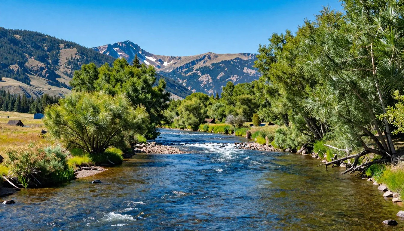
The Medicine Bow River and numerous tributaries offer stream fishing. These cold, clear waters support healthy trout populations.
Most lakes require hiking to reach, with distances ranging from easy roadside access to challenging multi-mile approaches. Remote lakes typically provide better fishing due to lighter pressure.
Wyoming fishing regulations apply throughout most of the range. Colorado licenses are required for waters within that state’s boundaries.
Photography Destinations
Photographers find endless subjects throughout Medicine Bow Mountains. Alpine wildflowers create spectacular displays during July and August.
Check 30,000+ Local Sightseeing Tours Worldwide
✓ Numerous languages and currencies are available
Lake reflections work best during calm morning hours before wind develops. Mirror Lake, Lake Marie, and Brooklyn Lake all offer excellent reflection opportunities.
Fall colors peak in late September when aspen groves turn brilliant gold. Lower elevation forests provide the most extensive displays.
Wildlife photography requires patience and proper equipment. Long lenses help maintain safe distances while capturing detailed images.

Winter Recreation
When Highway 130 closes, winter recreation opportunities shift to cross-country skiing and snowmobiling. Designated trails provide access through snow-covered forests.
Backcountry skiing attracts adventurous visitors seeking pristine powder. Avalanche danger exists throughout the range, requiring proper training and equipment.
Snowmobiling on designated routes allows winter access to areas unreachable by other means. The Medicine Bow Trail system includes over 483 km (300 miles) of marked snowmobile routes.
Safety, Etiquette & Local Customs

Altitude Considerations
Most areas in Medicine Bow sit above 2,438 m (8,000 feet) elevation. Many trailheads start above 3,048 m (10,000 feet), and peaks reach over 3,658 m (12,000 feet).
Altitude sickness affects many visitors, especially those arriving from sea level. Symptoms include headache, nausea, fatigue, and shortness of breath.
Allow at least one full day to acclimatize before attempting strenuous hikes. Spend time at moderate elevations before ascending to higher areas.
Drink extra water at altitude where dehydration occurs more rapidly. Aim for at least 3-4 liters daily during active hiking.
Weather Preparedness
Mountain weather changes rapidly. Afternoon thunderstorms develop almost daily during summer, bringing lightning, hail, and sudden temperature drops.
Start hikes early and plan to descend from exposed ridges and summits by early afternoon. Lightning poses serious danger on peaks and open terrain.
Temperatures can fluctuate 15-20°C (27-36°F) between morning and afternoon. Layer clothing to adjust as conditions change.
Snow can fall any month of the year above 3,048 m (10,000 feet). Carry extra warm layers even during summer.
Leave No Trace Principles
Practice Leave No Trace ethics to preserve Medicine Bow’s pristine wilderness. Pack out all trash, including food scraps and toilet paper.
Camp at least 61 m (200 feet) from lakes and streams. Use established campsites when available to minimize impact on vegetation.
Campfires are permitted in many areas but discouraged above treeline where wood is scarce. Use camp stoves instead whenever possible.
Stay on established trails to prevent erosion and damage to alpine tundra. This fragile ecosystem takes decades to recover from trampling.
Wildlife Safety
Black bears inhabit the entire range. Store food properly using bear canisters or hanging at least 3.7 m (12 feet) high and 1.2 m (4 feet) from tree trunks.
Never approach wildlife for photographs. Use telephoto lenses to capture images while maintaining safe distances.
Moose can be aggressive, especially cows with calves. Give them wide berth, at least 23 m (75 feet) distance.
Emergency Contact Information
Cell phone coverage remains unreliable throughout most of Medicine Bow. Carry satellite communication devices for emergencies in remote areas.
For emergencies requiring search and rescue:
Albany County Sheriff handles emergencies on the Wyoming side of the range. Carbon County authorities respond to incidents in southern areas.
Register your hiking plans with friends or family before departing. Provide specific itinerary details including expected return time.
Visitor Comments About Medicine Bow Mountains
“We spent a week exploring Medicine Bow and barely scratched the surface. The wildflower displays exceeded anything we’d seen in more famous Colorado destinations. Medicine Bow Peak challenged us, but the summit views made every step worthwhile. We’ll definitely return to explore more of the lakes and trails we missed.”
“As a photographer, I found Medicine Bow to be an absolute dream. The morning light on Mirror Lake created reflections I’ve only seen in magazine photos before. We encountered maybe a dozen other people all day, unlike the crowds at Rocky Mountain National Park. The solitude and pristine conditions made for an incredible experience.”
“Our family camped at Brooklyn Lake and spent four days hiking different trails each day. The kids loved fishing and spotted a moose near our campsite one morning. The Snowy Range Scenic Byway alone is worth the trip. We’re already planning our return visit for fall colors next year.”
Additional Nearby Destinations

Rocky Mountain National Park
Located about 161 km (100 miles) south, Rocky Mountain National Park offers spectacular scenery and extensive trail systems. This famous destination attracts millions of visitors annually.
The park requires timed entry permits during peak summer months. Reserve these well in advance if planning to visit.
Trail Ridge Road climbs to 3,713 m (12,183 feet), providing the highest continuous paved road in North America. The scenic drive offers stunning views across alpine tundra.
Colorado State Forest State Park
This state park lies about 64 km (40 miles) south of Medicine Bow Mountains. The park encompasses 28,732 hectares (71,000 acres) of forests, meadows, and high peaks.
The Rawah Wilderness borders the park, providing additional hiking opportunities. These mountains continue the same geological formations found in Medicine Bow.
Moose viewing opportunities exceed those in most Colorado locations. The park supports a healthy moose population throughout its wetland areas.
For Colorado State Forest State Park information:
Vedauwoo Recreation Area
About 56 km (35 miles) northeast of Centennial, Vedauwoo features spectacular granite rock formations. These unique geological features attract rock climbers from across the country.
Hiking trails wind between massive boulders creating otherworldly landscapes. The area provides easier access than higher Medicine Bow peaks while still offering beautiful scenery.
Encampment River Wilderness
This designated wilderness area protects 4,047 hectares (10,000 acres) west of the main Snowy Range. Remote trails follow the Encampment River through pristine forests.
Fishing opportunities abound in the river and its tributaries. The wilderness sees far fewer visitors than more accessible areas.
Practical Travel Tips
Essential Gear
Proper equipment makes Medicine Bow experiences safer and more enjoyable.
- Sturdy hiking boots with ankle support and good traction
- Layered clothing including insulating and waterproof shells
- Sun protection: hat, sunglasses, and SPF 30+ sunscreen
- Navigation tools: map, compass, and GPS device
- First aid kit with altitude sickness medications
- Water filtration system or purification tablets
- Headlamp with extra batteries
- Emergency shelter and fire-starting materials
Money & Costs
Budget planning helps prepare for expenses during your visit.
- National forest access remains free with no entrance fees
- Developed campground fees range $10-20 per night
- Gas prices in small mountain towns run higher than cities
- Restaurant meals in Centennial cost $15-30 per person
- Wyoming fishing licenses start at $14 for residents, $24 for non-residents
- Hotel rooms in Laramie range $80-150 per night
- Bring sufficient cash as cell service limits card payments
Health Precautions
High altitude and wilderness conditions require special health considerations.
- Acclimatize gradually to prevent altitude sickness symptoms
- Apply sunscreen frequently as UV exposure intensifies at elevation
- Treat all water sources before drinking to prevent illness
- Carry adequate first aid supplies for minor injuries
- Know symptoms of hypothermia and altitude sickness
- Pack prescription medications plus several days extra supply
Best Resources
Information sources help plan successful Medicine Bow adventures.
- Medicine Bow-Routt National Forest visitor centers provide maps and current conditions
- Wyoming State Parks website offers campground reservation information
- National Weather Service mountain forecasts predict conditions accurately
- USGS topographic maps show detailed trail and terrain information
- Local outdoor shops in Laramie stock gear and provide beta
- AllTrails app includes user reviews and recent trail reports
Permits & Regulations
No permits are required for day hiking in Medicine Bow National Forest. Overnight wilderness camping remains free and doesn’t require permits, though you must follow Leave No Trace principles.
Campfire restrictions apply during high fire danger periods. Check current conditions with forest service offices before your visit.
Dogs must remain under control at all times. Keep them on leash near developed areas and campgrounds to protect wildlife and other visitors.
Communication & Connectivity
Cell phone service works sporadically along Highway 130 near the Snowy Range. Most backcountry areas have zero coverage.
Download offline maps before entering the mountains. Services like Google Maps and AllTrails allow map downloads for areas without connectivity.
Satellite messengers provide emergency communication capability. Devices like Garmin inReach allow two-way texting and SOS activation anywhere.
Wi-Fi access exists in Laramie hotels and some Saratoga establishments. Don’t expect internet connectivity in remote mountain areas.
Photography Tips
Golden hour lighting occurs about 30 minutes before sunset and after sunrise. These times provide the warmest, most dramatic light for mountain photography.
Polarizing filters reduce glare from water and sky while enhancing colors. These prove especially useful for lake reflections.
Wide-angle lenses capture sweeping landscape vistas. Bring focal lengths between 16-35mm for optimal mountain scenery.
Protect camera gear from altitude condensation when temperature changes occur rapidly. Allow equipment to adjust gradually to new conditions.
Your Medicine Bow Mountains Adventure Awaits
Medicine Bow Mountains stand ready to reward adventurous travelers with experiences matching Colorado’s most famous destinations. The range offers everything from casual scenic drives to challenging peak climbs.
Pristine wilderness, abundant wildlife, and stunning alpine lakes create the perfect backdrop for outdoor adventures. Whether you seek solitude in remote wilderness areas or prefer accessible roadside beauty, Medicine Bow delivers.
The Snowy Range’s relatively undiscovered status means you’ll find the authentic mountain experience increasingly rare in Colorado today. Start planning your Medicine Bow Mountains adventure and discover why this range deserves recognition among the state’s finest wilderness destinations.
Check 30,000+ Local Sightseeing Tours Worldwide
✓ Numerous languages and currencies are available
The high peaks and crystal-clear lakes await your footsteps. Pack your bags, prepare your gear, and head to Medicine Bow for an unforgettable Rocky Mountain experience.