Hotels by Trip.com
Flights by Trip.com
Standing at an impressive 4,395 meters (14,421 feet), Mount Harvard ranks as Colorado’s third-highest summit. Yet here’s something most visitors don’t know: this towering 14er was nearly named Mount Yale until a Harvard professor successfully lobbied for the change in 1869. The peak receives fewer than 2,000 summit attempts annually, making it surprisingly uncrowded compared to other Collegiate Peaks.
This comprehensive guide reveals everything you need to know about Mount Harvard. Whether you’re planning your first 14er climb or exploring the Buena Vista area, you’ll find practical information to make your visit unforgettable.
Getting There and Planning Your Journey

Your journey to Mount Harvard begins with selecting the right airport. Denver International Airport (DEN) sits 201 kilometers (125 miles) northeast and offers the most flight options. Colorado Springs Airport (COS) provides an alternative 161 kilometers (100 miles) away.
From Denver, take Highway 285 south to Buena Vista. The scenic drive takes approximately three hours through mountain passes and valleys. Vehicle rental at the airport proves essential, as public transportation doesn’t reach the trailhead.
Reaching the Trailhead
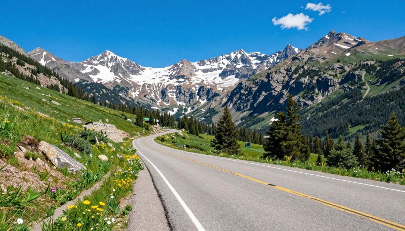
The North Cottonwood Creek trailhead serves as the primary starting point. From Buena Vista, drive west on County Road 350 for 11 kilometers (7 miles). Turn right onto Road 365 and continue for another 8 kilometers (5 miles) on unpaved surface.
High-clearance vehicles handle the rough road better. Standard cars can reach the lower parking area, but the final 3 kilometers (2 miles) challenge low-clearance vehicles. Many hikers park early and walk the extra distance.
Planning Tip: Reserve accommodations in Buena Vista at least two weeks ahead during peak season (June through September). The small mountain town fills quickly with outdoor enthusiasts.
Best Time to Visit and Weather Tips
Recommended Months
- July – Peak wildflower season with stable weather
- August – Warmest temperatures and longest days
- Early September – Fewer crowds and beautiful fall colors
- Late June – Snow melting but trail accessible
Months to Avoid
- October through May – Heavy snow coverage
- April – Unpredictable avalanche conditions
- Late September – Early season snowstorms
- Winter months – Extreme cold and dangerous terrain
Mount Harvard experiences dramatic weather changes throughout the day. Morning temperatures at the trailhead hover around 10°C (50°F) in summer. The summit drops to 2°C (35°F) even in July.
Afternoon thunderstorms develop regularly between June and August. Start your hike by 5:00 AM to reach the summit before noon. This timing helps you descend safely before weather deteriorates.
Seasonal Weather Patterns
Summer brings the most stable conditions. Expect clear mornings with cloud buildup after 11:00 AM. Snow patches linger in Horn Fork Basin through July. The area receives minimal precipitation, but storms arrive quickly.
Fall offers spectacular scenery but shorter days. Temperatures drop significantly after sunset. First snowfalls typically occur in late September, making the trail more challenging.
Weather Safety: Lightning poses the greatest danger on exposed ridges. If thunderheads appear, descend immediately regardless of your progress. The summit will be there another day.
Getting Around Locally
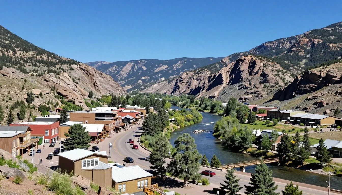
Buena Vista operates as your base camp for exploring Mount Harvard. This small town lacks public transportation, making a personal vehicle necessary. The compact downtown area spans just eight blocks, perfect for walking.
Gas stations appear limited once you leave town. Fill your tank in Buena Vista before heading to any trailhead. The nearest fuel beyond town sits 40 kilometers (25 miles) away.
Local Transportation Options
Several shuttle services transport hikers to trailheads. These services prove valuable for point-to-point hikes or if your vehicle can’t handle rough roads. Book these shuttles two days in advance during peak season.
Bike rentals offer another way to explore the area. Paved paths connect Buena Vista to nearby towns. However, bikes can’t reach Mount Harvard’s trailhead due to steep, unpaved terrain.
Where to Stay

Buena Vista provides diverse lodging options five kilometers (16 miles) from the trailhead. Hotels, vacation rentals, and bed-and-breakfasts cater to different budgets and preferences.
Accommodation Types
Mountain lodges offer comfortable rooms with mountain views. These properties typically include breakfast and hiking advice from experienced staff. Prices range from $120 to $280 per night during summer.
Vacation rentals provide full kitchens and more space for groups. These homes accommodate four to eight people. Booking three months ahead secures better selection and pricing.
Budget travelers find several motels along the main highway. These no-frills options cost $70 to $100 nightly. They provide basic amenities and easy highway access.
Camping Options
Dispersed camping along North Cottonwood Creek puts you closest to the trail. No facilities exist, but the location cuts two hours from your morning drive. Arrive before 4:00 PM to claim a spot.
Developed campgrounds near Buena Vista offer restrooms and water. Collegiate Peaks Campground sits 13 kilometers (8 miles) from town. Sites cost $25 per night and fill quickly on weekends.
Dining and Local Cuisine
Buena Vista’s restaurant scene reflects its mountain culture. Hearty breakfast spots fuel hikers before dawn. Evening dining options range from casual to upscale.
Breakfast Spots
Several cafes open early for hikers. These establishments serve substantial breakfast burritos, pancakes, and strong coffee. Expect to pay $12 to $18 per person. Arrive by 6:00 AM to avoid weekend crowds.
Gas station convenience stores provide grab-and-go options. Stock up on trail snacks, sandwiches, and energy bars. These stores open as early as 5:00 AM.
Dinner Options
Local brewpubs serve Colorado craft beer alongside burgers and pizzas. These relaxed venues attract tired hikers comparing trail stories. Most feature outdoor patios with mountain views.
Upscale restaurants showcase Colorado ingredients like elk, trout, and locally raised beef. Reservations help during peak season. Dinner costs $25 to $45 per person without drinks.
Local Favorite: Many hikers celebrate summit success with locally brewed beer and wood-fired pizza. This tradition has become part of the Mount Harvard experience.
Attractions, Sightseeing, and Activities

Climbing Mount Harvard
The standard route via Horn Fork Basin presents a challenging but achievable goal. This trail covers 21 kilometers (13 miles) round trip with 1,372 meters (4,500 feet) of elevation gain. Most fit hikers complete it in 10 to 14 hours.
Begin at the North Cottonwood Creek trailhead at 2,987 meters (9,800 feet). The trail follows the creek for 6 kilometers (4 miles) through forest and meadows. You’ll reach Horn Fork Basin where views open dramatically.
The route continues up the basin, crossing occasional snowfields. Stay left of the main drainage as you climb. Rocky terrain requires careful foot placement. Trekking poles help maintain balance on loose scree.
Summit Push
The final ascent tackles steep slopes to the summit ridge. No technical climbing skills needed, but stamina proves essential. The summit offers 360-degree views of the Collegiate Peaks and Sawatch Range.
Allow at least seven hours for ascent and five hours for descent. Weather deteriorates quickly, so monitor clouds carefully. Turn around by 1:00 PM regardless of your position.
Alternative Routes
Experienced mountaineers attempt Mount Harvard from Bear Lake. This longer approach adds 8 kilometers (5 miles) but offers a quieter experience. The difficulty increases with more elevation gain and technical sections.
Some people combine Mount Harvard with neighboring Mount Columbia. This double-peak day exceeds 25 kilometers (16 miles) and demands excellent fitness. Only attempt this after acclimating for several days.
Nature and Outdoor Experiences

Flora and Fauna
Mount Harvard area supports diverse wildlife. Elk herds graze in valleys during summer mornings. Marmots whistle warnings from boulder fields. Pikas scurry across talus slopes gathering vegetation.
Wildflower displays peak in July. Columbines, paintbrush, and alpine sunflowers blanket meadows. The Collegiate Peaks area protects rare alpine plants found nowhere else in Colorado.
Photography Opportunities
Sunrise from Horn Fork Basin creates spectacular lighting. The golden hour illuminates peaks with warm tones. Bring a wide-angle lens to capture expansive mountain vistas.
Wildlife photography requires patience and telephoto lenses. Marmots and pikas become active mid-morning. Maintain safe distances from all wildlife, especially elk during rutting season.
Fishing and Water Activities
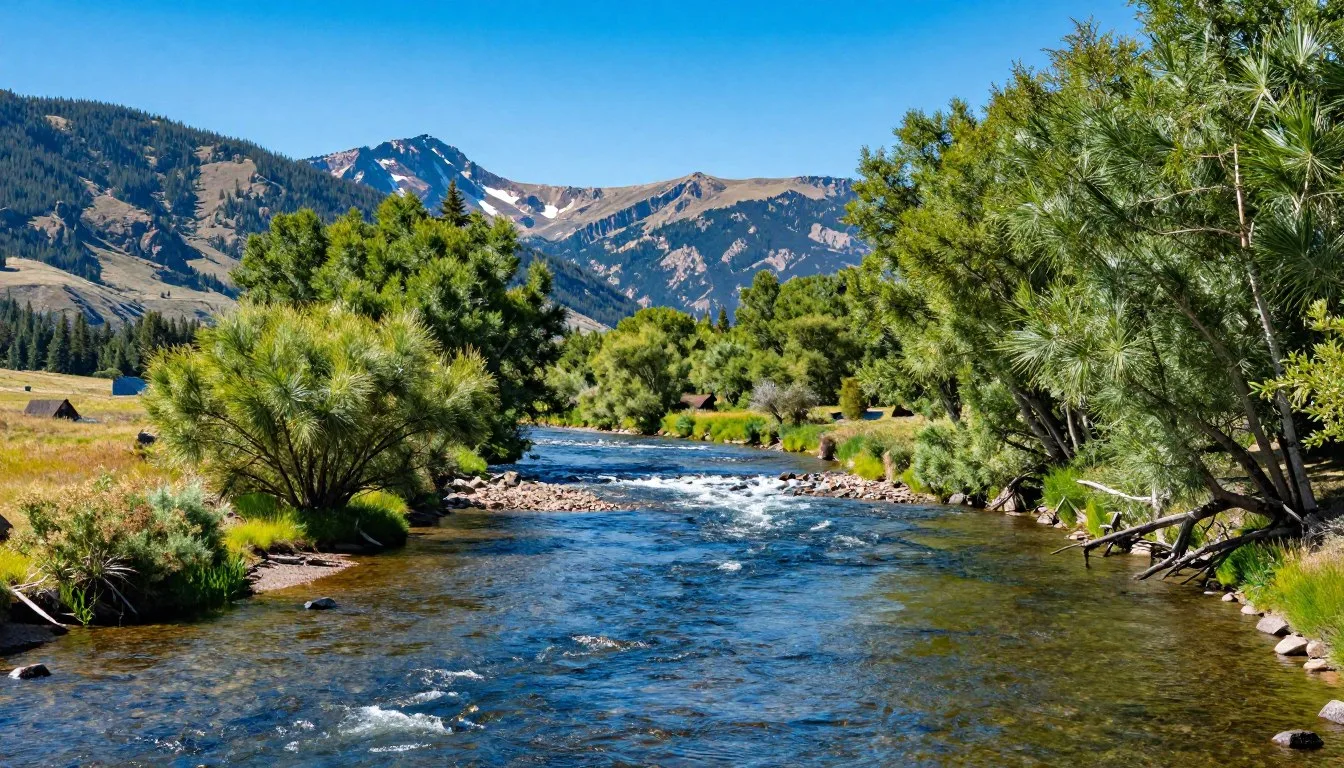
North Cottonwood Creek offers trout fishing below the trailhead. Colorado fishing licenses can be purchased online or at local shops. Creek fishing produces best results in early morning or evening.
Bear Lake, accessible via alternative route, provides high-altitude fishing. Native cutthroat trout inhabit these pristine waters. The lake sits at 3,475 meters (11,400 feet) elevation.

Safety, Etiquette, and Local Customs

Essential Safety Guidelines
Altitude sickness affects many visitors. Spend at least one night in Buena Vista before attempting the summit. Symptoms include headache, nausea, and dizziness. Descend immediately if symptoms worsen.
Carry these essential items on every hike:
- Three liters of water per person minimum
- High-energy snacks and lunch
- Warm layers including insulated jacket
- Rain gear and wind protection
- First aid kit with blister treatment
- Headlamp with extra batteries
- Map, compass, and GPS device
- Sunscreen and sunglasses
Weather Precautions
Lightning kills several Colorado hikers annually. Leave the summit when you hear thunder or see lightning, even if it seems distant. Avoid lone trees and ridge tops during storms.
Hypothermia risks increase when temperatures drop and wind picks up. Wet clothing accelerates heat loss. Change into dry layers immediately if you get wet from rain or snow.
Trail Etiquette
Uphill hikers have right-of-way on narrow sections. Step aside and let faster hikers pass safely. Keep noise levels reasonable to preserve wilderness character.
Pack out all trash including orange peels and apple cores. These items take months to decompose at high altitude. Many hikers carry extra bags to pack out others’ forgotten trash.
Leave No Trace Principles
Stay on established trails to prevent erosion. Cutting switchbacks damages fragile alpine vegetation that takes decades to recover. Use existing campsites if you bivouac near the trail.
Human waste requires proper disposal. Pack out toilet paper in sealed bags. Bury solid waste 15 centimeters (6 inches) deep and 60 meters (200 feet) from water sources.
Emergency Contact: Cell service doesn’t reach most of the trail. Inform someone of your plans and expected return time. Chaffee County Search and Rescue responds to mountain emergencies.
Visitor Comments About Mount Harvard
M.D., Elizabeth
“The Horn Fork Basin approach exceeded my expectations. We started at dawn and reached the summit by 11:30 AM. The wildflower displays in the basin were absolutely stunning. The final push to the summit challenged us, but the views made every step worthwhile. Bring plenty of water and start early!”
C.A., Halifax
“Mount Harvard was our third 14er and definitely the most remote. The road to the trailhead tested our rental SUV, but we made it. Saw only six other people the entire day. The solitude and pristine wilderness made this peak special. Weather changed fast in the afternoon, so we descended quickly. Would definitely return.”
P.N., Aberdeen
“Acclimation made all the difference for us. We spent two days in Buena Vista before attempting the summit. The extra time helped tremendously with altitude adjustment. The route finding through the basin required attention, but the trail was generally clear. Summit views of the Collegiate Peaks were magnificent. Highly recommend this less-crowded alternative to more popular 14ers.”
Location and Map
Mount Harvard location in the Sawatch Range, Chaffee County, Colorado
Additional Nearby Destinations

Collegiate Peaks Wilderness
Mount Harvard sits within the 109,187-hectare (269,783-acre) Collegiate Peaks Wilderness. This protected area contains eight 14ers, more than any other wilderness in Colorado. Miles of trails connect peaks, lakes, and valleys.
Nearby Mount Columbia stands just 5 kilometers (3 miles) northeast of Harvard. At 4,287 meters (14,073 feet), it ranks as Colorado’s tenth-highest peak. Experienced hikers combine both summits in one ambitious day.
Buena Vista Attractions
The Arkansas River flows through Buena Vista, creating world-class whitewater rafting. Commercial outfitters run trips from May through September. Rapids range from Class II to Class IV difficulty.
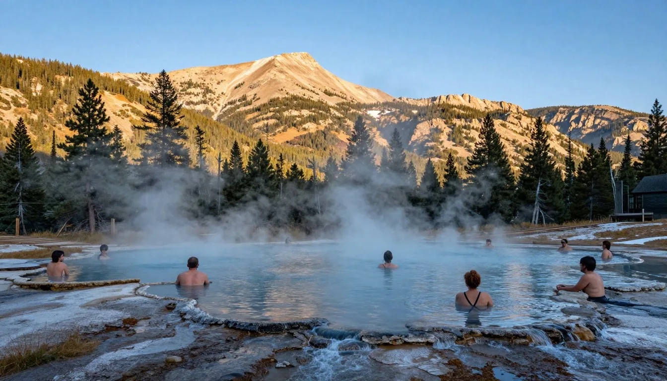
Mount Princeton Hot Springs sits 24 kilometers (15 miles) south of town. Natural hot springs feed multiple pools with temperatures from 35°C to 42°C (95°F to 108°F). The resort welcomes day visitors for $25 per person.
Historic Mining Towns
St. Elmo ghost town preserves Colorado mining history 26 kilometers (16 miles) southwest of Buena Vista. Restored buildings showcase 1880s mining life. The town sits at 3,048 meters (10,000 feet) elevation along a scenic mountain road.
Leadville, Colorado’s highest incorporated city, sits 64 kilometers (40 miles) north. Historic downtown buildings house museums, restaurants, and shops. The National Mining Hall of Fame documents Colorado’s mining heritage.
Practical Travel Tips
Physical Preparation
Train for Mount Harvard at least eight weeks before your trip. Focus on cardiovascular fitness and leg strength. Practice hiking with a loaded backpack on varied terrain.
Stair climbing builds specific muscles needed for sustained uphill hiking. Aim for 60 minutes of cardio exercise four times weekly. Include at least one long hike weekly with elevation gain.
Gear Recommendations
Sturdy hiking boots with ankle support prevent injuries on rocky terrain. Break in new boots during training hikes, not on Mount Harvard. Trekking poles reduce knee stress during descent.
Layer clothing for changing temperatures. Start with moisture-wicking base layers. Add insulating mid-layers and waterproof outer shells. Avoid cotton which retains moisture.
Permits and Regulations
Mount Harvard requires no permits for day hiking. Overnight camping in the wilderness needs self-registration at trailheads. Groups larger than 12 people require special permission from the Forest Service.
Dogs are allowed on leash but rarely attempt 14ers successfully. The distance and difficulty challenge even well-conditioned dogs. Consider the animal’s safety and abilities before bringing pets.
Money and Services
Buena Vista has one bank with ATM services. Credit cards work at most businesses, but carry cash for parking fees or small purchases. Cell service remains unreliable outside town.
No services exist at the trailhead. Plan accordingly for full-day self-sufficiency. The nearest medical facility operates in Buena Vista, 24 kilometers (15 miles) from the trailhead.
Essential Packing List
- Navigation tools (map, GPS, compass)
- Sun protection (sunscreen, hat, sunglasses)
- Emergency shelter (space blanket)
- Fire starter and matches in waterproof container
- Knife or multi-tool
- Whistle for emergencies
Food and Hydration
- Minimum 3 liters water per person
- High-calorie snacks every hour
- Electrolyte replacement drinks
- Substantial lunch for energy
- Emergency extra food
- Water purification tablets
Communication and Connectivity
Download offline maps before leaving town. Cell service disappears quickly once you leave Buena Vista. GPS devices work throughout the area but carry paper maps as backup.
Satellite communication devices provide emergency contact capability. These rental units cost $30 to $50 weekly. Several outdoor shops in Buena Vista rent satellite messengers.
Your Mount Harvard Adventure Awaits
Mount Harvard offers an authentic Colorado 14er experience without overwhelming crowds. The challenging trail rewards hikers with spectacular alpine scenery and genuine wilderness solitude. From the wildflower-filled Horn Fork Basin to the expansive summit views, every step reveals why the Collegiate Peaks rank among Colorado’s most beloved ranges.
Proper preparation transforms this ambitious hike into an achievable goal. Acclimate properly, start early, and respect changing weather. Whether you’re adding Harvard to your 14er list or discovering Colorado’s high country for the first time, this magnificent peak delivers memories that last a lifetime. Pack your gear, train well, and prepare for an unforgettable adventure in the heart of the Sawatch Range.