Hotels by Trip.com
Flights by Trip.com
Did you know that Mount of the Holy Cross was once so revered that it became a National Monument in 1929, only to lose that status 21 years later? This 4,271 m (14,009′) peak in the Sawatch Range captivates visitors with its massive snow-filled cross formation visible on the northeast face. The mountain draws thousands of hikers each year who seek both spiritual reflection and physical challenge.
The cross measures roughly 457 m (1,500′) vertically and 229 m (750′) horizontally. It remains one of Colorado’s most photographed peaks. This guide reveals everything you need to plan an unforgettable journey to this sacred mountain.
Getting There & Planning Your Journey
The closest major airport is Denver International Airport (DEN), located approximately 193 km (120 miles) east of the trailhead. From Denver, you’ll drive west through the scenic Interstate 70 corridor. The journey takes about 2.5 hours under normal conditions.
Eagle County Regional Airport (EGE) in Gypsum offers a closer alternative. It sits just 64 km (40 miles) from the mountain access points. This smaller airport serves seasonal flights and provides quicker access to the Holy Cross Wilderness area.
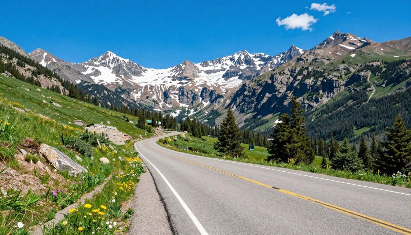
From either airport, you’ll head toward the town of Minturn. Take Tigiwon Road, a rugged forest service road that requires high-clearance vehicles. The road extends roughly 13 km (8 miles) to the Half Moon Trailhead. This serves as the primary starting point for summit attempts.
Important: Tigiwon Road typically opens in late June or early July. Snow and mud can block passage until mid-summer. Always check current road conditions before departure.
The drive on Tigiwon Road takes 45 minutes to an hour. The rough, rocky surface demands careful navigation. Many visitors choose to park at the lower parking area and walk the extra distance. This decision saves vehicle wear and eliminates concerns about getting stuck.
By Car
Driving offers maximum flexibility for accessing trailheads and nearby destinations throughout the Sawatch Range.
- Rental cars available at both airports
- High-clearance SUV recommended for Tigiwon Road
- Four-wheel drive helpful but not always required
- Gas stations available in Minturn and Vail
Shuttle Services
Several companies operate shuttle services from Denver and Eagle airports to mountain communities.
- Shared shuttles run daily to Vail and surrounding areas
- Private transfers available for groups
- Some services offer trailhead drop-offs
- Advance booking recommended during peak season
Best Time to Visit & Weather Tips

July through September represents the ideal window for visiting Mount of the Holy Cross. These summer months bring stable weather and clear trail access. Snow melts from most routes by mid-July, opening safe passage to the summit.
August stands out as the most popular month. Weather patterns stabilize and afternoon thunderstorms become more predictable. Hikers can start early and typically descend before electrical storms develop around 2 PM.
Best Months to Visit
- July: Trails become accessible, wildflowers bloom profusely, some snow patches remain
- August: Peak season with most stable weather and warmest temperatures
- September: Fewer crowds, cooler temperatures, autumn colors begin to emerge
Months to Avoid
- October through May: Heavy snow, extreme avalanche danger, impassable roads
- June: Unpredictable conditions, significant snow on trail, road may remain closed
- Winter months: Recommended only for experienced mountaineers with specialized equipment
Summer temperatures at the trailhead range from 10°C to 21°C (50°F to 70°F). At the summit, expect conditions 11°C to 17°C (20°F to 30°F) cooler. Morning starts often begin near freezing, even in July and August.
Lightning Safety: Afternoon thunderstorms develop rapidly above tree line. Plan to reach the summit by noon and begin your descent immediately. Lightning poses the greatest weather hazard on Colorado peaks.
Snow conditions vary significantly year to year. Some seasons bring heavy snowfall that lingers into late July. Other years see early melting and dry conditions by mid-June. Always check recent trip reports before heading out.
Fall brings spectacular golden aspen displays in surrounding valleys. September offers excellent climbing conditions with crisp air and stunning colors. However, snow can arrive suddenly after mid-September, closing the season abruptly.
Getting Around Locally

Minturn serves as the gateway community for Mount of the Holy Cross. This small town sits along Highway 24, just 8 km (5 miles) south of Interstate 70. Most visitors use Minturn as a base for accessing Tigiwon Road and the Half Moon Trailhead.
Personal vehicles provide the most practical transportation in this remote area. Public transit doesn’t reach the trailheads. The nearest bus services operate in Vail, located 16 km (10 miles) north of Minturn.
Bike transportation works for determined cyclists. The route from Minturn to the lower parking area covers about 19 km (12 miles) with significant elevation gain. Mountain bikes handle Tigiwon Road better than road bikes.
Parking fills quickly at Half Moon Trailhead on summer weekends. Arrive before 6 AM to secure a spot. Overflow parking exists at lower elevations along Tigiwon Road. This adds 3 to 5 km (2 to 3 miles) to your hike.
Carpooling reduces parking pressure and environmental impact. Many hikers coordinate through online forums and social media groups. This practice also improves safety by ensuring someone knows your plans.
Alternative trailheads exist on the east side via Fall Creek. This route requires even longer driving on rough roads. Most hikers prefer the Half Moon approach for its shorter distance and better road conditions.
Where to Stay

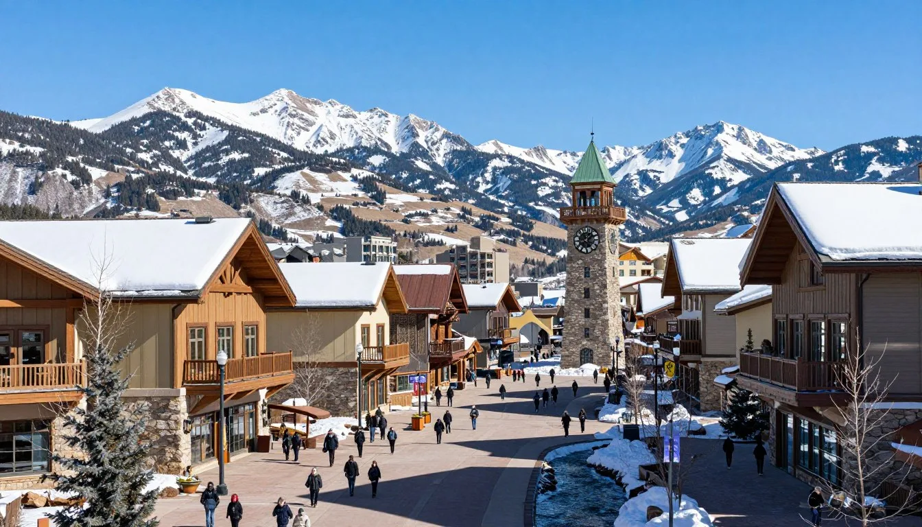
Accommodation options cluster in nearby mountain communities. Vail offers the most extensive selection, ranging from luxury resorts to budget-friendly hotels. The town sits 24 km (15 miles) from the trailhead via winding mountain roads.
Minturn provides closer lodging with a more authentic Colorado atmosphere. Several small hotels and vacation rentals serve hikers and outdoor enthusiasts. Prices generally run lower than Vail while maintaining quality standards.
Hotels and Lodges

Vail features numerous hotels from international chains to boutique properties. Summer rates drop significantly compared to winter ski season. Many properties include breakfast and offer hiker-friendly amenities like early checkouts and packed lunches.
The Minturn Inn provides intimate accommodations in a historic building. This bed and breakfast caters specifically to outdoor adventurers. Rooms include comfortable beds and hearty breakfasts perfect for early mountain starts.
Camping Options

Camp Hale sits about 19 km (12 miles) south of Minturn. This historic military training site offers dispersed camping in a beautiful valley setting. No fees apply, but facilities remain minimal with vault toilets only.
Tigiwon Community House provides unique rustic lodging near the trailhead. This historic structure operated by Colorado Fourteeners Initiative offers bunks for overnight stays. Reservations are required and fill quickly during peak season.
Backcountry camping is permitted throughout Holy Cross Wilderness with proper precautions. Campsites must sit at least 61 m (200 feet) from water sources. Popular spots exist near Cross Creek and below tree line on approach routes.
Vacation Rentals
Entire homes and condos are available for rent in Vail, Minturn, and surrounding areas. These options work well for groups or families wanting kitchen facilities and more space. Many rentals require minimum stays of two or three nights.
Dining & Local Cuisine

Minturn’s dining scene centers on hearty mountain fare perfect for fueling outdoor adventures. The Minturn Saloon stands as the town’s most famous establishment. This historic restaurant serves Mexican-American fusion in a casual, welcoming atmosphere.
Breakfast options prove crucial for early summit attempts. The Minturn Country Club offers substantial morning meals starting at 7 AM. Their portions satisfy hungry hikers preparing for long days in the mountains.
Local Specialties
Colorado cuisine emphasizes locally sourced ingredients and game meats. Elk, bison, and trout appear frequently on menus. These proteins provide the energy needed for high-altitude activities.
Craft beer flows abundantly throughout the region. Vail and nearby Avon host several microbreweries producing excellent mountain-themed ales and lagers. Many hikers enjoy celebrating successful climbs with local brews.
Recommended Restaurants
- The Minturn Saloon: Famous for tacos and margaritas
- Turntable Coffee: Excellent morning coffee and pastries
- Chili Willy’s: Quick Mexican food for early starts
- Pazzo’s Pizzeria: Quality pizza and Italian dishes
Grocery and Supplies
- City Market in Avon: Full-service grocery store
- Minturn Market: Small store with basic supplies
- Vail Village: Multiple options for specialty foods
- Pack trail snacks, energy bars, and electrolyte drinks
Vail expands dining choices considerably with upscale restaurants and international cuisine. However, prices climb substantially compared to Minturn. Budget-conscious travelers often shop at grocery stores and prepare meals at their accommodations.
Attractions, Sightseeing & Activities

Mount of the Holy Cross dominates the attraction landscape. The mountain itself serves as the primary draw for visitors. Multiple routes offer varying difficulty levels and scenic rewards.
Summit Routes
The North Ridge route via Half Moon Pass represents the standard path to the summit. This trail covers approximately 10 km (6.2 miles) one way. Hikers gain 1,676 m (5,500 feet) in elevation from the trailhead.
The route begins through dense forest along the Half Moon Trail. After 4 km (2.5 miles), you reach tree line and continue across alpine tundra. The path climbs steeply to Half Moon Pass at 3,962 m (13,000 feet).

From the pass, the route follows the ridge north toward the summit. This section includes moderate scrambling over Class 2 terrain. The final push requires careful foot placement on loose rock and occasional exposure.
The east approach via Fall Creek and Cross Creek offers a longer alternative. This route extends roughly 16 km (10 miles) each way. It provides spectacular views of the cross formation from different angles. Most hikers choose this as a two-day backpacking trip.
Notch Mountain Trail

For those not attempting the summit, Notch Mountain provides the best views of the cross formation. This trail starts from the same Half Moon Trailhead. The hike covers 8 km (5 miles) one way with 1,219 m (4,000 feet) elevation gain.
The trail splits from the summit route after 3 km (2 miles). It traverses south along the ridge to Notch Mountain’s summit at 3,998 m (13,108 feet). This vantage point offers photographers the classic perspective of the holy cross.
Many visitors complete this hike in a single day. The difficulty level rates as moderate to strenuous. Views rival those from Mount Holy Cross summit without the technical challenges.
Additional Activities
Wildlife viewing opportunities abound throughout the Holy Cross Wilderness area. Mountain goats frequent high ridges and rocky outcrops. Elk graze in meadows during early morning and evening hours. Marmots and pikas inhabit the alpine zone.
Photography draws enthusiasts from around the world. The dramatic cross formation creates powerful images year-round. Sunrise and sunset provide the best lighting conditions. Fall colors add extra dimension to landscape compositions.
Fishing is permitted in East Cross Creek and other wilderness streams. Native cutthroat trout populate these cold mountain waters. Colorado fishing licenses are required for anyone over 16 years old.
Museums, Cultural Spots & Festivals

The Vail Valley hosts several cultural venues within short driving distance. The Colorado Snowsports Museum in Vail Village chronicles the state’s skiing heritage. Exhibits include vintage equipment and photographs documenting mountain recreation history.
Camp Hale’s historical significance adds cultural depth to the area. The 10th Mountain Division trained here during World War II. Interpretive signs throughout the valley explain the site’s military importance. The division’s influence shaped Colorado’s post-war development.
Local Festivals and Events
The Bravo! Vail Music Festival occurs each summer from late June through early August. World-class musicians perform classical concerts in stunning mountain settings. Some performances take place at outdoor venues with spectacular backdrops.
Minturn hosts the annual Salsa Festival in late August. This celebration features live music, dancing, and competition among local restaurants. The event draws visitors throughout Eagle County.
GoPro Mountain Games take place in Vail each June. This multi-sport festival showcases adventure sports including climbing, kayaking, and trail running. Professional athletes and amateurs compete in various disciplines.
Visitor Centers

The Holy Cross Ranger District office in Minturn provides current trail conditions and wilderness permits. Staff members offer expert advice on route selection and safety considerations. The office maintains updated weather forecasts and recent trip reports.
Operating hours typically run Monday through Friday from 8 AM to 4:30 PM. During peak summer season, weekend hours may be available. Call ahead to confirm current schedules.
Nature & Outdoor Experiences

The Holy Cross Wilderness encompasses 51,300 hectares (126,782 acres) of protected mountain terrain. This designated wilderness prohibits motorized vehicles and mechanized equipment. The area preserves pristine alpine environments and fragile ecosystems.
Alpine Tundra Ecosystems
Above tree line at approximately 3,505 m (11,500 feet), alpine tundra dominates the landscape. These harsh environments support specialized plants adapted to extreme conditions. Cushion plants, sedges, and low-growing flowers create colorful displays during brief summer growing seasons.

Wildlife thrives in these exposed zones despite challenging conditions. Pikas harvest grasses and flowers for winter food stores. Yellow-bellied marmots sun themselves on warm rocks. Ptarmigan, camouflaged white in winter and mottled brown in summer, nest among the rocks.
Mountain Streams and Watersheds
Cross Creek originates high on Mount Holy Cross slopes. This pristine waterway flows through the wilderness before joining Eagle River. The creek provides critical habitat for native fish species and countless insects.
Waterfalls punctuate several wilderness streams. Spring runoff creates dramatic cascades as snowmelt rushes downslope. By late summer, flows diminish but water remains crystal clear and extremely cold.
Forest Environments

Dense conifer forests blanket lower elevations throughout the area. Engelmann spruce and subalpine fir dominate between 2,743 m (9,000 feet) and tree line. These shade-tolerant species create cool, moist understories.
Aspen groves add deciduous variety to the forest mix. These white-barked trees colonize disturbed areas and create spectacular golden displays each autumn. The aspens provide important habitat for cavity-nesting birds and browsing mammals.
Backcountry Camping
Wilderness camping requires no permits, but regulations apply. Groups are limited to 15 people maximum. Campfires are discouraged above tree line and prohibited in some areas. Always check current fire restrictions before your trip.
Choose durable surfaces for campsites away from trails and water sources. The 61 m (200 foot) setback protects riparian zones and maintains solitude for other visitors. Established sites should be used when available to prevent new impact.
Safety, Etiquette & Local Customs

High-altitude safety demands respect and preparation. Mount of the Holy Cross summit rises above 4,267 m (14,000 feet) where oxygen levels drop significantly. Altitude sickness affects many visitors, even experienced hikers. Symptoms include headache, nausea, and extreme fatigue.
Altitude Acclimatization
Spend at least one night at elevation before attempting your climb. Sleep in Vail at 2,476 m (8,122 feet) or Minturn at 2,408 m (7,900 feet). This allows your body to begin adjusting to reduced oxygen levels.
Hydration becomes critical at altitude. Drink at least 3 to 4 liters of water throughout your hiking day. Dehydration compounds altitude effects and impairs judgment. Carry water purification methods for refilling from mountain streams.
Emergency Contact: Eagle County Communications Center handles all 911 calls. Cell phone coverage remains spotty in the wilderness. Satellite communication devices provide reliable emergency contact options.
Weather Hazards
Lightning presents the most serious weather threat on Colorado peaks. Afternoon thunderstorms develop with startling speed during summer months. Dark clouds, increasing wind, and static electricity signal approaching danger.
Leave the summit by noon at the latest. Begin your descent immediately if storms threaten. Avoid ridge tops, isolated trees, and open areas during electrical activity. Seek shelter in low-lying areas away from water.
Hypothermia can occur even in summer. Temperatures drop rapidly above tree line. Wind chill creates dangerous conditions when combined with rain or snow. Always pack insulating layers, waterproof shells, and emergency shelter.
Navigation and Route Finding
Carry detailed maps and compass or GPS device. The route becomes less obvious above tree line. Fog and clouds can reduce visibility to a few meters. Cairns mark the standard path but may be difficult to locate in poor weather.
Download offline maps before your trip. Cell service is unreliable throughout the wilderness. GPS coordinates for key waypoints should be recorded in your device.
Wildlife Etiquette
Maintain distance from all wildlife. Elk can become aggressive, especially during fall rutting season. Mountain goats seem docile but possess sharp horns and defend their space. Never feed or approach wild animals.
Food storage regulations require proper precautions. Black bears inhabit the area, though encounters remain relatively uncommon. Use bear-proof containers or hang food at least 3 m (10 feet) high and 1.2 m (4 feet) from tree trunks.
Leave No Trace Principles
Pack out all trash including orange peels, energy bar wrappers, and toilet paper. Carry a small trowel for human waste disposal. Dig catholes 15 to 20 cm (6 to 8 inches) deep and at least 61 m (200 feet) from water sources.
Stay on established trails to prevent erosion. Cutting switchbacks damages fragile vegetation and creates drainage problems. Walking single file on muddy sections prevents trail widening.
Respect other visitors by yielding trail appropriately. Uphill hikers have right-of-way. Step aside on narrow sections to let faster groups pass. Keep noise levels low to preserve wilderness character.
Visitor Comments About Mount of the Holy Cross

“The hike challenged every part of me physically and mentally. Reaching Half Moon Pass felt like an accomplishment itself. Then seeing the summit ahead gave me renewed energy. The cross formation looks even more impressive in person than photos suggest. This peak deserves its legendary status.”
“I spent two days backpacking the east approach via Cross Creek. The extra distance proved absolutely worthwhile. Camping below the ridge allowed me to summit early morning with perfect weather. The solitude on this route contrasts sharply with the crowded Half Moon Trail. Highly recommended for experienced backpackers.”
“We attempted the summit but turned around at Half Moon Pass due to afternoon storms rolling in. Despite not reaching the top, the experience was incredible. The wildflowers along the trail amazed us. We plan to return better prepared for an earlier start. The mountain will still be there waiting.”
Additional Nearby Destinations

The Sawatch Range contains 15 of Colorado’s 58 fourteeners. Mount Massive and Mount Elbert, the state’s highest peak at 4,401 m (14,440 feet), lie within easy reach. Both mountains offer less technical climbs than Holy Cross.
Mount Massive
Colorado’s second-highest mountain rises just 24 km (15 miles) south of Mount of the Holy Cross. The standard route via the Southwest Slopes covers 11 km (7 miles) round trip. Most hikers complete this climb in 7 to 9 hours.
Mount Elbert
The highest peak in Colorado attracts thousands of climbers annually. The Northeast Ridge route starts near Leadville and gains 1,341 m (4,400 feet) over 7 km (4.5 miles). This mountain makes an excellent objective for acclimatization before attempting Holy Cross.
Vail Mountain

During summer, Vail Resort operates scenic gondola rides to mid-mountain elevations. Hiking and mountain biking trails fan out from the top station. The area provides excellent options for rest days between climbing objectives.
Maroon Bells-Snowmass Wilderness
Located 64 km (40 miles) southwest, this wilderness area protects some of Colorado’s most photographed peaks. The Maroon Bells reflect brilliantly in Maroon Lake. Numerous hiking trails explore alpine basins and high passes throughout the region.
Historic Leadville
This old mining town sits 40 km (25 miles) south at 3,094 m (10,152 feet) elevation. Leadville preserves significant Colorado history from the silver mining era. Museums, historic buildings, and cultural sites provide fascinating diversions from mountain activities.
Practical Travel Tips
Essential Gear
Proper equipment makes the difference between success and struggle on Mount Holy Cross. Sturdy hiking boots with ankle support prevent injuries on rocky terrain. Break in new boots before your trip to avoid blisters.
Clothing Layers
- Moisture-wicking base layer
- Insulating mid-layer (fleece or down)
- Waterproof and windproof shell jacket
- Rain pants or waterproof hiking pants
- Warm hat and sun hat
- Gloves for cold and wind protection
Required Equipment
- Headlamp with extra batteries
- First aid kit with blister treatment
- Map, compass, or GPS device
- Sun protection: sunscreen, sunglasses, lip balm
- Emergency shelter or bivy sack
- Fire starter and knife
Physical Preparation
Training for Holy Cross should begin weeks before your trip. Cardiovascular fitness matters more than pure strength. Long hikes with elevation gain build the specific endurance needed for mountain climbs.
Stair climbing with a weighted pack simulates mountain conditions. Gradually increase weight and duration. Target ability to hike 5 to 6 hours continuously with 9 to 11 kg (20 to 25 pounds) pack weight.
Permits and Regulations
No permits are required for day hiking in the Holy Cross Wilderness. Overnight camping remains unrestricted but follows Leave No Trace principles. Groups larger than 15 people need special authorization from the Forest Service.
Parking permits are not required at trailheads. However, standard recreation passes apply for parking at some Forest Service facilities. Check current requirements before departure.
Money and Costs
Budget for fuel costs reaching the trailhead. Gas prices in mountain communities typically exceed urban rates. Restaurants in Vail charge premium prices while Minturn offers more reasonable options.
Lodging costs vary dramatically by location and season. Summer rates in Vail range from $150 to $400 per night. Minturn and camping options reduce expenses significantly.
Cost-Saving Tips: Shop for groceries in larger towns before reaching mountain communities. Prepare your own meals. Camp instead of staying in hotels. Visit during shoulder season when lodging rates drop.
Internet and Communications
Cell phone coverage remains spotty throughout the wilderness. Verizon typically provides the best service in the region. Do not rely on phones for emergency communication or navigation.
Download offline maps and resources before leaving cellular coverage. Many hiking apps offer this feature. Save important phone numbers in your contacts, not online bookmarks.
Best Resources for Planning
The Fourteeners Initiative website provides current trail conditions and route descriptions. Trip reports from recent climbers offer valuable insights into snow conditions and hazards. Local outdoor retailers in Vail and Leadville stock topographic maps and guidebooks.
Weather forecasts specific to high elevations come from Mountain-Forecast.com and NOAA Mountain Weather. Check forecasts the evening before and morning of your climb. Be prepared to change plans based on conditions.
Your Colorado Mountain Adventure Awaits
Mount of the Holy Cross stands as a testament to Colorado’s natural grandeur and spiritual significance. Whether you summit the peak or admire the cross from Notch Mountain, this destination delivers unforgettable experiences. The combination of challenging terrain, stunning scenery, and rich history creates something truly special.
Start planning your journey today. Research current conditions, prepare your gear, and train your body for the altitude challenge. The mountain rewards those who approach with respect, preparation, and humility. When you stand on that summit or gaze at the cross formation, you’ll understand why this place captures hearts and imaginations.
The peaks are calling. Colorado’s high country awaits your discovery. Make this the year you answer that call and create memories that last a lifetime.