Hotels by Trip.com
Flights by Trip.com
Every summer, more than 15,000 hikers attempt to summit Mt. Sneffels, yet fewer than half reach the top. This stunning 4,267 m (14,150′) peak in Colorado’s San Juan Mountains isn’t just another fourteener. It stands as one of the most photographed mountains in North America, instantly recognizable from its appearance on the Coors beer label and countless adventure magazines.
Named after the Icelandic volcano in Jules Verne’s “Journey to the Center of the Earth,” Mount Sneffels offers far more than summit glory. The surrounding area encompasses some of Colorado’s most spectacular alpine terrain, from the flower-carpeted meadows of Yankee Boy Basin to the turquoise waters of Blue Lakes.
Whether you’re an experienced mountaineer eyeing the Southwest Ridge route or a casual visitor seeking breathtaking scenery, this comprehensive Mount Sneffels Colorado travel guide will help you discover everything this remarkable destination offers. From practical route-finding tips to hidden local gems, you’ll find the information needed to plan an unforgettable mountain adventure.
Getting There & Planning Your Journey

Reaching the Mount Sneffels area requires some planning, but the journey itself rewards travelers with spectacular Colorado scenery. The closest commercial airport is Montrose Regional Airport, located approximately 64 km (40 miles) from the mountain. This regional facility offers daily flights from major hubs including Denver, Dallas, and Houston.
From Montrose, rental cars provide the most flexibility for exploring the area. The drive to the towns of Ouray or Telluride takes about an hour, winding through stunning red rock canyons before ascending into alpine territory. For those preferring a larger airport with more flight options, Denver International Airport sits 531 km (330 miles) northeast, roughly a six-hour drive through the Rocky Mountains.
Transportation from Airports
Several shuttle services operate between Montrose Regional Airport and nearby mountain towns. These typically cost between $65 and $95 per person one-way. During summer and winter peak seasons, advance reservations are essential. The route passes through Ridgway, often called the “Gateway to the San Juans,” where many visitors stop for supplies before heading into the mountains.
If driving from Denver, Highway 550 – known as the Million Dollar Highway – provides the most scenic approach. This famous route climbs over Red Mountain Pass at 3,353 m (11,000′), offering jaw-dropping views but requiring careful driving, especially during spring and fall when conditions can change rapidly.
Essential Planning Tips
Start planning your Mount Sneffels visit at least three months in advance, particularly for summer travel between July and September. This lead time allows you to secure preferred accommodations and familiarize yourself with route conditions. The area experiences rapid weather changes, so flexible travel dates help ensure optimal conditions.
Before You Go
Essential preparations ensure a safe journey to the mountain.
- Check current road conditions for Camp Bird Road and Yankee Boy Basin access
- Reserve accommodations early during peak summer season
- Obtain necessary parking passes or permits
- Download offline maps as cell service is limited
What to Bring
Pack these essentials for mountain travel and hiking.
- Layered clothing for temperature swings of 15-20°C
- High-clearance vehicle or 4WD for rough mountain roads
- Extra fuel as gas stations are sparse
- Emergency supplies including first aid and extra food
Vehicle Requirements
Road conditions dictate vehicle needs for the area.
- High-clearance vehicles strongly recommended
- 4WD required for upper Yankee Boy Basin after snowmelt
- All-weather tires minimum for shoulder seasons
- Spare tire and basic tools essential on remote roads
Altitude Considerations
Prepare your body for high-elevation adventures.
- Spend first day or two at lower elevations
- Stay hydrated with at least 3-4 liters daily
- Watch for altitude sickness symptoms above 2,400 m
- Consider medication if you’re sensitive to elevation
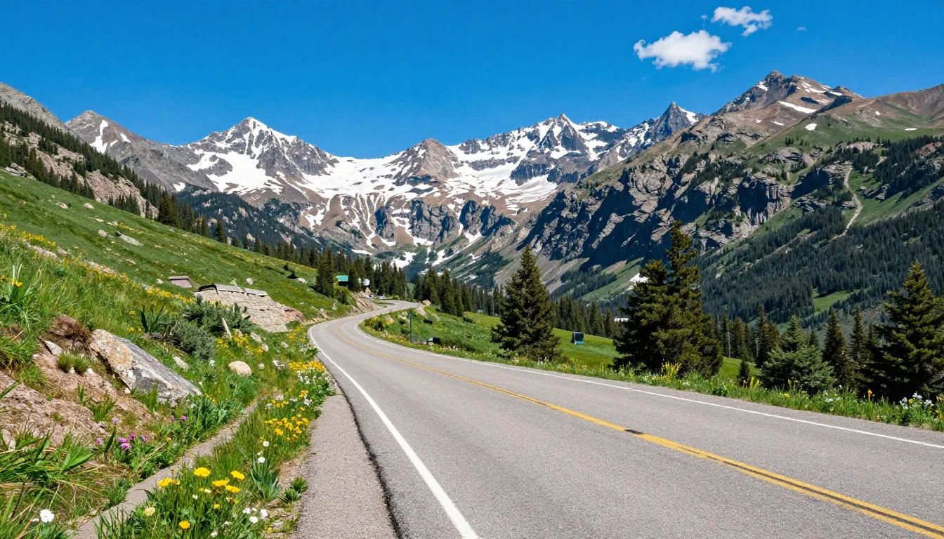
The drive into Yankee Boy Basin itself requires special mention. This rough, rocky road climbs steeply from the town of Ouray, gaining over 914 m (3,000′) in just a few miles. While passenger cars can sometimes reach the lower basin areas, a high-clearance 4WD vehicle is necessary to reach the upper trailheads and Blue Lakes Pass approach.
Best Time to Visit & Weather Tips

Timing your Mount Sneffels visit correctly can mean the difference between a spectacular adventure and a frustrating experience. The mountain’s weather patterns follow typical Colorado alpine conditions, with distinct seasonal variations that dramatically affect accessibility and enjoyment.
Prime Visiting Seasons
Late June through early October offers the best window for most Mount Sneffels activities. During these months, snow typically clears from lower elevation trails and roads, making access possible for standard vehicles in some areas. July and August represent peak season when weather is most stable and all routes are generally accessible.
Wildflower enthusiasts should target mid-July through early August. During this brief window, Yankee Boy Basin transforms into a painter’s palette of colorful blooms. Columbines, paintbrush, and alpine sunflowers carpet the meadows, creating one of Colorado’s most photogenic landscapes.
Month-by-Month Breakdown
| Month | Conditions | Temperature Range | Recommendation |
| June | Heavy snow at high elevations, roads opening | 4-16°C (40-60°F) | Only for experienced winter climbers |
| July | Peak wildflowers, afternoon thunderstorms | 10-21°C (50-70°F) | Excellent for all activities |
| August | Stable weather, warm days, cool nights | 8-20°C (46-68°F) | Best overall month |
| September | Golden aspen, fewer crowds, variable weather | 2-15°C (36-59°F) | Great for experienced hikers |
| October | Early snow possible, cold nights, brilliant colors | -2-10°C (28-50°F) | Advanced hikers only |
Weather Patterns and Safety
Mountain weather changes rapidly in the San Juan range. Summer mornings typically start clear and calm, but afternoon thunderstorms develop with remarkable regularity. Lightning poses a serious threat above treeline, making early starts essential for summit attempts. Plan to be off exposed ridges by noon during summer months.
Winter conditions persist on Mount Sneffels from November through May. Snow accumulations can exceed 6 m (20′) on the upper mountain, and avalanche danger remains significant well into spring. Winter ascents require ice climbing experience, technical gear, and avalanche training.
Months to Avoid
Late October through early June presents serious challenges for most visitors. Heavy snow blocks roads, creates avalanche hazards, and makes route-finding extremely difficult. Even experienced mountaineers limit their attempts during these months. November, December, January, February, March, April, and early May see minimal visitation due to dangerous winter conditions.
Weather Reality Check: Even during peak summer, temperatures at the Mt. Sneffels summit can drop below freezing. The mountain creates its own weather systems, and conditions at the summit often differ dramatically from the valley below. Always pack winter layers regardless of the forecast.
Daily Weather Timing
Understanding the daily weather cycle helps plan safer adventures. Clear mornings give way to cloud buildup starting around 10 AM. By early afternoon, towering cumulus clouds often develop into thunderstorms. These typically dissipate by evening, though overnight storms occasionally occur during unsettled weather patterns.
Summit climbers should begin hiking no later than 5 AM during summer, aiming to reach the top by 11 AM and descend below treeline before afternoon storms arrive. This timing also helps avoid afternoon snow softening that makes scrambling more hazardous on certain routes.
Notable Annual Festivals

The Mount Sneffels region celebrates its mountain heritage and outdoor culture through several annual festivals. These events bring together locals and visitors for unique cultural experiences that showcase the area’s character and traditions.
Ouray Ice Festival
Held each January in nearby Ouray, the Ice Festival draws ice climbers from around the world. The event features clinics, competitions, and demonstrations on the famous Ouray Ice Park’s frozen waterfalls. While not directly at Mount Sneffels, many attendees explore the winter mountain scenery. Contact organizers at 970-325-4288 for current year dates and registration information.
Telluride Bluegrass Festival
Late June brings world-class acoustic music to Telluride, about 32 km (20 miles) from Mount Sneffels. This four-day festival has run for over 40 years, attracting legendary performers and thousands of music lovers. The town sits in a spectacular box canyon with views of surrounding peaks. Festival information: 800-624-2422.
Ridgway Rendezvous Arts & Crafts Festival
Every July, Ridgway hosts this celebration of Western arts and crafts. Local artisans display paintings, sculpture, and handmade goods against the backdrop of Mount Sneffels visible from the town plaza. The event includes live music and regional food vendors. Details available at 970-626-5181.
Imogene Pass Run
September’s Imogene Pass Run challenges runners to race from Ouray to Telluride over a 4,267 m (14,000′) mountain pass. Though not specifically on Mount Sneffels, the route traverses similar San Juan terrain. Spectators enjoy dramatic mountain scenery throughout the course. Registration and information: 970-325-4746.
Getting Around Locally

Navigating the Mount Sneffels area requires understanding the limited infrastructure and challenging road conditions typical of Colorado’s high country. Unlike developed resort areas, this region maintains a wilderness character with minimal public transportation and rough access routes.
Personal Vehicle Requirements
A personal vehicle provides essential mobility for exploring the Mount Sneffels region. The town of Ouray serves as the primary base, sitting just 13 km (8 miles) from the Yankee Boy Basin trailhead. However, this short distance includes steep, rocky road sections that challenge even capable vehicles.
Standard sedans can navigate paved Highway 550 and reach Ouray, Ridgway, and Telluride without difficulty. Exploring beyond town limits requires progressively more capable vehicles. The lower portions of Camp Bird Road accept high-clearance vehicles, while reaching upper Yankee Boy Basin and the Blue Lakes trailhead demands true 4WD capability.
Road Conditions and Access
Camp Bird Road begins in Ouray and climbs toward Mount Sneffels through a narrow canyon. The first 8 km (5 miles) feature graded gravel suitable for careful driving in most vehicles. Beyond the historic Camp Bird Mine, conditions deteriorate significantly with large rocks, steep grades, and water crossings.
Upper Yankee Boy Basin roads rank among Colorado’s most challenging passenger vehicle routes. Boulder fields, off-camber sections, and extreme grades test both vehicle and driver. Many visitors park at lower elevations and hike the final 3-5 km to avoid vehicle damage.
Alternative Transportation Options
Several Ouray-based companies offer jeep tours into Yankee Boy Basin and surrounding high country. These guided excursions use modified 4WD vehicles to navigate the rough roads while providing interpretation about the area’s geology, history, and ecology. Tours typically run three to four hours and eliminate driving stress.
Shuttle services occasionally operate during peak season, transporting hikers to popular trailheads. Availability varies year to year, so check current options when planning. Some local guides also provide drop-off and pickup services for summit attempts.
Parking and Trailhead Access
Parking fills quickly at all Mount Sneffels trailheads during summer weekends. The Blue Lakes trailhead offers the largest parking area but still reaches capacity by 6 AM on popular days. Arrive early or consider weekday visits to guarantee parking.
Overnight parking is permitted at most trailheads, allowing backpackers to extend their adventures. However, securing vehicles against wildlife is essential. Black bears actively search for food in parked cars, and leaving any scented items visible invites break-ins.
Road Closure Alert: Heavy snow typically closes Camp Bird Road and Yankee Boy Basin access from late October through June. Even after official opening, lingering snowfields can block the upper road into July. Always check current conditions before attempting the drive, as getting stuck requires expensive vehicle recovery.
Where to Stay

Accommodation options near Mount Sneffels range from rustic campgrounds to Victorian-era hotels, with most lodging concentrated in nearby Ouray, Telluride, and Ridgway. Choosing the right base depends on your budget, desired amenities, and planned activities.
Ouray Accommodations
Ouray offers the closest lodging to Mount Sneffels trailheads, making it the preferred base for serious hikers and climbers. This historic mining town features numerous bed-and-breakfast establishments, small hotels, and vacation rentals. The natural hot springs pools provide perfect relaxation after long mountain days.
Several properties maintain an authentic Victorian character while offering modern comforts. Expect to pay $120-250 per night during summer peak season, with lower rates in spring and fall. The town’s compact size means everything stays within walking distance, though parking can be tight on busy weekends.
Camping and Backcountry Options
Dispersed camping is permitted throughout the Uncompahgre National Forest surrounding Mount Sneffels. Popular camping areas line Camp Bird Road below Yankee Boy Basin, though facilities are minimal. These sites offer free camping with incredible mountain views but require complete self-sufficiency.
The Amphitheater Campground provides the nearest developed camping option. Located high in the basin, this small facility offers stunning proximity to the mountain but limited amenities. Sites accommodate tents and small campers, filling quickly throughout summer. Elevation exceeds 3,200 m (10,500′), so prepare for cold nights even in August.
Telluride Luxury Options
Telluride sits roughly 32 km (20 miles) from Mount Sneffels but offers premium accommodations and dining. This former mining town transformed into an upscale resort community features high-end hotels, condominiums, and full-service spas. Prices reflect the resort atmosphere, with rooms often exceeding $300 nightly during peak season.
The trade-off for luxury and amenities is distance from the mountain. Driving from Telluride to Yankee Boy Basin trailheads requires 45-60 minutes each way. However, the town provides excellent restaurants, nightlife, and cultural activities for rest days or when weather prevents mountain adventures.
Ridgway Practical Choice
Ridgway positions itself between Ouray and Telluride, offering a middle-ground option. This small ranching community maintains more affordable lodging than its neighbors while keeping Mount Sneffels within 30 minutes’ drive. Several motels, small inns, and vacation rentals serve visitors seeking value and convenience.
The town’s lower elevation at 2,134 m (7,000′) makes it more comfortable for those sensitive to altitude. Ridgway State Park nearby provides additional camping options with lake access for swimming and fishing, making it appealing for families or those wanting varied activities.
Budget-Friendly Stays
Free dispersed camping along Camp Bird Road offers the most economical option. Arrive early for best spots with morning sun and mountain views. Bring all supplies including water, as facilities don’t exist. Ridgway motels provide the cheapest indoor lodging at $80-120 nightly.
Mid-Range Comfort
Ouray bed-and-breakfasts balance character, comfort, and proximity. Most include breakfast and hot springs passes, adding value. Expect Victorian architecture, personalized service, and genuine hospitality. Book several months ahead for summer weekends when properties fill completely.
Backcountry Camping Near the Summit
Experienced backpackers can camp high on the mountain, shortening summit day significantly. Popular camping areas include Blue Lakes basin and various sites along the approach routes. Water sources exist but require treatment, and weather can turn severe rapidly at these elevations above 3,600 m (12,000′).
Proper gear becomes critical for high camps. Temperatures regularly drop below freezing overnight, and afternoon storms can dump snow even in midsummer. Four-season tents, warm sleeping bags, and experience with alpine camping are essential for safe high-elevation overnight stays.
Dining & Local Cuisine

The Mount Sneffels region offers surprising culinary diversity for such a small mountain area. Local restaurants emphasize fresh ingredients, craft beverages, and hearty portions that satisfy hungry hikers while showcasing Colorado’s evolving food scene.
Ouray Dining Scene
Ouray’s compact downtown packs diverse dining options into a few walkable blocks. Several restaurants feature outdoor patios where diners enjoy views of surrounding peaks while savoring their meals. The culinary scene leans toward comfort food and American classics, though international flavors appear on many menus.
Local favorites include establishments serving elk burgers, trout caught from nearby streams, and Colorado lamb. Many restaurants source produce from Western Slope farms during summer months. Portions tend toward generous, reflecting the mountain town tradition of fueling outdoor adventures.
Breakfast and Early Morning Options
Summit attempts require early starts, making pre-dawn breakfast challenging. Several Ouray bakeries open by 6 AM, offering fresh pastries, strong coffee, and grab-and-go breakfast burritos. Stock up the night before at local markets for the earliest starts, as most restaurants don’t serve before sunrise.
Weekend breakfast crowds can mean long waits at popular spots. Arrive before 8 AM or after 10 AM to avoid peak times. Many bed-and-breakfast properties serve substantial breakfasts included with room rates, providing fuel for mountain adventures without restaurant hunting.
Post-Hike Recovery Meals
After descending from Mount Sneffels, refueling becomes priority. Ouray’s brewpub scene offers cold craft beer and satisfying pub fare perfect for recovery. Wood-fired pizza, burgers, and creative takes on mountain classics dominate menus. Outdoor seating lets tired hikers relax while recounting summit adventures.
The town’s Mexican restaurants serve generous portions of authentic regional cuisine. Green chile, a Colorado staple, appears on nearly every menu. Don’t miss trying it smothering breakfast burritos or topping burgers for true local flavor.
Telluride Upscale Options
Telluride elevates mountain dining with sophisticated restaurants featuring creative menus and extensive wine lists. Expect contemporary American cuisine with global influences, local ingredients, and presentation worthy of urban destinations. Prices reflect the resort town atmosphere, with entrees often exceeding $30.
Reservations are essential at popular Telluride restaurants, especially during festival weekends and peak season. Many establishments offer innovative small plates perfect for sharing, allowing diners to sample diverse flavors. The town’s culinary reputation attracts talented chefs who create memorable mountain dining experiences.
Local Food Specialties
Provisions and Trail Food
Stock up on supplies at Ouray’s markets before heading into the mountains. Limited selection means planning ahead, especially for dietary restrictions. Energy bars, trail mix, and electrolyte drinks are available, though prices exceed city rates. Smart hikers bring basics from home and supplement with fresh items locally.
Ridgway offers a larger supermarket with better selection and prices. Many visitors stop here before continuing to Ouray or the trailheads. The store carries camping supplies, basic outdoor gear, and extensive food options for multi-day trips.
Attractions, Sightseeing & Activities

Mount Sneffels and the surrounding San Juan Mountains offer far more than summit climbing. The region contains diverse attractions appealing to all activity levels, from gentle nature walks to extreme alpine adventures. Each season reveals different aspects of this spectacular mountain landscape.
Summit Routes and Scrambling
The Southwest Ridge route serves as the standard approach to Mt. Sneffels summit. This Class 3 scramble involves loose rock, steep terrain, and significant exposure but requires no technical climbing gear under normal summer conditions. The route gains roughly 1,067 m (3,500′) from the Blue Lakes trailhead, taking most climbers five to seven hours round trip.
Alternative routes exist for those seeking greater challenge. The North Face couloir provides a steep snow and ice climb popular in spring and early summer. This approach requires ice axes, crampons, and experience with steep snow climbing. Avalanche conditions persist well into the season, demanding careful assessment before attempting.
The Blue Lakes Pass approach offers another perspective, traversing beneath the mountain’s dramatic east face. This route adds distance but rewards climbers with spectacular scenery through wildflower meadows and past turquoise alpine lakes. Either approach requires route-finding skills as trails fade above treeline.
Yankee Boy Basin Exploration
Yankee Boy Basin ranks among Colorado’s most beautiful accessible alpine areas. The basin sits at approximately 3,353 m (11,000′), featuring expansive wildflower displays during peak season. Casual visitors can drive partway into the basin, then walk gentle trails through flower-filled meadows with Mount Sneffels towering overhead.
Photography opportunities abound throughout the basin. Morning light illuminates the east-facing peaks while afternoon sun brings out the vibrant colors of alpine flora. The area sees heavy visitation during peak wildflower weeks in mid-summer, but early morning or weekday visits offer more solitude.
Several waterfalls cascade down the basin’s walls, accessible via short hikes from the road. These seasonal flows peak during snowmelt in June and July, creating impressive displays of mountain water power. Pools at the waterfall bases provide refreshing, if shockingly cold, swimming opportunities for the brave.
Blue Lakes Trail
The Blue Lakes Trail provides the primary hiking route toward Mount Sneffels from Yankee Boy Basin. This path climbs steeply through increasingly sparse vegetation, reaching a series of brilliant blue alpine lakes after approximately 3.2 km (2 miles) and 457 m (1,500′) of elevation gain.
The lakes themselves justify the hike even for those not continuing to the summit. Mineral content creates their distinctive turquoise color, and the reflecting pools mirror surrounding peaks on calm days. Anglers find cutthroat trout in the lower lakes, though fish populations vary and regulations apply.
Blue Lakes Pass, at roughly 4,023 m (13,200′), marks the high point of the trail for non-summit hikers. The pass offers panoramic views across the San Juan range and into the valleys beyond. Early season snow often blocks the pass into July, creating beautiful but potentially hazardous conditions.

Photography and Scenic Viewpoints
Mount Sneffels offers endless photography opportunities from easily accessible locations. The Dallas Divide viewpoint along Highway 62 provides classic foreground/background compositions with aspen groves framing the distant peak. This location attracts photographers especially during fall color season in late September.
Sunrise and sunset create magical light on the mountain’s distinctive profile. The east-facing aspects glow pink and orange during sunrise, while evening light paints the west side in warm tones. Cloud formations often develop dramatic displays, particularly during transitional weather periods.
Wildlife photography opportunities exist throughout the area. Marmots, pikas, and mountain goats inhabit the alpine zone, while elk, deer, and occasional black bears roam lower elevations. Patience and telephoto lenses yield best results, always maintaining safe distances from wildlife.
Four-Wheel Drive Adventures
The San Juan Mountains contain hundreds of miles of 4WD roads threading through spectacular terrain. Imogene Pass, Ophir Pass, and Black Bear Pass offer challenging routes with incredible scenery. These high-altitude roads cross above treeline, requiring capable vehicles, experienced drivers, and favorable weather.
Guided jeep tours provide access to these remote areas without the stress of driving. Local operators use specially equipped vehicles and know the routes intimately. Tours typically include historical commentary about the mining era and geological interpretation of the dramatic landscape.
Several mountain passes remain snow-free only from mid-July through September. The short season creates concentrated visitation, but rewards those who time it right with uncrowded mountain experiences and incredible wildflower displays. Always check current conditions as sudden storms can close passes temporarily.
Trail Running and Mountain Biking
Trail runners find excellent opportunities throughout the Mount Sneffels area. The Blue Lakes trail sees regular runner traffic, and the basin roads provide moderate-grade ascents for high-altitude training. The Imogene Pass run course crosses nearby terrain, offering a taste of this challenging mountain race route.
Mountain biking is permitted on most forest roads but restricted on foot trails in the immediate Mount Sneffels area. The surrounding national forest contains extensive riding opportunities on mining roads and designated trails. Riders should respect closure signs and yield to hikers on shared routes.
Museums, Cultural Spots & Festivals

The Mount Sneffels region’s cultural attractions reflect its mining heritage and mountain town character. While outdoor recreation dominates, several museums and cultural sites provide context for understanding the area’s colorful past and present community.
Ouray County Historical Museum
This small museum in downtown Ouray chronicles the region’s mining boom era and development. Exhibits showcase mining equipment, Victorian-era household items, and photographs documenting the challenging mountain life of early settlers. The collection includes artifacts from the nearby Camp Bird Mine, once among Colorado’s richest gold producers.
Original hospital equipment, period clothing, and mining machinery fill the historic building. Knowledgeable volunteers often staff the museum, sharing stories passed down through local families. Admission is modest, making it an excellent rainy-day activity or educational complement to outdoor adventures.
Historic Mining Sites
The Camp Bird Mine road passes several historic mining structures still standing after more than a century. While most mines are closed for safety, external viewing provides glimpses into the industrial past. The impressive mill buildings showcase the scale of operations that once dominated these mountains.
Interpretive signs along the route explain the mining process and the challenges of operating at high altitude in extreme conditions. The area produced millions in gold and silver during its heyday, attracting thousands of miners to this remote mountain region. Respect all closure signs as abandoned mines present serious hazards.
Western Art Galleries
Both Ouray and Telluride feature galleries showcasing Western and mountain-themed artwork. Local painters, photographers, and sculptors display pieces inspired by the surrounding landscape. Many galleries occupy historic buildings, adding architectural interest to art viewing.
First Friday gallery walks in Telluride create social art experiences with wine, conversation, and artist meet-and-greets. These events reveal the creative community thriving in the San Juan Mountains. Purchasing local art provides authentic souvenirs supporting regional artists.
Cultural Heritage
The Ute people originally inhabited the San Juan region, hunting and gathering in seasonal patterns that utilized different elevations throughout the year. While little visible evidence remains in the immediate Mount Sneffels area, the broader region contains archaeological sites and cultural resources significant to modern Ute nations.
Mining heritage defines the modern cultural landscape. Towns like Ouray emerged practically overnight during gold rushes, then survived boom-and-bust cycles that destroyed many contemporaries. The architecture, street layout, and community character still reflect this mining town origin.
Community Events
Summer brings regular community gatherings to area towns. Farmers markets feature local produce, crafts, and live music. These weekly events create opportunities to meet residents and sample regional products. The relaxed atmosphere welcomes visitors interested in local culture beyond tourist attractions.
Concert series utilize outdoor venues with mountain backdrops. Music ranges from classical to bluegrass, often featuring regional performers. Bring blankets or chairs for casual seating under the stars. These events showcase the vibrant community life sustaining year-round residents through long winters.
Nature & Outdoor Experiences

The natural environment surrounding Mount Sneffels provides the region’s primary attraction. From delicate alpine flowers to massive granite peaks, the landscape offers constant discovery for those attuned to mountain ecosystems and natural processes.
Alpine Flora
Yankee Boy Basin hosts one of Colorado’s most spectacular wildflower displays. Peak bloom typically occurs mid-July through early August, though timing varies with snowmelt and spring temperatures. Paintbrush, columbine, alpine sunflowers, and dozens of other species create a living carpet across the basin floor.
The area’s elevation range from 2,438 m (8,000′) to over 4,267 m (14,000′) supports diverse plant communities. Lower elevation forests give way to subalpine meadows, then tundra-like conditions above treeline. Each zone features specialized plant adaptations to harsh mountain conditions.
Photographers find endless subjects among the micro-ecosystems. Tiny forget-me-nots grow beside tumbling streams, while hardy krummholz trees twist into sculptural forms at treeline. Macro photography reveals intricate flower structures, while wide-angle compositions capture sweeping floral landscapes.
Wildlife Viewing
Mountain goats inhabit the high ridges around Mount Sneffels, often visible on rocky slopes above the Blue Lakes trail. These sure-footed animals navigate seemingly impossible terrain with ease. Observe from distance using binoculars or telephoto lenses, never approaching or feeding wildlife.
Marmots and pikas enliven the boulder fields with chirps and whistles. These small mammals prepare for winter throughout the brief summer season, gathering vegetation and basking on warm rocks. Patient observers can watch complex social behaviors and feeding patterns.
Elk herds inhabit the valleys surrounding the mountain, particularly visible during fall rutting season. Bulls issue haunting bugles that echo through the mountains on crisp autumn mornings. Dawn and dusk offer best viewing opportunities, though maintain safe distances as bulls become aggressive during rut.

Geological Features
Mount Sneffels formed from volcanic activity millions of years ago, part of the San Juan volcanic field that created much of southwestern Colorado’s dramatic topography. The mountain’s distinctive profile results from differential erosion of various rock types, with harder formations creating the summit blocks.
Glacial activity sculpted the cirques and valleys surrounding the peak. Blue Lakes occupy glacially carved basins, while U-shaped valleys reveal the passage of massive ice rivers. Polished rock surfaces and erratic boulders provide additional evidence of the ice age’s transformative power.
Mineral veins threading through the rock attracted miners a century ago. Gold, silver, lead, and zinc deposits created immense wealth, though extracting these riches from such remote, harsh terrain required incredible effort. The colorful rock faces display the mineral complexity that made mining viable.
High-Altitude Ecosystems
Above treeline, harsh conditions limit life to specially adapted species. Plants grow in compact cushions reducing wind exposure, while animals shelter in rock crevices and burrows. The growing season lasts barely two months, requiring rapid growth and reproduction strategies.
These fragile ecosystems recover slowly from disturbance. Staying on established trails prevents vegetation damage that may require decades to heal. The alpine tundra appears barren but supports complex ecological relationships developed over millennia.
Climate change impacts become visible in high mountain environments. Treeline advancement, glacier retreat, and shifting wildflower phenology reflect warming temperatures. Scientists study these areas as early indicators of broader environmental changes.
Water Features
Numerous waterfalls cascade through Yankee Boy Basin, fed by snowmelt and glacial melt throughout summer. Flows peak in June and July, creating impressive displays. Some falls remain unnamed, while others like Twin Falls attract regular visitor attention.
The Blue Lakes themselves rank among the region’s most beautiful water features. Their turquoise color comes from glacial flour – finely ground rock particles suspended in the water. The lakes remain painfully cold even in August, fed by snowfields and underground seepage.
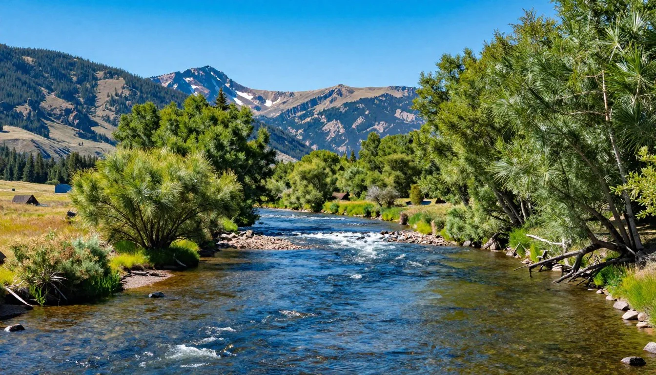
Mountain streams provide critical habitat for native fish and countless invertebrates. These cold, clear waters support cutthroat trout populations, though numbers fluctuate with conditions. Anglers must follow regulations protecting native species and maintaining population health.
Seasonal Natural Events
Autumn transforms the surrounding valleys with golden aspen displays. Late September through early October brings peak color, though timing varies annually. The contrast between golden aspens, dark evergreens, and snow-dusted peaks creates Colorado’s signature fall scenery.
Spring snowmelt triggers impressive waterfall flows and meadow greening. This transitional season sees rapidly changing conditions as winter releases its grip. Avalanche activity remains significant, and access roads stay closed, but the awakening landscape offers unique beauty.
Summer thunderstorms create dramatic weather displays. Dark clouds build over the peaks in afternoon, often producing lightning, hail, and brief downpours. These storms water the wildflowers and demonstrate the powerful forces shaping mountain environments.
Safety, Etiquette & Local Customs

Mountain safety and environmental stewardship ensure both personal wellbeing and landscape preservation. Understanding the unique challenges of high-altitude environments and respecting local customs creates positive experiences while protecting this special place.
Altitude Acclimatization
Mount Sneffels rises to 4,267 m (14,150′), where oxygen levels drop significantly compared to sea level. Visitors arriving from lower elevations often experience altitude sickness symptoms including headache, nausea, and fatigue. Spending a day or two below 3,048 m (10,000′) before attempting higher elevations helps bodies adjust.
Hydration becomes critical at altitude. Drink at least three to four liters daily, more during strenuous activity. Avoid alcohol the first couple days as it worsens dehydration and altitude symptoms. Recognize that physical fitness doesn’t prevent altitude sickness – even elite athletes can suffer.
Severe altitude sickness requires immediate descent. Symptoms including confusion, severe headache unrelieved by medication, or breathing difficulty at rest indicate dangerous conditions. Don’t hesitate to turn back if feeling unwell, as the mountain will still be there for future attempts.
Weather Hazards
Lightning poses the most serious weather threat on Mount Sneffels. Summer afternoon thunderstorms develop regularly, creating deadly conditions above treeline. Start climbs early to summit by late morning, then descend before storms arrive. If caught in lightning, avoid ridge tops, lone trees, and metal objects.
Hypothermia can occur even in summer. Temperatures at the summit may hover near freezing while valleys enjoy pleasant warmth. Wet clothing, wind, and fatigue accelerate heat loss. Pack insulating layers, rain protection, and extra clothing for emergencies regardless of the forecast.
Snow and ice persist on certain routes year-round. The North Face couloir requires ice climbing skills and appropriate gear. Even the standard route may have snow patches into midsummer. Inexperienced parties should avoid snow slopes, which become dangerously soft in afternoon sun.
Mountain Scrambling Skills
The Southwest Ridge route requires Class 3 scrambling over loose, steep rock. This involves using hands for balance and choosing routes through boulder fields. Inexperienced scramblers should practice on easier terrain before attempting Mount Sneffels, as mistakes can prove fatal.
Loose rock creates serious hazards. Test holds before trusting your weight, and be extremely careful not to dislodge rocks onto climbers below. Travel in small groups to minimize rockfall risk, and warn others loudly if rocks come loose.
Route-finding skills become essential as trails disappear above treeline. Cairns mark the general way, but fog, snow, or poor visibility can make navigation extremely difficult. Carry maps, compass, and GPS, knowing how to use them before depending on them in emergency situations.
Leave No Trace Principles
Pack out all trash including food scraps, which don’t decompose quickly in alpine conditions. Carry a small bag for collecting micro-trash like energy bar wrappers. Many visitors practice “pack it in, pack it out plus one,” collecting one piece of litter left by others.
Human waste requires proper disposal to protect water quality and aesthetics. Above treeline, pack out solid waste in specialized bags. Below treeline, dig catholes 15-20 cm (6-8 inches) deep at least 61 m (200′) from water sources, trails, and camps. Pack out all toilet paper.
Stay on established trails and paths to prevent erosion and vegetation damage. Cutting switchbacks creates lasting scars and accelerates soil loss. In areas without trails, spread out rather than creating new paths, and choose durable surfaces like rock or snow when possible.
Wildlife Interactions
Maintain minimum 23 m (75′) distance from all wildlife, more for bears and elk. Never feed animals, as human food creates dependencies that harm wildlife and create dangerous situations. Store food properly in vehicles or bear-resistant containers when camping.
Dogs must remain leashed on most trails, and some areas prohibit them entirely. Even well-behaved dogs disturb wildlife and other visitors. Check regulations before bringing pets, and always pick up and pack out dog waste.
Observe quietly without approaching or calling to animals. Natural behaviors provide the most interesting viewing, and stress from human presence wastes energy animals need for survival. Use telephoto lenses for photography rather than approaching for close-ups.
Local Community Respect
Mountain towns depend on tourism but value their community character. Respect private property, noise ordinances, and local customs. Support local businesses when possible, and treat service workers with courtesy. Many seasonal workers struggle with high living costs in resort areas.
Parking regulations in Ouray and Telluride exist due to limited space. Don’t block driveways, park in resident-only zones, or ignore time limits. Overflow parking areas exist but may require walking to reach downtown.
Mining claims still exist on some land surrounding Mount Sneffels. While hiking is generally permitted, respect posted private property and active claims. The Bureau of Land Management and Forest Service manage most recreational areas, but patchwork private holdings complicate some access.
Emergency Contacts: Cell phone service is extremely limited or nonexistent on Mount Sneffels and surrounding trails. Satellite messengers or personal locator beacons provide the only reliable emergency communication. The nearest hospital is in Montrose, approximately one hour from Ouray under good conditions. Ouray County Search and Rescue can be reached through 911, but response times to remote areas may exceed several hours.
Visitor Comments About Mount Sneffels

“Mount Sneffels exceeded every expectation. The Southwest Ridge route challenged me more than anticipated, but reaching the summit delivered views that made every step worthwhile. Yankee Boy Basin’s wildflowers were absolutely spectacular in mid-July. Start early to avoid afternoon storms – we summited by 10 AM and watched dark clouds roll in as we descended. The drive up was rough but manageable in our rented Jeep.”
“I’ve climbed mountains on three continents, and Mount Sneffels ranks among the most beautiful. The approach through Blue Lakes basin is stunning, with turquoise water reflecting the surrounding peaks. The scrambling proved more technical than I expected for a standard route – definitely bring gloves and be comfortable with exposure. Weather changed rapidly, going from calm to threatening in less than an hour. The San Juan range is truly special, and this peak captures everything that makes Colorado climbing memorable.”
“We didn’t summit but enjoyed an incredible day exploring Yankee Boy Basin. The wildflower diversity amazed us – dozens of species in full bloom creating a natural garden. Our kids loved spotting marmots among the rocks and splashing in the ice-cold streams. The road up tested our SUV’s capabilities, but parking lower and walking added to the adventure. Even without summiting, this area offers spectacular scenery accessible to families willing to hike moderate trails.”
Additional Nearby Destinations

The Mount Sneffels area anchors a larger region packed with natural wonders and mountain adventures. Extending your visit to explore surrounding attractions reveals the full scope of the San Juan Mountains’ spectacular character.
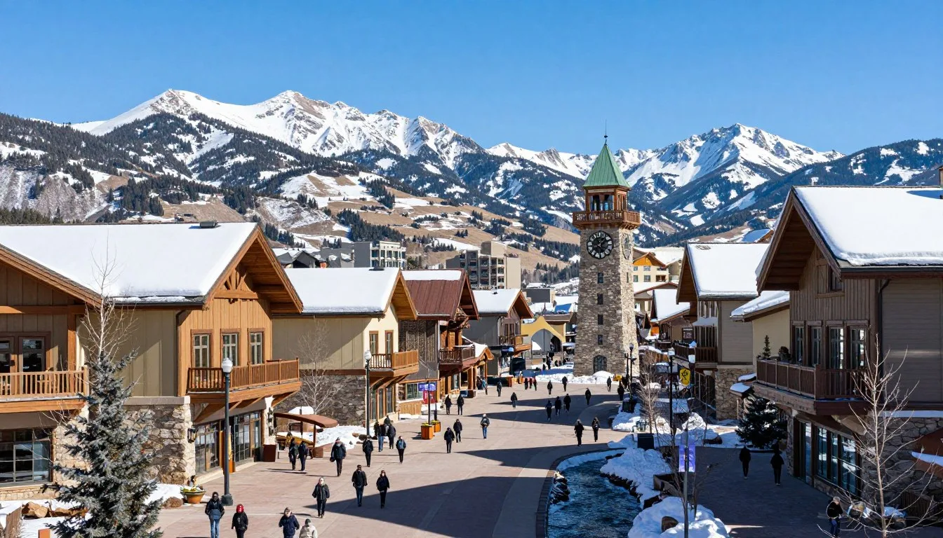
Telluride
This historic mining town turned upscale resort sits approximately 32 km (20 miles) southwest of Mount Sneffels. The dramatic box canyon setting creates one of Colorado’s most picturesque townscapes. Free gondola rides connect the historic downtown with Mountain Village, offering stunning aerial views.
Summer brings hiking, mountain biking, and festival events. The surrounding peaks include several accessible fourteeners and countless alpine trails. Winter transforms Telluride into a world-class ski destination. The town maintains authentic character despite resort development, with Victorian architecture and a vibrant cultural scene.
Black Canyon of the Gunnison
Located roughly 97 km (60 miles) northwest, this national park protects one of North America’s steepest and most dramatic canyons. Sheer walls plunge over 610 m (2,000′) to the Gunnison River below. Several overlooks provide safe viewing of the incredible geology carved over millions of years.
The park offers hiking, rock climbing, and fishing opportunities. The canyon’s depth creates unique ecosystems supporting diverse wildlife. Visit as a day trip from the Mount Sneffels area, or camp in the park to experience sunset and sunrise over this geological wonder.
Ouray Hot Springs
The town of Ouray features several natural hot springs pools open to the public. These geothermally heated waters provide perfect relaxation after mountain adventures. The main pool complex includes multiple pools at varying temperatures, with spectacular mountain views from the water.
Soaking in mineral-rich waters soothes tired muscles and has been a mountain town tradition for over a century. The pools stay open year-round, creating surreal experiences soaking in steaming water while snow falls. Many accommodations include hot springs access, or day passes allow visitors to enjoy the facilities.
Million Dollar Highway
Highway 550 between Ouray and Silverton ranks among America’s most scenic drives. The route climbs over Red Mountain Pass at 3,353 m (11,000′), with steep drop-offs and no guardrails in sections. The name comes either from the million dollars per mile construction cost or the mineral-rich gravel used in the roadbed.
The drive requires about 45 minutes but deserves much longer with stops at overlooks. Old mines, waterfall viewpoints, and sweeping mountain vistas appear around every curve. Drive slowly, use pullouts for photos, and avoid winter conditions unless experienced with mountain driving.
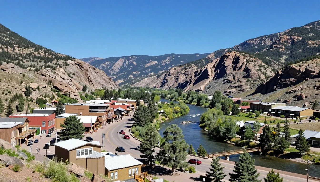
Silverton
This authentic mining town preserves remarkable historical character at 2,835 m (9,300′) elevation. The entire town is a National Historic Landmark with Victorian-era buildings lining unpaved main streets. The Durango & Silverton Narrow Gauge Railroad terminates here, bringing steam train passengers from Durango.
Silverton serves as a base for exploring numerous peaks and alpine areas. The nearby Ice Lakes basin rivals Yankee Boy Basin for wildflower displays and photographic beauty. The town embraces its rough heritage while welcoming visitors to experience authentic mountain atmosphere.
Durango
Situated 161 km (100 miles) southeast, Durango offers a larger town experience with diverse attractions. The historic downtown features excellent restaurants, breweries, and shopping. The Durango & Silverton Railroad provides a scenic journey through mountain wilderness.
Mesa Verde National Park lies within easy driving distance, protecting remarkable ancient cliff dwellings. The Animas River supports kayaking, rafting, and fishing. Durango combines mountain access with cultural amenities, making it a popular base for exploring southwestern Colorado.
Ridgway State Park
This reservoir park offers water recreation just 16 km (10 miles) north of Mount Sneffels trailheads. The 405-hectare (1,000-acre) lake provides swimming, boating, and fishing at a more moderate elevation than the high peaks. Campgrounds offer alternatives to town lodging with mountain views.
The park includes nature trails, visitor center, and marina facilities. It’s especially appealing for families or those wanting to mix mountain adventures with water activities. The reservoir’s creation in the 1990s makes this a relatively new recreational resource for the area.
Practical Travel Tips

Successful Mount Sneffels adventures require thoughtful preparation and attention to practical details. These tips help navigate common challenges and maximize your mountain experience.
Physical Preparation
Summit attempts demand good physical conditioning. The elevation gain, altitude, and technical scrambling challenge even fit individuals. Train with hills or stairs wearing a weighted pack for several months before attempting the climb. Cardiovascular fitness helps manage the thin air above 4,000 m (13,000′).
Practice scrambling on rock before attempting Class 3 terrain. Many climbing gyms offer bouldering areas simulating the movement skills needed. Confidence moving over uneven rock reduces summit day stress and improves safety margins.
Essential Gear
Summer Summit Essentials
- Sturdy hiking boots with ankle support and aggressive tread
- Layered clothing including insulation and waterproof shell
- Gloves for hand protection during scrambling
- Sun protection including sunscreen, hat, and sunglasses
- Three to four liters of water plus electrolyte supplements
- High-energy snacks and emergency food
- First aid kit with blister treatment and pain medication
- Headlamp with extra batteries for emergency descents
- Map, compass, and GPS device with downloaded routes
- Emergency shelter or space blanket
Weather can change dramatically within minutes on high peaks. The gear list looks extensive, but each item serves specific safety or comfort purposes. Experienced mountaineers customize their kits based on conditions and personal needs, but beginning climbers shouldn’t skip recommended items.
Quality gear makes significant difference in mountain environments. Waterproof doesn’t mean water-resistant – cheap shells fail in sustained rain. Proper boots prevent blisters and provide necessary support on loose rock. Invest in reliable equipment rather than risking discomfort or danger from inadequate gear.
Navigation Skills
GPS devices and smartphone apps provide excellent navigation tools, but batteries die and electronics fail. Carry paper maps and know how to use them. The USGS Mount Sneffels quadrangle map shows terrain details essential for safe route-finding.
Download offline maps before leaving cellular coverage. Several apps allow this functionality, ensuring navigation capability even without signal. Mark your parking location and key waypoints to aid navigation in poor visibility conditions.
Money and Services
ATMs exist in Ouray, Ridgway, and Telluride, but not at trailheads or in remote areas. Bring sufficient cash for incidentals as some small businesses don’t accept cards. Credit cards work at most restaurants and lodging establishments.
Gas stations are spaced far apart in mountain regions. Fill up in towns and don’t let the tank run low. Prices typically exceed Front Range rates due to transportation costs. The nearest major shopping remains Montrose, about 48 km (30 miles) from Ouray.
Communication
Cell phone coverage is essentially nonexistent on Mount Sneffels and surrounding trails. Satellite messengers or personal locator beacons provide the only reliable emergency communication. Several affordable rental options exist for short-term visitors.
Leave detailed trip plans with someone responsible who will alert authorities if you’re overdue. Include planned route, expected return time, and vehicle description. This simple step dramatically improves rescue chances in emergencies.
Permits and Regulations
No special permits are required for day hiking Mount Sneffels during normal summer season. However, check current regulations as policies can change. Overnight camping may require permits in specific areas, particularly near lakes or heavily used zones.
Forest Service regulations prohibit campfires above treeline and within specified distances of water sources. Portable stoves provide cooking capability without fire impacts. Pack out all trash including food waste which doesn’t decompose quickly in alpine environments.
Photography Considerations
The best light occurs early morning and late evening, requiring pre-dawn starts or overnight camping for serious photographers. Midday harsh light creates challenging conditions for landscape photography, though drama builds with afternoon storm clouds.
Protect camera gear from altitude, temperature swings, and weather. Batteries drain faster in cold and altitude. Bring extras and keep them warm against your body. Lens changes in dusty or wet conditions risk sensor contamination – use zoom lenses to minimize changes.
Group Size Recommendations
Solo climbing increases risks but offers solitude and flexibility. Groups of three to four provide safety redundancy without creating crowding or logistical complications. Larger groups move slowly, create more environmental impact, and complicate decision-making on the mountain.
Match group members’ abilities and expectations before committing to summit attempts together. Significant fitness disparities lead to frustration and potentially dangerous decisions. Discuss turnaround times and conditions that would trigger retreat before starting the climb.
Seasonal Considerations
Each season presents unique opportunities and challenges. Summer offers reliable access but afternoon thunderstorm risks. Fall brings spectacular colors and stable weather but shorter days and cold nights. Spring and winter require technical skills and specialized equipment.
Plan activities matching current conditions rather than calendar dates. Early season can mean late-season snow, while warm autumns extend summer climbing windows. Flexibility allows adapting to actual mountain conditions rather than predetermined schedules.
Local Resources: The Ouray Visitor Center provides current trail conditions, weather forecasts, and local knowledge. Staff can recommend alternatives if your planned route faces unfavorable conditions. Stop here before heading to the trailhead to gather last-minute information and purchase any forgotten supplies from nearby shops.
Detailed Route Information

Understanding the specific routes up Mt. Sneffels helps climbers prepare appropriately and choose the approach matching their skills and conditions. Each route presents distinct characteristics, advantages, and challenges worth considering during trip planning.
Southwest Ridge Standard Route
This most popular route begins from the Blue Lakes trailhead in upper Yankee Boy Basin. The approach follows the Blue Lakes trail for approximately 3.2 km (2 miles), gaining 457 m (1,500′) to reach the basin beneath the peak. From here, the route ascends steep talus toward the southwest ridge.
The final section involves Class 3 scrambling up the ridge itself. Loose rock requires careful foot and hand placement. The exposure increases near the summit, with steep drop-offs on both sides of the narrow ridge. Most parties complete the round trip in five to eight hours depending on fitness and conditions.
Route-finding becomes challenging as multiple paths snake through the boulder field. Cairns mark the general way, but fog or poor visibility makes navigation difficult. The key is staying on the ridge crest rather than traversing onto the steep faces on either side.
Blue Lakes Pass Approach
An alternative approach traverses to Blue Lakes Pass before ascending the peak’s east side. This route adds distance but rewards climbers with stunning scenery through wildflower meadows and past brilliant blue alpine lakes. The lakes themselves sit at approximately 3,658 m (12,000′), requiring significant elevation gain from the trailhead.
Blue Lakes Pass reaches roughly 4,023 m (13,200′), providing a spectacular viewpoint even for those not continuing to the summit. The pass often holds snow into midsummer, requiring ice axes and crampons during early season. From the pass, scrambling up the ridge leads to the summit.
This approach sees less traffic than the standard route, offering more solitude. However, the additional distance and elevation gain make it more demanding. Strong parties often ascend this way and descend via the Southwest Ridge, creating a semi-loop that showcases different perspectives of the mountain.
North Face Couloir
Technical climbers seek out the North Face couloir for its steep snow and ice climbing. This route faces north, preserving snow and ice conditions well into summer. The couloir angle reaches 50-55 degrees in sections, requiring front-pointing crampon technique and ice axe proficiency.
Approach from Yankee Boy Basin leads to the base of the face. Early morning starts are essential as the couloir becomes dangerously soft and prone to rockfall as sun hits the face. Most parties climb this route in spring when consolidated snow provides better conditions than late summer ice.
Avalanche hazard remains significant in the couloir throughout winter and spring. Proper avalanche education, beacon/probe/shovel equipment, and current conditions assessment are mandatory. This route demands alpine climbing experience and should never be attempted by parties without appropriate technical skills.
Route Timing and Strategy
Standard route parties should start hiking between 4 and 6 AM during summer months. This timing allows reaching the summit by late morning, with descent complete before afternoon thunderstorms develop. Headlamps are necessary for the earliest starts, but getting off the mountain before weather deteriorates justifies the predawn wake-up.
Establish a turnaround time before starting the climb. A common guideline suggests turning back if you haven’t summited by 1 PM, regardless of how close you are. Afternoon storms develop quickly, and being caught above treeline during lightning is life-threatening.
Winter and spring attempts require entirely different timing. Longer days in late spring allow later starts, though avalanche conditions often improve after overnight freezing. Winter climbers face short days, requiring efficient movement and sometimes overnight high camps to position for summit pushes.
Descent Considerations
Descending loose rock requires extra caution. Tired legs and diminished concentration late in the day contribute to most accidents. Face into the slope when descending steep sections, using hands for balance. Test holds before weighting them, as rocks that felt solid ascending may shift when pulled from above.
Some parties prefer descending different routes than they ascended for variety or to create a loop. However, unfamiliar descent routes increase navigation challenges when tired. Unless you’ve previously descended the alternate way, sticking to your ascent route provides known conditions and easier route-finding.
Emergency Considerations
Cell service is nonexistent on the mountain. If someone in your party becomes injured or ill, one person should stay with them while others descend for help. Mark the location carefully using GPS coordinates. The nearest road access is the trailhead in Yankee Boy Basin, where you might encounter other parties who can assist.
Ouray County Search and Rescue responds to mountain emergencies, but reaching remote locations takes hours. Basic first aid knowledge and supplies can stabilize injuries until help arrives. Preventing emergencies through good judgment, proper preparation, and conservative decision-making far exceeds hoping for rescue if things go wrong.
Winter and Shoulder Season Climbing

Winter transforms Mount Sneffels from a challenging hike into a serious mountaineering objective. Snow, ice, avalanche danger, and extreme cold require technical skills and specialized equipment. Only experienced winter climbers should attempt the peak outside the standard summer season.
Snow and Ice Conditions
Snowpack on Mt. Sneffels can exceed 6 m (20′) during heavy winters. The snow typically begins accumulating in October and persists into June or even July. Spring climbing often encounters consolidated snow that provides good crampon purchase, but avalanche hazard peaks during this season.
Ice forms on rock faces and in gullies throughout winter. The North Face couloir becomes a classic ice climb under proper conditions. Rime ice coats the summit blocks, and verglas (thin ice on rock) makes scrambling extremely hazardous. Technical ice climbing equipment and skills become mandatory.
Avalanche Hazard
Several aspects of Mount Sneffels load with wind-deposited snow, creating dangerous avalanche conditions. The area’s heavy snowfall and steep terrain produce all avalanche types from loose snow sluffs to massive slab avalanches. The San Juan Mountains experience some of Colorado’s worst avalanche conditions.
Formal avalanche education is essential before winter climbing. Understanding snowpack assessment, terrain selection, and rescue techniques can prevent tragedies. Carry beacon, probe, and shovel, and know how to use them proficiently. Check the Colorado Avalanche Information Center forecast before any winter trip.
Route Variations in Winter
Winter routes often differ from summer approaches. Deep snow buries trails and cairns, requiring navigation skills and route-finding ability. Some summer scrambling sections become snow or ice climbs demanding technical skills. The Southwest Ridge transforms from Class 3 scrambling to potentially Class 4 or 5 climbing depending on conditions.
Snow conditions vary dramatically throughout winter and spring. Early winter often features unconsolidated powder over unstable layers. Spring brings firmer snow but increased avalanche risk during warm cycles. Late spring sometimes offers the best conditions with consolidated snow and longer days.
Required Winter Equipment
Winter ascents require mountaineering equipment beyond summer hiking gear. Ice axes, crampons, helmet, rope, and protection for belayed sections become necessary. Clothing must handle extreme cold, with temperatures potentially dropping below -18°C (0°F) with wind chill on the summit.
Four-season tents, winter sleeping bags rated to at least -18°C (0°F), and insulated sleeping pads support overnight camps. Cooking requires reliable stoves that function in extreme cold. Water sources freeze solid, necessitating melting snow for all water needs.
Shoulder Season Challenges
Late fall and early spring present unique challenges combining winter hazards with unpredictable weather. Roads may close unexpectedly due to snow. Conditions can range from bare rock to deep snow on the same route depending on aspect and recent weather.
September and October occasionally allow summit attempts before serious winter snow accumulates. However, early storms can trap unprepared parties. November through April see minimal traffic due to severe conditions. May and June involve heavy snowpack with increasing avalanche danger as temperatures warm.
Photography and Scenic Documentation

Mount Sneffels ranks among Colorado’s most photographed peaks, offering endless opportunities for capturing spectacular mountain imagery. Understanding light, composition, and location helps photographers create compelling images of this iconic landscape.
Best Photography Locations
The Dallas Divide viewpoint along Highway 62 provides the classic Mount Sneffels composition. Foreground aspen groves frame the distant peak, especially striking during fall color season. This easily accessible location requires no hiking, making it popular with photographers of all abilities.
Within Yankee Boy Basin itself, countless compositions present themselves. The lower basin meadows offer wildflower foregrounds with the peak rising behind. Higher elevations provide dramatic close-up perspectives. The Blue Lakes trail passes numerous photogenic spots with turquoise water reflecting surrounding peaks.
Blue Lakes themselves create stunning reflection opportunities on calm mornings. Arrive before sunrise to catch the still water and alpenglow on the peaks. The lakes’ distinctive color photographs beautifully against snow-covered summits in early season.
Optimal Lighting Conditions
Sunrise illuminates Mount Sneffels’ east-facing aspects with warm golden and pink tones. The peak catches first light while valleys remain in shadow, creating dramatic contrasts. Summer sunrise occurs around 6 AM, requiring very early starts to reach good vantage points.
Sunset light paints the west-facing slopes in warm colors. The best views come from east of the mountain, looking back at the illuminated peak. Evening light lasts longer than morning glow, providing more relaxed shooting schedules.
Cloudy days offer advantages for certain photography. Overcast skies provide soft, even light ideal for wildflower close-ups and forest scenes. Storm clouds add drama to mountain landscapes, particularly when breaks in clouds create light rays illuminating the peak.
Seasonal Photography Opportunities
Mid-July through early August brings peak wildflower displays to Yankee Boy Basin. The variety and density of blooms create spectacular foregrounds for mountain compositions. Macro photography reveals intricate flower structures, while wide-angle shots capture sweeping floral carpets.
Late September brings golden aspen foliage to the surrounding valleys. The contrast between golden aspens, dark evergreens, and often snow-dusted peaks creates Colorado’s signature autumn palette. Dallas Divide and the lower portions of Camp Bird Road offer excellent fall photography access.
Winter photography requires significant effort but rewards with pristine snow-covered landscapes. The mountain’s dramatic profile becomes even more striking crowned with snow and ice. Blue sky days after storms provide incredible clarity and contrast.
Technical Considerations
Altitude affects photography equipment. Batteries drain faster in cold and thin air. Bring extras and keep them warm in inside pockets. LCD screens may respond slowly in extreme cold. Memory cards occasionally malfunction at altitude, so carry spares.
Wide-angle lenses capture the scale of mountain landscapes and work well in tight valleys. Telephoto lenses compress distant peaks and isolate details. A versatile zoom covering 24-200mm range handles most mountain photography situations without lens changes in dusty or wet conditions.
Tripods stabilize cameras for low-light shooting and ensure sharp images. Lightweight carbon fiber tripods balance stability with packability for mountain travel. Use mirror lock-up and cable releases to eliminate camera shake during exposure.
Composition Guidelines
Include foreground elements to create depth and lead viewers’ eyes into scenes. Wildflowers, rocks, or streams in the foreground add interest to distant mountain shots. The rule of thirds helps position the horizon and key elements for balanced compositions.
Weather phenomena create dynamic images. Storm clouds, rainbows, and dramatic lighting tell stories beyond simple landscape documentation. Patience often rewards photographers with unique conditions worth waiting for.
Capture human scale by including people in some shots. Small figures emphasize the mountain’s massive size and create relatable images. Always get permission before photographing identifiable individuals.
Mining History and Cultural Heritage

Mount Sneffels’ modern recreation focus contrasts sharply with its industrial past. Understanding the mining heritage that shaped this region adds depth to mountain experiences and appreciation for the challenges faced by early settlers.
The Mining Boom Era
Gold and silver discoveries in the 1870s transformed the San Juan Mountains from wilderness to industrial center practically overnight. The Camp Bird Mine, located on the approach to Mount Sneffels, became one of Colorado’s richest gold producers. At its peak, the mine employed hundreds of workers and generated millions in gold and silver.
Miners worked year-round in incredibly harsh conditions. Winter snows buried buildings and avalanches claimed numerous lives. The altitude challenged workers unused to thin air. Yet the promise of wealth attracted thousands to these remote mountains.
The towns of Ouray and Telluride grew to support the mining operations. Elaborate Victorian buildings rose alongside rough mining camps. The contrast between wealth flowing from the mountains and the hard lives of miners who extracted it defined the era’s character.
Camp Bird Mine Legacy
The Camp Bird Mine operated from the 1890s through the 1970s with varying intensity. The massive mill buildings still standing today processed ore extracted from tunnels honeycomb the mountain. At one point, the mine produced over $20 million in gold at early 1900s prices.
Thomas Walsh purchased the mine in 1896 and made an immense fortune before selling out years later. His daughter Evalyn Walsh McLean would later own the famous Hope Diamond. The mine’s success funded lavish lifestyles far from the harsh mountain environment that created the wealth.
Modern visitors can view the exterior of remaining mine structures but should never enter abandoned mines. Unstable ground, bad air, and hidden shafts make them extremely dangerous. The standing buildings provide glimpses into the scale of operations without risking the hazards inside.
Ute Indian Heritage
Before Euro-American settlement, the Ute people inhabited the San Juan region for thousands of years. They used different elevations seasonally, hunting in high country during summer and retreating to lower valleys in winter. The mountain wilderness provided everything needed for their traditional lifestyle.
The Ute were forcibly removed to reservations as mining interests demanded access to mineral-rich land. The Brunot Agreement of 1873 ceded the San Juan Mountains to the United States, opening the region for mining and settlement. This displacement ended centuries of Ute presence in their traditional territory.
Modern Ute nations maintain cultural connections to the region despite physical removal. Some place names and archaeological sites preserve evidence of their long occupation. Respectful visitors acknowledge this indigenous heritage predating the mining era by millennia.
Preservation Efforts
Historical societies work to preserve remaining mining-era structures and artifacts. The harsh mountain environment accelerates deterioration, making preservation challenging. Some sites receive stabilization to prevent collapse while maintaining historical character.
Interpretive signs along roads explain the mining history and industrial heritage. These educational efforts help visitors understand the transformation from industrial landscape to recreational resource. The shift from extracting wealth to preserving beauty reflects changing values over the past century.
Conservation and Environmental Stewardship

The Mount Sneffels area faces increasing pressure from recreational use while dealing with climate change impacts. Understanding conservation challenges helps visitors minimize their impact and support efforts protecting this special landscape.
Climate Change Impacts
Glaciers that once covered much of the San Juan high country have largely disappeared. Small perennial snowfields persist but shrink annually. The loss of ice reduces water storage capacity and alters stream flow patterns that support downstream ecosystems and communities.
Treeline advances upward as temperatures warm, changing plant and animal communities. Alpine species adapted to cold conditions find their habitat shrinking as forests encroach on tundra. Some high-elevation species may disappear entirely as suitable habitat vanishes.
Wildflower bloom timing shifts earlier in spring, potentially disrupting relationships with pollinators evolved to coincide with historical blooming patterns. Ski seasons shorten and summer droughts intensify, affecting both recreation and ecosystems.
Trail and Habitat Degradation
Heavy recreational use concentrates on popular routes, causing soil erosion and vegetation loss. Trampling damages fragile alpine plants that require decades to recover. Shortcutting switchbacks creates erosion gullies that channel water and accelerate trail damage.
Camping impacts affect high-elevation lakes and meadows. Even careful campers compact soil and disturb vegetation. Human waste and food scraps contaminate water sources. These impacts accumulate as visitor numbers increase year after year.
Dispersed camping regulations aim to spread impacts rather than concentrating damage in popular areas. However, enforcement challenges and lack of visitor education mean many campers unknowingly harm sensitive environments.
Wildlife Pressures
Increased human presence disturbs wildlife, forcing animals to expend energy fleeing people instead of feeding or resting. Dogs off leash chase wildlife and disturb nesting birds. Food left accessible attracts bears and other animals, creating dangerous situations and habituation to human sources.
Critical wildlife habitat coincides with popular recreation areas. Nesting birds, birthing ungulates, and denning animals need undisturbed spaces during sensitive periods. Year-round recreation leaves few refuges for wildlife to escape human pressure.
Volunteer Conservation Efforts
Trail maintenance projects accept volunteers willing to donate time preserving mountain resources. Groups organize work weekends repairing trails, restoring vegetation, and cleaning up impacts. Participating provides hands-on stewardship while meeting like-minded outdoor enthusiasts.
Citizen science projects collect data on wildlife, plant phenology, and environmental changes. These observations help scientists track ecosystem responses to climate change and recreation pressure. Simple smartphone apps make contribution easy for visitors with minimal scientific background.
Responsible Recreation Practices
Individual choices collectively determine the landscape’s future condition. Small actions multiplied across thousands of visitors create significant impacts, positive or negative. Choose to leave places better than found, pack out litter left by others, and educate fellow visitors about proper practices.
Support organizations working to protect mountain environments through donations or memberships. Groups like the Colorado Fourteeners Initiative maintain trails and educate users specifically on high peaks. Your financial support enables conservation work beyond what individual actions can achieve.
Consider timing visits to avoid peak crowds that overwhelm popular areas. Weekday trips and shoulder season adventures provide quality experiences while reducing pressure during busiest periods. Exploring lesser-known areas spreads use rather than concentrating impacts on a few trails.
Your Mount Sneffels Adventure Awaits

Mount Sneffels embodies everything that makes Colorado’s high country special. From the challenging scramble to the summit to gentle walks through wildflower meadows, from the turquoise depths of Blue Lakes to golden autumn aspen groves, this single peak offers a lifetime of mountain experiences.
The practical information, route details, and local insights in this guide provide the foundation for planning your adventure. Whether you’re an experienced mountaineer eyeing winter ascents or a family seeking accessible alpine beauty, the Mount Sneffels area welcomes you with open arms and spectacular scenery.
Remember that the mountain will always be there. Don’t let summit fever override good judgment when weather deteriorates or conditions exceed your abilities. The most successful mountain adventures are those where everyone returns safely to share stories and plan the next trip.
Start planning now, because the wildflowers won’t wait forever, and those bluebird summit days are more precious for being rare. The San Juan Mountains call to those who love wild places, and Mount Sneffels stands as their magnificent ambassador. Your adventure among these towering peaks promises memories that will last far beyond the inevitable muscle soreness.
The trail begins with a single step. Make yours count.