Hotels by Trip.com
Flights by Trip.com
Did you know that Unaweep Canyon is the only canyon in North America where two rivers flow in opposite directions from a single divide? This geological wonder sits at the heart of the Unaweep-Tabeguache Scenic Byway, creating a landscape that has puzzled scientists for over a century. The name “Unaweep” comes from the Ute language, meaning “canyon with two mouths,” perfectly describing this extraordinary natural formation.
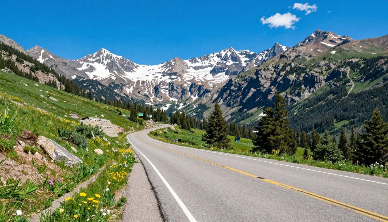
Stretching 133 miles through western Colorado’s most dramatic terrain, this scenic byway connects communities, history, and wilderness in ways few roads can match. From the towering cliffs of the Uncompahgre Plateau to the rushing waters of the San Miguel River, every mile offers something unexpected.
Whether you seek adventure on mountain trails, fascination with mining history, or simply a peaceful drive through stunning rock formations, this route delivers experiences that stay with you long after you return home. The byway winds through canyon walls that tell stories millions of years old, past ghost towns where miners once sought fortune, and alongside rivers where wildlife thrives today.
Getting There & Planning Your Journey

Grand Junction serves as the primary gateway to the Unaweep-Tabeguache Scenic Byway, offering the most convenient access point for travelers. The city sits just minutes from where the scenic drive begins its journey through Unaweep Canyon and the surrounding plateau country.
Closest Airports
Grand Junction Regional Airport stands as your nearest option, located only 8 km (5 miles) from downtown. This regional hub connects to major cities including Denver, Dallas, and Phoenix through daily flights. Car rental services operate directly at the terminal, making it simple to begin your scenic byway adventure immediately upon arrival.
Denver International Airport provides another gateway option, situated 402 km (250 miles) east. Though farther away, this major hub offers more flight options and competitive rental rates. The drive from Denver takes approximately four hours and crosses stunning mountain passes.
Montrose Regional Airport, located 113 km (70 miles) south, serves as a third alternative. This smaller facility works well for travelers approaching from the southern route or combining their byway visit with trips to Black Canyon of the Gunnison National Park.
Route Overview
The scenic byway follows State Highway 141 from Whitewater through Unaweep Canyon to Naturita, then continues northwest to the Utah border. From Grand Junction, most travelers begin at the Whitewater junction where the canyon entrance beckons with its dramatic rock walls.
Plan four to six hours minimum for the complete drive, though a full day allows proper time for stops, short walks, and photo opportunities. The road surface remains paved throughout, suitable for standard vehicles year round, though winter conditions may require chains or four wheel drive during storms.
Best Time to Visit & Weather Tips

Best Time to Visit Unaweep-Tabeguache Scenic Byway
Late spring through early fall provides ideal conditions for exploring the scenic byway. May through October offers the most reliable weather, with warm days perfect for hiking and outdoor activities. The canyon walls shelter the road from harsh winds, creating a microclimate that often feels more moderate than surrounding areas.
September and early October shine as particularly beautiful months. Autumn transforms cottonwood trees along West Creek and East Creek into golden ribbons of color against red rock walls. Daytime temperatures hover around 21°C (70°F), comfortable for all activities without summer crowds.
Spring months of April and May bring fresh green growth and wildflowers to canyon floors and plateaus. Snow melt fills creeks and waterfalls, adding movement and sound to the landscape. Temperatures range from 10°C to 21°C (50°F to 70°F), though higher elevations remain cooler.
Months to Avoid
Winter months from December through March present challenges for casual visitors. Heavy snow can close portions of the route, particularly at higher elevations near the Uncompahgre Plateau. Ice forms in shaded canyon sections, making driving treacherous without proper equipment.
✓ Check 30,000+ Local Sightseeing Tours Worldwide
Late July and August bring intense heat to lower canyon areas, with temperatures sometimes exceeding 37°C (100°F). Afternoon thunderstorms develop frequently during these months, creating flash flood risks in narrow canyon sections. Early morning drives work best if you must visit during summer peak.
Notable Annual Festivals
The area surrounding the scenic byway hosts several events worth timing your visit around. Grand Junction celebrates the Colorado Mountain Winefest each September, showcasing local vineyards and regional cuisine. The festival runs for two days and attracts thousands of wine enthusiasts.
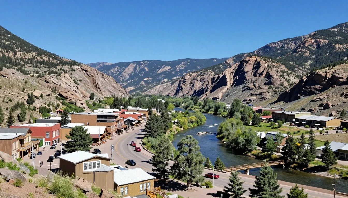
Naturita hosts the Rimrocker Historical Society events throughout summer months, celebrating the mining heritage that shaped these communities. Check their schedule for guided historical tours and demonstrations.
Getting Around Locally

Personal vehicles provide the only practical way to explore the Unaweep-Tabeguache Scenic Byway thoroughly. No public transportation serves the route, and the distances between points of interest make walking or cycling impractical for most visitors. The freedom of your own vehicle lets you stop whenever views captivate or wildlife appears.
Standard cars handle the paved highway easily throughout the year under normal conditions. The road features gentle curves and moderate grades, designed for comfortable touring rather than challenging driving. Pull outs and scenic overlooks appear regularly, offering safe places to stop without blocking traffic.
Fuel availability requires planning along the route. Gas stations operate in Whitewater at the eastern end and in Naturita toward the western portion, but the canyon section between offers no services. Fill your tank in Grand Junction or Whitewater before entering Unaweep Canyon to avoid range anxiety.
Cell phone coverage disappears for long stretches within the canyon. Download offline maps before departing and inform someone of your travel plans. The isolation adds to the wilderness experience but demands preparation and self reliance.
Where to Stay

Lodging options cluster in Grand Junction and South Grand Junction at the eastern end of the scenic byway, offering everything from budget motels to upscale hotels. The city provides the widest selection of accommodations, restaurants, and services, making it an excellent base for day trips along the route.
Hotels and Motels
Downtown Grand Junction features several well known chain hotels within walking distance of restaurants and shops. The Doubletree by Hilton and Hampton Inn offer comfortable rooms with modern amenities and breakfast included. Prices range from dollar 90 to dollar 150 per night depending on season.
Budget conscious travelers find reliable options along Horizon Drive, where older but clean motels offer rates starting around dollar 60 per night. These properties provide basic comfort and easy highway access for early morning departures to the byway.
Vacation Rentals
Cabin rentals dot the landscape near Gateway and along the San Miguel River corridor. These properties offer more space and kitchen facilities, perfect for families or groups planning multi day explorations. Nightly rates typically run dollar 120 to dollar 250, with minimum stay requirements common during peak season.
Camping Options
Primitive camping opportunities abound on public lands within the canyon and surrounding plateau. The Bureau of Land Management oversees much of this area, allowing dispersed camping in designated zones. No facilities exist at these sites, requiring complete self sufficiency.
Developed campgrounds operate near the communities of Gateway and Naturita, offering water and restroom facilities. Sites cost dollar 15 to dollar 25 per night and fill quickly on summer weekends. Reserve ahead when possible or arrive early in the day to claim available spots.
Dining & Local Cuisine

Dining options concentrate in Grand Junction, where restaurants serve everything from classic American fare to international cuisine. The scenic byway itself offers minimal food services, making provisions and planning essential for day trips through the canyon.
Local specialties reflect the region’s agricultural heritage and Western roots. Colorado lamb, raised on nearby ranches, appears on many menus prepared in various styles. The Grand Valley’s fruit orchards contribute peaches, apples, and cherries to seasonal dishes and desserts.
Wine production has flourished in recent years around Palisade, just east of Grand Junction. Several wineries operate tasting rooms where you can sample locally produced wines alongside cheese plates and light meals. The climate proves surprisingly suitable for growing wine grapes, creating a regional industry that has gained national recognition.
Dining Recommendations
Pack picnic supplies before entering Unaweep Canyon for the most flexibility. Scenic pull outs and creekside spots provide perfect lunch locations surrounded by dramatic rock walls. Grocery stores in Grand Junction stock everything needed for trail lunches and snacks.
Gateway Canyons Resort operates the only full service restaurant actually located along the byway route. Their dining room serves breakfast, lunch, and dinner featuring regional ingredients and upscale preparations. Reservations help during busy periods, though walk ins are usually accommodated.
Naturita offers basic cafe options for simple meals at the western end of the drive. These local establishments serve hearty portions of comfort food at reasonable prices, popular with area workers and passing travelers alike.
Attractions, Sightseeing & Activities

The Unaweep-Tabeguache Scenic Byway transforms every mile into a potential discovery. Geological formations, historical sites, and natural wonders create constant reasons to slow down and explore. The route links multiple ecosystems and elevation zones, each supporting different plant and animal communities.
Unaweep Canyon
This canyon stands as the byway’s centerpiece, carved by ancient rivers through resistant Precambrian rock. The unusual formation where West Creek and East Creek flow in opposite directions from a central divide continues to fascinate geologists. Stop at interpretive signs explaining how the Gunnison River once flowed through this canyon before volcanic activity redirected it.
Canyon walls tower 396 m (1,300 feet) above the road in places, creating dramatic vertical landscapes. The rock layers visible in cliff faces record nearly two billion years of Earth history, from ancient basement rocks to relatively recent sandstones.
Hanging Flume
This engineering marvel from the late 1800s still clings to canyon walls along the San Miguel River near Uravan. Miners constructed the wooden flume to carry water to placer gold operations, suspending it from cliffsides where no other path existed. Portions remain visible from the highway, testament to the determination and skill of early prospectors.
Pull outs near the flume offer photo opportunities and interpretive information about mining history in the region. The structure represents one of the most impressive remaining examples of mining era engineering in Colorado.
Driggs Mansion
Located in Unaweep Canyon, this historic log home dates to the late 1800s when John Driggs established a ranch in the area. The building served various purposes through the years, including housing miners and serving as a school. Today it stands as a tangible connection to pioneer life in this remote canyon.
The mansion sits on private property but remains visible from the road. Respect boundaries while appreciating this piece of history that survived when so many other frontier structures disappeared.
Rock Art Sites
Ancient petroglyphs mark several locations along the byway, created by Ancestral Puebloan and Ute people who inhabited these lands long before European settlement. The images depict animals, human figures, and abstract symbols whose meanings often remain mysterious.
These cultural treasures deserve respect and protection. View them from designated areas without touching the rock surfaces, as oils from skin damage the ancient artwork. Photography is permitted, but climbing on or defacing these irreplaceable sites violates federal law.
Museums, Cultural Spots & Festivals

Cultural attractions concentrate in Grand Junction rather than along the byway itself. The city has invested in preserving and presenting the region’s rich history through several quality facilities worth visiting before or after your scenic drive.
Museum of the West
This museum in downtown Grand Junction chronicles the Colorado Plateau’s human and natural history from dinosaurs to modern times. Exhibits cover Native American cultures, pioneer settlement, mining booms, and agricultural development. The collection includes artifacts from the Unaweep area, providing context for what you will see along the byway.
Interactive displays engage visitors of all ages, while research facilities serve those seeking deeper knowledge about regional history. Admission fees support ongoing preservation and education programs.
Cross Orchards Historic Site
This living history museum preserves a 1890s apple farm complete with original buildings and equipment. Costumed interpreters demonstrate heritage apple varieties and farming techniques that sustained early communities. The site illustrates how agriculture adapted to this semi arid climate, creating the fruit growing industry that still thrives today.
Art on the Corner
Grand Junction’s outdoor sculpture exhibit places contemporary Western art throughout downtown streets. More than 100 pieces rotate through the program annually, transforming sidewalks into an open air gallery. The art reflects themes of Western life, nature, and cultural heritage relevant to the surrounding landscape.
Nature & Outdoor Experiences

The wilderness surrounding the Unaweep-Tabeguache Scenic Byway offers endless opportunities for outdoor recreation. From casual nature walks to challenging backcountry expeditions, every skill level finds appropriate activities in this diverse landscape.
Hiking Trails
Dozens of trails branch from the byway into canyon side drainages and onto plateau tops. West Creek Trail follows its namesake stream through the heart of Unaweep Canyon, offering easy walking on relatively flat terrain. The path winds through cottonwood groves where birds concentrate during migration seasons.
More ambitious hikers tackle routes climbing to the Uncompahgre Plateau rim, where views extend across canyon country to distant mountain ranges. These ascents gain 610 m (2,000 feet) or more over several miles, requiring good fitness and plenty of water. Summer heat makes early starts essential for safety and comfort.
Trail conditions vary from well maintained paths to primitive routes marked only by cairns. Carry maps, compass, and GPS devices on longer hikes where trails may fade or split confusingly. Tell someone your plans and expected return time before heading into backcountry.
Wildlife Watching
The byway corridor supports remarkable wildlife diversity. Mule deer browse in canyon bottoms at dawn and dusk, while bighorn sheep sometimes appear on high cliff faces. Black bears inhabit forested areas at higher elevations, particularly in autumn when foraging intensively before winter.
Bird species number in the hundreds across different seasons. Golden eagles soar on thermals above canyon walls, while smaller raptors hunt from exposed perches. Riparian areas along creeks attract songbirds, waterfowl, and wading birds, particularly during spring and fall migrations.
Respect wildlife by observing from a distance and never feeding animals. Binoculars and telephoto lenses let you enjoy close up views without disturbing natural behaviors. Early morning and evening hours produce the most wildlife sightings when animals are most active.
Rock Climbing
The San Miguel River canyon near Uravan offers world class rock climbing on steep sandstone walls. Routes range from moderate traditional climbs to extremely difficult sport routes established by visiting experts. The unique rock quality and spectacular setting attract climbers from across the country.
Unaweep Canyon also holds climbing potential, though development remains limited compared to more famous Colorado climbing areas. The hard Precambrian rock provides excellent friction and solid protection placements for traditional gear.
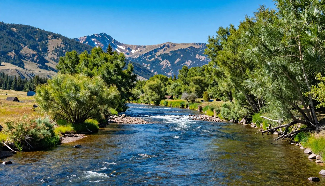
Fishing
The Dolores River and San Miguel River both support trout populations in sections accessible from the byway. Brown trout predominate in warmer lower reaches, while rainbows thrive in cooler headwaters. Stream flows vary dramatically with season, affecting both fish location and angler success.
Colorado fishing licenses are required for anyone over 16 years old. Regulations vary by water body and season, so check current rules before fishing. Local fly shops in Grand Junction provide advice on current conditions, productive patterns, and access points.

Paddling
The Dolores River offers paddling opportunities ranging from easy floats to challenging whitewater, depending on section and water levels. Spring runoff creates the most exciting conditions but demands advanced skills and proper equipment. Summer flows become too low for boating in many years.
Plan any paddling adventure carefully, understanding river conditions, access points, and shuttle logistics. Private land borders much of the river, limiting where you can stop or camp. Guided trips through local outfitters solve these complications while providing equipment and expertise.
Travel With Children

The Unaweep-Tabeguache Scenic Byway makes an excellent family destination with proper planning. The scenic drive itself entertains children through constantly changing landscapes, while frequent stops prevent restlessness on long stretches.
Pack activities to engage kids during drive time. Nature scavenger hunts challenge them to spot different rock colors, plant types, or animal tracks. Binoculars let young naturalists scan for wildlife and examine distant cliff features. Audio books or downloaded podcasts about geology, wildlife, or Western history turn drive time into learning opportunities.
Choose short, easy trails for family hikes, keeping distances realistic for small legs. West Creek offers gentle paths where even toddlers can walk short sections. Bring extra snacks and water, as children need more frequent breaks and refueling than adults during outdoor activities.
Safety considerations increase with children along. Keep kids close at overlooks and cliff edges, as barriers may not exist at many viewpoints. Teach them to stay on trails and avoid touching rock art or historical structures. Explain why leaving no trace matters for preserving these special places.
Plan accommodations with family needs in mind. Hotels with pools provide afternoon entertainment after morning adventures. Cabin rentals offer space for kids to spread out and parents to prepare simple meals without restaurant expenses every night.
Money Saving Tips

Exploring the Unaweep-Tabeguache Scenic Byway need not break your budget. The byway itself costs nothing to drive, and many of the best experiences require only time and curiosity rather than entrance fees or reservations.
Camping dramatically reduces lodging costs compared to hotels. Public land camping costs nothing when you choose dispersed sites, though you sacrifice amenities and convenience. Even developed campgrounds at dollar 20 per night cost far less than the cheapest motel rooms.
Prepare your own meals rather than eating all meals in restaurants. Grand Junction has several grocery stores where you can stock coolers with picnic supplies, snacks, and easy to prepare dinners. A simple camp stove expands meal options while keeping costs low.
Visit during shoulder seasons when lodging prices drop. September offers beautiful weather and fall colors without peak summer rates. Spring months of May and early June provide similar savings, though higher elevation areas may still hold snow.
Take advantage of free activities over paid alternatives. Hiking, wildlife watching, photography, and scenic driving cost nothing beyond your time. The landscape provides entertainment enough without requiring commercial attractions or guided tours for most visitors.
Fill your gas tank in larger towns where competition keeps prices lower. Fuel costs more in small communities along the route where stations have captive audiences. Planning fuel stops saves money over the course of a multi day trip.
Safety & Local Customs

Remote areas demand self reliance and preparation. Cell phone service disappears for long stretches through Unaweep Canyon and other portions of the byway. Inform someone of your travel plans including expected return times, especially when venturing onto side roads or trails.
Carry emergency supplies year round. A basic kit should include first aid materials, extra water, snacks, warm layers, flashlight, and basic tools. Winter travel requires additional items like blankets, sand or kitty litter for traction, and a shovel.
Weather Hazards
Summer thunderstorms develop rapidly over the Uncompahgre Plateau and surrounding mountains. These storms produce dangerous lightning, sudden temperature drops, and flash flooding in narrow canyons. Monitor weather forecasts before departing and head to safety if storms threaten.
Flash floods pose serious risks in Unaweep Canyon and side drainages during heavy rain. Water levels can rise within minutes, turning dry washes into raging torrents. Never camp in drainage bottoms during monsoon season, and move to high ground immediately if rain begins.
Winter brings ice, snow, and extreme cold to the area. Road conditions deteriorate quickly during storms, and help may be hours away if you become stuck. Check road conditions before traveling and carry proper equipment including chains or four wheel drive capability.
Wildlife Precautions
Black bears inhabit forested areas at higher elevations along the byway. Store food properly when camping, using bear resistant containers or hanging techniques. Never approach bears, and make noise when hiking to avoid surprising them on trails.
Rattlesnakes sun themselves on rocks and trails during warm months. Watch where you place hands and feet when scrambling on rocks or pushing through brush. Most snake bites occur when people try to handle or kill them, so simply move away if you encounter one.
Emergency Contacts
Local Customs
Western Colorado maintains a friendly, informal culture where waves to passing vehicles and casual conversations with strangers remain common. Ranch and mining heritage influence local attitudes emphasizing self reliance, respect for private property, and environmental stewardship.
Respect private land boundaries, which checkerboard public lands throughout the region. “No Trespassing” signs mean exactly that, even when fences look old or gates stand open. Always obtain permission before crossing private property to access public lands.
Pack out all trash and leave natural and historical sites undisturbed. Western communities take pride in their public lands and history, expecting visitors to treat these resources with respect. The Leave No Trace principles apply throughout the byway corridor.
Visitor Comments About Unaweep-Tabeguache Scenic Byway

The drive through Unaweep Canyon exceeded all expectations. Every turn revealed new rock formations and colors. We stopped countless times just to absorb the views. The isolation felt like stepping back in time, away from modern distractions. This scenic byway deserves far more recognition than it receives.
Our family spent three days exploring the area and still left wanting more time. The hiking trails offered something for everyone from easy strolls to challenging climbs. Wildlife sightings delighted the kids, especially when we spotted bighorn sheep on distant cliffs. The combination of natural beauty and frontier history made this trip memorable.
I have driven scenic byways across the western states, and this route ranks among the best. The geological features fascinate anyone interested in Earth’s history. The lack of commercial development preserves an authentic wilderness experience. Bring patience to truly appreciate what this landscape offers rather than rushing through.
Additional Nearby Destinations

The Unaweep-Tabeguache Scenic Byway connects to numerous other remarkable destinations within easy driving distance. Extending your trip to include these areas reveals even more of western Colorado’s diverse landscapes and attractions.
Grand Mesa
This massive flat topped mountain rises east of Grand Junction, claiming the title of world’s largest flat topped mountain. The mesa top sits at over 3,048 m (10,000 feet) elevation, supporting over 300 alpine lakes amid thick forests. Summer brings wildflower displays and excellent trout fishing, while winter transforms the mesa into a snowmobiling and cross country skiing destination.
Drive the scenic byway that crosses Grand Mesa for views that contrast dramatically with the canyon country below. The route climbs through multiple life zones, passing from pinon juniper scrubland through aspen forests to spruce fir wilderness at the top.
✓ Check 30,000+ Local Sightseeing Tours Worldwide
Colorado National Monument
These spectacular red rock canyons and towering monoliths lie just west of Grand Junction. The monument protects rugged plateau country cut by deep canyons exposing brilliant red, orange, and tan sandstone layers. Rim Rock Drive winds 37 km (23 miles) along canyon edges, offering continuous viewpoints and short trails to overlooks.
The monument makes an easy addition to a byway trip, located only minutes from Grand Junction. Camping, hiking, and rock climbing opportunities abound within its boundaries. Entrance fees apply, or use your federal lands annual pass.
Black Canyon of the Gunnison
This national park protects one of North America’s steepest, narrowest river gorges. Sheer walls drop 823 m (2,700 feet) to the Gunnison River below, creating dramatic views and extreme terrain. The park sits about 97 km (60 miles) south of the scenic byway, making it feasible for a day trip or overnight addition.
San Juan Mountains
These rugged peaks rise south of the byway, offering alpine scenery and historic mining towns. Telluride, Ouray, and Silverton preserve Victorian era architecture from mining boom days while serving as modern recreation centers. Mountain passes, waterfalls, and wilderness areas provide endless exploration opportunities.
Practical Travel Tips

Success along the Unaweep-Tabeguache Scenic Byway depends on good preparation and realistic expectations. This remote area lacks the infrastructure found in more developed tourist destinations, requiring visitors to plan accordingly.
What to Pack
Layer clothing for variable conditions, even during summer months. Temperatures swing dramatically between morning chill and afternoon heat, especially at higher elevations. Include rain gear regardless of forecasts, as mountain weather changes quickly.
Sun protection ranks as essential in this high elevation, high desert environment. Strong sunscreen, wide brimmed hats, and sunglasses prevent burns and eye damage from intense UV radiation. Lips burn easily, so include lip balm with sun protection.
Carry more water than you think necessary. The dry air and high elevation increase dehydration risks, while limited facilities mean you cannot easily refill bottles. Budget at least 4 liters per person for a full day of driving and short hikes.
Photography Tips
Morning and evening light transforms the red rock landscape, creating the most dramatic photographs. Midday sun washes out colors and creates harsh shadows, though it works for certain subjects. Plan your route to position yourself at key locations during optimal light.
Bring polarizing filters to deepen blue skies and reduce glare from rock surfaces. UV filters protect lenses from blowing dust, which can damage optical coatings. Extra batteries and memory cards prevent missing shots when equipment fails or fills.
Respect private property and cultural sites when photographing. Rock art and historic structures make compelling subjects, but always shoot from public land or designated viewing areas. Never touch or disturb these irreplaceable resources for better angles.
Navigation
Download offline maps before losing cell signal in the canyon. GPS devices work where cell phones fail, providing reliable navigation and emergency location if needed. Paper maps remain valuable backups when electronics malfunction or batteries die.
The main highway stays well marked, but side roads may lack signs or appear confusing at junctions. Pay attention to landmarks and mileage to avoid getting lost on exploration detours. Note your turn points to ensure you can retrace your route.
Permits and Regulations
Most areas along the byway require no permits for day use hiking, photography, and driving. Overnight camping on public land is allowed in designated dispersed camping areas without permits, though some sites may have maximum stay limits.
Check current regulations with the Bureau of Land Management regarding camping, campfires, and vehicle use. Rules change based on fire danger levels and other conditions. Respect all closures, which exist to protect resources or ensure visitor safety.
Where Canyons Whisper Your Name

The Unaweep-Tabeguache Scenic Byway leaves impressions that endure long after your return home. Those towering canyon walls and painted cliffs call to something deep within us, reminding us how small we are against geological time yet how privileged to witness such grandeur.
This journey offers more than beautiful views captured in photographs. It provides space to breathe, to slow down, to remember what matters beyond daily routines. The silence between canyon walls, broken only by wind and birdsong, refreshes spirits worn down by modern noise.
Pack your vehicle, load your curiosity, and point your wheels toward western Colorado. The scenic byway awaits with its two mouthed canyon, its layers of history written in stone, and its promise of discovery around every bend. Some places just need to be experienced, and this magnificent drive through time and terrain deserves your attention.