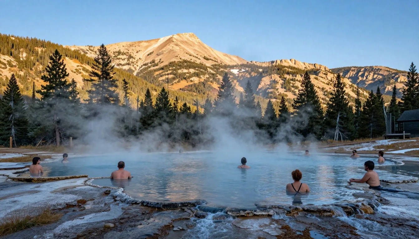
Stretching across 637,174 hectares (1,575,000 acres) of western Colorado’s most dramatic terrain, Uncompahgre National Forest hosts over 500,000 visitors annually who come to experience some of the state’s most pristine wilderness. The forest’s name comes from the Ute word “Uncompahgre,” meaning “red water spring” or “rocks that make water red,” referring to the area’s distinctive mineral-rich hot springs that early inhabitants discovered.
This sprawling forest encompasses six wilderness areas and contains fourteen peaks exceeding 4,267 m (14,000 feet). From the alpine lakes near Ouray to the red rock canyons surrounding Gateway, the landscape shifts dramatically.
Whether you seek challenging mountain trails, peaceful camping beneath towering pines, or thrilling mountain biking adventures, this comprehensive guide reveals everything you need to plan an unforgettable visit to one of Colorado’s most diverse national forests.
Getting There & Planning Your Journey
Reaching Uncompahgre National Forest requires careful planning due to its vast size and multiple access points. The forest stretches across several counties in western Colorado, with different entry areas offering unique experiences.

Closest Airports
Several airports provide access to the Uncompahgre area. Montrose Regional Airport sits just 97 km (60 miles) from the forest’s northern sections and offers daily flights from major cities.
Grand Junction Regional Airport, located 113 km (70 miles) northwest, serves as another convenient gateway with broader flight options. Denver International Airport, though 483 km (300 miles) away, provides the most flight choices and rental car options for visitors planning extended Colorado trips.
Northern Access Points
The towns of Ouray, Ridgway, and Montrose provide excellent northern entry points. These communities offer services and connect to major trailheads via well-maintained forest roads.
Southern Access Points
Telluride and the small town of Norwood serve as southern gateways. The drive from Telluride into the forest offers spectacular mountain scenery along every mile of road.
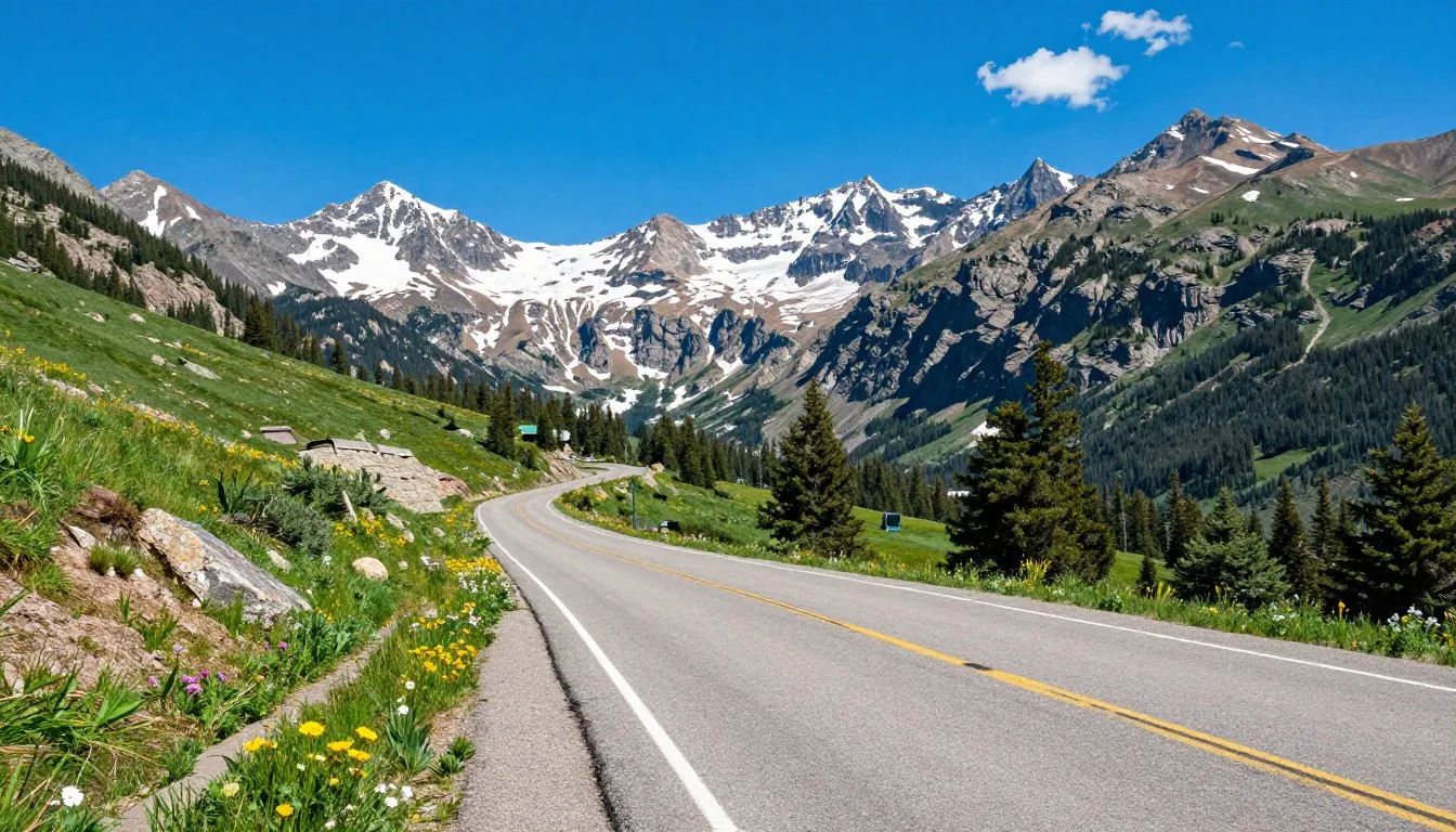
Driving Directions
From Montrose, take Highway 550 south toward Ouray. This scenic route enters the forest within 32 km (20 miles) and provides access to numerous trailheads and camping areas along the way.
From Grand Junction, Highway 141 southwest leads through the Uncompahgre Plateau’s red rock country. This route takes approximately two hours and showcases the forest’s diverse geology and ecosystems.
Uncompahgre National Forest Visitor Information
For current road conditions, trail updates, and forest alerts, contact the main visitor center before your trip.
Best Time to Visit & Weather Tips
Timing your visit to Uncompahgre National Forest dramatically affects your experience. Each season transforms the landscape and determines which areas remain accessible to visitors seeking outdoor adventures.

Best Time to Visit Uncompahgre National Forest
Late June through September offers the most reliable weather and full area access. Summer temperatures range from 21°C to 27°C (70°F to 80°F) at lower elevations, while alpine areas stay cooler at 10°C to 16°C (50°F to 60°F).
September and early October bring stunning fall colors as aspen groves turn golden. Daytime temperatures hover around 16°C to 21°C (60°F to 70°F), perfect for hiking without summer crowds.
Insider Tip: Late September offers the best combination of warm days, cool nights perfect for camping, brilliant fall foliage, and significantly fewer visitors than peak summer months.
Seasons to Avoid
Late October through May brings heavy snow to high elevations. Many forest roads close, and avalanche danger makes backcountry travel extremely hazardous without proper training and equipment.
April and May bring unpredictable “mud season” when snowmelt turns trails into quagmires. Many campgrounds remain closed, and road conditions change rapidly during this transitional period.
Weather Patterns
Summer Weather
Afternoon thunderstorms develop regularly from July through August. Lightning poses serious danger above treeline. Plan summit attempts for early morning hours, descending before noon when storms typically build.
Temperatures can swing 17°C (30°F) between day and night even in summer. Pack layers regardless of warm afternoon forecasts.
Winter Conditions
Winter transforms accessible areas into snow sports paradise. Temperatures drop to -12°C to -7°C (10°F to 20°F), with alpine areas much colder. Some lower elevation areas near Norwood and Gateway remain accessible year-round.
Snowfall accumulates heavily at higher elevations, with annual totals exceeding 762 cm (300 inches) in some areas. Check avalanche forecasts before any winter backcountry travel.

Notable Annual Festivals
The communities surrounding Uncompahgre National Forest celebrate their mountain heritage with festivals that draw visitors from across Colorado. These events showcase local culture and provide unique ways to experience the area beyond standard outdoor recreation.
Ouray Ice Festival
Every January, ice climbers from around the world gather in Ouray for North America’s premier ice climbing competition and festival. The event features competitions, clinics, and gear demos at the world-famous Ouray Ice Park.
Telluride Bluegrass Festival
Late June brings four days of world-class bluegrass music to Telluride. While technically outside the forest, many visitors camp in national forest campgrounds and commute to festival events daily.
Ridgway RidgeFest
This small-town festival in August celebrates mountain living with live music, local food vendors, and outdoor gear vendors. The event serves as a perfect base for exploring nearby forest areas.
Montrose County Fair
August brings traditional county fair activities to Montrose. The event includes rodeo competitions, agricultural exhibits, and carnival rides. Many visitors combine fair attendance with forest camping trips.
Festival Planning: Book accommodations 6-12 months ahead for major events like the Ice Festival and Bluegrass Festival. Campgrounds fill quickly during festival weekends.
Getting Around Locally
Personal vehicles provide the only practical transportation within Uncompahgre National Forest. The forest’s vast size and dispersed attractions make car-free travel essentially impossible for most visitors planning to explore multiple sites.

Vehicle Requirements
High-clearance vehicles handle forest roads better than standard sedans. Many popular destinations require driving on maintained dirt roads that develop washboard surfaces and occasional potholes during summer months.
Four-wheel drive becomes necessary for reaching remote trailheads and dispersed camping areas. Some backcountry roads close to 2WD vehicles but remain passable with proper equipment and driving experience.
Forest Road Conditions
The Forest Service maintains major access roads to passable condition through summer. However, afternoon thunderstorms can wash out sections temporarily. Always check current conditions before venturing onto unfamiliar forest roads.
Paved Access Routes
- Highway 550 (Million Dollar Highway)
- Highway 62 between Ridgway and Placerville
- Highway 145 south from Placerville
- Highway 141 through Unaweep Canyon
Major Dirt Roads
- Owl Creek Pass Road (seasonal)
- Last Dollar Road
- Divide Road
- Big Blue Creek Road
Parking Considerations
Popular trailheads fill early on summer weekends. Arrive before 8 AM to secure parking at Blue Lakes Trail, Wetterhorn Basin, and other heavily visited areas. Overflow parking often extends along roadways near capacity.
Some trailheads require adventure passes or parking fees. Display these clearly on dashboards to avoid citations. Passes are available at visitor centers and many local outdoor shops.
Navigation Tip: Download offline maps before entering the forest. Cell service disappears quickly once you leave main highways. GPS coordinates prove more reliable than street addresses for finding remote locations.
Where to Stay
Accommodation options near Uncompahgre National Forest range from rustic camping beneath towering pines to comfortable hotels in nearby mountain towns. Your choice depends on budget, desired amenities, and preferred level of immersion in wilderness settings.

Camping in Uncompahgre National Forest
The forest offers numerous developed campgrounds with amenities plus unlimited dispersed camping opportunities for those seeking solitude. Developed sites provide picnic tables, fire rings, and vault toilets.
Silver Jack Campground near Cimarron offers 60 sites with spectacular views of the San Juan Mountains. The facility sits at 2,743 m (9,000 feet) elevation and provides easy access to hiking trails and fishing waters.
Beaver Lake Campground features 11 sites near a picturesque alpine lake. This smaller facility fills quickly on weekends but offers peaceful camping experiences away from larger, busier campgrounds.
Campground Reservations
Reserve popular developed campgrounds up to six months in advance through Recreation.gov. First-come sites fill by Thursday for weekend visits.
Dispersed Camping
Free dispersed camping is allowed throughout most of the national forest, following Leave No Trace principles. Camp at least 61 m (200 feet) from water sources and established trails. No facilities exist at dispersed sites.
Popular dispersed camping areas include sections along Last Dollar Road and various spots off Owl Creek Pass Road. These areas offer solitude and spectacular views without campground fees or reservation requirements.

Nearby Towns and Hotels
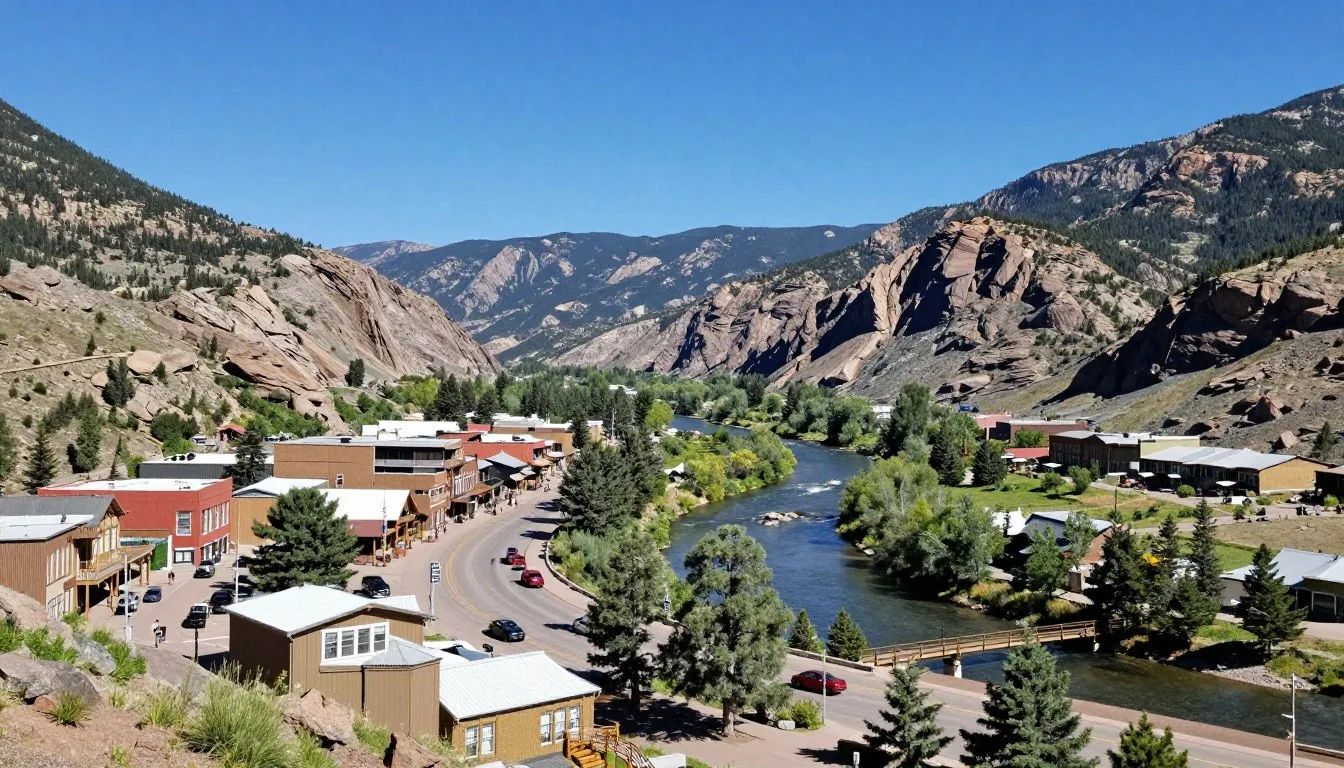
Ouray Lodging
This historic mining town offers charming Victorian hotels and modern resorts. Hot springs pools provide relaxation after long hiking days. Ouray sits just minutes from forest access points.
Ridgway Options
Budget-friendly motels and vacation rentals fill this quiet community north of Ouray. The town provides convenient access to northern forest areas while maintaining affordable pricing.
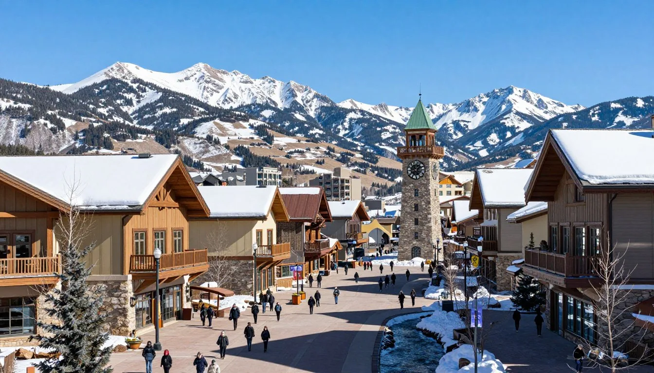
Telluride Resorts
Luxury accommodations and high-end vacation rentals dominate this former mining town turned ski resort. Summer rates drop significantly compared to winter peak season pricing.
Backcountry Cabins
Several historic cabins remain available for overnight rental throughout the forest. Leaf Cabin near Silverton sleeps four people and requires a moderate hike to reach. These rustic shelters provide unique overnight experiences.
Reserve backcountry cabins months ahead, especially for summer weekends. Most lack electricity and running water, requiring visitors to pack in all supplies and pack out all trash.
Dining & Local Cuisine
Communities surrounding Uncompahgre National Forest offer dining options ranging from casual cafes to upscale restaurants featuring locally sourced ingredients. Most visitors combine restaurant meals in nearby towns with camp cooking experiences within the forest itself.

Ouray Dining Scene
Ouray’s Main Street hosts numerous restaurants serving everything from breakfast burritos to fine dining experiences. Local establishments emphasize Colorado ingredients including grass-fed beef and regional produce when available seasonally.
Breakfast spots fill quickly during peak summer months. Arrive early or expect waits exceeding 30 minutes at popular cafes on weekend mornings when hikers fuel up before hitting nearby trails.
Ridgway Restaurants
This smaller community offers several excellent dining choices with shorter waits than Ouray. Local pizza joints and brewpubs provide casual atmospheres perfect for families returning from day adventures in the national forest.
Telluride Food Options
Upscale restaurants dominate Telluride’s dining scene, with prices reflecting the resort town atmosphere. However, several casual options serve quality food at more reasonable prices for budget-conscious travelers exploring the area.
Local Specialties
- Rocky Mountain trout from nearby streams
- Grass-fed Colorado beef burgers
- Craft beer from regional microbreweries
- Green chile breakfast burritos
Grocery Stores
- Full-service supermarkets in Montrose
- Smaller markets in Ouray and Ridgway
- Natural foods stores in Telluride
- Gas station convenience stores along highways
Camp Cooking Essentials
Stock up on groceries in larger towns before entering the forest. Montrose offers the best selection and prices. Smaller mountain communities charge premium prices for limited selections at local markets.
Pack bear-resistant food storage containers for backcountry trips. Black bears actively forage throughout the forest, and proper food storage protects both wildlife and your supplies.
Water Safety: Treat all water from streams and lakes before drinking. Giardia and other parasites exist throughout Colorado wilderness areas. Carry adequate water filtration or purification supplies.
Attractions, Sightseeing & Activities
Uncompahgre National Forest delivers endless opportunities for adventure across its massive area. From towering waterfalls to alpine lakes and challenging peaks, the forest showcases western Colorado’s most spectacular natural features.

Bridal Veil Falls
This stunning 111 m (365 foot) waterfall near Telluride ranks among Colorado’s most photographed waterfalls. A steep trail climbs beside the falls to a historic power plant perched at the top. The round-trip hike covers approximately 3.2 km (2 miles) with significant elevation gain.
Summer flows peak in June and early July when snowmelt feeds the cascade. By late August, flows diminish significantly but the waterfall remains impressive. The trail starts just outside Telluride and enters forest lands quickly.
Blue Lakes Trail
This challenging trail leads to a series of pristine alpine lakes beneath towering peaks. The full hike covers 11.3 km (7 miles) one-way with over 914 m (3,000 feet) of elevation gain, testing even experienced hikers.
Lower Blue Lake sits in a dramatic cirque surrounded by vertical cliffs. Upper Blue Lake requires additional scrambling but rewards determined hikers with even more spectacular scenery. Start early as afternoon thunderstorms develop regularly during summer months.

Mount Sneffels Wilderness
This designated wilderness area within the national forest encompasses 6,880 hectares (17,000 acres) of rugged terrain. Mount Sneffels itself rises to 4,315 m (14,156 feet), attracting peak baggers from across Colorado seeking to summit one of the state’s famous fourteeners.
Numerous trails crisscross the wilderness, offering everything from moderate day hikes to technical mountaineering routes. Yankee Boy Basin provides easier access to stunning wildflower displays and mountain views without requiring summit attempts.
Owl Creek Pass
This scenic mountain pass connects the Cimarron area with Ridgway via a graded dirt road suitable for most vehicles during dry conditions. The pass tops out at 3,231 m (10,600 feet) elevation, providing panoramic views of surrounding peaks.
The drive takes approximately 90 minutes and passes numerous dispersed camping spots and trailheads. Wildflowers bloom spectacularly in July along roadside meadows at higher elevations.
Popular Day Hikes
- Bear Creek Trail (moderate, 9.7 km/6 miles)
- Wetterhorn Basin (challenging, 12.9 km/8 miles)
- Cascade Falls (easy, 2.4 km/1.5 miles)
- Middle Fork Swan River (moderate, 8 km/5 miles)
Scenic Drives
- Last Dollar Road loop
- Alpine Loop Backcountry Byway
- Unaweep Canyon (Highway 141)
- Divide Road to Telluride
Fishing Opportunities
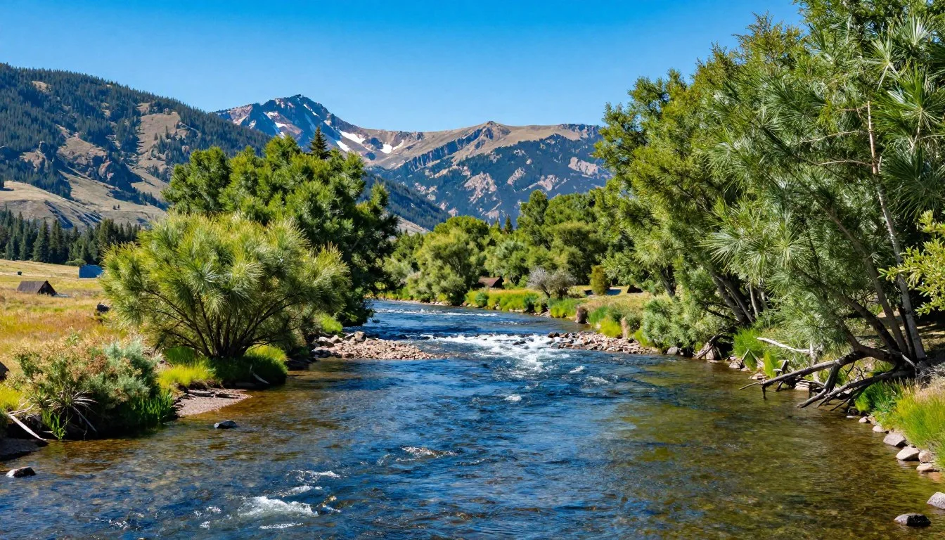
Streams and lakes throughout the forest hold healthy populations of trout. The Cimarron River and Silver Jack Reservoir provide excellent fishing for rainbow and brown trout. High alpine lakes require hiking but offer solitude and willing cutthroat trout.
Colorado fishing licenses are required for anyone over 16 years old. Purchase licenses online or at local sporting goods stores before fishing. Regulations vary by water body, so check current rules before casting.

Museums, Cultural Spots & Festivals
The region surrounding Uncompahgre National Forest preserves rich mining heritage and Native American history. Several museums and cultural sites help visitors understand the area’s fascinating past before white settlement and during the mining boom era.
Ouray County Museum
This small museum in downtown Ouray displays mining artifacts, vintage photographs, and exhibits explaining the region’s development. The museum occupies a historic building that once served as a hospital for injured miners working surrounding claims.
Admission costs remain nominal, and visits typically require 45-60 minutes. The museum provides excellent context for understanding the ghost towns and abandoned mines visitors encounter while exploring forest backroads.
Ridgway Railroad Museum
Railroad history shaped regional development during the late 1800s. This museum preserves that heritage with vintage rolling stock and detailed exhibits. The outdoor display includes several restored railroad cars visitors can board and explore.
Ute Indian Museum
Located in Montrose, this museum preserves and interprets Ute culture and history. The Ute people inhabited these lands for centuries before European settlement. Exhibits include traditional artifacts, contemporary art, and educational programs about Ute life and traditions.

Ghost Towns
Numerous abandoned mining settlements dot the landscape within and near the national forest. These ghost towns offer fascinating glimpses into boom-and-bust mining history. Exercise caution around unstable structures, and never enter old mine shafts.
Alta Lakes ghost town near Telluride features several preserved buildings accessible via moderate hikes. The site sits among beautiful alpine lakes, combining historical interest with scenic beauty for photographers and history enthusiasts.
Cultural Events
Summer brings outdoor concerts and cultural events to nearby communities. Ouray hosts free concerts in Fellin Park throughout summer. These events showcase regional musicians and provide family-friendly entertainment after days spent exploring the forest.
Nature & Outdoor Experiences
Uncompahgre National Forest serves as a premier destination for outdoor enthusiasts seeking adventure in one of Colorado’s most diverse landscapes. Activities span all skill levels from casual nature viewing to extreme technical climbing challenges.

Hiking Trails
Over 805 km (500 miles) of trails wind through the national forest, ranging from easy nature walks to grueling climbs testing the fittest adventurers. Trail conditions vary significantly based on elevation and recent weather patterns.
Lower elevation trails near Norwood and along Unaweep Canyon remain accessible from April through November. High alpine trails typically don’t clear of snow until late June or early July, with accumulation returning by late September.
Trail Etiquette: Yield to uphill hikers, stay on established paths to prevent erosion, and pack out all trash. Popular trails experience heavy use—practice Leave No Trace principles to preserve wilderness quality.
Mountain Biking
The forest offers world-class mountain biking on designated trails and forest roads. Some of Colorado’s most famous routes traverse the area, attracting riders from around the world seeking challenging terrain and spectacular views.
The Ridgway area provides numerous intermediate trails perfect for families and newer riders. More advanced bikers tackle technical singletrack in the Telluride area or test their endurance on long backcountry loops.

Rock Climbing
Numerous climbing areas within the forest challenge climbers of all abilities. Established routes range from beginner-friendly sport climbs to extreme multi-pitch traditional routes requiring advanced skills and equipment.
The Telluride area hosts several popular climbing zones. Routes are well-documented in regional climbing guidebooks available at outdoor shops in nearby towns. Always practice proper safety protocols and consider hiring guides for unfamiliar terrain.
Wildlife Viewing
The forest supports diverse wildlife populations. Elk congregate in large herds during fall rutting season, creating dramatic bugling sounds echoing through valleys. Mule deer browse throughout lower elevation areas year-round.
Black bears actively forage during summer months, especially near water sources and berry patches. Observe from safe distances and never approach or feed wild animals. Carry bear spray in backcountry areas for added safety.
Common Wildlife
- Rocky Mountain elk
- Mule deer and occasional whitetail deer
- Black bears throughout forest areas
- Mountain lions (rarely seen)
- Bighorn sheep on rocky slopes
Bird Species
- Golden eagles soaring above ridges
- Peregrine falcons on cliff faces
- Various hawk species
- Mountain bluebirds in meadows
- Multiple hummingbird species

Photography Opportunities
The forest ranks among Colorado’s most photogenic destinations. Dramatic peaks, pristine lakes, abundant wildlife, and seasonal wildflower displays create endless opportunities for capturing stunning images throughout the year.
Autumn delivers spectacular aspen colors, typically peaking between mid-September and early October. Golden groves contrast beautifully against evergreen forests and rocky peaks, attracting photographers from across the country during this brief window.
Backcountry Camping
Experienced backpackers find unlimited opportunities for multi-day trips into remote wilderness areas. Several designated wilderness zones within the forest prohibit motorized access, ensuring quiet solitude for properly equipped adventurers.
Plan carefully for backcountry trips. Carry appropriate gear for rapidly changing mountain weather, navigate using maps and compass or GPS, and inform someone of your planned route and expected return time before departing.

Water Activities
Alpine lakes and reservoirs offer opportunities for non-motorized boating. Several small lakes accommodate kayaking and stand-up paddleboarding during summer months. Water temperatures remain cold year-round due to high elevation and snowmelt sources.
Silver Jack Reservoir permits boating and is accessible via maintained roads. The reservoir sits at high elevation, providing scenic paddling with mountain views. Launch facilities remain basic but adequate for small watercraft.

Winter Recreation
Snow transforms accessible areas into winter playgrounds for cross-country skiing, snowshoeing, and snowmobiling. Designated routes accommodate each activity type, separating different users for safety and enjoyment.
Avalanche danger increases significantly during winter months. Obtain proper training, carry safety equipment, and check daily avalanche forecasts before venturing into backcountry areas during snow season.
Travel With Children
Families discover countless ways to introduce children to mountain wilderness within Uncompahgre National Forest. Shorter trails, developed campgrounds with amenities, and scenic drives provide options suitable for various ages and energy levels.

Family-Friendly Trails
Cascade Falls Trail offers an easy 2.4 km (1.5 mile) round trip perfect for families with young children. The well-maintained path leads to a beautiful waterfall with minimal elevation gain, allowing even small hikers to complete the journey successfully.
Bear Creek Falls near Ouray provides another excellent family option. The short trail leads to a viewing platform overlooking the impressive cascade. The path remains gentle enough for children while delivering rewarding scenery.
Junior Ranger Programs
Children can participate in Junior Ranger activities through visitor centers. These educational programs teach forest ecology, safety principles, and Leave No Trace ethics while kids complete fun activities earning badges and certificates.
Campground Activities
Developed campgrounds provide safe environments where children can explore under supervision. Nature scavenger hunts, campfire programs, and simple explorations of nearby streams occupy young adventurers while parents relax at campsites.
Kid-Appropriate Activities
- Stream splashing and rock skipping
- Wildlife spotting with binoculars
- Nature photography walks
- Star gazing on clear nights
- Simple fishing at stocked lakes
Safety Considerations
- Stay on established trails
- Supervise near water constantly
- Teach wildlife safety rules
- Pack extra layers for children
- Bring high-energy snacks
Educational Opportunities
Forest visits provide excellent learning experiences. Children discover mountain ecosystems, learn wilderness skills, and develop appreciation for nature conservation. Many families find these trips create lasting memories and inspire lifelong outdoor interests.
Altitude Awareness: Children may experience altitude effects above 2,438 m (8,000 feet). Plan shorter activities for first days, ensure adequate hydration, and watch for symptoms like unusual tiredness or headaches.

Money Saving Tips
Visiting Uncompahgre National Forest can fit various budgets with strategic planning. The forest itself charges no entrance fees, and numerous free or low-cost options exist for lodging, activities, and dining during your mountain adventure.
Free Activities
Hiking costs nothing beyond initial gear investment. Hundreds of trails offer free access to spectacular scenery, waterfalls, and alpine lakes. Scenic drives showcase mountain landscapes without requiring any fees or special permits.
Dispersed camping eliminates accommodation costs entirely. Thousands of acres remain open for free camping following basic regulations. This option saves hundreds of dollars compared to hotel rates in nearby resort towns.
Reduce Accommodation Costs
Developed campground fees range from $15-30 per night, dramatically cheaper than hotel rooms costing $150-300 in peak season. Silver Jack Campground and other forest sites provide excellent value with beautiful settings and basic amenities.
Consider staying in Ridgway rather than expensive Telluride or Ouray. This practical community offers lower lodging rates while maintaining convenient access to forest areas. The 20-minute drive saves significant money over multiple nights.
Budget Strategies
- Cook meals at campsites instead of restaurants
- Visit during shoulder season for lower rates
- Purchase groceries in Montrose before entering area
- Use free dispersed camping sites
- Bring your own recreation equipment
Free Entertainment
- Wildlife watching requires no fees
- Forest Service visitor centers offer free exhibits
- Wildflower viewing during peak seasons
- Photography at countless scenic locations
- Swimming in lakes and streams
Equipment Considerations
Rent specialized equipment in nearby towns rather than purchasing for single trips. Several outdoor shops rent camping gear, mountain bikes, fishing equipment, and other supplies at daily or weekly rates.
Share costs with friends or family by coordinating group trips. Split gas, camping fees, and grocery expenses across multiple people, significantly reducing per-person costs while enhancing the social experience.
Annual Pass Value: If visiting multiple national forests or parks during your Colorado trip, purchase an America the Beautiful annual pass for $80. This pass covers entrance fees at all federal recreation sites nationwide.
Dining Savings
Pack coolers with groceries from home or purchased at big-box stores in Montrose. Preparing your own meals saves substantially compared to restaurant dining. Simple camp meals cost a fraction of restaurant prices in expensive mountain towns.
Many trailheads and picnic areas provide tables and basic facilities for free day use. Pack lunches and enjoy meals with spectacular views rather than paying premium prices at limited food services within the area.
Safety & Local Customs
Mountain wilderness demands respect and preparation. Understanding potential hazards and appropriate responses keeps visitors safe while exploring Uncompahgre National Forest’s diverse terrain and unpredictable weather patterns.

Altitude Considerations
Most forest areas sit above 2,438 m (8,000 feet) elevation, with many trails climbing above 3,048 m (10,000 feet). Altitude affects everyone differently. Symptoms include headaches, nausea, dizziness, and unusual fatigue.
Acclimatize gradually by spending first days at lower elevations before attempting high-altitude hikes. Drink extra water, avoid alcohol initially, and recognize when symptoms require descending to lower elevations for recovery.
Weather Hazards
Afternoon thunderstorms develop rapidly during summer months. Lightning strikes pose serious danger above treeline. Start early, summit by noon, and descend immediately when storms approach. Never shelter under isolated trees during lightning activity.
Temperature swings exceed 17°C (30°F) between day and night even during summer. Hypothermia threatens unprepared hikers caught by weather changes. Always pack extra layers regardless of warm departure conditions.
Emergency Contact Information
For emergencies within the national forest, contact emergency services immediately. Cell service is limited—consider carrying a satellite communication device for remote areas.
Wildlife Safety
Black bears actively forage throughout summer and fall. Store food properly in bear-resistant containers or vehicles. Never leave food or scented items in tents. If encountering bears, remain calm, speak quietly, and back away slowly without running.
Mountain lions inhabit the forest but rarely appear near humans. If encountering a lion, maintain eye contact, appear large by raising arms, and back away slowly. Never run, as this triggers predatory instincts.
Trail Safety
Stay on established trails to prevent getting lost and minimize environmental impact. Cutting switchbacks causes erosion and creates dangerous shortcuts. Carry maps, know your route, and turn back if conditions exceed your abilities.
Inform someone of your plans before departing, including expected return time. Many accidents occur when solo hikers encounter problems with no one aware of their location or schedule.
Essential Safety Items
- Navigation tools (map, compass, GPS)
- Extra food and water beyond planned needs
- Additional clothing layers and rain gear
- First aid supplies and emergency shelter
- Headlamp with extra batteries
Local Customs
- Practice Leave No Trace principles
- Yield trail to uphill hikers
- Keep dogs leashed on trails
- Respect private property boundaries
- Support local businesses in gateway communities
Water Safety
Mountain streams appear pristine but contain harmful parasites including giardia. Always treat water before drinking using filtration, purification tablets, or boiling. Even crystal-clear streams at high elevations require treatment.
Stream crossings pose hazards during high water from snowmelt. Swift current can sweep even strong adults downstream. Cross early morning when flows run lowest, unbuckle pack waist straps, and use trekking poles for stability.
Cell Phone Limitations: Cell service disappears quickly outside towns and main highways. Download offline maps, carry paper maps as backup, and never rely solely on phone navigation in wilderness areas.
Vehicle Safety
Lock vehicles at trailheads and avoid leaving valuables visible. Break-ins occur occasionally at popular locations. Store everything in trunk or covered cargo areas before reaching parking areas.
Four-wheel drive roads require appropriate vehicles and driving skills. Inexperienced drivers attempting challenging routes risk getting stuck, causing damage, or creating dangerous situations requiring expensive rescue operations.
Visitor Comments About Uncompahgre National Forest
Travelers consistently praise Uncompahgre National Forest for its diverse landscapes and abundant recreation opportunities. Here’s what recent visitors shared about their experiences exploring this magnificent Colorado wilderness area.
“The variety amazed us most. We started the week in red rock canyons and ended camping beside alpine lakes surrounded by towering peaks. Every day brought completely different scenery. The Blue Lakes Trail challenged us but delivered the most spectacular mountain views we’ve ever experienced. We’re already planning our return trip.”
“Our family discovered perfect trails for our children ages 7 and 10. The Cascade Falls hike gave them confidence for longer adventures later in the week. Camping at Silver Jack Campground provided great amenities while maintaining that wilderness feeling. The stars at night were absolutely incredible. Our kids talk about this trip constantly.”
“As a photographer, I found endless subjects throughout the forest. Sunrise at Blue Lakes, afternoon light on the Sneffels Range, and golden aspens in September exceeded my expectations. The dispersed camping allowed me to position near perfect sunrise locations. I captured portfolio pieces I’ll treasure forever.”

Additional Nearby Destinations
Exploring beyond Uncompahgre National Forest reveals additional spectacular destinations within easy driving distance. These neighboring areas complement a forest-focused trip while showcasing different aspects of western Colorado’s diverse landscapes.
Black Canyon of the Gunnison National Park
This dramatic canyon lies approximately 64 km (40 miles) from northern forest access points. Sheer walls plunge 610 m (2,000 feet) to the Gunnison River below, creating one of America’s most impressive gorges.
The South Rim Road provides easy access to numerous overlooks. More adventurous visitors tackle the challenging inner canyon routes requiring permits and advanced outdoor skills. The park charges entrance fees but offers excellent value for dramatic scenery.
Grand Mesa National Forest
The world’s largest flat-topped mountain sits northeast of Uncompahgre National Forest. Grand Mesa hosts over 300 lakes scattered across its forested plateau, creating unique fishing and camping opportunities different from mountain terrain.
The area offers excellent fall color viewing and winter recreation including snowmobiling and Nordic skiing. Summer temperatures run cooler than surrounding lowlands, providing escape from valley heat.

Mesa Verde National Park
Ancient cliff dwellings constructed by ancestral Puebloan people occupy alcoves in spectacular canyon walls approximately 177 km (110 miles) southwest of the forest. This UNESCO World Heritage Site preserves remarkable archaeological treasures.
Guided tours lead visitors into famous dwellings including Cliff Palace and Balcony House. The park requires several hours minimum for meaningful visits. Consider overnight stays in nearby Cortez or Durango to fully experience the area.
Gunnison National Forest
Administratively combined with Uncompahgre under joint management, Gunnison National Forest adjoins to the east. The forest encompasses the Fossil Ridge Wilderness and portions of the Sawatch Range hosting multiple fourteeners.
Taylor Reservoir and Blue Mesa Reservoir provide water-based recreation including boating, fishing, and lakeside camping. These larger bodies of water contrast with smaller alpine lakes within Uncompahgre proper.
Mountain Towns Worth Visiting
- Crested Butte (stunning scenery, mountain culture)
- Silverton (historic mining town, narrow gauge railroad)
- Durango (larger town, diverse dining and lodging)
- Gunnison (practical services, fishing access)
Other Natural Areas
- Lizard Head Wilderness (challenging peaks)
- Curecanti National Recreation Area (reservoirs)
- San Juan Skyway (scenic driving route)
- Colorado National Monument (red rock formations)
San Juan Mountains
Uncompahgre National Forest occupies the northern San Juan Mountains, but the range extends south encompassing additional wilderness and mining history. The San Juan Skyway scenic byway loops through the region, connecting historic towns and providing constantly changing mountain vistas.
This 381 km (237 mile) paved loop ranks among America’s most scenic drives. Plan a full day minimum, or better yet, multiple days with overnight stops in various mountain communities along the route.
Practical Travel Tips
Successful trips to Uncompahgre National Forest require attention to practical details often overlooked during initial planning. These insider tips help visitors avoid common mistakes and enhance their mountain experiences.

Packing Essentials
Layer clothing rather than packing heavy jackets. Temperatures fluctuate dramatically between morning and afternoon. Multiple thin layers provide better temperature regulation than single heavy items while packing more efficiently.
Sunscreen and lip balm rank among most-forgotten items. High altitude increases UV exposure significantly. Apply sunscreen liberally and reapply frequently, even on cloudy days. Sunburn occurs quickly at elevations above 2,743 m (9,000 feet).
Vehicle Preparation
Fill gas tanks in towns before entering remote forest areas. Gas stations become sparse outside population centers. Running out of fuel on forest roads creates serious problems requiring expensive assistance.
Check tire pressure and tread before tackling dirt roads. Rough surfaces accelerate tire wear and increase puncture risk. Carry a working spare tire and know how to change it before venturing onto backcountry routes.
Important Contacts
Save these numbers before losing cell service:
- Forest Service Office
- Local emergency services
- Accommodation providers
- Vehicle roadside assistance
- Travel companions’ numbers
Must-Have Items
- Paper maps as cell backup
- Water filtration equipment
- Headlamp with extra batteries
- Multi-tool or knife
- Emergency whistle
Photography Tips
Golden hour lighting (first hour after sunrise and last hour before sunset) produces best mountain photography. Set alarms for early wake-ups and plan evening shoots. Midday harsh light creates unflattering images compared to soft morning and evening illumination.
Bring extra memory cards and batteries. Cold temperatures drain batteries faster than normal. Keep spare batteries warm in pockets and swap them into cameras as needed throughout cold mornings.
Hydration Strategy
Drink more water than seems necessary. Altitude and physical exertion increase hydration needs significantly. Dark urine indicates dehydration. Aim for clear to pale yellow coloring throughout the day.
Carry water bottles even on short hikes. Stopping frequently for small sips maintains better hydration than drinking large amounts less often. Consider hydration bladders for hands-free drinking on longer trail adventures.
Current Conditions & Alerts
Check current forest conditions, fire restrictions, and road closures before your visit. Conditions change rapidly, especially during spring and fall transition periods.
Leave No Trace Principles
Pack out everything you pack in, including toilet paper. Bury human waste at least 61 m (200 feet) from water sources in holes 15-20 cm (6-8 inches) deep. Many areas now require packing out all waste in designated bags.
Stay on established trails even when muddy or snowy. Cutting trails creates erosion and damages fragile alpine vegetation requiring decades to recover. Walk through mud rather than around it, wearing appropriate waterproof footwear.
Wildlife Etiquette
Observe animals from safe distances using binoculars or telephoto lenses. Approaching wildlife stresses animals and creates dangerous situations. Never feed any wild creatures, as this habituates them to humans and often leads to animal deaths.
Keep dogs leashed on trails. Unleashed dogs chase wildlife, disturb other visitors, and sometimes get injured or lost. Many areas specifically require leashes due to wildlife sensitivity.

Connectivity Expectations
Accept limited connectivity as part of the wilderness experience. Cell service exists only near towns and major highways. This disconnection from constant digital contact often becomes favorite aspects of forest visits for many travelers.
Download offline entertainment, maps, and guidebooks before losing service. Inform family and friends you’ll be unreachable during specific periods to avoid concerns about communication gaps.
Seasonal Considerations
Spring visits require flexible planning due to unpredictable snow conditions and road closures. Have backup plans for activities and destinations. Some years see late snow affecting June accessibility while other years clear early.
Fall offers spectacular colors but brings colder nights requiring better sleeping bags and warmer clothing. Days remain pleasant, but temperatures drop rapidly after sunset. Plan accordingly with appropriate gear for temperature swings.
Your Uncompahgre Adventure Awaits
Uncompahgre National Forest delivers authentic Colorado mountain experiences across its vast and varied landscape. From challenging fourteener summits to gentle waterfall walks, from primitive backcountry camping to comfortable developed campgrounds, this remarkable forest accommodates every skill level and adventure style.
The forest’s remarkable diversity means you could visit repeatedly and discover new trails, hidden lakes, and spectacular viewpoints each time. Whether you seek solitude in remote wilderness areas or prefer popular trails with fellow outdoor enthusiasts, the national forest provides exactly the mountain experience you desire.

Start planning your journey today. Research trails matching your fitness level, reserve campsites for peak season visits, and prepare proper gear for mountain conditions. The stunning landscapes, fresh mountain air, and sense of accomplishment from wilderness exploration create memories lasting far beyond your visit.
The San Juan Mountains await your discovery. Pack your bags, fill your water bottles, and point your vehicle toward western Colorado’s most spectacular national forest. Adventure, beauty, and wilderness experiences beyond imagination wait among the peaks, valleys, and forests of Uncompahgre.