Hotels by Trip.com
Flights by Trip.com
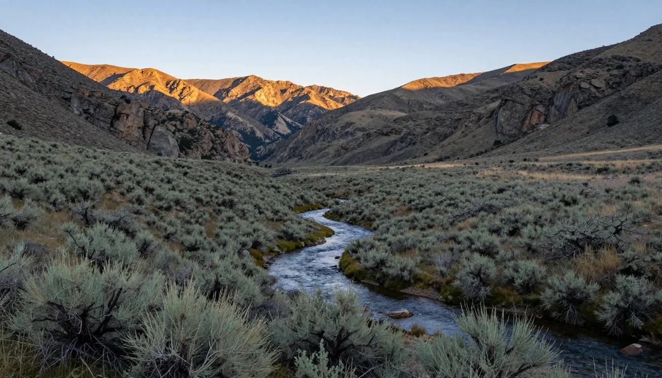
Spanning an astounding 2.5 million acres across Nevada and eastern California, the Humboldt-Toiyabe National Forest stands as the largest national forest in the lower 48 states. Yet despite its massive size, this wilderness wonderland remains one of the least-visited national forests in America.
The high country roads weaving through this extraordinary landscape offer access to some of the most pristine wilderness areas in the West. These routes traverse everything from alpine meadows to desert valleys, connecting remote mountain ranges that rise dramatically from the Great Basin floor.
This guide unlocks the secrets of exploring the Humboldt-Toiyabe High Country Roads. You’ll discover hidden peaks, wilderness trails, and practical planning tips for an unforgettable Nevada adventure.
Getting There & Planning Your Journey

The Humboldt-Toiyabe National Forest encompasses scattered mountain ranges across Nevada. Planning your approach depends on which section of the forest you want to explore.
Closest Airports
Several airports provide access to different sections of the Humboldt-Toiyabe National Forest:
- Reno-Tahoe International Airport (RNO) – Best for accessing the Mount Rose Wilderness and Sierra Nevada sections, located 11 km (7 miles) southeast of downtown Reno
- Elko Regional Airport (EKO) – Ideal for Ruby Mountains access, located 5 km (3 miles) southwest of Elko
- Las Vegas McCarran International Airport (LAS) – Convenient for southern wilderness areas, located 8 km (5 miles) south of downtown Las Vegas
From these airports, you’ll need a rental vehicle. High-clearance vehicles are recommended for backcountry roads. Four-wheel drive becomes essential during spring runoff and after summer thunderstorms.
Ranger District Contacts
Contact the appropriate ranger district before your visit for current road conditions and permit requirements:
Best Time to Visit & Weather Tips

Recommended Months
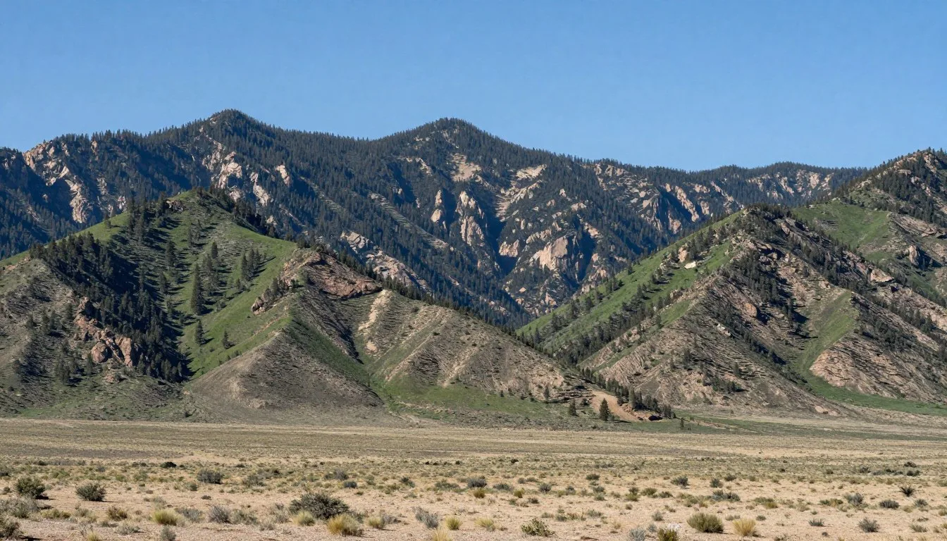
June through September offers the most reliable access to high country roads in the Humboldt-Toiyabe National Forest. July and August provide peak conditions for hiking and camping in the wilderness areas.
Late September and early October deliver spectacular fall colors in mountain ranges like the Ruby Mountains. Aspen groves transform into golden blankets against granite peaks.
Winter transforms the area into a snow sports paradise. December through March attracts snowshoers and cross-country skiers to lower elevation trails.
Months to Avoid
April and May bring unpredictable conditions. Snowmelt makes many high country roads impassable. Spring runoff can turn streams into raging torrents.
Late October through November sees early winter storms. These can dump heavy snow at higher elevations with little warning.
Weather Patterns
Summer Conditions
Expect warm days with temperatures ranging from 21°C to 29°C (70°F to 85°F) in valleys. High elevations stay cooler at 13°C to 21°C (55°F to 70°F).
✓ Check 30,000+ Local Sightseeing Tours Worldwide
- Afternoon thunderstorms develop frequently
- Start hikes early to avoid lightning risk
- Carry rain gear despite sunny mornings
- UV radiation intensifies at higher elevations
Winter Conditions
Winter temperatures plunge to -12°C to 4°C (10°F to 40°F) at lower elevations. Mountain summits experience arctic conditions well below freezing.
- Snow accumulation exceeds 3 m (10 feet) in some areas
- Roads close from November through May
- Avalanche danger exists in steep terrain
- Check weather forecasts daily
Spring Conditions
Spring brings volatile weather with temperatures fluctuating between -1°C and 18°C (30°F and 65°F). Conditions change rapidly throughout the day.
- Snow lingers at elevations above 2,400 m (8,000 feet)
- Mud season makes roads treacherous
- Wildflowers begin blooming at lower elevations
- Wildlife becomes more active
Fall Conditions
Autumn delivers crisp temperatures from 7°C to 21°C (45°F to 70°F). Nights turn cold quickly as September transitions to October.
- First snow arrives at high elevations by late September
- Crowds diminish significantly
- Aspen groves display brilliant gold colors
- Hunting season begins in some areas
Getting Around Locally

The Humboldt-Toiyabe National Forest covers such vast territory that getting around requires careful planning. No public transportation serves the remote wilderness areas.
Vehicle Requirements
High country roads demand appropriate vehicles. Standard passenger cars work fine on main paved routes. However, accessing trailheads and wilderness areas requires high-clearance vehicles.
Four-wheel drive becomes necessary on many forest roads. These unpaved routes cross streams, climb steep grades, and navigate loose rock. Check with ranger districts about current road conditions before departing.
Road Conditions
Paved highways connect major towns around the forest perimeter. State Route 488 provides paved access to Lamoille Canyon in the Ruby Mountains. The Mount Rose Highway offers paved passage to high elevations near Lake Tahoe.
Unpaved forest roads range from well-maintained gravel to rough two-track trails. Some require aggressive tire tread and substantial ground clearance. Water crossings appear frequently on backcountry routes.
Navigation Tips
Cell phone coverage disappears in most wilderness areas. Download offline maps before leaving civilization. GPS units provide reliable navigation backup.
Carry detailed forest maps from ranger districts. These show road numbers, campgrounds, and trailheads. Many high country roads lack signs at intersections.
Where to Stay

Lodging options around the Humboldt-Toiyabe National Forest range from primitive camping to comfortable hotels in gateway towns.
Camping Options
The forest contains numerous developed campgrounds with basic amenities. Thomas Canyon Campground in the Ruby Mountains offers 40 sites at 2,073 m (6,800 feet) elevation. Sites include picnic tables and fire rings.
Dispersed camping is permitted throughout most of the national forest. Camp at least 61 m (200 feet) from water sources. Practice Leave No Trace principles in all wilderness areas.
Some designated wilderness areas require permits for overnight stays. Contact ranger districts for permit information and availability.
Gateway Towns
Elko serves as the primary base for exploring the Ruby Mountains section. The town offers hotels, restaurants, and outdoor gear shops. Located 35 km (22 miles) from Lamoille Canyon, Elko provides convenient access.
Reno and Carson City provide lodging for visitors to the Mount Rose Wilderness and Sierra Nevada sections. These cities offer full amenities including major hotel chains and vacation rentals.
Las Vegas serves visitors to southern portions of the Humboldt-Toiyabe National Forest. The Spring Mountains rise just 40 km (25 miles) northwest of the Las Vegas Strip.
Reservation Timing
Book campgrounds six months in advance for peak summer weekends. Popular sites like those in Lamoille Canyon fill quickly for July and August visits.
Gateway town hotels require advance booking during major events. Elko’s National Cowboy Poetry Gathering in January attracts thousands of visitors.
Dining & Local Cuisine

Dining options in the Humboldt-Toiyabe area reflect Nevada’s ranching heritage and Basque cultural influences.
Basque Cuisine
Elko and surrounding towns feature authentic Basque restaurants. These family-style establishments serve multi-course meals at communal tables. Expect dishes like paella, chorizo, and lamb stew.
The Star Hotel in Elko has served Basque food since 1910. Meals include soup, salad, beans, French fries, vegetables, and a main protein course.
Local Specialties
Nevada beef appears on menus throughout the region. Locally raised cattle graze on high desert ranches. Steakhouses in Elko and Reno serve excellent cuts.
Wild game dishes appear seasonally. Elk, deer, and antelope come from surrounding mountains and valleys. Some restaurants feature these proteins when available.
Trail Food Planning
No restaurants or food services exist within wilderness areas. Pack all food for backcountry trips. Gateway towns have full grocery stores for stocking up.
Bear canisters are recommended for overnight trips in some areas. Store food properly to avoid attracting wildlife to campsites.
Attractions, Sightseeing & Activities

Scenic Drives
The Lamoille Canyon Scenic Byway ranks among Nevada’s most spectacular drives. This paved 19 km (12 mile) route climbs 1,067 m (3,500 feet) through glacier-carved canyon walls. The road terminates at 2,621 m (8,600 feet) elevation.
The Mount Rose Highway traverses the Carson Range between Reno and Lake Tahoe. This route crosses the Mount Rose Wilderness at 2,637 m (8,652 feet), offering panoramic views of the Sierra Nevada.
Photography Locations
Island Lake in the Ruby Mountains provides stunning reflections of glacier-polished peaks. The 6 km (4 mile) trail leads to this alpine gem at 2,926 m (9,600 feet) elevation.
The Tahoe Rim Trail offers countless photo opportunities. This 274 km (170 mile) route circles Lake Tahoe, with sections passing through the Humboldt-Toiyabe National Forest.

Wildlife Viewing
Mountain goats inhabit the Ruby Mountains above treeline. These white ungulates navigate impossibly steep cliffs with ease. Bring binoculars for distant viewing.
Mule deer appear throughout the forest at dawn and dusk. Elk herds roam higher elevations during summer months. Black bears occasionally wander through camps searching for food.
Bighorn sheep live in several mountain ranges within the Humboldt-Toiyabe National Forest. The Desert National Wildlife Range to the south hosts significant populations.
Museums, Cultural Spots & Festivals

Historical Sites
The California National Historic Trail crosses portions of the Humboldt-Toiyabe National Forest. Wagon ruts from the 1840s remain visible in some locations. Interpretive sites explain the arduous journey emigrants endured.
Old mining camps dot the landscape. These ghost towns from Nevada’s silver boom tell stories of frontier life. Always respect private property and stay safe around abandoned structures.
Cultural Centers
The Western Folklife Center in Elko preserves Great Basin cultural traditions. This museum hosts year-round exhibits about ranching, mining, and Basque heritage. Programs include workshops and performances.
The National Automobile Museum in Reno displays over 200 vintage cars. While not directly related to the forest, it offers excellent rainy-day entertainment in this gateway city.
Annual Events
The National Cowboy Poetry Gathering occurs each January in Elko. This week-long celebration attracts poets, musicians, and storytellers from across the West. Attendance exceeds 8,000 visitors annually.
Ruby Mountain Balloon Festival launches each July. Hot air balloons rise against the dramatic mountain backdrop. The event includes music and local food vendors.
Nature & Outdoor Experiences

Hiking Trails
The Ruby Crest Trail ranks as one of America’s premier high-country backpacking routes. This 64 km (40 mile) trail traverses the Ruby Mountains crest. Elevations range from 2,438 m to 3,353 m (8,000 to 11,000 feet).
Expect alpine lakes, glacier-carved valleys, and expansive summit views. The trail passes through designated wilderness areas with limited visitation. Complete the route in 3 to 5 days.
The Mount Rose Summit Trail climbs 3 km (1.8 miles) to the mountain’s 3,285 m (10,776 foot) summit. This popular day hike offers 360-degree views spanning Lake Tahoe to the Great Basin.

Peak Climbing
Boundary Peak stands as Nevada’s highest summit at 4,007 m (13,147 feet). Located in the White Mountains section of the Humboldt-Toiyabe National Forest, this peak requires a strenuous 13 km (8 mile) round-trip hike.
Ruby Dome reaches 3,471 m (11,388 feet) in the Ruby Mountains. Several routes access the summit, ranging from moderate scrambles to technical rock climbs.
Mount Rose towers over Reno at 3,285 m (10,776 feet). The maintained trail to its summit attracts hundreds of hikers during summer weekends. Start early to beat afternoon thunderstorms.
Rock Climbing
The Ruby Mountains offer excellent granite climbing. Routes range from beginner-friendly slabs to challenging multi-pitch walls. Liberty Pass area features numerous established routes.
The Mount Rose Wilderness contains quality rock near the Tahoe Rim Trail. Climbers find both sport and traditional routes on solid granite formations.

Mountain Biking
Extensive forest road networks provide endless biking opportunities. The Ophir Creek Trail offers 10 km (6 miles) of singletrack through pine forests near Lake Tahoe.
Ruby Mountains foothills contain numerous trails open to mountain biking. Check ranger district regulations, as designated wilderness areas prohibit bikes on trails.
Water Activities
Alpine lakes throughout the forest offer fishing opportunities. Ruby Crest Trail passes several lakes stocked with trout. Nevada fishing licenses are required.
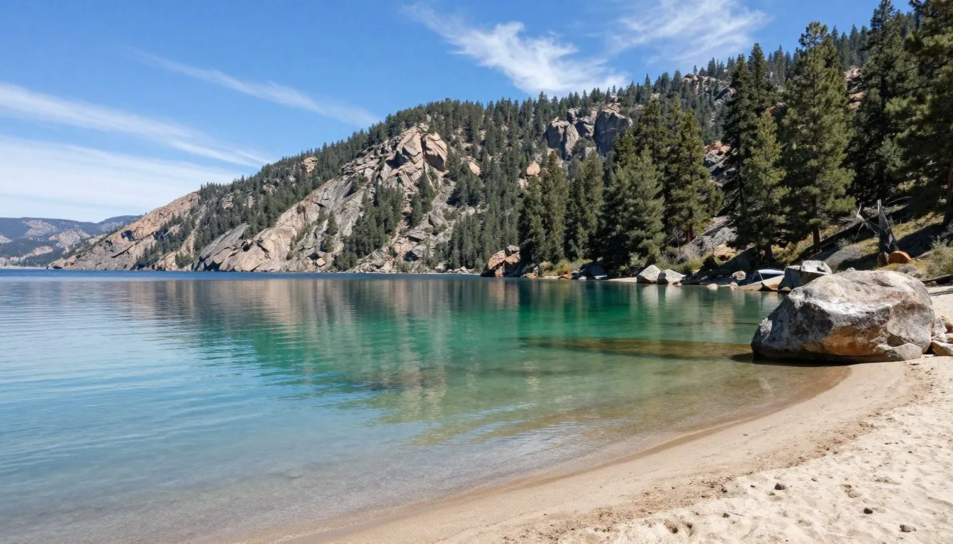
Lake Tahoe borders the northwestern section of the Humboldt-Toiyabe National Forest. Kayaking and paddleboarding thrive in protected coves along the eastern shore.

Winter Recreation
Cross-country skiing opportunities abound once snow blankets the high country. The Tahoe Rim Trail becomes a winter wonderland for backcountry skiers.
Snowshoeing provides access to frozen landscapes. Many summer hiking trails transform into excellent snowshoe routes. Avalanche awareness becomes critical in steep terrain.
Mount Rose Ski Resort operates on forest land near the wilderness area. This resort offers downhill skiing and snowboarding with stunning Lake Tahoe views.
Safety, Etiquette & Local Customs

Wilderness Safety
Altitude sickness affects many visitors to high elevations. Ascend gradually to allow acclimatization. Drink extra water and avoid alcohol during the first 24 hours above 2,438 m (8,000 feet).
Afternoon thunderstorms develop rapidly during summer months. Lightning poses serious danger on exposed peaks and ridges. Descend from summits by noon to avoid storms.
Carry the ten essentials on every hike. Include navigation tools, sun protection, insulation, illumination, first aid, fire starter, repair kit, nutrition, hydration, and emergency shelter.
Wildlife Precautions
Black bears inhabit forested areas throughout the Humboldt-Toiyabe National Forest. Store food in bear-resistant containers or hang it properly. Never approach or feed bears.
Mountain lions roam throughout the area. While attacks remain extremely rare, stay alert during dawn and dusk hours. Keep children close on trails.
Rattlesnakes appear at lower elevations during warm months. Watch where you place hands and feet. Give snakes space to retreat if encountered.
Leave No Trace Principles
Pack out all trash, including food scraps and toilet paper. The “pack it in, pack it out” ethic preserves wilderness character for future visitors.
Camp on durable surfaces at least 61 m (200 feet) from lakes and streams. Use established campsites when available. Avoid creating new sites in pristine areas.
Respect designated wilderness areas where mechanized travel is prohibited. This includes mountain bikes, game carts, and motorized vehicles.
Fire Restrictions
Fire danger escalates during summer and fall. Check current restrictions with ranger districts before planning campfires. Some areas prohibit fires entirely during high-risk periods.
Use existing fire rings when campfires are permitted. Keep fires small and completely extinguish them before leaving camp or sleeping.
Visitor Comments About Humboldt-Toiyabe High Country Roads, Nevada

“The Ruby Crest Trail exceeded every expectation. We spent five days traversing those incredible peaks and never saw another soul after the second day. The alpine lakes were pristine, and the wildflowers in July created a carpet of color across the meadows. This ranks among the best backpacking trips I’ve completed anywhere in the West.”
“Driving the Lamoille Canyon Scenic Byway took my breath away at every turn. The glacier-carved walls tower overhead, and the road just keeps climbing into increasingly dramatic terrain. We spotted mountain goats on the cliffs above the road end. I returned three more times during our Nevada vacation and discovered something new each visit.”
“Mount Rose summit trail delivered spectacular views despite being such a short hike. We could see Lake Tahoe sparkling to the west and the entire Great Basin stretching east toward infinity. The wildflowers at that elevation were still blooming in August. Just remember to start early because afternoon storms roll in fast up there.”
Additional Nearby Destinations

Lake Tahoe
Lake Tahoe borders the Mount Rose Wilderness section of the Humboldt-Toiyabe National Forest. This massive alpine lake covers 49,000 hectares (122,000 acres) with crystal-clear water.
The Tahoe Rim Trail circumnavigates the lake through both Nevada and California. Multiple sections cross Humboldt-Toiyabe land, offering excellent day hiking and backpacking.
Great Basin National Park
Located 161 km (100 miles) southeast of the Ruby Mountains, Great Basin National Park protects alpine lakes, ancient bristlecone pines, and Lehman Caves. Wheeler Peak rises to 3,982 m (13,065 feet).
The park receives far fewer visitors than famous national parks. Solitude comes easily on trails and in backcountry campsites.
✓ Check 30,000+ Local Sightseeing Tours Worldwide
Jarbidge Wilderness
This remote wilderness area lies in the northern Humboldt-Toiyabe National Forest. The Jarbidge River carves a spectacular canyon through these mountains.
Access requires driving rough dirt roads. The tiny town of Jarbidge serves as the gateway. Expect true wilderness conditions and minimal facilities.
Valley of Fire State Park
This Nevada state park sits 80 km (50 miles) northeast of Las Vegas. Red sandstone formations create an otherworldly landscape. Ancient petroglyphs cover canyon walls.
The park offers a dramatic contrast to the high-elevation forests. Desert hiking conditions prevail year-round.
Practical Travel Tips

Permits and Regulations
Most day hiking requires no permits in the Humboldt-Toiyabe National Forest. However, some designated wilderness areas limit overnight use. Contact ranger districts at least two weeks before planned trips.
The Hoover Wilderness and Mount Rose Wilderness have specific regulations. Group sizes are limited to protect fragile alpine environments.
Nevada fishing licenses are available online or at sporting goods stores. Separate stamps may be required for certain species or waters.
Cell Phone Coverage
Expect no cell service in wilderness areas and along most high country roads. Download offline maps and important information before leaving towns.
Satellite communication devices provide emergency contact capability. Consider renting or purchasing a device for extended backcountry trips.
Water Sources
Treat all backcountry water before drinking. Giardia and other organisms contaminate even pristine-looking streams and lakes. Carry filtration systems or purification tablets.
Alpine streams may dry up by late summer. Plan water carries carefully on multi-day trips. Check current conditions with ranger districts.
Gear Recommendations
Layer clothing for rapidly changing mountain weather. Temperatures can swing 17°C (30°F) between morning and afternoon. Pack insulation even for summer trips.
Sturdy hiking boots prevent ankle injuries on rocky trails. Break in new boots before attempting long hikes. Carry a basic repair kit for gear failures.
Sun protection becomes critical at high elevations. Bring sunscreen, lip balm, sunglasses, and a wide-brimmed hat. UV radiation intensifies with altitude.
Additional Ranger District Contacts
Emergency Information
Call 911 for life-threatening emergencies. Be prepared to provide your location coordinates. GPS coordinates help rescue teams locate you faster than landmark descriptions.
The nearest trauma centers are in Reno and Elko. Remote areas may require helicopter evacuation. Travel insurance covering rescue costs provides peace of mind.
Your Adventure Awaits in Nevada’s Hidden Wilderness
The Humboldt-Toiyabe High Country Roads unlock access to some of America’s most spectacular and least-crowded wilderness. From the granite spires of the Ruby Mountains to the alpine meadows surrounding Mount Rose, these landscapes reward adventurous travelers with unforgettable experiences.
Whether you spend a single day driving scenic byways or commit to week-long backpacking expeditions, this vast national forest delivers natural beauty at every turn. The combination of mountain ranges, designated wilderness areas, and diverse recreation opportunities creates a destination that deserves far more attention than it receives.
Start planning your journey to Nevada’s high country today. The peaks are calling, the trails await, and the wilderness stands ready to reveal its secrets to those willing to venture beyond the crowds.