Hotels by Trip.com
Flights by Trip.com
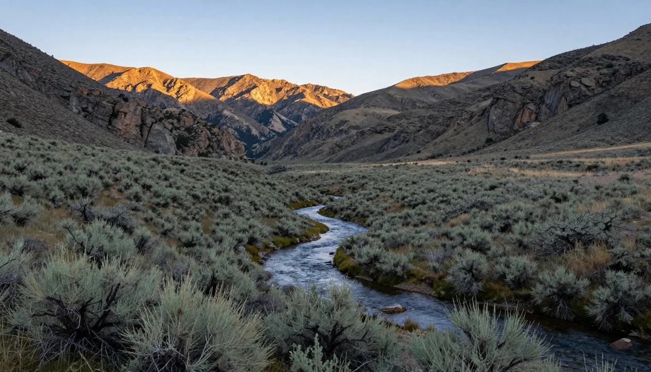
Spanning an incredible 2.5 million hectares (6.3 million acres) across Nevada and eastern California, Humboldt-Toiyabe National Forest holds a remarkable distinction. It is the largest national forest in the lower 48 states. This vast wilderness encompasses everything from desert valleys to alpine peaks exceeding 3,353 meters (11,000 feet).
The forest contains over 60 mountain ranges. Each range offers distinct ecosystems and adventures. Visitors discover ancient bristlecone pines, crystalline alpine lakes, and trails that stretch for hundreds of kilometers.
Whether you seek challenging mountain ascents or peaceful lakeside camping, this forest delivers. The diversity here rivals entire regions. A single visit can take you from sagebrush flats to snow-capped summits in just hours.
Getting There & Planning Your Journey

Reno-Tahoe International Airport serves as the primary gateway to Humboldt-Toiyabe National Forest Nevada. The airport sits approximately 24 kilometers (15 miles) from the nearest forest access points. Most visitors rent vehicles here for the flexibility needed to explore remote areas.
Las Vegas McCarran International Airport offers another option. This works well for those exploring the southern portions of the forest. The drive takes roughly 4-5 hours to reach key southern wilderness areas.
From Reno, Highway 395 provides the main north-south corridor. Numerous forest access roads branch off this route. Highway 50, known as “The Loneliest Road in America,” cuts through the central forest. It offers stunning scenery with minimal traffic.
Plan for variable road conditions. Many high-elevation areas close during winter months. Snow can persist on mountain passes through May or even June. Check current conditions before departure.
Best Time to Visit & Weather Tips

Summer months from June through September offer peak accessibility. Temperatures at mid-elevations hover between 21-27°C (70-80°F) during the day. Nights cool down to 4-10°C (40-50°F), perfect for campfire evenings.
Alpine areas remain 10-15 degrees cooler. Pack layers even for summer visits. Afternoon thunderstorms develop frequently from July through August. Start hikes early to avoid lightning risk.
Fall brings spectacular color changes. Late September through October showcases golden aspens against evergreen backdrops. Crowds thin considerably after Labor Day. Weather remains pleasant through mid-October.
Winter transforms accessible areas into snow sports destinations. Cross-country skiing and snowshoeing become popular activities. Many high-elevation roads close from November through May.
Recommended Visiting Months
Best months: June, July, August, September, October
Shoulder season: May, November (limited access, fewer crowds)
Check 30,000+ Local Sightseeing Tours Worldwide
✓ Numerous languages and currencies are available
Avoid if seeking full access: December through April (heavy snow, road closures)
Spring visits require flexibility. Snowmelt creates peak waterfall flows and blooming wildflowers. However, trail conditions vary dramatically based on elevation and aspect. Lower trails open by April, while alpine areas remain snowbound until July.
Getting Around Locally
Personal vehicles provide the only practical transportation within Humboldt-Toiyabe National Forest. Public transit does not serve the forest. Rental cars from Reno or Las Vegas offer the most flexibility.
Standard passenger vehicles access many popular areas. However, high-clearance vehicles open more possibilities. Some remote trailheads require navigating rough dirt roads. Four-wheel drive becomes necessary after storms or during spring snowmelt.
Gas stations appear infrequently along forest routes. Fill your tank before entering remote sections. Carry extra fuel for extended backcountry trips. Cell phone coverage remains spotty throughout most of the forest.
Download offline maps before your visit. Paper maps from ranger stations provide reliable backup navigation. GPS units work well but bring fresh batteries or charging capabilities.
Where to Stay

Developed campgrounds dot the forest at various elevations. Sites typically cost between 15-25 dollars per night. Popular campgrounds include Thomas Canyon, Cave Lake, and Prosser. Reservations open six months in advance through recreation websites.
Dispersed camping offers free alternatives throughout most of the forest. Camp at least 61 meters (200 feet) from water sources. Follow Leave No Trace principles. Some wilderness areas restrict camping locations to minimize impact.
Gateway towns provide hotel accommodations. Reno offers the widest selection with options ranging from budget motels to luxury resorts. Smaller communities like Minden, Gardnerville, and Ely provide closer proximity to specific forest sections.
Backcountry permits allow overnight wilderness camping. Most areas require no permit for day use. Check specific wilderness area regulations as requirements vary. Popular zones like Mount Rose Wilderness see heavier use.
Remote cabins and fire lookouts offer unique rental opportunities. These require advance booking and often book months ahead. Facilities range from rustic to moderately equipped.
Dining & Local Cuisine
Pack your own food for forest visits. No restaurants or stores operate within the national forest boundaries. Plan meals carefully based on trip length. Bear-resistant food storage becomes mandatory in many areas.
Reno provides extensive dining options before or after forest adventures. The city features everything from casual diners to upscale steakhouses. Basque restaurants offer regional specialties reflecting Nevada’s cultural heritage.
Smaller gateway towns maintain basic amenities. Grocery stores in Minden and Gardnerville stock supplies for camping trips. Carson City offers mid-range restaurant choices along Highway 395.
Bring a camp stove for hot meals in the backcountry. Open fires face restrictions during dry periods. Always check current fire regulations before striking a match. Water filtration equipment proves essential as natural sources require treatment.
Attractions, Sightseeing & Activities

Mount Rose Summit
Mount Rose reaches 3,286 meters (10,776 feet) in elevation. The summit trail gains 610 meters (2,000 feet) over 8 kilometers (5 miles) one way. Hikers enjoy panoramic views stretching across Lake Tahoe and the surrounding peaks.
The trailhead sits along Mount Rose Highway between Reno and Lake Tahoe. Start early to avoid afternoon thunderstorms. Snow lingers on this route until late June most years. Wildflowers peak in July and early August.
Tahoe Rim Trail
This 274-kilometer (170-mile) trail circumnavigates Lake Tahoe. Sections within Humboldt-Toiyabe National Forest showcase alpine meadows and ridge-top vistas. Day hikers can access numerous trailheads for shorter out-and-back adventures.
The trail passes through diverse ecosystems. Elevations range from lakeside at 1,899 meters (6,230 feet) to mountaintops exceeding 3,048 meters (10,000 feet). Through-hikers typically complete the circuit in 10-14 days.
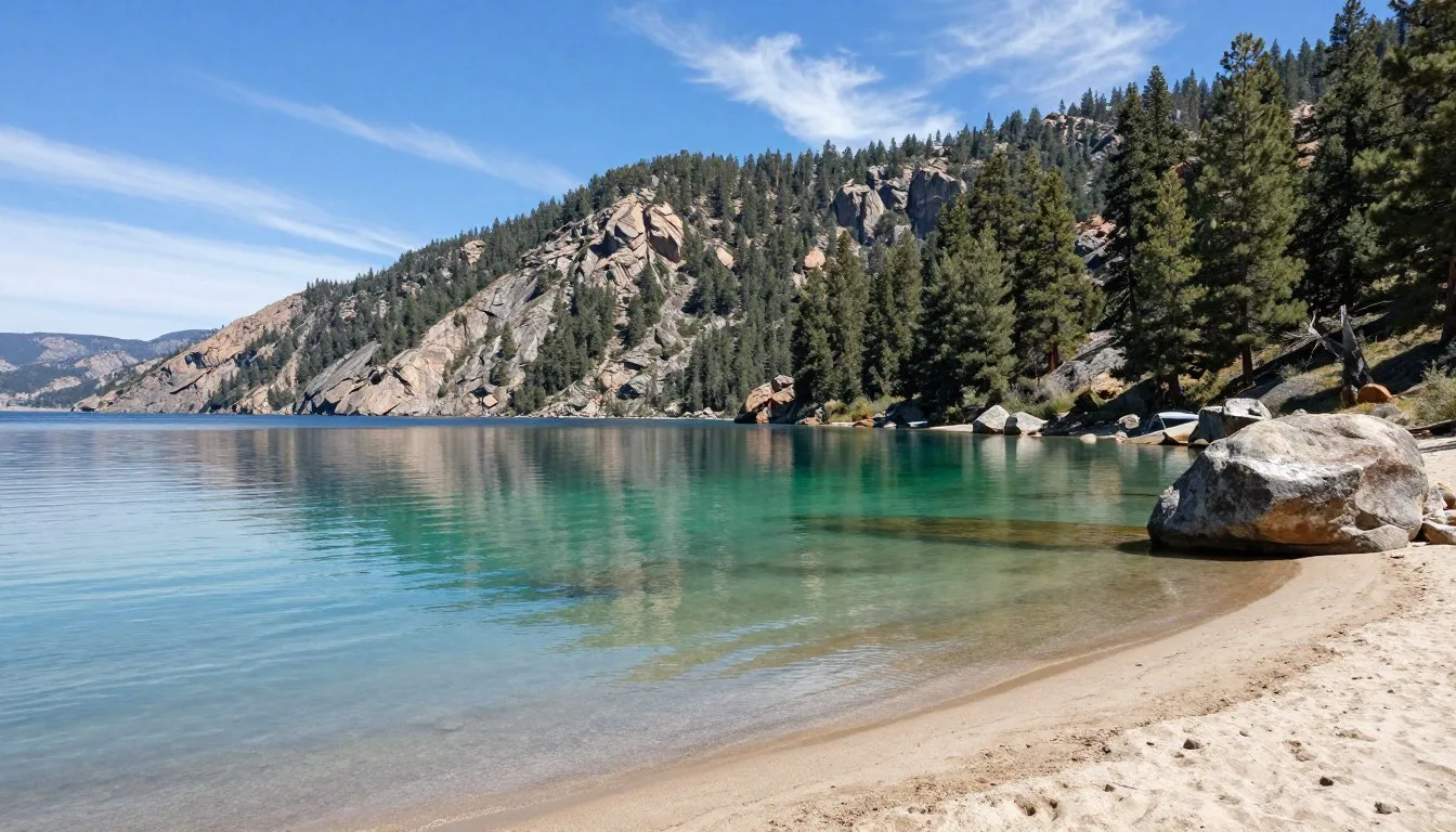
Mount Rose Wilderness
This 11,331-hectare (28,000-acre) wilderness protects pristine alpine terrain. Alpine lakes dot the landscape between granite peaks. The area receives heavy winter snowfall, creating dramatic summer scenery.
Popular trails lead to destinations like Tamarack Lake and Gray Lake. Backpackers find solitude once they venture beyond day-hiking range. Wildlife sightings include mule deer, mountain lions, and various bird species.

Hunter Creek Trail
This accessible trail begins near Reno’s urban edge. The path follows Hunter Creek through a scenic canyon. Waterfalls appear during spring runoff. The trail extends 14 kilometers (8.7 miles) one way, gaining 762 meters (2,500 feet).
Lower sections remain snow-free much of the year. Upper elevations connect with the Tahoe Rim Trail. Many hikers turn around at various waterfalls rather than completing the full distance.
Jarbidge Wilderness
Remote Jarbidge Wilderness covers 43,706 hectares (108,000 acres) in northern Nevada. Access requires dedication, with rough roads leading to trailheads. The effort rewards visitors with solitude and pristine alpine scenery.
Jarbidge Peak rises to 3,248 meters (10,654 feet). Trails wind through forests and meadows to alpine lakes. Fall brings golden aspens and reduced mosquito populations. This area sees a fraction of the visitors compared to western sections.
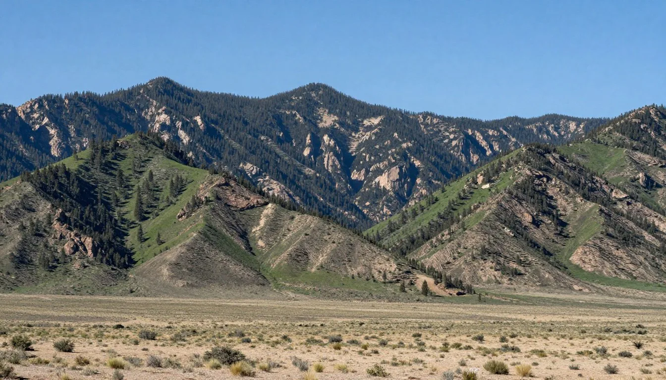
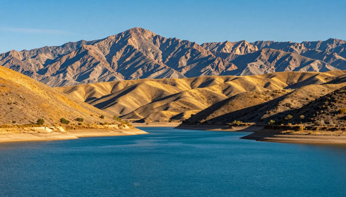
Arc Dome Wilderness
Central Nevada’s Arc Dome Wilderness encompasses 46,539 hectares (115,000 acres). The Toiyabe Range dominates the landscape here. Arc Dome itself reaches 3,590 meters (11,778 feet), making it one of the forest’s highest points.
Trails follow creek drainages through mixed forest zones. Alpine areas above treeline offer sweeping views across Nevada’s Basin and Range. Solitude comes easily in this lesser-known section of Humboldt-Toiyabe National Forest.

Museums, Cultural Spots & Festivals
Ranger stations serve as primary information centers. Staff provide maps, current conditions, and wilderness permits. The Humboldt-Toiyabe National Forest Supervisor’s Office operates in Sparks. District offices appear in various gateway communities.
Nearby Reno hosts the Nevada Museum of Art. The National Automobile Museum showcases classic cars. These attractions suit rest days or extend your regional visit.
Carson City, Nevada’s capital, maintains several historical museums. The Nevada State Museum explores regional natural and cultural history. The Nevada State Railroad Museum appeals to transportation enthusiasts.
Summer brings occasional ranger-led programs. These interpretive talks cover topics from fire ecology to wildlife. Check with individual ranger districts for current schedules.
Nature & Outdoor Experiences

Hiking Adventures
Humboldt-Toiyabe National Forest contains thousands of kilometers of trails. Routes range from easy nature walks to multi-day backpacking expeditions. The Pacific Crest Trail passes through the western portions, offering through-hiking opportunities.
Alpine zones showcase wildflower displays during July and August. Lower elevation trails provide year-round access in many areas. Trail maintenance varies, with popular routes receiving more attention than remote paths.
Water Activities
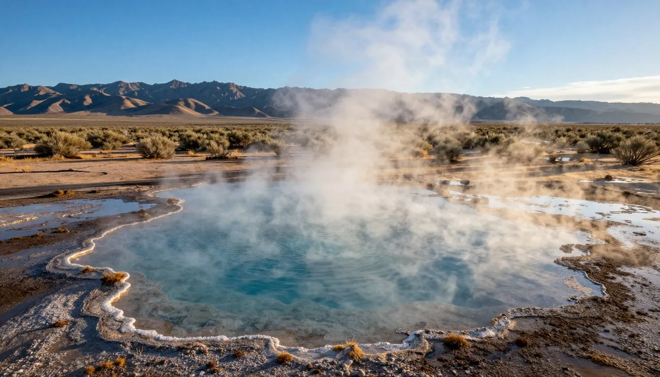
Dozens of alpine lakes dot the higher elevations. These glacially-carved waters offer fishing opportunities for brook, rainbow, and cutthroat trout. Most lakes require hiking to reach. Waters remain cold even during summer months.
Cave Lake State Park adjoins the forest near Ely. The 78-hectare (193-acre) reservoir allows boating and swimming. Rainbow trout fishing draws anglers throughout the season.

Wildlife Watching
Wildlife thrives throughout Humboldt-Toiyabe National Forest Nevada. Mule deer browse in meadows during dawn and dusk. Black bears inhabit forested zones. Proper food storage prevents bear encounters.
Mountain lions roam the backcountry but rarely appear to hikers. Bighorn sheep occupy remote alpine areas. Birdwatchers spot species ranging from mountain bluebirds to golden eagles.
Spring and fall migrations bring diverse bird populations. Riparian areas along creeks attract the highest concentrations. Early morning offers the best viewing times.
Rock Climbing
Granite cliffs provide climbing opportunities throughout the forest. The Mount Rose area features established routes. Climbers find everything from easy scrambles to technical multi-pitch challenges.
Less developed crags offer adventure for those willing to explore. Bring complete rack and approach information. Cell coverage remains limited for emergencies.

Mountain Biking
Designated trails welcome mountain bikers. Routes wind through forest and meadow terrain. Technical difficulty varies from smooth doubletrack to challenging singletrack.
Wilderness areas prohibit bicycles. Check regulations before planning routes. Lower elevation trails remain rideable longer into fall and earlier in spring.
Horseback Riding
Equestrian use remains popular throughout accessible areas. Many trailheads provide horse trailer parking. Pack stock ventures deeper into wilderness zones than day hikers typically reach.
Stock users must follow specific regulations. These include distance requirements from water sources and proper waste disposal. Some areas restrict stock access during sensitive seasons.
Winter Activities
Snow transforms accessible areas into winter wonderlands. Cross-country skiing follows summer trails and forest roads. Snowshoeing opens up off-trail exploration.
Backcountry skiing attracts advanced winter visitors. Avalanche danger exists in steep terrain. Proper training and equipment become essential. Check avalanche forecasts before any winter backcountry travel.

Camping Experiences
Primitive camping offers true wilderness immersion. Set up camp in pristine locations far from roads. Alpine sites beside lakes provide memorable evenings under star-filled skies.
Campfire regulations vary by season and location. During high fire danger, only gas stoves receive approval. Always check current restrictions. Dispersed camping spots appear unlimited for those willing to hike.
Photography Opportunities
Dramatic landscapes attract photographers year-round. Sunrise and sunset light transforms granite peaks and alpine waters. Fall aspens create golden backdrops against evergreen forests.
Wildlife photography requires patience and telephoto lenses. Respect minimum distance requirements for all animals. Dawn and dusk provide the best opportunities for most species.
Safety, Etiquette & Local Customs

Altitude Awareness
Many trails reach elevations above 2,743 meters (9,000 feet). Altitude sickness affects some visitors. Symptoms include headache, nausea, and fatigue. Ascend gradually and stay hydrated.
Physical exertion feels harder at elevation. Pace yourself accordingly. Descend if symptoms worsen. Most people acclimate within a day or two.
Weather Preparedness
Mountain weather changes rapidly. Afternoon thunderstorms develop quickly during summer. Lightning poses serious danger above treeline. Start early and descend by early afternoon.
Temperature swings require layered clothing. Pack rain gear even on clear mornings. Hypothermia risk exists even during summer at high elevations. Wind increases heat loss dramatically.
Water Safety
Treat all natural water sources before drinking. Giardia and other pathogens exist in seemingly pristine streams. Filters, purification tablets, or boiling ensure safety.
Carry adequate water for your entire hike. Sources may run dry by late summer. Plan for one liter per two hours of activity. Increase this in hot weather.
Wildlife Precautions
Store food in bear-resistant containers in designated areas. Hang food bags where containers are not required. Keep a clean camp with no food odors in sleeping areas.
Give all wildlife space. Never approach or feed animals. Mountain lion encounters remain rare but do happen. Make noise on trails to avoid surprises.
Leave No Trace Principles
Pack out all trash including toilet paper. Bury human waste 15-20 centimeters (6-8 inches) deep and at least 61 meters (200 feet) from water. Use existing campsites when possible.
Keep noise levels down to preserve wilderness character. Respect other visitors seeking solitude. Stay on established trails to prevent erosion.
Fire Regulations
Check current fire restrictions before every trip. Regulations change based on conditions. During high fire danger, all open flames may be prohibited.
Use existing fire rings when fires are allowed. Keep fires small and fully extinguish before leaving. Scatter cold ashes. Consider gas stoves as safer alternatives.
Navigation Skills
Trails may fade in alpine areas. Cairns mark routes above treeline. Bring map and compass skills. GPS devices help but carry backup navigation.
Tell someone your plans before entering the backcountry. Leave trip details including expected return time. Cell service remains unreliable for emergencies.
Visitor Comments About Humboldt-Toiyabe National Forest Nevada
“The sheer scale of Humboldt-Toiyabe National Forest amazed us. We spent a week exploring different wilderness areas and barely scratched the surface. Mount Rose Summit provided incredible views across Lake Tahoe. The alpine lakes we discovered felt like our own private paradise. Every trail revealed new scenery. This forest deserves far more recognition than it receives.”
J.W., Albury – Wodonga
“Backpacking through the Arc Dome Wilderness changed my perspective on Nevada landscapes. Most people think desert when they picture Nevada. These mountains rival anything I have hiked in the Rockies. Crystal clear streams, wildflower meadows, and towering peaks filled our days. We encountered maybe five other hikers all week. The solitude felt therapeutic after busy city life.”
I.C., Maui
“Our family chose Humboldt-Toiyabe National Forest for a camping trip last summer. The kids loved exploring around our campsite at Thomas Canyon. We hiked several trails suitable for ages ranging from 6 to 14. Wildlife sightings included deer, various birds, and even a black bear from a safe distance. The ranger programs taught everyone about forest ecology. Already planning our return visit.”
H.K., Atlanta
Check 30,000+ Local Sightseeing Tours Worldwide
✓ Numerous languages and currencies are available
Additional Nearby Destinations

Lake Tahoe
Lake Tahoe sits adjacent to the western sections of Humboldt-Toiyabe National Forest. The lake covers 49,413 hectares (122,160 acres). Crystal clear waters and surrounding peaks create an iconic Sierra Nevada landscape.
Beaches, water sports, and scenic drives attract summer visitors. Winter transforms the area into a major ski destination. The lake remains accessible year-round with varying seasonal activities.
Great Basin National Park
Located in eastern Nevada, Great Basin National Park lies about 322 kilometers (200 miles) from the forest’s southern sections. Wheeler Peak reaches 3,982 meters (13,065 feet). Lehman Caves offer underground exploration.
Ancient bristlecone pines grow on the mountain slopes. Some trees exceed 4,000 years in age. The park receives fewer visitors than many western parks, offering uncrowded experiences.
Virginia City
This historic mining town preserves Nevada’s silver rush heritage. Virginia City sits about 40 kilometers (25 miles) from forest access points. Wooden sidewalks and Victorian buildings line the main street.
Museums detail the Comstock Lode mining history. Saloons and shops maintain period atmosphere. The town provides an interesting cultural contrast to wilderness adventures.
Carson City
Nevada’s capital offers urban amenities and historical attractions. The Nevada State Capitol building welcomes visitors. Museums cover state history, railroads, and natural history.
Carson City serves as a practical base for forest exploration. Grocery stores, outdoor equipment shops, and restaurants provide trip preparation resources.
Practical Travel Tips
Essential Gear
- Sturdy hiking boots with ankle support
- Layered clothing for temperature changes
- Rain jacket and warm insulation layer
- Sun protection including hat and sunscreen
- Water filtration or purification method
- First aid supplies and emergency whistle
- Map, compass, and GPS device
- Headlamp with extra batteries
Money Matters
- Campground fees range from 15-25 dollars
- Day use typically remains free
- ATMs available only in gateway towns
- Credit cards accepted at developed campgrounds
- Bring cash for small purchases
Communication
- Cell service unreliable in most forest areas
- Download offline maps before arrival
- Satellite communicators recommended for backcountry
- Emergency contact available through 911 when service exists
- Leave trip plans with friends or family
Permits and Regulations
- Wilderness permits required for overnight stays in designated areas
- Campfire permits may be needed depending on season
- Fishing requires valid Nevada license
- Hunting permitted in season with proper licenses
- Check current regulations at ranger stations
Quick Reference Numbers
Humboldt-Toiyabe National Forest Supervisor’s Office: Sparks, Nevada
Emergency Services: Call 911 where cell service available
Forest Information: Contact local ranger districts for current conditions
Reservation Information: Federal recreation websites handle campground bookings
Photography Etiquette
- Respect wildlife by using telephoto lenses
- Stay on trails to capture landscape shots
- Avoid disturbing other visitors seeking solitude
- Practice Leave No Trace while setting up shots
- Share location information responsibly to prevent overuse
Accessibility Considerations
Limited accessible trails exist within the forest. Contact specific ranger districts about accessible campgrounds and facilities. Most backcountry areas require hiking ability and fitness.
Developed campgrounds offer the most accessible options. Some feature paved paths and accessible restrooms. Plan ahead for specific accessibility needs.
Seasonal Closures
High elevation roads typically close from first heavy snow until snowmelt. This usually spans November through May or June. Lower elevation access remains available year-round in many sections.
Check current road conditions before departure. Unexpected storms can close passes even during summer months. Ranger stations maintain updated information.
Your Adventure Awaits in Nevada’s Wilderness Crown Jewel
Humboldt-Toiyabe National Forest Nevada stands ready to exceed your wildest expectations. From the first glimpse of alpine wildflowers to the last sunset over granite peaks, every moment creates lasting memories.
The trails call to adventurers of all skill levels. Whether you seek a peaceful afternoon by an alpine lake or a week-long backcountry expedition, this forest delivers. The diversity within these 2.5 million hectares ensures discoveries await around every bend.
Pack your gear, fill your water bottles, and point your compass toward Nevada’s mountains. The largest national forest in the lower 48 states promises adventures that will draw you back season after season. Your story in this magnificent wilderness begins the moment you arrive.