Hotels by Trip.com
Flights by Trip.com
Standing at 3,286 m (10,776 feet), Mount Rose claims the title as the highest peak in the Carson Range. Yet fewer than fifteen percent of Lake Tahoe visitors ever discover this alpine treasure. Most travelers rush past on Highway 431, unaware that some of Nevada’s most stunning wilderness lies just minutes from the road.
This towering mountain offers year-round adventures. Winter transforms the area into a premier skiing destination. Summer reveals wildflower meadows and crystal lakes. Between these seasons, the landscape shifts through countless moods, each offering unique experiences.
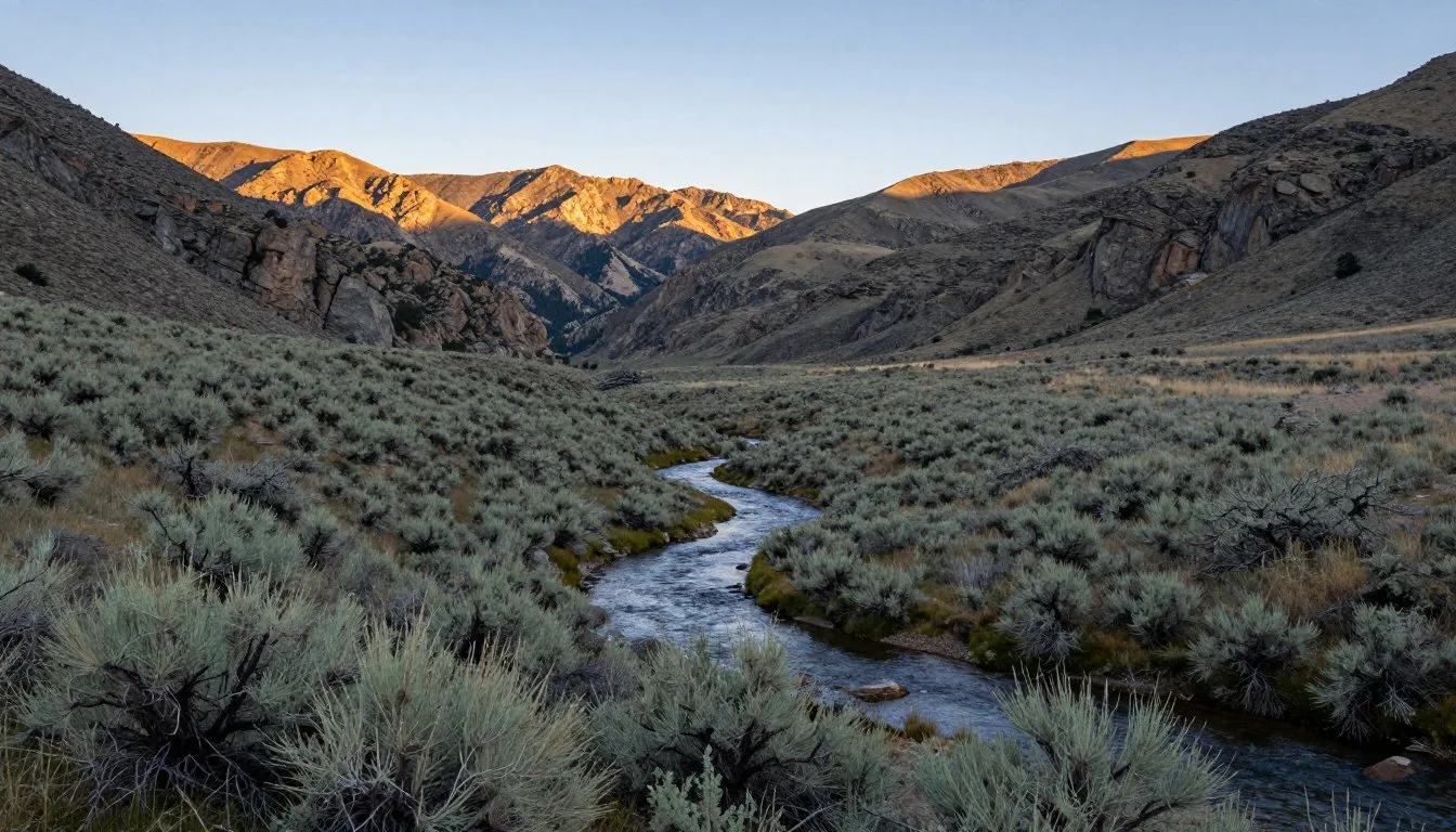
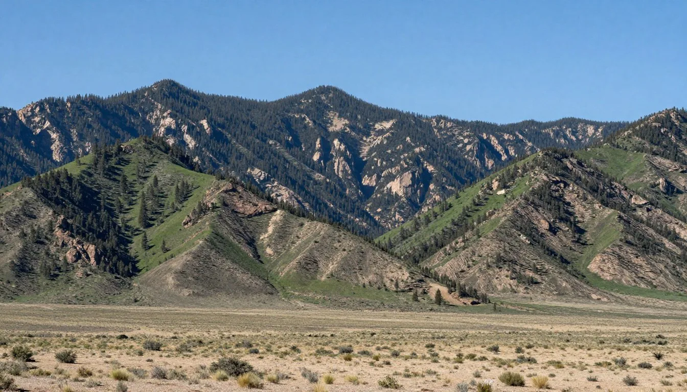
The mountain sits at the crossroads of two ecosystems. You will find Sierra Nevada forests meeting Great Basin desert here. This creates remarkable biodiversity within a compact area. Trails wind through ancient forests, past rushing waterfalls, and onto windswept ridges with views stretching across two states.
Getting There and Planning Your Journey

Reno-Tahoe International Airport serves as your primary gateway. Located just 40 km (25 miles) northeast, the airport offers daily flights from major cities. Most visitors rent vehicles here, as public transportation options remain limited in the mountain areas.
Mount Rose Highway (Route 431) connects Reno directly to Incline Village. This scenic route passes through the heart of Mount Rose Wilderness. The drive takes approximately forty-five minutes under normal conditions. Snow can extend travel time during winter months.
From Incline Village, the main trailhead sits 16 km (10 miles) west. Watch for the marked parking lot on the highway’s south side. The lot fills quickly on summer weekends. Arriving before eight AM ensures parking access. Overflow parking exists but requires walking additional distance to reach the trailhead.
Sacramento International Airport provides another option. Located 193 km (120 miles) west, this larger hub often features better flight prices. The drive crosses the Sierra Nevada via Interstate 80, then connects to Route 431. Budget three hours for this journey.
Plan your route carefully during winter. Mount Rose Highway closes during heavy snowfall. Chains or four-wheel drive become mandatory from November through April. Check road conditions before departing. The Nevada Department of Transportation provides real-time updates.
Best Time to Visit and Weather Tips
Recommended Seasons
July through September offers ideal hiking conditions. Trails become snow-free by early July. Wildflowers peak in late July. Temperatures hover around 21°C (70°F) during day hours. Nights drop to 7°C (45°F), requiring warm layers.
December through March attracts winter sports enthusiasts. The ski resort receives over 9 m (350 inches) of snow annually. Powder conditions rank among the Tahoe Basin’s best. Temperatures range from -7°C to 2°C (20°F to 35°F).
Spring brings unpredictable weather. Snow lingers on trails through June. Lower elevation hikes become accessible by May. This season sees fewer crowds but requires flexibility.
Seasons to Avoid
Late October through early December presents challenges. Snow arrives but depths remain insufficient for winter sports. Many trails close. Few services operate. This transition period offers limited activities.
August afternoon thunderstorms create danger on exposed ridges. Lightning strikes pose serious risks above the tree line. Start summit hikes before dawn. Return to lower elevations by early afternoon.
✓ Check 30,000+ Local Sightseeing Tours Worldwide

Notable Annual Festivals
- Reno River Festival (May) – Whitewater competition and outdoor expo in downtown Reno, 32 km (20 miles) from Mt. Rose
- Lake Tahoe Summer Concert Series (July-August) – Free outdoor performances at various Tahoe Basin venues
- Great Reno Balloon Race (September) – World’s largest free hot-air balloon event, visible from mountain viewpoints
- SnowFest! (March) – Ten-day winter celebration throughout North Lake Tahoe communities
Contact Incline Village Crystal Bay Visitors Bureau at +1 (775) 832-1606 for festival details and dates.
Getting Around Locally
Personal vehicles provide essential transportation. The Rose wilderness area lacks public transit. Roads remain well-maintained but narrow and winding. Drive cautiously, especially during adverse weather.
Parking exists at major trailheads. The Mount Rose summit trailhead accommodates approximately fifty vehicles. Galena Creek visitor area offers similar capacity. Arrive early during peak season. Weekdays see significantly less congestion than weekends.
Bike rentals operate in Incline Village. Several shops rent mountain bikes suitable for area trails. The Mount Rose Highway features a bike lane. Steep grades challenge casual cyclists. Experienced riders enjoy the scenic route.
Ride-sharing services operate sporadically. Coverage depends on driver availability. Do not rely on these services for trailhead access. Limited cell reception complicates pickup coordination.
Where to Stay

Incline Village provides closest accommodations. This upscale community sits 16 km (10 miles) from trailheads. Hotels range from budget chains to luxury resorts. Book well in advance during summer and winter peak seasons.
Accommodation Options
- Hyatt Regency Lake Tahoe – Full-service resort with mountain views and spa facilities
- The Landing Resort and Spa – Boutique property offering lake access and fine dining
- Tahoe Seasons Resort – Mid-range hotel with kitchenettes and pool
- Mount Rose Campground – Forest Service sites near hiking trails, no reservations
- Vacation rentals through local property managers – Houses and condos for groups
Reno offers budget-friendly alternatives. Numerous hotels line South Virginia Street. Prices run forty percent lower than Tahoe Basin properties. The forty-minute drive discourages day trippers but works for multi-day visits.
Camping provides immersive experiences. Developed campgrounds cluster around Galena Creek. Sites include picnic tables and fire rings. Water and restrooms operate May through October. Reserve through Recreation.gov during peak periods.
Backcountry camping requires permits. Dispersed camping is allowed in Mount Rose Wilderness. Follow Leave No Trace principles. Camp at least 61 m (200 feet) from water sources and trails.
Dining and Local Cuisine
Incline Village and Crystal Bay host diverse restaurants. Fresh seafood arrives daily despite the mountain location. Lake Tahoe’s culinary scene emphasizes locally sourced ingredients and craft beverages.
Notable Dining Spots
- Bite American Tapas – Creative small plates with mountain views
- Soule Domain – Fine dining in historic log cabin setting
- T’s Mesquite Rotisserie – Casual BBQ and rotisserie chicken
- Tunnel Creek Cafe – Breakfast specialist known for hearty portions
- Lone Eagle Grille – Lakefront location with regional specialties
- Frederick’s Bistro – European-inspired cuisine and wine selection
- Village Pizza – Family-friendly Italian-American fare
- Wildwood Cafe – Organic options and vegetarian menu
Pack trail snacks and water. No services exist within the wilderness area. The summit hike requires at least two liters of water per person. High altitude increases dehydration risk. Bring energy-dense foods like nuts and dried fruit.
South Lake Tahoe provides additional options. This larger community sits 45 km (28 miles) south. The drive takes fifty minutes via Route 431 and Highway 28. Dozens of restaurants span all price ranges and cuisines.
Attractions, Sightseeing, and Activities

The Mount Rose summit trail ranks as the area’s premier attraction. This 16 km (10-mile) round trip gains 610 m (2,000 feet) of elevation. Most hikers complete the journey in five to seven hours. The path winds through multiple ecosystems before reaching the windswept summit.
Views from the top span hundreds of kilometers. Lake Tahoe dominates the southern horizon. Reno spreads across the valley floor below. On clear days, you can spot peaks in California’s Central Valley.
Popular Activities
- Summit hiking – The signature Mount Rose trail challenges and rewards in equal measure
- Mt. Rose Ski Tahoe – Winter resort offering 486 hectares (1,200 acres) of terrain
- Waterfall hikes – Multiple cascades accessible via short trails from the highway
- Wildlife viewing – Marmots, pikas, and occasional black bears inhabit the area
- Photography – Alpine lakes and wildflower meadows create stunning compositions
- Mountain biking – Rose wilderness trails welcome bikes on designated routes
Tahoe Meadows represents another highlight. This subalpine meadow sits at 2,591 m (8,500 feet) elevation. Short, family-friendly trails loop through the grassland. Wildflowers bloom prolifically from July through August. The area provides gentle terrain ideal for acclimating to altitude.
Rose wilderness encompasses 115 square km (28,000 acres). Over 48 km (30 miles) of trails crisscross the protected area. Routes range from easy nature walks to challenging peak ascents. Trail conditions vary significantly with season and weather.
Museums, Cultural Spots, and Festivals
The area’s cultural attractions concentrate in nearby communities. Incline Village hosts the Incline Heritage Museum. This small facility documents local logging and railroad history. Admission costs five dollars. Open weekends during summer months.
Reno provides extensive museum options. The Nevada Museum of Art features contemporary exhibitions. The National Automobile Museum displays vintage vehicles. Both sit within forty minutes’ drive from Mount Rose.
Thunderbird Lodge offers historic tours. This 1930s estate overlooks Lake Tahoe. Built by wealthy businessman George Whittell, the property showcases classic architecture. Tours run May through October. Reserve tickets weeks in advance.
Shakespeare in the Sierra performs outdoors at Sand Harbor. This summer tradition brings classic plays to lakefront amphitheater settings. Performances occur weekly from July through August. Arrive early for parking and picnic seating.
Nature and Outdoor Experiences

Galena Creek Falls provides an accessible natural wonder. The 0.8 km (half-mile) trail gains minimal elevation. Water plunges 23 m (75 feet) over granite cliffs. Peak flow occurs during spring snowmelt. The falls reduce to a trickle by late summer.
Third Creek Trail explores subalpine forest. This moderate 11 km (7-mile) route follows a mountain stream. Ancient whitebark pines line the path. The trail accesses a backcountry lake at 2,743 m (9,000 feet). Allow five hours for the round trip.
Trail Highlights
Easy Trails
- Tahoe Meadows Interpretive Loop – 2.1 km (1.3 miles), flat terrain
- Ophir Creek Trail – 3.2 km (2 miles), gentle grade to swimming holes
- Galena Falls – 0.8 km (0.5 miles), paved access to waterfall viewing
Challenging Trails
- Mount Rose Summit – 16 km (10 miles), 610 m (2,000′) elevation gain
- Relay Peak – 14.5 km (9 miles), 823 m (2,700′) climb to ridge views
- Rose Knob Peak – 12.9 km (8 miles), technical scrambling required

Alpine lakes dot the higher elevations. Most require significant hiking to reach. Tamarack Lake sits 8 km (5 miles) from the nearest trailhead. The 263-hectare (650-acre) body of water offers excellent fishing. Rainbow and brook trout inhabit these waters. Nevada fishing licenses apply throughout the wilderness.
Winter transforms the landscape. Cross-country skiing becomes popular on snow-covered roads. Snowshoers explore meadows and forests. Avalanche danger exists on steeper slopes. Check conditions and carry proper safety equipment. The ski resort maintains groomed Nordic trails.
Rock climbing opportunities exist but remain underdeveloped. Granite outcrops offer short routes. Most climbers head to Donner Pass or Lover’s Leap. These areas provide better access and established routes.
Safety, Etiquette, and Local Customs

Altitude affects everyone differently. Mount Rose’s trailheads start above 2,438 m (8,000 feet). Many visitors arrive from sea level. Spend a day acclimating before attempting strenuous hikes. Drink extra water. Recognize symptoms of altitude sickness.
Weather changes rapidly at elevation. Afternoon thunderstorms develop quickly during summer. Start hikes early. Carry rain gear and warm layers. Temperatures drop fast when clouds arrive. Hypothermia risk exists even during warm months.
Essential Safety Tips
- Carry plenty of water – At least one liter per hour of hiking time
- Inform others of plans – Leave itinerary with friends or family members
- Pack the ten essentials – Map, compass, sunscreen, first aid, knife, fire starter, shelter, extra food, water, and clothes
- Stay on marked trails – Shortcutting damages vegetation and causes erosion
- Respect wildlife – Observe from distance, never feed animals
- Check weather forecasts – Conditions change rapidly in mountains
Bears inhabit the Rose wilderness. Store food properly. Use bear canisters for overnight trips. Never leave food in vehicles. Black bears damage cars searching for snacks. Make noise while hiking. Most bears avoid human contact.
Trail etiquette matters. Uphill hikers have right of way. Step aside when faster hikers approach. Yield to horses and pack animals. Keep dogs leashed. Clean up all pet waste. Many trails prohibit dogs during nesting season.
Fire restrictions change throughout the year. Campfires may be banned during dry periods. Use established fire rings only. Never leave fires unattended. Douse thoroughly before leaving. Wildfires devastate these forests.
Cell phone coverage remains spotty. Many areas lack service entirely. Download offline maps before departing. Carry paper maps as backup. Emergency communication devices provide extra security on remote trails.
Visitor Comments About Mount Rose
“The summit hike challenged us more than expected, but those views made every step worthwhile. Lake Tahoe stretched below like a blue mirror. We started at dawn and had the peak to ourselves for nearly an hour. Bring warm clothes even in July.”
“Mount Rose exceeded expectations in every way. The trail conditions were excellent, and wildflowers covered entire hillsides. We spotted marmots near the summit. The elevation gained slowly, which helped with acclimatization. Definitely returning next summer.”
“Skiing at Mt. Rose beats the crowded resorts down south. Short lift lines and incredible terrain variety. The chutes off the backside provide expert challenges. Snow quality rivals anywhere in Tahoe. We bought season passes after one visit.”
Additional Nearby Destinations

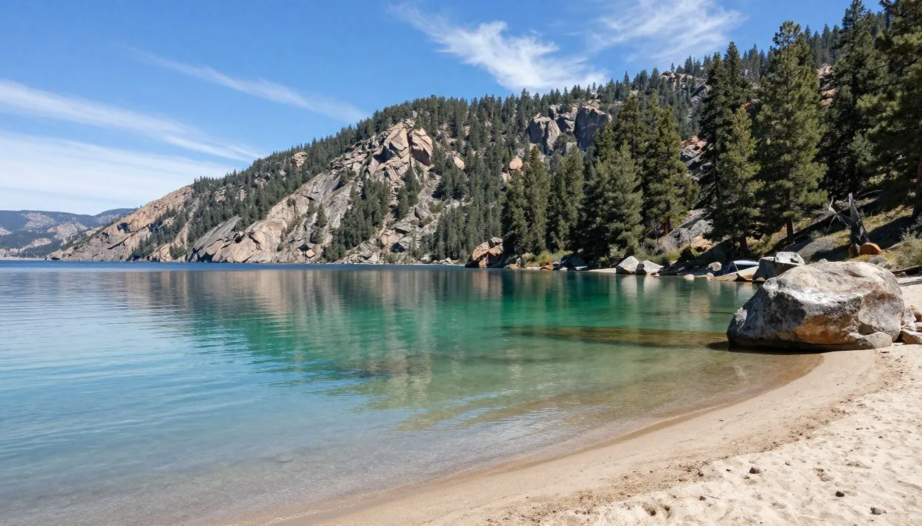
Lake Tahoe surrounds the Rose area. This massive alpine lake covers 49,500 hectares (122,000 acres). The 115 km (72-mile) shoreline offers endless exploration. Beaches, marinas, and scenic overlooks dot the perimeter.
Nearby Attractions
- Sand Harbor State Park – Beautiful beach with turquoise water, 11 km (7 miles) southeast
- Virginia City – Historic mining town with museums and saloons, 32 km (20 miles) northeast
- Donner Memorial State Park – Historical site and museum, 56 km (35 miles) west
- Pyramid Lake – Ancient lake with tufa formations, 64 km (40 miles) north
- Spooner Lake – Easy hiking and mountain biking, 24 km (15 miles) south
- Emerald Bay – Iconic Tahoe vista point and hiking destination, 56 km (35 miles) southwest
Reno provides urban amenities. Casinos, restaurants, and entertainment venues operate year-round. The Riverwalk district features shops and dining along the Truckee River. Downtown events occur most weekends during summer.
Carson City serves as Nevada’s capital. Museums document state history and geology. The historic Mint building houses exhibits. Government buildings showcase classic architecture. The city sits thirty minutes from Mount Rose via Route 431.
Practical Travel Tips
What to Pack
- Layered clothing for temperature changes
- Sturdy hiking boots with ankle support
- Sunscreen and sunglasses (UV intensity increases with altitude)
- Reusable water bottles or hydration system
- Headlamp or flashlight with extra batteries
- Trekking poles for knee support on descents
Money and Services
- ATMs available in Incline Village and nearby communities
- Credit cards accepted at most businesses
- Gas stations limited along Mount Rose Highway
- Cell service unreliable in wilderness areas
- Grocery stores in Incline Village and Kings Beach
- Medical facilities in Incline Village and Reno
Permits are not required for day hiking. Overnight camping requires wilderness permits during peak season. Obtain these at Galena Creek Visitor Center or through Recreation.gov. Permits limit backcountry impact and help with search and rescue operations.
Parking passes are unnecessary at most trailheads. The National Forest manages these areas. Commercial tour operators require special use permits. Private visitors hike for free. Donations support trail maintenance programs.
Water sources exist along many trails. Always treat or filter water before drinking. Giardia and other pathogens contaminate even pristine streams. Carry sufficient water rather than relying on natural sources.
Restroom facilities vary by location. The main Mount Rose trailhead offers vault toilets. Remote areas lack any facilities. Practice proper wilderness sanitation. Pack out all toilet paper and hygiene products.
Your Mountain Adventure Awaits
Mount Rose stands ready to reveal its secrets. Summit trails promise unforgettable vistas. Forest paths lead to hidden waterfalls. Winter slopes deliver powder dreams. Each season transforms this wilderness into something new.
The mountain rewards those who venture beyond the obvious. Popular trails offer spectacular experiences. Lesser-known routes provide solitude and discovery. Whether you seek adventure or tranquility, these peaks deliver both.
Start planning your journey today. Pack your boots. Check the weather. Point your vehicle toward the Sierra Nevada. Mount Rose, Nevada waits to become your next great story.