Hotels by Trip.com
Flights by Trip.com
Did you know that Alamo Road, stretching over 40 miles through the Pahranagat Range, connects two national wildlife refuges while passing through one of Nevada’s most pristine Mojave Desert landscapes? This remote backcountry route sees fewer than 100 vehicles per day, yet offers access to ancient petroglyphs, rare wildlife viewing opportunities, and some of the darkest night skies in North America.
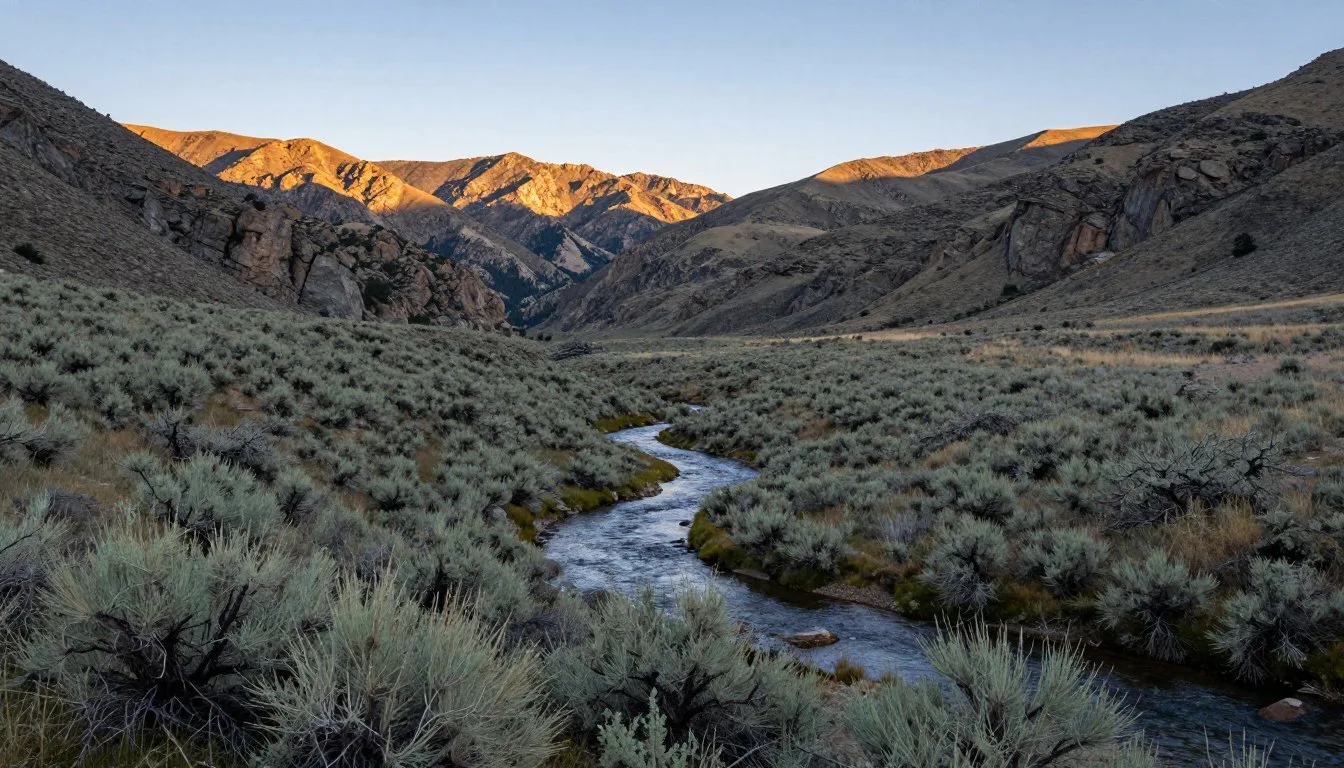
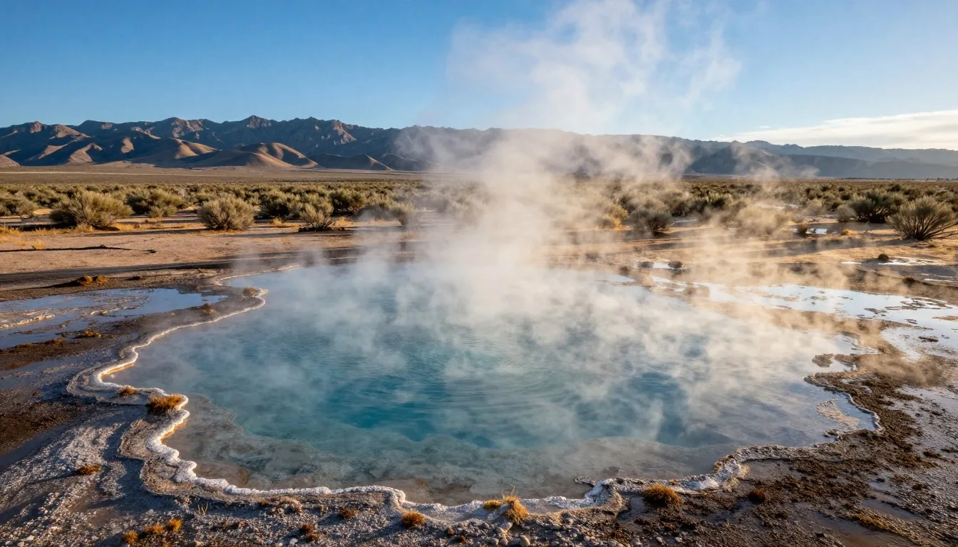
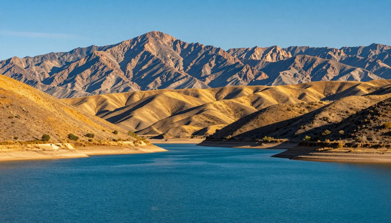
The Pahranagat Range backcountry roads wind through a landscape where water springs from the desert floor, creating lush oases that have sustained life for thousands of years. This journey takes you far from Nevada’s crowded tourist corridors into a realm where solitude meets natural wonder.
Whether you’re drawn by the call of migratory birds at Pahranagat National Wildlife Refuge, the mystery of ancient rock art along desert trails, or simply the adventure of exploring unpaved routes through rugged terrain, this guide provides everything you need to plan an unforgettable experience.
Getting There & Planning Your Journey
Reaching the Pahranagat Range backcountry roads requires some planning, as this area sits in one of Nevada’s most remote regions. The main access point is Alamo, a small community along State Route 93 in Lincoln County.
Closest Airports
The nearest major airport is Harry Reid International Airport in Las Vegas, located approximately 145 km (90 miles) south of the Pahranagat area. This airport offers the most flight options and car rental agencies.
Cedar City Regional Airport in Utah sits about 241 km (150 miles) northeast and serves travelers coming from that direction. St. George Regional Airport, also in Utah, provides another alternative at approximately 209 km (130 miles) away.
Planning Tip: Reserve a high-clearance vehicle or SUV when booking your rental car. Many backcountry roads in this area require vehicles with good ground clearance, especially after weather events.
Driving Routes
From Las Vegas, take US Route 93 north for approximately 145 km (90 miles) to reach Alamo. This route passes through diverse desert landscapes and takes about 1.5 hours under normal conditions.
The famous Alamo Road begins just north of the town of Alamo and runs northward for over 64 km (40 miles). This graded dirt road provides the main backcountry access through the area. Road conditions vary seasonally, so contact the visitor center before departing.
Alternative access routes include State Route 375, known as the Extraterrestrial Highway, which intersects with backcountry roads on the western edge of the Pahranagat Valley. This route adds adventure for those interested in Nevada’s UFO culture and quirky roadside attractions.
Best Time to Visit & Weather Tips

Recommended Seasons
Spring emerges as the premier time to explore Pahranagat Range backcountry roads, particularly from March through May. During these months, temperatures remain comfortable, ranging from 15°C to 26°C (60°F to 80°F). Desert wildflowers paint the landscape in brilliant colors, and migratory birds fill the refuge wetlands.
Fall, specifically September through November, offers another excellent window. Temperatures cool to pleasant levels after summer’s intensity, wildlife becomes more active, and the refuge sees peak bird migrations. October typically provides the most stable weather patterns.
Winter months from December through February bring cooler temperatures, averaging 4°C to 15°C (40°F to 60°F). While colder, this season offers crystalline air quality perfect for photography and the area’s darkest skies for stargazing. Snow occasionally dusts higher elevations, creating striking visual contrasts.
Seasons to Approach with Caution
Summer, particularly July and August, challenges visitors with extreme heat. Daytime temperatures regularly exceed 38°C (100°F), making midday outdoor activities potentially dangerous. Monsoon thunderstorms during late summer can flood desert washes and make dirt roads impassable.
Late winter storms occasionally impact the area in January and February, bringing rain that turns Alamo Road into sticky mud. Check weather forecasts and road conditions before venturing out during these months.
Spring Highlights
- Wildflower blooms across desert landscapes
- Mild temperatures ideal for hiking
- Peak bird migration at refuge wetlands
- Optimal road conditions throughout the area
Fall Advantages
- Comfortable temperatures after summer heat
- Increased wildlife activity
- Excellent visibility for photography
- Fewer visitors than spring season
Weather Preparation Tips
Desert weather changes rapidly in this region. Morning temperatures may start at 10°C (50°F) and climb to 27°C (80°F) by afternoon during spring and fall. Layer clothing to adjust comfortably throughout the day.
Afternoon thunderstorms can develop quickly during monsoon season, typically July through September. Monitor sky conditions and retreat from exposed areas if storms approach. Flash flooding poses serious risks in desert washes and low-lying areas.
Winter visitors should prepare for cold nights, when temperatures frequently drop below freezing. Bring appropriate sleeping gear if camping, and ensure your vehicle has emergency supplies including blankets, water, and food.
Notable Annual Festivals

While the Pahranagat Range remains primarily a natural destination, nearby communities host several annual events that celebrate the region’s heritage and culture. These festivals provide opportunities to connect with local residents and experience rural Nevada traditions.
Lincoln County Fair
Held annually in August in Panaca, about 48 km (30 miles) north of Alamo, this traditional county fair showcases agricultural heritage, livestock exhibitions, and local crafts. The event typically runs for four days and features rodeo competitions, carnival rides, and regional food vendors.
Silver State Classic Challenge
Each September, State Route 318 near the Pahranagat area transforms into America’s fastest public road during this unique motorsports event. Participants race vehicles at high speeds on a temporarily closed highway section. Spectators gather at designated viewing areas to witness this unusual competition.
Alamo Community Days
This small-town celebration occurs each May, featuring local music, craft vendors, and community barbecues. The intimate event offers authentic insight into rural Nevada life and welcomes visitors warmly. Local volunteers organize games, raffles, and historical presentations about the Pahranagat Valley.
Festival Planning: Many area events rely on volunteer organizers and may have limited advance publicity. Contact the Lincoln County Tourism Office for current year schedules and details: +1 775-962-5207
Getting Around Locally
Transportation in the Pahranagat Range area differs significantly from urban destinations. Personal vehicles provide the only practical means of exploring this remote region, as no public transportation, taxi services, or ride-sharing options operate here.
Vehicle Requirements
A high-clearance vehicle or SUV serves best for navigating backcountry roads. While Alamo Road maintains regular grading, side routes often feature rougher conditions with rocks, ruts, and washboard surfaces. Four-wheel drive becomes necessary after rain or snow events.
Standard passenger cars can access paved State Route 93 and the main refuge headquarters area without difficulty. However, venturing onto any dirt roads risks undercarriage damage in conventional vehicles.
Fuel Considerations
Alamo offers the only fuel services for many miles in any direction. Fill your tank before exploring backcountry roads. The nearest alternative fuel stops sit 64 km (40 miles) south in Caliente or 97 km (60 miles) north in Rachel.
Carry extra fuel if planning extensive exploration. A five-gallon jerry can provides peace of mind, especially when photographing wildlife or visiting remote sites where you may idle your vehicle for extended periods.
Remote Area Alert: Cell phone service remains spotty or nonexistent throughout most of the Pahranagat backcountry. Download offline maps before departing and inform someone of your planned route and return time. Carry physical maps as backup navigation tools.
Road Conditions and Safety
Alamo Road requires approximately 1.5 hours to traverse its full length under good conditions. However, plan additional time for wildlife viewing, photography stops, and potential road obstacles. The graded dirt surface generally remains smooth but can deteriorate quickly after weather events.
Side roads branching from the main route vary dramatically in condition. Some provide easy access to hiking trailheads, while others challenge even experienced off-road drivers. Assess each route carefully before proceeding, and never drive beyond your skill level or vehicle capabilities.
Flash floods pose the most serious driving hazard in this desert environment. Never attempt to cross flowing water in washes or low spots. Turn around and wait for water to recede, which typically happens within a few hours of storm passage.
Where to Stay

Lodging options near Pahranagat Range backcountry roads reflect the area’s rural character. Accommodations range from basic motels to primitive camping, with most facilities concentrated in small communities along State Route 93.
Alamo Area Lodging
Alamo offers limited but functional overnight accommodations. The town features one small motel providing clean, no-frills rooms suitable for travelers focused on outdoor exploration rather than lodging amenities. Basic amenities include air conditioning, private bathrooms, and parking.
Book accommodations well in advance during spring and fall when wildlife enthusiasts and photographers visit the refuge. Summer typically sees greater availability due to extreme temperatures discouraging tourism.
Nearby Towns
Caliente, located 64 km (40 miles) south on State Route 93, provides additional lodging choices. This larger community features several motels, a few bed-and-breakfast establishments, and RV parks with full hookups. The historic architecture adds charm to overnight stays.
Rachel, famous for its proximity to Area 51, sits 97 km (60 miles) north and offers quirky accommodations for those interested in UFO culture. The Little A’Le’Inn provides rooms and RV parking with a distinctive extraterrestrial theme.
Camping Options
Pahranagat National Wildlife Refuge does not permit camping within its boundaries. However, Bureau of Land Management lands surrounding the refuge allow dispersed camping in designated areas. These primitive sites offer no facilities but provide authentic desert camping experiences.
Developed campgrounds exist in nearby mountain ranges. Cathedral Gorge State Park, about 80 km (50 miles) southeast, features developed campsites with water, restrooms, and picnic tables. This alternative works well for those desiring camping comfort while exploring the Pahranagat area.
Dispersed Camping Guidelines
- Camp at least 61 m (200 feet) from water sources
- Use existing campsites when available
- Pack out all trash and waste
- Extinguish fires completely before leaving
- Limit stays to 14 days in any 28-day period
Accommodation Booking: For current lodging information and availability in Lincoln County, contact the tourism office at +1 775-962-5207
RV and Vehicle Camping
Self-contained RVs and camper vans provide excellent accommodation options for exploring this area. Several pullouts along Alamo Road permit overnight parking, though facilities remain nonexistent. Bring plenty of water and ensure waste tanks have adequate capacity.
The refuge visitor center parking lot closes at night, prohibiting overnight stays there. However, surrounding public lands offer numerous spots suitable for RV camping with proper preparation and self-sufficiency.
Dining & Local Cuisine

Dining options in the Pahranagat Range area embrace simplicity and practicality. Don’t expect gourmet cuisine or extensive menus; instead, discover honest food that fuels outdoor adventures and reflects rural Nevada’s straightforward character.
Alamo Dining
Alamo supports a couple of small cafes and a convenience store. These establishments serve basic American fare including breakfast items, sandwiches, and simple hot meals. Hours can be irregular, especially during off-season months, so call ahead if planning to dine at specific times.
The local cafes provide gathering spots where visitors can chat with residents and gain insider knowledge about current conditions in the backcountry. Coffee stays hot, portions run generous, and prices remain reasonable.
Regional Specialties
While not specifically local to Pahranagat, several Nevada food traditions appear on menus in this area. Basque cuisine, brought by sheepherders who once worked throughout Nevada, influences some dishes. Look for hearty stews and family-style meals when available.
Green chili appears frequently as a topping or side dish, reflecting the region’s proximity to southwestern culinary influences. The mild to moderate heat pairs well with eggs, burgers, and breakfast burritos.
Self-Catering Necessities
Serious explorers should provision substantially before arriving. Stock up on groceries in Las Vegas or Cedar City before driving to the area. The small stores in Alamo carry limited selections focused on basics and emergency supplies rather than full grocery inventories.
Bring a cooler with ice and pack picnic supplies for trail lunches. Water sources remain scarce in the desert, so carry at least 4 liters per person per day during warm weather. Add extra for cooking if camping.
Practical Dining Tip: Prepare for limited dining hours and options by bringing snacks, energy bars, and meal supplements. Many visitors find preparing their own trail meals more convenient than relying on local restaurants with restricted hours.
Nearby Alternatives
Caliente offers more diverse dining options including a family restaurant, pizza place, and Mexican food. The drive south takes about 45 minutes but provides better choices for those staying multiple days who desire menu variety.
Pack a cooler with drinks and snacks for day trips into the backcountry. No services exist along Alamo Road or most side routes. Plan as if no supplies will be available once you leave town, because they won’t be.
Attractions, Sightseeing & Activities

Pahranagat National Wildlife Refuge
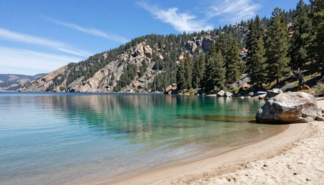
The refuge comprises 2,238 hectares (5,530 acres) of wetlands, uplands, and desert habitat. Upper Pahranagat Lake, Middle Marsh, and Lower Pahranagat Lake form the refuge’s core, attracting over 230 bird species throughout the year. These wetlands exist as rare oases within the surrounding Mojave Desert landscape.
A self-guided auto tour route winds through the refuge, offering excellent wildlife viewing from your vehicle. This convenience proves especially valuable during hot summer months or when photographing skittish birds that tolerate vehicles better than pedestrians.
The visitor center provides interpretive displays explaining the refuge’s ecological importance and the wildlife species found here. Knowledgeable staff answer questions about current bird sightings and suggest optimal viewing locations based on season and recent activity.
Alamo Road Scenic Drive
The 64 km (40 mile) Alamo Road journey between Pahranagat and Desert National Wildlife Refuges ranks among Nevada’s most scenic backcountry routes. The graded dirt road traverses diverse landscapes including Pahranagat Valley’s agricultural area, desert flats, mountain passes, and volcanic formations.
Petroglyphs appear at several locations along the way, marking sites where ancient peoples recorded their presence. These rock art panels require short walks from the road and offer fascinating glimpses into prehistoric life in this arid region.
Wildlife encounters happen frequently along Alamo Road. Watch for pronghorn antelope racing across desert flats, raptors soaring overhead, and occasional desert bighorn sheep on rocky slopes. Early morning and late afternoon provide the best wildlife viewing opportunities.

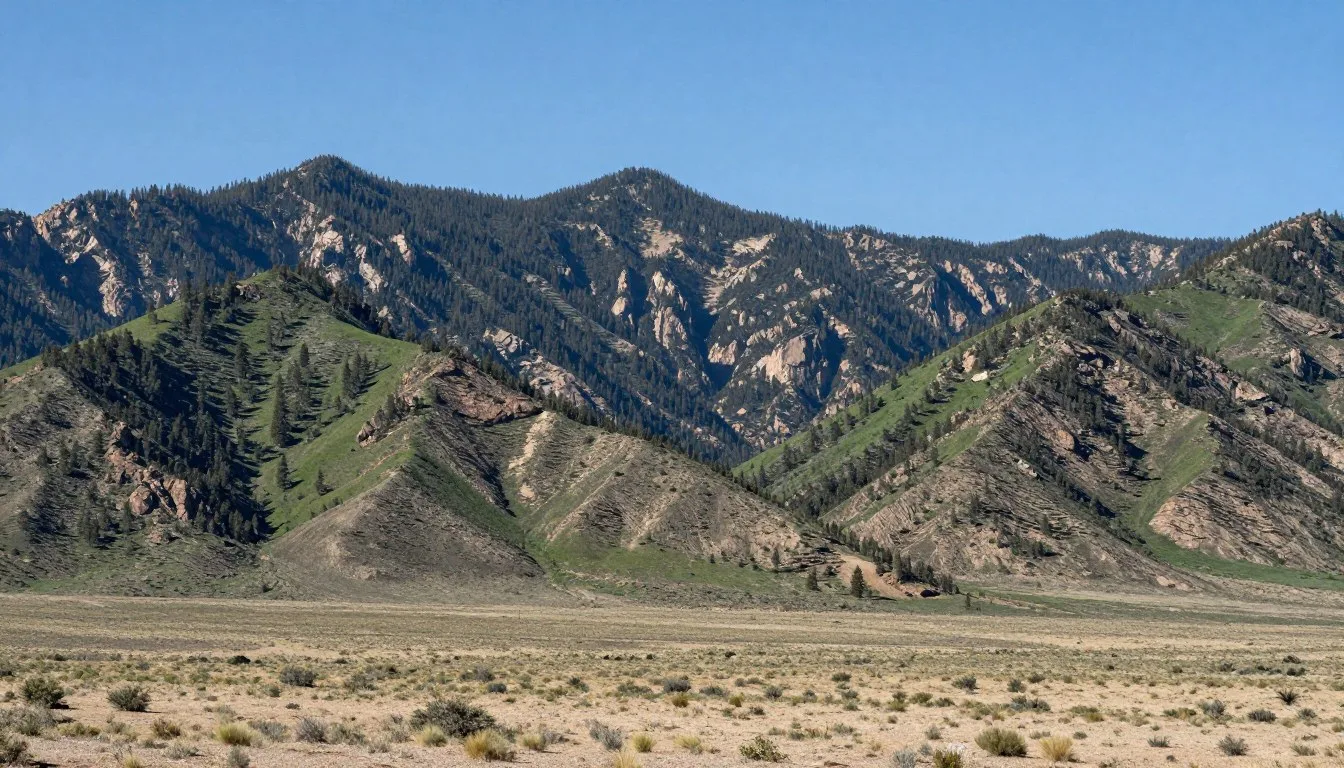
Black Canyon Wilderness Area
This rugged wilderness area borders the eastern edge of the Pahranagat Valley. Black Canyon offers serious hikers challenging routes through volcanic terrain with minimal trail development. The area’s isolation guarantees solitude but demands navigation skills and desert hiking experience.
The canyon’s dark volcanic walls contrast dramatically with the desert’s typical tan and brown hues. Geological formations showcase the region’s violent volcanic past, with basalt flows and volcanic necks creating otherworldly landscapes.
Tikaboo Peak
While not directly in the Pahranagat Range, Tikaboo Peak sits close enough to warrant mention for adventurous visitors. This mountain provides the closest legal vantage point for viewing the famous Area 51 facility. The strenuous hike covers approximately 11 km (7 miles) round trip with significant elevation gain.
Most visitors undertake this challenging trek for the unique views rather than wildlife or natural beauty. Bring high-quality binoculars or a spotting scope, and prepare for a full day’s effort reaching the summit and returning safely.
Photography Opportunities
The Pahranagat area delivers exceptional photography subjects. Spring wildflower blooms create colorful foregrounds against mountain backdrops. Refuge wetlands reflect dramatic sunrise and sunset colors while providing opportunities for bird photography.
Night skies in this remote region rank among the darkest in the continental United States. Photographers capture stunning Milky Way images with minimal light pollution. The desert’s clear air and high elevation enhance celestial visibility.
Spring Attractions
- Migratory bird concentrations at refuge
- Desert wildflower photography
- Comfortable hiking temperatures
- Newborn wildlife sightings
Year-Round Activities
- Petroglyphs exploration along trails
- Backcountry scenic driving
- Dark sky stargazing and astrophotography
- Solitude and wilderness experiences
Museums, Cultural Spots & Festivals

Cultural attractions in the Pahranagat Range area reflect the region’s mining heritage, ranching history, and indigenous presence. While not abundant, these sites provide valuable context for understanding this remote corner of Nevada.
Local History Resources
The area lacks formal museums, but the Pahranagat National Wildlife Refuge visitor center offers interpretive displays about regional natural and cultural history. Exhibits explain how springs created unique habitats in the desert and how various cultures utilized these water sources over millennia.
Historic ranching operations dot the valley, though most remain private property. The landscape itself tells stories of past uses, from old fence lines to abandoned homesteads visible from roads. These remnants illustrate the challenges of settling this arid environment.
Archaeological Sites
Numerous petroglyphs and pictographs appear throughout the Pahranagat Range, created by ancestral Puebloan peoples and later Southern Paiute groups. Some panels feature geometric designs, while others depict bighorn sheep, human figures, and abstract symbols.
Treat all rock art sites with respect. Never touch petroglyphs, as skin oils damage the ancient images. Photograph from appropriate distances and report any vandalism to refuge or BLM officials. These irreplaceable cultural resources deserve protection for future generations.
Cultural Site Protection: Federal laws protect archaeological sites on public lands. Removing artifacts, damaging rock art, or disturbing sites carries serious penalties. Observe, photograph, but never touch or collect from cultural sites.
Regional Museums
Cathedral Gorge State Park, about 80 km (50 miles) southeast, maintains a small visitor center with exhibits about regional geology and early settlers. The park’s dramatic eroded formations provide natural attractions alongside cultural information.
Pioche, approximately 96 km (60 miles) northeast, preserves several historic buildings from its wild mining town days. The Million Dollar Courthouse and historic cemetery offer glimpses into Nevada’s frontier past. The town welcomes visitors exploring its historic main street.
Community Events
Small communities throughout Lincoln County host occasional gatherings celebrating local heritage. These informal events might include historical society presentations, ranching demonstrations, or traditional skills workshops. Check with the tourism office for current schedules.
The area’s isolation has preserved traditional rural lifestyles largely unchanged by modern development. Conversations with longtime residents often reveal fascinating family histories spanning generations of ranching, mining, and adapting to desert life’s challenges.
Nature & Outdoor Experiences

Hiking Opportunities
Formal hiking trails remain limited in the Pahranagat backcountry, but numerous routes follow old roads, washes, and wildlife paths. The refuge features the Dove Dike Trail, a 1.1 km (0.7 mile) path offering excellent bird watching along marsh edges. This easy trail provides level walking suitable for all fitness levels.
Backcountry hiking beyond established trails requires navigation skills and desert experience. The terrain’s openness tempts hikers to wander freely, but lack of landmarks makes returning to vehicles challenging without GPS or strong compass skills. Willow trees along water sources help with orientation in the valley.
Always carry abundant water when hiking in this desert environment. Calculate at least 1 liter per hour of activity during warm weather, and double that during summer. Dehydration happens quickly in the dry air, even when temperatures feel moderate.
Wildlife Watching
Pahranagat National Wildlife Refuge exists primarily for bird conservation. Over 230 species visit these wetlands during various seasons. Spring and fall migrations bring the greatest diversity, with waterfowl, shorebirds, and songbirds concentrating at the refuge’s lakes and marshes.
Year-round residents include great blue herons, white-faced ibis, and various duck species. Bald eagles winter at the refuge, while summer brings breeding birds including killdeer and American avocets. Bring binoculars and a field guide to maximize wildlife identification opportunities.

Mammals seen in the area include coyotes, kit foxes, and occasional bobcats. Pronghorn antelope inhabit open desert areas, capable of remarkable speeds when alarmed. Desert bighorn sheep occupy rocky terrain in surrounding mountains, though sightings require luck and patience.
Stargazing
The Pahranagat Valley’s remote location and minimal light pollution create exceptional dark sky conditions. On moonless nights, the Milky Way appears brilliantly overhead, and thousands of stars invisible in urban areas shine clearly.
Bring a star chart or astronomy app to identify constellations and planets. Binoculars reveal nebulae and star clusters, while telescopes showcase deep sky objects in remarkable detail. The dry desert air provides steady atmospheric conditions ideal for astronomical observation.
Plan stargazing sessions during new moon phases for darkest skies. Allow eyes 20-30 minutes to adapt fully to darkness before expecting optimal night vision. Avoid white flashlights; use red LED lights to preserve night vision while moving around.
Desert Ecology Exploration
The transition zone where Mojave Desert meets Great Basin creates unique plant communities. Creosote bush dominates lower elevations, while sagebrush increases at higher areas. Joshua trees appear sporadically, marking the edge of their natural range.
Spring brings ephemeral displays when winter rains soak the desert. Wildflowers including desert marigold, lupine, and penstemon create colorful carpets across valley floors. These blooms typically peak in April but timing varies with precipitation patterns.
Wildlife Viewing Tips
- Visit during early morning or late afternoon for activity peaks
- Remain quiet and move slowly near wildlife
- Use vehicles as blinds for photography
- Keep binoculars and camera ready at all times
- Respect wildlife by maintaining safe distances
Desert Photography Success
- Shoot during golden hour for warm light
- Use polarizing filters to deepen blue skies
- Protect cameras from dust with protective bags
- Bracket exposures in high-contrast conditions
- Clean equipment frequently to prevent dust damage
Desert Survival Skills
Understanding desert ecology enhances safety and appreciation. Learn to identify water sources by following wildlife trails and looking for green vegetation. Understand how desert animals adapt through nocturnal habits and specialized physiology.
Practice Leave No Trace principles rigorously in this fragile environment. Desert soils recover slowly from disturbance. Stick to established routes when possible, and avoid creating new trails across pristine desert surfaces. Pack out all trash, including organic waste that decomposes slowly in arid conditions.
Safety, Etiquette & Local Customs

Desert Safety Essentials
Remote desert travel demands serious safety preparation. Cell phone service remains unreliable throughout most of the area. Download offline maps before departing and carry physical backup maps. GPS devices work well but bring spare batteries or solar charging capability.
Inform someone of your planned route and expected return time before venturing into backcountry areas. Establish a check-in protocol so someone will alert authorities if you fail to return as scheduled. This simple precaution saves lives when unexpected problems occur.
Vehicle breakdowns in remote areas create serious situations. Carry emergency supplies including extra water (at least 7 liters per person), non-perishable food, first aid kit, blankets, flashlight, and basic tools. A satellite communicator or emergency beacon provides peace of mind when traveling beyond cell coverage.
Weather Hazards
Flash floods pose the greatest weather danger in desert environments. These sudden torrents can occur even when skies appear clear overhead, caused by distant thunderstorms. Never camp in washes or low areas, and avoid driving through standing water of any depth.
Lightning threatens exposed areas during thunderstorms. Retreat from ridges, lone trees, and open areas when storms approach. Take shelter in vehicles if caught in exposed terrain, as they provide effective lightning protection through tire insulation.
Extreme heat during summer months creates dangerous conditions. Temperatures exceeding 38°C (100°F) make strenuous outdoor activities potentially fatal. Plan hiking for early morning hours, carry abundant water, and recognize heat exhaustion symptoms including dizziness, nausea, and confusion.
Emergency Contact: In case of emergency, dial 911. However, cell service limitations may prevent calls. Lincoln County Sheriff’s Office: +1 775-962-5136
Wildlife Precautions
Rattlesnakes inhabit this area and become active during warm weather. Watch where you place hands and feet when scrambling over rocks or reaching into crevices. Snakes typically retreat when given opportunity; most bites occur when people accidentally step on or handle them.
Scorpions hide under rocks and debris during daylight. Shake out boots and clothing before dressing, especially when camping. Their stings cause pain but rarely create medical emergencies in healthy adults. Seek medical attention if severe reactions develop.
Avoid approaching or feeding any wildlife. Animals habituated to humans lose natural wariness and may become aggressive. Maintain safe distances using binoculars or telephoto lenses for viewing. Store food securely to prevent attracting animals to campsites.
Backcountry Etiquette
Respect private property boundaries throughout the valley. Many parcels along roads remain privately owned despite the surrounding public lands. Never trespass on fenced or posted areas, and close all gates exactly as you found them.
Ranching remains an active livelihood in this area. Give livestock wide berth and never disturb or harass cattle. During spring, be especially cautious around calves, as protective mother cows may charge perceived threats.
Many roads in this area serve working ranches and mining operations. Yield to local traffic, which often includes large vehicles towing trailers or hauling equipment. Pull completely off the road when stopping for photography or wildlife viewing.
Cultural Sensitivity
Rural Nevada communities value self-reliance, privacy, and traditional ways of life. Approach interactions respectfully, understanding that many residents’ families have worked this land for generations. Ask permission before photographing private property or individuals.
Native American sites deserve special reverence. Never disturb archaeological resources, and report suspected vandalism or looting to authorities. These sites connect contemporary indigenous peoples with their ancestors and heritage.
Preparation Checklist: Never venture onto backcountry roads without these essentials: abundant water, detailed maps, full fuel tank, emergency supplies, first aid kit, appropriate clothing layers, and communication plan.
Visitor Comments About Pahranagat Range Backcountry Roads

“The solitude along Alamo Road exceeded all expectations. We drove the entire route without encountering another vehicle, and the wildlife sightings were phenomenal. Three pronghorn crossed right in front of us, and we spotted numerous raptors. The petroglyphs near mile marker 12 left us speechless. This trip reminded us why we love exploring Nevada’s remote places.”
“Pahranagat refuge provided the best birding we’ve experienced in the Southwest. The spring migration brought incredible diversity, and we identified over 80 species during our three-day visit. The auto tour route made photography easy, and refuge staff offered excellent advice about current hot spots. Upper Pahranagat Lake at sunrise was magical with hundreds of waterfowl taking flight.”
“Our family discovered this area accidentally while driving between national parks, and it became a trip highlight. The kids loved exploring the different landscapes along Alamo Road, from valley farmland to rugged mountain passes. We camped on BLM land with incredible dark skies showing the Milky Way brilliantly. The area’s remoteness felt refreshing after crowded tourist attractions. We’ll definitely return for more exploration.”
Additional Nearby Destinations

The Pahranagat Range’s central location within Lincoln County positions visitors to explore numerous additional attractions. These destinations combine well with your backcountry adventure, creating comprehensive Nevada experiences.
Cathedral Gorge State Park
Located 80 km (50 miles) southeast near Panaca, this state park features dramatic eroded clay formations creating cathedral-like spires and narrow slot canyons. Easy trails wind through the formations, suitable for all ages and fitness levels. The park offers camping, picnic areas, and interpretive programs.
The gorge’s buff-colored cliffs glow beautifully during sunrise and sunset. Photography enthusiasts spend hours capturing the interplay of light and shadow on eroded surfaces. Summer evenings bring ranger-led programs explaining the geology and ecology.
Desert National Wildlife Refuge
Alamo Road’s northern terminus reaches Desert National Wildlife Refuge, the largest refuge in the lower 48 states. This vast protected area encompasses 647,497 hectares (1.6 million acres) of Mojave Desert habitat, including critical bighorn sheep populations.
The refuge offers additional backcountry driving opportunities and wilderness hiking. Mormon Well Road provides another scenic route through diverse terrain. Visitor facilities remain minimal, emphasizing wilderness character over developed amenities.
Area 51 Vicinity
The famous top-secret military installation sits just northwest of the Pahranagat area. While the base itself remains strictly off-limits, the surrounding region embraces its alien-themed identity. Rachel’s Little A’Le’Inn provides quirky entertainment and photo opportunities.
The Extraterrestrial Highway (State Route 375) offers scenic desert driving with numerous pullouts featuring alien-themed displays and information panels. This route connects to the western side of the Pahranagat backcountry road network.
Caliente and Kershaw-Ryan State Park
Caliente, 64 km (40 miles) south, preserves beautiful early 20th-century railroad architecture. The town’s historic depot and downtown buildings showcase Mission Revival style. Just south of town, Kershaw-Ryan State Park features a shaded canyon with hiking trails and picnic facilities.
The park’s canyon provides welcome relief from open desert landscapes. A small stream supports lush vegetation creating a microclimate oasis. Easy trails explore the narrow canyon while more challenging routes climb to overlooks.
North
- Desert National Wildlife Refuge
- Extraterrestrial Highway attractions
- Rachel and Little A’Le’Inn
South
- Caliente historic district
- Kershaw-Ryan State Park
- Rainbow Canyon scenic route
East
- Cathedral Gorge State Park
- Pioche historic mining town
- Echo Canyon State Park
Great Basin National Park
Though requiring a longer drive at approximately 209 km (130 miles) northeast, Great Basin National Park rewards the journey with dramatically different landscapes. The park features ancient bristlecone pine forests, Lehman Caves, and Wheeler Peak rising to 3,982 m (13,065 feet).
This park provides excellent contrast to Pahranagat’s desert environments. Alpine meadows, permanent snowfields, and mountain streams showcase Nevada’s ecological diversity. Plan at least one full day to explore the park’s highlights adequately.
Practical Travel Tips

Essential Packing List
Beyond standard travel items, desert backcountry exploration requires specialized equipment. Bring at least 7 liters of water per person per day during warm seasons. Add extra for vehicle radiator emergencies in case of breakdowns. Collapsible water containers save space when empty.
Sun protection proves critical in Nevada’s intense desert environment. Pack broad-spectrum sunscreen rated SPF 30 or higher, wide-brimmed hats, and UV-protective sunglasses. Lip balm with sun protection prevents painful chapping in the dry air. Long-sleeved shirts and pants provide better protection than relying solely on sunscreen.
Navigation tools should include detailed maps, GPS device or smartphone with downloaded offline maps, and a compass. Paper maps never run out of batteries and provide valuable backup. The BLM Nevada map series covers this region in excellent detail.
Money and Services
ATMs exist in Alamo and Caliente but can run out of cash during busy periods or experience technical problems. Carry sufficient cash for your entire trip. Many small businesses in rural Nevada prefer cash and may have limited ability to process cards.
Credit cards work at most gas stations and lodging facilities, but small cafes and stores may be cash-only. Plan accordingly to avoid inconvenience. No currency exchange services exist in this area; handle exchanges before arrival if coming from outside the United States.
Communication and Connectivity
Cell phone coverage remains spotty throughout Lincoln County. Major carriers provide service along State Route 93 corridors, but backcountry roads often lack any signal. Download all necessary information, maps, and guides before leaving service areas.
Consider renting or purchasing a satellite communicator for serious backcountry exploration. Devices like Garmin inReach provide two-way text messaging and emergency SOS capability anywhere. This technology offers invaluable peace of mind when venturing into remote areas.
WiFi availability remains limited to some lodging facilities. Don’t expect internet access in most locations. Plan entertainment and information needs accordingly, downloading music, podcasts, or audiobooks before arrival.
Trip Planning Resources: Contact Pahranagat National Wildlife Refuge for current conditions, road status, and wildlife activity: +1 775-725-3417
Lincoln County Tourism Office provides regional information: +1 775-962-5207
Photography Considerations
Desert dust infiltrates camera equipment relentlessly. Bring protective bags or covers for cameras when not actively shooting. Clean sensors and lenses frequently using proper techniques and tools. Consider bringing older camera bodies for dusty conditions rather than risking expensive equipment.
Extra batteries prove essential as cold nights drain power quickly. Memory cards should have ample capacity since no stores sell photography supplies nearby. Bring laptop or tablet if you plan to back up images during your trip.
Seasonal Clothing Recommendations
Spring and fall require layered clothing systems. Mornings start cold, afternoons warm considerably, and evenings cool rapidly. Bring fleece or insulated jackets, long pants, and light shirts that layer effectively. Temperatures can swing 17°C (30°F) between morning and afternoon.
Summer demands lightweight, breathable fabrics in light colors. Despite heat, cover skin for sun protection rather than exposing it. Wide-brimmed hats protect face and neck more effectively than baseball caps.
Winter visitors need serious cold-weather gear for nights and early mornings. Temperatures drop below freezing regularly, and wind chill makes conditions feel even colder. Insulated layers, warm sleeping bags, and hand warmers prove worthwhile.
Vehicle Preparation
Check tire pressure and condition before departing on dirt roads. Carry a full-size spare tire, jack, and lug wrench. Small portable air compressors allow adjusting tire pressure for different road conditions. Lower pressure improves traction on sandy or washboard roads.
Bring basic tools and spare fluids including motor oil, coolant, and transmission fluid. A shovel helps when vehicles become stuck in sand or mud. Recovery straps provide options for self-extraction or assistance from other travelers.
Ensure vehicle cooling systems function properly before tackling desert travel. Overheating creates dangerous situations in remote locations. Check coolant levels, hoses, and radiator caps for any signs of deterioration.
Summer Essentials
- Extra water (double normal amount)
- Electrolyte replacement drinks
- Cooling towels and spray bottles
- Sunscreen SPF 50 or higher
- Wide-brimmed hat and light colors
Winter Preparations
- Insulated clothing layers
- Cold-weather sleeping bag
- Emergency blankets
- Hand and foot warmers
- Ice scraper and warm gloves
Your Desert Adventure Awaits
The Pahranagat Range backcountry roads reveal a Nevada far removed from neon lights and casino crowds. Here, ancient petroglyphs speak across millennia, wildlife thrives in unexpected oases, and vast silences invite contemplation. Every mile of Alamo Road’s 64 km journey offers discoveries from geological wonders to rare bird sightings.
This landscape rewards those who embrace remoteness and prepare thoughtfully. Whether you spend days photographing marsh birds at the national wildlife refuge, exploring volcanic formations along desert trails, or simply savoring star-filled skies unmarred by light pollution, the Pahranagat backcountry creates lasting memories.
Pack your sense of adventure along with plenty of water, respect the desert’s power, and venture into this remarkable corner of the Silver State. The Pahranagat Range awaits with experiences impossible to find in more traveled destinations. Your desert journey begins where the pavement ends and true Nevada reveals itself.