Hotels by Trip.com
Flights by Trip.com
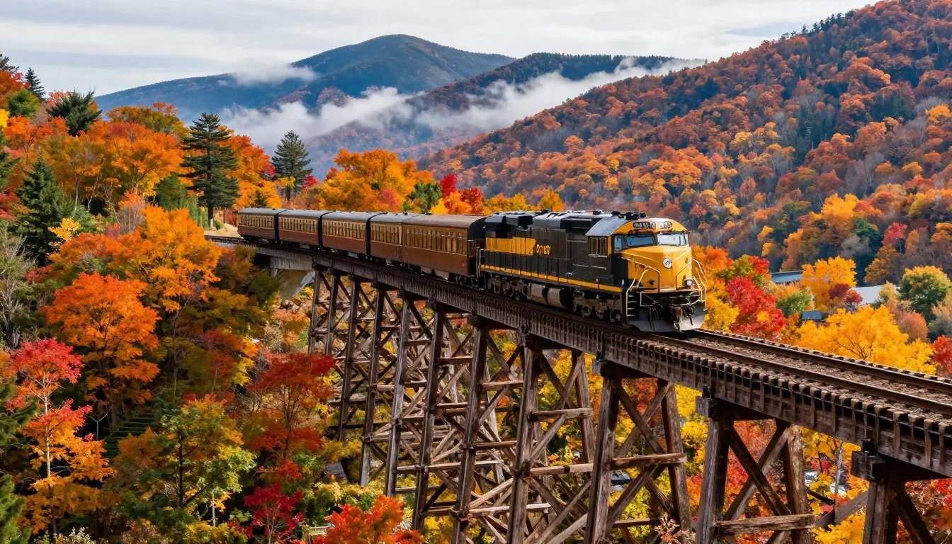
The Great Balsam Mountains hold six peaks above 1,829 m (6,000′), making this range one of the highest concentrations of tall summits in the eastern United States. This remarkable mountain range stretches along the border of Jackson and Haywood Counties in western North Carolina.
The name “Balsam” comes from the Fraser fir trees that blanket the highest elevations. Early settlers noticed these fragrant evergreens resembled the balsam firs of northern forests.
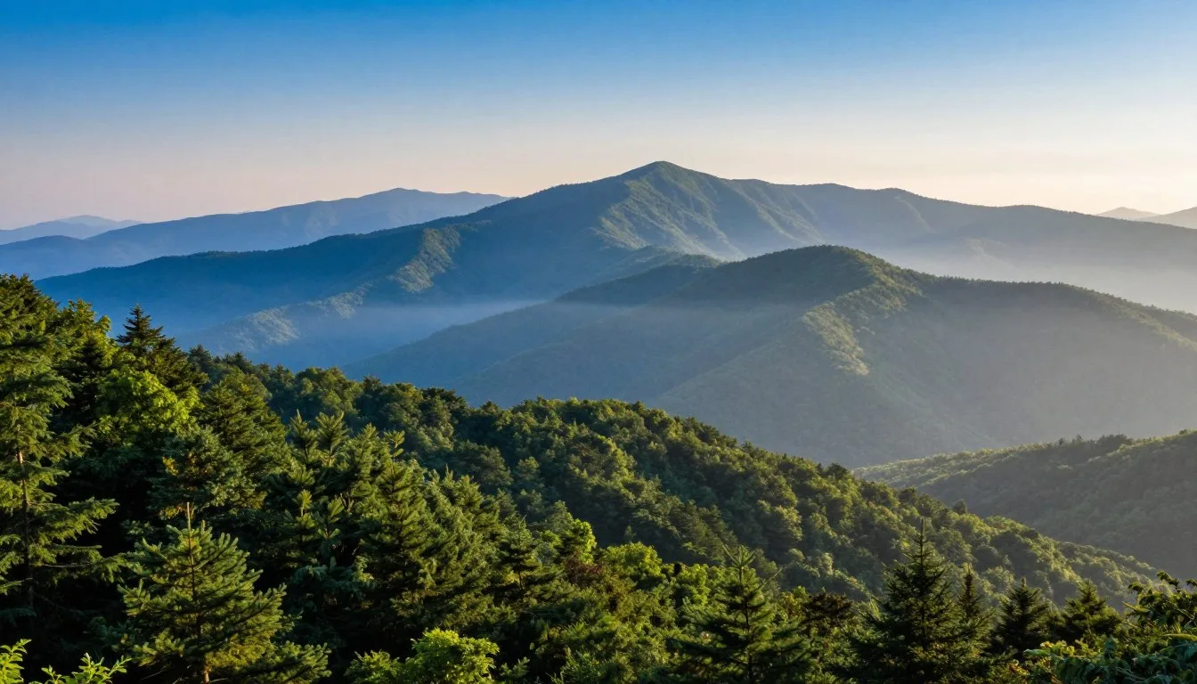
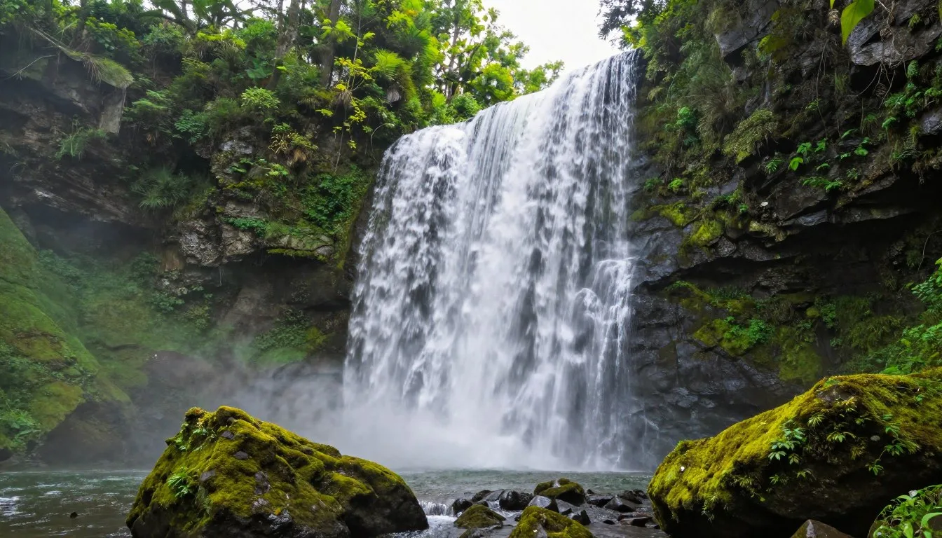
These mountains form part of the Blue Ridge Mountains and connect directly to Great Smoky Mountains National Park. The area offers pristine wilderness, challenging trails, and some of the most spectacular views in North Carolina.
Whether you seek peaceful forest walks or demanding summit hikes, the Great Balsam Mountains deliver unforgettable outdoor experiences. This guide covers everything you need to plan your mountain adventure.
Getting There & Planning Your Journey

The Great Balsam Mountains sit in western North Carolina, approximately 48 km (30 miles) west of Asheville. The Blue Ridge Parkway provides the primary access route to this mountain range.
Most visitors arrive through Asheville Regional Airport, located 64 km (40 miles) northeast of the area. This airport offers connections to major cities across the United States. Rental cars are available at the airport.
Charlotte Douglas International Airport sits 209 km (130 miles) east. This larger hub provides more flight options but requires a longer drive through scenic mountain roads.
From Asheville, take Interstate 40 west, then connect to the Blue Ridge Parkway. The parkway winds through the mountains, offering spectacular overlooks and trail access points. Plan for slow driving on the parkway’s curves.
The nearest towns include Waynesville to the north and Sylva to the south. Both communities offer services, supplies, and lodging options. Waynesville sits just 24 km (15 miles) from major trailheads.
Planning Tip: Contact the Blue Ridge Parkway Visitor Center for current road conditions and seasonal closures. Winter storms frequently close high-elevation sections of the parkway from November through April.
The National Park Service maintains the parkway and nearby facilities. Call ahead to verify trail conditions and campground availability before your trip.
Mountain roads require careful navigation. Sharp curves, steep grades, and weather changes demand attention. Allow extra travel time, especially during peak fall foliage season when traffic increases significantly.
✓ Check 30,000+ Local Sightseeing Tours Worldwide
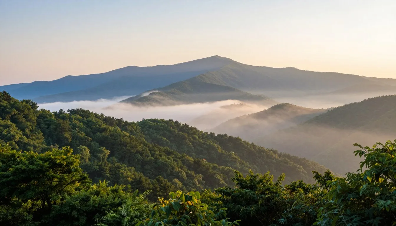
Best Time to Visit & Weather Tips
Spring arrives late in the Great Balsam Mountains. May and June bring wildflowers and comfortable temperatures. Daytime highs reach 18°C to 24°C (65°F to 75°F) at lower elevations.
Summer offers the warmest weather from July through August. Temperatures range from 21°C to 27°C (70°F to 80°F) in valleys. High peaks remain cooler, perfect for hiking.
Fall transforms the mountains into a spectacular display. Late September through October delivers peak foliage colors. Expect large crowds during this popular season. Temperatures drop to 10°C to 18°C (50°F to 65°F).
Winter brings snow and ice to high elevations. November through March sees frequent storms. Many trails become dangerous. The Blue Ridge Parkway often closes.
Recommended Visiting Months
Best Months
- May – Wildflowers bloom, mild weather
- June – Clear skies, comfortable temperatures
- September – Fewer crowds, pleasant hiking conditions
- October – Fall foliage at peak, crisp air
Months to Avoid
- January – Heavy snow, road closures
- February – Coldest temperatures, ice hazards
- March – Unpredictable storms, muddy trails
- November – Early winter conditions begin
Weather changes rapidly at elevation. Morning sunshine can turn to afternoon thunderstorms within hours. Pack layers regardless of season.
High peaks like Richland Balsam at 1,893 m (6,410′) experience temperatures 8°C to 11°C (15°F to 20°F) cooler than valleys. Wind chill factors significantly affect comfort levels on exposed summits.
Weather Safety: Check forecasts before every hike. Afternoon thunderstorms occur frequently from June through August. Start early and plan to finish before 2 PM during summer months.
Notable Annual Festivals

The surrounding communities celebrate mountain culture throughout the year. These festivals showcase local traditions, music, and crafts.
Folkmoot USA takes place in Waynesville each July. This international folk festival brings dancers and musicians from around the world. The event runs for two weeks with multiple performances daily.
Folkmoot USA Information:
The Balsam Range Music Festival occurs in September. This bluegrass celebration features regional bands and workshops. The festival takes place in nearby Canton.
Apple Harvest Festival in Waynesville happens each October. Local orchards showcase their harvest with tastings, crafts, and mountain music. This event coincides with peak fall colors.
The Mountain Heritage Day Festival celebrates Appalachian culture every September. Held at Western Carolina University in Cullowhee, this free event features traditional crafts, music, and food.
Mountain Heritage Festival Contact:
Contact festival organizers directly for current dates and schedules. Events sometimes shift dates based on weather or local calendars.
Getting Around Locally
Personal vehicles provide the only practical transportation in the Great Balsam Mountains. Public transit does not serve this rural mountain area.
The Blue Ridge Parkway functions as the main route through the mountains. This scenic road has a speed limit of 72 km/h (45 mph). No commercial vehicles are permitted on the parkway.
Secondary forest roads provide access to trailheads and campgrounds. Many of these roads remain unpaved. High-clearance vehicles handle rough conditions better than low cars.
Parking areas fill quickly on weekends and during fall foliage season. Arrive early at popular trailheads. The Grassy Cove parking area often reaches capacity by 9 AM on Saturdays.
Cell phone service becomes unreliable in valleys and remote areas. Download offline maps before entering the mountains. The National Forest Service offers free trail maps at ranger stations.
Gas stations are scarce along the parkway. Fill your tank in Waynesville or Sylva before heading into the mountains. The nearest fuel stops may be 32 km (20 miles) away from trailheads.
Navigation Tip: GPS systems sometimes provide incorrect directions on mountain roads. Verify routes with paper maps or downloaded offline maps. Forest Service roads may not appear accurately on standard GPS devices.
Where to Stay

Lodging options range from primitive camping to comfortable mountain inns. The area offers choices for every budget and comfort level.
Camping Options
Heintooga Ridge Campground sits within Great Smoky Mountains National Park. This campground provides 16 sites near Balsam Mountain. The facility operates from late May through October.
Campground Reservations:
Black Balsam Knob area allows dispersed camping. Hikers can camp along the Art Loeb Trail with proper permits. Contact the Pisgah National Forest office for current regulations.
Private campgrounds operate in Waynesville and Sylva. These facilities offer RV hookups, showers, and amenities not available in forest campgrounds.
Mountain Lodges and Inns
The Balsam Mountain Inn in Balsam provides historic accommodations. This restored railroad hotel dates to 1908. The inn features period furnishings and mountain views.
Waynesville offers numerous bed and breakfast establishments. These family-run properties provide personal service and local knowledge. Many serve breakfast featuring regional specialties.
Chain hotels concentrate in Waynesville and Sylva. These options work well for travelers wanting familiar amenities and rewards programs.
Vacation Rentals
Mountain cabins provide privacy and full kitchens. Rental properties dot the hillsides around Waynesville. Many offer hot tubs, fireplaces, and panoramic views.
Book accommodations well in advance for October visits. Fall foliage season fills properties months ahead. Summer weekends also require early reservations.
Booking Tip: Reserve campsites and lodging at least two months ahead for peak season. Last-minute availability becomes very limited during fall color season and summer holidays.
Dining & Local Cuisine
Mountain cuisine reflects Appalachian traditions. Local restaurants serve hearty portions of regional favorites. Fresh trout, country ham, and seasonal vegetables feature prominently on menus.
Waynesville’s downtown offers the highest concentration of dining options. Several restaurants focus on farm-to-table concepts using local produce and meats.
Breakfast often includes country ham, biscuits with gravy, and grits. Many diners open early to serve hikers heading to trails. Portions typically satisfy hungry appetites after morning hikes.
Trout appears on most menus in the area. Local streams provide fresh rainbow and brook trout. Restaurants prepare the fish pan-fried, grilled, or smoked.
Barbecue styles vary between vinegar-based eastern Carolina and tomato-based western styles. Several local joints have earned regional recognition for their pulled pork and ribs.
Craft breweries have multiplied in recent years. Waynesville and Sylva each host several small breweries featuring mountain-themed beers. Tasting rooms welcome visitors.
Regional Specialties
- Apple stack cake – traditional layered dessert
- Ramp dishes – wild mountain leeks
- Sourwood honey from local beekeepers
- Cherokee fry bread at cultural sites
Dining Tips
- Cash-only establishments still common
- Restaurants close early on weeknights
- Limited options directly on the parkway
- Pack trail snacks and lunch for hikes
Grocery stores in Waynesville and Sylva stock supplies for camping and cooking. Farmers markets operate seasonally, offering local produce and honey.
Attractions, Sightseeing & Activities

The Great Balsam Mountains offer countless ways to experience mountain beauty. Activities range from gentle sightseeing drives to challenging outdoor pursuits.
Scenic Drives
The Blue Ridge Parkway provides the premier scenic drive through the area. Mile markers 443 through 458 traverse the Great Balsam range. Numerous overlooks offer photo opportunities and interpretive signs.
Heintooga Ridge Road branches off the parkway into Great Smoky Mountains National Park. This side road leads to overlooks and the Heintooga Campground. The gravel portion requires careful driving.
Each season transforms the parkway views. Spring brings flowering dogwoods and rhododendrons. Summer offers lush green canopies. Fall delivers the famous color display.
Photography Locations
Richland Balsam Overlook at milepost 431 provides sweeping views across multiple ranges. Sunrise and sunset both produce excellent lighting conditions here.
The summit of Cold Mountain attracts photographers seeking dramatic landscapes. This peak gained fame from the novel and film of the same name.
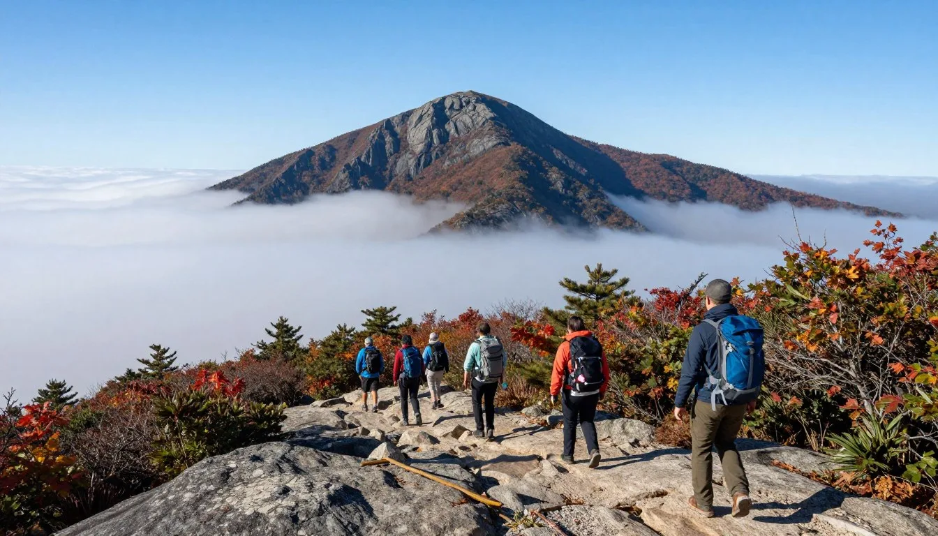
Grassy Ridge balds offer 360-degree views above treeline. These open meadows showcase wildflowers in summer and panoramic mountain vistas year-round.
Wildlife Viewing
Black bears inhabit the forests throughout the Great Balsam Mountains. Early morning and evening hours provide the best viewing opportunities. Maintain safe distances and never approach or feed bears.
White-tailed deer browse in meadows and forest edges. Elk populations in nearby Cataloochee Valley sometimes wander into the southern Balsam area.
Bird species include ravens, peregrine falcons, and numerous songbirds. The high-elevation spruce-fir forests host rare species like the northern saw-whet owl.
Bear Safety: Store all food in bear-proof containers or vehicles. Never leave food unattended at campsites. Make noise while hiking to avoid surprising bears on trails.
Museums, Cultural Spots & Festivals
Cultural attractions in nearby communities complement outdoor experiences. Museums preserve mountain heritage and Cherokee traditions.
The Museum of North Carolina Handicrafts in Waynesville displays traditional mountain crafts. Exhibits showcase quilts, pottery, and woodworking from regional artisans. The museum occupies a historic schoolhouse built in 1875.
Shelton House Museum in Waynesville presents life in early Haywood County. Period furnishings and artifacts illustrate 19th-century mountain living. Volunteers provide tours and historical context.
The Museum of the Cherokee Indian in Cherokee explores thousands of years of Native American history. Interactive exhibits and artifacts tell the story of the Eastern Band of Cherokee Indians.
Downtown Waynesville hosts First Friday Gallery Walks. Local artists open studios and galleries on the first Friday evening of each month. The events run from April through December.
The Haywood Arts Regional Theatre presents productions year-round. This community theater showcases both classic and contemporary works.
Cultural Tip: Many cultural sites offer reduced admission on certain days. Contact museums directly for current hours and special program schedules.
Nature & Outdoor Experiences

Hiking trails network throughout the Great Balsam Mountains. Routes range from easy nature walks to demanding multi-day backpacking trips.
Featured Hiking Trails
The Art Loeb Trail extends 48 km (30 miles) through Pisgah National Forest. This challenging route crosses the highest peaks of the Great Balsam range. The trail connects to other paths for extended backpacking trips.
Black Balsam Knob trail offers easier access to high-elevation views. This 2.4 km (1.5 mile) hike climbs to 1,860 m (6,100′) elevation. The treeless summit provides panoramic vistas across western North Carolina.
Richland Balsam Trail forms a 2.2 km (1.4 mile) loop to the highest peak on the Blue Ridge Parkway. The well-maintained path winds through spruce-fir forest to the 1,893 m (6,410′) summit.
Grassy Cove Top trail covers 5.3 km (3.3 miles) one way. This moderate hike traverses open balds and forest. Views extend to Great Smoky Mountains National Park on clear days.
Trail Conditions and Preparation
Elevation gains challenge even experienced hikers. Most trails climb 305 to 610 m (1,000 to 2,000 feet) from trailheads. Pace yourself and take breaks as needed.
Weather changes rapidly at high elevations. Carry rain gear and warm layers even on sunny days. Afternoon thunderstorms develop quickly during summer months.
Water sources are limited on ridge trails. Carry sufficient water for your entire hike. Plan for at least one liter per person per 8 km (5 miles) of trail.
✓ Check 30,000+ Local Sightseeing Tours Worldwide
Essential Hiking Gear
- Navigation tools – map, compass, GPS device
- Extra food and water beyond planned needs
- Rain jacket and insulating layers
- First aid kit with blister treatment
- Headlamp or flashlight with extra batteries
- Fire starter and emergency shelter
- Multi-tool or knife
- Sun protection – sunscreen, hat, sunglasses
- Whistle for emergency signaling
- Trekking poles for steep sections
Backpacking Opportunities
The Art Loeb Trail supports multi-day trips through the mountains. Designated camping areas appear at intervals along the route. Backcountry permits are required from the National Forest Service.
Backcountry Permit Information:
Shining Rock Wilderness Area borders the Great Balsam range. This 7,284-hectare (18,000-acre) wilderness offers primitive camping and challenging terrain. Navigation skills are essential as trails are often unmarked.
Seasonal Considerations
Spring brings mud and slippery conditions to trails. Wait for trails to dry before hiking to prevent erosion damage. May and June offer the best spring hiking weather.
Summer provides the most stable weather patterns. However, afternoon thunderstorms pose lightning risks on exposed ridges. Start hikes early to finish before storms develop.
Fall hiking delivers spectacular colors and comfortable temperatures. Crowds increase significantly during October. Weekday visits offer more solitude than weekends.
Winter hiking demands specialized gear and experience. Ice, snow, and freezing temperatures create dangerous conditions. Only experienced winter hikers should attempt high-elevation trails from November through March.
Travel With Children

The Great Balsam Mountains offer family-friendly activities alongside challenging adventures. Selecting appropriate trails and activities ensures enjoyable experiences for all ages.
Kid-Friendly Trails
The Richland Balsam Trail works well for families with older children. The 2.2 km (1.4 mile) loop includes gradual elevation gain. Interpretive signs along the path teach about mountain ecology.
Heintooga Overlook provides easy access to mountain views. A short walk from the parking area reaches the viewpoint. This spot requires minimal hiking while delivering impressive scenery.
Nature walks near campgrounds offer gentle introductions to mountain environments. Children can explore without demanding mileage requirements.
Educational Opportunities
Junior Ranger programs at Great Smoky Mountains National Park engage children with interactive activities. Kids complete activity booklets to earn badges. Programs focus on wildlife, plants, and mountain history.
Wildflower identification provides a fun learning activity. Spring and summer blooms offer numerous species to discover. Many trailhead kiosks display common flower guides.
Wildlife tracking in soft trail mud excites young explorers. Look for deer, bear, and raccoon prints. Teach children to observe without disturbing animals or habitat.
Safety Considerations
Keep children within sight on trails. Mountain paths include steep drop-offs and obstacles. Hold hands with young children near cliff edges and stream crossings.
Dress children in bright colors for visibility. Layers allow adjustments as activity levels and weather change. Pack extra clothing for children who may get wet or cold.
Bring adequate snacks and water. Children need frequent fuel during physical activities. Plan for more breaks than adult-only hikes require.
Family Hiking Tip: Choose trails rated easy or moderate for family outings. Plan for half the mileage you would normally hike. Children tire more quickly and need frequent rest stops.
Teach children about bear safety before hiking. Explain the importance of making noise and staying together as a group. Show them how to identify bear sign without approaching.
Money Saving Tips
Mountain vacations can strain budgets, but smart planning reduces costs significantly. These strategies help maximize experiences while minimizing expenses.
Accommodation Savings
- Camp instead of staying in hotels – saves 75% or more
- Visit during shoulder seasons for lower lodging rates
- Book vacation rentals with kitchens to prepare meals
- Share cabin rentals with another family
Activity Savings
- All hiking trails are completely free
- Blue Ridge Parkway requires no entrance fee
- Bring your own equipment instead of renting
- Visit museums on discount days
Pack food from home rather than buying supplies in mountain towns. Grocery prices increase in tourist areas. Coolers keep food fresh for several days of camping.
Free activities dominate the area. Hiking, wildlife viewing, and scenic drives cost nothing. These experiences often prove more memorable than paid attractions.
National Forest campgrounds cost significantly less than private campgrounds. Primitive sites offer even greater savings. Dispersed camping in national forests is free with proper permits.
Visit during weekdays when possible. Lodging rates drop Sunday through Thursday. Trails and attractions are less crowded on weekdays too.
Annual America the Beautiful Pass covers entrance fees to all national parks and federal recreation sites. The pass costs less than a week in several parks. This works well for families planning multiple park visits.
Budget Planning: A week-long trip for a family of four can cost under $500 by camping, cooking meals, and focusing on free outdoor activities. Compare this to $2,000 or more for hotels and restaurants.
Safety & Local Customs
Mountain environments present unique challenges. Understanding local conditions and customs ensures safer, more enjoyable visits.
Wilderness Safety
Tell someone your hiking plans before entering the backcountry. Provide expected return times and trail names. This information proves critical if rescue becomes necessary.
Cell phone coverage is unreliable throughout the mountains. Do not depend on phones for emergency communication or navigation. Carry paper maps and compass as backup navigation tools.
Weather changes create the most common hazards. Hypothermia can occur even in summer when rain and wind combine. Lightning strikes pose serious risks on exposed ridges during thunderstorms.
Stream crossings become dangerous during high water. Heavy rain can make normally easy crossings impassable. Never attempt to cross swift water above knee depth.
Emergency Contact: In case of emergency, call 911 from any location with cell service. For non-emergency assistance, contact the Pisgah National Forest office during business hours.
Bear Country Precautions
Black bears actively forage throughout the Great Balsam area. Proper food storage prevents bear encounters and protects wildlife.
Store all food, toiletries, and scented items in bear canisters or vehicles. Never keep food in tents, even briefly. Bears have excellent sense of smell and investigate any food odors.
Make noise while hiking to avoid surprising bears. Talk, sing, or clap hands periodically. Most bears retreat when they detect humans approaching.
If you encounter a bear, remain calm. Do not run. Make yourself appear larger by raising arms. Back away slowly while facing the bear. Never approach bear cubs or position yourself between mother and cubs.
Leave No Trace Principles
Pack out all trash and litter. The mountains lack garbage facilities on most trails. Carry trash bags to remove everything you bring.
Stay on designated trails to prevent erosion. Shortcuts damage vegetation and create new erosion channels. Walk through mud puddles rather than around them to keep trails narrow.
Camp only in designated sites or at least 61 m (200 feet) from water sources. Disperse waste water away from streams. Use biodegradable soap sparingly.
Local Customs and Etiquette
Mountain communities value friendliness and courtesy. Greet fellow hikers and locals you encounter. A simple “hello” acknowledges shared mountain experiences.
Yield to uphill hikers on narrow trails. They work harder and maintain momentum more easily if they don’t stop. Step aside on the downhill side when possible.
Respect private property boundaries. Many trails cross private land through easements. Stay on marked paths and do not trespass.
Support local businesses when purchasing supplies and meals. Small mountain communities depend on tourism dollars. Your patronage helps maintain these gateway towns.
Visitor Comments About Great Balsam Mountains
“The Art Loeb Trail challenged every muscle, but those views from Black Balsam made every step worthwhile. I’ve hiked mountains across the country, and these summits rank among the most spectacular. The rhododendron blooms in June created a purple wonderland.”
“Our family spent a week camping near Grassy Cove. The kids loved exploring the forest and spotting wildlife. We saw deer every evening near the campground. The night sky without light pollution amazed us all. This area offers the perfect blend of adventure and relaxation.”
“As a photographer, the Great Balsam Mountains exceeded my expectations. Sunrise from Richland Balsam delivered colors I’ve never captured elsewhere. The fog rolling through valleys created ethereal scenes. Fall foliage provided two weeks of incredible shooting opportunities.”
Additional Nearby Destinations

The Great Balsam Mountains sit amid numerous other attractions. These nearby destinations complement a mountain visit.
Great Smoky Mountains National Park
The national park borders the Great Balsam range. Cataloochee Valley offers wildlife viewing and historic buildings. Clingmans Dome provides the highest peak in Tennessee at 2,025 m (6,643′).
The park receives over 12 million visitors annually, making it America’s most visited national park. Free admission allows budget-friendly exploration.
Blue Ridge Parkway
This 755 km (469 mile) scenic highway connects Great Smoky Mountains National Park to Shenandoah National Park. The section through the Great Balsam Mountains represents just one highlight of this legendary drive.
Numerous overlooks, trails, and visitor centers line the parkway. Plan several days to fully explore the route through North Carolina and Virginia.
Pisgah National Forest
This vast forest encompasses much of the Great Balsam area. Shining Rock Wilderness and Middle Prong Wilderness offer primitive backpacking. Waterfalls, mountain streams, and diverse forests fill this protected area.
The forest covers 207,000 hectares (512,000 acres) across western North Carolina. Hiking trails total over 644 km (400 miles) throughout the forest.
Cherokee
The Eastern Band of Cherokee Indians maintains tribal lands adjacent to the Great Smoky Mountains. Cultural attractions include the Museum of the Cherokee Indian and Oconaluftee Indian Village.
The town serves as a gateway to the national park. Shops sell authentic Cherokee crafts and artwork.
Asheville
This mountain city combines outdoor access with urban amenities. The Biltmore Estate, America’s largest home, draws visitors year-round. Downtown features craft breweries, restaurants, and art galleries.
Asheville sits less than an hour from Great Balsam trailheads. The city makes an excellent base for day trips into the mountains.
Practical Travel Tips
Before You Go
- Download offline maps for navigation
- Check weather forecasts daily
- Verify road and trail conditions
- Make campground reservations early
- Purchase required permits and passes
- Break in hiking boots before trip
What to Pack
- Layered clothing for temperature changes
- Rain gear regardless of forecast
- Sufficient water containers
- High-energy trail snacks
- First aid supplies and medications
- Headlamp with extra batteries
Physical Preparation
High-elevation hiking demands good fitness levels. Begin training several weeks before your trip. Walk or hike regularly to build endurance.
Elevation affects everyone differently. Even fit individuals may experience shortness of breath above 1,524 m (5,000′). Take breaks frequently and maintain a steady pace.
Altitude can cause mild symptoms including headaches and fatigue. These typically resolve as your body adjusts. Severe symptoms require descent to lower elevations.
✓ Check 30,000+ Local Sightseeing Tours Worldwide
Photography Tips
Golden hour lighting occurs shortly after sunrise and before sunset. These times produce the best landscape photography conditions. Plan to be at scenic locations during these periods.
Tripods help stabilize cameras in low light conditions. However, bulky equipment adds significant weight to your pack. Consider lightweight travel tripods for backpacking trips.
Weather creates dramatic photography opportunities. Fog, clouds, and storms produce moody mountain scenes. Protect camera equipment from moisture with rain covers or plastic bags.
Seasonal Packing Variations
Spring requires mud-ready footwear and rain gear. Trails can be wet and slippery through May. Waterproof boots provide better traction than trail runners.
Summer demands sun protection and insect repellent. Ticks are active from April through October. Check for ticks after every hike and remove them promptly.
Fall brings unpredictable weather shifts. Pack for both warm days and cold nights. Temperatures can vary 17°C (30°F) between day and night in October.
Winter requires specialized cold-weather gear. Insulated boots, warm gloves, and face protection become essential. Microspikes or crampons provide traction on icy trails.
Final Tip: Start planning your Great Balsam Mountains trip at least three months in advance for peak season visits. This timeline allows securing preferred accommodations and preparing physically for mountain hiking challenges.
Great Balsam Mountains Location
Embrace Your Mountain Adventure

The Great Balsam Mountains await your exploration. These ancient peaks hold countless discoveries for every visitor who ventures onto their trails.
From the summit of Richland Balsam to the meadows of Grassy Cove, each trail reveals mountain magic. The challenge of elevation and distance rewards you with views that stretch across multiple states.
Whether you seek solitary wilderness or family-friendly nature walks, these mountains accommodate all experience levels. The peaks have witnessed centuries of change while maintaining their timeless beauty.
Pack your gear, lace your boots, and head to western North Carolina. The Great Balsam Mountains stand ready to share their wonders. Your mountain adventure begins with that first step onto the trail.