Hotels by Trip.com
Flights by Trip.com
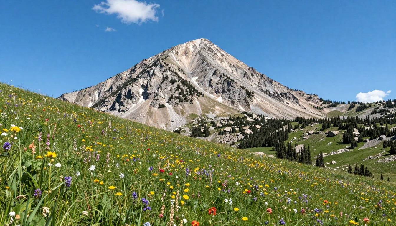
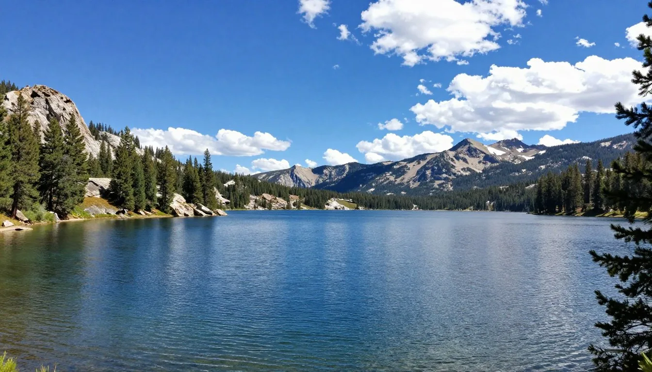
Did you know that Bountiful Peak sits at an elevation of 2,869 meters (9,413 feet), offering panoramic views stretching over 160 kilometers (100 miles) on clear days? This stunning vista encompasses the entire Great Salt Lake basin, making it one of Utah’s most breathtaking yet under-explored mountain destinations.
Nestled in the Wasatch Mountains just north of Salt Lake City, the Bountiful Peak Wildlife Management Area offers an escape into pristine wilderness. This remarkable area combines rugged mountain terrain with diverse ecosystems.
Whether you seek challenging trails, peaceful camping under towering aspen groves, or wildlife viewing opportunities, this destination delivers year-round adventure. From spring wildflower displays to autumn golden aspen forests, each season transforms the landscape into something extraordinary.
Getting There and Planning Your Journey
Reaching Bountiful Peak Wildlife Management Area requires some planning, but the journey rewards you with spectacular scenery. The area sits approximately 24 kilometers (15 miles) north of Salt Lake City in the Uinta-Wasatch-Cache National Forest.
Closest Airports
Salt Lake City International Airport serves as your primary gateway. Located just 40 kilometers (25 miles) south of the area, this major hub offers direct flights from across North America and international destinations.
From the airport, rent a vehicle suitable for mountain roads. A high-clearance vehicle is recommended, though not always required depending on seasonal conditions and your destination within the area.

Primary Access Routes
Most visitors approach via Farmington Canyon Road from the west. This route begins in Farmington and climbs steadily into the mountains. The lower sections feature paved road that transitions to well-maintained gravel.
Turn left onto Skyline Drive to access the higher elevation areas and Bountiful Peak Campground. This scenic route follows the mountain ridge, offering continuous views of the Great Salt Lake valley below.
Another access point starts from Bountiful Canyon Road. This eastern approach also leads to Skyline Drive. Both routes converge at the ridge, creating loop possibilities for day trips.
Important Contact Information: Before your visit, contact the Salt Lake Ranger District for current road conditions and any seasonal closures. Mountain weather changes rapidly, affecting road accessibility.
Office hours: Monday through Friday, 8:00 AM to 4:30 PM Mountain Time
Drive Time Estimates
From Salt Lake City center to the lower trailheads, expect 45 to 60 minutes. Reaching higher elevations and Bountiful Peak Campground adds another 30 to 45 minutes on gravel roads.
Check 30,000+ Local Sightseeing Tours Worldwide
✓ Numerous languages and currencies are available
Allow extra time for wildlife viewing and photo stops. The journey itself offers remarkable scenery worth savoring rather than rushing.
Best Time to Visit and Weather Tips
Timing your visit to Bountiful Peak dramatically affects your experience. Each season offers distinct advantages, though summer and early fall provide the most reliable access and comfortable conditions.
Recommended Seasons
Late June through September represents the prime visiting window. Roads typically clear of snow by mid-June, opening full access to higher elevations including Bountiful Peak Campground at 2,438 meters (8,000 feet).
July and August deliver the warmest, most stable weather. Daytime temperatures at elevation range from 18°C to 24°C (65°F to 75°F), perfect for hiking and camping. Nights cool to 4°C to 10°C (40°F to 50°F), requiring warm sleeping gear.
Early September through mid-October showcases spectacular fall colors. Aspen groves transform into golden canopies, creating photographer’s paradise. Temperatures remain pleasant, though nights grow colder.

Seasons to Approach with Caution
Winter brings heavy snow, closing most roads from November through May. Only experienced winter enthusiasts with proper equipment should venture here during these months. Snowshoeing and backcountry skiing become the primary activities.
Spring conditions prove highly variable. Snow persists at higher elevations well into June. Muddy roads and unpredictable weather create challenging conditions. Late May offers a transition period worth considering for hardy adventurers.
Weather Patterns and Preparation
Mountain weather changes rapidly regardless of season. Morning sunshine can give way to afternoon thunderstorms, especially July through August. These storms typically develop between 2:00 PM and 6:00 PM.
Start hikes early to avoid afternoon lightning danger. Carry rain gear year-round. Even summer visitors should pack warm layers, as temperatures drop significantly with elevation gain and after sunset.
Strong winds frequently sweep across exposed ridges and the Bountiful Peak summit. Windproof outer layers prove essential for comfortable ridge hiking and wildlife viewing.
Summer Packing Essentials
- Layered clothing for temperature swings
- Rain jacket and rain pants
- Sun protection including hat and sunscreen
- Insulated jacket for evening
- Plenty of water (minimum 3 liters per person per day)
Fall Considerations
- Warmer sleeping bag (rated to -7°C or 20°F)
- Insulated clothing layers
- Weather monitoring capability
- Backup warm clothing in vehicle
- Emergency supplies for rapid weather changes
Notable Annual Festivals
While Bountiful Peak Wildlife Management Area itself hosts no organized festivals due to its wilderness character, nearby communities celebrate events that complement your mountain visit.
Farmington City Events
Farmington, the primary gateway community, hosts several annual celebrations. The Farmington Fourth of July celebration features a morning parade, family activities, and evening fireworks visible from lower elevation viewpoints.
The Farmington Daze festival occurs each September, offering craft fairs, food vendors, and entertainment. This event coincides with peak fall color season, allowing you to combine cultural experiences with mountain exploration.
For event details and specific dates, contact Farmington City:
Bountiful Community Celebrations
The city of Bountiful celebrates Bountiful Handcart Days each July, commemorating pioneer heritage. This multi-day event includes historical reenactments, a parade, carnival, and outdoor activities.
These community festivals provide excellent opportunities to experience local culture before or after your wilderness adventures. They also offer convenient access to supplies and dining options.
Getting Around Locally
Navigation within Bountiful Peak Wildlife Management Area requires self-sufficiency. No public transportation serves this remote mountain location, making personal vehicles essential.
Vehicle Requirements
While standard passenger vehicles can reach lower trailheads on paved sections, higher elevations demand more capable transportation. Skyline Drive and access to Bountiful Peak Campground involve well-maintained gravel roads suitable for most vehicles during dry conditions.
However, wet weather transforms gravel surfaces into slippery, rutted challenges. High-clearance vehicles handle these conditions more confidently. Four-wheel drive provides additional security but is not mandatory during normal summer conditions.
Check current road conditions before departure. Spring snowmelt and summer thunderstorms temporarily affect road quality.

Navigation Tools
Cell phone coverage becomes spotty or nonexistent at higher elevations. Download offline maps before leaving paved roads. GPS devices function reliably throughout the area.
Paper maps from the Salt Lake Ranger District office provide valuable backup navigation. These maps show trails, camping areas, and important landmarks clearly marked.
The main routes are generally well-signed at key junctions. However, numerous side roads and trails create potential confusion. Study your route beforehand and note key landmarks and turn points.
Parking Considerations
Popular trailheads fill quickly on summer weekends and during fall color peak. Arrive early, especially for Bountiful Peak Campground and major trail access points. Create parking opportunities rather than blocking roads or creating new spaces that damage vegetation.
Winter visits require parking at snow closure gates, adding significant distance to any objectives. Familiarize yourself with winter parking regulations to avoid citations.
Where to Stay
Accommodation options range from primitive camping under the stars to comfortable hotels in nearby cities. Your choice depends on desired amenities, budget, and adventure preferences.
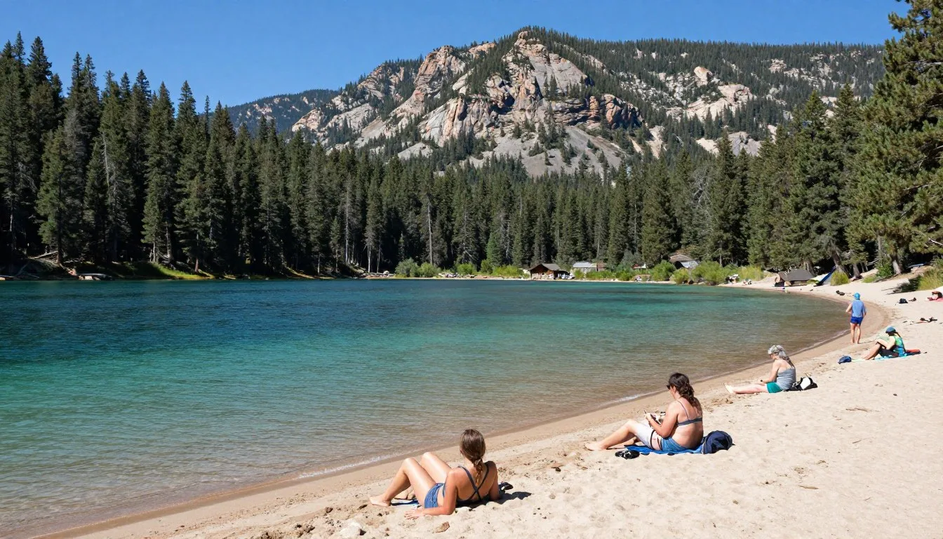
Bountiful Peak Campground
This Forest Service campground sits at 2,438 meters (8,000 feet) elevation, offering 26 campsites among aspen and conifer groves. Each space accommodates one vehicle with a tent pad and picnic table.
The campground operates on a first-come, first-served basis. No reservations are accepted. Arriving Thursday or Friday afternoon provides best chances for weekend camping. Weekday availability is generally excellent.

Facilities include vault toilets and bear-proof food storage boxes at each site. No potable water is available. Pack all water needs or bring filtration equipment for nearby streams.
A nightly use fee applies, payable at the self-service fee station. Senior and Access Pass holders receive discounts. The campground typically opens by mid-June and closes in late September, depending on snow conditions.
Campground Information: For current availability, conditions, and specific fees, contact the Salt Lake Ranger District:
Dispersed Camping
Free dispersed camping is permitted throughout much of the Uinta-Wasatch-Cache National Forest surrounding the wildlife management area. Camp at least 61 meters (200 feet) from water sources and established trails.
Popular dispersed areas line Skyline Drive, offering dramatic sunset views over Great Salt Lake. These spots fill quickly during peak season. Practice Leave No Trace principles, packing out all waste.
Dispersed camping requires complete self-sufficiency. Bring adequate water, proper waste disposal systems, and prepare for primitive conditions. Campfires may be restricted during dry periods.
Nearby Towns and Hotels
Farmington and Bountiful, both within 30 minutes drive of lower trailheads, offer full-service hotels, motels, and vacation rentals. These communities provide comfortable bases with restaurant access and supply shopping.
Major hotel chains operate in both cities, offering reliable accommodations with amenities like hot showers, wifi, and breakfast options. Prices range from budget-friendly to moderate.
Bed and breakfast establishments in the area provide more personalized experiences. These often include local knowledge and recommendations for mountain exploration.
Salt Lake City, 40 kilometers (25 miles) south, presents the widest accommodation selection. This option works well for visitors combining mountain adventures with urban attractions.
Dining and Local Cuisine
The Bountiful Peak Wildlife Management Area itself contains no dining facilities. Plan accordingly, bringing all food for mountain time. However, gateway communities offer diverse dining options for meals before and after adventures.
Dining in Farmington
Farmington Station, the city’s main commercial district, features numerous restaurants within easy reach of mountain access roads. Options range from quick breakfast spots to full-service dinner establishments.
Local favorites include Mexican restaurants serving hearty portions ideal for fueling mountain activities. Several pizza places provide perfect post-hike comfort food. Chain restaurants offer familiar options for those preferring predictable menus.
Coffee shops near the freeway exit provide convenient morning stops. Grab espresso drinks and pastries before heading into the mountains where caffeine options vanish.

Bountiful Dining Scene
Historic Main Street in Bountiful offers charming local eateries with mountain views. Family-owned restaurants serve American comfort food, while newer establishments experiment with fusion concepts and healthier options.
Several bakeries in town prepare fresh bread, pastries, and custom sandwiches perfect for trail lunches. Stop by the morning of your hike to build the perfect mountain meal.
Grocery stores in both communities provide extensive selections for provisioning camping trips. Stock up on supplies, remembering that no services exist once you enter the forest.
Mountain Meal Planning
Plan and pack all food before leaving civilization. The nearest restaurant or store sits at least 45 minutes from mountain destinations.
Bear activity in the area requires proper food storage. Use provided bear boxes at Bountiful Peak Campground. Dispersed campers must hang food or use bear canisters. Never store food in vehicles overnight, as bears have learned to break into cars.
Pack extra snacks and emergency food. Mountain activities demand more calories than anticipated. Dehydration and exhaustion often stem from inadequate fueling.
- Bring high-energy snacks like nuts, dried fruit, and energy bars
- Pack extra water or water treatment capability
- Plan for one additional meal beyond your expected stay
- Include electrolyte replacement drinks for hot weather hiking
- Pack food in airtight containers to prevent wildlife attraction
Attractions, Sightseeing, and Activities
Bountiful Peak Wildlife Management Area centers on outdoor recreation rather than built attractions. The landscape itself provides the entertainment through hiking, wildlife watching, and scenic exploration.
Summit Hikes
The Bountiful Peak summit trail offers the area’s signature experience. Starting from Bountiful Peak Campground, this relatively short but steep trail climbs 427 meters (1,400 feet) to the 2,869-meter (9,413-foot) summit.
The hike takes most people 2 to 3 hours round trip. The path becomes rocky and exposed near the top, requiring careful foot placement. However, no technical climbing skills are needed.
Summit views span the entire Wasatch Front, from the Great Salt Lake’s blue expanse to distant mountain ranges. On exceptionally clear days, visibility extends beyond 160 kilometers (100 miles).

Skyline Drive Scenic Tour
Driving Skyline Drive provides spectacular scenery accessible to anyone with a vehicle. This ridge-top road runs for miles along the mountain crest, offering continuous views of Great Salt Lake to the west and mountain wilderness to the east.
Numerous pullouts allow safe stops for photography and wildlife observation. The drive takes 1 to 2 hours at a leisurely pace with stops.
Turn left at key junctions to explore side roads leading to additional viewpoints and trailheads. Each turn reveals new perspectives and quieter spaces away from the main route.
Trail Network Exploration
Multiple trails branch throughout the area, ranging from easy nature walks to challenging backcountry routes. The Bountiful Peak trail represents just one option among dozens of possibilities.
Lower elevation trails through canyon bottoms offer shaded hiking among streams and wildflowers. These paths suit hot summer days when ridge routes become exposed and intense.
Connecting trails allow creative loop hikes. Study maps to design custom routes matching your fitness level and time availability. Most trails are well-maintained but see significantly less use than popular Wasatch trails farther south.
Wildlife Viewing Opportunities
The wildlife management area designation reflects the rich animal populations inhabiting these mountains. Patient observers encounter numerous species throughout the day.
Mule deer appear frequently, especially during morning and evening hours. These graceful animals often graze near roads and campgrounds, becoming habituated to human presence while maintaining appropriate wariness.
Elk populations roam the higher elevations. Listen for their distinctive bugles during autumn rutting season. These magnificent animals often gather in meadows near tree lines.

Moose occasionally appear in wetter areas with willows and aspens. Give these large, unpredictable animals wide berth. They can be aggressive, especially mothers with calves.
Bird diversity impresses throughout seasons. Raptors including eagles and hawks soar on thermal currents. Smaller birds fill aspen groves with song. Patient birdwatchers identify dozens of species during single outings.
Black bears inhabit the area, though sightings remain relatively uncommon. Make noise while hiking to avoid surprising bears. Properly store all food and scented items to prevent bear encounters at camp.
Check 30,000+ Local Sightseeing Tours Worldwide
✓ Numerous languages and currencies are available
Museums, Cultural Spots, and Festivals
The Bountiful Peak area itself contains no museums or cultural facilities due to its wilderness character. However, understanding the region’s cultural context enriches your mountain experience.
Local Heritage Context
The Wasatch Mountains hold deep significance for indigenous peoples including Shoshone and Ute tribes. These groups hunted and gathered throughout these mountains for thousands of years before European settlement.
Mormon pioneers settled the valleys below in the 1840s and 1850s. They harvested timber from these mountains and grazed livestock in high meadows. Evidence of this history appears in old cabin foundations and historic trails.
The establishment of national forest protection in the early 1900s transitioned these mountains from exploitation to conservation. The wildlife management area designation furthers protection for native species.
Nearby Cultural Attractions
Farmington and Bountiful maintain historical societies preserving local heritage. Small museums in both communities showcase pioneer artifacts, photographs, and stories of settlement.
Lagoon Amusement Park, visible from Bountiful Peak on clear days, represents one of America’s oldest continuously operating amusement parks. This family attraction provides contrast to wilderness experiences.
Salt Lake City, less than an hour away, offers world-class museums including the Natural History Museum of Utah. This facility provides excellent context for understanding the geology, ecology, and human history of the Wasatch Mountains.
Temple Square in Salt Lake City represents Utah’s most visited cultural attraction. The architecture, gardens, and historical significance draw visitors regardless of religious affiliation.
Nature and Outdoor Experiences
The Bountiful Peak Wildlife Management Area exists primarily for nature appreciation and outdoor recreation. Every activity connects directly with the natural environment.
Hiking Adventures
Trail options accommodate all ability levels. Easy walks along canyon streams provide gentle introductions to mountain environments. These paths rarely exceed 1.6 kilometers (1 mile) and gain minimal elevation.
Moderate hikes exploring aspen groves and forest trails offer half-day adventures. Routes typically cover 5 to 10 kilometers (3 to 6 miles) with elevation gains of 300 to 600 meters (1,000 to 2,000 feet).
Advanced hikers tackle ridge traverses and peak ascents. These demanding routes exceed 16 kilometers (10 miles) and gain over 900 meters (3,000 feet). Proper fitness and mountain experience are essential.

Always carry the ten essentials including navigation tools, extra food and water, first aid supplies, fire starting capability, emergency shelter, and appropriate clothing layers. Mountain weather changes rapidly regardless of forecasts.
Wildflower Viewing
Spring and early summer transform meadows into colorful displays. Lupine, Indian paintbrush, columbine, and dozens of other species create natural gardens from June through August.
Peak bloom typically occurs in July at higher elevations. Lower canyons bloom earlier, extending the wildflower season across several months.
Bring a wildflower identification guide to learn species names. Photograph flowers rather than picking them, preserving beauty for following visitors and supporting pollinators.
Photography Opportunities
Landscape photographers find endless subjects throughout the area. Sunrise from Bountiful Peak illuminates Great Salt Lake in golden light. Sunset along Skyline Drive paints mountains in warm hues.
Aspen groves during fall color peak create spectacular compositions. The contrast between golden leaves and dark conifers offers dramatic visual impact.
Wildlife photography requires patience and long lenses. Early morning and late evening provide best opportunities as animals become most active. Always maintain safe distances, using telephoto capabilities rather than approaching closely.
Mountain Biking Routes
Many trails welcome mountain bikers, though some remain closed to protect sensitive areas or prevent user conflicts. Check current regulations before riding.
Skyline Drive provides excellent cycling with spectacular views and minimal technical challenge. The gravel surface suits both mountain bikes and gravel bikes.
Single-track trails offer more technical riding through forests and meadows. These routes demand mountain biking skills and appropriate equipment.
Winter Recreation
Snow transforms the area into winter wonderland from November through April. Snowshoers and backcountry skiers explore routes inaccessible during summer.
Winter visitors must possess avalanche knowledge and appropriate safety equipment. Slopes throughout the area present avalanche danger during unstable conditions.
Roads close to vehicles, adding significant approach distances to any objectives. Plan shorter days accounting for limited daylight hours and slower travel in snow.

Travel With Children
Bountiful Peak Wildlife Management Area offers family-friendly adventures when properly planned. Success depends on choosing appropriate activities and preparing children for mountain environments.
Age-Appropriate Activities
Young children enjoy short nature walks and campground exploration. The area around Bountiful Peak Campground provides safe spaces for supervised play and nature discovery.
School-age children handle moderate hikes with frequent breaks and engaging activities. Turn hikes into scavenger hunts, identifying plants, animals, and geological features. This approach maintains interest during longer walks.
Teenagers often enjoy more challenging adventures including summit hikes and longer explorations. Involve them in planning and navigation, building skills and investment in the experience.
Safety Considerations
Supervise children constantly near cliffs, steep slopes, and water sources. Mountain terrain presents real dangers requiring adult vigilance.
Dress children in bright colors making them easily visible. Consider whistles as signaling devices if separation occurs.
Pack extra clothing, snacks, and water for children. Their smaller bodies heat and cool more rapidly, and energy levels fluctuate unpredictably.
Teach children about wildlife safety. Maintain distance from all animals, never feeding or approaching them. Explain bear safety protocols appropriate for their age.

Practical Family Tips
Plan shorter outings than adult-only trips. Children tire more quickly and need frequent breaks for snacks and rest.
Bring entertainment for downtime at camp. Books, cards, or simple games occupy children during afternoon heat when hiking becomes unwise.
Consider staying at Bountiful Peak Campground rather than dispersed camping. Established facilities provide security and toilets helpful for families with young children.
Pack first aid supplies including items specific to children such as children’s pain relievers and extra bandages. Minor scrapes and bumps happen frequently during mountain exploration.
- Start with easy activities building confidence before attempting challenging hikes
- Allow children to set reasonable pace rather than pushing adult speeds
- Take photos of children against mountain backdrops creating lasting memories
- Teach Leave No Trace principles making children environmental stewards
- Celebrate accomplishments reinforcing positive outdoor experiences
Money Saving Tips
Visiting Bountiful Peak Wildlife Management Area can fit modest budgets with smart planning. Many experiences cost nothing beyond basic camping fees and transportation.
Free and Low-Cost Activities
Hiking, wildlife viewing, photography, and scenic driving cost nothing beyond getting there. The majority of area attractions require no entrance fees or permits.
Dispersed camping eliminates accommodation costs entirely. Free campsites along forest roads provide all the essentials – flat ground, wilderness setting, and mountain views.
Even Bountiful Peak Campground charges modest fees compared to private campgrounds or hotels. Senior and Access Pass holders enjoy additional discounts on Forest Service campgrounds.
Meal Cost Management
Preparing all meals yourself cuts expenses dramatically. Grocery store provisions cost far less than restaurant meals.
Simple camping meals satisfy without complexity. Oatmeal for breakfast, sandwiches for lunch, and one-pot dinners keep cooking equipment minimal and costs low.
Bringing food from home rather than shopping near the destination saves additional money. Urban grocery prices beat small-town convenience stores.
Transportation Savings
Carpooling splits fuel costs among multiple people. Organize group trips with friends or family to reduce individual expenses.
Many vehicles handle the gravel roads adequately during dry summer conditions. You may not need to rent a specialized high-clearance vehicle if your personal car meets basic requirements.
Combining multiple days into single trips reduces total travel costs. Camping several nights costs little more than one night but provides extended mountain experiences.

Timing Strategies
Visiting during shoulder seasons in June or September often means smaller crowds and easier campsite availability. You avoid competition for spaces while enjoying pleasant conditions.
Weekday visits eliminate weekend crowds. Mid-week camping almost guarantees campsite availability without reservations or early arrival stress.
Plan trips during good weather forecasts. Cutting a trip short due to storms wastes travel expenses and creates disappointment.
Equipment Considerations
Borrow or rent specialized equipment rather than buying items for single trips. Friends, family, or outdoor retailers often rent camping gear at reasonable rates.
Basic equipment serves well for summer camping. Expensive technical gear becomes unnecessary when weather stays mild and routes remain non-technical.
Invest in quality items you will use repeatedly – boots, backpack, sleeping bag. These purchases pay dividends over many trips rather than representing one-time expenses.
Safety, Etiquette, and Local Customs
Visiting Bountiful Peak Wildlife Management Area safely and responsibly ensures positive experiences for yourself and others while protecting natural resources.
Mountain Safety Essentials
Altitude affects visitors unaccustomed to elevation. Bountiful Peak Campground sits at 2,438 meters (8,000 feet), high enough to cause mild altitude sickness. Drink extra water, avoid alcohol, and ascend gradually if experiencing symptoms.
Lightning danger increases dramatically during afternoon thunderstorms. Leave exposed ridges and summits by early afternoon. Avoid isolated trees, and never shelter under overhanging rocks during storms.
Hypothermia threatens even during summer. Wet clothing combined with wind creates dangerous cooling. Carry extra layers and rain protection on every hike regardless of morning conditions.
Dehydration occurs easily in dry mountain air. Drink water before feeling thirsty. Carry at least 3 liters per person for day hikes, more during hot weather.
Emergency Contact: Cell phone service is unreliable throughout most of the area. In genuine emergencies, attempt to reach high points for possible signal. For life-threatening situations, call 911. For non-emergency forest service issues, contact the Salt Lake Ranger District after returning to service areas.
Wildlife Safety Protocols
Black bears inhabit the area though encounters remain uncommon. Make noise while hiking to avoid surprising bears. If you see a bear, give it space to leave. Never run from bears.
Moose pose greater danger than bears due to unpredictable temperament. Give moose at least 50 meters (150 feet) of space. They can charge and kick with deadly force when feeling threatened.
Never feed wildlife, intentionally or through carelessness. Animals that learn to associate humans with food become dangerous and often must be destroyed. Secure all food in bear boxes or proper containers.

Leave No Trace Principles
Pack out everything you pack in. Leave no food scraps, trash, or gear behind. What you carry in weighs the same going out, making this practice simple to follow.
Use established campsites rather than creating new ones. Concentrated use in durable locations protects surrounding areas from damage.
Stay on established trails. Cutting switchbacks and creating social trails causes erosion and vegetation destruction. Thousands of footsteps compound even small shortcuts into major scars.
Bury human waste in catholes 15 to 20 centimeters (6 to 8 inches) deep, at least 61 meters (200 feet) from water, trails, and camp. Pack out toilet paper or burn it completely in the cathole before burial.
Minimize campfire impacts by using established fire rings. Better yet, use portable stoves eliminating fire impacts entirely. Never leave fires unattended, and ensure complete extinguishment before leaving camp or sleeping.
Respecting Other Visitors
Keep noise levels reasonable. People visit mountains seeking peace and natural sounds. Loud voices, music, and mechanical noise disturb both wildlife and other visitors.
Yield trail right-of-way appropriately. Hikers going uphill have right-of-way. Bikers yield to hikers. Everyone yields to horses, moving off the downhill side of trails.
Camp away from trails and other groups. Even at established campgrounds, maintain quiet hours after 10:00 PM and before 6:00 AM.
Dogs must remain under control at all times. Voice control is insufficient in areas with wildlife. Leashes protect both your pet and wild animals from dangerous encounters.
Forest Service Regulations
Observe posted regulations regarding campfires, camping restrictions, and seasonal closures. These rules protect resources and public safety.
Purchase required passes and permits. Display them properly to avoid citations. Fees support trail maintenance and facility upkeep benefiting all users.
Report serious problems including injured visitors, dangerous wildlife encounters, or resource damage to forest service personnel. Your observations help managers maintain area quality and safety.
Visitor Comments About Bountiful Peak Wildlife Management Area
Hearing from others who have explored Bountiful Peak provides valuable perspectives and insights for planning your visit.
“The views from Bountiful Peak absolutely took my breath away. Standing at the summit, I could see the entire Great Salt Lake stretching to the horizon. The hike challenged me more than expected, but reaching the top made every difficult step worthwhile. We camped at Bountiful Peak Campground two nights, and the aspen groves provided perfect shade during hot afternoons. I wish we had planned more time to explore additional trails.”
“Visiting during early October proved ideal for our family. The fall colors exceeded anything we had seen before, with golden aspens covering entire mountainsides. Our children loved exploring around the campground and spotting deer in the meadows. The drive along Skyline Drive became a highlight, with countless stops for photos. We encountered few other visitors despite the spectacular scenery. This area deserves much more recognition.”
“As a photographer, I have explored mountain ranges across the western United States. Bountiful Peak ranks among the most photogenic locations I have found. The combination of accessible viewpoints, diverse landscapes, and relatively few people creates ideal conditions. I spent four days photographing everything from intimate forest details to grand panoramas. The afternoon thunderstorms provided dramatic skies. I will definitely return, probably multiple times each year.”
Additional Nearby Destinations
Bountiful Peak Wildlife Management Area positions you perfectly for exploring numerous other attractions throughout northern Utah. Extend your trip to discover complementary destinations.
Antelope Island State Park
Located in Great Salt Lake, this island offers completely different experiences from mountain exploration. Drive across a causeway to reach wild bison herds, unique birds, and stark beauty.
Antelope Island sits approximately 48 kilometers (30 miles) from Bountiful. The contrast between lakeside and mountain environments in single days showcases Utah’s diversity remarkably.

Salt Lake City Attractions
Utah’s capital city offers world-class museums, dining, entertainment, and shopping. Temple Square, the State Capitol, and numerous museums provide cultural experiences complementing outdoor adventures.
The city sits 40 kilometers (25 miles) south, making day trips simple. Many visitors base themselves in Salt Lake City, taking day trips to mountains and returning to urban amenities each evening.
Ogden and Historic 25th Street
This historic railroad town maintains authentic Western character while embracing modern outdoor culture. The revitalized downtown features restaurants, breweries, and shops in historic buildings.
Ogden sits about 48 kilometers (30 miles) north. The city provides gateway access to additional mountain recreation in the Ogden area canyons.
Sundance Resort Area
Located in Provo Canyon southeast of Salt Lake City, this area offers year-round mountain experiences. Summer brings hiking and mountain biking, while winter attracts skiers to Sundance and neighboring resorts.
The drive from Bountiful Peak to Sundance covers approximately 95 kilometers (60 miles), making it reasonable for visitors spending multiple days in the region.
Cache Valley and Logan
Heading north into Cache Valley reveals fertile farmland surrounded by mountains. Logan, the valley’s main city, features Utah State University and serves as gateway to spectacular Bear River Range.
This destination sits about 105 kilometers (65 miles) from Bountiful, suitable for overnight additions to your Utah mountain exploration.
Practical Travel Tips
These final practical considerations help ensure smooth, enjoyable visits to Bountiful Peak Wildlife Management Area.
What to Pack
Essential items beyond standard camping gear include high-altitude sun protection. UV radiation intensifies with elevation, causing rapid sunburn. Pack high-SPF sunscreen, lip balm with sun protection, sunglasses, and wide-brimmed hats.
Bring comprehensive first aid supplies. Mountain environments present increased injury risks from falls, scrapes, and blisters. Include blister treatment, pain relievers, bandages, antibiotic ointment, and any personal medications.
Water filtration or purification systems allow refilling from streams rather than carrying all water. This dramatically reduces pack weight on longer hikes.
Layered clothing systems adapt to changing conditions more effectively than single heavy garments. Pack base layers, insulating mid-layers, and weatherproof outer shells.
Day Hike Checklist
- 3 liters of water per person
- High-energy snacks and lunch
- First aid kit
- Navigation tools including map and compass
- Sun protection
- Rain jacket and extra insulation layer
- Headlamp with extra batteries
- Fire starting materials
- Emergency shelter
- Knife or multi-tool
Camping Addition Checklist
- Tent with rain fly
- Sleeping bag rated for expected temperatures
- Sleeping pad for insulation and comfort
- Cooking system and utensils
- Food for all meals plus extra
- Bear-proof food storage
- Toiletries and toilet paper
- Camp chairs or sitting pads
- Repair kit for gear
- Entertainment for downtime
Best Times for Photography
Golden hour light transforms mountain landscapes. Plan photography sessions for the first hour after sunrise and the last hour before sunset when warm, angled light creates depth and drama.
Overcast days work well for forest and waterfall photography. Soft, diffused light eliminates harsh shadows and prevents blown-out highlights.
Blue hour, the period just before sunrise and after sunset, offers unique opportunities for twilight images featuring both landscape detail and emerging stars.

Fitness Preparation
Mountain hiking demands more exertion than flat-ground walking. Prepare by building cardiovascular fitness through regular walking, hiking, cycling, or other aerobic activities.
Practice hiking with loaded backpack before your trip. This reveals fit issues with pack or boots and builds specific muscles used during mountain travel.
Start trips with easier objectives, gradually increasing difficulty. This allows acclimatization to altitude and assessment of capabilities before committing to challenging routes.
Communication and Connectivity
Cell service is unreliable to nonexistent throughout most of the area. Inform someone reliable about your plans including expected return time and emergency contact procedures.
Download offline maps and information before leaving service areas. GPS devices function without cell service, providing reliable navigation.
Consider satellite communication devices for serious backcountry trips. These allow emergency communication and provide peace of mind for both travelers and families at home.
Seasonal Considerations
Summer visitors should start activities early. Afternoon thunderstorms develop regularly, creating lightning danger and unpleasant hiking conditions.
Fall travelers must prepare for potential early winter storms. September generally remains pleasant, but October introduces snow possibilities at higher elevations.
Spring visitors face highly variable conditions. Snow often lingers through June at Bountiful Peak Campground elevation. Roads may be impassable or extremely muddy.
Current Conditions Information: Always check current conditions before departing for the mountains. Road status, weather forecasts, and any special closures or restrictions significantly affect trip plans.
Contact the Salt Lake Ranger District for the most accurate, current information:
Permits and Regulations
Most day use in the area requires no special permits. However, overnight camping at developed sites like Bountiful Peak Campground involves fees paid at self-service stations.
Group size limits apply in some areas. Check current regulations if traveling with large groups to ensure compliance.
Campfire restrictions vary by season and conditions. During high fire danger, campfires may be prohibited entirely. Portable stoves remain legal when campfires are banned.
Location Map
Bountiful Peak Wildlife Management Area sits in the Wasatch Mountains north of Salt Lake City. Use this map to orient yourself and plan your approach route.
Your Mountain Adventure Awaits
Bountiful Peak Wildlife Management Area stands ready to deliver the mountain experiences you crave. Whether you seek challenging summit hikes, peaceful camping among aspens, spectacular photography opportunities, or simply escape from urban intensity, these mountains provide the perfect setting.
The combination of accessibility and authentic wilderness creates rare opportunities. Drive from Salt Lake City’s airport to mountain trailheads in under an hour, yet find yourself immersed in wild landscapes where elk bugle and eagles soar.
Pack your gear, study the maps, check the weather, and point your vehicle toward the Wasatch Mountains. Bountiful Peak’s summit awaits with views stretching across valleys to distant ranges. The aspens stand ready to share their golden autumn glory. Wildlife watches from forest shadows, and clear mountain air fills your lungs with each breath.
Your Utah mountain adventure begins the moment you decide to go. Make that decision today, and soon you will stand among the peaks discovering why those who know these mountains return again and again. The wilderness calls, and Bountiful Peak Wildlife Management Area answers with everything you hope to find.