Hotels by Trip.com
Flights by Trip.com
Did you know that the Brian Head-Panguitch Lake Scenic Byway climbs to over 3,350 m (11,000′) elevation, making it one of the highest paved routes in Utah? This remarkable 88.5 km (55-mile) journey along Highway 143 connects two distinct ecosystems within minutes. You’ll traverse ancient lava flows, pristine alpine lakes, and forests of aspen and pine.
The scenic byway begins near Parowan and winds through Dixie National Forest before reaching the charming town of Panguitch. Along the way, you’ll encounter Cedar Breaks National Monument, Brian Head ski resort, and countless viewpoints. The road itself tells a story of geological forces and human determination.
This comprehensive guide reveals everything you need to plan an unforgettable journey. Whether you’re seeking winter adventures or summer fishing, family activities or solo exploration, the Brian Head-Panguitch Lake Scenic Byway offers experiences for every traveler. Let’s discover what makes this route truly exceptional.
Interactive map showing the complete Brian Head-Panguitch Lake Scenic Byway route through southern Utah
Getting There & Planning Your Journey

The Brian Head-Panguitch Lake Scenic Byway is remarkably accessible from several major airports. Las Vegas McCarran International Airport sits just 274 km (170 miles) southwest. Salt Lake City International Airport lies 402 km (250 miles) north. Both airports offer rental car services and direct highway access to the scenic byway area.
From Las Vegas, take Interstate 15 north to Parowan, then follow Highway 143 east. The drive takes approximately three hours in good weather. From Salt Lake City, head south on Interstate 15 to reach the western terminus near Parowan. The journey requires about four hours of driving time.
St. George Regional Airport provides another option at just 113 km (70 miles) southwest. This smaller facility serves travelers preferring a closer starting point. Cedar City Regional Airport, located 40 km (25 miles) from the byway, offers limited commercial service but convenient access for private aircraft.
Route Overview and Access Points
Highway 143 forms the backbone of this scenic byway journey. The road officially begins at the junction with Interstate 15 near Parowan. From there, it climbs steadily through Parowan Canyon into the high country. The route passes through diverse terrain before descending to Panguitch.
Three main access points serve different travel goals. The western entrance near Parowan offers the gentlest approach. The central section near Brian Head provides direct access to ski areas and Cedar Breaks National Monument. The eastern terminus at Panguitch connects to other scenic routes including the Utah Patchwork Parkway.
Important Planning Note: Winter weather can close portions of Highway 143, particularly near Cedar Breaks National Monument. The high-elevation section typically remains closed from November through May. Always check current road conditions before departure during shoulder seasons.
Essential Planning Considerations
Allow a full day to experience the scenic byway properly. Rushing through in two hours means missing incredible viewpoints and natural wonders. Plan for frequent stops to photograph aspen groves, explore lava formations, and enjoy panoramic vistas from the Markagunt Plateau.
Fuel availability requires attention along this route. Parowan and Panguitch offer the most reliable gas stations. Brian Head has limited services that may operate seasonally. Fill your tank before starting and carry emergency supplies including water, snacks, and warm clothing.
Check 30,000+ Local Sightseeing Tours Worldwide
✓ Numerous languages and currencies are available
Cell phone coverage proves spotty throughout much of the scenic byway. Download offline maps before departure. Inform someone of your travel plans and expected arrival time. Carry a physical map as backup navigation.
Best Time to Visit & Weather Tips

Optimal Visiting Seasons
Late June through September represents the prime window for experiencing the full scenic byway. Summer weather brings comfortable temperatures ranging from 18°C to 24°C (65°F to 75°F) at lower elevations. Higher areas near Brian Head Peak remain cooler, offering refreshing escapes from valley heat.
September and early October showcase spectacular fall colors. Aspen trees transform entire mountainsides into golden tapestries. Peak foliage typically occurs between September 15 and October 10, though exact timing varies annually based on weather patterns. This period combines beautiful scenery with fewer crowds than summer months.
Winter transforms the scenic byway into a snowy wonderland. December through March attracts skiers and snowboarders to Brian Head ski resort. However, portions of Highway 143 close during winter, limiting through-traffic. Winter visitors should focus on the western section and Brian Head area specifically.
Seasons to Approach With Caution
November proves challenging for scenic byway travel. Early winter storms can arrive unexpectedly, creating hazardous driving conditions. Road closures become increasingly common as the month progresses. Most services in Brian Head reduce hours or close entirely after ski season ends.
Late March through May brings unpredictable spring weather. Snowmelt creates muddy conditions on unpaved side roads. Afternoon thunderstorms develop rapidly over the Markagunt Plateau. Morning starts generally offer better weather stability during shoulder seasons.
Month-by-Month Weather Guide
Summer Months (June-August)
- Daytime temperatures: 21°C to 27°C (70°F to 80°F) at lower elevations
- Mountain areas: 13°C to 18°C (55°F to 65°F)
- Afternoon thunderstorms possible, especially July and August
- All roads typically open and accessible
- Peak tourist season with maximum services available
Fall Season (September-October)
- Daytime temperatures: 10°C to 21°C (50°F to 70°F)
- Nights grow cold, sometimes below freezing
- First snowfall possible by mid-October
- Reduced crowds after Labor Day weekend
- Best hiking conditions with stable weather
Winter Period (November-March)
- Heavy snow at high elevations
- Road closures near Cedar Breaks common
- Brian Head ski area operational
- Temperatures: -12°C to 2°C (10°F to 35°F)
- Excellent powder snow conditions
Spring Transition (April-May)
- Gradual warming with variable conditions
- Road reopening typically late May
- Wildflowers begin blooming in June
- Temperatures: 4°C to 18°C (40°F to 65°F)
- Fishing season begins at Panguitch Lake
Pro Weather Tip: Elevation changes of over 914 m (3,000′) along the scenic byway create multiple climate zones. Pack layers to accommodate temperature variations. What feels warm in Parowan might require a jacket at Brian Head Peak.
Notable Annual Festivals

Brian Head Mountain Summer Festival
The Brian Head Mountain Summer Festival takes place each July, celebrating the town’s transition from winter sports to summer activities. Live music fills the mountain air while local artisans display handcrafted goods. Families enjoy activities ranging from mountain biking demonstrations to nature walks guided by forest rangers.
Food vendors serve regional specialties alongside classic festival fare. The event showcases local breweries and Utah’s emerging wine scene. Children’s activities include face painting, climbing walls, and wildlife education programs. The festival typically runs during the third weekend of July.
Panguitch Valley Balloon Rally
Each June, dozens of hot air balloons fill the skies above Panguitch during this spectacular three-day event. Early morning launches provide photographers with stunning opportunities as colorful balloons rise against red rock backdrops. Evening balloon glows create magical displays after sunset.
The rally attracts pilots from across the western United States. Spectators enjoy free viewing areas with close-up access to inflation processes. Local restaurants offer special balloon rally breakfasts. The event coincides with the town’s Quilt Walk festival, creating a full weekend of activities.
Cedar Breaks Wildflower Festival
Late July brings peak wildflower blooms to Cedar Breaks National Monument. The annual Wildflower Festival celebrates this natural spectacle with guided hikes, photography workshops, and botanical education programs. Expert naturalists lead walks through alpine meadows carpeted with over 150 species of flowering plants.
Festival activities suit all fitness levels. Short nature walks accommodate families with young children. More challenging hikes venture into backcountry areas rarely visited by casual tourists. Evening programs feature speakers discussing high-altitude ecology and conservation efforts.
Parowan Heritage Days
This September celebration in Parowan honors the town’s pioneer history and Mormon heritage. The festival features a parade, rodeo events, and historical reenactments. Local museums extend hours and offer special exhibits about early settlement in the region.
Heritage Days includes traditional crafts demonstrations showing pioneer skills. Blacksmithing, quilting, and butter churning bring history to life. Food vendors serve recipes passed down through generations. The event provides cultural context for travelers beginning their scenic byway journey.
Getting Around Locally

Personal vehicles provide the most practical way to explore the Brian Head-Panguitch Lake Scenic Byway. Public transportation options remain extremely limited throughout this rural area. Most visitors rent cars from airports in Las Vegas, Salt Lake City, or St. George before beginning their journey.
Vehicle Recommendations
Standard passenger cars handle the paved Highway 143 route without difficulty during summer months. The main scenic byway receives regular maintenance and features good pavement quality. However, exploring side roads and accessing trailheads often requires higher clearance vehicles.
SUVs or trucks with four-wheel drive unlock additional exploration opportunities. Many spectacular viewpoints and fishing spots sit at the end of unpaved forest roads. Winter visitors absolutely need vehicles equipped for snow and ice conditions. Chains or snow tires become mandatory when weather deteriorates.
Parking and Viewpoint Access
Designated pullouts appear regularly along Highway 143, providing safe parking for photography and sightseeing. Cedar Breaks National Monument maintains paved parking areas at major viewpoints. These facilities accommodate RVs and vehicles towing trailers.
Popular hiking trailheads fill quickly during peak summer weekends. Arrive before 9 AM to secure parking at Panguitch Lake or Brian Head Peak access points. Overflow parking sometimes becomes necessary at Cedar Breaks when tour buses visit.
Road Conditions and Safety
Highway 143 features numerous curves and steep grades as it traverses the Markagunt Plateau. Posted speed limits reflect road geometry and should be respected. Wildlife crossings occur frequently, especially during dawn and dusk hours. Deer, elk, and occasionally black bears appear along the route.
Check current road conditions before departure, particularly during shoulder seasons. The Utah Department of Transportation operates a road conditions hotline providing real-time updates. Weather can change rapidly at high elevations, creating hazardous driving situations within minutes.
Fuel and Services
Plan fuel stops carefully along this route. Parowan offers multiple gas stations near the Interstate 15 junction. Brian Head has limited fuel availability with seasonal hours and higher prices. Panguitch provides reliable services at the eastern end of the scenic byway.
The distance between services can exceed 48 km (30 miles) in some sections. Mechanical problems in remote areas may require long waits for assistance. Carry emergency supplies and maintain your vehicle in good condition before attempting the drive.
Where to Stay

Brian Head Accommodations
Brian Head offers the most convenient lodging directly along the scenic byway route. This mountain town caters primarily to ski visitors but remains open year-round. Accommodations range from basic hotel rooms to luxury condominiums with full kitchens and mountain views.
Cedar Breaks Lodge provides comfortable rooms within walking distance of restaurants and shops. The property features an indoor pool and hot tub perfect for relaxing after hiking. Rates vary significantly between summer and winter seasons, with ski season commanding premium prices.
Vacation rental condos suit families and groups preferring more space. Many properties include full kitchens, multiple bedrooms, and private decks. Booking several months ahead becomes essential for peak summer weekends and winter ski periods.
Panguitch Lodging Options
Panguitch presents a different lodging experience with historic character and small-town charm. Several vintage motels line the main street, offering budget-friendly rates and nostalgic Americana atmosphere. These properties provide clean, basic accommodations perfect for road-trippers.
The historic Adobe Sands Motel features renovated rooms blending modern comforts with 1950s aesthetics. Color Country Motel offers another reliable option with reasonable rates and friendly service. Both properties provide easy access to local restaurants and shops.
Bed and breakfast inns operate in restored Victorian homes throughout Panguitch. These properties deliver personalized service, homemade breakfasts, and insights into local history. Book directly with innkeepers to learn about the area and receive dining recommendations.
Camping and RV Facilities
Dixie National Forest maintains numerous campgrounds along the scenic byway corridor. Panguitch Lake North and South campgrounds offer lakeside sites with fishing access. These developed facilities include vault toilets, picnic tables, and fire rings.
Reservations become necessary for summer weekends and holiday periods. Book through the federal recreation system at least two weeks ahead. Many sites accommodate RVs up to 10.7 m (35′) in length, though hookups remain unavailable at national forest campgrounds.
Dispersed camping provides free alternatives throughout Dixie National Forest. Travelers with self-contained vehicles can camp along designated forest roads. Follow Leave No Trace principles and camp at least 61 m (200′) from water sources. Check current fire restrictions before planning campfires.
Nearby Towns
Parowan and Cedar City offer additional lodging options within easy driving distance. These towns provide chain hotels, budget motels, and more dining variety than Brian Head or Panguitch. Cedar City sits about 45 km (28 miles) from the scenic byway’s western access point.
Staying in Cedar City grants access to Southern Utah University’s Shakespeare Festival during summer months. The town also serves as a gateway to Cedar Breaks National Monument via Highway 14. This alternative approach provides different scenic perspectives.
Dining & Local Cuisine

Brian Head Dining
Brian Head’s dining scene reflects its status as a ski resort town. Restaurants focus on hearty mountain fare with influences from American and international cuisines. Most establishments operate seasonally, with limited options during spring and fall shoulder periods.
The Edge Sports Grill & Pub serves comfort food favorites including burgers, steaks, and pasta. Their outdoor deck provides stunning views during summer months. The menu features local microbrews and an extensive selection of regional wines. Service remains casual and family-friendly.
Pizza and Italian options dominate quick dining choices. Several establishments offer delivery to condominiums and lodges. Groceries and basics are available at small markets, though selection remains limited and prices run higher than valley towns.
Panguitch Restaurants
Panguitch offers more diverse dining options than its small size might suggest. Main Street hosts several restaurants serving everything from classic American diner fare to authentic Mexican cuisine. Local establishments pride themselves on generous portions and reasonable prices.
Cowboy’s Smokehouse Café specializes in barbecue with all the traditional fixings. Their pulled pork and beef brisket receive consistent praise from visitors. The casual atmosphere welcomes families and groups. Breakfast service features substantial portions perfect for fueling hiking adventures.
Pizza places and sandwich shops provide quick lunch options. Several restaurants bake fresh pies daily, continuing Panguitch’s tradition of homemade desserts. Don’t leave without trying a slice of local fruit pie, particularly during cherry and berry seasons.
Local Specialties and Regional Cuisine
Utah’s dining traditions reflect pioneer heritage and agricultural roots. Look for dishes featuring locally raised beef and lamb. Rainbow trout from Panguitch Lake appears on several restaurant menus when available fresh. Ask about daily specials showcasing seasonal ingredients.
Fry sauce, a Utah condiment combining ketchup and mayonnaise, accompanies French fries throughout the region. The state’s Dutch oven cooking tradition influences many restaurant preparations. Sourdough breads recall pioneer baking methods still practiced in some local kitchens.
Dining Tips and Practical Advice
Restaurant hours vary seasonally throughout the scenic byway area. Summer brings extended hours and full menus. Winter operations often reduce schedules to match ski resort activities. Spring and fall may see some restaurants closed entirely for maintenance.
Call ahead to verify hours, especially during shoulder seasons. Small staffs mean occasional temporary closures for private events or staff shortages. Weekends generally offer more reliable service than weekdays in Brian Head.
Pack snacks and beverages for day trips along the scenic byway. Few services operate between towns. Picnic supplies purchased in larger communities save money compared to limited convenience stores in mountain areas.
Attractions, Sightseeing & Activities

Cedar Breaks National Monument
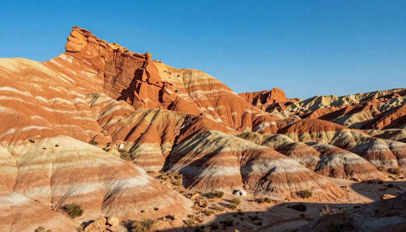
Cedar Breaks National Monument represents the crown jewel of attractions along the scenic byway. This geological wonder showcases a massive amphitheater carved into the Markagunt Plateau’s western edge. Colorful rock formations display bands of orange, red, and purple sediment deposited over millions of years.
The monument sits at elevations exceeding 3,048 m (10,000′), creating an alpine environment rarely found at Utah’s national parks. Five overlooks accessible by paved roads provide different perspectives into the 610 m (2,000′) deep canyon. Point Supreme Overlook offers the most dramatic views and includes a visitor center.
Rangers lead educational programs during summer months. Topics cover geology, ecology, and the area’s relationship to nearby Bryce Canyon and Zion National Parks. The scenic byway provides direct access to the monument’s eastern entrance.
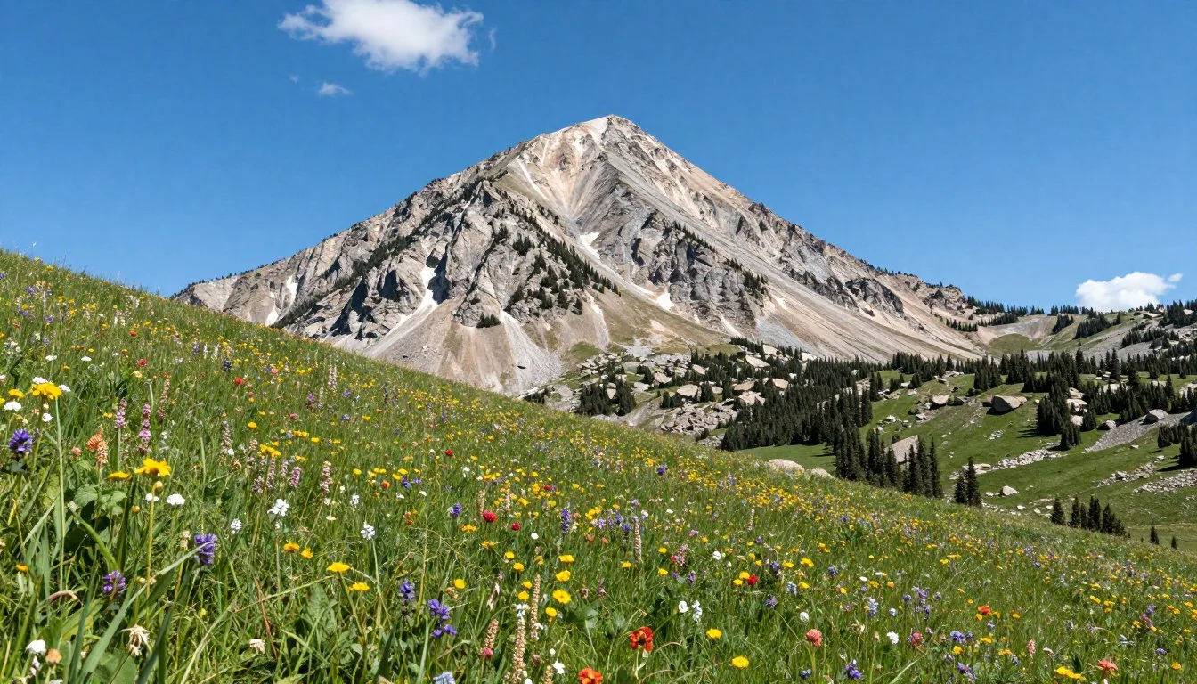
Brian Head Peak
Brian Head Peak rises to 3,458 m (11,348′), claiming the title of highest point in Iron County. A gravel road accessible to most vehicles climbs to within a short hike of the summit. The panoramic views from the top encompass hundreds of square kilometers.
On clear days, you can identify landmarks across five different mountain ranges. The Great Basin stretches westward while the Colorado Plateau extends east. Interpretive signs help visitors identify distant peaks and understand the region’s complex geology.
Sunset visits reward photographers with spectacular light painting mountain ridges in golden hues. Arrive at least an hour before sunset to secure parking and walk to the summit. Temperatures drop rapidly after sundown, so bring warm layers even during summer.

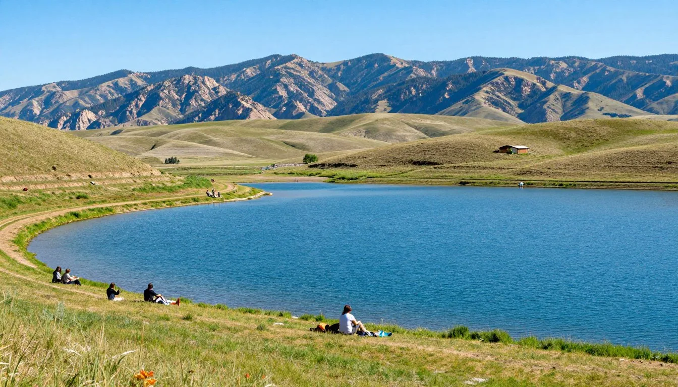
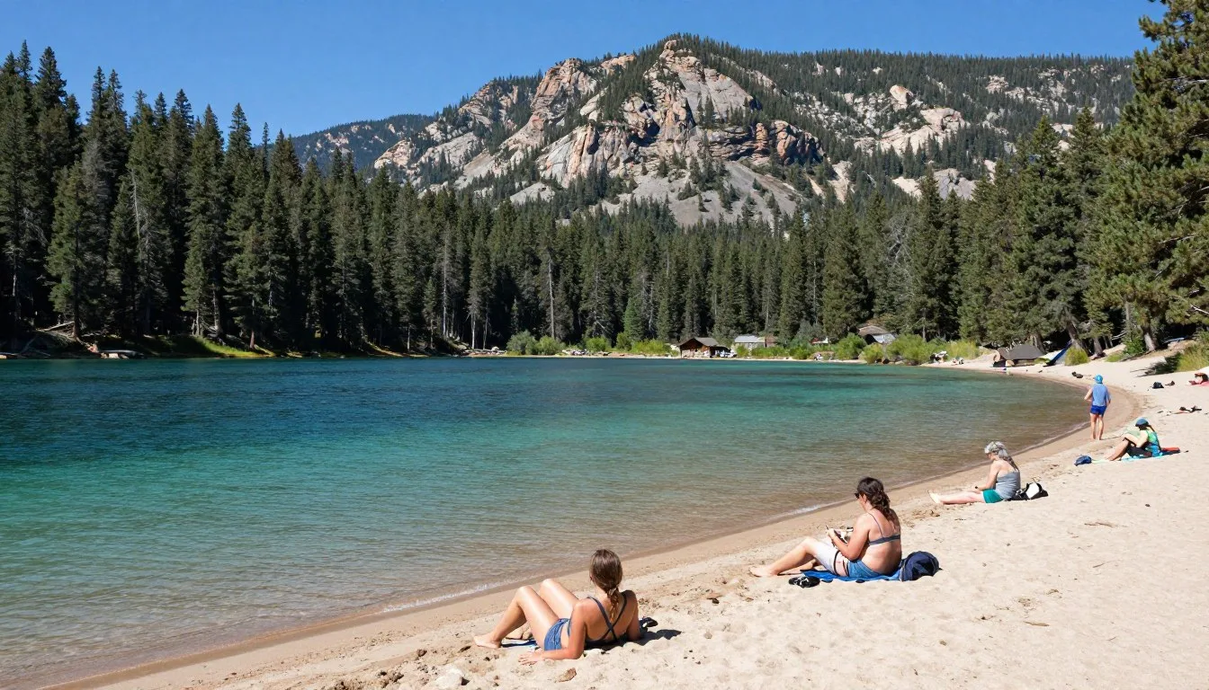
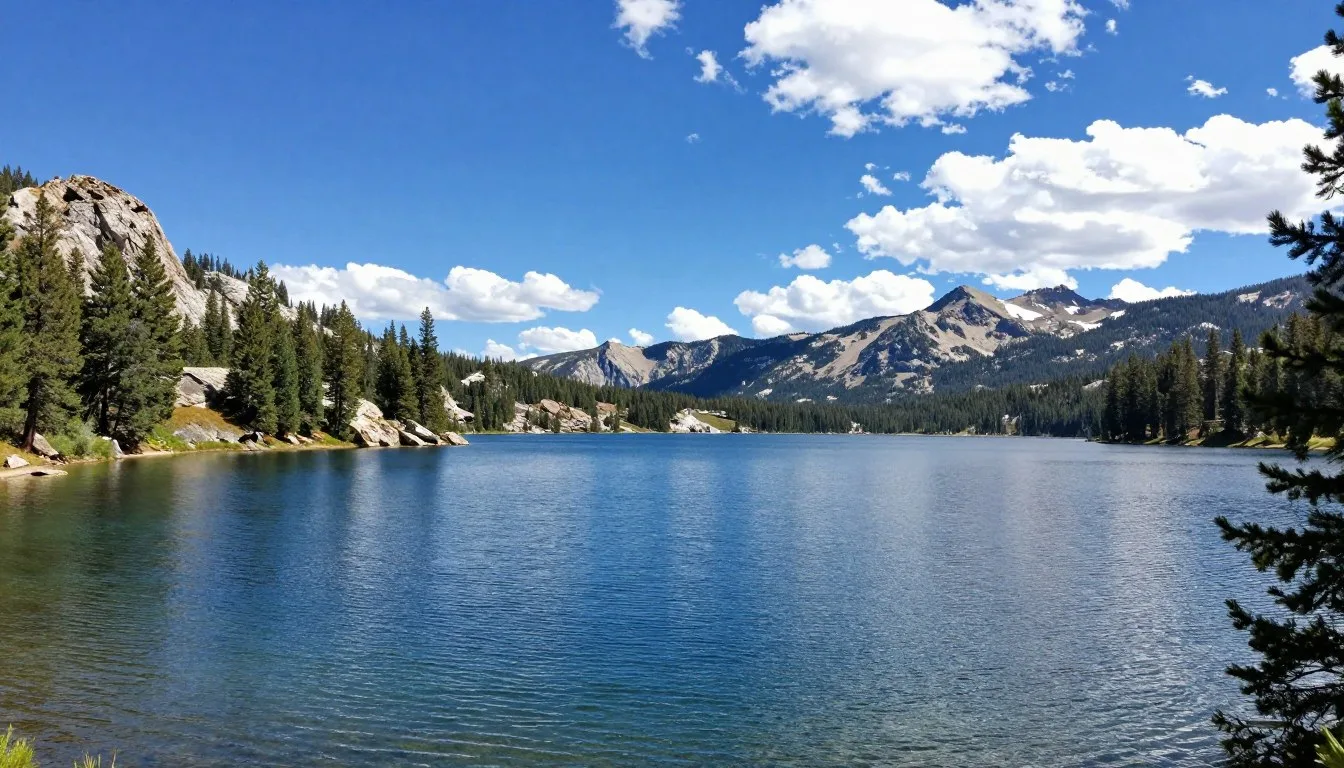
Panguitch Lake
Panguitch Lake covers approximately 518 hectares (1,280 acres) at an elevation of 2,530 m (8,300′). The lake’s cold, clear waters support thriving populations of rainbow trout, brook trout, and tiger muskellunge. Fishing attracts visitors throughout the open water season from June through October.
A paved road circles most of the lake, providing access to boat ramps, campgrounds, and day-use areas. Several resorts rent boats, kayaks, and fishing equipment. Ice fishing becomes popular during winter months when the lake freezes solid.
The lake sits in a volcanic basin surrounded by pine and aspen forests. Wildlife viewing opportunities abound, with ospreys, eagles, and waterfowl commonly spotted. Moose occasionally visit shoreline areas during early morning hours.
Parowan Gap Petroglyphs
Located near the western end of the scenic byway, Parowan Gap preserves ancient rock art created by indigenous peoples. The gap itself represents a natural pass through the Red Hills where erosion created a wind tunnel effect. This geological feature made the area significant for prehistoric travelers.
Over 90 petroglyph panels display geometric patterns, animal figures, and symbols. Some designs may relate to astronomical observations or solstice markers. Interpretive signs explain the site’s archaeological importance and theories about the artwork’s meaning.
The site requires a short drive from Highway 143 on a maintained gravel road. Arrive during morning or late afternoon for better lighting on the rock faces. The area receives full sun midday, making photography challenging and conditions hot during summer.
Vermillion Castle
Vermillion Castle refers to a distinctive red rock formation visible from Highway 143. The colorful spires and towers create a miniature version of formations found in Bryce Canyon. Photographers stop frequently at roadside pullouts to capture these striking features.
The castle sits within Dixie National Forest on public lands accessible for hiking. No formal trails exist, but adventurous visitors can explore the area following Leave No Trace principles. The formation takes on different characters throughout the day as sunlight shifts.
Mormon Pioneer Sites
The scenic byway passes through an area rich in Mormon pioneer history. Parowan, founded in 1851, represents one of southern Utah’s oldest settlements. Historic buildings downtown include the Old Rock Church, now serving as a community arts center.
Panguitch’s Main Street showcases well-preserved Victorian architecture from the late 1800s. Walking tours highlight significant buildings and explain the town’s development. The annual Quilt Walk Festival commemorates a legendary winter rescue mission involving blankets laid on snow.
Museums, Cultural Spots & Festivals

Check 30,000+ Local Sightseeing Tours Worldwide
✓ Numerous languages and currencies are available
Panguitch Historic Museum
The Panguitch Historic Museum occupies a former church building in the heart of downtown. Exhibits chronicle the town’s settlement, early industries, and pioneer life. Displays include period furniture, farm equipment, and photographs documenting community development.
Volunteer docents, many descendants of original settlers, share personal stories bringing history alive. The museum maintains extensive genealogical records for researchers tracing Mormon pioneer ancestry. A small gift shop sells local crafts and historical publications.
Summer hours run from Memorial Day through Labor Day, typically 10 AM to 4 PM weekdays. Call ahead during shoulder seasons as the all-volunteer operation may keep irregular hours. Admission fees remain minimal, helping support preservation efforts.
Parowan Heritage Park
This outdoor museum preserves historic buildings relocated from across Iron County. The collection includes a pioneer cabin, one-room schoolhouse, and early agricultural structures. Each building contains period furnishings and tools demonstrating frontier life.
Guided tours operate during summer months with volunteers demonstrating traditional crafts. Children enjoy hands-on activities like grinding wheat or trying their hand at pioneer games. The park hosts special events during Heritage Days and other community celebrations.
Cultural Events and Community Programs
The Groovefest summer music series brings free concerts to Brian Head throughout July and August. Local and regional bands perform various genres from folk to rock. These family-friendly events create festive atmospheres on summer evenings.
Panguitch’s ArtWalk takes place monthly during summer, showcasing local artists and craftspeople. Galleries and shops stay open late while artists demonstrate their techniques. This event provides opportunities to purchase original artwork and meet creative residents.
Native American Heritage
The Paiute people inhabited this region long before Mormon settlement. Their traditional territories encompassed the areas now traversed by the scenic byway. Though no dedicated museums focus on Native American history along this route, interpretive signs at various locations acknowledge indigenous heritage.
The Parowan Gap petroglyphs offer the most direct connection to prehistoric peoples. These ancient artworks predate Paiute occupation, created by even earlier cultures. Respect these irreplaceable cultural resources by observing from designated viewing areas without touching the rock art.
Nature & Outdoor Experiences

Hiking Trails
The Brian Head-Panguitch Lake area offers hiking trails for all experience levels. Cedar Breaks National Monument maintains several short walks perfect for families. The Spectra Point Trail extends 3.2 km (2 miles) round trip along the amphitheater rim, passing through ancient bristlecone pine forests.
Alpine Pond Trail provides an easier option at just 1.6 km (1 mile) round trip. This accessible path circles a scenic pond surrounded by wildflower meadows. Interpretive signs explain high-altitude ecology and the short growing season these plants endure.
More challenging hikes venture into Dixie National Forest backcountry. The Twisted Forest Trail near Brian Head explores an area of wind-sculpted trees. The 6.4 km (4-mile) loop gains modest elevation while showcasing unique tree formations.
Mountain Biking
Brian Head transforms into a mountain biking destination when snow melts. The Brian Head Resort operates a lift-served bike park with trails ranging from beginner to expert. Rental bikes and protective equipment are available at resort shops.
Cross-country riders enjoy extensive trail networks through Dixie National Forest. The Bunker Creek Trail offers 19.3 km (12 miles) of rolling terrain through mixed forest and meadows. Riders encounter minimal elevation gain compared to more technical routes.
The Dark Hollow area features advanced trails with technical features and steep descents. These routes challenge experienced riders while providing spectacular views. Always carry repair tools, extra water, and let someone know your planned route.

Fishing Adventures
Panguitch Lake ranks among southern Utah’s premier fishing destinations. The cold waters produce excellent trout fishing from June through October. Shore fishing succeeds at several access points, though boats increase catch rates substantially.
Rainbow trout form the primary target species, with fish averaging 30 to 46 cm (12 to 18 inches). Trophy trout exceeding 51 cm (20 inches) are caught regularly. Fly fishers find success with standard patterns including woolly buggers, prince nymphs, and elk hair caddis.
Several smaller lakes and streams throughout the area offer additional fishing opportunities. Yankee Meadow Reservoir and Navajo Lake require forest road access but provide less crowded alternatives. Utah fishing licenses are required and available at local sporting goods stores.
Wildlife Watching
The elevation and habitat diversity along the scenic byway create excellent wildlife viewing opportunities. Mule deer appear commonly throughout the area, particularly during dawn and dusk hours. Elk herds inhabit higher elevations during summer months.
Bird enthusiasts should watch for mountain bluebirds, Steller’s jays, and Clark’s nutcrackers. Raptors including red-tailed hawks, golden eagles, and peregrine falcons patrol the skies. Panguitch Lake attracts waterfowl and shorebirds during migration periods.
Black bears inhabit Dixie National Forest, though sightings remain relatively uncommon. Store food properly at campgrounds and never approach wildlife. Maintain respectful distances and use binoculars or telephoto lenses for closer views.
Winter Activities
Brian Head Ski Resort operates two mountains with over 71 trails covering 268 hectares (662 acres). The resort typically opens in early December and operates through March or early April depending on snow conditions. Annual snowfall averages 11.4 m (450 inches) of light, dry powder.
Cross-country skiing and snowshoeing trails wind through Dixie National Forest. Groomed tracks near Brian Head provide easy access. Backcountry enthusiasts find unlimited terrain for exploration, though avalanche awareness and proper equipment become essential.
Snowmobiling remains popular throughout the area with hundreds of kilometers of marked trails. Rental machines are available in Brian Head. Riders must stay on designated routes to protect winter wildlife habitat and revegetation efforts.

Scenic Photography Locations
The entire scenic byway offers exceptional photography opportunities. Sunrise at Panguitch Lake creates mirror reflections when winds remain calm. The lake’s east side provides unobstructed views of dawn light painting surrounding peaks.
Cedar Breaks National Monument delivers extraordinary afternoon and sunset light. The colorful rock formations glow intensely during the golden hour before sunset. Autumn photography particularly shines when aspen gold contrasts with red rock hues.
Roadside aspen groves between Brian Head and Panguitch Lake peak during late September. Scout locations during midday, then return for ideal lighting conditions. Overcast days create soft, even light reducing harsh shadows in forest scenes.
Travel With Children

Family-Friendly Activities
The Brian Head-Panguitch Lake Scenic Byway offers numerous activities suitable for children. Short nature walks at Cedar Breaks National Monument engage young explorers without demanding excessive hiking. The visitor center provides junior ranger programs where kids complete activity books earning badges.
Panguitch Lake’s calm waters suit beginning paddlers and swimmers. Several resorts rent pedal boats and kayaks sized for children. Beach areas with shallow entries allow safe water play under parental supervision. Life jackets in various sizes are available at rental facilities.
Wildlife watching excites children of all ages. Create a scavenger hunt listing animals, birds, and plants to spot along the route. Binoculars help kids observe animals from safe distances. Download wildlife identification guides before your trip for educational engagement.
Age-Appropriate Attractions
Preschool children enjoy short stops at scenic overlooks where they can safely explore. Pack magnifying glasses for examining rocks, pine cones, and wildflowers. The sensory experiences of mountain environments—cool air, pine scents, bird songs—create lasting memories.
Elementary-aged kids handle moderate hiking distances. The Alpine Pond Trail at Cedar Breaks works well for this age group. Bring field guides encouraging children to identify trees, flowers, and birds. Photography assignments engage tech-savvy kids while teaching observation skills.
Teenagers appreciate more challenging activities like mountain biking or longer hikes. Brian Head’s bike park offers progressive terrain where skills develop safely. Rock climbing instruction is available through local guide services for adventurous families.
Safety Considerations
High elevation affects children differently than adults. The scenic byway’s maximum elevation exceeds 3,353 m (11,000′), where oxygen levels drop noticeably. Watch for signs of altitude sickness including headaches, nausea, or unusual fatigue. Descend to lower elevations if symptoms appear.
Hydration becomes critical at altitude. Children often forget to drink water when engaged in activities. Pack extra water and enforce regular drinking breaks. Bring electrolyte supplements for extended hiking or biking adventures.
Sunscreen and sun protection require special attention. The thinner atmosphere at high elevations allows more UV radiation. Apply broad-spectrum sunscreen with SPF 30 or higher. Hats, sunglasses, and lightweight long sleeves provide additional protection.
Practical Tips for Family Travel
Pack layers of clothing for children since mountain weather changes rapidly. Morning chill gives way to warm afternoons before cool evenings return. A light jacket or fleece should always be accessible even on seemingly warm days.
Bring abundant snacks to maintain energy levels during activities. High-protein options sustain kids better than sugary treats. Pack favorite foods since dining options remain limited and may not suit picky eaters.
Plan frequent stops along the scenic byway. Children tolerate shorter driving segments better than marathon sessions. Scenic pullouts provide opportunities to stretch legs and burn energy between destinations.
Family Travel Tip: Download offline entertainment before arrival. Cell service remains spotty throughout the scenic byway area. Pre-loaded movies, audiobooks, or games occupy children during drives without requiring connectivity.
Money Saving Tips

Free and Low-Cost Attractions
Driving the scenic byway itself costs nothing beyond fuel. Multiple pullouts and viewpoints provide spectacular scenery without entrance fees. The route passes through Dixie National Forest where hiking and exploring remain free activities.
Cedar Breaks National Monument charges admission fees, but the National Parks and Federal Recreational Lands Annual Pass covers entry. This pass costs less than four individual monument visits and includes access to thousands of federal recreation sites nationwide.
Parowan Gap Petroglyphs require no fees and offer fascinating cultural experiences. The site operates unstaffed with interpretive signs providing information. Visit during shoulder seasons when wildflowers bloom for bonus scenic value.
Accommodation Savings
Camping represents the most economical lodging choice. Dixie National Forest campgrounds charge minimal fees compared to hotels. Reserve sites early for popular weekends, but weekday availability often allows spontaneous camping.
Dispersed camping on forest lands costs nothing and provides solitude. Self-contained campers can stay up to 14 days in most areas. Research regulations and obtain forest maps showing legal camping zones before attempting dispersed camping.
Visit during shoulder seasons when hotel rates drop significantly. Late May and September offer excellent weather with reduced crowds and prices. Brian Head’s summer rates cost substantially less than winter ski season pricing.
Dining on a Budget
Grocery shopping in larger towns saves money compared to restaurant meals. Cedar City and Panguitch have supermarkets with better selection and prices than mountain area convenience stores. Pack coolers with picnic supplies for several days.
Prepare breakfasts at your lodging or campsite. Morning meals typically cost the least to self-cater. Save restaurant budgets for dinners when you’re tired from activities and prefer to relax.
Many restaurants offer early-bird specials or happy hour pricing. Ask about discounts when calling for hours. Local establishments often provide better value than resort-area dining in Brian Head.
Activity Cost Reductions
Ranger-led programs at Cedar Breaks cost nothing and provide excellent educational value. Check the visitor center schedule for guided walks, talks, and evening programs. These activities teach children about geology, ecology, and history.
Rent equipment for only what you need rather than full days. Many outfitters offer half-day bike rentals at reduced rates. Kayak and boat rentals by the hour cost less than all-day commitments.
Share costs with travel companions when renting larger items. A boat rental split among four people becomes quite affordable. Guide services often reduce per-person rates for larger groups.
Transportation Savings
Fuel economy improves by consolidating trips and planning efficient routes. Drive the scenic byway in one direction, exploring attractions sequentially rather than backtracking. This approach saves time and fuel.
Share rides when traveling with multiple vehicles. Carpooling to trailheads reduces parking congestion and cuts fuel costs. Coordinate with camping neighbors for grocery runs rather than everyone driving separately.
Strategic Planning
Book accommodations well in advance for festivals and peak season weekends. Last-minute availability costs more and may require settling for less desirable properties. Early planning secures preferred lodging at better rates.
Combine multiple activities in single days. Hike near Cedar Breaks in the morning when temperatures remain comfortable. Spend hot afternoons at Panguitch Lake swimming or fishing. Maximize value from every tank of gas.
Download area maps, trail guides, and recreation information before arrival. Free resources from the U.S. Forest Service and National Park Service eliminate the need for purchasing commercial guidebooks. Tourist information centers provide complimentary printed materials.
Safety, Etiquette & Local Customs

Altitude and Weather Safety
Elevations along the scenic byway range from approximately 1,829 m (6,000′) to over 3,353 m (11,000′). This rapid elevation gain affects many visitors. Symptoms of altitude sickness include headaches, nausea, dizziness, and shortness of breath. Ascend gradually and stay hydrated to minimize risks.
Mountain weather changes unpredictably throughout the year. Summer afternoon thunderstorms develop rapidly over high peaks. Lightning poses serious dangers on exposed ridges and summits. Start hikes early and descend before noon when possible during storm season.
Hypothermia remains a risk even during summer months. Temperatures can drop 20°C (35°F) or more when storms arrive. Pack rain gear and extra warm layers for all outdoor activities. Cotton clothing loses insulating properties when wet—choose synthetic or wool materials instead.
Wildlife Encounters
Black bears inhabit Dixie National Forest throughout the scenic byway corridor. Store food properly in bear-resistant containers or vehicle trunks. Never leave food, trash, or scented items in tents. Cook and eat away from sleeping areas at backcountry campsites.
Maintain safe distances from all wildlife. Use the rule of thumb—if your thumb at arm’s length doesn’t cover the animal, you’re too close. Moose become particularly aggressive during calving season in spring. Give these large animals wide berth.
Deer and elk cause numerous vehicle collisions annually. Drive cautiously during dawn and dusk when animals move between feeding areas. Watch for eye-shine in headlights and assume where one animal crosses, others may follow.
Road Safety
Highway 143 features steep grades and sharp curves requiring attentive driving. Use lower gears when descending to avoid brake overheating. RV and trailer drivers should be especially cautious on narrow mountain sections.
Ice and snow create hazardous conditions from October through May at higher elevations. Carry chains even if forecasts appear favorable. Weather can change within minutes, transforming dry pavement to ice-covered danger.
Limited cell service means accident assistance may take longer than in urban areas. Drive defensively and allow extra following distance. Pullouts accommodate slower vehicles—use them to let faster traffic pass.
Leave No Trace Principles
Practice Leave No Trace ethics throughout your visit. Pack out all trash including organic waste like fruit peels and food scraps. These items don’t decompose quickly at high elevations and attract wildlife to human areas.
Stay on designated trails to prevent erosion and protect fragile alpine vegetation. Switchbacks exist for good reason—cutting across them creates erosion scars lasting decades. One person’s shortcut damages resources for countless future visitors.
Camp only in established sites or at least 61 m (200′) from water sources. Bury human waste 15 to 20 cm (6 to 8 inches) deep and 61 m (200′) from water. Pack out toilet paper in sealed bags rather than burying it.
Local Customs and Etiquette
The communities along the scenic byway reflect strong Mormon heritage. Respect local customs even if they differ from your background. Most businesses close on Sundays or operate limited hours. Plan accordingly for Sunday travel.
Conservative dress remains common in small towns. While visitors aren’t expected to adopt local standards, modest attire shows respect. Tank tops and short shorts acceptable on hiking trails may seem inappropriate in restaurants or churches.
Small-town hospitality runs deep in these communities. Locals often strike up conversations with visitors. Engage politely and you’ll receive excellent advice about current conditions, hidden gems, and local history. These interactions enrich travel experiences.
Emergency Preparedness
Cell service remains unreliable throughout much of the scenic byway. Download offline maps before departure. Carry paper maps as backup navigation. Inform someone outside your travel party of your itinerary and expected return time.
Emergency services respond from Parowan, Cedar City, or Panguitch depending on location. Response times can exceed 30 minutes in remote areas. Carry first aid supplies and know basic wilderness medicine. Consider taking a wilderness first aid course before backcountry adventures.
Fire Safety
Wildfire danger peaks during summer and early fall. Check current fire restrictions before planning campfires. Restrictions may prohibit all open flames including camp stoves during extreme conditions. Violators face substantial fines and liability for suppression costs.
When campfires are permitted, use established fire rings. Keep fires small and never leave them unattended. Extinguish completely with water, stirring ashes until cold to the touch. “Dead out” means you can place your bare hand in ashes safely.
Visitor Comments About Brian Head-Panguitch Lake Scenic Byway

“The drive through Cedar Breaks absolutely took my breath away. We visited in late September and the combination of golden aspens with red rock formations created the most spectacular scenery I’ve ever witnessed. The whole family agreed this ranked as our favorite Utah experience, surpassing even our expectations. We spent an entire afternoon just stopping at overlooks and taking photographs.”
“Panguitch Lake fishing exceeded all my hopes. I caught my personal best rainbow trout measuring just over 51 cm. The lake’s setting is pristine and peaceful, surrounded by mountains and pine forest. Our family rented a cabin nearby and spent four days exploring the area. The scenic byway drive provided new discoveries each time we ventured out.”
“As someone who’s traveled extensively through mountain regions worldwide, I found the Brian Head area uniquely beautiful. The combination of high elevation, diverse terrain, and relatively few tourists creates an authentic experience. We hiked several trails and never encountered crowds. The small towns along the route maintained genuine character without excessive commercialization. Highly recommended for travelers seeking natural beauty.”
Additional Nearby Destinations

Bryce Canyon National Park
Bryce Canyon National Park lies approximately 40 km (25 miles) east of Panguitch via Highway 12. This world-famous park showcases thousands of hoodoos—spire-shaped rock formations creating an otherworldly landscape. The amphitheater viewpoints rank among Earth’s most photographed natural wonders.
The Rim Trail offers easy walking with spectacular views. More adventurous visitors descend into the canyon on trails like Navajo Loop or Queens Garden. Sunrise and sunset transform the red rocks into glowing masterpieces of natural art.
Bryce Canyon requires a separate entrance fee or is included with the America the Beautiful Annual Pass. Summer crowds can be substantial, so arrive early or visit during shoulder seasons. The park maintains year-round access with reduced services during winter.
Zion National Park
Zion National Park sits about 129 km (80 miles) southwest of the scenic byway via Cedar City. This iconic park features towering sandstone cliffs, narrow slot canyons, and the Virgin River. Angels Landing and The Narrows rank among America’s most famous hikes.
The park operates a mandatory shuttle system during peak season to manage crowds and protect resources. Reservations are required for popular hikes. Despite crowds, Zion’s beauty justifies the extra planning effort.
Combine visits to Brian Head, Cedar Breaks, Bryce Canyon, and Zion for an ultimate southern Utah road trip. This circuit showcases diverse geology and landscapes within relatively compact distances. Allow at least one week to experience all four areas properly.
Cedar City and Frontier Homestead State Park
Cedar City, located 45 km (28 miles) from Brian Head, offers urban amenities and cultural attractions. The Utah Shakespeare Festival runs from June through October, presenting professional theater productions. The Southern Utah Museum of Art displays regional and national artwork.
Frontier Homestead State Park preserves pioneer history through historic buildings and exhibits. Collections include wagons, farm equipment, and household items from settlement era. Living history demonstrations occur regularly during summer months.
Red Canyon
Red Canyon along Highway 12 serves as a preview of Bryce Canyon’s geology. The canyon features distinctive red rocks pierced by hoodoos and natural arches. The scenic highway passes through two rock tunnels creating unique photo opportunities.
Hiking trails range from short nature walks to challenging backcountry routes. Mountain biking is permitted on several trails, unlike in nearby national parks. The Thunder Mountain Trail offers 8 km (5 miles) of intermediate riding through spectacular scenery.
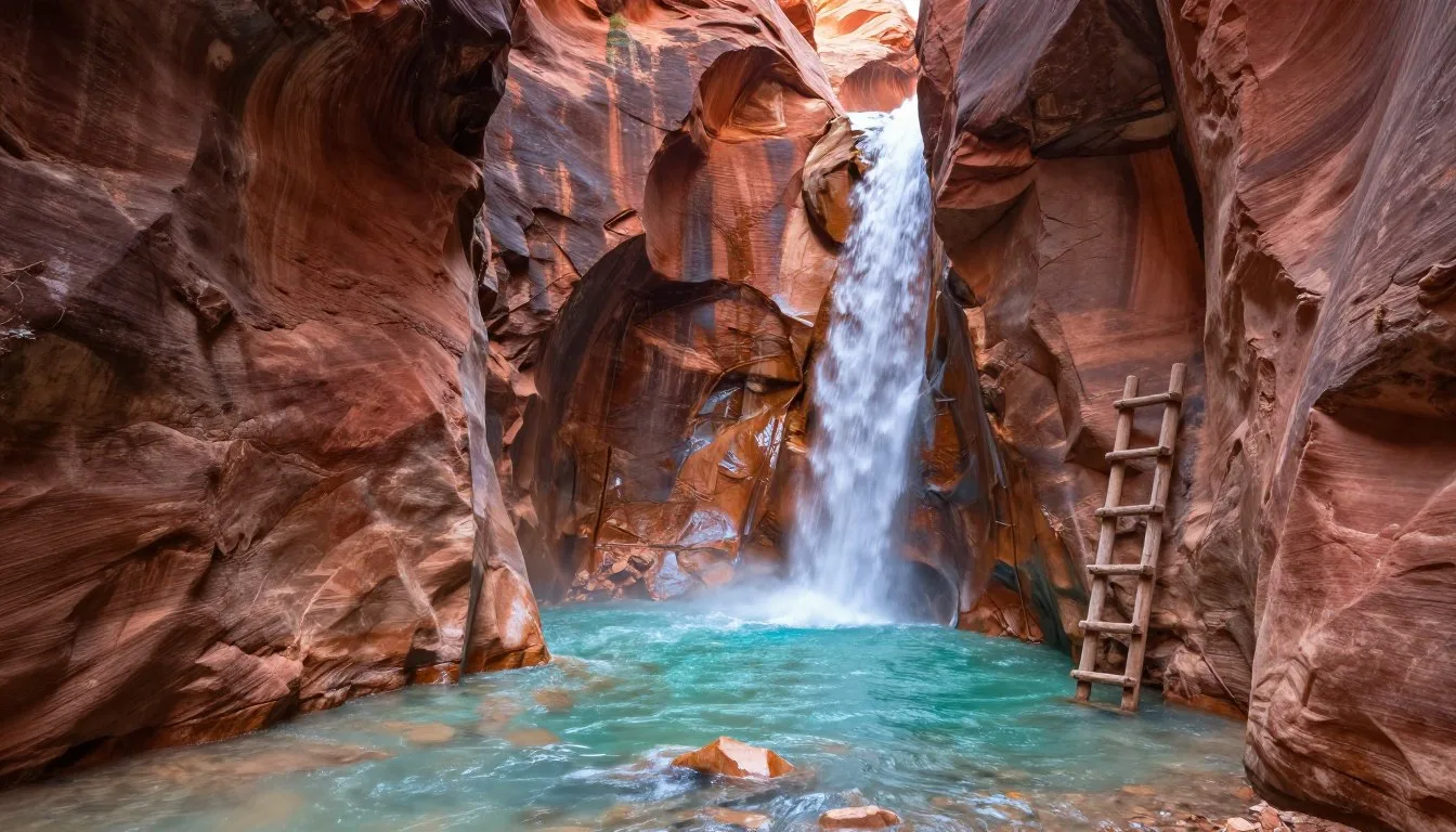
Kanarraville Falls
This slot canyon adventure near Kanarraville requires hiking through water but rewards with stunning waterfalls. The 7.2 km (4.5-mile) round trip involves wading through the creek and climbing two waterfalls using chains and ladders.
Permits are required and often sell out days in advance during peak season. The hike suits adventurous families with older children. Water levels vary seasonally—late summer typically offers the safest conditions.
Pine Valley Mountain Wilderness
This wilderness area northwest of the scenic byway offers pristine backcountry experiences. Over 20,234 hectares (50,000 acres) of roadless terrain invite serious hikers and backpackers. The area receives far less visitation than nearby national parks.
Summit Trail climbs to Signal Peak at 3,251 m (10,365′) with views spanning hundreds of square kilometers. The challenging 27.4 km (17-mile) round trip suits experienced hikers prepared for high-elevation effort. Carry adequate water as sources remain limited.
Practical Travel Tips

What to Pack
Layered clothing proves essential for comfort across elevation changes and variable weather. Start with moisture-wicking base layers, add insulating mid-layers, and top with waterproof outer shells. Pack these items even for summer visits when temperatures can vary 28°C (50°F) between morning and afternoon.
Sun protection items rank as critical gear. Bring broad-spectrum sunscreen with SPF 30 or higher, reapplying every two hours. Wide-brimmed hats protect faces and necks from intense high-altitude sun. Quality sunglasses with UV protection prevent eye damage.
Hydration supplies should exceed what you think necessary. Carry at least two liters of water per person for day hikes. Collapsible bottles save space when empty. Water filtration systems allow refilling from streams and lakes in backcountry areas.
Best Photography Equipment
Wide-angle lenses capture sweeping landscape vistas at Cedar Breaks and along the scenic byway. A 16-35mm zoom suits full-frame cameras, while 10-24mm works for crop-sensor bodies. Telephoto lenses compress mountain scenes and photograph distant wildlife.
Tripods stabilize cameras during low-light conditions at sunrise and sunset. These golden hours provide the most dramatic lighting on rock formations. Circular polarizing filters reduce glare and deepen blue skies.
Extra batteries drain faster in cold weather and at high altitude. Carry spares and keep them warm in inside pockets. Memory cards should have ample capacity—mountain scenery inspires many photographs.
Internet and Communications
Cell phone service remains unreliable throughout most of the scenic byway corridor. Verizon typically provides the most extensive coverage, but even this carrier has significant gaps. AT&T and T-Mobile coverage proves spottier.
Download maps, trail guides, and other resources before leaving areas with reliable internet. Cedar City and Panguitch have WiFi at hotels, libraries, and some restaurants. Brian Head’s limited connectivity reflects its remote mountain location.
Satellite communicators like Garmin InReach provide emergency communication in areas without cell service. These devices allow two-way messaging and SOS functions. Consider renting or purchasing one for backcountry adventures.
Seasonal Considerations
Summer visitors should plan outdoor activities for morning hours. Afternoon thunderstorms develop frequently, particularly during July and August monsoon season. Lightning danger increases dramatically on exposed ridges and peaks.
Fall brings stable weather patterns and spectacular foliage. Pack layers as temperature swings increase. First snowfall can occur by late September at higher elevations. Monitor forecasts closely during shoulder seasons.
Winter travelers need specialized equipment and skills. Tire chains become mandatory during storms. Avalanche awareness is essential for backcountry travel. Check with local authorities about current conditions before attempting winter adventures.
Accessibility Information
Cedar Breaks National Monument maintains accessible viewpoints at Point Supreme and Sunset View. Paved parking and level viewing areas accommodate wheelchairs. The visitor center features accessible restrooms and exhibits.
Some Panguitch Lake facilities offer accessible fishing platforms and campsites. Contact specific resorts and campgrounds about accessibility features when making reservations. The lake’s relatively flat terrain suits visitors with mobility limitations.
Most scenic byway viewpoints along Highway 143 feature paved or compacted surfaces. However, accessibility varies between locations. Call ahead to discuss specific needs with visitor centers or land management agencies.
Language and Cultural Notes
English is the primary language throughout the region. Small-town residents typically speak clearly and may adjust pace when communicating with international visitors. Tourism industry workers have experience with diverse accents and communication styles.
The region’s strong Mormon influence affects some business practices. Sunday closures occur commonly, and alcohol availability remains limited. Utah’s liquor laws differ from many states—research regulations if planning to purchase alcohol.
Visitor Center Resources: Stop at visitor centers in Parowan, Brian Head, or Panguitch for current conditions, road status, and local insights. Rangers and volunteers provide valuable information about seasonal highlights and lesser-known attractions.
Your Mountain Adventure Awaits
The Brian Head-Panguitch Lake Scenic Byway delivers an extraordinary journey through some of Utah’s most diverse and beautiful landscapes. From the geological marvels of Cedar Breaks National Monument to the serene waters of Panguitch Lake, every kilometer reveals new wonders. The route’s elevation changes create multiple ecosystems within a single drive.
Whether you seek outdoor adventure, scenic photography, family recreation, or peaceful solitude, this byway offers experiences matching every travel style. Summer wildflowers, autumn aspens, and winter snowscapes each present distinct beauty. The small communities along the route preserve authentic western character while welcoming visitors warmly.
Start planning your adventure today. The mountains are calling, and the scenic byway awaits your discovery. Each season brings its own magic to this remarkable corner of southern Utah. Your journey along the Brian Head-Panguitch Lake Scenic Byway will create memories lasting far beyond your visit.