Hotels by Trip.com
Flights by Trip.com
Did you know that Grand Staircase–Escalante National Monument protects 760,000 hectares (1.9 million acres) of some of the most remote and rugged landscape in the continental United States? This vast wilderness area contains more land than the entire state of Rhode Island. Yet much of this territory remains unexplored by modern science.
Established in 1996, this monument represents the last region in the United States to be mapped. The area holds secrets dating back millions of years. Paleontologists continue discovering new dinosaur species here regularly.
The monument stretches across southern Utah’s canyon country. It features three distinct sections: the Grand Staircase, the Kaiparowits Plateau, and the Canyons of the Escalante. Each section offers unique geological wonders and outdoor adventures.
This comprehensive guide reveals everything you need to plan an unforgettable journey to this remarkable national monument. From slot canyons to petrified forests, from ancient rock art to modern hiking trails, you’ll discover why this landscape captivates adventurers from around the world.
Getting There & Planning Your Journey

Reaching Grand Staircase–Escalante National Monument requires thoughtful planning due to its remote location. The monument sits in south-central Utah, far from major metropolitan areas. However, several route options make the journey accessible for determined travelers.
Closest Airports
The nearest commercial airports offer various distance and service level options. Your choice depends on flight availability and rental car preferences.
- St. George Regional Airport (SGU) – 145 kilometers (90 miles) southwest of the monument entrance near Cannonville
- Cedar City Regional Airport (CDC) – 177 kilometers (110 miles) northwest, serving the monument’s western approaches
- Salt Lake City International Airport (SLC) – 403 kilometers (250 miles) north, offering the most flight options and competitive rental rates
- Las Vegas McCarran International Airport (LAS) – 426 kilometers (265 miles) southwest, popular for combining monument visits with Nevada attractions
Primary Access Points
The monument has no single entrance gate. Instead, multiple access points surround its perimeter. Each gateway serves different sections and offers distinct experiences.
Highway 12 provides the most scenic northern access route. This All-American Road passes through the towns of Boulder and Escalante. Both communities serve as excellent base camps for monument exploration.
Highway 89 borders the monument’s eastern and southern edges. The small town of Big Water near Glen Canyon offers access to the monument’s remote southeastern sections.
Kanab, located south of the monument on Highway 89, serves as another popular staging area. This town offers more services than smaller gateway communities.
Visitor Center Information: The Escalante Interagency Visitor Center provides essential trip planning resources, current road conditions, and required permits for overnight backcountry camping.
Road Conditions and Vehicle Requirements
Understanding road conditions proves critical for safe monument access. The area features three distinct road types requiring different vehicle capabilities.
Paved highways circle the monument perimeter. These routes remain accessible year-round in standard vehicles. Scenic Byway 12 ranks among America’s most beautiful drives.
✓ Check 30,000+ Local Sightseeing Tours Worldwide
Maintained dirt roads penetrate deeper into monument territory. These routes generally accommodate passenger cars during dry conditions. Hole-in-the-Rock Road and Cottonwood Canyon Road represent this category.
Unmaintained backcountry roads require high-clearance four-wheel-drive vehicles. These primitive routes often feature deep sand, sharp rocks, and steep grades. Weather can render them impassable quickly.
Best Time to Visit & Weather Tips

Timing your visit to Grand Staircase–Escalante National Monument significantly impacts your experience. The region experiences dramatic seasonal variations affecting accessibility, comfort, and safety.
Recommended Visiting Seasons
Spring emerges as the prime season for monument exploration. April through early June offers moderate temperatures and spectacular wildflower displays. Daytime temperatures range from 18°C to 27°C (65°F to 80°F).
Fall provides another excellent window for visits. September through October delivers comfortable hiking weather with fewer crowds. The landscape transforms with golden cottonwoods along the Escalante River corridor.
Early spring and late fall present ideal conditions for strenuous activities. The cooler weather suits long hiking days in exposed terrain. Water sources remain more reliable than summer months.
Seasons to Approach With Caution
Summer brings extreme heat to this desert environment. July and August see temperatures exceeding 38°C (100°F) regularly. Afternoon thunderstorms create flash flood dangers in slot canyons.
Winter transforms the monument into a challenging destination. December through February brings freezing temperatures and occasional snow. Many dirt roads become impassable due to mud and ice.
High-elevation areas like the Kaiparowits Plateau remain snow-covered well into spring. Winter visitors should have winter camping experience and appropriate gear.
Month-by-Month Weather Guide
Spring Conditions
March temperatures range from 4°C to 16°C (40°F to 60°F). Snow still affects higher elevations. April warms to 10°C to 21°C (50°F to 70°F) with peak wildflower blooms. May offers near-perfect conditions before summer heat arrives.
Summer Considerations
June begins the hot season with temperatures climbing to 32°C (90°F). July and August bring intense heat exceeding 38°C (100°F). Monsoon season starts in mid-July, creating afternoon storm patterns and flash flood risks.
Autumn Appeal
September maintains warm days around 29°C (85°F) but cooler nights. October drops to comfortable 21°C (70°F) days. November transitions toward winter with temperatures falling to 10°C (50°F).
Winter Realities
December through February sees daytime highs around 4°C to 7°C (40°F to 45°F). Nighttime temperatures plunge below freezing regularly. Snowfall varies annually but can reach 30 centimeters (12 inches) in higher regions.
Flash Flood Warning: Never enter narrow slot canyons when thunderstorms threaten the region. Flash floods can occur miles from storm locations with minimal warning. Check weather forecasts before exploring canyon systems.
Notable Annual Festivals

The gateway communities surrounding Grand Staircase–Escalante National Monument host several annual events celebrating the region’s natural and cultural heritage. These festivals offer unique opportunities to connect with local culture while exploring the monument.
Escalante Canyons Art Festival
This September event transforms the town of Escalante into an outdoor art gallery. Local and regional artists display works inspired by the surrounding landscape. The festival includes live music, local food vendors, and guided nature walks.
The celebration typically occurs during the last weekend of September. Artists demonstrate traditional techniques including pottery, weaving, and landscape painting.
Festival Information:
Kanab Balloon Festival
Each January, the town of Kanab hosts this colorful hot air balloon gathering. While not directly within the monument, the festival provides spectacular views of the Grand Staircase from above. Early morning launches create stunning photography opportunities.
The festival runs for three days during the third week of January. Pilots from across the western United States participate in this high-desert aviation celebration.
Balloon Festival Contact:
Boulder Heritage Days
This July event celebrates the pioneer history of Boulder, one of the last towns in the continental United States to receive mail by mule train. The festival features historical reenactments, traditional crafts demonstrations, and local music performances.
Activities include dutch oven cooking competitions and children’s programs focusing on pioneer life. The celebration occurs during the second weekend of July annually.
Escalante Heritage Days
Every June, Escalante commemorates its pioneer heritage with this multi-day festival. Events include a parade, rodeo, craft fair, and outdoor concerts. The celebration provides insight into the resilient communities that settled this challenging landscape.
The festival typically spans four days around the first weekend of June. Local ranchers demonstrate traditional skills including roping and horseshoeing.
Getting Around Locally

Navigating Grand Staircase–Escalante National Monument requires self-sufficiency and careful planning. Unlike traditional national parks, this monument lacks internal shuttle systems or public transportation options.
Personal Vehicle Requirements
Your own vehicle provides the only practical way to explore the monument. Rental cars from nearby airports work well for paved routes and major dirt roads during dry conditions.
High-clearance vehicles enable access to more remote locations. Four-wheel-drive capability becomes essential for backcountry routes during any season. Many rental agencies in St. George and Salt Lake City offer suitable vehicles.
Fuel availability remains limited within monument boundaries. The town of Escalante offers the most centrally located services. Plan fuel stops carefully as distances between services exceed 80 kilometers (50 miles) on some routes.
Navigation Challenges
Cell phone service proves unreliable throughout most monument areas. Download offline maps before your journey begins. Paper maps remain essential backup navigation tools.
Road signs appear infrequently on backcountry routes. Carry detailed topographic maps and a GPS device with fresh batteries. The Bureau of Land Management publishes excellent monument-specific maps.
Washboard surfaces characterize many dirt roads. These corrugated conditions develop from traffic and require reduced speeds for vehicle control and comfort.
Distance and Time Considerations
Distances deceive in this rugged terrain. A 48-kilometer (30-mile) journey might require two hours on rough dirt roads. Always allocate extra time for unexpected road conditions or wildlife viewing opportunities.
The monument’s vast size means some areas require full-day drives to reach. Hole-in-the-Rock Road extends 93 kilometers (58 miles) from Highway 12 to Glen Canyon. Budget entire days for exploring remote sections.
Essential Driving Tip: Always check current road conditions at visitor centers before attempting backcountry routes. Recent rain can make roads impassable for days. Staff provide current information about road accessibility throughout the monument.
Where to Stay

Accommodation options around Grand Staircase–Escalante National Monument range from rustic campgrounds to comfortable lodges. The gateway communities of Escalante, Boulder, and Kanab provide the most convenient bases for monument exploration.
Escalante Lodging
The town of Escalante offers the most central location for monument access. Several small motels and inns provide comfortable rooms with modern amenities. Family-owned establishments dominate this community of approximately 800 residents.
Escalante Outfitters provides unique accommodations in renovated cabins and offers camping spaces. The property includes a cafe and gear shop serving outdoor enthusiasts.
Escalante Accommodations:
Boulder Options
Boulder maintains its remote character while offering quality lodging. This tiny community sits along Highway 12 and serves travelers exploring the monument’s northern sections.
Boulder Mountain Lodge features a wildlife sanctuary and pond attracting numerous bird species. The property combines modern comfort with environmental sensitivity. Rooms overlook the sanctuary or Escalante River valley.
Several bed-and-breakfast establishments operate in Boulder. These smaller properties provide personalized service and local knowledge about monument trails and conditions.
Kanab Accommodations
Kanab offers the widest selection of lodging options. This larger town includes national hotel chains and independent properties. The location provides convenient access to the monument’s southern sections.
More than twenty lodging establishments operate in Kanab. Options range from budget motels to boutique hotels. The town serves as a hub for visitors exploring multiple nearby public lands.
Camping Opportunities
Developed campgrounds provide accessible camping experiences. Calf Creek Campground sits along Highway 12 near the popular Calf Creek Falls trail. The facility offers basic amenities in a beautiful canyon setting.
Dispersed camping throughout the monument allows free camping in most areas. Regulations require camping at least 60 meters (200 feet) from water sources and developed roads. No facilities exist at dispersed sites.
Backcountry camping requires permits for extended trips. The permit system helps manage visitor impact in sensitive areas. Obtain permits from visitor centers or online through the Bureau of Land Management website.
Developed Campground Features
- Picnic tables and fire rings at individual sites
- Vault toilets providing basic facilities
- Potable water at select locations
- First-come, first-served basis for most sites
Dispersed Camping Guidelines
- No fees required for dispersed camping
- Pack out all trash and waste
- Use existing fire rings when available
- Respect fourteen-day camping limit
Dining & Local Cuisine

Dining options near Grand Staircase–Escalante National Monument reflect the region’s rural character and pioneer heritage. While choices remain limited compared to urban areas, local establishments serve satisfying meals emphasizing regional ingredients and traditions.
Escalante Dining Scene
Escalante supports several restaurants catering to hungry hikers and travelers. The Outfitters Cafe combines hearty breakfast options with made-to-order sandwiches perfect for trail lunches. Their pizza night draws locals and visitors alike.
Circle D Eatery serves classic American comfort food in generous portions. The restaurant features homemade pies that showcase seasonal fruits. Breakfast service begins early to accommodate adventurers heading into the monument.
Escalante’s Cowboy Blues serves Southwestern-inspired cuisine in a casual atmosphere. The menu emphasizes grilled meats and regional specialties. Local artwork decorates the dining room.
Boulder Culinary Experiences
Boulder boasts dining experiences that exceed expectations for such a remote location. Hell’s Backbone Grill earned national recognition for its farm-to-table approach and creative menu.
The restaurant sources ingredients from its own organic farm and regional producers. Dishes incorporate native plants and traditional preparation methods. Reservations strongly recommended during peak season.
Burr Trail Grill offers more casual dining with views of the surrounding landscape. The menu features burgers, sandwiches, and salads using fresh ingredients. The outdoor patio provides pleasant dining during warm months.
Kanab Food Options
Kanab’s larger population supports diverse dining choices. Sego Restaurant features Utah-raised meats and seasonal vegetables. The chef creates innovative dishes respecting regional culinary traditions.
Rocking V Cafe serves eclectic fare in a converted gas station. The menu ranges from Asian-influenced noodle dishes to American classics. Vegetarian options exceed those found in smaller towns.
Several quick-service restaurants and cafes operate in Kanab. These establishments provide convenient meals for travelers focused on maximizing exploration time.
Regional Specialties
Dutch oven cooking remains part of the local culinary heritage. Some restaurants feature dishes prepared using this traditional method. Slow-cooked roasts and cobblers showcase the technique.
Fry bread appears on many menus reflecting Native American culinary influence. This versatile bread accompanies savory dishes or serves as dessert with honey and powdered sugar.
Local beef from regional ranches features prominently in area restaurants. The cattle graze on public lands surrounding the monument creating distinctive flavor profiles.
Grocery Shopping: Stock up on supplies in Escalante or Kanab before extended monument visits. Small markets in both towns carry camping and hiking food essentials. Selection exceeds what you’ll find in tiny Boulder.
Attractions, Sightseeing & Activities

Grand Staircase–Escalante National Monument encompasses such vast territory that weeks of exploration barely scratch the surface. The monument protects geological wonders, archaeological sites, and pristine wilderness areas attracting adventurers worldwide.
Slot Canyon Adventures
Slot canyons represent the monument’s most photographed features. These narrow passages carved by water over millions of years create otherworldly landscapes. Light beams penetrating the narrows provide spectacular photo opportunities.
Zebra Slot Canyon ranks among the monument’s most spectacular slot canyons. The four-kilometer (2.5-mile) round-trip hike requires some scrambling and route-finding. Zebra-striped walls give this canyon its distinctive name.
Spooky and Peek-a-Boo Gulch offer accessible slot canyon experiences. These short but exciting routes feature tight squeezes and short climbs. Both canyons sit near each other allowing combined exploration.
Willis Creek provides family-friendly slot canyon access. The gentle six-kilometer (3.7-mile) route follows a seasonal creek through narrows. Multiple entry and exit points allow flexible trip lengths.
Waterfall Destinations
Calf Creek Falls draws visitors to its beautiful 38-meter (126-foot) cascade. The 9.6-kilometer (6-mile) round-trip trail follows Calf Creek through a scenic canyon. Ancient rock art panels line the route to the falls.
The trail gains minimal elevation making it accessible for most fitness levels. However, the route traverses sandy sections requiring more effort than distance suggests. Plan three to four hours for the complete hike.
Lower Calf Creek Falls provides easier access than the upper falls. The developed trailhead includes restrooms and a campground. Summer weekends see heavy use from both day hikers and campers.
The Escalante River Corridor
The Escalante River carved spectacular canyons through this desert landscape. Numerous side canyons branch from the main drainage creating endless exploration opportunities. Multi-day backpacking trips follow the river for 80 kilometers (50 miles) to Lake Powell.
✓ Check 30,000+ Local Sightseeing Tours Worldwide
Death Hollow represents one of the monument’s premier wilderness experiences. This challenging route requires wading through water and scrambling over obstacles. Technical skills and proper gear prove essential for safe passage.
Highway 12 crosses the Escalante River near the town of Escalante. Multiple trailheads along this section provide day-hike access to slot canyons and archaeological sites.
Scenic Drives
Hole-in-the-Rock Road extends 93 kilometers (58 miles) from Highway 12 toward Glen Canyon. This maintained dirt route accesses numerous hiking trails and primitive camping areas. The road follows the historic route of Mormon pioneers.
Cottonwood Canyon Road connects Highway 12 with Highway 89 providing a scenic alternative route. The 74-kilometer (46-mile) road passes through colorful badlands and offers views of the Cockscomb formation.
Burr Trail Road begins in Boulder and traverses spectacular landscape toward Capitol Reef National Park. The paved and dirt sections showcase dramatic geological features including the Waterpocket Fold.

Archaeological and Paleontological Sites
The monument protects thousands of archaeological sites spanning 10,000 years of human history. Ancient rock art panels decorate canyon walls throughout the region. Viewing these cultural treasures requires minimal hiking in many locations.
The Kaiparowits Plateau yields extraordinary dinosaur fossils. Scientists have discovered several new species in recent years. Most paleontological sites remain protected and closed to casual visitors.
Hundred Hands Pictograph Panel features numerous handprints from ancestral Puebloan people. The site sits along a short spur from Highway 12. Interpretive signs explain the cultural significance of the artwork.
Remote Wilderness Areas
The monument’s vast acreage includes extensive roadless areas perfect for solitude seekers. The Escalante Canyons wilderness encompasses the most rugged terrain. Technical canyoneering skills open additional remote destinations.
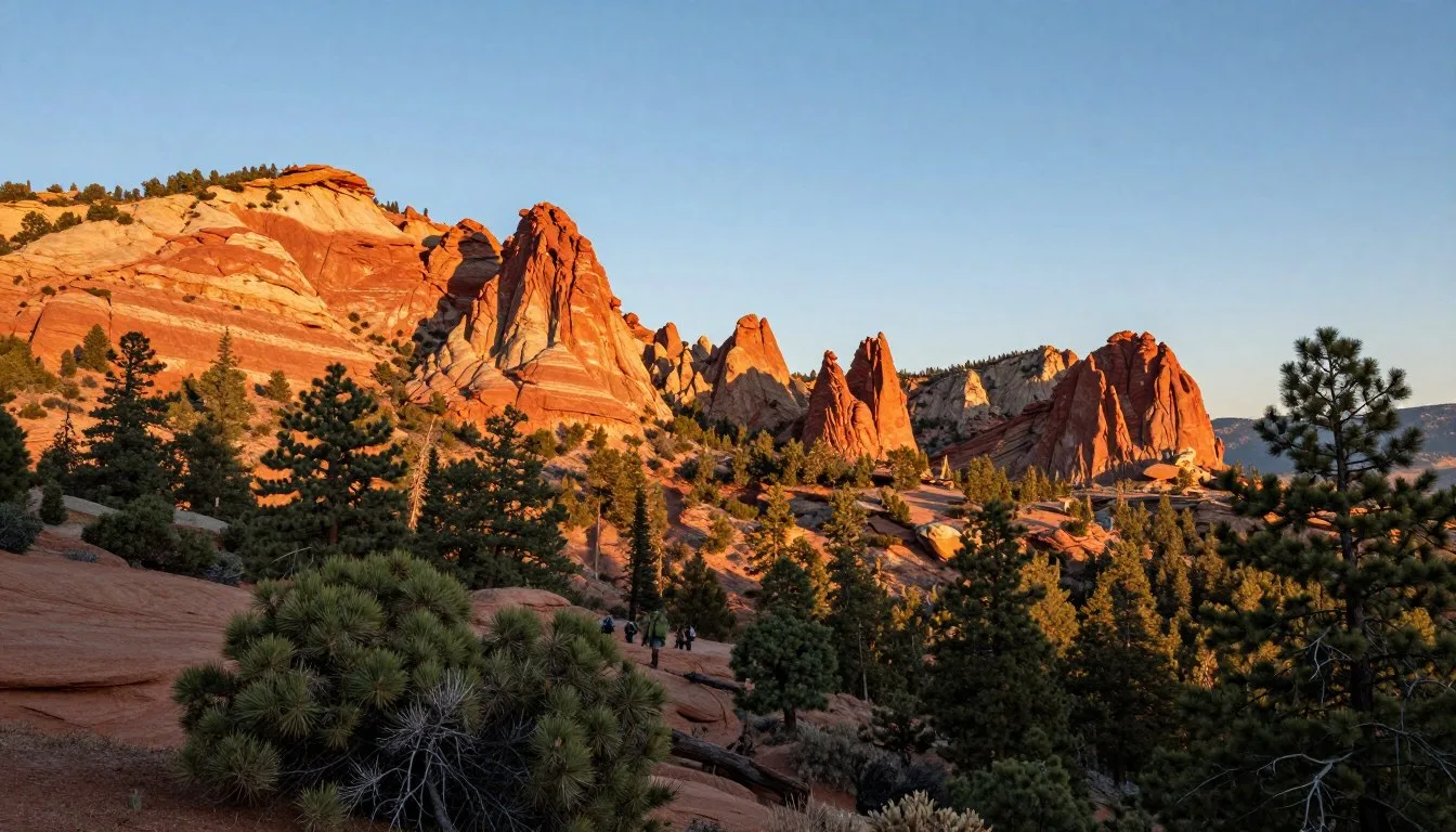
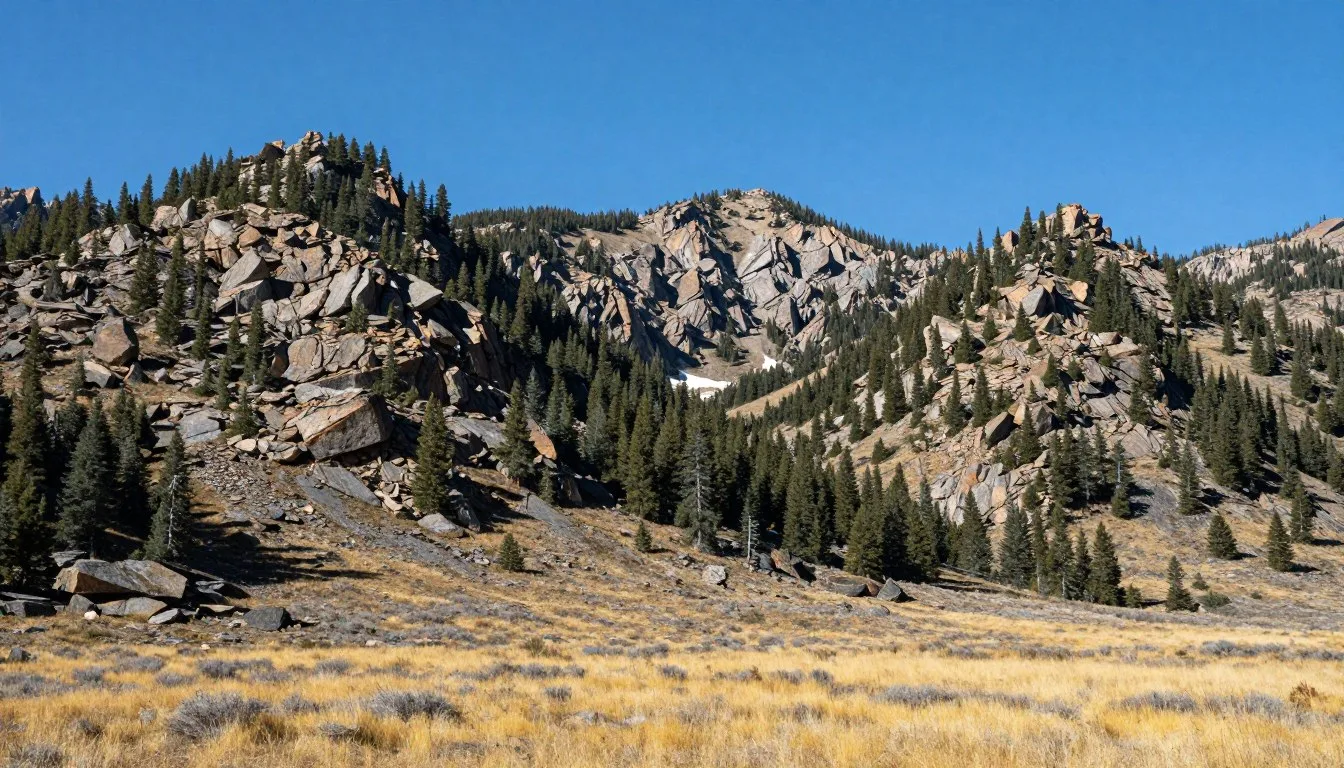
The Kaiparowits Plateau rises to 2,286 meters (7,500 feet) elevation. This high desert tableland remains one of the Lower 48’s most isolated regions. Few maintained routes penetrate its interior requiring serious backcountry skills.
The Grand Staircase section features tilted rock layers creating colorful bands visible from great distances. This geologic feature gives the monument its name and provides stunning landscape photography subjects.
Museums, Cultural Spots & Festivals

Understanding Grand Staircase–Escalante National Monument’s natural and cultural history enriches any visit. Several museums and cultural centers in gateway communities provide context for the landscapes you’ll explore.
Escalante Interagency Visitor Center
This facility serves as more than a permit office. Excellent exhibits explain the monument’s geology, paleontology, and human history. Fossils discovered in the monument fill display cases alongside artifacts from ancestral Puebloan cultures.
Rangers staff the center year-round providing trip planning assistance. Interactive displays help visitors understand the area’s complex geological story. A relief map shows the monument’s three distinct sections and major features.
The center maintains current information about road conditions, weather forecasts, and trail status. Book sales support public land education programs. Most publications focus on monument-specific content unavailable elsewhere.
Anasazi State Park Museum
Located in Boulder, this museum protects an ancestral Puebloan village site. The facility houses artifacts excavated from the pueblo that thrived here 800 years ago. A reconstructed dwelling provides insight into ancient living conditions.
Excavated rooms remain visible beneath protective structures. Interpretive panels explain how archaeologists uncovered and studied this important site. The museum gift shop features authentic Native American crafts from contemporary artists.
The site sits along Highway 12 making it convenient to visit while traveling through the region. A short nature trail explores the surrounding landscape and native plant uses.
Big Water Visitor Center
This small facility near the monument’s southeastern boundary features excellent paleontology exhibits. Life-size dinosaur models greet visitors outside the building. Interior displays showcase fossils found within the monument.
The center emphasizes the Kaiparowits Plateau’s significance to paleontological research. Scientists continue discovering new dinosaur species in this fossil-rich region. Staff explain ongoing research projects and recent discoveries.
The location provides information for visitors exploring the monument’s more remote southern sections. Maps detail nearby routes including the challenging road to Paria Canyon.
Cultural Heritage Sites
Rock art panels throughout the monument document thousands of years of human presence. Many sites remain accessible via short hikes from roads. Respect for these irreplaceable cultural resources proves essential.
Never touch rock art panels as skin oils damage ancient pigments. Photographs provide lasting memories without harming the artwork. Stay on designated trails to prevent inadvertent damage to archaeological sites.
The monument protects both ancient dwellings and historic ranching structures. Old corrals and line cabins tell stories of pioneers who wrested livings from this challenging landscape.
Cultural Resource Protection: Federal law protects all archaeological and paleontological resources. Removing artifacts or fossils constitutes a serious crime resulting in substantial fines and imprisonment. Enjoy these treasures in place for future generations.
Nature & Outdoor Experiences

Grand Staircase–Escalante National Monument exists primarily for outdoor recreation and wilderness preservation. The monument’s remote character and minimal development attract adventurers seeking authentic wilderness experiences.
Hiking Opportunities
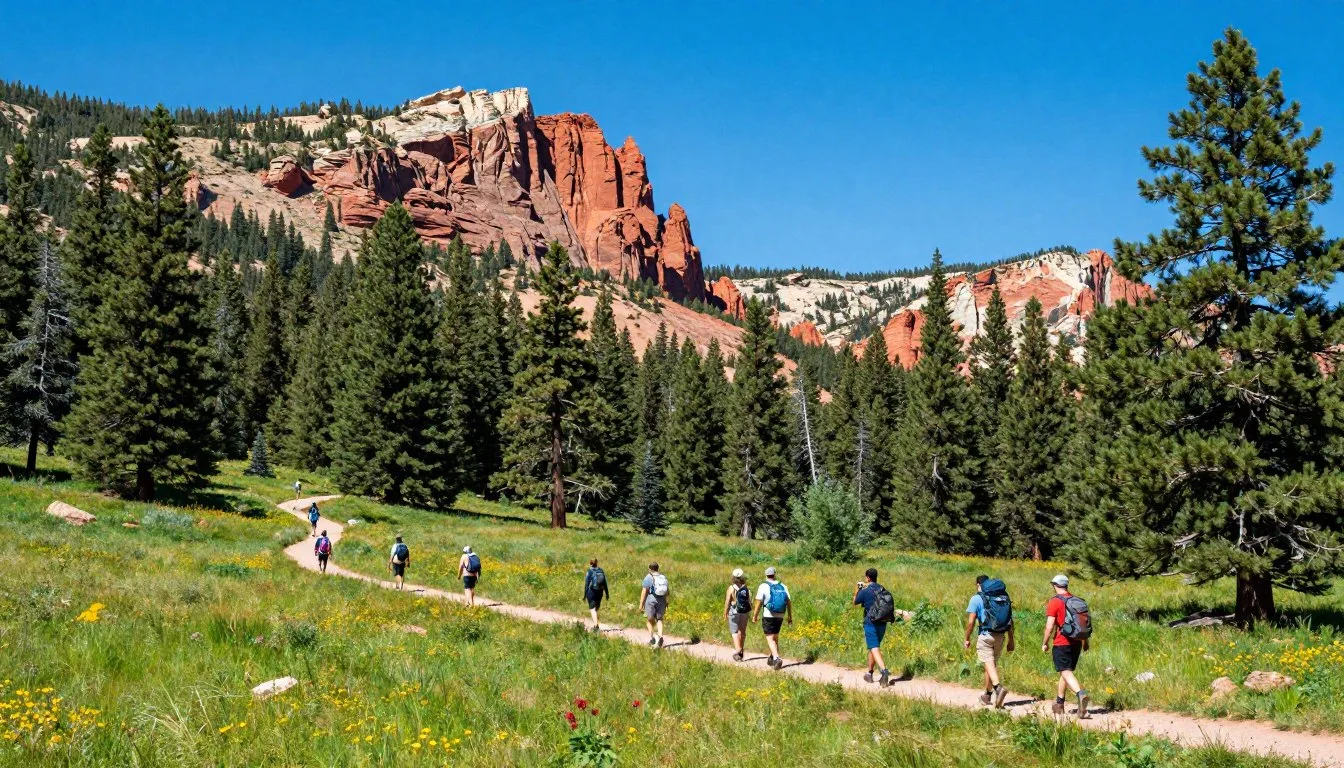
Hundreds of kilometers of hiking trails crisscross the monument. Routes range from easy nature walks to multi-day wilderness expeditions. Most trails follow canyons or ridgelines providing dramatic scenery.
The Boulder Mail Trail recreates a historic route connecting Boulder with Escalante. This 27-kilometer (17-mile) trail crosses open desert country offering expansive views. The route requires navigation skills as cairns mark much of the way.
Lower Escalante River canyons provide excellent day-hiking opportunities. Side canyon explorations reveal slot canyons, natural arches, and seeps supporting hanging gardens. Distances vary based on individual interests and abilities.
Phipps Arch stands as one of the monument’s hidden gems. The eight-kilometer (5-mile) round-trip hike crosses slickrock terrain to an impressive sandstone arch. Navigation challenges add interest for experienced hikers.
Backpacking Adventures
Extended wilderness trips allow deeper monument exploration. The Escalante River corridor supports multi-day journeys through spectacular canyon country. Plan five to seven days for complete through-hikes.
Permits required for overnight backcountry camping help manage visitor impact. Obtain permits from visitor centers or online before your trip. Regulations limit group sizes and camping locations in sensitive areas.
Water availability varies seasonally throughout the monument. Springs and seeps provide reliable sources in many canyons. Carry water treatment systems as giardia and other pathogens contaminate untreated water.
Leave No Trace principles prove essential in this fragile desert environment. Pack out all waste including toilet paper. Use existing campsites when available to minimize impact on vegetation and soils.

Rock Climbing and Canyoneering
Technical canyoneering opens access to the monument’s most spectacular slot canyons. These routes require rope skills, specialized equipment, and canyon rescue knowledge. Never attempt technical canyons without proper training and gear.
Guided canyoneering trips provide safe introduction to this specialized activity. Local outfitters lead excursions into famous slot canyons. These services include necessary equipment and instruction.
Sport climbing opportunities exist on select sandstone formations. However, most climbing occurs in nearby areas with more established route development. Check current regulations as some areas remain closed protecting nesting raptors.
Photography Experiences
The monument rewards photographers with endless subjects. Slot canyons create natural studios where reflected light paints canyon walls in warm tones. Midday light works best in deep narrows when sun angles penetrate the depths.
Landscape photographers find inspiration in the monument’s vast scale. Sunrise and sunset paint the layered rock formations in dramatic colors. The region’s low humidity and minimal light pollution enable stunning night sky photography.
Wildlife photography requires patience but yields rewards. Desert bighorn sheep inhabit remote regions while smaller mammals and reptiles appear more regularly. Spring mornings offer best opportunities for animal activity.
Stargazing Opportunities
Dark skies free from light pollution make the monument exceptional for astronomy. The Milky Way stretches brilliantly overhead on moonless nights. Meteor showers appear particularly spectacular from this remote region.
Winter offers the longest nights for stargazing though temperatures drop significantly. Summer’s warmer temperatures make comfortable all-night observation sessions possible. Check moon phases when planning stargazing trips.
The monument’s high elevation and dry climate create excellent atmospheric conditions. Stars appear remarkably bright and numerous compared to urban areas. Binoculars reveal countless celestial objects invisible to city dwellers.

Flora and Fauna
The monument protects remarkable biodiversity considering its arid climate. Five life zones exist here ranging from hot desert valleys to cool pine forests. Each zone supports distinct plant and animal communities.
Cryptobiotic soil crusts carpet the ground between plants in healthy areas. These living communities of lichens, mosses, and cyanobacteria prevent erosion and enrich soils. Never walk on these delicate crusts as recovery requires decades.
Spring wildflower displays transform the desert landscape. Peak blooms occur in April and May following good winter precipitation. Wildflower species vary dramatically based on elevation and moisture availability.
Desert bighorn sheep roam the monument’s most rugged terrain. These sure-footed animals navigate cliffs that appear impassable to humans. Early morning and late afternoon increase wildlife viewing opportunities.
Condors occasionally soar over the monument after being reintroduced to nearby regions. These massive birds with three-meter wingspans represent conservation success stories. Their presence highlights the monument’s role in ecosystem restoration.
Travel With Children

Grand Staircase–Escalante National Monument offers family-friendly adventures alongside its challenging wilderness expeditions. Thoughtful planning ensures children enjoy safe and memorable experiences in this spectacular landscape.
Age-Appropriate Activities
Younger children enjoy shorter trails with interesting destinations. The hike to Calf Creek Falls provides a clear goal and swimming opportunities. The 9.6-kilometer (6-mile) distance challenges kids while remaining achievable.
Willis Creek slot canyon delights children with its narrow passages and stream crossings. The relatively easy route allows kids to experience slot canyon adventure without technical difficulties. Multiple turnaround points accommodate varying energy levels.
Junior Ranger programs at visitor centers engage children in educational activities. Kids complete activity booklets earning badges and certificates. These programs teach Leave No Trace principles and natural history concepts.
Safety Considerations
Sun protection proves critical for children’s sensitive skin. Apply sunscreen regularly and have kids wear wide-brimmed hats and lightweight long-sleeved shirts. The desert sun burns exposed skin quickly even on cloudy days.
Children dehydrate faster than adults in hot, dry conditions. Carry extra water and encourage frequent drinking even when kids don’t feel thirsty. Dehydration symptoms include fatigue, headache, and decreased urination.
Flash flood dangers require extra caution with children. Avoid narrow canyons when any thunderstorm risk exists. Teach children to recognize weather warning signs and establish meeting points if separated.
Family Camping Tips
Car camping at developed campgrounds provides excellent family base camps. Sites at Calf Creek Campground offer easy access to the falls trail. Picnic tables and vault toilets make camping comfortable for kids new to outdoor experiences.
Tent camping builds family memories through shared experiences. Involve children in camp setup and meal preparation. Evening campfires create opportunities for storytelling and stargazing.
Keep first camp trips short to gauge children’s interest and comfort levels. One or two nights prove sufficient for initial family camping adventures. Success on short trips builds enthusiasm for longer expeditions.
Educational Opportunities
The monument provides outstanding outdoor classroom experiences. Geological formations illustrate earth science concepts better than textbooks. Ancient rock art panels spark discussions about human history and cultural preservation.
Fossil hunting in designated areas fascinates children interested in paleontology. While removing fossils remains illegal, photographing specimens and searching adds excitement to hikes. Visitor center displays show complete specimens from monument discoveries.
Plant and animal identification activities engage curious minds. Wildflower guides help children recognize species encountered along trails. Tracking skills develop through observing animal signs like tracks and scat.
Family Trip Planning: Start with easier adventures building children’s confidence and skills. Success on shorter hikes motivates kids for more challenging routes. Remember that children move slower than adults so allow extra time for all activities.
Money Saving Tips

Exploring Grand Staircase–Escalante National Monument need not strain travel budgets. The monument’s minimal development actually reduces costs compared to more commercialized destinations. Strategic planning maximizes value while maintaining adventure quality.
Free and Low-Cost Activities
No entrance fees exist for Grand Staircase–Escalante National Monument. Day use remains completely free making this destination exceptional value. Hiking, photography, and sightseeing cost nothing beyond transportation and supplies.
Dispersed camping throughout most monument areas costs nothing. These primitive sites lack facilities but provide freedom and solitude. Camping at least 60 meters (200 feet) from roads and water sources satisfies regulations.
✓ Check 30,000+ Local Sightseeing Tours Worldwide
Self-guided exploration eliminates guide service costs. Excellent maps and trail descriptions enable independent adventures. Visitor center staff provide free trip planning assistance and current condition updates.
Accommodation Savings
Camping rather than using hotels dramatically reduces lodging costs. Developed campgrounds charge modest fees around fifteen dollars nightly. Dispersed camping remains free with proper Leave No Trace practices.
Book accommodations well in advance for best rates. Last-minute lodging in small towns often costs more due to limited inventory. Shoulder season visits in April, May, September, and October offer lower prices than peak summer months.
Consider staying in larger towns like Kanab where competition keeps prices reasonable. The extra driving to trailheads may offset lodging savings depending on current fuel costs and trip length.
Food Cost Management
Preparing your own meals saves substantially compared to restaurant dining. Stock up on groceries in larger towns before arriving in gateway communities. Small-town markets charge higher prices due to transportation costs.
Bring coolers packed with meals for camping trips. Simple camp cooking equipment enables hot meals without restaurant expenses. Many campsites include fire rings allowing no-cost cooking over wood fires.
Pack trail lunches rather than returning to town midday. This strategy saves money while maximizing hiking time. Sandwiches, fruits, and energy bars travel well in desert conditions.
Transportation Economies
Fuel represents a significant trip expense in this remote region. Plan efficient routes minimizing backtracking. Combine multiple attractions in single outings reducing total mileage.
Carpool with other travelers when possible to share fuel costs. Solo travelers might find companions at visitor centers or through online forums. Shared rides benefit everyone financially and socially.
Rent fuel-efficient vehicles for paved route exploration. High-clearance four-wheel-drive vehicles consume more fuel but access additional areas. Match vehicle choice to your specific route plans.
Seasonal Timing
Visit during shoulder seasons for lower accommodation costs and smaller crowds. Spring and fall offer excellent conditions with reduced demand for lodging. Winter visits save money but require additional cold-weather gear and skills.
Weekday trips cost less than weekend visits in some gateway towns. Locals and regional visitors dominate weekend periods driving up demand. Midweek timing provides better value and more solitude.
Free Resources
- Visitor center maps and information
- Ranger presentations and trip planning assistance
- Dispersed camping throughout most areas
- All hiking trails and overlooks
- Wildlife watching and photography
Budget-Friendly Choices
- Bring your own camping gear
- Cook meals at camp rather than restaurants
- Visit during shoulder seasons
- Carpool with other travelers
- Book lodging well in advance
Safety, Etiquette & Local Customs

Staying safe in Grand Staircase–Escalante National Monument requires respecting the environment’s inherent hazards. This remote landscape punishes carelessness while rewarding preparation and good judgment. Understanding local customs ensures positive interactions with gateway communities.
Desert Safety Essentials
Water management determines survival in desert environments. Carry at least four liters (one gallon) per person for day hikes. Hot conditions and physical exertion increase water needs significantly.
Dehydration symptoms develop quickly in dry air. Thirst alone inadequately signals hydration needs. Drink water regularly throughout activities rather than waiting until feeling thirsty.
Heat exhaustion and heat stroke represent serious dangers during summer months. Recognize warning signs including dizziness, nausea, confusion, and cessation of sweating. Seek shade immediately and cool the affected person if symptoms appear.
Hypothermia threatens visitors during winter months and cool nights. Temperatures drop dramatically after sunset year-round. Pack layers allowing adjustment to changing conditions throughout the day.
Navigation and Communication
Cell phone service remains unavailable throughout most monument areas. Satellite communication devices provide emergency contact capability in remote locations. Personal locator beacons summon rescue services when activated.
Carry detailed maps and compass for all backcountry trips. GPS devices supplement but never replace traditional navigation skills. Batteries fail but paper maps work reliably in any conditions.
Inform someone of your plans before entering remote areas. Provide detailed itinerary including expected return time. This information proves critical if rescue becomes necessary.
Travel with companions when possible for enhanced safety. Solo travel increases risks substantially in this remote landscape. Partners provide assistance during emergencies and improve overall experience.
Flash Flood Awareness
Flash floods represent the greatest danger in monument canyons. These violent walls of water appear suddenly often miles from storms. Never enter narrow canyons when rain threatens the region.
Monitor weather forecasts carefully during monsoon season from July through September. Afternoon thunderstorms develop rapidly creating dangerous conditions. Morning canyon trips allow escape before storms develop.
Recognize weather warning signs including darkening skies, distant thunder, and sudden wind changes. Exit narrow canyons immediately if conditions deteriorate. Your life depends on heeding these warnings.
High water marks on canyon walls show past flood levels. These stains indicate the height floods reached during previous events. Current stream depth bears no relation to potential flood levels.
Wildlife Safety
Rattlesnakes inhabit the monument emerging during warm months. Watch where you place hands and feet. Snakes typically avoid humans but strike defensively when threatened.
Maintain distance from all wildlife. Never feed animals as this behavior harms them despite appearing kind. Fed animals become aggressive and lose natural foraging abilities.
Store food properly to prevent attracting wildlife to camps. Hang food bags or use bear canisters in backcountry sites. Even desert rodents damage equipment while seeking food.
Cultural Resource Protection
Federal law protects all archaeological and paleontological resources. View rock art panels from established trails never touching fragile surfaces. Photograph sites without disturbing surroundings.
Never remove artifacts or fossils from the monument. These items provide scientific data about past environments and cultures. Report significant discoveries to ranger staff.
Respect cryptobiotic soil crusts staying on designated trails and slickrock surfaces. These living communities require decades to recover from foot traffic. Step only on bare rock or sandy areas between crusts.
Local Community Respect
Gateway communities maintain traditional rural character and values. Respect local customs even if different from urban norms. Small-town residents welcome visitors while valuing privacy and independence.
Support local businesses when possible. These establishments sustain small communities and employ local residents. Your patronage directly benefits families living in these remote areas.
Drive carefully on rural roads. Livestock sometimes wander onto highways creating collision hazards. Slow down when approaching animals giving them time to move aside.
Emergency Contacts: Dial 911 for emergencies within cell service areas. Kane County Sheriff: +1 (435) 644-2349. Garfield County Sheriff: +1 (435) 676-2678. Carry physical copies of emergency numbers as cell service remains unavailable in most monument areas.
Visitor Comments About Grand Staircase–Escalante National Monument

“Our family spent five days exploring different sections of the monument and barely scratched the surface. The slot canyons exceeded our expectations with their beauty and adventure. Our teenagers particularly loved Spooky Gulch’s tight passages. We stayed in Escalante and found the locals incredibly helpful with trip planning advice. This national monument deserves far more recognition than it receives.”
“I’ve photographed landscapes throughout the American West for twenty years and Grand Staircase–Escalante ranks among my favorite destinations. The monument’s vast scale and minimal crowds allow genuine wilderness experiences becoming rare elsewhere. Spring wildflowers painted the desert in incredible colors during my April visit. The light in slot canyons creates magical photography opportunities. I’ll definitely return to explore areas I missed this trip.”
“My partner and I completed a four-day backpacking trip through the Escalante River canyons. The route challenged us with route-finding and water crossings but rewarded us with stunning scenery and complete solitude. We encountered only two other groups during our entire trip. The night skies away from any light pollution left us speechless. This monument protects truly wild country where you can still find adventure and silence.”
Additional Nearby Destinations

Grand Staircase–Escalante National Monument sits amid extraordinary concentration of protected public lands. Combining the monument with nearby parks and monuments creates unforgettable road trip experiences. Each destination offers distinct geological features and recreational opportunities.
Bryce Canyon National Park
Located 64 kilometers (40 miles) northwest of Cannonville, Bryce Canyon National Park protects thousands of colorful hoodoos. These distinctive rock spires create otherworldly landscapes especially beautiful at sunrise and sunset.
The park’s rim trail provides easy access to spectacular overlooks. More ambitious hikers descend into the canyon on trails winding between hoodoos. Winter transforms the park into a snowy wonderland popular with snowshoe enthusiasts.
Bryce Canyon receives far more visitors than Grand Staircase–Escalante. Expect crowds during peak summer season. Spring and fall visits combine pleasant weather with fewer people.
Capitol Reef National Park
Capitol Reef protects 97 kilometers (60 miles) of the Waterpocket Fold, a massive wrinkle in the Earth’s crust. The park lies 113 kilometers (70 miles) northeast of Escalante via scenic Highway 12.
Historic orchards planted by Mormon pioneers still produce fruit available for picking. The park’s relative obscurity means smaller crowds than Utah’s other national parks. Backcountry hiking opportunities rival those in the monument.
The Cathedral Valley section features remote dirt roads accessing spectacular formations. High-clearance vehicles essential for this isolated region. Plan full days for exploring this remote park section.
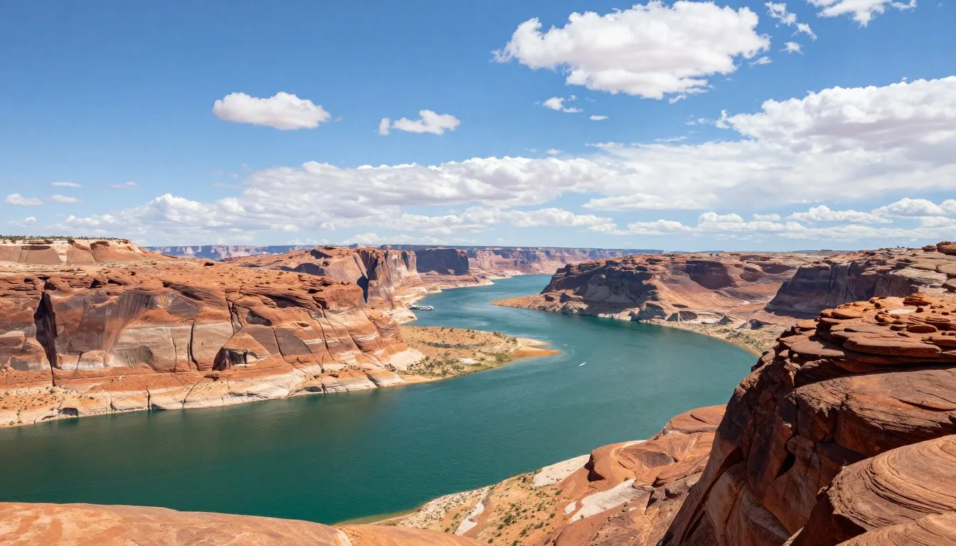
Glen Canyon National Recreation Area
This recreation area surrounds Lake Powell and includes spectacular slot canyons. The monument’s southeastern boundary adjoins Glen Canyon creating combined exploration opportunities.
Water-based recreation contrasts with the monument’s desert hiking. Houseboating, kayaking, and paddleboarding attract summer visitors. Side canyons accessible by boat reveal hidden waterfalls and beaches.
The dam creating Lake Powell generates controversy among conservationists. The reservoir flooded Glen Canyon’s legendary beauty beneath hundreds of feet of water.
Zion National Park
Utah’s most visited national park sits 121 kilometers (75 miles) southwest of the monument. Zion’s towering sandstone cliffs and narrow canyons draw millions annually. The park operates mandatory shuttle systems during peak season.
Iconic hikes include Angels Landing and The Narrows. Both trails require permits and proper preparation. Less crowded alternatives exist throughout the park’s extensive trail system.
Springdale adjacent to the park entrance offers abundant lodging and dining options. Book accommodations months in advance for summer visits. Shoulder seasons provide better availability and weather.
Kodachrome Basin State Park
This small state park lies just 15 kilometers (9 miles) from Cannonville along Cottonwood Canyon Road. The park protects dozens of sedimentary pipes unique geological features. Easy trails explore colorful badlands and rock formations.
The developed campground provides comfortable base camp for exploring both the state park and nearby monument areas. Equestrian facilities accommodate horse camping. The park sees relatively light visitation despite convenient access.
North of the Monument
- Bryce Canyon National Park – 64 km (40 miles)
- Capitol Reef National Park – 113 km (70 miles)
- Kodachrome Basin State Park – 15 km (9 miles)
- Escalante Petrified Forest State Park – adjacent to Escalante
South of the Monument
- Glen Canyon National Recreation Area – adjacent
- Vermilion Cliffs National Monument – 113 km (70 miles)
- Zion National Park – 121 km (75 miles)
- Coral Pink Sand Dunes State Park – 80 km (50 miles)
Practical Travel Tips

Successful Grand Staircase–Escalante National Monument visits require practical preparation beyond general travel planning. The remote location and minimal services demand self-sufficiency and careful attention to details often overlooked in more developed destinations.
Essential Packing List
Sun protection proves critical in this high-desert environment. Sunscreen rated SPF 30 or higher prevents burns during extended outdoor exposure. Reapply frequently especially after sweating or swimming.
Wide-brimmed hats protect face and neck from intense solar radiation. Lightweight long-sleeved shirts provide additional protection while remaining comfortable in hot conditions. UV-blocking sunglasses prevent eye damage from bright desert light.
Navigation equipment includes detailed maps, compass, and GPS device with spare batteries. Download offline maps to smartphones as backup. Paper maps never fail making them essential safety equipment.
First aid supplies appropriate for remote locations exceed basic kits. Include blister treatment, pain relievers, antihistamines, and wound care materials. Consider wilderness first aid training before extended backcountry trips.
Water and Hydration
Carry more water than you think necessary. Desert conditions and physical exertion dramatically increase fluid requirements. Minimum four liters per person for day hikes in moderate conditions.
Water filtration or purification systems allow using natural sources. All surface water requires treatment as giardia and other pathogens contaminate even remote springs. Chemical tablets, filters, or UV sterilizers each work effectively.
Electrolyte supplements prevent hyponatremia during extreme exertion. Plain water alone can dilute blood sodium levels during prolonged sweating. Sports drinks or electrolyte tablets maintain proper balance.
Vehicle Preparation
Check tire pressure and condition before driving remote roads. Carry full-size spare tire with necessary tools for roadside changes. Low tire pressure improves traction on sand and reduces puncture risk.
Emergency vehicle supplies include extra water, food, blankets, and communication devices. Even short trips into remote areas require preparation for unexpected delays. Vehicle breakdowns occur frequently on rough roads.
Know your vehicle’s clearance height and capabilities. Don’t attempt routes exceeding your vehicle’s abilities. Recovery from remote breakdowns costs thousands of dollars and endangers occupants.
Communication Planning
Cell phones work only near gateway towns and along main highways. Most monument territory lacks any cellular coverage. Don’t rely on phones for emergency communication or navigation.
Satellite messengers provide emergency contact capability throughout the monument. These devices send preset messages and summon rescue services. Monthly subscription fees apply but provide crucial safety backup.
Personal locator beacons broadcast distress signals to search and rescue services. One-time purchase with no subscription fees. Reserve for genuine life-threatening emergencies only.
Photography Considerations
Protect camera equipment from dust pervading the desert environment. Sealed cameras and lenses work best in these conditions. Clean sensors and lenses frequently during extended trips.
Carry extra batteries and memory cards as replacement opportunities don’t exist in remote areas. Desert heat drains batteries faster than normal. Store spare batteries close to body warmth in cold conditions.
Tripods enable low-light photography in slot canyons and night sky imaging. Lightweight carbon fiber models reduce pack weight. Ball heads allow quick composition adjustments.
Leave No Trace Practices
Pack out all trash including toilet paper and hygiene products. Desert environments decompose waste extremely slowly. Orange peels and apple cores persist for years in dry conditions.
Human waste requires proper disposal following Leave No Trace guidelines. Dig catholes 15 to 20 centimeters (6 to 8 inches) deep at least 60 meters (200 feet) from water sources. Pack out toilet paper in sealed bags.
Camp on durable surfaces minimizing vegetation damage. Use existing campsites when available. Avoid camping in cryptobiotic soil areas or on vegetation.
Permits and Regulations: Day use requires no permits for most monument areas. Overnight backcountry camping requires free permits obtained from visitor centers or online. Some specific areas require advance reservations. Check current regulations before your visit as rules change.
Your Adventure Awaits
Grand Staircase–Escalante National Monument stands as testament to wilderness preservation in an increasingly developed world. Its 760,000 hectares protect landscapes where silence still exists and stars shine without competition from artificial light. The monument challenges visitors with its ruggedness while rewarding them with experiences increasingly rare in modern life.
Your journey through this remarkable landscape will create memories lasting far beyond your visit. Whether exploring narrow slot canyons, backpacking through remote wilderness, or simply gazing at million-year-old rock layers, you’ll connect with something larger than daily life allows. The monument reminds us that wild places still exist where human presence remains temporary and nature dominates.
Start planning your Grand Staircase–Escalante adventure today. The canyons, plateaus, and endless horizons await your discovery. This landscape has survived millions of years and will endure long after we’re gone. Yet right now, in this moment, it’s yours to explore and cherish.
✓ Check 30,000+ Local Sightseeing Tours Worldwide