Hotels by Trip.com
Flights by Trip.com
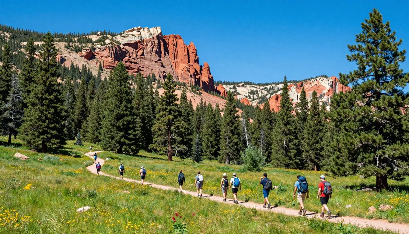
Did you know that Paunsaugunt Plateau rises to elevations exceeding 2,743 meters (9,000 feet) and experiences temperature variations of more than 28 degrees Celsius (50 degrees Fahrenheit) between its highest and lowest points? This dramatic elevation change creates distinct ecosystems within just a few miles, making it one of Utah’s most ecologically diverse regions.
The name “Paunsaugunt” comes from the Paiute language, meaning “home of the beaver.” Indigenous peoples recognized the abundant water sources and wildlife that made this high plateau a rich hunting and gathering ground for thousands of years.
Stretching across southern Utah, this elevated wonderland encompasses far more than its most famous feature. While millions flock to Bryce Canyon National Park each year, few realize they’re standing on just one edge of a vast plateau that extends for miles in every direction.
This comprehensive guide reveals everything you need to plan an unforgettable journey to this remarkable destination. From hidden trails and wildlife viewing to practical lodging tips and money-saving strategies, you’ll discover why those who venture beyond the obvious are rewarded with experiences that linger long after you return home.
Getting There & Planning Your Journey

Reaching Paunsaugunt Plateau requires some planning, but the journey itself offers stunning scenery. The plateau sits in southwestern Utah, accessible from several regional airports and well-maintained highways.
Closest Airports
Your nearest major airport options include:
- Cedar City Regional Airport (CDC) – 80 kilometers (50 miles) west, approximately one-hour drive
- St. George Regional Airport (SGU) – 161 kilometers (100 miles) southwest, approximately two-hour drive
- Las Vegas McCarran International Airport (LAS) – 435 kilometers (270 miles) southwest, approximately four-hour drive
- Salt Lake City International Airport (SLC) – 402 kilometers (250 miles) north, approximately four-hour drive
Cedar City offers the closest access but with limited flight options. Most visitors fly into Las Vegas or Salt Lake City for better flight availability and competitive pricing. Both cities offer numerous rental car companies.
Driving Routes
From Las Vegas, take Interstate 15 north to Utah Highway 20, then connect to Highway 89. This route showcases desert landscapes transitioning to red rock country. The drive includes rest stops at Mesquite and St. George.
From Salt Lake City, follow Interstate 15 south through Provo and connect to Highway 89 south near Panguitch. This scenic route passes through mountain valleys and small Mormon pioneer towns.
Planning Tip: Book rental cars well in advance during peak summer months (June through August). Prices can double, and availability becomes limited in smaller airports like Cedar City.
What to Pack
The plateau’s elevation creates unique packing requirements. Temperature swings demand layered clothing even in summer. Bring:
- Layered clothing for temperature changes of 17°C (30°F) or more daily
- Sturdy hiking boots with ankle support for rocky terrain
- Sun protection including hat, sunglasses, and SPF 50+ sunscreen
- Reusable water bottles – at least 2 liters (68 ounces) per person
- Basic first aid kit including blister treatment
- High-energy snacks for trail nutrition
- Binoculars for wildlife viewing
- Camera equipment with extra batteries (cold drains battery life)
Winter visitors need additional gear including tire chains, emergency blankets, and extra food supplies. Snow can close roads unexpectedly.

Best Time to Visit & Weather Tips

Best Time to Visit Paunsaugunt Plateau
Spring (April through May) and fall (September through October) offer ideal visiting conditions. These shoulder seasons provide comfortable temperatures, smaller crowds, and lower accommodation prices.
✓ Check 30,000+ Local Sightseeing Tours Worldwide
Spring brings wildflower blooms across meadows and hillsides. Temperatures range from 10°C to 21°C (50°F to 70°F) during daytime, though nights remain cold near freezing. Some higher elevation trails may still have snow patches in early April.
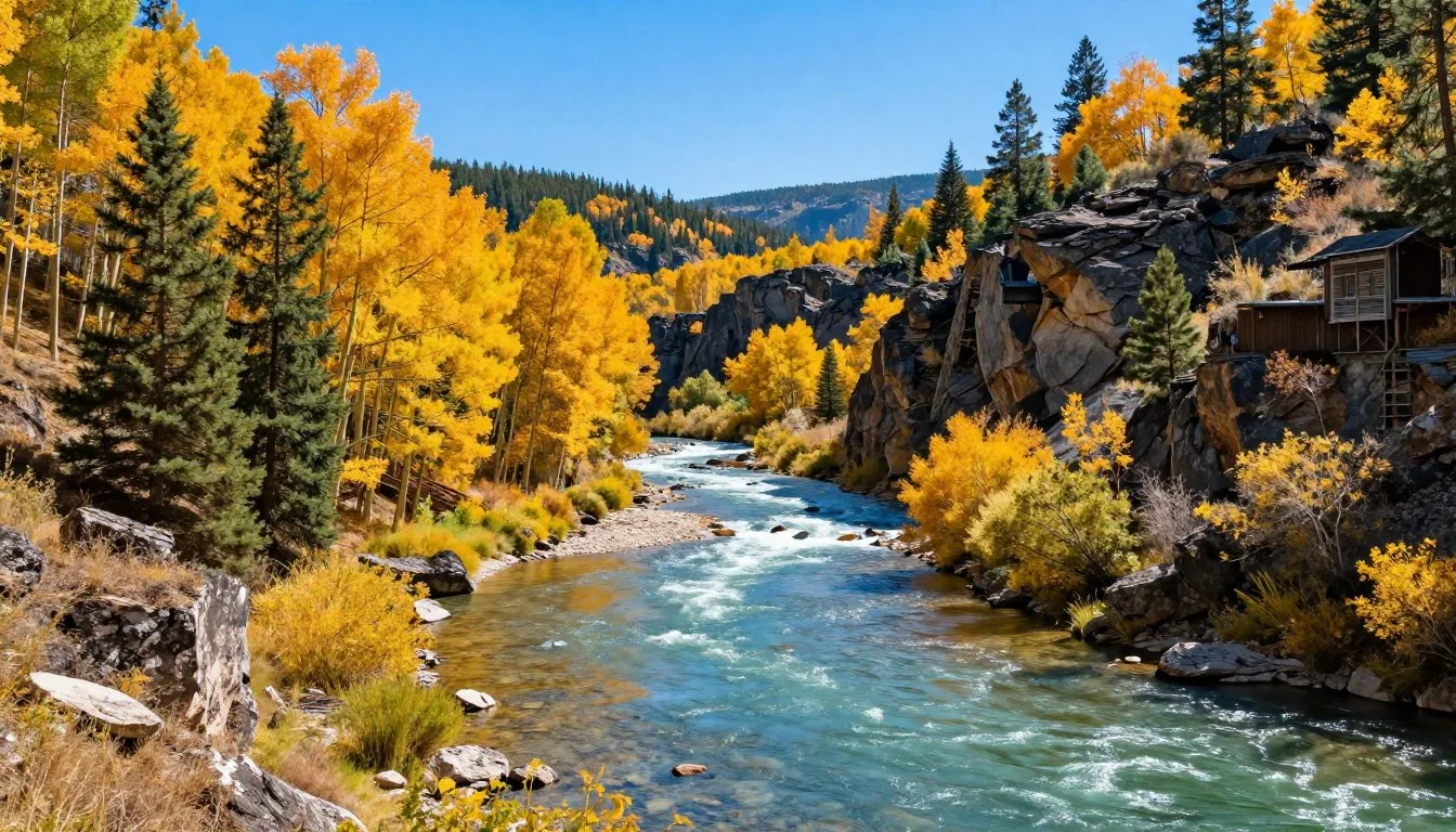
Fall delivers spectacular foliage as aspen groves turn golden yellow against red rock backdrops. Crisp air and clear skies create perfect hiking conditions. Daytime temperatures range from 13°C to 24°C (55°F to 75°F), dropping significantly after sunset.
Summer Season (June through August)
Summer represents peak visitor season with warm, dry weather. Daytime temperatures reach 24°C to 29°C (75°F to 85°F) at lower elevations, staying cooler at higher points. Afternoon thunderstorms occur frequently, typically between 2:00 PM and 5:00 PM.
Pros include all facilities operating at full capacity, long daylight hours for activities, and accessibility to all trails. Cons involve larger crowds, higher prices, and intense sun exposure requiring extra precautions.
Weather Alert: Lightning strikes pose serious danger during summer thunderstorms. Monitor weather forecasts daily and start hikes early to return before afternoon storm activity begins.
Winter Conditions (November through March)
Winter transforms the area into a snowy wonderland but presents significant challenges. Temperatures plunge from -7°C to 4°C (20°F to 40°F), with extreme cold snaps reaching -18°C (0°F) or below.
Snow accumulation ranges from 61 centimeters to 152 centimeters (24 inches to 60 inches) at higher elevations. Roads require four-wheel drive or chains. Many lodging facilities close, and services become limited.
However, winter offers unique rewards. Snow-covered formations create otherworldly landscapes. Crowds disappear almost entirely. Cross-country skiing and snowshoeing provide excellent winter recreation opportunities.
Months to Avoid
Late November and early April present the most challenging conditions. These transition periods combine unpredictable weather, potential road closures, limited services, and higher risk of storms. March often brings the heaviest snowfall of the entire winter season.
Recommended Visiting Periods
- Late April through May – Spring bloom season
- September through mid-October – Fall colors peak
- June through early July – Summer access with manageable crowds
Challenging Periods
- Late July through August – Peak crowds and heat
- November through March – Winter closures and extreme cold
- Late March through early April – Unpredictable transition weather

Notable Annual Festivals

The communities surrounding Paunsaugunt Plateau celebrate their Western heritage and natural surroundings through annual festivals. These events provide cultural insight and entertainment for visitors.
Bryce Canyon Winter Festival
Held annually in February, this three-day event celebrates winter recreation and astronomy. Activities include guided snowshoe hikes, cross-country skiing lessons, geology talks, and nighttime telescope viewing.
The festival operates from the visitor center and surrounding areas. All activities are free, though some require advance registration. Contact the Bryce Canyon Natural History Association for current dates and registration.
Panguitch Valley Balloon Rally
Each June, dozens of hot air balloons lift off from Panguitch Valley, just west of the plateau. The three-day event features dawn and dusk balloon launches, tethered balloon rides, live music, and local food vendors.
Spectators can watch launches for free from designated viewing areas. The colorful balloons drift across red rock landscapes, creating spectacular photo opportunities. Events run Friday evening through Sunday morning.
Contact Panguitch Valley Balloon Rally organizers:
Tropic Rodeo Days
The tiny town of Tropic, located on the plateau’s eastern edge, hosts this traditional rodeo every Fourth of July weekend. Events include bull riding, barrel racing, team roping, and junior rodeo competitions.
The festival maintains authentic Western traditions with minimal commercial influence. Local families have participated for generations. Grandstand seating costs minimal admission, with proceeds supporting community projects.
Panguitch Quilt Walk Festival
This unique June festival commemorates pioneer history with quilt displays, demonstrations, and walking tours. The event recalls the winter of 1864 when settlers crossed a snow-covered valley on quilts to reach supplies.
Downtown Panguitch transforms into an outdoor gallery with hundreds of quilts displayed on buildings. Vendors sell handmade crafts, and quilting workshops teach traditional techniques.

Getting Around Locally

Personal vehicles provide the only practical transportation method for exploring Paunsaugunt Plateau and surrounding areas. No public transportation, rideshare services, or taxi companies operate in this remote region.
Vehicle Requirements
A standard passenger car suffices for paved roads and main attractions during summer months. However, higher clearance vehicles provide advantages for accessing remote areas and handling unpaved forest roads.
Four-wheel drive becomes essential from November through April when snow and ice cover roads. Some scenic backroads remain accessible only to high-clearance 4WD vehicles even in summer.
Rental companies in Cedar City, St. George, Las Vegas, and Salt Lake City offer various vehicle types. Reserve SUVs or 4WD vehicles months ahead for winter visits.
Main Roads and Highways
Utah State Route 12 forms the primary access road, recognized as one of America’s most scenic byways. This paved highway connects Panguitch to Boulder, passing through diverse terrain from red rock canyons to alpine forests.
Highway 89 runs along the western edge, connecting larger towns including Panguitch and Hatch. Well-maintained year-round, this route provides reliable access even during winter storms.
Highway 63 branches east from Highway 89, leading directly into Bryce Canyon National Park. This 6-kilometer (4-mile) spur road climbs steadily, gaining 305 meters (1,000 feet) elevation.
Unpaved Forest Roads
Dozens of unpaved forest service roads crisscross the plateau, accessing remote viewpoints, trailheads, and camping areas. These roads range from well-graded gravel to rough four-wheel-drive tracks.
Popular forest roads include:
- Forest Road 087 (Dave Canyon Road) – Accesses southern plateau areas
- Forest Road 132 (East Fork Sevier Road) – Connects to high elevation meadows
- Forest Road 144 (King Creek Road) – Leads to backcountry camping spots
Always check current road conditions at ranger stations before attempting unpaved routes. Conditions change rapidly after rain or snowmelt.
Important: Cell phone coverage remains extremely limited or nonexistent across most of the plateau. Download offline maps before departing and inform someone of your planned route and expected return time.
Parking Considerations
Main attraction parking lots fill quickly between 10:00 AM and 2:00 PM during summer. Arrive before 9:00 AM or after 3:00 PM to secure spots easily. Overflow parking may require walking considerable distances.
Parking at trailheads operates on a first-come basis with no reservations. Popular trails like Fairyland Loop and Peek-a-boo Loop often have full parking by mid-morning on weekends.
Fuel Availability
Gas stations operate in Panguitch, Hatch, and Tropic, but stations close early evening. Fuel prices run 15-25% higher than urban areas due to remote location and limited competition.
No fuel services exist within the national park or on remote plateau areas. Fill your tank completely before exploring backcountry routes. Carry extra fuel containers for extended remote travel.

Where to Stay

Accommodation options around Paunsaugunt Plateau range from rustic camping to comfortable lodges. Booking well ahead proves essential during peak season, as lodging capacity remains limited in this remote area.
Hotels and Lodges
The Lodge at Bryce Canyon operates as the only accommodation within the national park boundary. This historic lodge offers rooms with park views, a restaurant, and immediate trail access. Open April through October only.
Reservations fill months ahead for summer dates. Contact reservations directly:
Surrounding towns provide additional hotel options:
- Panguitch – Fifteen minutes west, offers budget motels and mid-range hotels
- Tropic – Five minutes east, features small inns and bed-and-breakfast establishments
- Bryce – Adjacent to park entrance, hosts several chain hotels and independent lodges
- Hatch – Twenty minutes south, provides budget-friendly options with fewer crowds
Most properties operate seasonally from April through October. Winter lodging becomes very limited, with only a handful of properties remaining open.
Camping Options
Multiple campgrounds serve visitors seeking outdoor accommodation. Sites range from developed campgrounds with amenities to primitive dispersed camping.
North Campground and Sunset Campground operate within the national park. Both offer 215 sites total with restrooms, water, and dump stations. Sites accommodate RVs up to 14 meters (45 feet). No hookups available.
Reservations open six months ahead and fill immediately for summer weekends. Weekday sites sometimes remain available for walk-up camping.
Red Canyon Campground, located 16 kilometers (10 miles) west, provides 37 sites among colorful rock formations. This Forest Service facility costs half the price of park campgrounds and receives fewer crowds.
Backcountry Camping
Dispersed camping on surrounding Forest Service land offers free primitive camping. Drive forest roads to find suitable spots, following Leave No Trace principles. Popular areas include:
- Dave Canyon area – Forest Road 087 accesses numerous dispersed sites
- Pine Lake area – High elevation with cooler summer temperatures
- King Creek vicinity – Secluded spots near seasonal creek
No facilities exist at dispersed sites. Pack out all trash and waste. Campfires require current fire restrictions checking at ranger stations.
Alternative Accommodations
Several private RV parks operate near park entrances, offering full hookups, showers, and laundry facilities. Rates exceed National Park campgrounds but provide more amenities.
Vacation rental homes and cabins in Panguitch, Tropic, and Hatch accommodate groups and families seeking more space. Kitchen facilities enable meal preparation, reducing dining costs.
Booking Strategy: Reserve accommodations six months ahead for summer visits. Check cancellation policies carefully, as weather can impact mountain travel plans unexpectedly.

Dining & Local Cuisine

Dining options around Paunsaugunt Plateau reflect the region’s rural character and pioneer heritage. Restaurants emphasize hearty portions, Western comfort food, and locally sourced ingredients when possible.
Restaurant Scene
The area lacks fine dining establishments, instead offering casual family restaurants, cafes, and roadside diners. Most restaurants close by 8:00 PM or 9:00 PM, reflecting small-town rhythms.
The Lodge at Bryce Canyon operates the only restaurant within park boundaries. Their dining room serves breakfast, lunch, and dinner with mountain views. Menu features include bison burgers, trout, and Southwestern-inspired dishes.
Panguitch, as the largest nearby town, hosts the greatest restaurant variety. Options include American diners, pizza parlors, and Mexican restaurants. Local favorite establishments include Cowboy’s Smokehouse Cafe for barbecue and The Flying M for steaks.
Local Specialties
Regional cuisine draws from pioneer traditions and ranching heritage. Common menu items reflect this background:
- Dutch oven cooking – Stews, roasts, and cobblers prepared in cast iron pots
- Fry bread – Native American flatbread served with honey or as taco base
- Trout – Locally caught and pan-fried or grilled
- Beef dishes – Locally raised cattle provide steaks, burgers, and roasts
- Berry desserts – Wild berries picked seasonally appear in pies and cobblers
Several restaurants prepare house-smoked meats using local wood. Brisket, pulled pork, and ribs feature hickory or mesquite smoking methods.
Quick Meals and Groceries
Fast food chains exist only in larger towns like Cedar City or Richfield, requiring 45-minute or longer drives. Local alternatives include small cafes offering breakfast sandwiches, burgers, and wraps.
Small grocery stores operate in Panguitch, Hatch, and Tropic. Selection remains limited compared to urban supermarkets, but basics like bread, eggs, produce, and packaged foods are available.
Prices run 10-20% higher than urban areas due to transportation costs and limited competition. Stock up on groceries and supplies before reaching the plateau if budget concerns exist.
Picnic and Trail Food
Many visitors prepare their own meals for flexibility and cost savings. Picnic areas with tables exist throughout the region. Popular picnic spots include:
- Red Canyon overlooks – Tables with dramatic rock formation views
- Mossy Cave area – Shaded sites near seasonal waterfall
- Forest Service campgrounds – Day-use areas open to non-campers
Grocery stores sell pre-made sandwiches, snacks, and drinks suitable for day trips. Local bakeries in Panguitch offer fresh bread, pastries, and cookies for trail food.
Dining Tip: Restaurants close one or two days weekly during slow seasons. Call ahead to verify hours, especially visiting Sunday through Tuesday when closures occur most frequently.
Special Dietary Needs
Vegetarian options appear on most menus but tend toward basic salads and pasta. Vegan choices prove very limited outside of self-catering.
Gluten-free awareness remains developing in this rural area. Some restaurants accommodate requests, but cross-contamination precautions may be limited. Those with serious allergies should prepare their own meals.

Attractions, Sightseeing & Activities

Paunsaugunt Plateau offers remarkable geological formations, diverse hiking trails, and abundant wildlife viewing. Activities range from easy overlook visits to challenging backcountry treks.
Bryce Canyon National Park
This world-famous national park occupies the plateau’s eastern edge. The park showcases the largest concentration of hoodoos (tall thin rock spires) on Earth, with thousands of formations creating a red and orange maze.
Entrance fees cost $35 USD per vehicle, valid for seven consecutive days. Annual passes providing access to all national parks cost $80 USD, worthwhile for those visiting multiple parks.
The 29-kilometer (18-mile) scenic drive stops at thirteen viewpoints, each offering unique perspectives. Sunrise Point and Sunset Point provide classic views and easiest access. Bryce Point offers the highest elevation overview at 2,528 meters (8,296 feet).
Rainbow Point marks the drive’s southern terminus at 2,775 meters (9,105 feet) elevation. This viewpoint looks south across the Grand Staircase, a series of colorful rock layers stepping down toward the Grand Canyon 145 kilometers (90 miles) distant.
Hiking Trails
Over 80 kilometers (50 miles) of maintained trails explore the plateau. Trail difficulty ranges from easy paved rim walks to strenuous all-day backcountry routes.
Rim Trail spans 8.8 kilometers (5.5 miles) along the canyon edge, mostly paved and accessible. This easy walk connects major viewpoints, allowing visitors to hop on and off at parking areas.
Queens Garden Trail descends 98 meters (320 feet) into the canyon among hoodoos and twisted pines. The 2.9-kilometer (1.8-mile) round trip takes 1-2 hours and ranks as the park’s easiest below-rim hike.
✓ Check 30,000+ Local Sightseeing Tours Worldwide
Navajo Loop Trail drops 158 meters (520 feet) through narrow slot canyons and past towering walls. The 2.2-kilometer (1.4-mile) loop includes Wall Street, a narrow passage between 30-meter (100-foot) cliffs.
Combining Queens Garden and Navajo Loop creates a 4.6-kilometer (2.9-mile) figure-eight, the most popular moderate hike. Allow 2-3 hours for this route.
Fairyland Loop provides 13 kilometers (8 miles) of backcountry solitude despite starting near the park entrance. This strenuous trail gains and loses 457 meters (1,500 feet) elevation while circling an isolated formation area. Expect 4-6 hours for completion.
Peek-a-boo Loop combines 8.8 kilometers (5.5 miles) of challenging terrain with spectacular scenery. Steep climbs, exposed sections, and loose rock demand fitness and proper footwear. Allow 3-4 hours.
Scenic Drives
Highway 12 Scenic Byway continues east from the park, crossing high meadows and descending through colorful badlands. This 200-kilometer (124-mile) route eventually reaches Capitol Reef National Park.
Red Canyon, located 16 kilometers (10 miles) west of the park entrance, offers its own collection of red rock spires visible from the highway. A short tunnel carved through solid rock creates a dramatic driving experience. Several pullouts provide photo opportunities.
Forest roads access remote plateau areas away from crowds. The journey becomes part of the adventure on these unpaved routes. Stunning views reward those willing to drive slowly on rough roads.

Wildlife Viewing
The plateau supports diverse wildlife across its elevation zones. Patient observers spot numerous species throughout the year.
Mule deer browse throughout the park and surrounding forests, often visible near roads during dawn and dusk. Bucks grow impressive antlers visible in summer and fall before shedding in winter.
Elk inhabit higher elevation meadows and forests. These large animals stand 1.5 meters (5 feet) tall at shoulder and weigh up to 450 kilograms (1,000 pounds). Fall brings the rut (mating season) when males bugle haunting calls echoing across canyons.
Pronghorn antelope graze open areas and valleys surrounding the plateau. North America’s fastest land animal, pronghorns reach speeds exceeding 88 kilometers per hour (55 miles per hour).
Utah prairie dogs, found nowhere else on Earth, create extensive burrow systems in meadows and campgrounds. These endangered rodents provide crucial ecosystem services through their digging activities.
Over 170 bird species visit or reside on the plateau. Notable species include:
- California condors – Rare sightings of these enormous vultures with 2.9-meter (9.5-foot) wingspans
- Peregrine falcons – Fast-diving raptors nesting on cliff faces
- Steller’s jays – Bold blue birds common at picnic areas and campgrounds
- Violet-green swallows – Acrobatic fliers catching insects mid-air
Photography Opportunities
The plateau ranks among the world’s premier landscape photography destinations. Dramatic lighting, colorful rocks, and unique formations inspire photographers from amateur to professional.
Sunrise and sunset create the most dramatic lighting as low-angle sun illuminates rock faces with intense orange and red hues. Shadows add depth and dimension absent during midday flat lighting.
Optimal sunrise viewpoints include Sunrise Point (naturally), Bryce Point, and Paria View. Arrive 30 minutes before sunrise as color begins subtly before the sun actually appears.
Sunset photography works well from Sunset Point, Inspiration Point, and Rainbow Point. Summer sunsets occur after 8:00 PM, while winter sunsets happen before 5:00 PM.
Milky Way photography thrives here thanks to minimal light pollution and high elevation clear skies. The galactic core rises from March through October, creating spectacular nightscapes.

Museums, Cultural Spots & Festivals

Cultural attractions around Paunsaugunt Plateau focus on pioneer history, Native American heritage, and geological education. Small museums and interpretive centers provide context for the natural wonders surrounding them.
Visitor Centers
Bryce Canyon Visitor Center operates year-round near the park entrance. Rangers answer questions, issue permits, and provide weather updates. The center features geological exhibits explaining how erosion creates hoodoos over millions of years.
A 22-minute orientation film runs every 30 minutes, offering excellent introduction to park geology and ecology. Books, maps, and field guides fill a well-stocked bookstore.
Ranger-led programs run daily during summer, including guided hikes, geology talks, and evening campfire programs. Winter programs operate on limited schedules but offer unique snowshoe-guided walks.
Panguitch Heritage Museum
Located in downtown Panguitch, this small museum preserves local pioneer history. Exhibits showcase early Mormon settlement, ranching heritage, and development of tourism in the region.
Historic photographs document the town’s transformation from isolated farming community to gateway for national park visitors. Pioneer tools, household items, and clothing illustrate 19th-century frontier life.
The museum operates Memorial Day through Labor Day with limited hours. Admission by donation. Friendly volunteers share stories about local history and family connections to early settlers.
Cultural Sites
Historic buildings scatter throughout surrounding towns, preserving architectural heritage. Panguitch features numerous historic brick homes built by early Mormon settlers in the 1870s-1880s.
The Panguitch Social Hall, built in 1907, serves as community gathering space and performance venue. Original hardwood floors and pressed-tin ceiling survive from the building’s early days.
Small cemeteries provide insight into pioneer hardships. Headstones document families losing children to disease, accidents, and harsh frontier conditions. These sobering reminders illustrate the courage required for settlement.
Native American Heritage
Paiute peoples inhabited this region for thousands of years before European settlement. They traveled seasonally, following game animals and plant harvests across the plateau and surrounding valleys.
Archaeological sites exist throughout the area, though most remain unmarked and protected. Rock art panels decorate some canyon walls, depicting hunting scenes and spiritual symbols.
The nearest tribal cultural center operates in Cedar City, 80 kilometers (50 miles) west. The Southern Paiute Cultural Center and Museum offers exhibits, traditional craft demonstrations, and educational programs.
Educational Programs
Junior Ranger programs engage children with activity booklets teaching park ecology, geology, and conservation. Completing activities earns an official badge and certificate.
Geology talks explain the Grand Staircase concept, showing how the plateau fits into a massive series of rock layers descending southward. Rangers use rock samples and diagrams to illustrate millions of years of geological history.
Full moon hikes occur monthly during summer, allowing visitors to experience the landscape under natural night lighting. These ranger-guided walks require reservations made months ahead due to popularity.

Nature & Outdoor Experiences

Beyond famous rock formations, Paunsaugunt Plateau rewards nature enthusiasts with diverse ecosystems, unique flora, and exceptional stargazing. Outdoor experiences range from gentle nature walks to challenging backcountry adventures.
Forest Ecosystems
Ponderosa pine and Douglas fir forests blanket much of the plateau, interspersed with quaking aspen groves and mountain meadows. Elevation determines which species dominate.
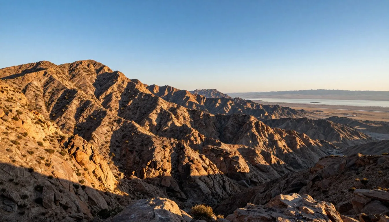
Lower elevations, between 1,981 meters and 2,286 meters (6,500 and 7,500 feet), support drought-tolerant ponderosas mixed with pinyon pines and junipers. These areas receive less rainfall and experience hotter summer temperatures.
Higher reaches, climbing toward 2,743 meters (9,000 feet), host dense stands of Douglas fir, white fir, and Engelmann spruce. These cooler, wetter zones support lush undergrowth including wildflowers and berries.
Aspen groves create islands of deciduous trees among evergreens. Their white bark and heart-shaped leaves turn brilliant yellow each September and early October. The quaking motion of aspen leaves in gentle breezes gives the species its common name.
Wildflower Viewing
Spring and early summer transform meadows into colorful displays. Peak bloom timing depends on elevation and winter snow depth.
Lower elevations bloom first, typically late April through May. Higher meadows peak in June and July as snowmelt releases moisture. Common species include:
- Lupine – Purple spires carpeting meadows in dense stands
- Indian paintbrush – Red-orange bracts creating vivid color splashes
- Columbine – Delicate blue and white flowers preferring shaded areas
- Penstemon – Pink to purple tubular blooms attractive to hummingbirds
- Mule’s ear – Large yellow sunflower-like blooms on tall stems
- Wild iris – Blue-purple flowers in wet meadow areas
The plateau’s diversity allows flower viewing from April through August as bloom waves move upward in elevation. Photographers find endless subjects among flowering meadows with rock formation backdrops.
Horseback Riding
Several outfitters offer guided horseback rides ranging from one-hour scenic tours to multi-day pack trips. Horses provide access to steep trails and backcountry areas challenging for hiking.
Canyon Trail Rides operates within the national park, offering trips descending below the rim among hoodoos. Two-hour and half-day options let visitors experience the canyon from saddle perspective.
Private outfitters based in surrounding towns lead trips into Forest Service wilderness areas. Multi-day pack trips with camping allow deep wilderness immersion. These adventures require advance booking, often months ahead for summer dates.
No riding experience necessary for most guided trips. Outfitters match horses to rider ability levels and provide basic instruction. Weight limits typically range around 100 kilograms (220 pounds).

Mountain Biking
Dozens of miles of forest roads and singletrack trails accommodate mountain bikes. Riding offers faster ground coverage than hiking while maintaining close nature connection.
Red Canyon features several marked mountain bike trails through red rock formations. Thunder Mountain Trail provides 12 kilometers (7.5 miles) of flowing singletrack suitable for intermediate riders. Dramatic scenery rivals the national park without crowds.
Forest roads throughout the plateau allow easy pedaling access to remote areas. These routes suit touring bikes and casual riders, though surface conditions vary from smooth gravel to rough washboard.
Bikes are not allowed on trails within the national park boundaries. This rule protects trail surfaces and ensures peaceful hiking experiences.
Winter Activities
Snow transforms the plateau into a winter wonderland from November through March. Activities shift to cold-weather pursuits requiring specialized gear.
Cross-country skiing and snowshoeing let visitors explore snow-covered landscapes in peaceful solitude. Popular routes follow summer hiking trails and forest roads, now buried under meters of snow.
The park offers marked snowshoe trails starting from the rim. Rangers lead guided snowshoe hikes on weekends during winter, providing equipment and interpretation. These free programs fill quickly and require advance registration.
Backcountry skiing attracts advanced winter enthusiasts seeking untracked powder. The plateau’s gentle terrain suits Nordic skiing better than alpine downhill, though some gladed areas provide short descent opportunities.
Stargazing
Paunsaugunt Plateau earned International Dark Sky Park designation, recognizing exceptional nighttime visibility. Minimal light pollution and high elevation create world-class astronomical viewing.
Thousands of stars become visible on clear moonless nights. The Milky Way arches overhead as a glowing band of concentrated stars. Planets appear bright enough to cast shadows.
Astronomy programs run during summer months, with rangers and volunteers setting up telescopes for public viewing. These programs typically occur at the visitor center or campground amphitheaters.
Best stargazing occurs during new moon phases when lunar light doesn’t wash out faint stars. Check moon phase calendars when planning visits for astronomical viewing.

Travel With Children

Paunsaugunt Plateau offers excellent family adventures with activities suitable for various age groups. Planning ahead ensures children enjoy the visit while staying safe and engaged.
Age-Appropriate Activities
Young children (ages 3-7) enjoy easy rim walks with frequent viewpoint stops. Short attention spans benefit from ranger programs telling stories about animals and rocks. The visitor center’s exhibits and films provide engaging education during rest breaks.
Elementary-age children (ages 8-12) handle moderate hikes like Queens Garden Trail. The Junior Ranger program provides structured activities keeping them engaged throughout the visit. Wildlife spotting games turn drives into adventures.
Teenagers appreciate more challenging hikes like Navajo Loop or Fairyland Loop. Photography opportunities appeal to social-media-minded teens. They often enjoy early morning or sunset outings adults appreciate.
Safety Considerations
Altitude affects children more than adults. The plateau’s 2,438-meter (8,000-foot) average elevation can cause headaches, nausea, or fatigue. Allow time for acclimatization, especially for families arriving from sea level.
Trail edges lack barriers in many areas. Steep drops require constant supervision of young children. Hold hands near cliff edges and establish clear boundaries about staying on marked trails.
Sun exposure intensifies at high elevation. Apply sunscreen frequently and ensure children wear hats and sunglasses. UV radiation increases approximately 10% per 305 meters (1,000 feet) elevation gain.
✓ Check 30,000+ Local Sightseeing Tours Worldwide
Dehydration occurs quickly in dry mountain air. Children need frequent water breaks, even if not requesting drinks. Pack at least 1 liter (34 ounces) per child for short hikes.
Family-Friendly Trails
Rim Trail’s paved sections accommodate strollers and wheelchairs between certain viewpoints. Sunset Point to Sunrise Point covers 1.6 kilometers (1 mile) with gentle grades and spectacular views.
Mossy Cave Trail provides easy 1.3-kilometer (0.8-mile) round trip suitable for young children. The trail reaches a small waterfall and cave alcove in about 30 minutes. Kids enjoy searching for actual moss growing in shaded areas.
Bristlecone Loop, an easy 1.6-kilometer (1-mile) trail at Rainbow Point, introduces families to ancient bristlecone pines. Some trees exceed 1,800 years old, growing twisted shapes from harsh weather exposure.
Educational Opportunities
Junior Ranger activity booklets engage children while teaching park ecology and geology. Age-specific versions ensure appropriate difficulty levels. Completing activities and attending a ranger program earns an official badge.
Ranger-led programs specifically designed for families occur daily during summer. Typical programs include guided nature walks, rock talks, and evening campfire stories. Check schedules at visitor centers.
Scavenger hunts turn hikes into games. Create lists of items to find: specific rock colors, animal tracks, tree species, or bird calls. Photography scavenger hunts work well for older children with cameras or phones.
Practical Tips
Pack extra layers for children. They cool down quickly after stopping activity. Temperature drops of 11°C (20°F) between sun and shade are common.
Bring familiar snacks children actually eat. Trail mix and energy bars from home beat expensive, unfamiliar snacks from gift shops. Hungry children complain more and enjoy experiences less.
Schedule flexibility prevents frustration. Children tire unpredictably or need bathroom breaks at inconvenient times. Build extra time into itineraries rather than rushing between activities.
The small town atmosphere means limited child-specific attractions. Stock toys, games, or tablets for downtime at lodging. After active outdoor days, children often need quiet indoor time.
Money Saving Tips

Visiting Paunsaugunt Plateau need not strain budgets. Strategic planning reduces costs significantly while maintaining quality experiences.
Timing Strategies
Shoulder season visits (April-May and September-October) offer substantial savings. Lodging prices drop 30-50% compared to peak summer rates. Smaller crowds mean easier campsite availability at lower-cost campgrounds.
Weekday visits cost less than weekends. Tuesday through Thursday lodging rates run lowest. Many properties offer midweek specials not advertised online, so calling directly may reveal discounts.
Book accommodations far ahead for best selection at lowest prices. Last-minute bookings typically cost more and offer fewer choices. Six months advance booking provides optimal balance of selection and cancellation flexibility.
National Park Pass Benefits
America the Beautiful Annual Pass costs $80 USD and provides unlimited entry to all national parks and federal recreation areas for one year. The pass pays for itself after visiting just three national parks at standard $35 entry fees.
Seniors age 62 and older qualify for lifetime passes costing $80 USD or annual passes for $20 USD. Military members, veterans, and fourth-graders enter free with appropriate documentation.
Each pass covers the pass holder plus three additional adults in the same vehicle. Children under 16 always enter free, making family visits especially economical.
Accommodation Savings
Camping dramatically reduces lodging costs. National Forest campgrounds charge $15-20 USD per night versus $150-300 USD for hotel rooms. Dispersed camping on Forest Service land costs nothing.
Vacation rentals save money for groups and families. Splitting rental costs among multiple families reduces per-person expenses below hotel rates. Kitchen facilities enable meal preparation, eliminating restaurant costs.
Towns farther from park entrances offer lower prices. Panguitch lodging costs less than properties in Bryce, just 11 kilometers (7 miles) distant. The extra 15-minute drive saves significant money over multi-night stays.
Food and Dining Savings
Grocery shopping for breakfast and lunch items reduces dining expenses by 50% or more. Preparing sandwiches, fruits, and snacks for day trips eliminates expensive restaurant meals.
Coolers keep perishables fresh for multiple days. Ice available at gas stations and grocery stores costs $2-3 USD per bag. Frozen water bottles serve dual purpose as ice and drinking water.
Picnicking at scenic overlooks provides free entertainment with meals. Many pullouts feature tables, though bringing blankets expands options.
Restaurant early-bird specials and lunch portions offer value. Dinner entrees cost 30-40% more than identical lunch portions. Eating main meals at lunch saves money while providing energy for afternoon activities.
Activity Cost Reductions
Free ranger programs provide expert-led experiences without guide fees. These programs match or exceed expensive private tours in quality and education value.
Hiking costs nothing beyond personal gear investment. The plateau offers hundreds of kilometers of free trails rivaling expensive guided experiences.
Self-guided driving tours eliminate tour costs while providing flexibility. The scenic drive and Highway 12 Scenic Byway showcase spectacular landscapes from your vehicle.
Library books, downloaded podcasts, and free park brochures provide educational content replacing expensive guidebooks. Visitor center libraries loan books to anyone, no card required.
Transportation Savings
Filling gas tanks in larger towns saves 10-15% versus remote gas stations. Cedar City, St. George, and Richfield offer competitive fuel prices before entering higher-cost rural areas.
Carpooling with other travelers splits fuel and vehicle rental costs. Online travel forums and park bulletin boards help connect travelers.
Smaller rental cars cost less and use less fuel. Standard sedans handle paved roads adequately during summer months when 4WD becomes unnecessary.
Budget Tip: Free admission days occur several times yearly. Check National Park Service websites for specific dates when entrance fees are waived at all parks nationwide.

Safety & Local Customs
Understanding local safety concerns and cultural norms ensures positive interactions and prevents problems during your visit to Paunsaugunt Plateau.
Altitude Considerations
The plateau’s elevation between 2,134 meters and 2,743 meters (7,000 and 9,000 feet) affects visitors unaccustomed to altitude. Common symptoms include headaches, shortness of breath, fatigue, and nausea.
Acclimatization requires time. Spend your first day at lower elevations doing light activity. Avoid strenuous hikes immediately after arriving from sea level.
Hydration helps prevent altitude sickness. Drink more water than normal thirst indicates. Urine should remain clear to pale yellow. Alcohol consumption increases dehydration and worsens altitude effects.
Weather Hazards
Afternoon thunderstorms develop rapidly during summer months. Lightning strikes present serious danger, killing several people in Utah’s high country annually.
Monitor weather forecasts daily. Start hikes early to finish before afternoon storm development. If caught in storms, avoid high points, lone trees, and cliff edges. Seek shelter in low areas away from tall objects.
Flash floods occur in narrow canyons during heavy rainfall, even from distant storms. Never enter slot canyons if rain threatens anywhere in the watershed. Water can arrive as a wall with little warning.
Winter brings extreme cold and dangerous driving conditions. Black ice forms on roads after sunset when temperatures plunge. Four-wheel drive and chains become mandatory equipment.
Wildlife Safety
Mountain lions inhabit the plateau though sightings occur rarely. These large cats avoid humans usually but encounters occasionally happen. Never approach or run from mountain lions. Face the animal, appear large, and back away slowly.
Black bears occasionally wander through the area. Proper food storage in bear-proof containers or vehicles prevents conflicts. Never feed wildlife or leave food unattended.
Prairie dogs bite when approached too closely or fed human food. Observe from distance and never touch. They carry diseases including plague, transmitted through fleas.
Rattlesnakes inhabit lower elevations though numbers remain small. Watch where you place hands and feet when scrambling over rocks. Bites require immediate medical attention but rarely prove fatal with treatment.
Trail Safety
Stay on marked trails to prevent erosion and protect fragile soil crusts. Biological soil crusts take decades to form but seconds to destroy. These living communities of moss, lichen, and bacteria prevent erosion.
Cliff edges lack guardrails in most areas. Loose rock makes footing unstable near drops. Several people fall to their deaths annually in Utah’s national parks, almost always from leaving trails for photos.
Tell someone your hiking plans including expected return time. Cell service remains unavailable across most of the plateau. Rescue takes hours if you fail to return as expected.
Carry essentials even on short hikes: extra water, snacks, first aid kit, map, flashlight, and extra clothing layer. Weather changes rapidly at elevation.
Local Customs
The region’s predominantly Mormon (Latter-day Saint) culture influences local customs. Most residents don’t drink alcohol, coffee, or tea. Respect these choices while enjoying personal preferences.
Small-town values emphasize politeness and respect. Greet people pleasantly and thank service providers. Western hospitality responds well to friendly visitors.
Sunday closures affect some businesses as residents observe Sabbath. Plan accordingly and avoid assuming services operate seven days weekly.
Leave No Trace principles extend beyond wilderness areas. Pack out all trash, respect private property, and leave areas cleaner than found. Rural residents notice and appreciate visitors who respect their home.
Emergency Contact: Cell service is limited or absent throughout most of the plateau. In emergencies, dial 911 if service exists. Otherwise, seek help at visitor centers, ranger stations, or by flagging passing vehicles on main roads.

Visitor Comments About Paunsaugunt Plateau

Real visitors share their experiences exploring this remarkable destination:
“We spent three days exploring beyond just the famous park areas and discovered incredible solitude on forest roads leading to hidden viewpoints. The wildflower meadows in June took our breath away. Every turn revealed another stunning vista, and we encountered maybe a dozen people total away from the main attractions. This place rewards those willing to venture off the beaten path.”
“Traveling with our two kids ages seven and ten, we worried the hiking might prove too challenging, but the variety of trail options meant everyone found their comfort level. The Junior Ranger program kept them engaged throughout our visit. Rangers were incredibly patient answering endless questions. Our children still talk about seeing elk at sunrise and sleeping under more stars than they knew existed.”
“As a photographer, I’ve visited many famous landscapes, but the combination of unique formations, diverse ecosystems, and incredible light quality makes this one of my favorite locations. I stayed a week and barely scratched the surface of photographic possibilities. The lack of crowds outside peak hours means you can work compositions without people walking through shots. Sunrise and sunset light on those red rocks creates magic you have to see to believe.”
Additional Nearby Destinations

Paunsaugunt Plateau’s location makes it ideal base for exploring multiple Utah destinations. Several world-class parks and natural areas lie within day-trip distance.
Grand Staircase-Escalante National Monument
This vast 760,000-hectare (1.9-million-acre) monument begins immediately east of the plateau. Highway 12 Scenic Byway traverses the monument, accessing slot canyons, petrified forests, and remote badlands.
Popular areas include Calf Creek Falls, a 3.2-kilometer (2-mile) hike to a 38-meter (126-foot) waterfall. Spooky and Peek-a-boo slot canyons offer exciting narrows exploration. Escalante River canyons provide multi-day backpacking adventures.
The monument’s immense size and limited development mean true wilderness experiences. Prepare carefully with water, navigation tools, and self-sufficiency skills.
Cedar Breaks National Monument
Located 64 kilometers (40 miles) northwest, Cedar Breaks showcases an amphitheater of colorful formations similar to Bryce Canyon but at even higher elevation. The rim reaches 3,200 meters (10,500 feet).
Access roads open only June through October due to heavy snow. The 8-kilometer (5-mile) rim drive stops at multiple viewpoints. Short trails explore alpine meadows bursting with wildflowers during July and August.
Significantly smaller crowds than Bryce Canyon make Cedar Breaks feel almost private during weekdays.
Zion National Park
Utah’s most-visited national park lies 113 kilometers (70 miles) southwest, about a 90-minute drive. Zion’s massive sandstone cliffs tower up to 914 meters (3,000 feet) above the canyon floor.
The famous Narrows hike wades up the Virgin River through towering slot canyon walls. Angels Landing challenges hikers with exposed cliff-edge trails and chain-assisted sections reaching a dramatic summit.
Zion receives over 4 million visitors annually. Advance shuttle reservations are required during peak season. Visit early morning or evening for best experience and parking availability.
Capitol Reef National Park
This lesser-known park sits 200 kilometers (125 miles) northeast, approximately a three-hour scenic drive via Highway 12. The park preserves a 160-kilometer (100-mile) wrinkle in Earth’s crust called the Waterpocket Fold.
Historic orchards planted by Mormon pioneers still produce fruit. Visitors can pick apples, peaches, and cherries during harvest seasons. Narrow canyons, natural arches, and petroglyphs reward explorers.
Smaller crowds and free admission to most areas make Capitol Reef excellent for those seeking solitude.
Kodachrome Basin State Park
Located just 37 kilometers (23 miles) southeast, this small state park features 67 distinctive rock spires called sedimentary pipes. These unique formations occur nowhere else on Earth in such concentration.
✓ Check 30,000+ Local Sightseeing Tours Worldwide
Easy trails explore the compact basin. The park offers excellent camping and serves as quieter alternative to busier national park campgrounds. Dark skies provide exceptional stargazing.
Multi-Park Itineraries
The “Grand Circle” route connects five national parks across southern Utah and northern Arizona. Visitors often spend 7-14 days exploring Zion, Bryce Canyon (Paunsaugunt Plateau), Capitol Reef, Canyonlands, and Arches, plus Grand Canyon.
Highway 89 and 12 form scenic backbone routes linking these destinations. Each park requires at least a full day, though 2-3 days enables deeper exploration.

Practical Travel Tips

These final practical details help smooth your journey and ensure readiness for the unique challenges of visiting this high plateau region.
What to Wear
Layering proves essential for dramatic temperature swings. Morning temperatures may hover near freezing while afternoon highs reach 24°C (75°F). Base layers, insulating middle layers, and windproof outer shells allow adjustment throughout the day.
Sturdy closed-toe shoes with good tread prevent twisted ankles on rocky, uneven trails. Save sandals for lodge relaxation. Broken-in boots prevent blisters better than new footwear.
Wide-brimmed hats provide crucial sun protection. Baseball caps leave ears and neck exposed to intense UV radiation. Neck gaiters or bandanas offer additional coverage.
Sunglasses rated UV400 protect eyes from elevation-intensified ultraviolet exposure. Polarized lenses reduce glare from rocks and improve comfort during long outdoor days.
Technology Considerations
Download offline maps before arrival. Cell coverage remains spotty to nonexistent across most of the plateau. GPS navigation apps like Google Maps allow downloading specific areas for offline use.
Portable battery chargers extend phone life for photography and emergency communication. Cold weather drains batteries rapidly. Keep devices warm in inner pockets.
Cameras perform well in the dry climate, but dust infiltrates gear. Bring cleaning supplies including lens tissue and brush. Change lenses in protected areas to prevent dust entering camera bodies.
Health Preparations
Consult physicians about altitude if you have heart or respiratory conditions. The elevation stresses cardiovascular systems more than sea-level activities.
Bring adequate prescription medications plus extras in case travel delays prevent returning home as scheduled. Pharmacies exist only in larger towns requiring significant driving.
Basic first aid supplies should include blister treatment, pain relievers, antihistamines, and any personal medications. Small injuries become bigger problems without treatment capability.
Communication Planning
Inform family or friends of your itinerary with specific return dates. Provide copies of camping reservations and hiking plans. Establish check-in schedules for multi-day trips.
Satellite communicators or personal locator beacons provide emergency contact ability in areas without cell service. Rental options exist for those not wanting to purchase devices.
Currency and Banking
Credit cards work at most established businesses, but carry cash for small purchases, tips, and emergencies. ATMs operate in Panguitch and other small towns but charge high fees.
Small bills and coins help with exact change for camping fees, vending machines, and roadside stands. Breaking large bills can challenge small businesses with limited cash on hand.
Internet and Connectivity
Most lodging offers WiFi, though speeds may disappoint those accustomed to urban broadband. Expect difficulties with video streaming or large downloads.
Visitor centers sometimes provide public internet access. Connection speeds serve email and basic browsing but struggle with data-intensive tasks.
Plan on digital detox during your visit. Limited connectivity provides opportunity to disconnect and immerse in natural surroundings.
Packing Checklist
- Valid identification and travel documents
- National park pass or entry fee payment method
- Reservation confirmations for lodging and activities
- Layered clothing for temperature changes
- Rain gear and warm jacket
- Sturdy hiking footwear
- Sun protection: hat, sunglasses, high SPF sunscreen
- Reusable water bottles – at least 2 liters capacity per person
- Snacks and trail food
- First aid kit with blister treatment
- Flashlight or headlamp with extra batteries
- Phone charger and portable battery pack
- Camera equipment and memory cards
- Binoculars for wildlife viewing
- Day pack for hiking
- Paper maps and guidebooks
- Personal medications and prescriptions
- Cash and credit cards
- Sunscreen and lip balm
- Insect repellent (minimal bugs but helpful at dawn/dusk)
Final Tip: Download this article or save offline for reference during your trip. Internet access limitations make having saved information invaluable for quick reference while traveling.

Location Map
Paunsaugunt Plateau spans across southwestern Utah, with Bryce Canyon National Park along its eastern rim.
Your Adventure Awaits on Utah’s Hidden Plateau
Paunsaugunt Plateau stands ready to reward your adventurous spirit with experiences that transcend ordinary travel. Beyond the famous hoodoos lies an entire ecosystem of alpine forests, wildflower meadows, and wildlife-rich habitats waiting for exploration.
The dramatic elevation changes create microclimates supporting incredible biodiversity within compact areas. Morning may find you hiking among red rock spires, afternoon exploring dense pine forests, and evening stargazing under some of Earth’s darkest skies.
Small-town hospitality surrounds this natural wonderland. Local residents genuinely welcome visitors and share pride in their remarkable backyard. Their pioneer heritage lives on through maintained traditions and Western values.
Whether you seek challenging backcountry adventures or gentle nature walks, family-friendly activities or solitary contemplation, photography opportunities or cultural insights, this plateau delivers. Every season transforms the landscape, offering completely different experiences throughout the year.
Pack your sense of wonder alongside practical gear. Prepare for temperature swings and altitude challenges. Then set forth to discover why those who venture to this elevated corner of Utah return home transformed by the experience. The plateau’s ancient rocks, towering trees, and endless vistas await your footsteps.
Your journey to one of America’s most remarkable yet lesser-known destinations begins with a single step onto a trail, a turn onto a scenic byway, or a sunrise view from a canyon rim. The Paunsaugunt Plateau calls. Will you answer?