Hotels by Trip.com
Flights by Trip.com
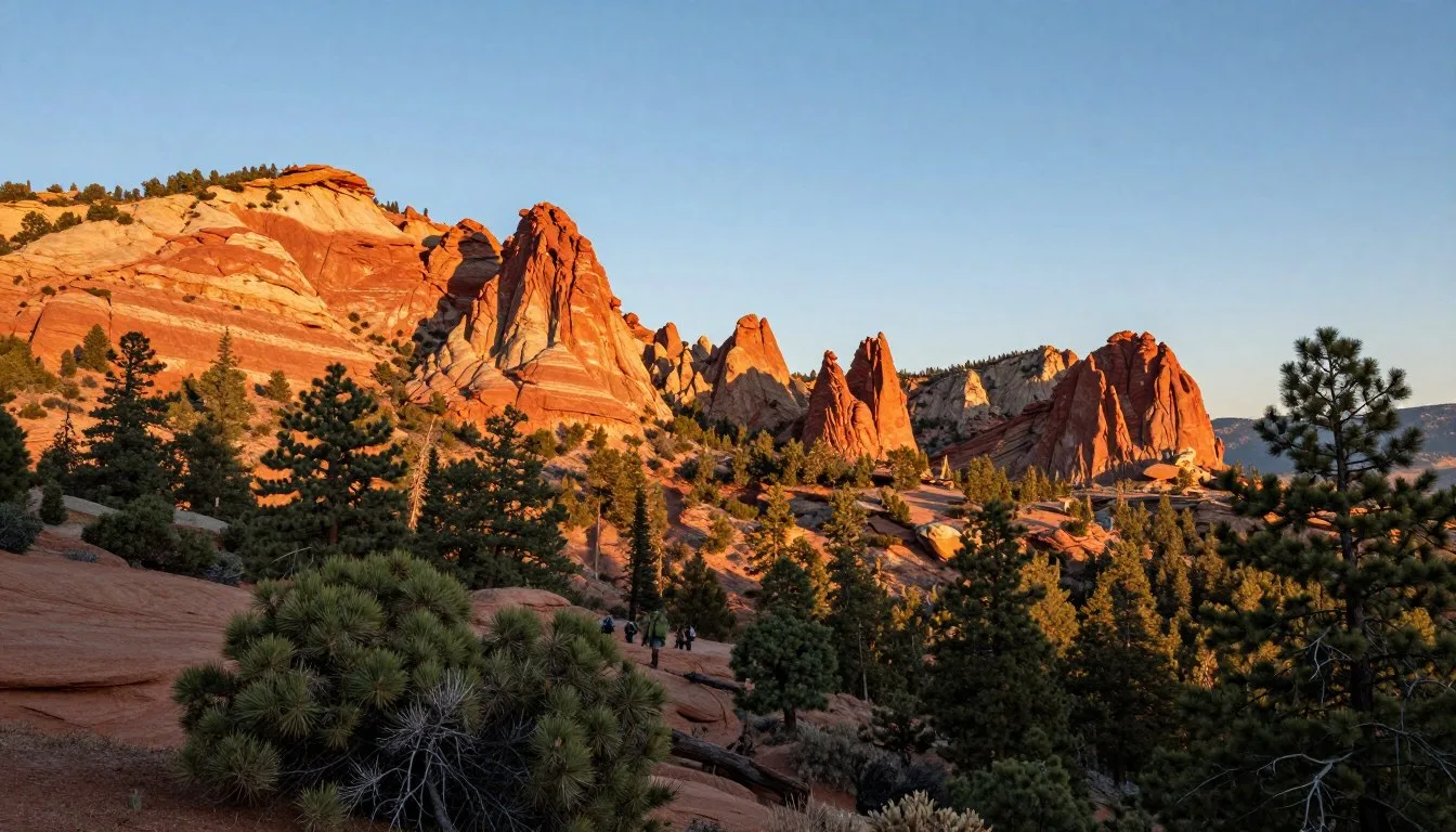
Did you know the Oquirrh Mountains stretch 48 kilometers (30 miles) alongside the Great Salt Lake yet remain one of Utah’s most overlooked mountain ranges? While millions flock to the Wasatch Range each year, this parallel range offers equally stunning vistas with a fraction of the crowds. The name “Oquirrh” derives from the Goshute Native American word meaning “wooded mountain,” though today these peaks present a dramatic contrast of golden grasslands and rocky summits.
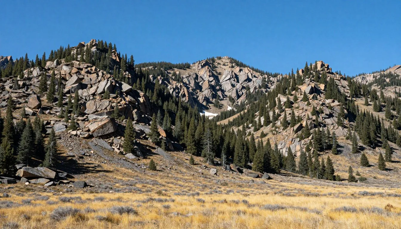
These mountains rise abruptly from the valley floor west of Salt Lake City. The range reaches its highest point at Flat Top Mountain, standing 3,237 meters (10,620 feet) above sea level. The Oquirrh Mountains have shaped Utah’s history through extensive mining operations that extracted copper, gold, silver, and other minerals for over a century.
Visitors discover a landscape where mining heritage meets outdoor recreation. The range offers hiking trails with panoramic views of the Great Salt Lake and Salt Lake Valley. Understanding access restrictions and respecting private property boundaries remains essential for anyone exploring this unique mountain area.
Getting There & Planning Your Journey
The Oquirrh Mountains sit conveniently between major Utah cities. Salt Lake City provides the closest major airport and serves as the primary gateway for visitors. The range’s eastern slopes rise just west of the Salt Lake Valley, making access remarkably straightforward for travelers.

Closest Airports
Salt Lake City International Airport (SLC) sits approximately 32 kilometers (20 miles) from the eastern edge of the Oquirrh Mountains. This major hub offers direct flights from cities across North America and international destinations. Ground transportation options include rental cars, rideshare services, and hotel shuttles.
The drive from the airport to the Oquirrh Range takes 25 to 40 minutes depending on your specific destination. Interstate 80 and State Route 111 provide primary access corridors. Most visitors rent vehicles for maximum flexibility exploring the area.
Regional Access Points
Several communities border the Oquirrh Mountains and serve as access points. Tooele sits on the western side, while West Jordan and South Jordan anchor the eastern approaches. Each town offers different entry points to trails and viewpoints throughout the range.
Butterfield Canyon Road on the eastern side provides one of the most popular access routes. This paved road winds into the mountains from the Salt Lake Valley. Ophir Canyon on the western slope offers another scenic route, though portions require high-clearance vehicles.
Important Access Considerations
Private property and active mining operations significantly limit public access throughout the Oquirrh Mountains. Large sections of the range remain off-limits to casual visitors. Research specific access points carefully before visiting to avoid trespassing on private land.
The Kennecott Copper Mine operates on the eastern slopes. This massive open-pit mine restricts access to surrounding areas. Always respect posted signs and property boundaries throughout your visit.
Access Alert: Much of the Oquirrh Range consists of private property or active mining land. Verify public access rights before hiking or exploring any area. Trespassing violations can result in substantial fines.
Best Time to Visit & Weather Tips
The Oquirrh Mountains experience four distinct seasons. Each season brings unique conditions that affect outdoor activities. Planning your visit around weather patterns ensures the best possible experience in this high-desert mountain environment.
Check 30,000+ Local Sightseeing Tours Worldwide
✓ Numerous languages and currencies are available
Best Time to Visit Oquirrh Mountains
Late spring and early fall provide optimal conditions for exploring the Oquirrh Mountains. May through June offers comfortable temperatures, blooming wildflowers, and accessible trails. September through October delivers pleasant weather, vibrant fall colors on higher slopes, and excellent visibility for photography.
Summer months from July through August bring hot temperatures, especially at lower elevations. Temperatures frequently exceed 32°C (90°F) in valleys, though higher peaks remain more moderate. Start hikes early in the morning during summer to avoid afternoon heat.
Winter transforms the range into a snow-covered landscape. November through March sees significant snowfall, particularly above 2,400 meters (8,000 feet). Winter access becomes challenging on many roads and trails. Snow enthusiasts find opportunities for snowshoeing and winter hiking on accessible routes.
Recommended Visiting Periods
- May to June: Ideal temperatures, spring wildflowers
- September to October: Pleasant weather, fall colors
- April: Shoulder season with fewer crowds
- Early November: Clear skies before heavy snow
Months to Avoid
- January to February: Extreme cold, heavy snow
- July to August: Excessive heat at lower elevations
- March: Unpredictable weather, muddy trails
- December: Limited daylight, road closures
Seasonal Weather Patterns
Spring weather in the Oquirrh Mountains arrives gradually. March brings fluctuating conditions with occasional snow at higher elevations. April and May see warming trends with daytime temperatures ranging from 15°C to 24°C (59°F to 75°F). Afternoon thunderstorms develop occasionally in late spring.
Summer heat dominates the landscape. Lower canyon roads and valley-adjacent trails experience intense sun exposure. Higher elevation areas like Flat Top Mountain remain 5°C to 8°C (9°F to 14°F) cooler than valley floors. Carry extra water during summer visits as natural water sources are scarce.
Fall brings stable weather patterns. September maintains warm days around 24°C to 27°C (75°F to 81°F) with cooler evenings. October temperatures drop to 13°C to 18°C (55°F to 65°F). The first significant snowfall typically arrives in late October or November.
Winter conditions can be severe. High peaks accumulate substantial snow from December through February. Valley temperatures range from -7°C to 4°C (20°F to 40°F). Strong winds affect exposed ridges and summit areas. Check weather forecasts carefully before any winter excursion.

What to Pack for Each Season
Spring and fall require layered clothing. Mornings start cool while afternoons warm considerably. Bring a light jacket, sun protection, and sturdy hiking boots. Rain gear proves valuable during spring’s occasional storms.
Summer demands sun protection as a priority. Wide-brimmed hats, sunscreen, and lightweight, breathable clothing help manage heat exposure. Carry at least twice as much water as you think necessary. Trails offer minimal shade along most routes.
Winter visitors need serious cold-weather gear. Insulated layers, waterproof boots, gloves, and warm hats become essential. Snowshoes or traction devices may be required on trails. Always inform someone of your plans before winter hiking.
Notable Annual Festivals
The communities surrounding the Oquirrh Mountains host several annual events celebrating local heritage and culture. These festivals provide insights into the area’s mining history and contemporary community spirit.
Tooele County hosts the annual Tooele Arts Festival each June. This event showcases regional artists, live music, food vendors, and family activities. The festival takes place in downtown Tooele with views of the Oquirrh Mountains forming a dramatic backdrop.
The Bingham Canyon Copper Mine hosts periodic public viewing events. These special occasions allow visitors inside the observation area overlooking one of the world’s largest excavations. Contact the mine’s visitor services for current event schedules.
South Jordan celebrates its heritage with the South Jordan Community Days each summer. This multi-day event includes parades, concerts, and outdoor activities. The festival occurs in late June or early July at city parks near the eastern Oquirrh foothills.
Tooele County Tourism – Festival information and event schedules
West Jordan hosts the annual Harvest Days Festival each September. This autumn celebration features local produce, craft vendors, and entertainment. The event coincides with peak fall colors in the nearby Oquirrh canyons.
Getting Around Locally
Personal vehicles provide the most practical way to explore the Oquirrh Mountains. Public transportation serves the Salt Lake Valley communities along the eastern range but does not extend into the mountains themselves. Most trailheads and access points require driving on paved roads with occasional gravel or dirt sections.
Rental cars are available at Salt Lake City International Airport and throughout the metropolitan area. Standard passenger vehicles suffice for paved canyon roads like Butterfield Canyon. Higher-clearance vehicles or SUVs offer advantages on rougher roads leading to remote trailheads.
Primary Access Roads
Butterfield Canyon Road (State Route 111) provides the main eastern access corridor. This paved road climbs from the Salt Lake Valley through scenic canyon terrain. The road passes residential areas before entering the natural mountain environment. Parking areas appear at various points along the route.
Ophir Canyon Road on the western side offers a scenic drive through historic mining country. The small community of Ophir sits in this canyon, preserving buildings from its mining heyday. The road continues beyond Ophir but becomes increasingly rough. Check current conditions before proceeding on unpaved sections.
State Route 68 runs along the northern end of the range. This road connects Lake Point and Tooele, providing access to several northern trailheads. The route offers excellent views of the Great Salt Lake and Stansbury Island.
Parking and Trailhead Access
Most trailheads offer limited informal parking. Pullouts along canyon roads accommodate several vehicles but fill quickly on weekends during peak season. Arrive early for popular trails to secure parking. Never block roads or gates when parking.
Some access points cross private property. Always park only in designated public areas. Respect all posted signs regarding parking restrictions and property boundaries. Unauthorized parking may result in towing or citations.
Navigation Tip: Cell phone coverage becomes spotty in canyon areas and on remote peaks. Download offline maps before your visit. Carry a physical map as backup navigation for hiking routes.
Road Conditions and Seasonal Closures
Winter snow closes some mountain roads from December through April. Butterfield Canyon Road typically remains open year-round but may require tire chains or four-wheel drive during storms. Many unpaved roads become impassable during winter and spring thaw.
Summer thunderstorms can create flash flood conditions in canyons. Avoid canyon roads during heavy rainfall. Check weather forecasts before heading into the mountains. Rangers and local authorities may close roads during extreme weather events.
Where to Stay
Accommodation options surround the Oquirrh Mountains in nearby valley communities. No lodging exists within the range itself due to private ownership and limited development. Most visitors base themselves in Salt Lake City suburbs or Tooele County towns.

Eastern Slope Communities
West Jordan and South Jordan offer numerous hotel chains and mid-range accommodations. These cities sit 15 to 25 minutes from eastern Oquirrh trailheads. Major brands include Hampton Inn, Holiday Inn Express, and Courtyard by Marriott. Prices range from moderate to mid-level depending on season.
Herriman provides newer hotel options with mountain views. This rapidly growing community sits directly at the base of the Oquirrh foothills. Several recently constructed hotels serve business travelers and tourists. The town’s location offers convenient access to Butterfield Canyon.
Salt Lake City proper expands accommodation choices significantly. Downtown hotels provide full-service options with restaurants, amenities, and public transportation connections. The drive to the Oquirrh Mountains takes 30 to 45 minutes from downtown, depending on traffic.
Western Slope Options
Tooele serves as the primary town on the western side of the range. Several budget-friendly motels and small hotels operate in Tooele. The Hampton Inn and Holiday Inn Express provide reliable chain accommodations. Local independent motels offer more economical rates for budget-conscious travelers.
Grantsville, located further west, has limited lodging. This small agricultural community offers a few bed and breakfast establishments. The rural setting provides quiet surroundings away from urban areas.
Alternative Lodging
Vacation rentals through platforms like Vrbo appear in communities surrounding the mountains. Entire homes or apartments provide options for families and groups. Properties in Herriman, South Jordan, and Tooele offer varying price points and amenities.
RV parks operate in Tooele and Grantsville for motorhome travelers. These facilities provide hookups and basic amenities. Some RV parks permit tent camping in designated areas.
Camping within the Oquirrh Mountains themselves remains extremely limited. Private property restrictions eliminate most potential camping spots. A few dispersed camping areas exist on public land parcels, but access and availability require careful research. Most outdoor enthusiasts camp in nearby ranges like the Wasatch Mountains where public lands offer established campgrounds.
Camping Alert: Do not assume you can camp anywhere in the Oquirrh Mountains. Most of the range consists of private property where camping is prohibited. Verify land ownership and camping permissions before setting up camp anywhere.
Dining & Local Cuisine
Dining options in the Oquirrh Mountains area reflect Utah’s blend of Western American cuisine with local specialties. Communities surrounding the range offer everything from quick casual dining to family restaurants. No restaurants operate within the mountains themselves, so plan meals before or after your outdoor adventures.
Western Valley Dining
South Jordan and West Jordan host diverse restaurant selections. National chains mix with local establishments along commercial corridors. Cafe Rio, a Utah-based fast-casual chain, serves popular Mexican-inspired cuisine with fresh ingredients. Their sweet pork barbacoa has become a regional favorite.
Local steakhouses provide hearty meals fitting for post-hike dining. These establishments specialize in grilled meats, baked potatoes, and traditional Western sides. Many feature rustic decor echoing the area’s ranching and mining heritage.
Asian cuisine options include sushi restaurants, Thai eateries, and Chinese restaurants throughout the valley communities. These establishments cater to the area’s diverse population and provide alternatives to Western fare.
Tooele Dining Scene
Tooele offers a more limited but authentic small-town dining experience. Local diners serve breakfast all day with generous portions. The breakfast burrito and biscuits with gravy appear on most morning menus.
Mexican restaurants in Tooele range from fast food to sit-down family establishments. El Mexsal and La Hacienda provide popular choices for authentic Mexican dishes. Combination plates offer good value with substantial portions.
Pizza places and sandwich shops provide quick lunch options. Several local pizzerias have developed loyal followings. Subway, Jimmy John’s, and local sub shops compete for the quick-service market.
Local Specialties and Regional Favorites
Utah’s famous fry sauce accompanies French fries and onion rings at most casual restaurants. This pink condiment blends mayonnaise and ketchup with spices. It’s considered a state tradition that visitors should try at least once.
Funeral potatoes, a creamy potato casserole topped with cornflakes, appear on many comfort food menus. This Utah favorite combines hash browns, cheese, cream soup, and butter into a rich side dish. Despite the morbid name, it’s a celebration staple served year-round.
Local bakeries sell scones, though Utah’s version differs from traditional British scones. These fried dough pieces resemble Native American fry bread. They’re served with honey butter or topped with cinnamon sugar. Several bakeries near the Oquirrh Mountains prepare fresh scones daily.

Grocery Stores and Picnic Supplies
Smith’s Food and Drug stores operate throughout the Salt Lake Valley communities. These full-service supermarkets provide deli sections perfect for assembling picnic lunches. Pick up sandwiches, fresh fruit, and snacks before heading into the mountains.
Walmart and Target stores in West Jordan and South Jordan offer one-stop shopping for food and outdoor supplies. Their grocery sections include prepared foods, sandwich materials, and hiking snacks.
Tooele has a Walmart and several smaller grocery stores. These locations provide essential supplies for day trips or extended stays. Local convenience stores along canyon roads sell limited snacks and drinks but at premium prices.
Attractions, Sightseeing & Activities
The Oquirrh Mountains offer distinctive attractions that blend natural beauty with industrial heritage. Visitors discover a landscape shaped equally by geology and human activity. The range presents opportunities for sightseeing, photography, and understanding Utah’s mining legacy.
Bingham Canyon Mine Overlook
The Kennecott Copper Mine represents one of the world’s largest human excavations visible from space. The mine has operated for over a century, extracting copper, gold, silver, and molybdenum. The overlook facility provides dramatic views into the massive terraced pit.
The mine visitor center offers educational displays explaining mining operations and geology. Interactive exhibits detail the extraction process and mineral formation. A viewing platform allows photography of the immense pit. The facility charges a modest admission fee and operates seasonally from April through October.
Scale becomes immediately apparent at the overlook. The pit measures approximately 4 kilometers (2.5 miles) wide and 1,200 meters (4,000 feet) deep. Massive haul trucks visible on the terraces appear tiny despite being the size of two-story buildings. This perspective illustrates the mine’s incredible scope.

Flat Top Mountain
Flat Top Mountain stands as the highest peak in the Oquirrh Range at 3,237 meters (10,620 feet). The summit provides panoramic views spanning from the Wasatch Range to the Great Salt Lake. On clear days, visibility extends over 160 kilometers (100 miles) in all directions.
Reaching Flat Top requires navigating access restrictions. Much of the approach crosses private property. The most common route begins in Butterfield Canyon and follows old mining roads to the summit ridge. Verify current access status before attempting this hike as restrictions change based on mining activities.
The summit rewards persistent hikers with unique perspectives. The Oquirrh Mountains drop steeply into valleys on both sides, creating dramatic elevation contrasts. The Great Salt Lake dominates western views while the Salt Lake City metropolitan area spreads across the eastern valley.
Ophir Town and Canyon
The small community of Ophir preserves remnants of Utah’s mining boom era. Historic buildings line the canyon road, offering glimpses into 19th-century mining life. The town’s population fluctuates seasonally with many structures serving as vacation cabins.
Ophir Canyon provides scenic driving with opportunities for photography. The narrow canyon road winds through rugged terrain with mine remnants visible on surrounding slopes. Autumn brings vibrant colors to the canyon as scrub oak and maples change color.
The Ophir Canyon Trailhead serves as a starting point for several hiking routes. Trails climb from the canyon floor toward higher peaks and ridges. These routes offer moderate to strenuous hiking with significant elevation gain. Always check trail conditions and access restrictions before hiking.
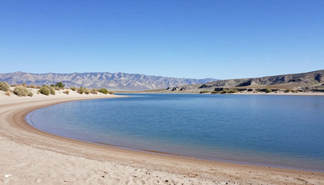
Great Salt Lake Viewpoints
The Oquirrh Mountains provide exceptional vantage points overlooking the Great Salt Lake. Several viewpoints along the northern ridge offer unobstructed lake views. The lake’s vast expanse creates stunning visual contrasts with the surrounding desert landscape.
Sunrise and sunset photography from Oquirrh viewpoints produces spectacular results. The lake’s surface reflects changing light, creating brilliant colors. The lake covers approximately 4,400 square kilometers (1,700 square miles) when at average levels, though size fluctuates based on precipitation.
Bring binoculars to observe waterfowl and shorebirds using the lake. The Great Salt Lake ecosystem supports millions of migrating birds. Spring and fall migrations bring particularly impressive concentrations of avian species to the area.
Mining Heritage Sites
Remnants of historic mining operations dot the Oquirrh Mountains. Old mine shafts, equipment, and structural ruins appear throughout the range. These sites offer tangible connections to the area’s industrial past. Never enter mine shafts or tunnels as they present serious safety hazards.
Interpretive signs at some locations explain mining history and techniques. The Oquirrh Mountains produced substantial quantities of copper, gold, silver, and lead. Mining operations shaped the region’s development and remain economically important today.
Photography enthusiasts find weathered mining structures compelling subjects. Rusted equipment against mountain backdrops creates dramatic compositions. Always stay on established paths and respect property boundaries when photographing mining sites.
Check 30,000+ Local Sightseeing Tours Worldwide
✓ Numerous languages and currencies are available
Museums, Cultural Spots & Festivals
Cultural attractions in the Oquirrh Mountains area focus heavily on mining heritage and pioneer history. While the mountains themselves contain no museums, surrounding communities preserve important historical collections. These facilities provide context for understanding the region’s development.
Tooele Valley Railroad Museum
This small museum in Tooele documents the area’s railroad history. Displays include vintage photographs, railroad equipment, and historical artifacts. The museum occupies a historic railroad depot building adding authenticity to the experience. Admission is free though donations are appreciated.
Railroad transportation played crucial roles in developing the Oquirrh mining industry. Trains hauled ore from mountain mines to processing facilities and markets. The museum explains these connections through exhibits and preserved equipment.
Bingham Canyon Mine Visitor Center
Beyond its viewing platform, the visitor center functions as a mining museum. Exhibits detail copper mining from discovery through modern operations. Interactive displays demonstrate ore processing and refining techniques. A short film chronicles the mine’s century-long history.
Mineral samples showcase the variety of metals extracted from the Oquirrh Mountains. Copper ore, gold specimens, and other mineral displays illustrate the range’s geological wealth. Educational programming targets school groups and general visitors.
Pioneer Heritage Sites
Communities surrounding the Oquirrh Mountains contain pioneer-era buildings and monuments. Grantsville preserves several 19th-century structures including historic homes and a one-room schoolhouse. These buildings reflect the challenging conditions faced by early settlers in this arid landscape.
Local historical societies maintain small museums and archives. The Tooele County Historical Society operates a museum with rotating exhibits. Collections include pioneer artifacts, Native American items, and mining memorabilia. Contact the historical society for current hours and exhibit information.
Cultural Events and Community Gatherings
Community celebrations in Oquirrh-adjacent towns often incorporate local history. Summer festivals feature pioneer demonstrations, historical reenactments, and heritage crafts. These events provide entertaining ways to learn about regional culture.
The Tooele County Fair occurs annually each August. This agricultural fair showcases livestock, produce, and local crafts. Fair activities include rodeo events, carnival rides, and entertainment. The fairgrounds sit with views of the Oquirrh Mountains.
Art galleries in South Jordan and surrounding communities display works by regional artists. Many pieces feature the Oquirrh Mountains and Utah landscapes. Gallery walks and art festivals occur periodically throughout the year.
Nature & Outdoor Experiences
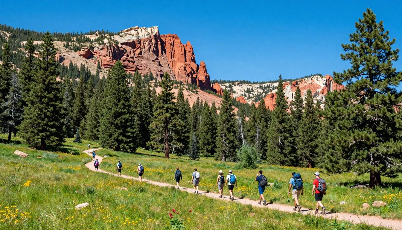
The Oquirrh Mountains offer diverse outdoor recreation opportunities despite access limitations. Hiking remains the primary activity for most visitors. The range’s unique geology and ecosystems reward those who explore its trails and peaks responsibly.

Hiking Trails and Routes
Butterfield Canyon provides several trail access points. The canyon road allows hiking along the route itself, though watch for occasional vehicle traffic. Side trails branch from the main canyon leading to ridge viewpoints and peak approaches.
The trail to Flat Top Mountain begins from various points depending on access. The most common route follows old mining roads approximately 8 kilometers (5 miles) one way. Elevation gain totals roughly 915 meters (3,000 feet). This strenuous hike requires good physical conditioning and proper preparation.
Lewiston Peak at 3,090 meters (10,140 feet) offers another challenging summit objective. Access typically begins in Butterfield Canyon with a demanding climb to the summit ridge. Views from Lewiston Peak rival those from Flat Top with slightly easier access in some seasons.
North Oquirrh trails accessible from State Route 68 provide moderate hiking options. These routes explore the northern section of the range with views toward the Great Salt Lake. Several trails loop back to trailheads allowing varied route planning.
Trespassing Warning: Many Oquirrh Range trails cross private property at some point. Some routes have historically been open to hikers but access rights can change. Always respect “No Trespassing” signs and verify current access status before hiking.
Wildlife Watching
The Oquirrh Mountains support diverse wildlife populations despite their proximity to urban areas. Mule deer inhabit canyons and slopes throughout the range. Morning and evening hours offer the best opportunities for deer observation.
Elk herds roam the higher elevations of the Oquirrh Mountains. These majestic animals tend toward remote areas away from human activity. Patient observers with binoculars may spot elk on distant ridges, particularly during summer and fall.
Bird species include golden eagles, red-tailed hawks, and various raptors. These predatory birds use the mountains’ updrafts for soaring and hunting. Smaller birds like mountain bluebirds, juncos, and finches inhabit canyon areas and lower slopes.
Coyotes, foxes, and other smaller mammals live throughout the range. Evidence of these animals appears more commonly than the animals themselves. Tracks, scat, and other signs indicate their presence along trails and roads.
Photography Opportunities
The Oquirrh Mountains provide exceptional photography subjects throughout the year. Sunrise light painting the peaks golden creates dramatic images. The Great Salt Lake adds unique elements to compositions from high vantage points.
Wildflower blooms in late spring offer colorful foreground subjects. Look for lupine, Indian paintbrush, and various sunflower species on middle-elevation slopes. Macro photography enthusiasts find abundant insect subjects during warmer months.
Fall colors develop in canyon areas with concentrations of scrub oak and maple trees. Peak color typically occurs in late September through early October. Combinations of golden grasslands, red-orange foliage, and rocky peaks create vibrant scenes.
Night sky photography benefits from the area’s relative darkness away from major cities. The Milky Way appears clearly on moonless nights from higher elevations. Winter’s clear air produces particularly sharp star images.

Mountain Biking
Limited mountain biking opportunities exist on roads and select trails. Butterfield Canyon Road allows cycling though traffic requires caution. The paved surface provides a challenging climb with rewarding descent for road cyclists.
Some old mining roads in accessible areas permit mountain bikes. These rough routes demand technical riding skills and sturdy bikes. Always verify that biking is permitted on specific routes as restrictions apply in many areas.
Winter Activities
Snowshoeing becomes viable on Oquirrh trails during winter months. Snow cover transforms the landscape while reducing crowds to nearly zero. The same access restrictions apply in winter, but snow can obscure property boundaries making navigation challenging.
Backcountry skiing attracts experienced skiers to certain Oquirrh slopes. Avalanche danger exists on steep terrain, particularly after storms. Never attempt backcountry skiing without proper avalanche safety training, equipment, and knowledge of current conditions.
Safety Considerations for Outdoor Activities
Water sources are extremely limited throughout the Oquirrh Mountains. Carry all water needed for your planned activity plus emergency reserves. One liter per hour of hiking represents a minimum guideline during warm weather.
Weather can change rapidly, especially at higher elevations. Afternoon thunderstorms develop quickly in summer. Lightning poses serious threats on exposed ridges and peaks. Descend immediately if storms approach.
Cell phone service proves unreliable in many canyon areas and on peaks. Inform someone of your plans including expected return time. Carry offline maps and basic navigation tools. A GPS device or compass provides backup navigation.
Mining hazards include open shafts, unstable structures, and abandoned equipment. Never enter old mines or explore industrial sites. These areas contain serious dangers including toxic substances, unstable ground, and structural collapse risks.
Travel With Children
Families can enjoy the Oquirrh Mountains area with appropriate planning. Some activities suit children better than others. Understanding limitations and selecting age-appropriate options ensures positive experiences for younger visitors.
Family-Friendly Attractions
The Bingham Canyon Mine overlook fascinates children with its enormous scale. Kids enjoy watching the massive trucks working far below. The visitor center’s interactive exhibits engage young minds with hands-on learning about geology and mining. Plan visits during cooler morning hours for children’s comfort.
Scenic drives through Butterfield Canyon or Ophir Canyon provide easy family outings. Stop at pullouts for short walks and exploration. Children enjoy spotting wildlife, collecting rocks (where permitted), and experiencing mountain environments without strenuous hiking.
Local parks in surrounding communities offer playgrounds and picnic facilities. These provide breaks between outdoor adventures. The Oquirrh Mountains create scenic backdrops for family gatherings and casual play.

Age-Appropriate Hiking
Most Oquirrh trails challenge young children due to distance, elevation gain, and rough terrain. Select shorter routes with minimal elevation change for families with kids under ten. Lower canyon walks along roads provide accessible options.
Pack extra snacks and water for children. Kids require more frequent breaks than adults. Build extra time into hiking plans to accommodate slower paces and rest stops. Turn hikes into adventures with simple games like nature scavenger hunts.
Avoid exposed ridge hikes and peak climbs with young children. These routes present legitimate dangers including steep drop-offs and weather exposure. Save challenging summits for when children reach appropriate ages and skill levels.
Safety Considerations for Families
Sun protection becomes critical for children in Utah’s intense sunlight. Apply sunscreen before outdoor activities and reapply regularly. Wide-brimmed hats and lightweight long-sleeved shirts provide additional protection. Children’s skin burns more easily than adult skin.
Watch children closely near old mining sites. Curious kids may wander toward dangerous areas without understanding risks. Establish clear boundaries before exploring areas with mining remnants. Keep children on established paths and away from old structures.
Teach children about respecting private property. Explain why trespassing rules matter in the Oquirrh Mountains. Making this a teaching moment helps children understand property rights and responsible outdoor behavior.
Educational Opportunities
The Oquirrh Mountains provide natural learning laboratories for children. Geology lessons come alive examining different rock types and formations. Discuss how the mountains formed and how erosion shapes the landscape.
Mining heritage offers history lessons beyond textbooks. Children can visualize how people worked in challenging conditions to extract valuable minerals. This connects history to the physical landscape in tangible ways.
Wildlife observation teaches ecology and biology. Identifying birds, tracking animals, and understanding ecosystems develops environmental awareness. Bring field guides appropriate for children’s reading levels.
Money Saving Tips
Visiting the Oquirrh Mountains can be remarkably affordable with smart planning. Many activities cost nothing while others require minimal expenses. Budget-conscious travelers can enjoy full experiences without breaking the bank.
Free Activities
Hiking on public trails costs nothing beyond transportation and personal supplies. Most trailheads have no entrance fees or parking charges. This makes the Oquirrh Mountains accessible to visitors on any budget. Bring your own food and water to avoid purchasing expensive items at convenience stores.
Scenic driving through the mountains is free. Pack lunches and make a day exploring different canyons and viewpoints. Photography enthusiasts can spend hours capturing images without spending money beyond fuel costs.
Wildlife watching requires only patience and binoculars. Dawn and dusk observation sessions cost nothing but time. These quiet hours often provide the best wildlife sightings.
Accommodation Savings
Staying in Tooele rather than Salt Lake City suburbs reduces lodging costs significantly. The extra driving distance is offset by lower nightly rates. Budget motels in Tooele charge substantially less than chain hotels in more developed areas.
Booking accommodations midweek saves money compared to weekend rates. Many hotels offer lower prices Monday through Thursday. Plan your visit during weekdays if your schedule allows flexibility.
Vacation rentals can provide value for groups or families. Splitting the cost among multiple people reduces per-person expenses. Properties with kitchens allow meal preparation, cutting food costs dramatically.
Food Cost Management
Grocery store delis provide inexpensive lunch options compared to restaurants. A sandwich, fruit, and drinks from a supermarket cost half what restaurant meals charge. Smith’s and Walmart delis offer ready-made options or ingredients for assembling your own meals.
Cook breakfasts at your accommodation if facilities are available. Breakfast costs at restaurants add up quickly over multiple days. Groceries for simple breakfasts cost far less than dining out.
Carry reusable water bottles and refill them rather than buying bottled water. This simple habit saves money and reduces plastic waste. Water quality is excellent throughout the region.
Transportation Economies
Personal vehicles provide the most economical transportation for exploring the Oquirrh area. Rental car rates typically cost less than hiring guides or joining tours. Compare rental agencies for the best rates and consider economy vehicles unless off-road capability is necessary.
Fuel costs can be managed by planning efficient routes. Group multiple objectives into single trips rather than making separate excursions. Gas prices in Tooele sometimes run lower than Salt Lake Valley stations.
Annual Passes and Discounts
While most Oquirrh attractions are free, the Bingham Canyon Mine charges admission. Check for any available discounts for seniors, military, or AAA members. These savings add up for families or groups.
Local tourism offices sometimes offer coupon books or discount cards for area attractions. Contact visitor information centers for available promotions before your trip.
Safety & Local Customs
Understanding safety protocols and respecting local customs ensures positive experiences in the Oquirrh Mountains area. Some dangers are unique to this region while others reflect general Utah conditions. Cultural awareness helps visitors connect respectfully with local communities.
Private Property Respect
The most important local custom involves property rights. Western United States culture places enormous emphasis on property ownership and boundaries. The Oquirrh Mountains’ extensive private ownership makes this particularly relevant for visitors.
Always respect “No Trespassing” signs without exception. These signs carry legal weight and ignoring them can result in prosecution. Property owners have broad rights to protect their land. Never assume access is acceptable without clear permission or public designation.
Gates and fences indicate boundaries even without posted signs. Closed gates should remain closed. Never cut fences or damage barriers. These actions constitute serious violations that anger local residents and authorities.
Mining Safety
Active mining operations present unique hazards. Large trucks travel mining roads and may not see smaller vehicles or pedestrians. Never enter active mining areas or approach working operations. Observe all warning signs near the Bingham Canyon Mine and other facilities.
Check 30,000+ Local Sightseeing Tours Worldwide
✓ Numerous languages and currencies are available
Abandoned mines pose severe dangers. Old shafts may be hundreds of feet deep with unstable edges. Toxic gases accumulate in closed spaces. Structural collapse risks exist in old buildings and tunnels. Exploring abandoned mines is illegal and potentially fatal.
Environmental Hazards
Utah’s high elevation intensifies sun exposure. Sunburn occurs more quickly at mountain elevations than at sea level. Apply broad-spectrum sunscreen with high SPF ratings. Reapply every two hours during outdoor activities.
Dehydration develops faster in Utah’s dry climate than humid environments. Drink water before feeling thirsty. Monitor urine color as a hydration indicator. Dark urine signals inadequate hydration requiring immediate fluid intake.
Lightning danger increases on exposed ridges and peaks. Thunderstorms develop rapidly in summer afternoons. Begin descents by early afternoon to avoid being caught on summits during storms. If caught in lightning, avoid isolated trees and move to low ground away from peaks.
Hypothermia risks exist even in summer at higher elevations. Mountain weather changes rapidly and temperatures drop significantly with elevation. Carry extra layers even on warm days. Wet conditions combined with wind create dangerous cooling effects.
Wildlife Safety
Mountain lions inhabit the Oquirrh Mountains though encounters remain rare. If you see a mountain lion, never run. Face the animal, make yourself appear large, and back away slowly. Fight back aggressively if attacked. Report all mountain lion sightings to authorities.
Rattlesnakes live in lower elevation areas, particularly around rocky outcrops and warm slopes. Watch where you place hands and feet. Most bites occur when people inadvertently contact snakes. Give snakes space and they will retreat. Seek immediate medical attention for any snakebite.
Do not approach or feed any wildlife. Feeding animals creates dangerous situations and is illegal. Keep all food secured. Habituated animals lose their natural wariness and may become aggressive.
Cultural Sensitivity
Utah has a significant Latter-day Saint (Mormon) population. Religious culture influences local customs and attitudes. Many businesses close or have reduced hours on Sundays. Plan accordingly for Sunday travel or activities.
Alcohol sales follow specific regulations in Utah. Beer above 5% alcohol by volume is sold only in state liquor stores with limited hours. Restaurants require food purchases with alcohol orders. These laws reflect local cultural values.
Local communities value conservative behavior and dress. While tourist areas see varied styles, surrounding towns remain traditional. Respectful behavior and modest dress avoid uncomfortable situations in small towns.
Emergency Services
Cell phone coverage becomes unreliable in mountain areas. Download offline maps before trips. Carry physical maps as backup. GPS devices work when cell signals fail.
Dial 911 for all emergencies. Be prepared to provide specific location information as responders may not be familiar with remote areas. Landmarks, mile markers, or GPS coordinates help emergency services locate you quickly.
The nearest hospital to the eastern Oquirrh Mountains is Mountain Point Medical Center in Lehi. Tooele has Mountain West Medical Center serving the western side. Know which direction leads to medical facilities before emergencies arise.
Salt Lake Ranger District – Trail conditions and safety information
Visitor Comments About Oquirrh Mountains
Recent visitors to the Oquirrh Mountains shared their experiences exploring this unique Utah destination. Their perspectives provide valuable insights for travelers planning their own visits.
“The views from the Flat Top Mountain trail absolutely took our breath away. We could see the Great Salt Lake stretching to the horizon on one side and the entire Salt Lake Valley on the other. The access situation was confusing with some roads gated, so we had to adjust our route. Despite that challenge, reaching the summit made everything worthwhile. The wildflowers in late June were spectacular.”
“We drove through Butterfield Canyon expecting something ordinary and were pleasantly surprised by the dramatic scenery. The canyon walls rise steeply on both sides creating an impressive corridor through the mountains. We stopped at several pullouts for photographs. The Bingham Canyon Mine overlook was fascinating, though quite commercial compared to the natural canyon areas. Our kids especially enjoyed seeing the enormous trucks working in the mine pit.”
“As a photographer, I found the Oquirrh Mountains perfect for sunrise and sunset shoots. The way light hits the peaks creates incredible colors that change by the minute. I visited in October when fall colors were peaking in the canyons. The combination of golden aspens, russet scrub oak, and rocky peaks provided endless compositions. I do wish there were clearer information about which areas allow public access. Some trails had conflicting information online versus what we found on the ground.”
Additional Nearby Destinations
The Oquirrh Mountains location provides convenient access to other notable Utah attractions. Extending your visit to include nearby destinations creates a more comprehensive Utah experience. Each area offers distinct characteristics complementing what the Oquirrh Mountains provide.

Great Salt Lake
The Great Salt Lake sits immediately north of the Oquirrh Mountains and should not be missed. Antelope Island State Park provides the most accessible lake experience with beaches, wildlife viewing, and hiking trails. The island supports free-roaming bison herds visible from park roads.
The lake’s salinity creates unique swimming experiences. Buoyancy makes floating effortless though the salt water stings any cuts or scrapes. Freshwater showers at beach areas help rinse off after swimming. The lake’s size fluctuates dramatically based on precipitation and drought cycles.
Birdwatching at the Great Salt Lake rivals any location in North America. Millions of migratory birds use the lake as a critical stopover. Spring and fall bring incredible concentrations of shorebirds, waterfowl, and wading birds. Bring binoculars and field guides for identifying species.
Salt Lake City
Utah’s capital city lies 30 to 45 minutes from the Oquirrh Mountains depending on traffic. Temple Square serves as the city’s historic and cultural center. Free tours explain Latter-day Saint history and architecture. The Salt Lake Temple and Tabernacle showcase impressive 19th-century construction.
Museums in downtown Salt Lake City include the Natural History Museum of Utah, Clark Planetarium, and Leonardo science museum. These institutions appeal to various interests from paleontology to space exploration. Several museums offer free admission on specific days.
The city’s dining scene surpasses what’s available in smaller towns around the Oquirrh Mountains. Downtown restaurants represent diverse cuisines from traditional American to international options. The food scene continues growing with new establishments opening regularly.
Wasatch Mountains
The Wasatch Range runs parallel to the Oquirrh Mountains east of Salt Lake City. These taller mountains host world-famous ski resorts including Alta, Snowbird, Park City, and Deer Valley. Summer activities include hiking, mountain biking, and scenic chairlift rides.
Big Cottonwood Canyon and Little Cottonwood Canyon provide spectacular scenic drives. These canyons cut deeply into the Wasatch Range with dramatic granite walls. Numerous trailheads offer access to alpine lakes, waterfalls, and peaks exceeding 3,350 meters (11,000 feet).
Park City, site of 2002 Winter Olympics events, maintains a charming historic downtown. Main Street features galleries, restaurants, and shops in restored 19th-century buildings. The town serves as a year-round resort destination 45 minutes from the Oquirrh Mountains.
Stansbury Mountains
The Stansbury Range lies west of the Oquirrh Mountains across Tooele Valley. These mountains receive fewer visitors than either the Oquirrh or Wasatch ranges. Desert Peak in the Stansbury Mountains reaches 3,362 meters (11,031 feet) and offers challenging hiking.
More public land exists in the Stansbury Mountains compared to the Oquirrh Range. This means easier access for recreation without extensive private property concerns. Trails in the Stansburys provide wilderness experiences with mountain lake destinations.
Timpanogos Cave National Monument
Located about one hour south of the Oquirrh Mountains, this National Monument protects a spectacular cave system. Guided tours lead visitors through three connected caves featuring dramatic formations. The hike to the cave entrance gains 310 meters (1,000 feet) in just 2.4 kilometers (1.5 miles).
Cave tours require advance reservations, especially during summer months. The cave maintains constant cool temperatures around 7°C (45°F) year-round. Bring layers even during hot summer weather as the temperature difference is significant.
Practical Travel Tips
Successfully navigating a visit to the Oquirrh Mountains requires understanding practical details beyond basic planning. These tips address common questions and challenges visitors encounter. Applying this guidance helps avoid frustrations and enhances your overall experience.
Best Resources for Current Information
The Tooele County tourism website provides updated information about events and conditions. Local newspaper websites including Tooele Transcript Bulletin report relevant news affecting visitors. Check these sources for road closures, weather alerts, or access changes.
The Utah Avalanche Center posts winter conditions and avalanche forecasts. Even if not backcountry skiing, these reports indicate overall mountain conditions during winter months. The forecasts include weather observations from high elevations.
Social media groups focused on Utah hiking often discuss Oquirrh Mountains conditions. Members share recent trip reports, trail conditions, and access updates. These community resources provide real-time information not available through official channels.
What to Pack
A comprehensive first aid kit belongs in your vehicle for any Oquirrh Mountains visit. Include bandages, pain relievers, antibiotic ointment, and any personal medications. Add items for treating blisters, sprains, and minor injuries common during hiking.
Navigation tools should include downloaded offline maps on your phone plus physical maps. A compass or GPS unit provides backup navigation. Mark your planned route and share it with someone not joining your trip.
Emergency supplies for vehicle travel include extra water, non-perishable snacks, flashlight, blanket, and basic tools. These items prove valuable if vehicle problems strand you on remote roads. A fully charged phone and portable battery pack maintain communication capability.
Sun protection requires multiple approaches. Sunscreen with SPF 50 or higher protects exposed skin. Wide-brimmed hats shield faces and necks. Sunglasses with UV protection prevent eye damage from intense mountain light. Lip balm with SPF prevents chapped, burned lips.
Photography Considerations
Early morning and late afternoon provide the best natural lighting. Midday sun creates harsh shadows and washed-out colors. Plan photography sessions around golden hours after sunrise and before sunset for optimal results.
Dust can be significant in the Oquirrh Mountains, especially during dry periods. Protect camera equipment from fine particles. Keep lenses covered when not actively shooting. Bring lens cleaning supplies to address dust on glass elements.
Polarizing filters enhance landscape photography by reducing glare and intensifying colors. These filters prove particularly effective photographing the Great Salt Lake from Oquirrh viewpoints. The lake’s reflective surface benefits dramatically from polarization.
Fitness Preparation
Elevation affects visitors from lower altitudes. The Oquirrh Mountains range from 1,500 meters (5,000 feet) at base elevations to over 3,200 meters (10,500 feet) on summits. Allow time for acclimatization if traveling from sea level. Drink extra water and moderate activity levels for the first day or two.
Conditioning before your trip makes mountain hiking more enjoyable. Walk or hike regularly for several weeks prior to arrival. Include elevation gain in training walks when possible. Strong cardiovascular fitness and leg strength reduce fatigue and injury risk.
Leave No Trace Principles
Pack out all trash including small items like food wrappers and tissue. Leave nothing behind regardless of size. Carry a small trash bag for collecting your waste throughout the day.
Stay on established trails to minimize erosion and vegetation damage. Shortcutting switchbacks accelerates trail degradation. Single-file hiking prevents trail widening in sensitive areas.
Respect wildlife by observing from distance. Never feed animals or leave food accessible. Human food harms wildlife health and alters natural behaviors. Secure all food in vehicles when not actively eating.
Seasonal Timing Recommendations
Wildflower enthusiasts should visit in late May through June. This period offers peak blooms on middle and upper elevation slopes. The exact timing varies yearly based on snowmelt and spring temperatures.
Fall color viewing targets late September through mid-October. Lower elevations change later than higher slopes. Scout multiple canyons to find peak color as timing varies by location and aspect.
Avoid holiday weekends when possible. Memorial Day, Fourth of July, and Labor Day draw maximum crowds to accessible areas. Midweek visits provide quieter experiences with better parking availability.
Your Oquirrh Mountains Adventure Awaits
The Oquirrh Mountains stand as Utah’s hidden gem, offering remarkable experiences without the overwhelming crowds found in more famous ranges. From summit panoramas encompassing the Great Salt Lake to intimate canyon explorations revealing mining heritage, these mountains reward curious travelers who venture beyond the obvious.
Whether you seek challenging peak ascents, scenic photography opportunities, or simple appreciation of dramatic landscapes, the Oquirrh Range delivers authentic Western mountain experiences. The area’s unique combination of natural beauty and industrial history creates narratives found nowhere else. Each visit uncovers new perspectives on how geology, human ambition, and natural forces have shaped this distinctive landscape.
Remember to respect private property boundaries, prepare thoroughly for mountain conditions, and leave no trace of your passage. These practices ensure the Oquirrh Mountains remain accessible and pristine for future visitors. Your adventure in these overlooked peaks will create memories as lasting as the ancient rocks forming their summits. Start planning your journey today to discover what makes the Oquirrh Mountains a treasured destination for those who know where to look.