Hotels by Trip.com
Flights by Trip.com
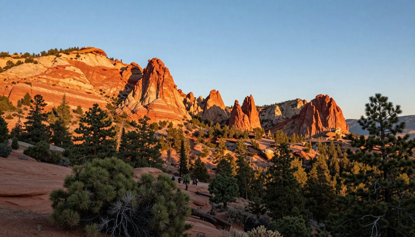
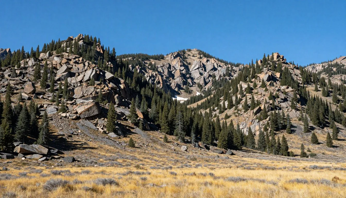
The High Uintas Wilderness stretches across 456,000 acres of pristine alpine terrain, making it one of the largest wilderness areas in the United States. This remarkable mountain range runs east to west, a geological rarity among North American peaks. Most mountain ranges extend north to south, but the Uintas defy convention.
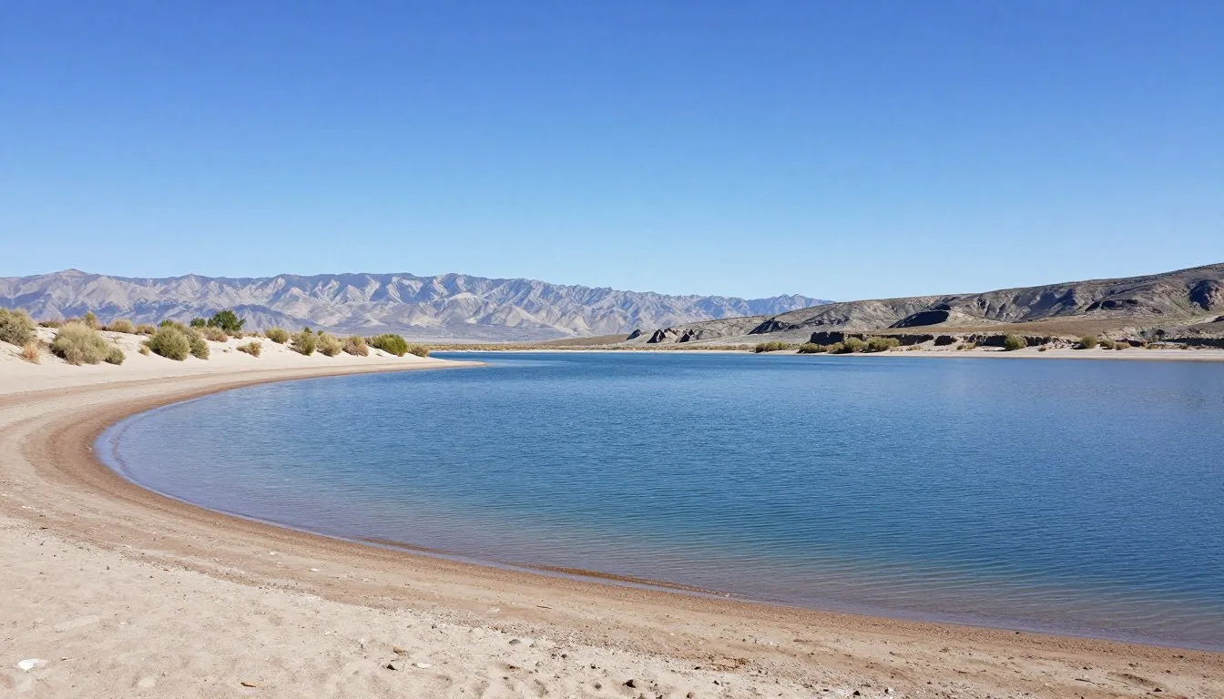
Within this vast wilderness, over 400 lakes shimmer beneath jagged peaks. Kings Peak, Utah’s highest point at 4,123 m (13,528 feet), crowns the range. The area offers endless opportunities for adventure seekers and nature lovers alike.
Getting There and Planning Your Journey
The High Uintas Wilderness sits in northeastern Utah, straddling the Ashley National Forest and Wasatch-Cache National Forest. Multiple access points serve different parts of this expansive area. Each trailhead offers unique entry routes into the wilderness.
Salt Lake City International Airport serves as the primary gateway, located approximately 161 km (100 miles) west of the wilderness. From the airport, rental cars provide the most flexible transportation option. The drive takes roughly two to three hours depending on your chosen trailhead.
Alternatively, Provo Municipal Airport offers a smaller option about 129 km (80 miles) from popular access points. This airport handles fewer flights but may suit travelers from specific regions. Denver International Airport, though farther at 483 km (300 miles), provides another option for visitors combining Colorado and Utah destinations.

Popular trailheads include Mirror Lake Highway (State Route 150), which provides access to numerous starting points. The Highline Trailhead near the Wyoming border offers entry to some of the most spectacular backcountry routes. Chepeta Lake and Swift Creek trailheads on the north side provide additional options.
Plan to arrive with a full tank of gas. Services become sparse as you approach the wilderness. Stock up on supplies in towns like Kamas, Roosevelt, or Mountain View before heading into remote areas. These communities offer last-chance opportunities for groceries, camping gear, and emergency supplies.
Best Time to Visit and Weather Tips
Summer months from July through early September offer the most reliable weather and accessible trails. Snow typically melts by mid-July at higher elevations, opening mountain passes and alpine lakes. This short window provides ideal conditions for backpacking and day hikes.
Recommended Months
Peak Season (July – August)
- Warmest temperatures, daytime highs 18-24°C (65-75°F)
- Most trails snow-free and accessible
- Wildflowers bloom across meadows
- Afternoon thunderstorms common
- Busiest period with most visitors
Shoulder Season (Late September)
- Fewer crowds on popular trails
- Aspen trees display golden colors
- Cooler temperatures, prepare for frost
- Some high passes may have early snow
- Shorter daylight hours require planning
Months to Avoid
October through June presents significant challenges. Heavy snowpack blankets the high country from late fall through early summer. Roads close, trails become impassable, and avalanche danger increases. Winter camping requires specialized gear and extensive experience.
Spring runoff from May through June creates dangerous river crossings. Swollen streams block routes and make navigation treacherous. Wait until water levels drop before attempting backcountry travel.

Weather Patterns and Preparation
Mountain weather changes rapidly. Morning sunshine often gives way to afternoon storms. Lightning poses serious danger above treeline. Plan to reach high passes and exposed ridges before noon, then descend to sheltered camps.
Pack layers for temperature swings. Mornings start cold, often near freezing even in summer. Afternoons warm considerably, but temperatures plunge again after sunset. Bring warm sleeping bags rated to -7°C (20°F) or lower.
Sudden storms can drop temperatures 15-20°C (30-40°F) within hours. Always carry rain gear, warm layers, and emergency shelter. The wilderness sits at high elevation where conditions turn severe quickly.
Notable Annual Festivals
The surrounding communities celebrate the mountain heritage through various events. These festivals occur in nearby towns rather than within the wilderness itself, respecting the protected natural area.
Mountain Man Rendezvous
Fort Bridger hosts this historical celebration each Labor Day weekend. The event recreates 1800s trading gatherings with period clothing, crafts, and demonstrations. Visitors experience black powder shooting, tomahawk throwing, and traditional skills. Contact Fort Bridger State Historic Site at (307) 782-3842 for specific dates and details.
Uintah County Fair
This August event in Vernal showcases local agriculture and western culture. Rodeo competitions, livestock exhibitions, and craft displays highlight regional traditions. The fair runs for one week typically in mid-August. Call (435) 789-0407 for the current year schedule.
Kamas Valley Demolition Derby
This summer entertainment draws crowds to Kamas each July. While not wilderness-focused, it provides local color and community atmosphere for visitors staying in the area. Contact Kamas City Office at (435) 783-4143 for event information.
Getting Around Locally
Personal vehicles provide essential transportation to trailheads and access points. No public transit serves the wilderness area or most surrounding regions. High-clearance vehicles handle rough forest roads better, though many main routes accommodate standard cars.
Mirror Lake Highway (SR-150) remains the primary paved access route. This scenic byway operates seasonally, typically opening in late May and closing with heavy snowfall in October or November. The road climbs to 3,048 m (10,000 feet) elevation, providing access to numerous trailheads.

Once in the wilderness, travel continues on foot or horseback. No motorized vehicles operate within wilderness boundaries. Popular trails like the Highline Trail extend for 127 km (79 miles), offering week-long backpacking opportunities. Day hikers can access shorter routes from various trailheads.
Trail conditions vary significantly. Well-maintained paths near popular lakes see regular use and clear marking. Remote routes may have faint tread with minimal blazing. Topographic maps and GPS devices help navigate less-traveled areas.
Water crossings require attention, especially during peak runoff. Some streams have log crossings or stepping stones. Others demand wading through cold, swift water. Trekking poles provide stability and balance.
Where to Stay
Accommodation options range from wilderness camping to comfortable lodges, depending on your adventure style. Most visitors combine both approaches, staying in towns before and after backcountry trips.
Backcountry Camping
The wilderness allows dispersed camping throughout the area. No permits are required for most zones, though group size limits apply. Camp at least 61 m (200 feet) from lakes and streams to protect water quality and wildlife habitat.
Popular camping areas include the Four Lakes Basin, Naturalist Basin, and Red Castle Lakes. These scenic spots attract many visitors during peak season. Arriving early in the day improves chances of finding preferred campsites.

Developed Campgrounds
Ashley National Forest operates several developed campgrounds along Mirror Lake Highway. These sites offer vault toilets, picnic tables, and fire rings. Popular options include Mirror Lake Campground, Butterfly Lake, and Moosehorn. Reservations through Recreation.gov secure sites during busy summer weekends.
Nearby Towns
Kamas, located 40 km (25 miles) from Mirror Lake Highway trailheads, provides hotels, vacation rentals, and supply stores. This small town serves as a convenient base for day trips into the Uintas.
Evanston, Wyoming sits north of the wilderness with additional lodging options. Roosevelt and Vernal on the south side offer larger communities with more extensive services. These towns work well for multi-day stays with various wilderness day trips.
Dining and Local Cuisine
Gateway communities provide dining options before and after wilderness adventures. Within the wilderness itself, visitors must pack all food and practice Leave No Trace principles.
Kamas offers several restaurants serving American comfort food. Local cafes provide hearty breakfasts perfect for fueling long hiking days. Stock up on groceries at Smith’s Food and Drug or smaller local markets.
Evanston features more diverse dining with Mexican, Chinese, and steakhouse options. Chain restaurants line the interstate corridor, while downtown holds local favorites. Bear River Coffee Company serves excellent morning brews for early trailhead departures.
Roosevelt and Vernal provide additional choices on the south side. These communities offer everything from fast food to sit-down restaurants. Visit Vernal Brewing Company for locally crafted beers and pub fare after completing your wilderness trip.
Backcountry Food Planning
Plan lightweight, high-calorie meals for backpacking trips. Dehydrated foods reduce pack weight significantly. Popular options include instant oatmeal, pasta dishes, rice meals, and trail mix.
Bear-proof food storage becomes mandatory in designated areas. Hard-sided canisters protect supplies from wildlife and comply with regulations. Hang food bags at least 3.7 m (12 feet) high and 1.2 m (4 feet) from tree trunks in areas without canister requirements.
Attractions, Sightseeing and Activities
The High Uintas Wilderness rewards visitors with extraordinary natural features. These mountains contain the highest concentration of alpine lakes in North America. Each lake offers unique character and surrounding landscapes.
Kings Peak Summit
Utah’s highest point stands at 4,123 m (13,528 feet) elevation. The standard route from Henry’s Fork Trailhead covers approximately 45 km (28 miles) round trip. Most climbers complete this as a two or three-day backpacking trip with camps at Dollar Lake or Gunsight Pass.
The final push to the summit gains significant elevation over rocky terrain. Start before dawn on summit day to avoid afternoon storms. Views from the top encompass hundreds of square kilometers of wilderness and surrounding basins.

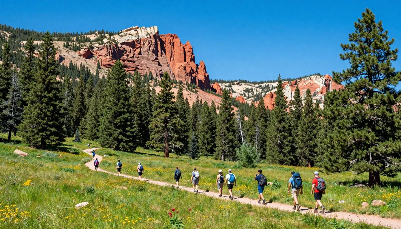
Highline Trail
This legendary route traverses the wilderness for 127 km (79 miles) from Hayden Pass to Mirror Lake Highway. The trail maintains relatively moderate elevation, staying mostly between 3,048-3,353 m (10,000-11,000 feet). Complete the entire route in six to eight days, or sample sections as shorter trips.
The path winds through diverse terrain including forests, meadows, and alpine basins. Numerous side trails branch to scenic lakes and peaks. This route provides quintessential High Uintas experiences with options for all skill levels.
Red Castle Lakes
These stunning lakes nestle beneath the distinctive Red Castle peak formation. The hike from China Meadows Trailhead covers approximately 27 km (17 miles) round trip. Moderately challenging terrain makes this accessible to fit hikers seeking remarkable alpine scenery.
The area receives considerable use but remains spectacular. Upper Red Castle Lake sits in a dramatic cirque with towering cliffs. Lower lakes offer gentler settings with excellent fishing opportunities.
Museums, Cultural Spots and Festivals
While the wilderness itself focuses purely on natural experiences, surrounding communities preserve regional history and culture. These sites provide context for understanding the land and its heritage.
Utah Field House of Natural History State Park Museum
Located in Vernal, this museum showcases prehistoric life and geological history. Outdoor dinosaur gardens display life-size replicas. Indoor exhibits explain the region’s ancient past and fossil discoveries. The museum helps visitors understand the geological forces that created the Uinta Mountains.
Western Heritage Museum
Also in Vernal, this facility documents pioneer settlement and ranching culture. Exhibits show how early settlers lived and worked in this challenging landscape. Historical photographs and artifacts tell stories of homesteading and development.
Ashley National Forest Ranger Stations
Several ranger stations around the wilderness provide educational information. Rangers share current conditions, safety tips, and natural history insights. Visitor centers display maps, wildlife information, and interpretive exhibits about forest ecology.
Nature and Outdoor Experiences
The High Uintas Wilderness creates endless opportunities for connecting with pristine nature. Activities span from peaceful lake contemplation to challenging peak ascents.

Backpacking Adventures
Multi-day trips allow deep wilderness immersion. Popular routes include loops through the Naturalist Basin, traverses along the Highline Trail, and explorations of remote northern basins. Most backpacking trips last three to seven days.
The terrain rewards those who venture beyond day-hike range. Remote lakes rarely see visitors, offering solitude and pristine camping. Wildlife encounters increase in less-traveled areas where elk, moose, and deer roam freely.
Fishing Opportunities
Over 400 lakes support populations of brook, cutthroat, and rainbow trout. Many lakes were historically stocked, though some now sustain natural reproduction. Fish sizes vary, with remote lakes often holding larger specimens.
Utah fishing licenses are required for anglers 12 years and older. Check current regulations as some lakes have special restrictions. Catch limits and size requirements protect fish populations. Barbless hooks reduce injury to released fish.
Wildlife Viewing
The wilderness supports diverse wildlife populations. Moose frequent willow-lined streams and lake shores, particularly during early morning and evening hours. Elk herds roam high meadows throughout summer months.
Mule deer appear commonly along trails and in forest clearings. These adaptable animals thrive across various elevations. Mountain goats inhabit the highest rocky peaks, though spotting them requires patience and binoculars.

Smaller mammals include marmots, pikas, and ground squirrels. These creatures add life to rocky areas and talus slopes. Birds range from ravens and Clark’s nutcrackers to rare sightings of golden eagles soaring above peaks.
Photography Locations
The wilderness offers extraordinary photography subjects year-round. Sunrise light transforms alpine lakes into mirrors reflecting surrounding peaks. Wildflower meadows explode with color during mid-summer weeks.
Popular photography destinations include Amethyst Lake, Island Lake, and the Red Castle formation. Each location provides unique compositions combining water, rock, and vegetation. Golden hour light creates magical conditions just after sunrise and before sunset.
Travel With Children
Family wilderness adventures create lasting memories, though careful planning ensures positive experiences. Choose appropriate trails and destinations matching children’s abilities and interests.
Recommended Family Trails
Mirror Lake Loop provides an easy 6.4 km (4 mile) walk suitable for young children. The relatively flat trail circles a scenic lake with mountain views. Numerous rest stops and interesting features maintain engagement.
Bald Mountain Trail offers more challenge with a 5.6 km (3.5 mile) round trip climb to a 3,596 m (11,800 foot) summit. Older children with hiking experience enjoy this moderately steep route. The panoramic views reward the effort.
Ruth Lake Trail extends 8 km (5 miles) round trip with gradual elevation gain. This route works well for families attempting their first overnight backpacking trip. The lake provides swimming opportunities and easy camping areas.

Safety Considerations
Altitude affects children differently than adults. Watch for signs of altitude sickness including headaches, nausea, and fatigue. Descend immediately if symptoms worsen. Proper hydration and gradual acclimatization prevent most problems.
Sun protection becomes critical at high elevation. Apply sunscreen frequently and ensure children wear hats and protective clothing. UV radiation intensifies with altitude, making sunburn more likely.
Cold nights surprise many families. Bring warm sleeping bags rated for below-freezing temperatures. Extra layers including hats and gloves keep children comfortable after sunset. Hypothermia risk increases quickly in cold, wet conditions.
Keeping Kids Engaged
Turn hikes into adventures with scavenger hunts and nature observation games. Encourage children to identify wildflowers, animal tracks, and bird calls. Field guides designed for young naturalists enhance learning.
Allow frequent breaks for snacks and exploration. Children need shorter hiking days with more rest stops than adult-only trips. Plan modest daily distances leaving energy for camp activities and play.
Money Saving Tips
Wilderness adventures can fit modest budgets with smart planning. The High Uintas offers tremendous value compared to developed tourist destinations.
Free and Low-Cost Access
No wilderness entry fees apply to most areas. Dispersed camping throughout the wilderness costs nothing beyond your camping gear. This contrasts sharply with national park entrance fees and campground charges.
Mirror Lake Highway requires a three-dollar day-use fee at developed recreation sites. Annual passes covering Ashley National Forest cost only 30 dollars, paying for themselves after ten visits. These minimal fees support trail maintenance and facilities.
Grocery Shopping Strategy
Purchase supplies in larger cities before reaching mountain communities. Prices increase in small gateway towns where selection decreases. Stock up in Salt Lake City or other urban areas along your route.
Bulk food stores offer excellent value for trail meals. Buy oatmeal, rice, pasta, and dried beans in large quantities. Repackage portions into lighter bags, eliminating excess packaging weight.
Equipment Rentals
Several outdoor shops in Salt Lake City rent backpacking gear including tents, sleeping bags, and packs. Renting specialized equipment makes sense for first-time visitors testing whether they enjoy wilderness camping. This approach costs less than buying quality gear for a single trip.
Visit During Shoulder Season
Late September offers empty trails and lower lodging rates in gateway towns. Hotels drop prices after summer peak season ends. You’ll find better availability and negotiating room for longer stays.
Safety, Etiquette and Local Customs
Wilderness safety requires knowledge, preparation, and sound judgment. The remote nature of the High Uintas means help sits hours or days away from most locations.
Essential Safety Practices
Always inform someone of your itinerary before entering the wilderness. Provide specific trailhead information, planned route, and expected return date. This simple step enables rescue efforts if problems arise.
Carry navigation tools including topographic maps, compass, and GPS device. Cell phones rarely have service within the wilderness. Download offline maps before departing and know how to use traditional navigation methods.

Pack comprehensive first aid supplies including treatment for blisters, cuts, sprains, and altitude sickness. Know how to use everything in your kit. Consider wilderness first aid training before tackling remote routes.
Lightning danger peaks during afternoon hours in summer. Storms build rapidly over high terrain. Avoid exposed ridges and summits after noon. Seek shelter in low areas away from isolated trees and water.
Water Treatment
All wilderness water sources require treatment before drinking. Even pristine-looking streams and lakes may harbor Giardia and other pathogens. Filter, boil, or chemically treat all drinking water.
Water filters provide convenient purification for most situations. Carry backup treatment tablets in case filters break or clog. During winter camping, chemical treatments work better than frozen filters.
Leave No Trace Principles
Pack out all trash including food scraps and toilet paper. The wilderness designation requires preserving natural conditions. What you carry in must come back out.
Camp on durable surfaces like rock, gravel, or established sites. Avoid creating new campsites in pristine areas. Set up at least 61 m (200 feet) from lakes and streams protecting riparian zones.
Minimize campfire impacts by using backpacking stoves for cooking. Where fires are permitted, use existing fire rings and burn wood completely to white ash. Never cut live trees or branches. Many high-elevation areas prohibit fires entirely due to scarce firewood.
Wildlife Etiquette
Observe animals from distance using binoculars or telephoto lenses. Never approach or feed wildlife. Moose become aggressive when feeling threatened, particularly mothers protecting calves. Give these large animals wide berth.
Store food properly preventing wildlife from accessing it. Habituated animals lose natural foraging behaviors and may require relocation or destruction. Protecting your food protects both you and the animals.
Visitor Comments About High Uintas Wilderness
O.H., Kapaa: “The High Uintas exceeded every expectation I had for a wilderness experience. We spent five days backpacking through the Naturalist Basin and encountered maybe a dozen other people the entire time. The lakes are absolutely pristine, and we saw moose nearly every evening. The elevation took some getting used to, but the stunning mountain views made every uphill step worthwhile. This is true wilderness in the best possible way.”
M.T., Sparks: “Our family took three children ages seven to thirteen on the Ruth Lake trail for our first overnight backpacking trip. The gradual elevation gain worked perfectly for getting the kids comfortable with wilderness camping. They loved fishing in the lake and spotting wildflowers along the way. We’ll definitely return for longer adventures as they get older. The High Uintas provide an ideal setting for introducing families to backcountry experiences.”
N.J., Pierre: “I summited Kings Peak in September and had the trail almost entirely to myself. The weather was perfect, though nights got quite cold. The route from Henry’s Fork challenged me physically, but reaching Utah’s highest point felt incredibly rewarding. Anyone attempting this peak needs to be prepared for serious hiking and potential weather changes. The wilderness feels vast and untamed up there.”
Additional Nearby Destinations
The High Uintas region offers numerous attractions beyond the wilderness itself. These nearby destinations complement wilderness visits with different perspectives on the area’s natural and cultural heritage.
Dinosaur National Monument
Located about 64 km (40 miles) east of Vernal, this monument protects one of the world’s most significant dinosaur fossil sites. The Quarry Exhibit Hall displays approximately 1,500 dinosaur bones still embedded in rock. River rafting through spectacular canyons provides adventure beyond the fossil exhibits.
Flaming Gorge National Recreation Area
This reservoir and surrounding canyon country sits northeast of the High Uintas. The dramatic red rock canyons contrast beautifully with the alpine wilderness. Activities include boating, fishing, camping, and scenic drives along rim roads. The area works well for rest days between wilderness trips.
Provo River
Flowing from the Uinta Mountains, the Provo River offers world-class fly fishing. Several sections provide excellent trout habitat with public access. The Middle Provo near Heber City ranks among Utah’s premier fishing destinations. Guided float trips help anglers access productive water.
Park City
This resort town sits about 97 km (60 miles) west of the High Uintas. Historic Main Street features shops, galleries, and restaurants. Summer activities include mountain biking, hiking, and scenic chairlift rides. The town provides upscale amenities contrasting with wilderness simplicity.
Practical Travel Tips
Successful High Uintas adventures depend on thorough preparation and realistic planning. These practical details help ensure smooth, enjoyable trips.
Physical Preparation
Start training several months before your trip if you don’t regularly hike with a loaded pack. Build endurance gradually with increasingly longer hikes carrying progressively heavier loads. The high elevation challenges even fit lowland residents.
Consider arriving one or two days early to acclimate to elevation. Spend time at moderate altitudes before pushing into high country. This adjustment period reduces altitude sickness risk and improves overall comfort.
Gear Essentials
Quality rain gear proves essential despite summer timing. Afternoon thunderstorms drench exposed hikers regularly. Waterproof jackets and pants keep you dry and prevent hypothermia in sudden weather changes.
Bring layers including insulating mid-layers and warm hats. Temperatures swing dramatically from day to night. What feels warm at noon may turn freezing by evening. Synthetic or wool fabrics dry quickly and retain warmth when wet.
Trekking poles reduce stress on knees during descents and improve stability on uneven terrain. They also help with stream crossings and provide support when tired. Many hikers initially resist poles but become converts after trying them.
Navigation and Communication
- USGS topographic maps of your route area
- Compass and knowledge of basic navigation
- GPS device with downloaded offline maps
- Personal locator beacon for emergencies
- Whistle for signaling if separated
Health and Safety Items
- Comprehensive first aid kit
- Water purification system plus backup
- Sunscreen and lip balm with high SPF
- Insect repellent for mosquito-prone areas
- Emergency shelter or bivy sack
Permits and Regulations
Most High Uintas areas don’t require permits for individual or small group camping. However, group size limits apply with maximum numbers varying by specific location. Check current regulations with Ashley National Forest or Wasatch-Cache National Forest offices.
Commercial outfitters and large organized groups need special permits. These requirements ensure the wilderness maintains its character and prevents overuse. Apply well in advance if leading commercial trips.
Leave Time Margins
Build flexibility into itineraries accounting for slower-than-expected progress, weather delays, or simple desires to linger in beautiful locations. Rigid schedules create stress and reduce enjoyment. The wilderness rewards those who move at nature’s pace rather than forcing predetermined timelines.
Photography Tips
Protect camera gear from moisture and temperature extremes. Waterproof cases safeguard electronics during stream crossings and rain. Condensation forms when bringing cold cameras into warm tents, so allow gradual temperature adjustment.
Bring extra batteries as cold temperatures drain power rapidly. Store batteries in inside pockets close to body heat overnight. Memory cards rarely fill up, but carry spares anyway for redundancy and peace of mind.
Environmental Responsibility
Use biodegradable soap sparingly and only far from water sources. Better yet, clean dishes with hot water and minimal or no soap. Scatter strained dishwater over wide areas rather than concentrating it in one spot.
Dispose of human waste properly by digging catholes 15-20 cm (6-8 inches) deep at least 61 m (200 feet) from water, trails, and camps. Pack out toilet paper in sealed bags rather than burying it. This practice prevents unsightly discoveries and protects water quality.
Your High Uintas Adventure Awaits
The High Uintas Wilderness stands ready to reward those who venture into its pristine landscapes. From challenging summit attempts to peaceful lakeside camps, this remarkable mountain range offers experiences matching every wilderness dream.
Whether you spend a single day exploring alpine meadows or embark on week-long backpacking odysseys, the Uintas create memories lasting far beyond your visit. The crystal lakes, soaring peaks, and abundant wildlife form a backdrop for personal discoveries and outdoor achievements.
Start planning your journey today. Research trails matching your abilities, gather necessary gear, and prepare for the elevation challenges. The wilderness will be there, timeless and magnificent, waiting to share its beauty with respectful visitors ready to experience true alpine solitude.