Hotels by Trip.com
Flights by Trip.com
The La Sal Mountain Loop Road stretches 97 km (60 miles) through one of Utah’s most dramatic landscape transitions. This round trip takes travelers from the red desert floor to alpine forests reaching 2,743 m (9,000′) elevation. Few realize this scenic drive connects two completely different ecosystems within a single afternoon adventure.
The name “La Sal” comes from Spanish explorers who thought the snow-capped peaks resembled salt deposits from a distance. They called them “Sierra La Sal,” meaning Salt Mountains.
This comprehensive guide reveals everything you need to experience this remarkable mountain loop. You’ll discover the best viewpoints, hidden trails, and practical tips for making the most of your journey through these mountains.
Getting There & Planning Your Journey

The loop road starts near Moab, Utah, making it accessible for day trips. Three major airports serve the area with connecting ground transportation.
Closest Airports:
- Canyonlands Field Airport (CNY) – 27 km (17 miles) from Moab, limited commercial service
- Grand Junction Regional Airport (GJT) – 177 km (110 miles) northeast, full commercial service
- Salt Lake City International Airport (SLC) – 375 km (233 miles) north, major hub with most flight options
Most visitors rent vehicles at these airports for the drive to the area. The road from Salt Lake City takes approximately four hours through scenic Utah landscapes.
The loop road begins on Utah State Route 128 along the Colorado River. You can access it from two main entry points near Moab. The northern access follows the river road through Castle Valley. The southern approach starts on La Sal Loop Road directly from Spanish Valley.
Plan at least half a day for the complete loop. Allow extra time for stopping at viewpoints, hiking trails, and photography. The dirt road sections require attention but remain passable for most vehicles during dry conditions.
Best Time to Visit & Weather Tips

Best Time to Visit La Sal Mountain Loop Road
Late spring through early fall offers the most reliable conditions for this mountain adventure. Each season brings distinct advantages for different interests.
Recommended Months:
- May through June – Wildflowers bloom, cooler temperatures, less crowded trails
- September through October – Fall colors transform aspens, comfortable weather, stunning photography
- July through August – All facilities open, warm weather, best for camping
Months to Avoid:
- November through April – Snow closes upper elevations, icy conditions on mountain sections
- Late July monsoon season – Afternoon thunderstorms, flash flood risk on dirt sections
Summer temperatures range from 21°C to 32°C (70°F to 90°F) in valleys. Mountain elevations stay 8-11°C (15-20°F) cooler. Spring and fall bring mild days of 15-24°C (60-75°F) with chilly nights near freezing.
Weather changes rapidly at higher elevations. Morning sunshine can turn to afternoon storms within hours. Bring layers regardless of the season.
Check 30,000+ Local Sightseeing Tours Worldwide
✓ Numerous languages and currencies are available
Notable Annual Festivals
The Moab area hosts several events that enhance your visit to the La Sal mountains region.
- Moab Music Festival – September, classical music in red rock settings, (435) 259-7003
- Moab Folk Festival – November, acoustic performances, (435) 259-2742
- La Sal Mountain Trail Run – July, mountain running event through alpine terrain
Getting Around Locally

Personal vehicles provide the best way to explore the sal loop road. Public transportation doesn’t serve this remote mountain area. Most visitors drive their own cars or rental vehicles.
The loop combines paved highways with maintained dirt sections. Standard cars handle the route during dry weather. High clearance vehicles perform better on rougher segments. Four-wheel drive isn’t necessary unless you venture onto side trails.
The road remains open year-round at lower elevations. Upper mountain sections close with winter snow. Check current conditions before starting your trip during shoulder seasons.
Fuel up in Moab before beginning the drive. No gas stations exist along the mountain loop road. The nearest services are in town, approximately 32 km (20 miles) from the farthest point.
Cell phone coverage disappears in many areas along the route. Download maps and directions before leaving. Bring a physical map as backup navigation.
Where to Stay

Lodging options cluster in Moab and along the Colorado River. The mountains themselves offer camping but no hotels or lodges.
Moab Accommodations:
- Hotels and motels – Full range from budget to luxury, convenient town location
- Vacation rentals – Condos and houses, ideal for families and groups
- Red Cliffs Lodge – Upscale riverside resort along the loop road route
Camping Options:
- Warner Lake Campground – High elevation camping near Warner Lake, first-come sites
- Oowah Lake Campground – Primitive camping, mountain lake setting
- La Sal Mountain dispersed camping – Free camping in designated forest areas
The Red Cliffs Lodge sits along Utah Route 128 near the northern loop entrance. This riverside property offers comfortable rooms with red rock views. The lodge provides a convenient base for exploring both the river road and sal mountain areas.
Mountain camping sites operate seasonally from late May through September. Elevations above 2,438 m (8,000′) can be quite cool even in summer. Bring warm sleeping bags for comfortable nights.
Dining & Local Cuisine

No restaurants or food services exist along the sal loop road itself. Plan accordingly by packing food and plenty of water for your mountain adventure.
Moab offers diverse dining ranging from casual cafes to upscale restaurants. Stop in town before or after your drive to enjoy local flavors.
The Red Cliffs Lodge features an on-site restaurant serving Southwestern cuisine. Their dining room overlooks the Colorado River with views toward Castle Valley and the mountains.
Pack a picnic to enjoy at scenic viewpoints along the way. Warner Lake and Oowah Lake provide beautiful settings for outdoor meals. Several pullouts offer tables and fantastic views of the desert below.
Bring more water than you think necessary. Mountain elevations and dry desert air increase hydration needs significantly. Plan for at least 3 liters (1 gallon) per person for a full day trip.
Attractions, Sightseeing & Activities

The loop road itself serves as the main attraction. Every turn reveals new perspectives on the changing landscape. Plan stops at key viewpoints to fully appreciate the scenery.
Scenic Viewpoints
Multiple pullouts provide safe places to stop and photograph the spectacular views. The transition from red rock desert to alpine forest creates ever-changing scenery.
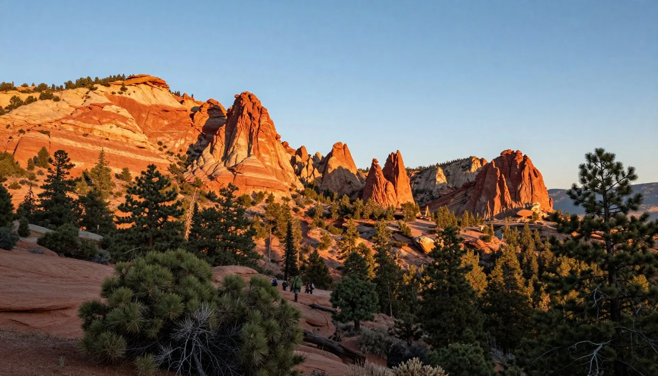
- Castle Valley Overlook – Panoramic views of red towers and Fisher Towers formations
- La Sal Viewpoint – Desert vistas stretching toward Arches and Canyonlands
- Geyser Pass – High elevation pass with 360-degree mountain views
Fisher Towers
These towering sandstone spires rise along the Colorado River near the northern loop entrance. The formations reach heights of 274 m (900′) above the valley floor. A hiking trail leads to their base for closer exploration.
Castle Valley
This stunning valley features massive red rock towers set against the sal mountains backdrop. The drive through Castle Valley ranks among Utah’s most scenic roads. Ancient formations create a landscape unlike anywhere else.
Museums, Cultural Spots & Festivals

The area’s cultural attractions center in Moab rather than along the mountain loop itself. Several museums provide context for the region’s natural and human history.
The Moab Museum showcases local history from ancient indigenous peoples through mining and ranching eras. Exhibits explain how the landscape shaped human settlement patterns.
Historic ranches dot the loop road area. These remnants of early settlement show how pioneers used the mountains for summer grazing. Many old cabins and corrals still stand among the aspens.
Indigenous peoples including the Ute tribe traditionally used these mountains. They harvested resources and hunted game in the high country. Respect any archaeological sites you might encounter.
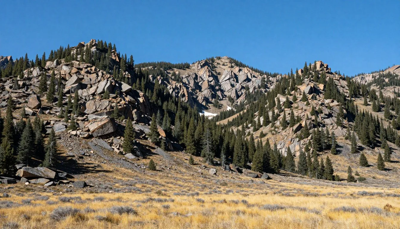
Nature & Outdoor Experiences

Outdoor adventures abound throughout the La Sal Mountain area. The diverse landscape supports activities from easy nature walks to challenging alpine adventures.
Hiking Trails
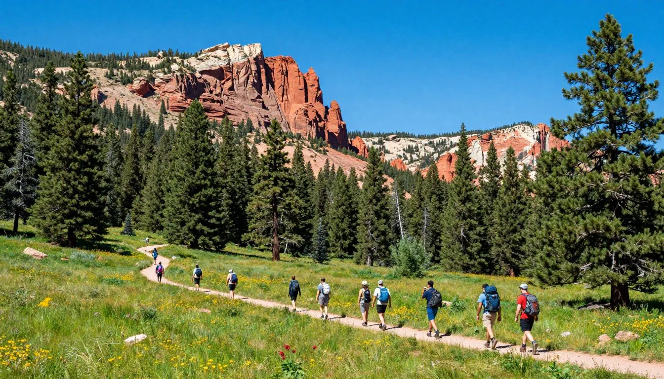
Numerous trails branch from the loop road into wilderness areas. Options range from short walks to full-day treks through mountain terrain.
- Warner Lake Trail – Easy 1.6 km (1 mile) walk around the mountain lake
- Trans-La Sal Trail – Challenging route through high alpine basins
- Burro Pass Trail – Moderate hike with excellent views of surrounding peaks
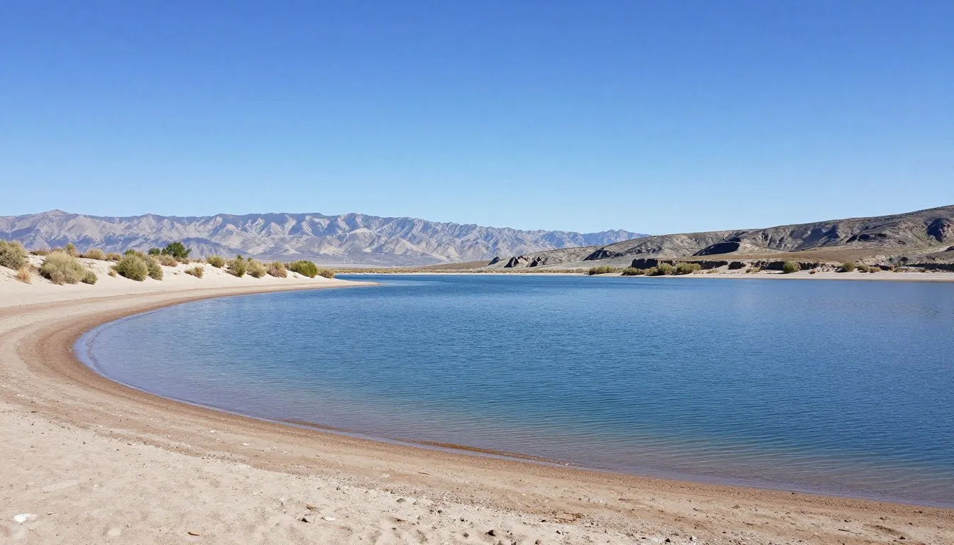
Mountain Lakes
Several alpine lakes dot the high country. Warner Lake covers approximately 4 hectares (10 acres) and sits at 2,896 m (9,500′) elevation. The lake offers fishing for brook trout during summer months.
Oowah Lake provides another scenic destination. This smaller lake nestles in a forested basin with good camping nearby. The area stays cooler even during hot summer days.
Wildlife Viewing
The mountains support diverse wildlife populations. Deer and elk frequent the forests and meadows. Black bears inhabit the area, making proper food storage essential at campsites.
Birds include mountain bluebirds, ravens, and various hawks. Early morning and evening offer the best wildlife viewing opportunities. Bring binoculars to observe animals from safe distances.
Photography
The changing views make this route a photographer’s paradise. Morning and evening light enhance the red rock formations. Midday sunshine illuminates the mountain peaks beautifully.
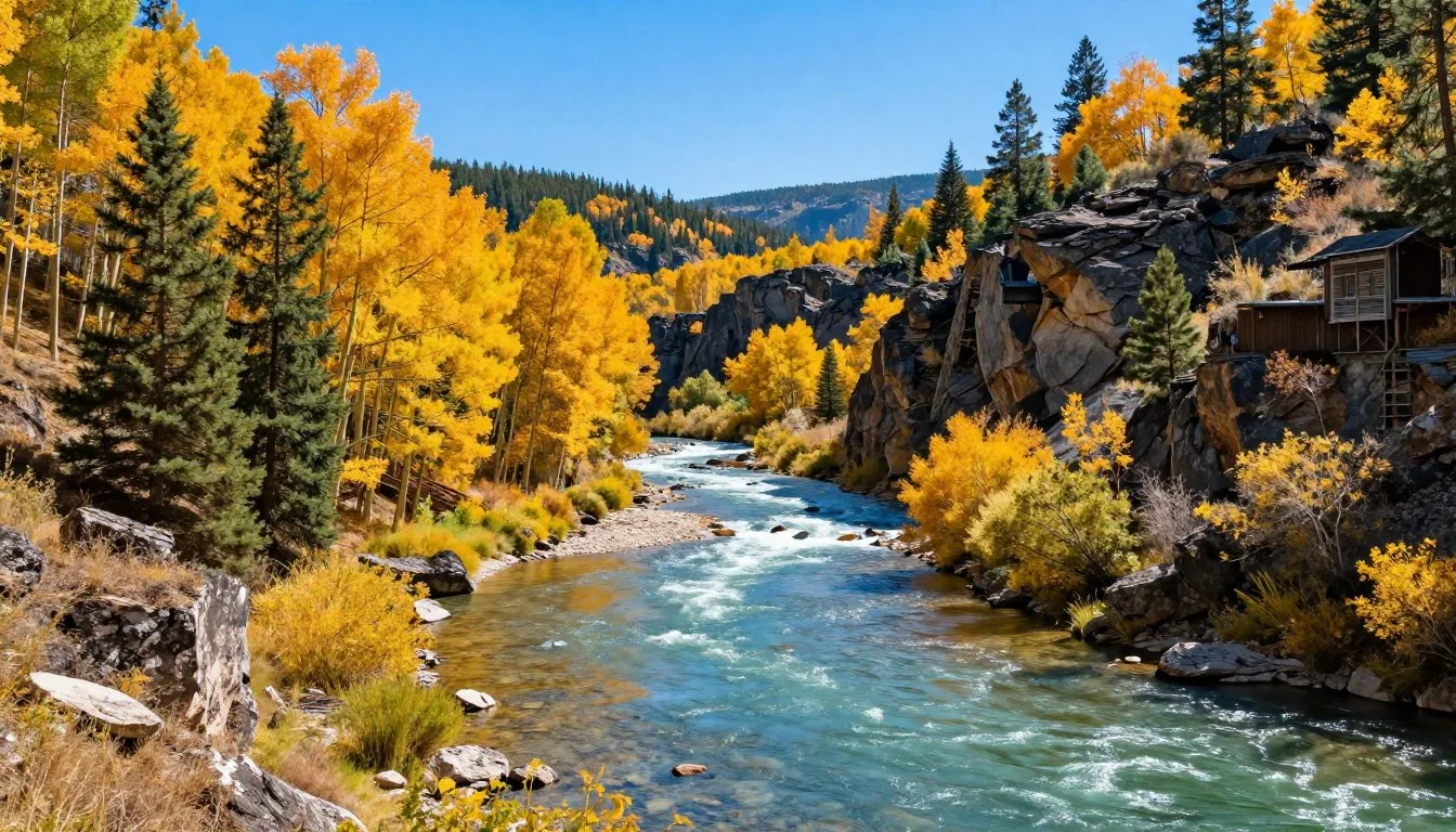
Aspens create stunning fall color displays. Late September through early October brings peak autumn hues. The contrast between golden trees and red rock produces unforgettable images.
Travel With Children

The loop road makes an excellent family adventure. Kids enjoy the dramatic scenery changes and chances to spot wildlife. Several aspects make this trip particularly family-friendly.
The drive itself provides entertainment for children. They can watch the landscape transform from desert to forest. Playing “I spy” with rock formations and wildlife keeps young travelers engaged.
Short walks at Warner Lake and other stops let kids stretch their legs. The lake trail stays relatively flat and easy for smaller children. Look for frogs, fish, and water birds around the shoreline.
Pack plenty of snacks and drinks for the journey. No stores exist along the mountain route. Bring favorite foods to avoid hunger-related meltdowns during the trip.
Cool mountain temperatures provide relief from desert heat. Even summer days stay comfortable at higher elevations. Bring light jackets for children as temperatures drop quickly in shade.
Money Saving Tips

Exploring the La Sal Mountain Loop Road costs minimal money compared to many Utah attractions. Smart planning reduces expenses further.
- Free access – No entrance fees for the loop road or mountain area
- Dispersed camping – Free camping in designated forest service areas
- Pack your own meals – Bring food and drinks to avoid restaurant costs
- Visit during shoulder seasons – Lower accommodation rates in Moab during spring and fall
- Self-guided tour – No need for paid tour guides on this well-marked route
Fill your gas tank in Moab where prices compete. Avoid running low and needing expensive emergency fuel. The entire round trip uses relatively little fuel.
Free camping at Warner Lake or dispersed sites saves significant money. These mountain sites rival expensive campgrounds for scenery. Arrive early to claim the best spots during busy summer weekends.
Bring your own recreation equipment rather than renting. Bikes, fishing gear, and hiking supplies from home cost nothing extra. The mountains offer endless free outdoor activities.
Safety & Local Customs

The remote mountain environment requires proper preparation and awareness. Understanding potential hazards ensures a safe and enjoyable adventure.
Road Conditions
Check current road conditions before starting your trip. The dirt sections become impassable when wet. Heavy rain turns the road to slippery mud requiring four-wheel drive or closure.
Drive slowly on unpaved sections to avoid damage to your vehicle. Sharp rocks can puncture tires. Carry a spare tire and know how to change it before heading into remote areas.
Weather Preparedness
Mountain weather changes rapidly without warning. Afternoon thunderstorms develop frequently during summer. Lightning poses serious danger above treeline. Descend from exposed areas when storms approach.
Bring warm layers even during summer. Temperatures at 2,743 m (9,000′) can drop to near freezing. Hypothermia risk exists year-round at high elevations.
Wildlife Safety
Black bears inhabit these mountains. Store food properly in bear-resistant containers at campsites. Never approach or feed any wildlife. Keep safe distances for observation.
Emergency Contacts
Cell service is unreliable throughout the mountains. Tell someone your plans before departing. Carry emergency supplies including first aid, extra food, and water.
For emergencies, contact Grand County Sheriff: (435) 259-8115. The nearest hospital is Moab Regional Hospital: (435) 719-3500.
Leave No Trace
Pack out all trash and waste. The area has no garbage facilities. Respect the landscape by staying on established roads and trails. Camp only in designated areas to protect fragile alpine environments.
Visitor Comments About La Sal Mountain Loop Road

“The contrast between the red desert and green mountains took my breath away. We stopped at every viewpoint and still didn’t want the drive to end. Warner Lake made a perfect picnic spot with incredible mountain reflections.”
“This scenic drive exceeded all expectations. The road conditions were better than anticipated, and our small car handled everything fine. We saw deer near Oowah Lake and the fall aspens were absolutely stunning. Best free adventure in Utah.”
“Pack plenty of water and snacks because there’s nothing up there. The views from Geyser Pass showed us why this loop is so special. We spent hours just taking photos and enjoying the fresh mountain air. Planning to return for the wildflowers next spring.”
Additional Nearby Destinations

The Moab area offers numerous other attractions worth exploring during your visit. These destinations combine well with the mountain loop for a comprehensive Utah adventure.
- Arches National Park – Famous red rock arches, 8 km (5 miles) from Moab
- Canyonlands National Park – Vast canyon landscapes, 51 km (32 miles) southwest
- Dead Horse Point State Park – Spectacular overlook above the Colorado River
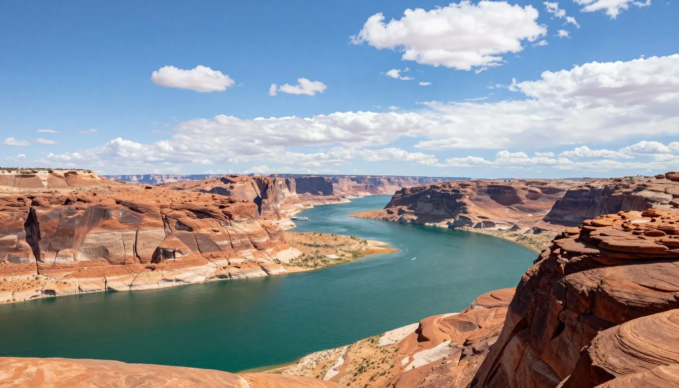
- Colorado River – Rafting, kayaking, and scenic drives along the water
- Moab downtown – Restaurants, shops, museums, and services
The La Sal Mountain Loop Road connects naturally with the Colorado River scenic byway. Many visitors combine both routes in a single day. This creates a complete tour showcasing the area’s diverse landscapes.
Castle Valley provides another worthwhile detour. This stunning valley lies along the northern approach to the loop road. Add an hour for exploring this remarkable area.
Practical Travel Tips

These final tips help ensure a smooth and memorable trip through the sal mountains area.
Essential Items to Bring
- Full tank of gas – No services along the entire loop
- Extra water – At least 3 liters (1 gallon) per person
- Food and snacks – Pack enough for the full day
- Layered clothing – Temperatures vary by elevation
- Sun protection – Sunscreen, hat, and sunglasses
- Camera – Countless photo opportunities await
- Physical map – Cell coverage is unreliable
Timing Your Visit
Start early in the day for the best experience. Morning light enhances photography and wildlife viewing. Afternoon storms become more likely during summer months.
Allow four to six hours for the complete round trip with stops. Add extra time for hiking trails or extended photography sessions. Some visitors prefer splitting the loop across two days with mountain camping.
Photography Tips
Bring multiple camera batteries and memory cards. The spectacular scenery will fill cards quickly. Morning and evening light create the most dramatic images.
Use polarizing filters to enhance blue skies and reduce glare. Wide-angle lenses capture the expansive vistas. Telephoto lenses work well for wildlife and distant mountain peaks.
Respecting the Environment
Stay on established roads and trails to protect fragile ecosystems. Camp only in designated areas. Pack out everything you bring in, leaving no trace of your visit.
The La Sal Mountains belong to everyone. Your careful stewardship ensures future generations can enjoy this remarkable landscape.
Location Map
Your Mountain Adventure Awaits
The La Sal Mountain Loop Road delivers an unforgettable journey through contrasting landscapes. You’ll experience dramatic desert vistas, towering red rock formations, cool alpine forests, and pristine mountain lakes all within a single drive.
This accessible adventure requires no special permits or fees. The well-maintained route welcomes families, photographers, and nature lovers seeking authentic Western beauty. Every season paints the landscape in different colors, from spring wildflowers to golden autumn aspens.
Pack your camera, fill your tank, and set aside a full day for exploration. The sal mountains and surrounding desert landscape will exceed your expectations. This remarkable corner of Utah has been waiting to share its secrets with you.