Hotels by Trip.com
Flights by Trip.com
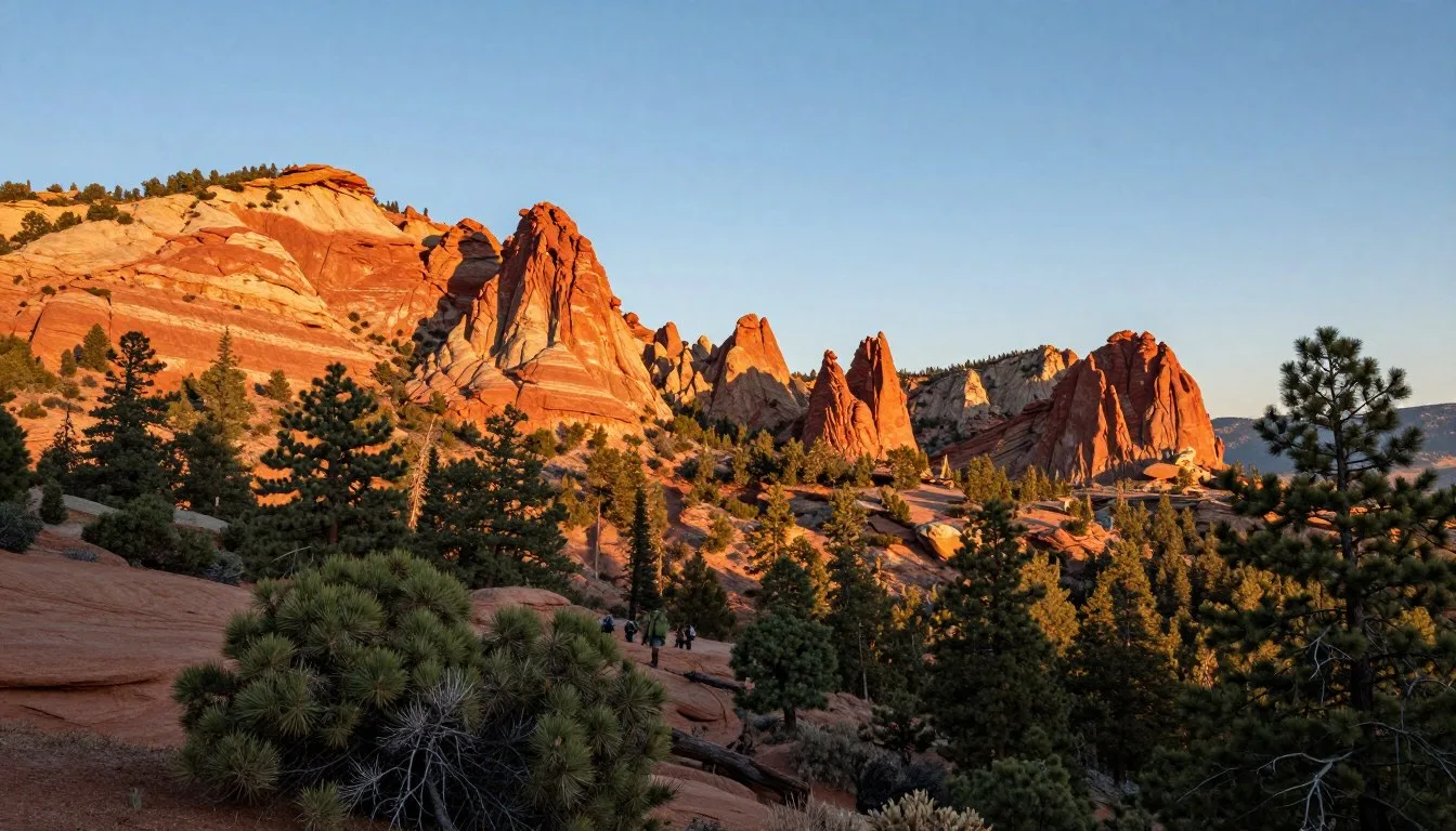
The La Sal Mountains reach heights of 3,877 meters (12,721 feet), making them the second-highest mountain range in Utah and creating a stunning contrast against the surrounding red rock desert. These peaks were named by Spanish explorers who mistook their snow-capped summits for massive salt deposits, giving rise to the name “La Sal,” which means “the salt” in Spanish.
Rising dramatically from the desert floor near Moab, these ancient mountains offer visitors a rare opportunity to experience alpine forests and meadows just minutes from canyon country. The range provides year-round recreation and serves as a cool refuge during scorching summer months.
This comprehensive guide covers everything you need to know about visiting the La Sal Mountains. From scenic drives to hiking trails, camping spots to cultural experiences, you’ll discover why this destination deserves a place on your Utah adventure itinerary.
Getting There and Planning Your Journey

The closest major airports to the La Sal Mountains are Canyonlands Field Airport in Moab, located just 29 kilometers (18 miles) from the mountain base. This regional airport offers limited commercial flights and serves as a convenient option for visitors.
For more flight options, Grand Junction Regional Airport in Colorado sits 177 kilometers (110 miles) northeast. This facility provides broader airline service and competitive pricing. Salt Lake City International Airport, located 381 kilometers (237 miles) northwest, offers the most extensive flight connections for international and domestic travelers.
The drive from Moab to the La Sal Mountains takes approximately 30 minutes via Highway 191 and the La Sal Mountain Loop Road. This scenic route provides access to trailheads, campgrounds, and viewpoints throughout the range. Most visitors rent vehicles in Moab or Grand Junction for maximum flexibility exploring the area.
Planning ahead ensures a smoother experience. The Manti-La Sal National Forest requires no entrance fees, making budget planning straightforward. However, some recreation areas charge small day-use fees. Book accommodations early during peak season from June through September when lodging fills quickly.
Best Time to Visit and Weather Tips
Best Time to Visit La Sal Mountains
Late spring through early fall offers ideal conditions for mountain exploration. May through October provides the most accessible period when higher elevation roads remain open and trails become snow-free.
Summer months from June through August deliver perfect hiking weather with daytime temperatures ranging from 21°C to 27°C (70°F to 80°F) at higher elevations. The mountains provide welcome relief from desert heat below, where temperatures often exceed 38°C (100°F).

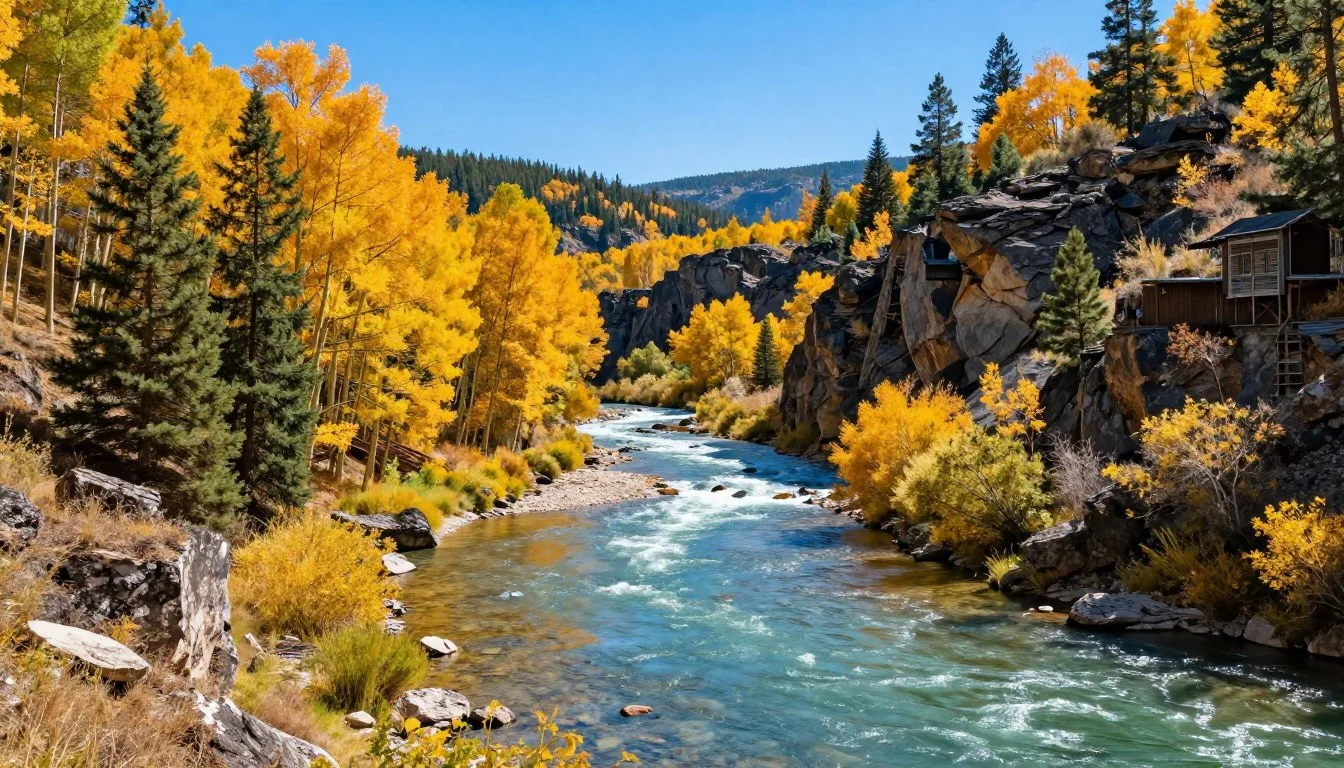
September and early October bring spectacular fall colors as aspen groves transform into golden canopies. Crowds thin considerably during autumn, creating peaceful trail experiences. Temperatures cool to 15°C to 21°C (60°F to 70°F), perfect for outdoor activities.
Winter transforms the range into a snowy wonderland from November through April. While the La Sal Mountain Loop Road closes to vehicles, the area attracts snowshoers, cross-country skiers, and backcountry enthusiasts. Winter temperatures drop to -7°C to 2°C (20°F to 35°F) at higher elevations.
Avoid visiting during late March and April when spring snowmelt creates muddy conditions. Roads become impassable and trails turn into quagmires. This shoulder season offers little enjoyment for most recreational activities.
Notable Annual Festivals
The Moab Music Festival runs each September, featuring chamber music performances in stunning natural settings including venues near the La Sal Mountains. Contact organizers at +1 (435) 259-7003 for performance schedules and ticket information.
Moab Folk Festival takes place each November, celebrating acoustic music traditions. While based in town, many visitors combine festival attendance with mountain exploration during the crisp autumn season.
Getting Around Locally
Personal vehicles provide the most practical transportation for exploring the sal mountains and surrounding Manti-La Sal National Forest. The primary route through the range, the La Sal Mountain Loop Road, stretches 103 kilometers (64 miles) and requires your own transportation.
This paved loop road connects to Highway 191 at two points south of Moab. The eastern section climbs through diverse ecosystems from desert scrubland through aspen groves to alpine forests. Most standard vehicles handle the route comfortably during summer months.

Mountain biking offers another popular way to experience the area. The loop road attracts serious cyclists who tackle the challenging elevation gain. Numerous forest service roads branch from the main route, providing options for mountain bike exploration.
No public transportation serves the mountain range itself. Shuttle services and guided tours operate from Moab, offering alternatives for visitors without personal vehicles. These tours typically combine mountain visits with other area attractions.
Four-wheel-drive vehicles open additional backcountry access. Many unpaved forest roads require high clearance and often 4WD capability. Check current road conditions with the Moab Ranger District before attempting unmaintained routes.
Where to Stay
Moab serves as the primary base for La Sal Mountains visitors, offering the widest accommodation selection. The town sits just 29 kilometers (18 miles) from mountain access points and provides options from budget motels to upscale resorts.
Pack Creek Ranch offers a unique mountain lodging experience within the range itself. This historic property provides cabin accommodations surrounded by spectacular scenery at the base of the peaks. Limited availability makes advance booking essential.

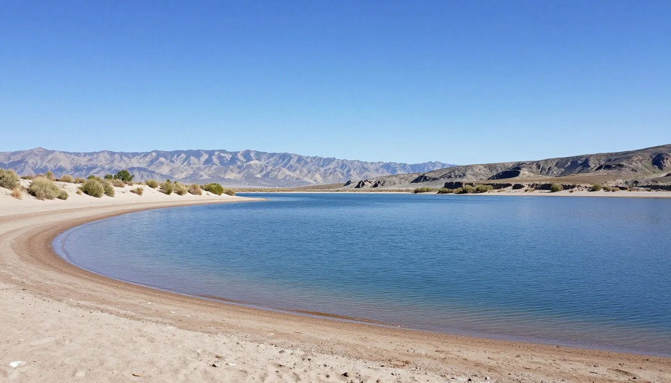
Camping enthusiasts find numerous options throughout the Manti-La Sal National Forest. Warner Lake Campground sits at 2,804 meters (9,200 feet) elevation and offers 20 sites near a pristine mountain lake. The campground operates from late May through September, depending on snow conditions.
Oowah Lake provides another developed camping area with stunning alpine scenery. Both lakes require reservations during peak summer weekends. Dispersed camping remains available throughout the national forest for those seeking solitude.
Castle Valley, located along the western approach to the mountains, features several vacation rental properties. These accommodations provide stunning red rock and mountain views while maintaining proximity to both Moab and the sal mountain loop road.
Dining and Local Cuisine
Most dining options concentrate in Moab rather than within the mountain range itself. Pack Creek Ranch operates a dining room for guests, but visitors should plan to bring supplies for mountain picnics and day trips.
Moab restaurants range from casual cafes to upscale establishments. The town’s dining scene reflects its outdoor recreation focus, with many eateries catering to hungry hikers and adventurers. Local breweries serve craft beers perfect for post-hike refreshment.

Several Moab establishments emphasize local and regional ingredients. Southwestern cuisine appears frequently on menus, incorporating flavors from Utah, Colorado, and New Mexico culinary traditions. Fresh trout from nearby waters features as a regional specialty.
Stock up on picnic supplies before heading into the mountains. Moab grocery stores provide everything needed for trail lunches and campsite meals. Many visitors prepare simple meals to enjoy at scenic overlooks along the loop road or at lakeside locations.
Remember that bears inhabit the mountain area. Proper food storage becomes essential at campsites and trailheads. Use bear-proof containers or hang food appropriately to protect both wildlife and your supplies.
Attractions, Sightseeing, and Activities
La Sal Mountain Loop Road
The sal mountain loop road ranks as the area’s premier scenic drive. This 103-kilometer (64-mile) route climbs from desert elevations through multiple ecological zones, showcasing dramatic landscape transitions.

Multiple pullouts along the route provide photo opportunities and interpretive information. The drive typically takes three to four hours without stops, but allow a full day to fully appreciate the scenery and explore side routes.
Geyser Pass Road branches from the main loop, leading to high-altitude viewpoints. This unpaved section requires careful driving but rewards visitors with spectacular vistas of Castle Valley and Arches National Park in the distance.
Warner Lake
Warner Lake sits nestled at high elevation, offering pristine alpine beauty. The lake spans approximately 6 hectares (15 acres) and provides excellent trout fishing opportunities. A gentle trail circles the shoreline, perfect for families and casual hikers.
The campground at Warner Lake serves as a base for exploring surrounding peaks and trails. Early morning visits often reveal wildlife including deer and elk near the water’s edge. The area remains wonderfully peaceful compared to crowded national parks nearby.
Castle Valley
Castle Valley stretches along the western base of the mountains, featuring iconic red rock formations. Castleton Tower and the Priest and Nuns formations create a dramatic skyline against mountain backdrops. This valley attracts rock climbers from around the world.

The valley road provides easy scenic access without strenuous hiking. Numerous pullouts allow visitors to appreciate the unique geology. Many consider the drive through Castle Valley equally impressive as the mountain loop itself.
Museums, Cultural Spots, and Festivals
The La Sal Mountains themselves contain limited cultural facilities, but nearby Moab offers several educational attractions. The Moab Museum of Film and Western Heritage documents the area’s role in Hollywood productions and Western settlement history.
Hole N’ The Rock represents a unique roadside attraction located along the route between Moab and the mountains. This 5,000-square-foot home carved into a massive rock formation offers tours showcasing pioneer ingenuity and determination.
The Moab Information Center provides forest service maps, trail conditions, and ranger advice for mountain exploration. Staff members share current information about road conditions, weather concerns, and wildlife activity in the Manti-La Sal National Forest.
Native American heritage runs deep throughout the region. Ancestral Puebloan peoples inhabited the area for centuries, leaving petroglyphs and archaeological sites. Respect these cultural resources by observing but never touching or disturbing artifacts.
Local art galleries in Moab showcase landscape paintings and photography featuring the mountains. These galleries often display works by artists who draw inspiration from the dramatic scenery and changing seasons in the range.
Nature and Outdoor Experiences
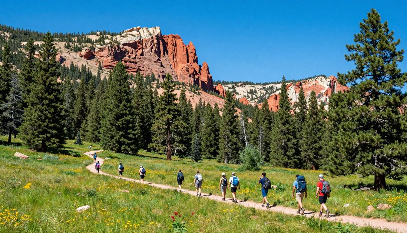
Hiking Trails
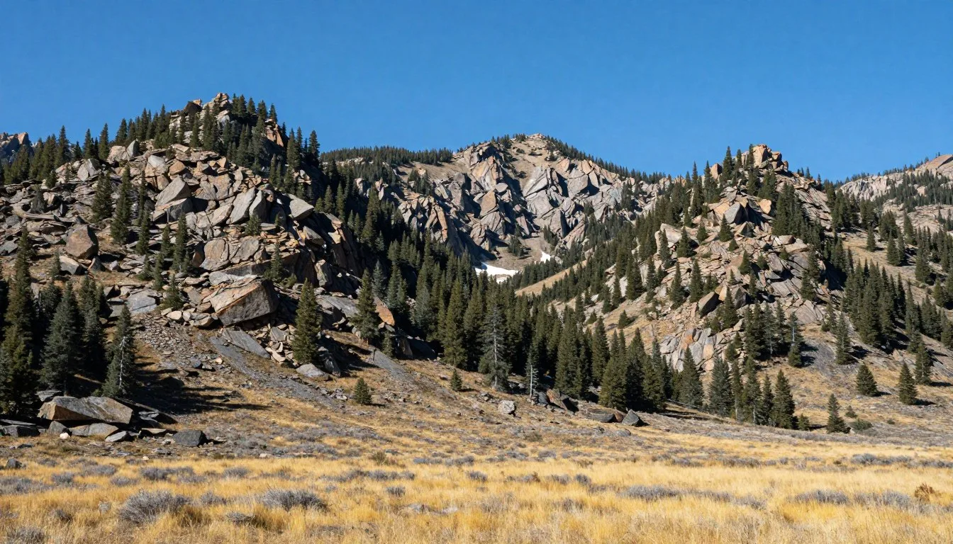
The Manti-La Sal National Forest offers dozens of trails ranging from easy nature walks to challenging summit ascents. Mount Peale, the range’s highest peak at 3,877 meters (12,721 feet), attracts experienced hikers seeking alpine adventure.

Burro Pass Trail provides a moderate 6.4-kilometer (4-mile) hike through aspen groves and meadows. The trail gains 305 meters (1,000 feet) elevation and reaches a high saddle with views spanning from the Colorado River to distant peaks.
Trans-La Sal Trail System creates an extensive network for mountain bikers and hikers. These interconnected routes allow multi-day backcountry trips through remote wilderness areas. Proper navigation skills and preparation become essential for extended adventures.
Wildlife Viewing
The mountains support diverse wildlife populations. Deer and elk browse mountain meadows, particularly visible during early morning and evening hours. Black bears inhabit the area, requiring proper food storage and awareness from visitors.
Mountain lions roam the range but remain elusive and rarely seen. Smaller mammals including marmots, pikas, and chipmunks entertain hikers along trails. Bird enthusiasts spot numerous species including raptors soaring above ridgelines.
Fishing Opportunities
Mountain lakes and streams provide excellent fishing for rainbow and brook trout. Warner Lake and Oowah Lake remain consistently productive, with regular stocking supplementing natural populations. Utah fishing licenses apply throughout the national forest.

Small streams tumbling down mountain slopes offer intimate fly-fishing experiences. These waters require skill and patience but reward anglers with solitude and natural beauty. Practice catch-and-release to preserve these delicate fisheries.
Winter Recreation
Snow transforms the sal mountains into winter recreation destination. Cross-country skiing and snowshoeing replace hiking as primary activities. The closed loop road becomes a snow-covered route for Nordic skiing adventures.
Backcountry skiing attracts experienced winter enthusiasts seeking untracked powder. Avalanche danger exists throughout the range during winter months. Proper training, equipment, and local knowledge become absolutely essential for safe winter backcountry travel.
Travel With Children
The La Sal Mountains offer family-friendly recreation opportunities with proper planning. Warner Lake provides an ideal introduction to mountain environments for children. The short loop trail around the lake accommodates small legs and short attention spans.

Picnic areas along the loop road provide easy stops for families. These developed sites feature tables, restrooms, and often interpretive displays. Children enjoy the dramatic elevation changes and ecosystem transitions visible during the scenic drive.
Junior Ranger programs operate throughout the Manti-La Sal National Forest during summer months. These activities help children learn about mountain ecology, wildlife, and conservation. Contact the Moab Ranger District for current program schedules.
Keep elevation changes in mind when traveling with young children. The rapid ascent from Moab at 1,228 meters (4,026 feet) to mountain areas above 2,743 meters (9,000 feet) can cause discomfort. Allow time for acclimatization and watch for altitude sickness symptoms.
Wildlife safety becomes particularly important with children. Teach kids to observe animals from safe distances and never approach or feed wildlife. Bear awareness and proper trail etiquette create learning opportunities while ensuring family safety.
Money Saving Tips
The Manti-La Sal National Forest charges no entrance fees, immediately making mountain exploration budget-friendly. Unlike nearby Arches National Park and Canyonlands, visitors access the entire area without paying admission charges.
Camping costs significantly less than hotel accommodations. Developed campgrounds charge modest fees around fifteen to twenty dollars per night. Dispersed camping throughout the forest remains completely free when following Leave No Trace principles.

Pack your own food and beverages rather than relying on restaurants. Moab grocery stores offer better value than dining establishments. Preparing trail lunches and campsite meals reduces trip costs substantially while providing flexibility.
Visit during shoulder seasons for the best accommodation rates in Moab. Late May through early June and September through October offer pleasant weather with significantly lower lodging prices compared to peak summer months.
Self-guided exploration costs nothing beyond transportation. The loop road, viewpoints, and many trails require no fees or permits. Download free forest service maps before arriving to minimize expenses while maximizing experience.
Consider multi-day visits to maximize value from travel expenses. The area provides enough variety for week-long stays. Combining mountain exploration with visits to nearby national parks creates comprehensive Utah adventure without additional travel costs.
Safety and Local Customs
Afternoon thunderstorms develop frequently during summer months in the mountains. Lightning poses serious danger on exposed ridges and peaks. Start hikes early and descend before afternoon storm development, typically beginning around 2:00 PM.
Altitude affects many visitors unaccustomed to elevation. The rapid climb from Moab to high mountain areas can trigger headaches, nausea, and fatigue. Stay hydrated, move slowly, and allow acclimatization time before strenuous activities.

Cell phone coverage remains spotty throughout the mountain range. Inform someone of your plans before heading into remote areas. Carry paper maps and basic navigation tools rather than relying solely on electronic devices.
Wildlife encounters require appropriate responses. Make noise while hiking to avoid surprising bears. Store food properly at campsites. Never approach or feed any wildlife, regardless of how harmless animals appear.
Leave No Trace principles guide proper outdoor behavior throughout the national forest. Pack out all trash, stay on established trails, and camp at designated or well-used sites. Respect closures protecting sensitive resources or wildlife habitat.
Water sources in the mountains require treatment before drinking. Giardia and other pathogens exist in even pristine-looking streams and lakes. Carry adequate water or reliable purification methods for all backcountry travel.
Weather changes rapidly at high elevations. Bring layered clothing even for summer day hikes. Temperatures can drop dramatically with elevation gain or afternoon storms. Hypothermia remains possible even during warm months.
Visitor Comments About La Sal Mountains
N.D., Leeds: “The sal mountain loop road exceeded all expectations. We stopped at numerous viewpoints and each offered completely different scenery. The contrast between red rock desert and alpine forest within such short distance amazed us. Warner Lake provided a perfect picnic spot with stunning reflections of the peaks.”
W.D., Hayward: “After days exploring Arches and Canyonlands national parks, the cool mountain air felt like paradise. We camped at Warner Lake and woke to elk grazing near our site. The hiking trails offered solitude we couldn’t find in the crowded parks. This became the highlight of our Utah trip.”
A.O., Hawick: “Castle Valley views left us speechless. The combination of red rock formations with snow-capped mountain peaks created scenery unlike anywhere else we’ve traveled. The drive itself justified the trip, but we also enjoyed excellent hiking and saw abundant wildlife. We’ll definitely return to explore more of the Manti-La Sal National Forest.”
Additional Nearby Destinations
Arches National Park sits just north of Moab, featuring over 2,000 natural stone arches. The park’s famous Delicate Arch and Landscape Arch attract visitors from around the world. Advanced reservations become necessary during peak season for timed entry.

Canyonlands National Park encompasses vast wilderness divided into distinct districts. The Island in the Sky district provides easily accessible overlooks while the Needles and Maze districts offer remote backcountry adventures. Each section showcases unique Colorado River canyon geology.
Dead Horse Point State Park overlooks a dramatic Colorado River gooseneck from sheer cliff edges. The viewpoint ranks among the most photographed vistas in the Southwest. Sunrise and sunset transform the scenery with spectacular light displays.
Colorado River recreation includes rafting trips ranging from calm scenic floats to challenging whitewater adventures. Daily raft trips depart from Moab, offering alternatives to mountain activities. Multi-day expeditions explore remote canyon reaches.
Fisher Towers trail leads to massive sandstone spires rising dramatically from the desert floor. The 3.7-kilometer (2.3-mile) route provides close-up views of these geological wonders. Castle Valley scenery complements the tower formations throughout the hike.
Professor Valley stretches along the Colorado River between Moab and Castle Valley. This scenic corridor has appeared in countless Western films and commercials. The river road offers stunning views of red rock formations backed by the sal mountains.
Practical Travel Tips
Download offline maps before departing Moab. Cell service disappears throughout much of the mountain route. GPS devices work reliably, but paper backup maps provide additional security for navigation.
Gas stations exist only in Moab and surrounding communities. Fill your tank before heading into the mountains. The loop road distance combined with elevation changes consumes more fuel than typical driving.
Restroom facilities remain limited along the mountain route. Developed campgrounds and picnic areas provide the only reliable options. Plan accordingly and practice Leave No Trace principles when nature calls between facilities.
Sunrise and sunset create magical lighting in the mountains. Early morning drives encounter less traffic and often reveal wildlife activity. Evening light transforms red rock formations and mountain peaks into brilliant displays.
Check current conditions before traveling. The Moab Ranger District provides updates on road status, trail conditions, and fire restrictions. Summer wildfire danger sometimes closes forest areas or restricts campfire use.
Bring binoculars for wildlife viewing and distant vista appreciation. The varied terrain and elevation changes offer opportunities to spot animals and geological features invisible to unaided eyes. Magnification enhances the mountain experience significantly.
Respect private property boundaries throughout Castle Valley and other areas. Much of the valley remains privately owned despite national forest surroundings. Stay on public roads and designated access points.
Your Mountain Adventure Awaits
The La Sal Mountains stand ready to transform your Utah experience from ordinary to extraordinary. These peaks offer refuge from desert heat, stunning scenery rivaling any national park, and peaceful trails far from tourist crowds.
Whether you seek challenging summit hikes, scenic drives through changing ecosystems, family camping adventures, or simply cool mountain breezes during summer heat, this range delivers. The combination of accessibility and wilderness character creates perfect conditions for memorable outdoor experiences.

Start planning your mountain journey today. The sal mountains rarely disappoint visitors who venture beyond Moab’s famous national parks. These peaks hold secrets worth discovering, views worth photographing, and memories worth creating. Your adventure in Utah’s second-highest range promises experiences you’ll treasure for years to come.