Hotels by Trip.com
Flights by Trip.com
Stretching across 556,178 hectares (1,374,419 acres) of southeastern Utah wilderness, Manti-La Sal National Forest contains the second-highest mountain range in the state. This remarkable forest encompasses two distinct divisions separated by more than 80 kilometers (50 miles) of desert terrain.
The forest derives its name from two Spanish-influenced sources. The Manti division honors the ancient Book of Mormon city, while the La Sal Mountains were named by early Spanish explorers who mistook snow-covered peaks for salt deposits, calling them “the salt mountains.”
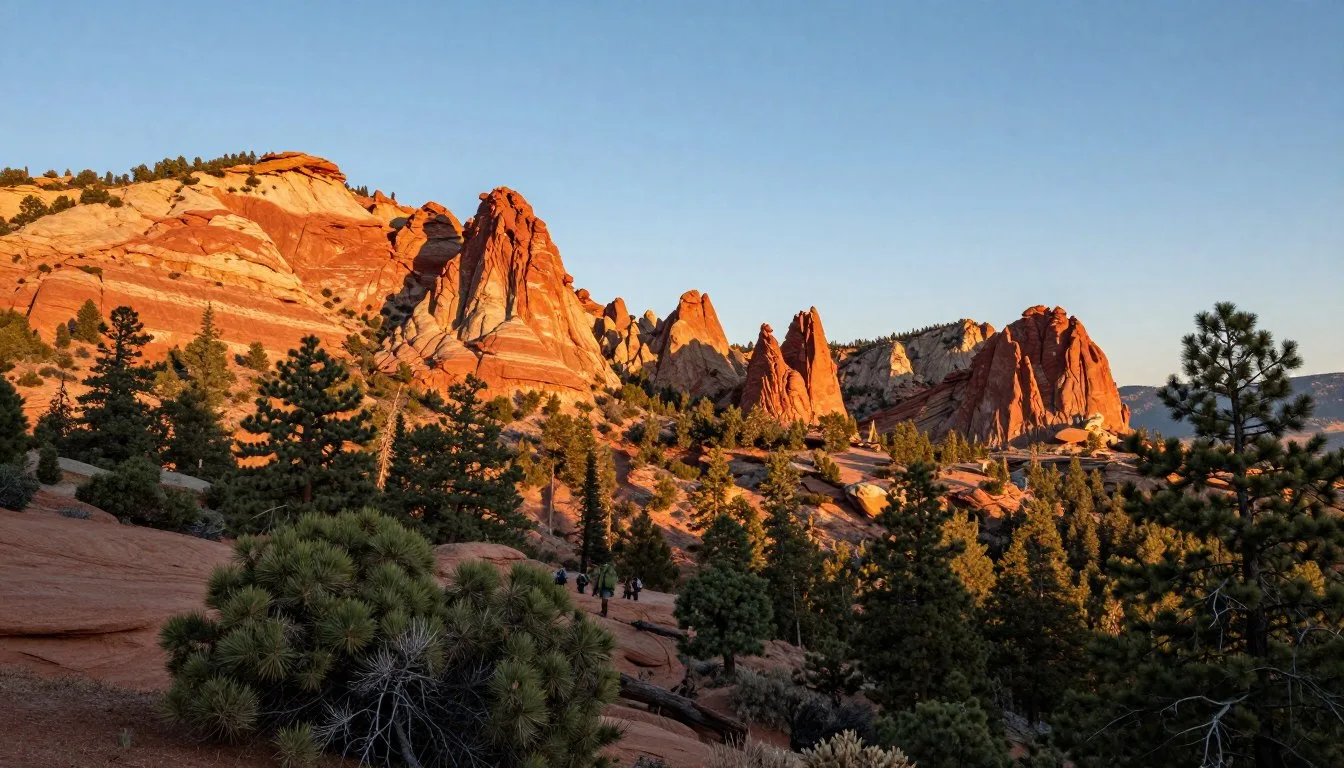
This unique landscape transitions from desert canyons at 1,524 meters (5,000 feet) to alpine peaks exceeding 3,658 meters (12,000 feet). The Sal Mountains rise dramatically from surrounding red rock terrain, creating one of Utah’s most striking natural contrasts.
Getting There & Planning Your Journey

Accessing Manti-La Sal National Forest requires planning based on which division you plan to visit. The forest spans two separate mountain ranges with different entry points and accessibility options.
Closest Airports
Several airports serve the Manti-La Sal National Forest area:
- Grand Junction Regional Airport, Colorado – 177 kilometers (110 miles) from the La Sal Division, offering the most flight options
- Canyonlands Field Airport, Moab – 64 kilometers (40 miles) from La Sal trailheads, smaller regional facility
- Salt Lake City International Airport – 322 kilometers (200 miles) northwest, major hub with extensive connections
- Provo Municipal Airport – 209 kilometers (130 miles) from Manti Division
Most visitors fly into Grand Junction or Salt Lake City and rent vehicles. The journey from these airports traverses spectacular canyon country and provides stunning introduction to southeastern Utah landscapes.
Rental vehicles are essential as public transportation does not serve the forest. Four-wheel-drive vehicles are recommended for accessing remote trailheads and backcountry areas, particularly during spring snowmelt and afternoon thunderstorm seasons.
Best Time to Visit & Weather Tips

Timing your visit to Manti-La Sal National Forest dramatically affects your experience. The forest’s elevation range creates diverse microclimates and seasonal variations across different zones.
Best Time to Visit Manti-La Sal National Forest
Recommended Seasons
Late June through September – Peak season for high-elevation trails, alpine lakes, and mountain biking. Temperatures range from 15°C to 24°C (60°F to 75°F) at elevation.
September to mid-October – Spectacular fall foliage transforms aspen forests into golden wonderlands. Cooler temperatures and fewer crowds make this ideal for photography.
May to early June – Lower elevation areas accessible while higher trails remain snow-covered. Wildflowers bloom prolifically across meadows and hillsides.
Seasons to Avoid
November through April – Heavy snowfall closes most forest roads and high-elevation trails. Avalanche danger exists in steep terrain. Temperatures plunge to -18°C (0°F) or below.
Late July through August afternoons – Intense thunderstorms develop rapidly, creating lightning hazards above treeline. Morning starts recommended for summit attempts.
Weather Patterns
The Sal Mountains create their own weather systems. Temperatures drop approximately 3°C (5.5°F) for every 305 meters (1,000 feet) of elevation gain. Summer mornings start cool at 7°C (45°F) even when valleys reach 32°C (90°F).
Afternoon thunderstorms occur frequently from mid-July through August. These storms build rapidly, producing lightning, hail, and heavy rain within minutes. Plan summit attempts and exposed ridge hikes for early morning completion.
Winter transforms the forest into deep snow country. Accumulations exceed 508 centimeters (200 inches) annually at higher elevations, creating excellent backcountry skiing conditions for experienced winter adventurers.
Notable Annual Festivals

The communities surrounding Manti-La Sal National Forest celebrate the region’s outdoor heritage and cultural traditions through seasonal events. These festivals showcase local culture while highlighting the area’s natural attractions.
Moab Folk Festival
This three-day music celebration occurs each November in nearby Moab. The festival features regional musicians, outdoor workshops, and community gatherings. Contact organizers at 435-259-3198 for current year dates and programming.
Ephraim Scandinavian Festival
Held annually on Memorial Day weekend, this event honors the Scandinavian heritage of early settlers. The festival includes traditional foods, folk dancing, and cultural demonstrations. Information available at 435-283-4631.
Manti Mormon Miracle Pageant
Running for two weeks each June and July, this outdoor theatrical production draws thousands of visitors. The pageant features elaborate sets against the Manti Temple backdrop. Details at 435-835-3000.
Dark Canyon Astronomy Festival
September brings stargazers to the forest’s dark skies for this astronomy celebration. Evening telescope viewings and daytime workshops explore the region’s exceptional night sky visibility.
Getting Around Locally
Navigating Manti-La Sal National Forest requires self-sufficient transportation. The forest’s remote character and dispersed recreation areas make personal vehicles essential for exploration.
Paved highways provide access to major forest entry points. Utah State Route 96 serves the Manti Division, while Utah State Route 46 and forest roads access the La Sal Division near Moab. These primary routes remain open year-round except during severe winter storms.
Forest Service roads extend throughout both divisions, ranging from maintained gravel routes to rough four-wheel-drive tracks. The Skyline Drive traverses the Wasatch Plateau section, offering spectacular views while remaining suitable for passenger vehicles during dry conditions.
Vehicle Requirements
- High-clearance vehicles recommended for most forest roads
- Four-wheel-drive necessary for backcountry access
- All-terrain or mud-terrain tires beneficial during wet periods
- Emergency supplies including spare tire, tools, water essential
Navigation Tools
- Motor Vehicle Use Maps available at ranger stations
- GPS units or smartphone apps with offline maps
- Paper topographic maps as backup navigation
- Forest Service road signs often missing or damaged
Cell phone coverage remains spotty throughout the forest. Download offline maps and inform others of your planned route before departing. Gas stations become scarce between towns, requiring fuel planning for remote explorations.
Where to Stay

Accommodation options near Manti-La Sal National Forest range from rustic campgrounds to comfortable hotels in surrounding communities. The forest itself offers primarily camping facilities, while gateway towns provide conventional lodging.
Forest Campgrounds
The national forest maintains over 30 developed campgrounds with varying amenities. Most operate from late May through September, offering sites among aspen groves and conifer forests.
Popular campgrounds include Oowah Lake, featuring lakeside sites at 2,743 meters (9,000 feet) elevation, and Warner Lake Campground with fishing access and mountain views. Sites cost between 15 to 25 dollars per night depending on amenities.
Dispersed camping is permitted throughout most forest areas, allowing free camping outside developed campgrounds. Visitors must follow Leave No Trace principles and camp at least 61 meters (200 feet) from water sources and trails.
Gateway Communities
Moab
This adventure hub offers extensive lodging from budget motels to upscale resorts. Located 64 kilometers (40 miles) from La Sal trailheads, Moab provides full services including restaurants, gear shops, and guided tour operators.
Manti
Smaller and quieter than Moab, Manti serves the forest’s western division. Several historic bed and breakfasts provide charm and character, while chain hotels offer familiar amenities. Restaurants and supplies available but more limited than Moab.
Ferron
This small community near the northern forest boundary offers basic accommodations and services. Local motels provide affordable rates and easy access to the Wasatch Plateau section and Skyline Drive.
Backcountry Options
Experienced backpackers can access remote wilderness areas for multi-day trips. The Dark Canyon Wilderness and other roadless areas provide exceptional solitude. Permits are not required but checking in at ranger stations helps with safety planning.
Dining & Local Cuisine

Dining options near Manti-La Sal National Forest reflect Utah’s pioneer heritage and modern outdoor recreation culture. Gateway communities offer restaurants ranging from casual cafes to regional cuisine specialists.
Moab Dining Scene
Moab’s restaurant scene caters to international visitors and outdoor enthusiasts. Establishments range from craft breweries serving burgers and pizzas to restaurants featuring southwestern fusion cuisine incorporating local ingredients.
Popular dishes include Navajo tacos built on fry bread, green chile preparations reflecting proximity to Colorado and New Mexico, and hearty breakfast plates fueling adventurers heading into the forest. Several coffee roasters provide quality espresso drinks and grab-and-go breakfast options.
Regional Specialties
Utah’s culinary traditions appear on menus throughout gateway towns. Scones served with honey butter represent pioneer heritage, while fry sauce accompanies most burger and fry orders. Local beef and lamb feature prominently, reflecting the area’s ranching history.
Roadside fruit stands near Manti offer seasonal peaches, cherries, and apples from orchards along the Wasatch Plateau. These fresh fruits make excellent trail snacks and provide authentic tastes of central Utah agriculture.
Provisions for Forest Trips
Stock up on supplies before entering the forest. Moab features large supermarkets, outdoor gear shops with freeze-dried meals, and natural food stores. Smaller communities offer basic groceries but limited selection.
Water availability in the forest varies seasonally. Carry purification systems and plan water sources carefully. Many streams run dry by late summer, making water planning crucial for backcountry trips.
Attractions, Sightseeing & Activities

Manti-La Sal National Forest delivers extraordinary diversity in attractions and activities. The landscape transitions from high desert to alpine environments, creating opportunities for varied outdoor pursuits across all skill levels.
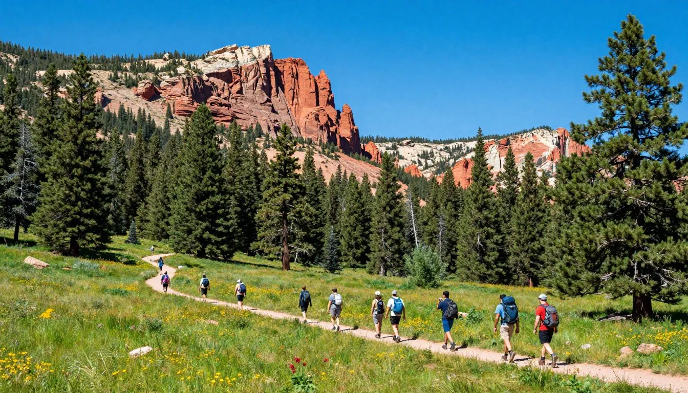
Burro Pass Trail
This moderate 11.3-kilometer (7-mile) round-trip trail climbs through aspen and conifer forests to reach panoramic views spanning the Colorado River corridor and Arches Canyonlands National Parks. The pass sits at 3,261 meters (10,700 feet), offering sweeping vistas across southeastern Utah desert landscapes.
Wildflowers bloom prolifically from late June through July, transforming meadows into colorful displays. The trail gains 610 meters (2,000 feet) elevation, making it achievable for moderately fit hikers while still providing challenge and elevation.
Castle Valley Scenic Drive
This paved route follows the base of the Sal Mountains through Castle Valley, showcasing dramatic red rock towers rising from valley floors. The drive connects Moab with La Sal Mountain Loop Road, providing access to multiple trailheads while offering spectacular photography opportunities.
Iconic formations including Castle Rock and the Priest and Nuns create stunning foreground elements against the forest’s mountain backdrop. The 27-kilometer (17-mile) route requires about 45 minutes without stops but deserves several hours for photography and exploration.
La Sal Mountain Loop Road
This 100-kilometer (62-mile) paved scenic byway circles the La Sal Mountains, climbing from desert elevations to cool mountain forests. The loop provides access to campgrounds, trailheads, and viewpoints while showcasing dramatic elevation changes and ecosystem diversity.
Plan three to four hours for the complete loop with stops. The route remains open from late May through October depending on snowfall. Several pullouts offer spectacular overlooks toward Canyonlands National Park and the Colorado River.
Mountain Biking
The forest contains extensive single-track and forest road networks. Burro Pass, Geyser Pass, and Dark Canyon Lake trails rank among regional favorites. Routes range from smooth cross-country paths to technical descents requiring advanced skills.
Fishing
High-elevation lakes and streams support populations of brook, rainbow, and cutthroat trout. Oowah Lake, Warner Lake, and Dark Canyon Lake provide easily accessible fishing. Remote backcountry streams offer solitude and challenging fishing for experienced anglers.
Wildlife Viewing
Elk herds migrate through the forest seasonally, with best viewing during fall rutting season. Mule deer, black bears, mountain lions, and numerous bird species inhabit various forest zones. Early morning and evening hours provide optimal wildlife observation opportunities.
Museums, Cultural Spots & Festivals

The Manti-La Sal National Forest region preserves significant cultural heritage from Native American inhabitants through pioneer settlement and ranching eras. Several sites and institutions interpret this rich history.
Museum of Moab
Located in downtown Moab, this regional museum explores area geology, paleontology, and human history. Exhibits cover uranium mining heritage, Native American cultures, and early ranching. The museum provides essential context for understanding the landscape surrounding the La Sal Division.
Historic Manti Temple
This stunning 1888 limestone temple dominates Manti’s skyline and represents pioneer architectural achievement. While temple interiors remain restricted, the grounds welcome visitors. The structure provides dramatic backdrop for the summer pageant and represents Utah’s settlement history.
Rock Art Sites
Ancient petroglyphs and pictographs appear throughout canyon areas surrounding the forest. These archaeological sites require respectful viewing without touching or disturbing rock surfaces. Several panels date back over 1,000 years, created by Ancestral Puebloan and Fremont cultures.
Historic Ranching Sites
Scattered throughout the forest, old cabins, corrals, and line camps represent ranching heritage extending into the early 1900s. These structures protected under historic preservation laws offer glimpses into challenging frontier lifestyles. Observe from distance without entering deteriorating buildings.
Nature & Outdoor Experiences

The forest’s elevation range creates remarkable biodiversity and landscape variety. From high desert canyons to alpine tundra, Manti-La Sal National Forest contains ecosystems supporting diverse plant and animal communities.
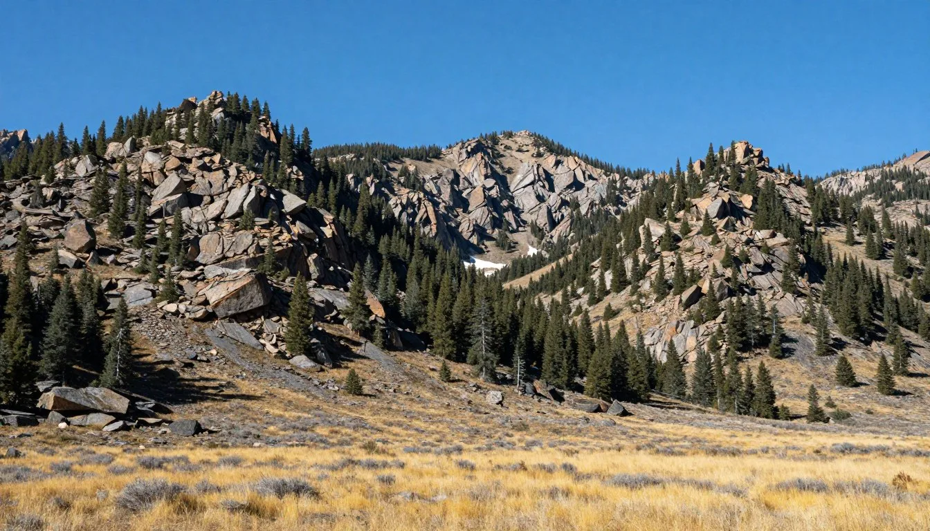
Sal Mountains Alpine Zone
Above 3,353 meters (11,000 feet), treeline gives way to alpine tundra and rocky peaks. Mount Peale at 3,877 meters (12,721 feet) stands as Utah’s second-highest summit. These high reaches support specialized plants adapted to extreme conditions including intense solar radiation and frequent freezing temperatures.
The alpine environment remains fragile and recovers slowly from disturbance. Hiker traffic should remain on established trails to protect delicate tundra vegetation requiring decades to reestablish after damage.
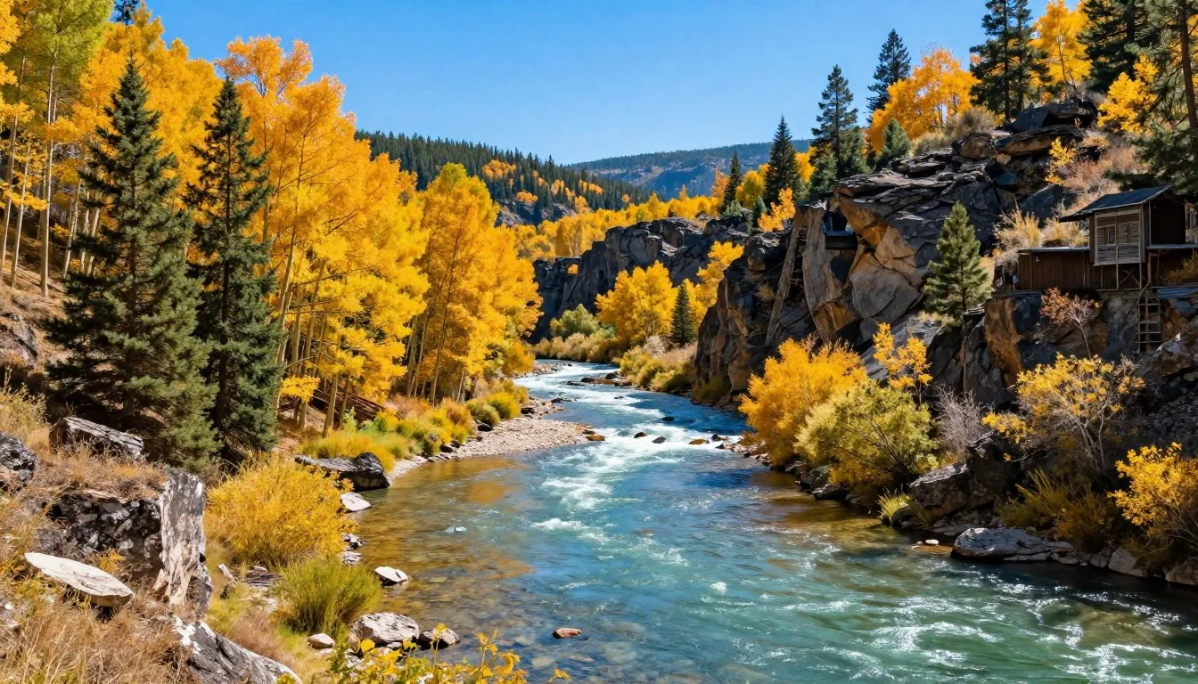
Aspen Ecosystems
Vast aspen groves cover mid-elevation slopes throughout both forest divisions. These deciduous forests create stunning fall displays while supporting diverse wildlife. Aspen stands often represent single organisms connected through underground root systems, making some groves among Earth’s largest living organisms.
Dark Canyon Wilderness
This 18,615-hectare (46,000-acre) designated wilderness area protects rugged canyon country along the forest’s southern boundary. Deep sandstone canyons carved by Dark Canyon and its tributaries create spectacular geology and exceptional solitude.
Accessing Dark Canyon requires serious preparation and backcountry skills. Routes involve difficult navigation, scarce water sources, and challenging terrain. Experienced wilderness travelers find remarkable beauty and isolation in these remote canyons.
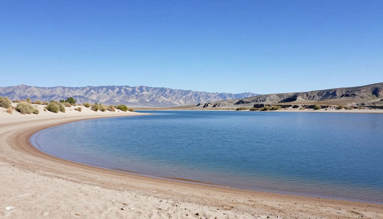
High Mountain Lakes
Over 20 alpine lakes dot the Sal Mountains, ranging from small tarns to larger fishing destinations. These lakes formed in glacially-carved basins, creating jewel-like settings surrounded by forests and peaks.
Oowah Lake covers approximately 12 hectares (30 acres) and provides campground access. Warner Lake and Dark Canyon Lake offer similar accessibility. Remote backcountry lakes require substantial hiking but reward effort with pristine beauty and solitude.
Forest Ecology
The forest supports mixed conifer communities including Engelmann spruce, subalpine fir, Douglas fir, and various pine species. These forests provide crucial wildlife habitat, watershed protection, and recreation opportunities.
Recent bark beetle outbreaks affected portions of the forest, creating standing dead trees that increase fire risk while providing important wildlife habitat. Forest managers balance fire prevention with ecological processes in these dynamic landscapes.

Red Rock Desert Interface
The transition zone where mountain forests meet surrounding desert creates unique ecological conditions. Pinyon-juniper woodlands give way to sagebrush and eventually slickrock, showcasing rapid elevation changes within short distances.
This interface supports specialized species adapted to both environments. Views from forest edges across red rock landscapes toward Canyonlands and Arches National Parks create iconic Utah scenery combining mountain and desert elements.
Travel With Children

Manti-La Sal National Forest offers excellent opportunities for family adventures with appropriate planning and activity selection. Many experiences suit children while introducing them to wilderness environments and outdoor skills.
Family-Friendly Trails
Several short, easy trails provide child-appropriate hiking. The Oowah Lake Loop circles this alpine lake for 1.6 kilometers (1 mile) with minimal elevation change. Children enjoy spotting trout in clear waters while parents appreciate spectacular mountain views.
Warner Lake Trail extends 3.2 kilometers (2 miles) round-trip through aspen groves to a fishing lake. The gentle grade accommodates young hikers, and the destination lake provides swimming opportunities during warm summer months.
Campground Activities
Developed campgrounds provide safe base camps for family exploration. Evening campfire programs at select campgrounds teach children about forest ecology, wildlife, and night sky observation. Junior Ranger programs offer activity booklets turning forest visits into educational adventures.
Safety Considerations
- Altitude affects children more severely – allow acclimatization time
- Afternoon thunderstorms develop rapidly – start hikes early
- Stream crossings require supervision – spring runoff creates hazards
- Wildlife including bears inhabit the forest – practice food storage
- Cell coverage unreliable – establish meeting points if separated
Engagement Strategies
- Scavenger hunts for pinecones, animal tracks, specific trees
- Nature journals documenting flowers, birds, weather observations
- Geocaching adventures combining hiking with treasure hunting
- Photography challenges capturing forest details and landscapes
- Stream play and rock skipping at safe water access points
Educational Opportunities
The forest’s ecosystem diversity provides natural classroom settings. Children learn about elevation zones by observing vegetation changes, practice navigation skills with maps and compasses, and develop environmental stewardship through Leave No Trace principles.
Ranger stations offer educational materials, maps designed for younger readers, and staff who answer questions about forest features. These interactions enhance children’s understanding while building appreciation for public lands and conservation.
Money Saving Tips
Visiting Manti-La Sal National Forest can remain remarkably affordable with strategic planning and utilizing free or low-cost resources. The forest itself charges no entrance fees, providing immediate savings compared to nearby national parks.
Free Activities and Access
Most forest trails, scenic drives, and viewpoints require no fees. Day hiking, wildlife viewing, photography, and scenic driving cost nothing beyond fuel. Dispersed camping throughout the forest eliminates campground fees while providing authentic wilderness experiences.
The America the Beautiful Pass covers developed campground fees at participating sites. At 80 dollars annually, the pass provides value for visitors planning multiple trips or longer stays. Senior and military passes offer discounted rates.
Timing and Seasonal Savings
Shoulder Season
Visit during June or late September for lower accommodation rates in gateway towns. Moab hotel prices drop significantly outside peak summer and fall foliage periods. Many attractions remain accessible while avoiding crowds.
Midweek Travel
Plan forest visits Monday through Thursday when possible. Campgrounds fill slower, trails see less traffic, and gateway town services operate at lower demand levels potentially offering better rates.
Advance Planning
Book campground reservations six months ahead for prime summer dates. Early booking secures preferred sites while ensuring availability eliminates last-minute premium pricing at commercial campgrounds.
Food and Supply Strategies
Purchase groceries and supplies before arriving in Moab where prices reflect tourist demand. Salt Lake City or Grand Junction supermarkets offer better prices and selection. Packing coolers with prepared foods reduces restaurant expenses.
Refillable water bottles and purification systems eliminate bottled water purchases. Forest streams provide abundant water during spring and early summer with proper treatment. This approach saves money while reducing plastic waste.
Equipment and Gear
Borrow or rent specialized equipment rather than purchasing. Moab outfitters rent mountain bikes, camping gear, and outdoor equipment at daily rates cheaper than buying for occasional use. Regional outdoor retailers offer used gear sections with significant savings.
Many forest activities require minimal specialized equipment. Hiking needs only appropriate footwear, clothing layers, and basic supplies. Starting with simple day hikes allows experiencing the forest without major equipment investments.
Safety & Local Customs

Manti-La Sal National Forest presents wilderness hazards requiring awareness and preparation. Understanding local conditions and practicing responsible recreation ensures safe, enjoyable visits while protecting forest resources.
Wilderness Safety Essentials
Altitude sickness affects many visitors unaccustomed to elevations exceeding 3,048 meters (10,000 feet). Symptoms include headache, nausea, and fatigue. Acclimatize gradually, maintain hydration, and descend if symptoms worsen. Recognize that physical fitness does not prevent altitude effects.
Lightning poses serious danger during summer thunderstorms. Avoid exposed ridges, summits, and isolated trees when storms approach. Begin descents by noon during peak thunderstorm season. If caught above treeline during lightning, crouch low avoiding contact with ground beyond your feet.
Wildlife Awareness
Black bears inhabit the forest, particularly in berry-producing areas during late summer. Store food in bear-resistant containers or hang from trees using proper techniques. Never approach bears regardless of size. Make noise while hiking to avoid surprise encounters.
Mountain lions roam throughout the forest but rarely encounter humans. If you see a mountain lion, maintain eye contact, appear large, and back away slowly. Never run, as this triggers predatory response. Keep children close and within sight on trails.
Environmental Hazards
- Stream crossings dangerous during spring snowmelt runoff
- Hypothermia risk exists even during summer at high elevations
- Dehydration occurs rapidly in dry mountain air
- Sun exposure intensifies with elevation and reflection
- Avalanche danger in steep terrain during winter and spring
Navigation and Communication
- Cell service unreliable throughout most forest areas
- GPS units and downloaded offline maps essential
- Inform others of planned routes and return times
- Carry paper maps as electronic backup
- Trail markers often minimal in wilderness areas
Leave No Trace Principles
Practice minimum impact camping and hiking. Pack out all trash including toilet paper and food scraps. Camp on durable surfaces at least 61 meters (200 feet) from lakes and streams. Use established fire rings where fires are permitted, or pack portable stoves.
Human waste requires proper disposal. Dig catholes 15 to 20 centimeters (6 to 8 inches) deep at least 61 meters (200 feet) from water, camps, and trails. Pack out toilet paper in sealed bags. Some high-use areas require packing out all human waste.
Local Customs and Etiquette
Gateway communities reflect Utah’s predominant religious culture with Sunday closures common for many businesses. Plan accordingly for weekend trips. Local residents value politeness, respect for private property, and environmental stewardship.
The forest sees mixed use including grazing, hunting, and motorized recreation. Respect varied user groups and understand multiple-use management allows diverse activities. Hunters frequent the forest during fall big-game seasons requiring increased trail awareness.
Visitor Comments About Manti-La Sal National Forest

“The contrast between the mountain peaks and surrounding desert takes your breath away. We hiked Burro Pass and couldn’t believe the views stretching to Canyonlands. The wildflowers in July created carpets of color across the meadows. This forest offers everything we hoped for in Utah wilderness.”
“Our family spent five days camping at Warner Lake. The children loved fishing for trout while we enjoyed the cooler mountain temperatures after visiting Moab’s desert. The forest provides a perfect escape from summer heat with plenty of easy trails suitable for our younger kids. We will definitely return.”
“As a landscape photographer, the Sal Mountains exceeded my expectations. The aspen groves during fall created stunning compositions with the mountain backdrop. I particularly enjoyed the La Sal Mountain Loop Road for accessing multiple viewpoints. The combination of red rock and alpine scenery makes this forest unique among Utah’s public lands.”
Additional Nearby Destinations

Manti-La Sal National Forest’s location in southeastern Utah positions visitors near several world-class destinations. Combining forest visits with nearby attractions creates comprehensive Utah experiences.
Arches and Canyonlands National Parks
These iconic parks lie within 64 kilometers (40 miles) of the La Sal Division. Arches showcases over 2,000 natural stone arches including the famous Delicate Arch. Canyonlands presents vast canyon landscapes carved by the Colorado River and its tributaries.
Plan separate days for each park as their scale prevents combined visits. Both parks charge entrance fees unless covered by annual passes. Summer temperatures in these desert parks exceed 38°C (100°F), making morning and evening visits most comfortable.
San Rafael Swell
This massive geologic uplift creates 518,000 hectares (1,280,000 acres) of canyon country northwest of the forest. The San Rafael Swell offers exceptional opportunities for remote exploration, slot canyons, and pictograph viewing. Most areas require four-wheel-drive vehicles and self-sufficient preparation.
Capitol Reef National Park
Located 161 kilometers (100 miles) northwest, Capitol Reef preserves the Waterpocket Fold, a 160-kilometer (100-mile) wrinkle in Earth’s crust. The park features orchards planted by Mormon pioneers, colorful geology, and excellent hiking. The scenic drive through the park costs minimal fees with camping available.
Dead Horse Point State Park
This state park protects a spectacular overlook 609 meters (2,000 feet) above the Colorado River. The viewpoint rivals national park vistas while requiring shorter driving distance from Moab. Sunset photography sessions create memorable images of canyon country.
Castle Valley
Red rock towers rise from this scenic valley at the base of the Sal Mountains. Popular with rock climbers, the valley offers stunning scenery without crowds. The paved Castle Valley Road provides access while showcasing iconic formations.
Goblin Valley State Park
Unusual mushroom-shaped hoodoos create an otherworldly landscape 145 kilometers (90 miles) northwest. Children love exploring among the goblin formations. The park offers camping and makes an excellent addition to southeastern Utah itineraries.
Practical Travel Tips
Successfully navigating Manti-La Sal National Forest requires attention to practical details often overlooked during trip planning. These considerations enhance experiences while preventing common frustrations.
Essential Gear and Supplies
Clothing Layers
- Base layers for temperature regulation
- Insulating mid-layers even during summer
- Waterproof shell for afternoon storms
- Sun protection including wide-brimmed hat
- Sturdy hiking boots with ankle support
Navigation and Safety
- Topographic maps of planned hiking areas
- GPS device or smartphone with offline maps
- Compass and knowledge of its use
- First aid kit including blister treatment
- Emergency shelter and fire-starting materials
Water and Hydration
Carry significantly more water than seems necessary. Dry mountain air and intense sun create rapid dehydration. Plan for 3 to 4 liters (0.8 to 1 gallon) per person for day hikes. Water purification tablets or filters allow refilling from streams, extending range on longer trips.
Many high-elevation streams run clear and cold but still contain microorganisms requiring treatment. Giardia exists throughout western wilderness areas. Always treat water from natural sources regardless of appearance.
Photography Considerations
Mountain light changes dramatically throughout the day. Golden hour occurs earlier at elevation with sunset colors appearing spectacular. Bring graduated neutral density filters for balancing bright skies with shadowed landscapes.
Afternoon clouds create dramatic lighting during summer thunderstorm season. These conditions produce stunning photography but require vigilant weather monitoring for safety. Lightning moves faster than photographers can descend from exposed locations.
Vehicle Preparation
Check tire pressure before driving forest roads as elevation changes affect pressure readings. Carry full-size spare tire as cell service for roadside assistance remains unavailable. Tools, extra fluids, and basic mechanical knowledge prevent minor issues from becoming major problems.
Forest roads change conditions rapidly after rain. Routes passable during dry periods become impassable mud after storms. Allow extra time and flexibility in schedules when exploring remote areas.
Seasonal Considerations
Spring
Snowmelt creates challenging stream crossings and muddy roads. Higher trails remain snow-covered into June. Wildflowers begin blooming at lower elevations while upper areas thaw. Black flies can be intense during peak runoff.
Summer
Prime season for high-elevation access. Afternoon thunderstorms develop regularly requiring early starts. Temperatures remain comfortable at elevation while valleys bake. Mosquitoes peak near lakes and wetlands in early summer.
Fall
Aspen color peaks late September through early October depending on elevation. Cooler temperatures and stable weather create ideal conditions. Hunting seasons begin requiring orange clothing for safety. First snows possible by late October.
Permits and Regulations
Most forest activities require no permits. Exceptions include commercial filming, large group gatherings, and special events requiring authorization. Campfire restrictions apply during dry periods. Check current conditions at ranger stations before trips.
Firewood collection regulations vary by location. Some areas prohibit gathering dead wood to protect wildlife habitat. Purchasing bundled firewood from approved vendors prevents spreading invasive insects between forests.
Your Mountain Adventure Awaits
Manti-La Sal National Forest stands ready to reveal its secrets to those who venture beyond the famous national parks dominating southeastern Utah’s landscape. These mountains offer something increasingly rare in modern America: genuine wilderness solitude combined with accessible beauty.
The forest rewards various approaches to exploration. Some visitors prefer comfortable campground bases for day hiking adventures. Others push deep into backcountry seeking challenge and isolation. Families discover outdoor skills while creating memories against spectacular backdrops.
Whatever draws you to these mountains, arrive prepared for rapid weather changes, respect the fragile alpine environments, and embrace the self-sufficiency wilderness demands. The Sal Mountains and Wasatch Plateau sections hold experiences worth the planning required to access them properly.
Between the contrasts of desert and alpine, between accessible and remote, between comfortable and challenging, Manti-La Sal National Forest provides the perfect balance for discovering your ideal Utah mountain experience.