Hotels by Trip.com
Flights by Trip.com
Fewer than 300 people call this tiny desert town home, yet thousands of travelers pass through each year to witness one of geology’s most peculiar masterpieces. The Mexican Hat Rock stands as a testament to millions of years of erosion, creating a formation so perfectly shaped that it appears almost deliberately crafted.
The town takes its name from the iconic rock formation that resembles a sombrero perched atop a pedestal. This distinctive landmark has become a symbol of the American Southwest and serves as a gateway to some of the region’s most spectacular landscapes.
Getting There and Planning Your Journey
Reaching Mexican Hat requires traveling through some of Utah’s most stunning desert country. The town sits in the southeastern corner of the state along U.S. Route 163, making it accessible yet wonderfully remote.
Closest Airports
Several airports provide access to this part of Utah:
- Cortez Municipal Airport (CEZ) – 64 km (40 miles) southeast, closest option for small aircraft
- Four Corners Regional Airport (FMN) – 121 km (75 miles) south in Farmington, New Mexico
- Durango-La Plata County Airport (DRO) – 153 km (95 miles) east in Colorado, offers commercial flights
- Grand Junction Regional Airport (GJT) – 257 km (160 miles) north, larger hub with more flight options
Most visitors rent a vehicle and drive from these airports. The journey itself becomes part of the adventure, passing through dramatic landscapes.
Driving Routes
From the north, travelers follow U.S. 191 through Blanding before connecting to U.S. 163. This route takes you past Valley of the Gods, a lesser-known but equally impressive collection of rock formations.
Southern approaches bring you through Monument Valley Navajo Tribal Park. The drive north on U.S. 163 offers some of the most photographed desert scenery in America.
Plan for fuel stops in larger towns. Gas stations are limited in this remote area, and the next services may be many miles away.
Best Time to Visit and Weather Tips

Best Time to Visit Mexican Hat Rock
Spring and fall offer ideal conditions for exploring this desert region. March through May brings comfortable temperatures ranging from 15°C to 26°C (60°F to 80°F). Wildflowers bloom across the desert in April, adding splashes of color.
September through November provides equally pleasant weather. October is particularly popular, with daytime temperatures around 21°C (70°F) and cool evenings perfect for stargazing.
Seasons to Approach with Caution
Summer months bring extreme heat. June through August sees temperatures exceeding 38°C (100°F) regularly. If visiting during this time, plan outdoor activities for early morning or evening.
Winter can be unpredictable. While daytime temperatures may reach 10°C (50°F), nights drop below freezing. Snow occasionally dusts the area, creating stunning contrasts against red rock but making some roads impassable.
Check 30,000+ Local Sightseeing Tours Worldwide
✓ Numerous languages and currencies are available
Weather Safety Tip: Summer thunderstorms develop quickly in the afternoon. Monitor weather conditions and avoid hiking in narrow canyons when storms threaten. Flash floods pose real danger in this terrain.
Notable Annual Festivals
The region celebrates its heritage and natural beauty through several events:
- Monument Valley Balloon Event (January) – Hot air balloons float above iconic rock formations
- Northern Navajo Nation Fair (October) – Traditional dances, rodeo, and cultural celebrations in Shiprock, New Mexico
- Bluff Balloon Festival (January) – Takes place 35 km (22 miles) northeast
For festival information and dates, contact the San Juan County Visitor Services.
Getting Around Locally
A personal vehicle is essential for exploring Mexican Hat and surrounding areas. No public transportation serves this remote region. The town itself can be walked easily, but attractions spread across vast distances.
Road conditions vary significantly. U.S. 163 and U.S. 191 are well-maintained paved highways. However, routes to Valley of the Gods and other backcountry areas require high-clearance vehicles. Four-wheel drive becomes necessary after rain or snow.
Gas up in town. The next fuel stations lie 40 km (25 miles) or more in either direction. Carry extra water, food, and emergency supplies when venturing off main highways.
Cell phone coverage is limited or nonexistent in many areas. Download offline maps before departing. Inform someone of your travel plans and expected return time.
Where to Stay

Accommodation options in Mexican Hat remain limited but adequate for most travelers. The town offers a few motels and lodges with basic amenities and spectacular views.
Local Lodging Options
Mexican Hat Lodge
This historic property sits directly on the San Juan River. Rooms feature private balconies overlooking the water. The on-site restaurant serves Navajo and American cuisine.
Spring through fall rates range from $90 to $140 per night. The lodge closes during winter months.
San Juan Inn and Trading Post
A riverside location provides easy access to rafting and fishing. The trading post sells Native American crafts and supplies. Rooms are simple but clean and comfortable.
Rates typically run $85 to $125 nightly depending on season and room type.
Nearby Alternatives
Bluff, located 35 km (22 miles) northeast, offers additional hotels and bed-and-breakfast inns. This small town provides more dining variety while still maintaining proximity to area attractions.
Monument Valley, 40 km (25 miles) south, has The View Hotel within the tribal park. Rooms here command premium prices but offer unmatched sunrise and sunset vistas of the monuments.
Camping Options
Several campgrounds serve the area. Goosenecks State Park, just minutes from town, provides basic sites with spectacular views of the San Juan River’s entrenched meanders. Sites cost around $20 per night and operate on a first-come basis.
BLM land surrounding the area permits dispersed camping. Choose established sites to minimize impact. Practice Leave No Trace principles in this fragile desert environment.
Dining and Local Cuisine

Dining options in Mexican Hat reflect the town’s small size and remote location. Don’t expect extensive menus or fine dining. Instead, enjoy hearty, satisfying meals with Southwestern and Native American influences.
Local Restaurants
The Mexican Hat Lodge Restaurant serves breakfast, lunch, and dinner during operating season. Their Navajo tacos feature fry bread topped with seasoned meat, beans, cheese, lettuce, and tomatoes. Portions are generous, and prices remain reasonable at $10 to $18 per entrée.
Swinging Steak offers basic American fare. Located at the San Juan Inn, this casual spot serves steaks, burgers, and sandwiches. The outdoor patio overlooks the river, providing pleasant dining when weather permits.
Regional Specialties
Try Navajo fry bread, a regional staple. This deep-fried dough can be served sweet with honey and powdered sugar or savory as a base for various toppings.
Blue corn appears in many dishes, from pancakes to mush. This traditional ingredient adds subtle sweetness and distinctive color to foods.
Practical Tip: Restaurant hours can be irregular, especially during off-season. Call ahead to confirm operating times. Carry snacks and water when exploring, as you may not find food services for miles.
Grocery and Supplies
A small trading post in town stocks basic groceries, camping supplies, and fuel. Selection is limited, so stock up in larger towns like Blanding or Bluff if you need specific items or plan to camp.
Attractions, Sightseeing, and Activities

Mexican Hat Rock Formation
The namesake rock formation demands attention. This geological wonder rises approximately 18 m (60 feet) above the desert floor. The top portion, measuring roughly 18 m (60 feet) in diameter, balances precariously on a narrower base, creating the distinctive sombrero shape.
A short, unmarked path leads from the highway to viewing areas near the base. The hike covers less than 1 km (0.5 miles) round trip over uneven terrain. Wear sturdy shoes and bring water even for this brief walk.
Photographers find the formation most dramatic during golden hour. Morning light illuminates the eastern face, while evening sun creates long shadows that emphasize the rock’s unusual profile.
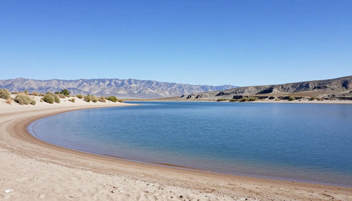
Goosenecks State Park

Just 6 km (4 miles) northwest of town, the San Juan River has carved some of the most dramatic entrenched meanders in North America. The river loops back on itself repeatedly, creating horseshoe bends visible from viewpoints perched 305 m (1,000 feet) above the water.
A paved road leads to the overlook. Short walking trails allow different perspectives of these geological features. The park stays open year-round, charging a small day-use fee of $5 per vehicle.
Sunset transforms the canyon into a palette of oranges and reds. Many photographers consider this among the top locations in the region for capturing the desert’s beauty.
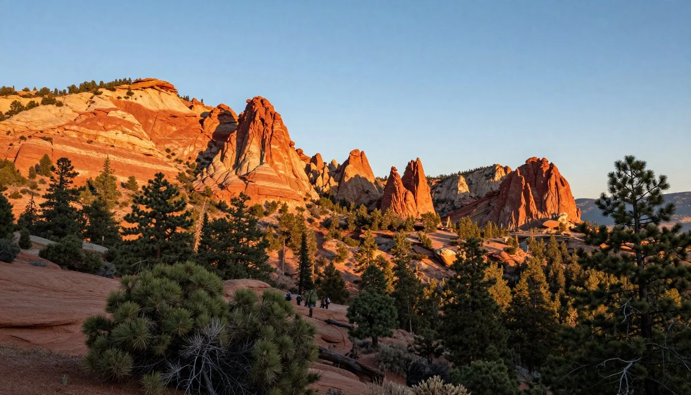
Valley of the Gods
This lesser-known area rivals nearby Monument Valley for stunning scenery without the crowds. A 27 km (17-mile) unpaved loop road winds through a landscape dotted with towering buttes, mesas, and spires.
The route requires 2 to 3 hours to drive. High-clearance vehicles are recommended, though regular cars can usually manage in dry conditions. Four-wheel drive becomes necessary after precipitation.
Unlike Monument Valley, no entrance fees apply here. BLM manages the area, permitting free access. Primitive camping is allowed along the route at established sites.
Monument Valley

Located 40 km (25 miles) south, Monument Valley Navajo Tribal Park protects some of the American West’s most iconic landscapes. Towering sandstone formations rise up to 305 m (1,000 feet) from the valley floor.
The 27 km (17-mile) scenic drive provides access to key viewpoints. Entrance fees are $8 per person. Guided tours led by Navajo guides offer deeper access to restricted areas and cultural insights.
Allow at least 3 hours to drive the loop and stop at viewpoints. Longer stays permit more exploration and better photography opportunities as light changes throughout the day.
San Juan River Adventures

The San Juan River flows directly through town, offering excellent opportunities for water-based recreation. Rafting trips range from half-day floats to multi-day expeditions through remote canyons.
Calm sections near town suit beginners and families. Downstream, Class II and III rapids provide excitement for more experienced paddlers. Many commercial outfitters run trips from March through October.
Fishing attracts anglers seeking catfish and bass. Spring and fall provide best conditions. A valid Utah fishing license is required for residents and visitors.
Museums, Cultural Spots, and Festivals
Mexican Hat itself contains limited cultural facilities due to its small size. However, the surrounding region is rich with Native American heritage, particularly Navajo culture.
Trading Posts
Historic trading posts served as economic and social centers for both Native Americans and settlers. The San Juan Inn Trading Post maintains this tradition, offering authentic Navajo rugs, pottery, jewelry, and baskets.
Many items are handcrafted by local artisans. Purchasing directly from these sources ensures artists receive fair compensation while helping preserve traditional crafts.
Navajo Nation Museum
Located in Window Rock, Arizona, about 177 km (110 miles) south, this facility showcases Navajo history, art, and culture. Exhibits cover everything from traditional weaving to contemporary Native American artists.
The museum opens Monday through Friday, 8:00 AM to 5:00 PM. Admission is free, though donations are appreciated.
Cultural Etiquette
Important: When visiting Monument Valley or other areas within the Navajo Nation, remember you are on sovereign tribal land. Photography of people requires permission. Some areas remain closed to visitors. Always respect posted restrictions and cultural sites.
Many Navajo people consider certain locations sacred. Climbing some rock formations is prohibited. Ask guides or local residents before exploring unfamiliar areas.
Nature and Outdoor Experiences

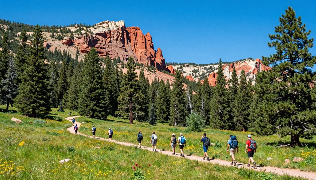
Hiking Opportunities
The area surrounding Mexican Hat offers countless hiking possibilities. Most trails are informal routes rather than maintained paths. This requires good navigation skills and preparation.
The Mexican Hat Rock trail provides an easy introduction. More adventurous hikers can explore washes and canyons radiating from the main valley. Always carry a map, compass, or GPS device.
Rock Climbing
Sandstone towers and cliffs attract climbers seeking both traditional and sport routes. The rock quality varies, with some formations offering solid climbing while others crumble easily.
Climbing Mexican Hat Rock itself is discouraged to preserve this iconic formation. However, numerous other towers and walls provide excellent opportunities for climbers of various skill levels.
Stargazing

Remote location and minimal light pollution make Mexican Hat exceptional for astronomy enthusiasts. The Milky Way stretches brilliantly across the night sky from spring through fall.
New moon periods offer darkest skies. Bring a red flashlight to preserve night vision. Winter nights are coldest but often feature the clearest atmospheric conditions.
Wildlife Viewing
Desert wildlife thrives in this harsh environment. Lizards and snakes are common during warm months. Watch where you place hands and feet when scrambling over rocks.
Larger mammals include mule deer, coyotes, and occasional mountain lions. Birds range from ravens and hawks to hummingbirds around rare water sources.
Spring and fall migrations bring additional bird species through the region. Early morning and evening hours provide best viewing opportunities when animals are most active.
Travel With Children

Mexican Hat can be an excellent destination for families willing to embrace outdoor adventure. The remote setting offers children chances to explore nature away from urban distractions.
Check 30,000+ Local Sightseeing Tours Worldwide
✓ Numerous languages and currencies are available
Family-Friendly Activities
Viewing the Mexican Hat Rock formation fascinates children. The short walk allows even young kids to reach the viewing area. The rock’s unusual shape captures imagination and makes for memorable photos.
Goosenecks State Park provides easy access to dramatic scenery. The overlook requires minimal walking, suitable for strollers. Children are naturally drawn to peering into the deep canyon, though close supervision is essential near cliff edges.
River activities engage families during warmer months. Calm sections near town permit safe wading and splash play. Always supervise children near water, as currents can be deceptive.
Safety Considerations
Heat and Sun Protection: Desert sun is intense, especially reflecting off light-colored rock. Children need frequent water breaks, sunscreen reapplication every 2 hours, and protective clothing including wide-brimmed hats.
Keep kids on established paths when possible. Desert plants like cacti can cause painful injuries. Teach children to look but not touch unknown plants and rocks where snakes or scorpions might hide.
Practical Tips
Limited restaurant options mean picky eaters may struggle. Bring familiar snacks and foods if your children have particular preferences. Most lodging includes small refrigerators for storing drinks and perishables.
Entertainment options are minimal. Pack books, games, and activities for downtime. The night sky provides natural entertainment, perfect for teaching kids about constellations and astronomy.
Money Saving Tips
Traveling in remote areas often costs less than visiting crowded tourist destinations. Mexican Hat offers opportunities to experience spectacular scenery without premium prices.
Accommodation Strategies
Camping represents the most economical lodging option. Goosenecks State Park sites cost only $20 per night. Free dispersed camping on BLM land costs nothing, though you sacrifice amenities.
Visit during shoulder seasons. Spring and fall rates at local motels run $20 to $40 less than peak summer prices. You’ll also encounter fewer crowds and more pleasant temperatures.
Food and Dining
Bring groceries from larger towns where selection is better and prices lower. Blanding and Bluff have supermarkets with competitive pricing. Stock up on snacks, breakfast foods, and lunch supplies.
Picnicking saves money while allowing you to dine amid spectacular scenery. Many viewpoints have tables or pleasant spots to spread a blanket.
Free Activities
Most area attractions charge minimal or no entrance fees. Valley of the Gods requires no payment. Goosenecks State Park asks just $5. Even Monument Valley’s $8 fee is modest compared to many national parks.
Hiking, photography, and stargazing cost nothing beyond basic equipment. The region’s natural beauty is freely accessible to those willing to explore.
Budget Tip: Fill your gas tank in Blanding or Cortez where prices run 15 to 25 cents per gallon cheaper than in Mexican Hat. The savings add up over a week-long trip.
Tour Considerations
Self-guided exploration costs far less than organized tours. You can drive Valley of the Gods and visit most viewpoints independently. Invest in good maps instead of paying for guides unless you specifically want the cultural insights they provide.
Safety and Local Customs
Desert environments present unique hazards. Preparation and awareness keep you safe while respecting this fragile landscape and its communities.
Environmental Hazards
Dehydration threatens visitors year-round. Dry air and high altitude increase water needs. Drink frequently even when you don’t feel thirsty. Carry at least one gallon per person per day for hiking.
Summer heat can be life-threatening. Temperatures exceeding 38°C (100°F) stress the body quickly. Limit outdoor activities to morning and evening hours during peak summer.
Flash floods pose danger despite the arid climate. Heavy rains miles away can send walls of water through dry washes with little warning. Never camp in drainage channels. Leave canyons immediately if rain threatens.
Wildlife Precautions
Rattlesnakes inhabit rocky areas. Watch where you step and place your hands. Most snakes will retreat if given opportunity. Wear closed-toe shoes and long pants when hiking off-trail.
Scorpions hide under rocks and logs. Shake out shoes and clothing before dressing. Check sleeping bags before climbing in.
Cultural Respect
The Navajo Nation surrounds Mexican Hat. Understanding and respecting Native American customs demonstrates courtesy and prevents misunderstandings.
Photography etiquette is particularly important. Never photograph people without explicit permission. Some ceremonies and locations are off-limits to cameras entirely.
Archaeological sites dot the landscape. Federal law protects these cultural resources. Look but never touch petroglyphs or remove artifacts. Report any vandalism to authorities.
Emergency Services: Cell coverage is unreliable. The nearest hospital is San Juan Health Service District in Blanding, 80 km (50 miles) away. For emergencies, dial 911. Satellite phones or emergency beacons provide backup communication in remote areas.
Road Safety
Highway speeds drop suddenly in small towns. Watch for posted limits and reduce speed appropriately. Free-ranging livestock can appear on roads unexpectedly, especially at dawn and dusk.
Dirt roads become impassable when wet. Clay soils turn incredibly slippery, stranding even four-wheel-drive vehicles. Wait for roads to dry before attempting to drive unpaved routes after storms.
Visitor Comments About Mexican Hat Rock
“We drove past Mexican Hat Rock three times before realizing we should actually stop and look closely. The formation is more impressive than photos suggest. The short walk to the base gives you real appreciation for how erosion created such a perfect shape. We visited at sunrise and had the place to ourselves.”
“Mexican Hat served as our base for exploring Monument Valley and the surrounding area. The town is tiny but had everything we needed. Goosenecks State Park was an unexpected highlight. Standing on the rim looking down at those river bends took my breath away. Much less crowded than the more famous national parks nearby.”
“Our kids loved spotting the Mexican Hat Rock from the highway and then hiking out to see it up close. The whole area feels like an adventure. We camped at Goosenecks and spent evenings watching stars like we’d never seen before. Bring supplies from a larger town because options are limited here, but that’s part of the charm.”
Additional Nearby Destinations

Mexican Hat’s location makes it an ideal base for exploring southeastern Utah’s canyon country and Four Corners region.
Nearby Natural Wonders
Natural Bridges National Monument lies 80 km (50 miles) northwest. Three massive stone bridges formed by stream erosion create some of Utah’s most remarkable geological features. A 14 km (9-mile) scenic drive connects overlooks for each bridge.
Cedar Mesa contains countless archaeological sites and dramatic canyons. Hiking opportunities range from easy walks to challenging backpacking routes through slot canyons and across slickrock.
Muley Point Overlook sits 32 km (20 miles) north, offering sweeping vistas of Monument Valley, Mexican Hat, and the San Juan River. The viewpoint requires a 8 km (5-mile) drive on graded dirt road.
Towns Worth Visiting
Bluff maintains a historic downtown with art galleries, restaurants, and shops. This small community has embraced tourism while preserving its Old West character. Quality lodging and dining exceed what’s available in Mexican Hat.
Blanding serves as the largest town in the area, with full services including grocery stores, gas stations, and medical facilities. The Edge of the Cedars State Park Museum showcases Ancestral Puebloan artifacts and culture.
Extended Trips
Moab sits 185 km (115 miles) north, providing access to Arches and Canyonlands National Parks. This outdoor recreation hub offers lodging, dining, and outfitter services for every adventure imaginable.
Four Corners Monument marks the only point in America where four states meet. Located 64 km (40 miles) southeast, this popular roadside attraction allows you to stand in Utah, Colorado, New Mexico, and Arizona simultaneously.
Practical Travel Tips
Final considerations help ensure your Mexican Hat adventure proceeds smoothly.
Communication
Internet access is limited. Most lodging offers WiFi, but speeds may disappoint those accustomed to urban connections. Cell service works in town but fades quickly when leaving settled areas.
Download maps, guides, and entertainment before arrival. Offline navigation apps prove essential for backcountry exploration.
Services and Banking
No banks or ATMs operate in Mexican Hat. Bring sufficient cash for your stay. Many local businesses prefer cash, though most accept credit cards.
The nearest banking services are in Blanding or Bluff. Plan accordingly if you need to access money during your visit.
Medical Care
Bring a well-stocked first aid kit. Minor injuries and illnesses must be treated yourself. The nearest medical facilities are hours away by car.
Carry any prescription medications you might need, plus a few days extra in case of travel delays. Pharmacies are not available locally.
What to Pack
- Sun protection: wide-brimmed hat, sunglasses, high-SPF sunscreen, lip balm
- Layers: temperatures swing dramatically between day and night
- Sturdy footwear: hiking boots or trail shoes with good traction
- Water containers: at least two liters capacity per person
- Navigation: maps, compass, GPS device with extra batteries
- Emergency supplies: flashlight, matches, knife, basic first aid kit
- Camera gear: bring extra memory cards and batteries
Best Practices
Leave No Trace principles are essential in this fragile desert environment. Pack out all trash. Use existing campsites rather than creating new ones. Stay on established trails when they exist.
Water sources are scarce and precious. Never contaminate springs or streams. Filter or treat all water before drinking.
Check 30,000+ Local Sightseeing Tours Worldwide
✓ Numerous languages and currencies are available
Check weather forecasts daily. Conditions can change rapidly, affecting travel plans and safety.
Your Desert Adventure Awaits
Mexican Hat Rock stands as a testament to the incredible forces that shaped the American Southwest over millions of years. This small town offers more than a quirky roadside attraction. It provides a gateway to some of the most stunning and least crowded landscapes in Utah.
Whether you spend a few hours photographing the iconic rock formation or use the town as a base for weeks of exploration, you’ll discover a landscape that stays with you long after you leave. The vast desert skies, ancient rock formations, and profound silence offer something increasingly rare in our busy world.
Start planning your journey to this remarkable corner of Utah. The hat-shaped rock is waiting to welcome you to canyon country at its finest.