Hotels by Trip.com
Flights by Trip.com
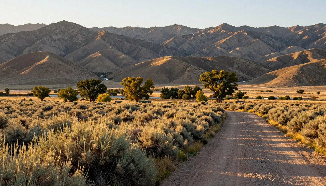
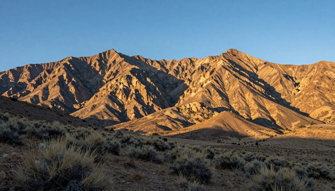
In the heart of Nevada lies one of America’s most isolated scenic drives where you might encounter more pronghorn antelope than people. The Belmont–Monitor Valley Loop stretches 76 miles of gravel road through central Nevada’s backcountry, where during a typical six-hour journey, you might not see a single other vehicle. This remarkable isolation, combined with towering 11,000-foot mountain peaks and expansive valley views, creates one of the Silver State’s most authentic wilderness experiences.
Getting There & Planning Your Journey
The Belmont–Monitor Valley Loop is located in central Nevada, approximately 30 miles southwest of Eureka. The most common access point is via US Highway 50 (known as “The Loneliest Highway in America”), where you’ll find the Belmont Road turnoff. Look for a small, easily missed sign marking this junction.
The nearest commercial airports are in Reno (365 km/227 miles west) and Las Vegas (425 km/264 miles south). From either city, you’ll need to rent a vehicle suitable for gravel roads. While the road is generally well-maintained and passable in a standard car during dry conditions, a high-clearance vehicle is recommended, especially if exploring side roads.
Before setting out, ensure your vehicle is in good condition with a full-sized spare tire. Cell service is virtually non-existent throughout the loop, so consider renting a satellite phone or emergency beacon for safety. Stock up on fuel, food, and water in larger towns like Eureka or Tonopah, as no services exist along the route.

Best Time to Visit & Weather Tips
The optimal time to explore the Belmont–Monitor Valley Loop is from late May through October when roads are typically dry and temperatures are most comfortable. June offers lush green valleys and wildflowers, while September and early October provide mild temperatures and golden autumn colors in the higher elevations.
- Recommended months: Late May, June, September, early October (ideal conditions with moderate temperatures)
- Shoulder season: July-August (hot daytime temperatures of 29-35°C/85-95°F but beautiful mornings and evenings)
- Months to avoid: November-April (potential for snow, ice, and impassable mud during spring thaw)
Weather in this high desert region (1,800-2,100 m/5,900-6,900 ft elevation) can change rapidly. Summer days often reach 32°C (90°F), while nights can drop below 10°C (50°F) even in summer. Afternoon thunderstorms are common in July and August. During May, be prepared for several small stream crossings as snowmelt creates seasonal water flows across the road.

Getting Around Locally
Navigating the Belmont–Monitor Valley Loop requires self-reliance and preparation. The main route follows the Belmont Road (also called Monitor Valley Road or State Route 82 in some sections), a well-maintained gravel road that’s typically wide and flat. Under normal conditions, you can comfortably travel at 50-65 km/h (30-40 mph), though washboarding can occur in heavily used sections.
Several fascinating side roads branch off the main loop, leading to hot springs, ghost towns, and hiking trails. These secondary roads vary greatly in quality—some are suitable for passenger cars, while others require high-clearance 4WD vehicles. Always check current conditions before attempting side roads.
A detailed paper map is essential, as GPS and online maps are often inaccurate in this remote region. The Benchmark Nevada Road & Recreation Atlas is highly recommended for its comprehensive coverage of back roads and points of interest.
Where to Stay
Accommodations along the Belmont–Monitor Valley Loop are extremely limited, emphasizing the area’s remote character. Most travelers choose one of these options:
Primitive Camping
The entire loop passes through public lands (BLM and National Forest), allowing for dispersed camping almost anywhere. Popular unofficial camping areas include spots near Diana’s Punchbowl and along the forested sections near Pete’s Summit. Practice Leave No Trace principles and camp at least 60 m (200 ft) from water sources.
Nearby Towns
For those preferring proper accommodations, the historic mining towns of Eureka (north) and Tonopah (south) offer hotels, motels, and restaurants. The Miles End B&B in Kingston (just off the loop) provides a charming base with exceptional hospitality, though advance reservations are essential as it’s the only lodging option in this tiny community.

Dining & Local Cuisine
The Belmont–Monitor Valley Loop offers an authentic taste of rural Nevada, though dining options are extremely limited. Plan to be self-sufficient for most of your journey.
Check 30,000+ Local Sightseeing Tours Worldwide
✓ Numerous languages and currencies are available
Local Options:
- Zach’s Lucky Spur Saloon (Kingston) – The only establishment in Kingston, offering basic pub fare and cold drinks in an authentic Nevada atmosphere.
- Dirty Dick’s Saloon (Belmont) – A historic watering hole in the ghost town of Belmont with limited food options but plenty of local character.
- Manhattan Bar & Motel (Manhattan) – The sole business in this semi-ghost town, providing basic meals and refreshments to travelers.
For proper restaurants and grocery stores, stock up in Eureka or Tonopah before beginning your journey. Many travelers bring coolers with supplies for the entire trip, including easy-to-prepare camping meals. Local specialties in the region include hearty miner’s fare like Dutch oven stews, Basque-influenced dishes (reflecting the area’s sheepherding history), and fresh trout when in season.

Attractions, Sightseeing & Activities
The Belmont–Monitor Valley Loop offers a perfect blend of natural wonders and historical sites that showcase central Nevada’s unique character. Here are the must-see attractions along the route:
Natural Wonders
- Diana’s Punchbowl – A remarkable geothermal feature resembling a small volcano with a 9 m (30 ft) deep crater filled with steaming blue-green water reaching temperatures over 60°C (140°F). Located in the center of Monitor Valley, this travertine mound offers spectacular photography opportunities. View from the rim only—the water is dangerously hot.
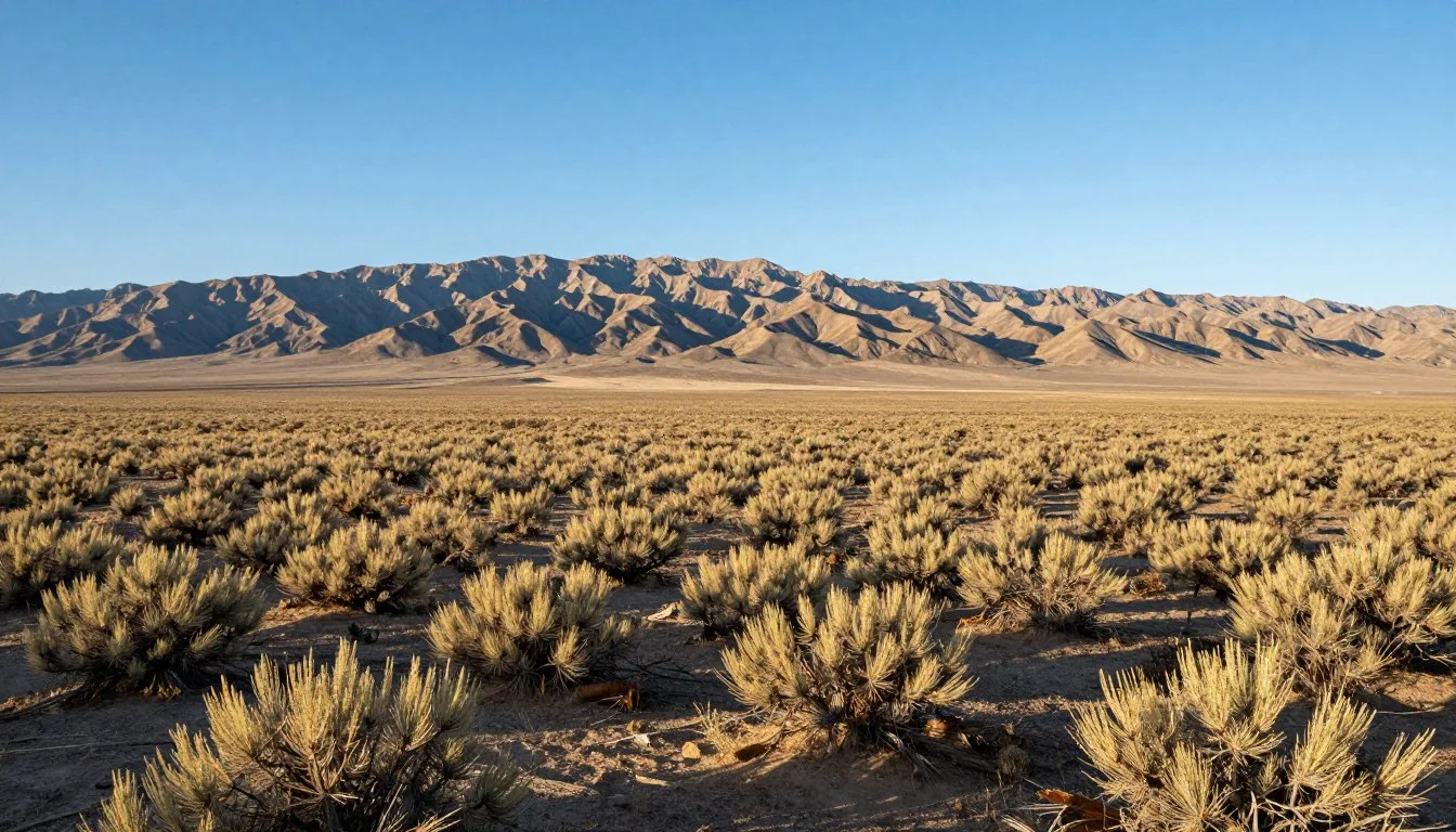
- Monitor Valley Vistas – The valley floor stretches 113 km (70 miles) in length and 16-32 km (10-20 miles) in width, flanked by the towering Toquima Mountains to the west. Multiple pullouts offer panoramic views of this vast landscape.
- Seasonal Streams – During May and early June, snowmelt creates picturesque stream crossings along the route. These shallow waterways add to the scenic beauty but rarely present driving challenges.
Historical Sites
- Belmont Ghost Town – Once the Nye County seat, this remarkably preserved ghost town features the impressive 1876 Belmont Courthouse, stone ruins of the Nye & Ormsby County Bank, and several intact structures. The courthouse has a fascinating history, including a brief visit by Charles Manson in 1969.
- Manhattan – A semi-ghost town with numerous abandoned buildings alongside a handful of occupied homes. The stone bank building and relocated church are particularly photogenic.
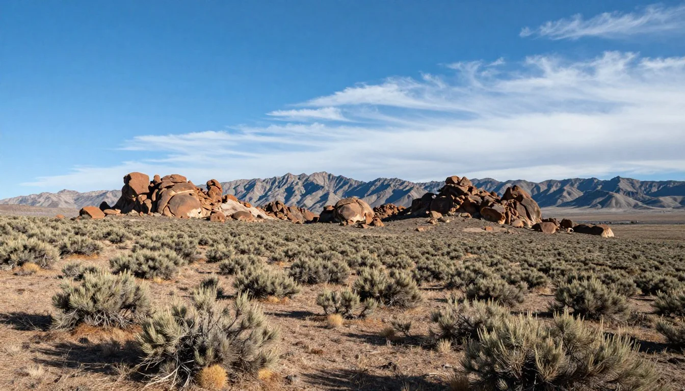
- Stone House Ranch – A century-old ranch structure visible from the road near Corcoran Canyon, representing the area’s ranching heritage.


Museums, Cultural Spots & Festivals
While the Belmont–Monitor Valley Loop is primarily known for its natural beauty and ghost towns, several cultural attractions provide insight into the region’s rich history:
Museums & Cultural Sites
- Toquima Cave – Located near Pete’s Summit, this archaeological site features remarkable Native American pictographs dating back centuries. A short 0.8 km (0.5 mile) hike leads to the cave where red, yellow, and white symbols cover the walls. This sacred site offers a glimpse into the indigenous history of the region.
- Belmont Courthouse Preservation – The Friends of the Belmont Courthouse organization occasionally offers guided tours of this historic structure. Check at Dirty Dick’s Saloon in Belmont for current information on tour availability.
- Geographic Center of Nevada – Located approximately 23 km (14.5 miles) south of Highway 50, a metal marker indicates the geographic center of the state. Though the official sign is sometimes missing, this spot represents the mathematical center of Nevada’s irregular shape.
Local Events
The remote nature of the region means formal festivals are rare, but several informal gatherings occur throughout the year:
- Belmont Days (typically in June) – A casual gathering of history enthusiasts and locals celebrating the ghost town’s heritage.
- Kingston Community Events – The tiny community occasionally hosts Dutch oven cookouts and other small gatherings, primarily for locals but welcoming to visitors. Ask at Miles End B&B or Zach’s Lucky Spur for any upcoming events.

Sports, Nature & Outdoor Experiences
The Belmont–Monitor Valley Loop offers outstanding opportunities for outdoor enthusiasts seeking solitude and unspoiled landscapes:
Hiking & Exploration
- Mount Jefferson – The highest point in Nye County at 3,641 m (11,949 ft), offering challenging hiking with spectacular views. The south summit is particularly rewarding for experienced hikers.
- Table Mountain Wilderness – Located on the eastern side of Monitor Valley, this designated wilderness area features numerous unmarked trails and opportunities for backcountry exploration.
- Kingston Canyon – The “back way” into Kingston offers beautiful hiking along a creek with several primitive campsites. Watch for wildlife including mule deer and desert bighorn sheep.
Fishing & Wildlife
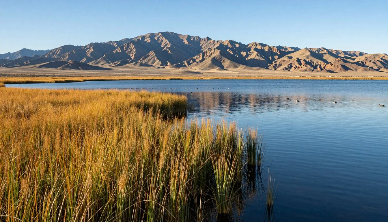
- Kingston Fishing Pond – This small community pond is stocked with rainbow trout and operates on a catch-and-release basis. Fish food can be purchased from a vending machine on site.
- Wildlife Viewing – The remote nature of the area makes it ideal for spotting pronghorn antelope, mule deer, coyotes, and numerous bird species. Dawn and dusk offer the best viewing opportunities.
- Photography – The combination of dramatic mountain backdrops, expansive valleys, and clear desert light creates perfect conditions for landscape photography. The area is also known for exceptional night sky viewing and astrophotography due to minimal light pollution.


Safety, Etiquette & Local Customs
Traveling the Belmont–Monitor Valley Loop requires preparation and respect for both the environment and local communities:
Safety Considerations
- Vehicle Preparation – Ensure your vehicle is in excellent condition with a full-sized spare tire, basic tools, and emergency supplies. Carry extra fuel, as the loop is 122 km (76 miles) without services.
- Communication – Cell service is non-existent throughout most of the loop. Consider renting a satellite phone or emergency beacon for remote travel.
- Water & Supplies – Carry at least 4 liters (1 gallon) of water per person per day, plus extra food, first-aid supplies, and warm clothing even in summer, as temperatures drop significantly at night.
- Weather Awareness – Check forecasts before departing and be prepared for rapid weather changes. Summer thunderstorms can cause flash flooding in low areas.
Etiquette & Local Customs
- Ghost Town Preservation – Never remove artifacts or disturb structures in ghost towns. These are protected historical sites, and removing items is illegal.
- Private Property – Some ranches and mining claims exist along the route. Respect all fences and “No Trespassing” signs.
- Local Interaction – The few permanent residents value their privacy but are generally friendly and helpful to respectful visitors. Patronizing local businesses like Zach’s Lucky Spur in Kingston or Dirty Dick’s in Belmont is appreciated.
- Environmental Responsibility – Practice Leave No Trace principles: pack out all trash, minimize campfire impacts, and stay on established roads to protect the fragile desert ecosystem.

Visitor Comments About Belmont–Monitor Valley Loop
“The Belmont–Monitor Valley Loop offers the authentic Nevada experience I’ve been searching for. Diana’s Punchbowl was unlike anything I’ve seen before, and the ghost towns transported me back in time. The vastness of the landscape and complete solitude were soul-refreshing. Just make sure your vehicle is prepared—we went 8 hours without seeing another car!”
“As a landscape photographer, the Belmont–Monitor Valley Loop exceeded all expectations. The quality of light at dawn and dusk is extraordinary, and the night skies are among the darkest I’ve experienced in the continental US. The Belmont Courthouse is hauntingly photogenic, especially in late afternoon light. Worth every mile of the journey.”
“We spent three days exploring the loop with base camp in Kingston. The Miles End B&B was a delightful surprise with incredible hospitality. John’s blueberry pancakes alone are worth the trip! The fishing pond in Kingston provided hours of entertainment, and the hiking opportunities seemed endless. This hidden gem deserves to be better known.”
Additional Nearby Destinations
While the Belmont–Monitor Valley Loop offers plenty to explore, several worthwhile destinations lie within a day’s drive:
Berlin-Ichthyosaur State Park
Located 97 km (60 miles) southwest of Belmont, this unique park combines a well-preserved ghost town with extraordinary paleontological discoveries. The remains of ancient marine reptiles (ichthyosaurs) are displayed where they were excavated, offering a glimpse into Nevada’s prehistoric past when the area was covered by a vast ocean.
Arc Dome Wilderness
Just west of the Monitor Valley in the Toiyabe Range, this wilderness area features excellent hiking trails and Nevada’s third-highest peak. The 64 km (40-mile) Toiyabe Crest Trail offers multi-day backpacking through spectacular high-country landscapes.
Lunar Crater Volcanic Field
Approximately 129 km (80 miles) southeast of Belmont, this National Natural Landmark features a massive volcanic crater 1,600 m (5,249 ft) in diameter and 130 m (430 ft) deep. The surrounding area includes cinder cones, lava flows, and other volcanic features in an otherworldly landscape.
Hickison Petroglyph Recreation Area
Located 48 km (30 miles) northeast of the Monitor Valley’s northern entrance, this easily accessible site features ancient rock art along a short interpretive trail. The area also offers camping facilities and panoramic views of the surrounding basins and ranges.

Practical Travel Tips
- Trip Duration – While the loop can technically be driven in a single day, allow 2-3 days to properly explore the ghost towns, natural features, and hiking opportunities.
- Navigation – The Benchmark Nevada Road & Recreation Atlas is essential for accurate navigation. Digital maps often show roads that no longer exist or miss important junctions.
- Fuel Planning – There are no fuel stations along the loop. Fill up in Eureka or Tonopah before starting your journey. Carrying an extra fuel container is recommended for extensive side trips.
- Water Crossings – During spring runoff (typically May), several small streams cross the road. These are usually shallow and easily navigable in any vehicle but check conditions if traveling after heavy rain.
- Photography – The area’s exceptional light makes for outstanding photography, especially during the golden hours around sunrise and sunset. Bring a tripod for night sky photography.
- Wildlife Encounters – Keep a respectful distance from all wildlife. While large predators are rarely seen, rattlesnakes are common during warm months—watch your step when hiking.
- Altitude Considerations – The route ranges from 1,800-2,400 m (5,900-7,900 ft) elevation. Those unaccustomed to altitude may experience mild symptoms and should stay well-hydrated.

Embrace the Magnificent Solitude
The Belmont–Monitor Valley Loop represents Nevada at its most authentic—a place where vast landscapes meet rich history, where silence is profound, and where the modern world feels wonderfully distant. As you travel this remarkable route, you’ll discover not just ghost towns and mountain vistas, but also a deeper connection to the land that defined the American West. Whether you’re photographing the perfect sunset over the Toquima Range, exploring the echoing halls of the Belmont Courthouse, or simply driving in peaceful solitude through Monitor Valley, you’re experiencing a Nevada that few travelers ever see. Pack your sense of adventure, prepare thoroughly, and set out to discover one of America’s last truly wild drives.
Related Posts
Ruby Lake National Wildlife Refuge, Nevada: Best Things to Do – Top Picks

Ruby Lake, Nevada: Best Things to Do – Top Picks
Rubi Desert Great Basin, Nevada: Best Things to Do – Top Picks
Round Mountain Recreation Area, Nevada: Best Things to Do – Top Picks
Robinson Mountains, Nevada: Best Things to Do – Top Picks