Hotels by Trip.com
Flights by Trip.com
Did you know that less than three percent of the original Pony Express trail remains visible today? Yet Nevada preserves the longest continuous stretch of this legendary route. The Pony Express operated for only eighteen months between 1860 and 1861. During that brief time, riders covered over 3,200 kilometers of treacherous terrain.
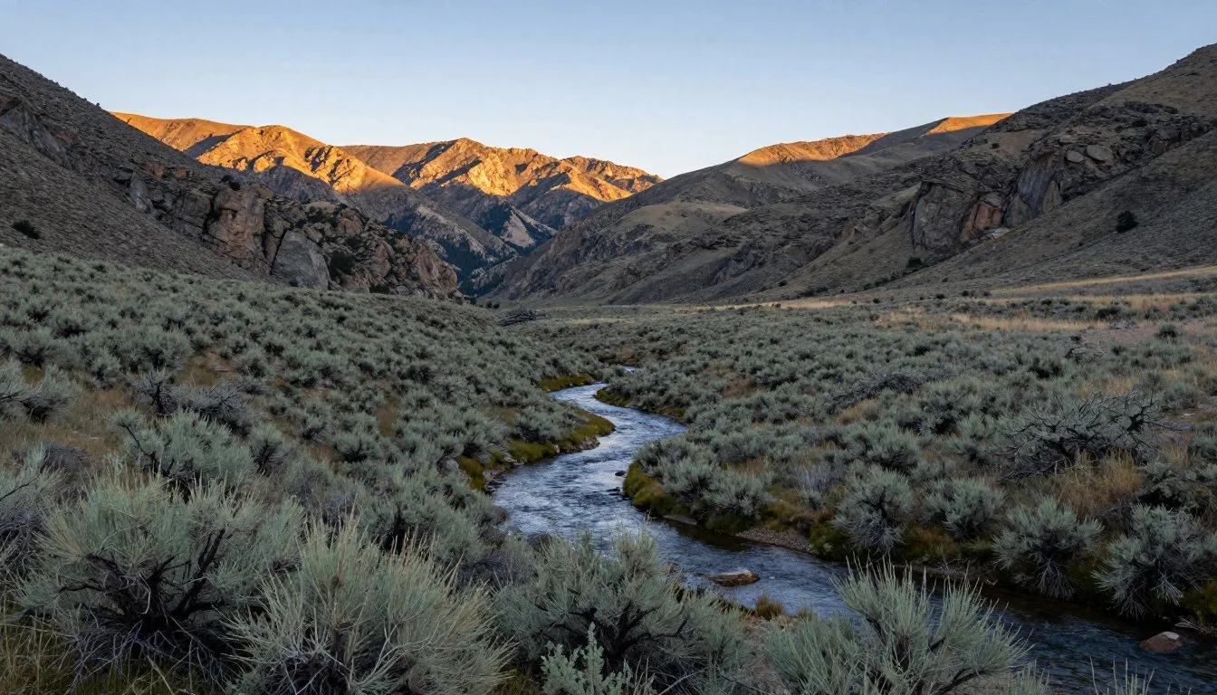
The Nevada section offers modern adventurers a rare glimpse into American frontier history. This remote backcountry trail winds through landscapes that have changed little since horse-mounted couriers galloped across them. Travelers today can trace the same route those brave riders took more than 160 years ago.
This comprehensive guide reveals everything you need to explore the Pony Express Backcountry Trail Routes in Nevada. From planning your journey to discovering hidden historical sites, you’ll find practical information for an unforgettable adventure through one of America’s most storied trails.
Getting There & Planning Your Journey

The Pony Express trail in Nevada stretches approximately 595 kilometers across the state’s midsection. The route crosses some of the most remote territory in the continental United States. Most visitors access the trail from either Reno or Salt Lake City.
Reno-Tahoe International Airport serves as the western gateway to the trail. This airport sits about 161 kilometers from the trail’s Nevada starting point near Lake Tahoe. Salt Lake City International Airport provides eastern access. It lies roughly 193 kilometers from the Nevada-Utah border crossing point.
Four-wheel-drive vehicles are essential for most sections of the Pony Express route. The trail conditions vary significantly throughout the year. Many segments become impassable during winter months due to snow and spring thaw. Summer brings extreme heat that can challenge both vehicles and visitors.
Planning your journey requires careful preparation. Cell phone coverage is nonexistent along most of the route. GPS devices and detailed paper maps are absolute necessities. Fuel stations are scarce, with some gaps exceeding 161 kilometers between services.
Plan Your Pony Express Trail Adventure
Contact the Bureau of Land Management Carson City District Office for current trail conditions, required permits, and detailed route information before your journey.
Best Time to Visit & Weather Tips
Late spring and early fall offer the most favorable conditions for exploring the Pony Express trail. May through June presents mild temperatures and blooming desert wildflowers. September through October delivers comfortable daytime weather with cool evenings perfect for camping.
Summer months from July to August bring extreme heat. Daytime temperatures frequently exceed 38°C (100°F) in lower elevations. Early morning starts become essential during this season. Carry significantly more water than you think necessary.
Winter transforms the trail into an inhospitable environment. Snow closes higher elevation passes from November through April. Even lower sections experience freezing temperatures at night. Spring thaw creates muddy, impassable conditions through March and early April.
Best Months to Visit
- May to June – Wildflower season, moderate temperatures
- September to October – Comfortable weather, fall colors
- Fewer crowds than summer peak season
- Stable trail conditions, minimal mud or snow
Months to Avoid
- November to April – Snow and freezing conditions
- July to August – Extreme heat, scarce water sources
- March to early April – Muddy trails from snowmelt
- Holiday weekends – Higher visitor numbers at popular stops
Notable Annual Festivals

The Pony Express Re-Ride takes place annually each June. This ten-day event features horseback riders retracing the original route from Sacramento to St. Joseph. Multiple Nevada communities along the trail host celebrations during this time. Riders exchange mail pouches at historic station sites.
Austin hosts its annual Pony Express Days celebration in mid-June. This small town sits directly on the trail route. The festival includes a parade, historical demonstrations, and local craft vendors. Contact Austin Chamber of Commerce at +1 (775) 964-2200 for specific dates and details.
Ely celebrates the Pony Express each July with its White Pine County Fair. This event combines agricultural exhibits with historical reenactments. The fairgrounds feature displays about the trail’s impact on local history. For information, call +1 (775) 289-3720.
Fallon hosts the annual Nevada Day Parade each October. While not exclusively Pony Express-themed, this celebration includes numerous historical elements. The parade often features riders in period costume representing the mail service. Contact Fallon Convention Center at +1 (775) 423-4556.
Getting Around Locally
Navigating the Pony Express trail requires self-reliance and preparation. No public transportation serves this remote route. Most travelers use high-clearance four-wheel-drive vehicles equipped for backcountry conditions. The trail surface varies from maintained gravel roads to primitive two-track paths.
Rental vehicles suitable for the trail are available in Reno and Salt Lake City. Companies specializing in four-wheel-drive rentals offer better-equipped vehicles than standard agencies. Reserve vehicles well in advance, especially during peak seasons. Verify that rental agreements permit off-highway travel.
The main trail route follows established roads and Bureau of Land Management tracks. However, navigation remains challenging in areas where multiple paths intersect. GPS coordinates for each historic station site prove invaluable. Download offline maps before departure since cellular service is unavailable.
Several tour companies offer guided expeditions along the Pony Express route. These multi-day adventures provide vehicles, camping equipment, and expert guides. Guided tours eliminate navigation concerns while providing historical context at each stop. Most tours accommodate small groups of four to eight people.
Where to Stay

Accommodation options along the Pony Express trail are limited but varied. Most travelers combine camping with occasional hotel stays in small towns. This approach balances adventure with comfort while allowing maximum flexibility for trail exploration.
Primitive camping is permitted on most Bureau of Land Management lands along the route. Established campgrounds exist near some historic station sites. Sand Springs Station offers a developed camping area with basic facilities. Cold Springs Station provides primitive camping with pit toilets but no water.
Austin provides the most centrally located hotel accommodations. This historic mining town offers several motels and bed-and-breakfast establishments. The town sits at the approximate midpoint of Nevada’s Pony Express corridor. Contact the Pony Express Lodge at +1 (775) 964-2306 for reservations.
Ely offers more extensive lodging options on the eastern end of the trail. Several chain hotels and independent motels serve travelers. The town makes an excellent base for exploring the eastern trail sections. Hotel Nevada provides historic atmosphere and modern amenities. Call +1 (775) 289-6665 for booking information.
Fallon anchors the western trail section with diverse accommodation choices. This agricultural community features multiple hotels and RV parks. The town provides full services including grocery stores and vehicle repair. Contact Fallon Tourism at +1 (775) 423-4556 for lodging recommendations.
Book Your Trail Accommodations
Secure your lodging early, especially during summer months when rooms fill quickly. Local establishments offer the best rates and insider trail knowledge.
Dining & Local Cuisine
Dining options along the Pony Express trail reflect the remote nature of the route. Small-town cafes and diners serve hearty, traditional Western fare. These establishments often function as community gathering spots where visitors can learn about local history and current trail conditions.
Austin offers several dining choices despite its small population. The International Hotel Restaurant serves steaks and traditional American cuisine in a historic setting. Local cafes provide breakfast and lunch options featuring home-style cooking. Most restaurants close early by urban standards, typically by 8:00 PM.
Ely provides the widest variety of dining establishments along the eastern trail. Several restaurants serve steaks, burgers, and regional specialties. The Cell Block Steakhouse combines dining with local history in a converted jail building. Chinese restaurants reflect the town’s mining heritage and diverse cultural roots.
Fallon restaurants emphasize agricultural products from surrounding farms. Local beef appears on most menus alongside Nevada-grown produce during summer months. Several Mexican restaurants serve the area’s significant Hispanic community. Fast-food chains provide familiar options for travelers seeking quick meals.
Self-sufficient meal planning is essential for multi-day trail expeditions. Stock up on supplies in larger towns before venturing into remote sections. Coolers and proper food storage protect provisions from heat. Many travelers bring camping stoves for hot meals at primitive campsites.
Attractions, Sightseeing & Activities
The Pony Express trail itself serves as the primary attraction. Over thirty historic station sites dot Nevada’s route. Each location offers unique insights into the mail service’s operations. Some stations feature interpretive signs while others remain unmarked ruins requiring careful navigation to locate.
Sand Springs Station stands as one of the best-preserved sites. This stone structure retains much of its original architecture. An interpretive trail with informative panels explains station operations and rider experiences. The site offers picnic facilities and restroom access making it ideal for extended visits.
Cold Springs Station represents another significant stop. Adobe ruins mark the location where several violent confrontations occurred during the trail’s operation. The remote setting evokes the isolation that riders faced. A short hike reveals additional stone foundations from outbuildings.
Simpson Park Station sits in a verdant canyon near Austin. This location provided crucial water and shade for horses and riders. The station site features interpretive signage and camping facilities. A small creek runs nearby during most seasons offering a rare water source along the arid route.
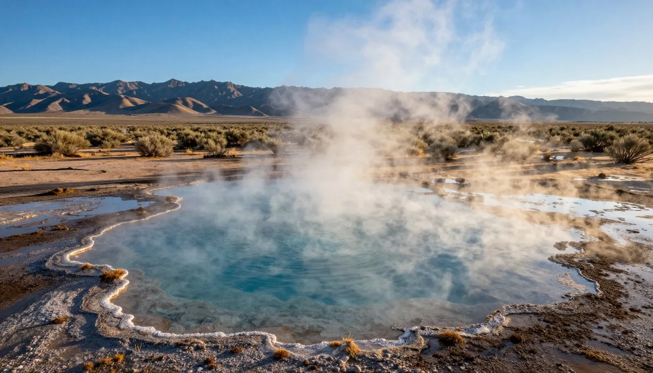
Photography opportunities abound throughout the trail corridor. Vast desert landscapes provide dramatic backdrops for sunrise and sunset images. Historic structures frame compelling shots combining natural beauty with cultural history. Night skies offer exceptional stargazing with minimal light pollution.
Museums, Cultural Spots & Festivals

The Churchill County Museum in Fallon houses extensive Pony Express exhibits. Collections include original artifacts, historical photographs, and detailed route maps. The museum offers self-guided tours through galleries exploring regional history. Admission costs $5 for adults with discounts for seniors and children. Contact them at +1 (775) 423-3677.
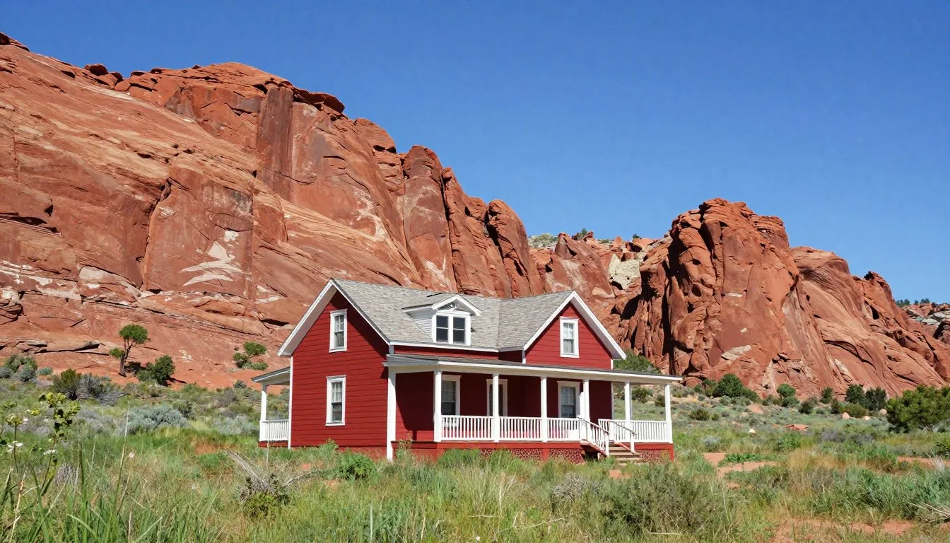
Austin’s historic downtown district functions as an open-air museum. Multiple buildings date from the 1860s when the Pony Express operated. Stokes Castle, a three-story stone tower, provides panoramic trail views. Walking tour brochures available at local businesses identify significant structures.
The White Pine Public Museum in Ely presents eastern Nevada history including Pony Express coverage. Exhibits detail the trail’s impact on regional development. The museum maintains extensive photo archives documenting station sites. Hours vary seasonally so call ahead at +1 (775) 289-4710.
Fort Churchill State Historic Park preserves Nevada’s largest historic military site. Though built after the Pony Express era, the fort protected mail routes. Visitors can explore adobe ruins and a visitor center with interpretive displays. The park charges $7 per vehicle for day use.
Nature & Outdoor Experiences

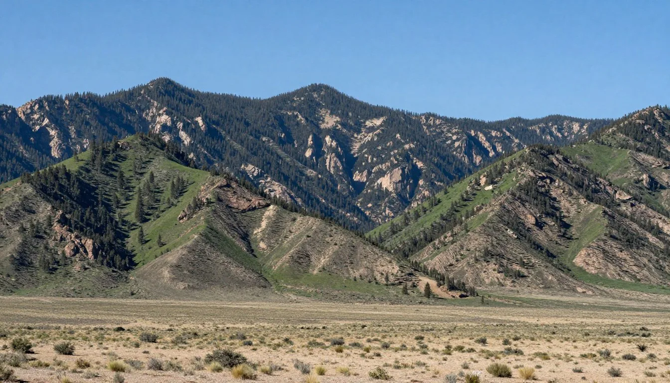
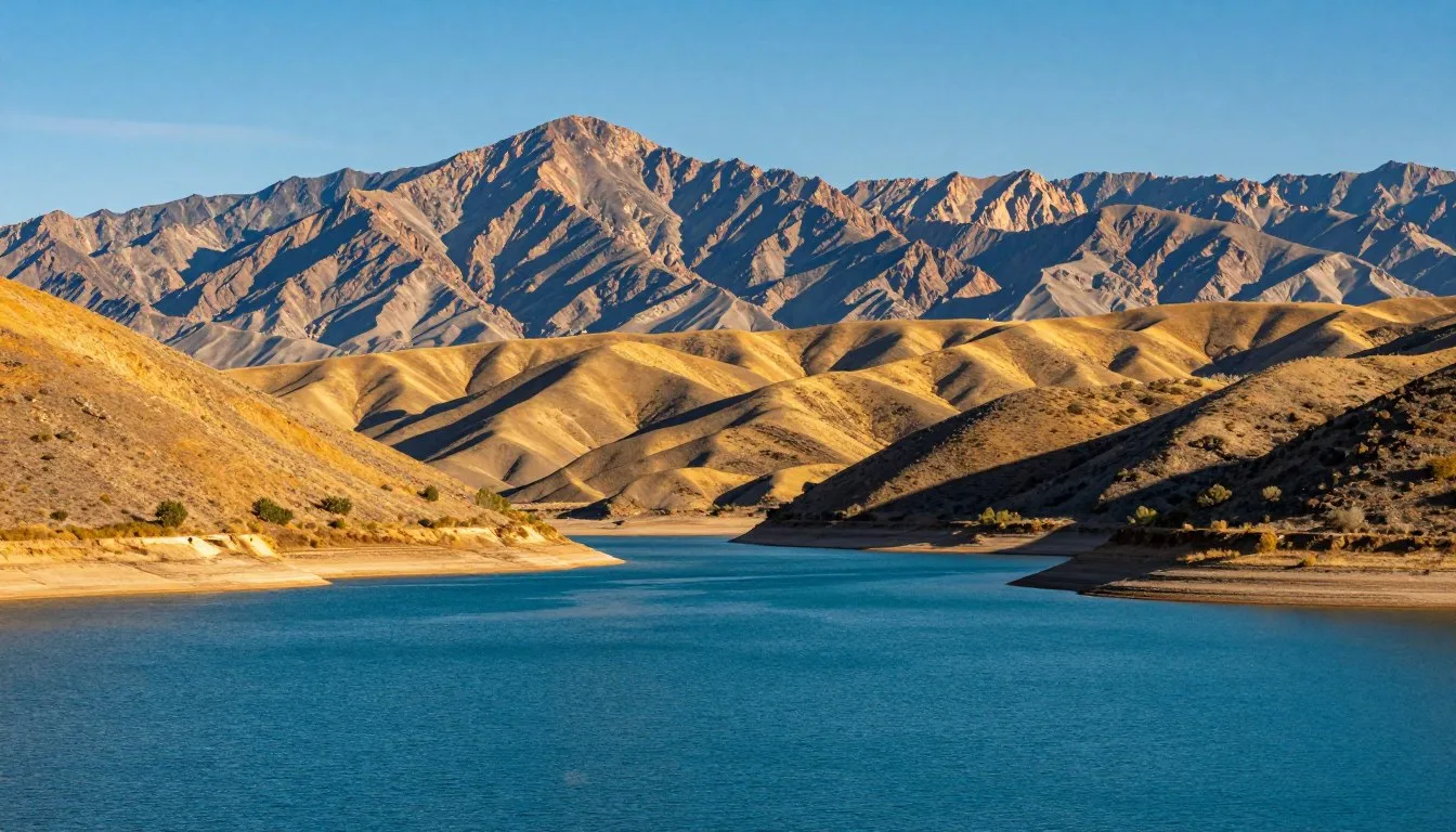
The Pony Express corridor traverses remarkable ecological diversity. Seven distinct mountain ranges cross the Nevada route. Each range creates unique microclimates supporting varied plant and animal communities. Elevations range from 1,219 meters (4,000 feet) in valleys to over 2,438 meters (8,000 feet) in mountain passes.
Wildlife viewing opportunities occur throughout the trail. Pronghorn antelope frequently appear in open valleys. These animals can run at speeds exceeding 88 kilometers per hour, rivaling the pace of Pony Express horses. Mule deer inhabit mountain sections while coyotes and kit foxes hunt across all elevations.
Bird watching attracts enthusiasts year-round. Golden eagles soar above ridgelines hunting for prey. Sage grouse perform elaborate mating displays during spring months. Ravens and magpies frequent camping areas while smaller songbirds inhabit riparian zones near springs.
Hiking opportunities extend beyond the main trail route. Many mountain ranges offer established trails reaching scenic summits. The Desatoya Mountains near Austin provide excellent day hiking. The Schell Creek Range east of Ely features alpine lakes and forests contrasting sharply with surrounding deserts.
Spring brings spectacular wildflower displays to the trail corridor. Desert sunflowers, Indian paintbrush, and lupine carpet hillsides during May and early June. Timing varies based on winter precipitation and spring temperatures. Lower elevations bloom first with mountain meadows following several weeks later.

Safety, Etiquette & Local Customs
Safety considerations dominate Pony Express trail travel. The remote environment demands thorough preparation and constant awareness. Cell phone service is unavailable along most of the route. Satellite communication devices provide the only reliable emergency contact method.
Vehicle breakdowns pose serious risks in this isolated terrain. Carry comprehensive spare parts including extra tires, belts, hoses, and fluids. Basic mechanical knowledge helps address common problems. Many travelers bring portable air compressors and tire repair kits.
Water represents the most critical supply consideration. Carry at least four liters per person per day plus reserves for emergencies. Natural water sources are scarce and often unreliable. Assume all natural water requires treatment before drinking. Heat-related illness develops rapidly in summer conditions.
Weather changes occur suddenly in Nevada’s basin and range terrain. Afternoon thunderstorms appear with little warning during summer months. Lightning strikes pose significant danger in exposed areas. Flash flooding can render normally dry washes impassable within minutes. Monitor weather forecasts before departure and remain alert to changing conditions.
Leave No Trace principles apply throughout the trail corridor. Pack out all trash including organic waste. Use existing campsites rather than creating new ones. Keep vehicles on established roads to prevent desert soil damage. The fragile environment shows impacts for decades.
Respect for historic sites ensures their preservation. Never disturb artifacts or ruins at station locations. Climbing on fragile stone structures accelerates deterioration. Take only photographs and leave sites exactly as found. Report vandalism or artifact theft to the Bureau of Land Management.
Emergency Contact Information
Save these numbers before departing. Emergency services response times can exceed several hours in remote areas. Always inform someone of your planned route and expected return date.
Visitor Comments About Pony Express Backcountry Trail Routes
The isolation and historic atmosphere exceeded all expectations. Standing at Cold Springs Station gave me chills imagining riders galloping through this exact landscape. Bring plenty of water and patience for rough roads. The experience rewards those willing to venture off paved highways.
We spent five days exploring the Nevada sections with our four-wheel-drive. Each station site offered unique insights into frontier life. The night skies absolutely stunned us with zero light pollution. Cell service is truly nonexistent so plan accordingly. Worth every bit of preparation required.
This trail delivers authentic backcountry adventure. The roads challenged our vehicle and skills but remained manageable with proper equipment. Austin served as an excellent base for exploring central sections. Local people shared wonderful stories about the trail’s history. Highly recommend visiting during spring or fall.
Additional Nearby Destinations

Great Basin National Park lies near the eastern end of Nevada’s Pony Express route. This park protects 31,246 hectares (77,180 acres) of high desert and alpine environments. Wheeler Peak rises to 3,982 meters (13,065 feet) offering hiking and scenic drives. Ancient bristlecone pines, some over 4,000 years old, grow on mountain slopes.
Lehman Caves provide underground exploration opportunities within the park. Guided tours reveal intricate limestone formations including stalactites, stalagmites, and rare shield formations. Tours run year-round with reservations recommended during peak season. The visitor center offers exhibits about park geology and ecology.
Berlin-Ichthyosaur State Park preserves both mining history and fossil discoveries. An intact fossil bed contains giant marine reptile remains from when oceans covered Nevada. The ghost town of Berlin maintains numerous original structures from the 1890s mining era. Camping facilities and interpretive programs operate seasonally.
Lunar Crater Volcanic Field showcases Nevada’s volcanic past. This area features numerous cinder cones, lava flows, and maar craters. Easy Boy Crater allows visitors to walk along a volcanic rim. The stark landscape resembles moon terrain attracting geology enthusiasts and photographers.
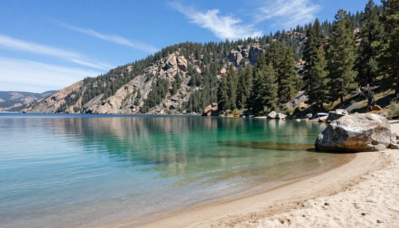
Lake Tahoe sits approximately 193 kilometers west of the trail’s Nevada starting point. This alpine lake straddles the California-Nevada border offering year-round recreation. Summer brings hiking, boating, and swimming while winter features world-class skiing. The lake covers 49,164 hectares (121,500 acres) with remarkable water clarity.
Practical Travel Tips
Vehicle preparation determines expedition success. Install skid plates to protect the undercarriage from rocks. Carry two full-size spare tires since punctures occur frequently on rough roads. A high-lift jack and tow straps prove essential for self-recovery. Check tire pressure regularly adjusting for terrain conditions.
Navigation tools require redundancy in this environment. GPS devices with preloaded topographic maps provide primary navigation. Download offline maps to smartphones as backup. Carry paper maps and a compass for situations when electronics fail. Mark waypoints for all planned camping locations and historic sites.
Fuel management demands careful planning. Calculate distances between services and add a safety margin. Some segments exceed 193 kilometers between fuel stations. Carry extra fuel in approved containers. Note that some small-town stations keep limited hours or close on Sundays.
Photography equipment requires protection from dust and temperature extremes. Keep cameras in sealed bags when not shooting. Bring lens cleaning supplies and extra batteries. Early morning and late afternoon provide the best natural lighting. Sunset photography at station ruins creates particularly compelling images.
Permits are generally not required for trail travel on public lands. However, verify current regulations with the Bureau of Land Management. Some areas may impose seasonal closures to protect wildlife or due to weather conditions. Campfire restrictions apply during dry periods typically from June through October.
Physical fitness influences comfort levels during the journey. Much of the experience involves sitting in vehicles on rough roads. However, exploring station sites requires moderate hiking ability. Some ruins sit several hundred meters from parking areas across uneven terrain. Heat tolerance is crucial during summer visits.
The Pony Express Trail crosses central Nevada from west to east, passing through Austin and connecting numerous historic station sites.
Your Adventure Awaits on This Historic Trail
The Pony Express Backcountry Trail Routes in Nevada offer an unparalleled journey through American history. Few places preserve frontier heritage with such authenticity and minimal modern intrusion. Every mile traveled connects you directly with the brave riders who risked everything to deliver mail across this unforgiving landscape.
Proper planning transforms this challenging route into a rewarding adventure. The isolation that intimidates some travelers becomes the very feature that makes the experience extraordinary. Standing alone at a remote station site creates connections to history impossible to achieve at crowded tourist destinations.
Whether you spend two days or two weeks exploring the trail, the experience will stay with you forever. The vast landscapes, star-filled nights, and tangible history combine to create memories that transcend ordinary travel. Start planning your expedition today and discover why this legendary route continues to captivate adventurers more than 160 years after the last rider galloped through.