Hotels by Trip.com
Flights by Trip.com
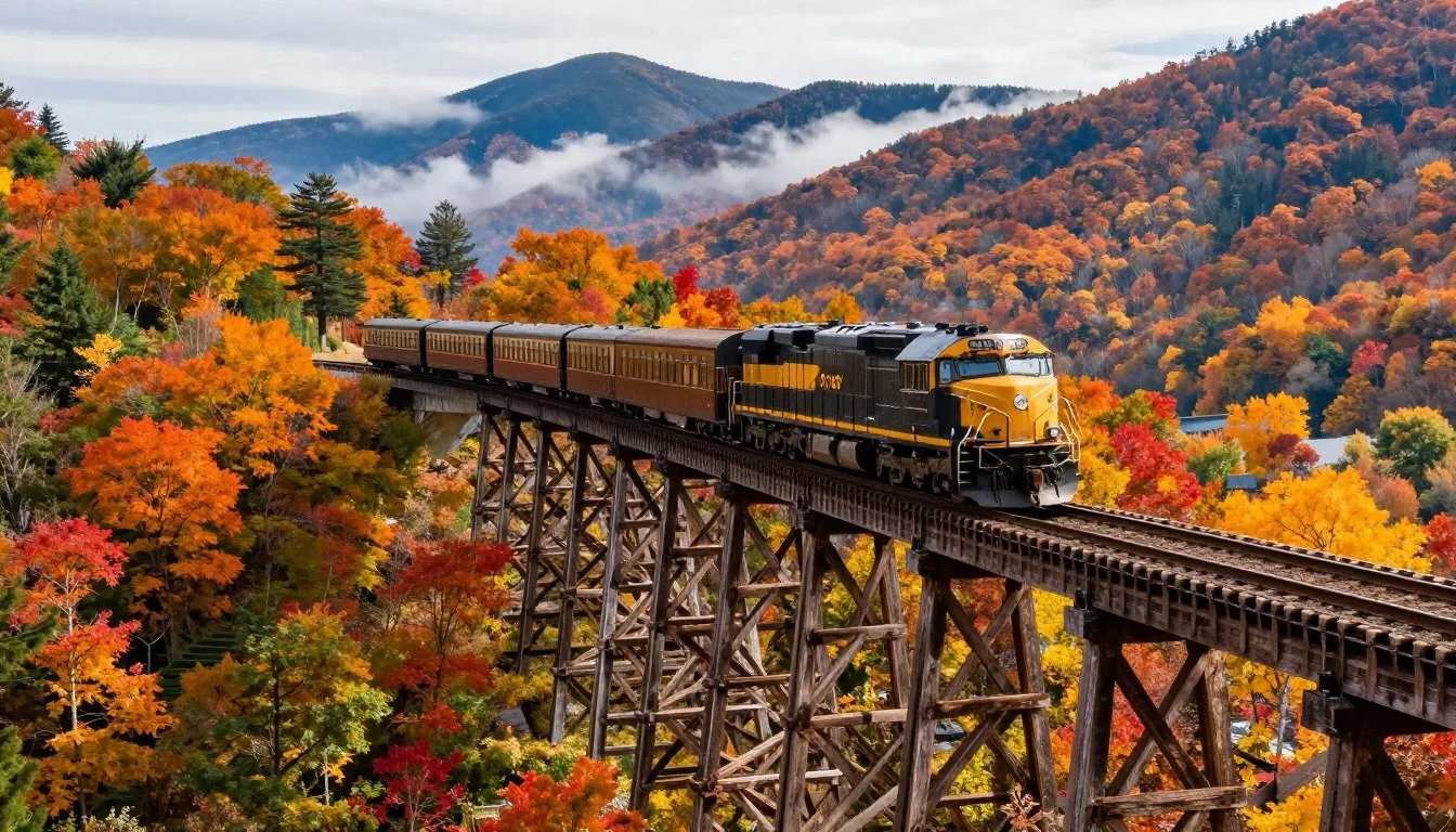
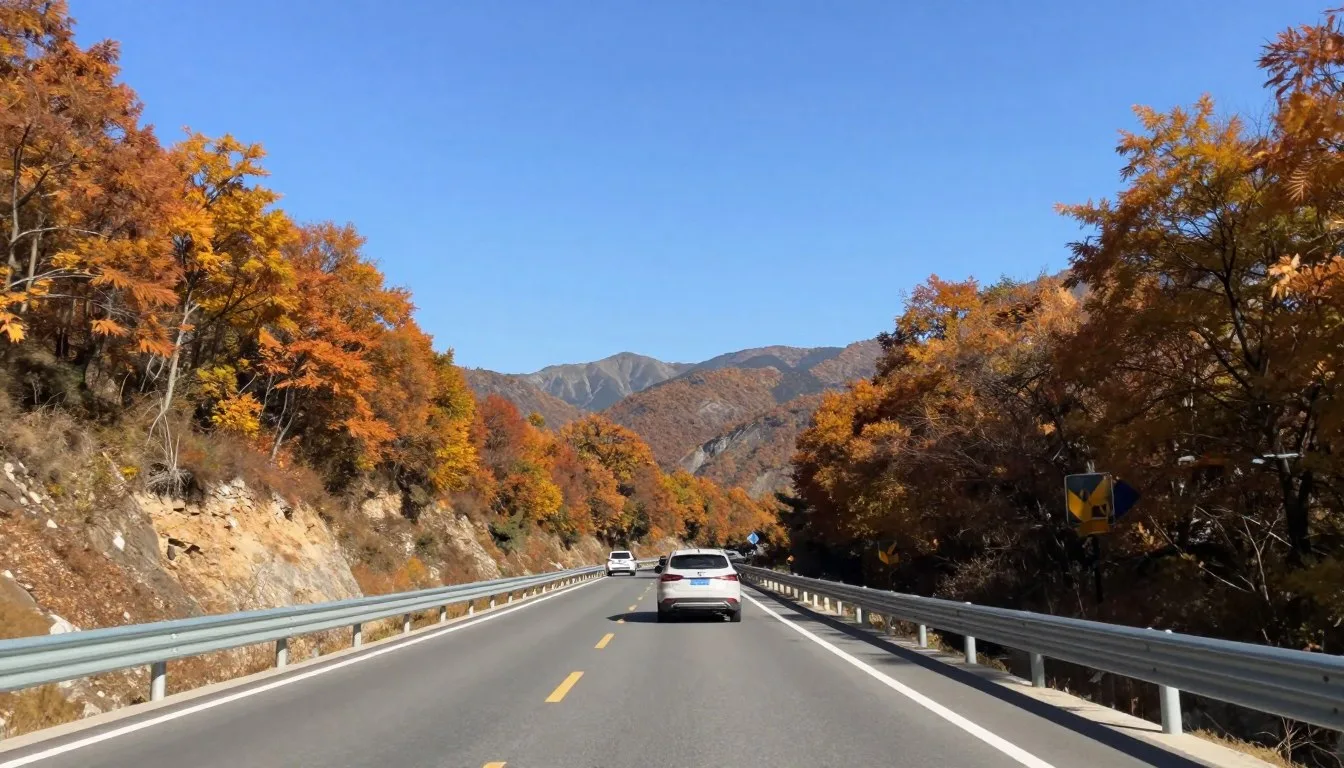
Only 100 vehicles travel the Cherohala Skyway on an average weekday, making it one of America’s least crowded scenic byways despite spanning 43 magnificent miles through the Appalachian Mountains. This National Scenic Byway connects Tellico Plains, Tennessee, to Robbinsville, North Carolina, reaching elevations of 1,615 meters (5,400 feet) with minimal commercial development disrupting the wilderness experience.
The name “Cherohala” combines Cherokee National Forest and Nantahala National Forest, the two protected wilderness areas this remarkable highway traverses. Construction took 34 years to complete, finally opening in 1996 after environmental challenges and engineering complexities delayed the project multiple times.
This comprehensive guide reveals everything you need to plan an unforgettable journey along one of western North Carolina’s most spectacular mountain roads.
Getting There & Planning Your Journey

The Cherohala Skyway begins in Tellico Plains, Tennessee, and ends in Robbinsville, North Carolina. Most visitors access this scenic byway from major airports in the southeastern United States.
McGhee Tyson Airport (TYS)
Located near Knoxville, Tennessee, approximately 97 kilometers (60 miles) from the western entrance at Tellico Plains. This regional airport offers convenient access with rental car facilities.
Asheville Regional Airport (AVL)
Situated 161 kilometers (100 miles) from the eastern entrance at Robbinsville. This airport serves the North Carolina side with multiple daily flights from major cities.
Charlotte Douglas International Airport (CLT)
North Carolina’s largest airport sits 241 kilometers (150 miles) from Robbinsville. This option works best for visitors combining multiple western North Carolina destinations.
The drive from Tellico Plains to Robbinsville takes approximately 90 minutes without stops. However, most travelers spend 3-4 hours exploring scenic overlooks, hiking trails, and photography opportunities.
Cherohala Skyway Visitor Center Contact:
The visitor center in Tellico Plains provides maps, weather updates, and current road conditions before your journey.
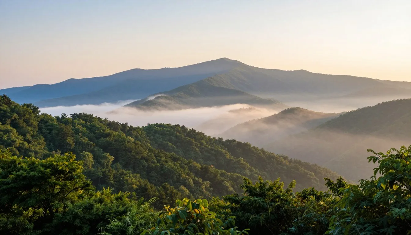
Best Time to Visit & Weather Tips

Best Time to Visit Cherohala Skyway
The ideal months to experience the Cherohala Skyway depend on your interests and weather preferences.
Recommended Seasons
- Mid-October to Early November: Peak fall foliage attracts the largest crowds but offers spectacular color displays across the mountains
- April through May: Spring wildflowers bloom, temperatures stay comfortable at 15-21°C (60-70°F), and traffic remains light
- June through September: Summer provides consistently warm weather and fully accessible hiking trails throughout both national forests
- Late September: Early autumn combines pleasant temperatures with emerging fall colors and minimal visitor congestion
Seasons to Avoid
- December through March: Winter weather creates hazardous driving conditions with ice, snow, and frequent road closures above 1,219 meters (4,000 feet)
- Late March: Unpredictable weather transitions between winter and spring cause temporary closures and limited visibility
- Peak Fall Weekends: Mid-October Saturdays see traffic congestion at popular overlooks and limited parking availability
Weather Patterns Throughout the Year
Mountain elevations along the Cherohala Skyway create distinct microclimates. Temperatures at higher elevations typically run 8-11°C (15-20°F) cooler than valley floors.
| Season | Average Temperature | Precipitation | Road Conditions |
| Spring (April-May) | 13-21°C (55-70°F) | Moderate rainfall | Generally clear, occasional closures |
| Summer (June-August) | 21-27°C (70-80°F) | Afternoon thunderstorms common | Excellent, all facilities open |
| Fall (September-November) | 10-21°C (50-70°F) | Low to moderate | Excellent until late November |
| Winter (December-March) | -1 to 10°C (30-50°F) | Snow and ice common | Frequent closures, hazardous |
Notable Annual Festivals

The communities surrounding the Cherohala Skyway celebrate mountain heritage through several annual festivals that showcase local culture, crafts, and traditions.
Cherohala Skyway Fall Motorcycle Ride
Held annually in mid-October, this organized ride attracts motorcycle enthusiasts from across the southeastern United States. The event coincides with peak fall foliage season, offering riders spectacular mountain views.
Contact: Cherohala Event Organizers
Tellico Plains Mountain Heritage Festival
This September celebration in Tellico Plains features traditional Appalachian music, local artisan crafts, and authentic mountain cuisine. The festival highlights the cultural history of the Cherokee National Forest area.
Contact: Tellico Plains Visitor Center
Robbinsville Snowbird Mountain Music Festival
Taking place each July in Robbinsville, North Carolina, this festival showcases bluegrass and traditional mountain music. Local and regional musicians perform throughout the weekend celebration.
Contact: Graham County Tourism
Spring Wildflower Pilgrimage
Guided wildflower walks and nature photography workshops occur throughout April and May. Forest Service naturalists lead educational programs highlighting native flora along the Cherohala Skyway.
Contact: Nantahala National Forest
Getting Around Locally
The Cherohala Skyway requires personal transportation. No public transit serves this remote mountain highway connecting Tellico Plains and Robbinsville.
Personal Vehicle
Most visitors drive personal cars or rental vehicles along the scenic byway. The road features well-maintained pavement with clearly marked scenic overlooks and parking areas.
Fuel stations operate in Tellico Plains and Robbinsville but not along the 43-mile highway itself. Fill your tank before beginning the drive.
Cell phone service becomes unreliable at higher elevations. Download offline maps before departure.
Motorcycle Travel
The Cherohala Skyway ranks among America’s premier motorcycle roads. Smooth pavement, sweeping curves, and minimal traffic create ideal riding conditions.
Motorcycle parking appears at all major overlooks. Weekend traffic increases during peak seasons, especially in October.
Weather changes rapidly at elevation. Carry rain gear and warm layers regardless of valley conditions.
Important Road Information: The Tennessee Department of Transportation and North Carolina DOT close portions of the Cherohala Skyway during winter weather. Check current conditions before traveling between November and April. Emergency call boxes are limited at high elevations.
Where to Stay

Lodging options near the Cherohala Skyway range from rustic campgrounds to comfortable mountain inns. Most accommodations cluster in Tellico Plains, Tennessee, and Robbinsville, North Carolina.
Tellico Plains Area Lodging
Mountain Cabins
Private rental cabins offer full kitchens, multiple bedrooms, and scenic views. Properties range from basic to luxury with amenities including hot tubs and fireplaces.
Nightly rates typically run $120-$280 depending on size and season.
Country Inns
Small locally-owned inns provide comfortable rooms with breakfast included. These properties offer personalized service and local knowledge from hosts.
Expect rates between $85-$150 per night for double occupancy rooms.
Campgrounds
Cherokee National Forest campgrounds near Tellico Plains feature tent sites and RV hookups. Indian Boundary Campground provides lake access and modern facilities.
Sites cost $15-$30 nightly with seasonal availability from April through October.
Robbinsville Area Lodging
Historic Hotels
Robbinsville features renovated historic hotels offering mountain hospitality. These properties maintain period character while providing modern comforts.
Room rates range from $95-$165 per night including continental breakfast.
Lakeside Resorts
Properties near Santeetlah Lake provide water access and mountain views. Resorts offer boat rentals, fishing guides, and outdoor recreation packages.
Expect $140-$250 nightly rates during peak summer and fall seasons.
National Forest Camping
Primitive and developed campgrounds in Nantahala National Forest surround Robbinsville. Sites accommodate tents and small RVs.
Camping fees run $12-$25 per night with limited winter availability.
Reserve accommodations several months ahead for October visits during peak fall foliage season. Summer weekends also book quickly at popular properties.
Dining & Local Cuisine

Dining options along the Cherohala Skyway reflect authentic Appalachian and Southern culinary traditions. Most restaurants operate in Tellico Plains and Robbinsville rather than along the highway itself.
Tellico Plains Restaurants
- Home-Style Cafes: Local diners serve traditional breakfast with biscuits, gravy, country ham, and farm-fresh eggs starting at 6:00 AM daily
- Barbecue Joints: Tennessee-style pulled pork and ribs smoked over hickory wood attract both locals and travelers throughout the week
- Family Restaurants: Casual establishments offer fried catfish, chicken, country vegetables, and homemade desserts at reasonable prices
- Pizza and Subs: Quick-service options provide convenient meals for hikers and travelers on tight schedules
Robbinsville Dining
- Mountain Trout: Fresh rainbow and brown trout from local streams appear on menus pan-fried or grilled with simple seasonings
- Southern Buffets: All-you-can-eat spreads feature regional favorites including fried chicken, green beans, mashed potatoes, and fruit cobblers
- Steakhouses: Several restaurants specialize in grilled steaks, burgers, and hearty American fare with mountain views
- Country Stores: General stores sell packaged sandwiches, snacks, and beverages for picnic meals along the scenic byway
Local Specialty: Try apple butter and stack cakes, traditional mountain desserts found at bakeries and country stores. These authentic treats reflect generations of Appalachian baking traditions passed through families.
Plan dining stops before or after driving the Cherohala Skyway. No restaurants operate along the 43-mile route between communities. Pack snacks and water for the journey.
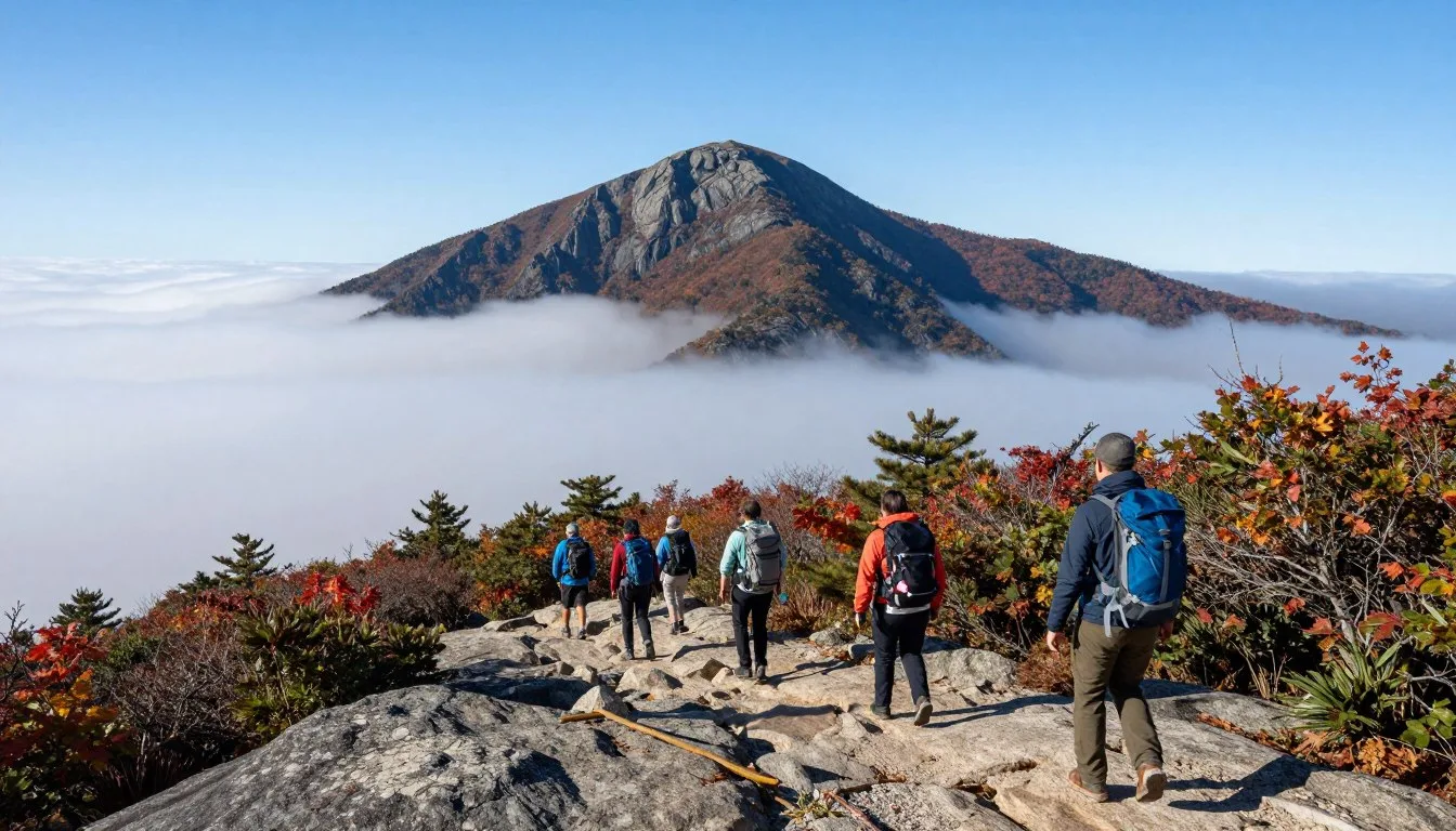
Attractions, Sightseeing & Activities

The Cherohala Skyway itself serves as the primary attraction. However, numerous stops and activities enhance the scenic drive experience.
Major Scenic Overlooks
Hooper Bald Overlook
Located at 1,615 meters (5,290 feet) elevation, this overlook provides 360-degree mountain views. Clear days reveal the Great Smoky Mountains National Park to the northeast.
Parking accommodates 15-20 vehicles. Arrive early during October weekends.
Santeetlah Overlook
This North Carolina viewpoint showcases Santeetlah Lake surrounded by forested ridges. The vista extends across Graham County wilderness areas.
Interpretive signs explain local geology and forest ecology.
Highway Highlights
- Bald River Falls – 30-meter (90-foot) waterfall accessible via short trail from Cherohala Skyway
- Indian Boundary Lake – 38-hectare (95-acre) mountain lake with swimming beach and recreation area
- Multiple creek crossings – Tellico River and numerous tributaries flow beneath the highway
- Wildflower displays – Spring blooms include trillium, rhododendron, and mountain laurel
Natural Features
- Trailheads – Hiking paths ranging from easy walks to challenging backcountry routes
- Fishing access – Mountain streams support wild trout populations
- Photography locations – Designated pullouts at peak vista points
- Picnic areas – Tables and restrooms at major overlooks
Recreation Access Points
Nearby Attractions
- Joyce Kilmer Memorial Forest: Old-growth forest preserve 16 kilometers (10 miles) from Robbinsville features trees over 400 years old and hiking trails through virgin timber
- Tail of the Dragon: Famous 11-mile road with 318 curves connects to Cherohala Skyway via highway 129, attracting sports car and motorcycle enthusiasts
- Tellico River: Renowned fly fishing destination flows alongside the western portion of the Cherohala Skyway through Cherokee National Forest
- Historic Robbinsville: Graham County seat features local history museum and authentic mountain town atmosphere
Museums, Cultural Spots & Festivals

The cultural heritage surrounding the Cherohala Skyway reflects Cherokee Native American history and Appalachian settlement traditions.
Cultural Sites in Tellico Plains
Charles Hall Museum
This small local history museum in Tellico Plains displays artifacts from early settlement periods. Collections include farming implements, household items, and photographs documenting the area’s development.
Free admission. Open Thursday through Saturday during summer months. Call ahead for current hours and winter closures.
Cherohala Skyway Visitor Center
The visitor center in Tellico Plains offers interpretive exhibits about the National Scenic Byway construction, forest ecology, and regional wildlife. Staff provide maps and current road conditions.
Open daily April through October. Weekend hours only November through March.
Graham County Cultural Sites
Yellow Branch Pottery
Traditional pottery studio 8 kilometers (5 miles) from Robbinsville creates handmade ceramics using techniques passed through generations. Visitors watch artisans work and purchase unique pieces.
Open Tuesday through Saturday year-round.
Stecoah Valley Center
This community arts center showcases regional crafts including quilting, woodworking, and traditional music. Monthly concerts feature bluegrass and old-time mountain musicians.
Gallery hours vary. Check schedule for special events and performances.
Heritage Learning Opportunities
- Forest Service ranger programs explain Cherokee National Forest and Nantahala National Forest management and conservation efforts
- Guided wildflower walks teach plant identification and traditional medicinal uses during spring months
- Historical society talks describe logging history and early highway construction in the mountain region
- Traditional craft demonstrations show basket weaving, blacksmithing, and other Appalachian skills at seasonal festivals
Nature & Outdoor Experiences

The Cherohala Skyway crosses two national forests offering exceptional outdoor recreation opportunities. Activities range from easy nature walks to challenging wilderness adventures.
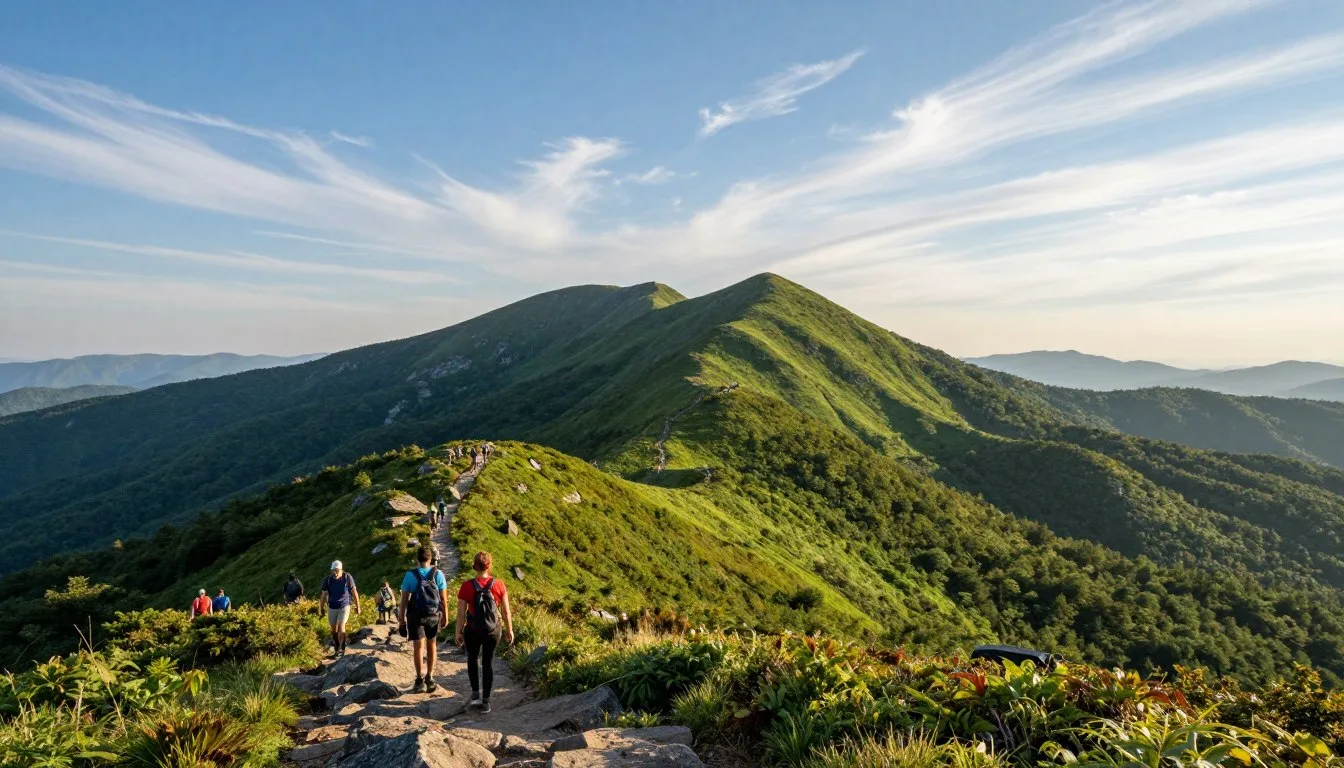
Hiking Trails
| Trail Name | Distance | Difficulty | Highlights |
| Stratton Bald Trail | 5.6 km (3.5 miles) | Moderate | Grassy bald summit with panoramic views |
| Joyce Kilmer Loop | 3.2 km (2 miles) | Easy | Old-growth forest, massive poplar trees |
| Bald River Falls Trail | 0.8 km (0.5 miles) | Easy | Waterfall viewing, wheelchair accessible |
| Bob Stratton Bald | 4.8 km (3 miles) | Moderate | Wildflower meadows, mountain vistas |
Water Activities

- Fly Fishing: The Tellico River supports native brook trout and stocked rainbow trout. North Carolina Wildlife licenses required for fishing
- Lake Recreation: Indian Boundary Lake offers swimming, canoeing, and kayaking during summer months with rental equipment available
- Santeetlah Lake: This 1,093-hectare (2,700-acre) reservoir near Robbinsville provides excellent bass fishing and peaceful paddling experiences
- Stream Exploration: Numerous creeks crossing under the highway offer wading and wildlife observation opportunities
Wildlife Watching
The Cherokee National Forest and Nantahala National Forests host diverse wildlife populations. Common sightings include white-tailed deer, black bears, wild turkeys, and numerous bird species.
Best Viewing Times
Dawn and dusk provide optimal wildlife observation periods. Early morning drives often reveal deer feeding in roadside meadows.
Spring migration brings warblers and other songbirds to mountain forests. October sees active feeding before winter.
Safety Considerations
Black bears frequent the area throughout summer and fall. Store food properly at campsites. Never approach or feed wildlife.
Observe animals from vehicles or designated overlooks. Use binoculars to view details while maintaining safe distances.
Photography Opportunities
- Sunrise shoots capture morning fog in mountain valleys creating dramatic layered landscapes
- Fall color photography peaks mid-October when mixed hardwoods display brilliant reds, oranges, and yellows
- Waterfall photography at Bald River Falls works best during spring runoff when flow volume increases
- Night sky photography benefits from minimal light pollution at higher elevations along the Cherohala Skyway
Travel With Children

The Cherohala Skyway offers family-friendly experiences suitable for children of various ages. Planning appropriate activities ensures enjoyable visits for everyone.
Kid-Friendly Activities
Short Nature Walks
Easy trails under 1.6 kilometers (1 mile) accommodate young children and strollers. Bald River Falls Trail provides wheelchair accessibility.
Junior Ranger programs at visitor centers teach forest ecology through hands-on activities.
Scenic Overlook Stops
Frequent pullouts allow children to stretch legs and enjoy mountain views. Pack binoculars for wildlife spotting games.
Interpretive signs at overlooks provide educational information suitable for elementary-age readers.
Lake Swimming
Indian Boundary Lake features a sandy beach with lifeguards during summer months. Shallow areas work well for young swimmers.
Picnic facilities and playgrounds adjacent to the beach provide additional recreation options.
Family Travel Tips
- Drive the highway during mid-morning hours when children feel most energetic and traffic remains light
- Pack motion sickness remedies as the winding mountain road contains hundreds of curves
- Bring layers of clothing since temperatures drop significantly at higher elevations even during summer
- Plan bathroom stops in Tellico Plains or Robbinsville as restroom facilities along the highway remain limited to major overlooks
- Download offline entertainment as cell service disappears for extended stretches along the route
- Allow extra travel time for unplanned stops at waterfalls, wildlife sightings, or scenic photo opportunities
Educational Opportunity: Use the drive to teach children about mountain ecosystems, forest management, and Cherokee Native American history. The Forest Service provides free educational materials at visitor centers designed for young learners.
Money Saving Tips
Experiencing the Cherohala Skyway requires minimal expense compared to many vacation destinations. Strategic planning reduces costs further while maintaining quality experiences.
Free Activities
- Driving the entire 43-mile Cherohala Skyway costs nothing – no tolls or entrance fees apply
- All scenic overlooks provide free parking and restroom access at designated facilities
- Hiking trails in Cherokee National Forest and Nantahala National Forests require no permits or fees
- Wildlife watching and photography throughout the area remain completely free activities
- Visitor center exhibits and ranger programs cost nothing to attend
Budget-Friendly Options
- National Forest campgrounds charge $12-$25 nightly versus $100+ for hotels
- Pack picnic lunches using grocery items from Tellico Plains or Robbinsville stores
- Visit during May or September for pleasant weather without peak-season accommodation rates
- Fill fuel tanks in larger towns before reaching mountain areas where gas prices run higher
- Use America the Beautiful pass if visiting multiple national forest areas during your trip
Cost Comparison
| Expense Category | Budget Option | Mid-Range Option | Premium Option |
| Lodging (per night) | $15-$30 camping | $95-$150 inn | $200-$280 cabin |
| Meals (per person daily) | $15-$25 groceries | $30-$50 restaurants | $60+ fine dining |
| Activities | $0 hiking/driving | $25-$50 guided tours | $100+ specialized guides |
| Transportation | Personal vehicle | $45-$65 daily rental | $100+ premium rental |
Additional Savings Strategies
- Book accommodations directly with properties rather than through booking sites to avoid service fees
- Visit during weekdays when lodging rates drop 20-30 percent compared to weekend pricing
- Combine Cherohala Skyway with nearby free attractions like Joyce Kilmer Memorial Forest for multi-day itineraries
- Purchase regional crafts directly from artisan studios rather than retail shops to support local makers and save money
Safety & Local Customs

Traveling the Cherohala Skyway safely requires preparation for mountain driving conditions and awareness of local wildlife.
Road Safety
- Drive slowly around curves – many turns require speeds below 40 km/h (25 mph) for safe navigation
- Watch for motorcycles especially during weekends when group rides frequently use the highway
- Maintain safe following distances as sudden stops for wildlife or scenic views occur regularly
- Use lower gears on steep descents to preserve brakes and maintain control on mountain grades
- Pull completely off the road at designated overlooks rather than stopping in travel lanes
- Check weather forecasts before departure as conditions change rapidly at high elevations
Wildlife Encounters
Black bears inhabit forests throughout the Cherohala Skyway corridor. Follow these guidelines for safe wildlife interactions.
Bear Safety Rules
- Never approach bears regardless of size or perceived friendliness
- Store all food in vehicles or bear-proof containers at campgrounds
- Make noise while hiking to avoid surprising bears on trails
- Back away slowly if you encounter a bear – never run
General Wildlife Caution
- Deer crossing signs mark high-activity areas – reduce speed in these zones
- Wild hogs occasionally cross the road – these animals can be aggressive if cornered
- Venomous snakes including copperheads inhabit the region – watch where you step
- Report injured or aggressive wildlife to Forest Service rangers
Emergency Contacts
Emergency Services: Dial 911 for police, fire, or medical emergencies. Specify your location using mile markers along the highway.
Cherokee National Forest Ranger District:
Nantahala National Forest Ranger District:
Road Conditions Hotline:
Local Customs & Etiquette
- Respect private property boundaries – much land along the highway remains privately owned despite the National Forest setting
- Practice Leave No Trace principles by packing out all trash and minimizing environmental impact
- Support local businesses in Tellico Plains and Robbinsville to contribute to mountain community economies
- Greet fellow travelers and locals with friendly acknowledgment – mountain hospitality traditions remain strong
- Drive courteously on narrow sections allowing faster vehicles to pass at designated pullouts
Visitor Comments About Cherohala Skyway
The Cherohala Skyway exceeded every expectation. We drove through during peak fall colors and stopped at every overlook. The views rival anything in the Great Smoky Mountains but without the crowds. My family spent an entire day exploring and we barely scratched the surface of hiking trails and waterfalls.
As a motorcycle rider, this road ranks among the best in North America. Smooth pavement, incredible scenery, and challenging curves make it perfect for an all-day ride. We stayed in Tellico Plains and rode the entire highway twice. The Bald River Falls stop was a highlight. Definitely returning next autumn.
Our family camped at Indian Boundary Lake and spent three days exploring the Cherohala Skyway area. The kids loved swimming in the lake and the short hikes to waterfalls. We saw deer every morning and evening. The visitor center staff provided excellent recommendations for family-friendly activities. This area offers exceptional value compared to more touristy mountain destinations.
Additional Nearby Destinations

The Cherohala Skyway serves as a gateway to numerous exceptional destinations throughout western North Carolina and eastern Tennessee.
Within 80 Kilometers (50 Miles)
Great Smoky Mountains National Park
America’s most visited national park sits 64 kilometers (40 miles) northeast via highway 129. Cades Cove, Clingmans Dome, and countless hiking trails attract millions annually.
Free admission. Parking can fill early during peak seasons.
Fontana Lake
This massive 4,450-hectare (11,000-acre) reservoir offers boating, fishing, and scenic beauty. Fontana Dam, the tallest dam east of the Rockies, provides tours and overlook access.
Located 32 kilometers (20 miles) from Robbinsville.
Tail of the Dragon
This legendary 11-mile stretch of highway 129 features 318 curves. Sports car and motorcycle enthusiasts travel globally to experience this challenging road.
Connects to Cherohala Skyway creating an extended scenic loop.
Regional Destinations
- Asheville: North Carolina’s mountain city offers craft breweries, art galleries, and Biltmore Estate 161 kilometers (100 miles) east of the Cherohala Skyway
- Chattanooga: Tennessee River city features Rock City, Ruby Falls, and Tennessee Aquarium 129 kilometers (80 miles) southwest
- Blue Ridge Parkway: America’s favorite scenic drive runs 72 kilometers (45 miles) from the eastern Cherohala Skyway terminus
- Cherokee Indian Reservation: Eastern Band of Cherokee Indians operates Oconaluftee Indian Village and Museum of the Cherokee Indian 56 kilometers (35 miles) northeast
Extended Trip Possibilities
Many visitors combine the Cherohala Skyway with multi-day Appalachian mountain tours. Popular routes include the Cherohala Skyway, Blue Ridge Parkway, and Skyline Drive creating week-long scenic driving adventures.
The Nantahala National Forest surrounding the eastern highway section connects to numerous wilderness areas perfect for backpacking and extended camping trips.
Practical Travel Tips
Successful Cherohala Skyway visits require preparation for remote mountain conditions and seasonal weather variations.
Essential Items to Pack
Year-Round Necessities
- Paper maps as backup navigation since cell service remains unreliable at elevation
- Extra layers of warm clothing even during summer months
- Rain gear including waterproof jackets regardless of forecast
- Sufficient fuel – fill tanks before leaving Tellico Plains or Robbinsville
- Emergency supplies including first aid kit, flashlight, and basic tools
- Food and water since no services operate along the 43-mile route
Seasonal Considerations
- Summer: Sunscreen, insect repellent, extra water for hydration
- Fall: Binoculars for leaf-peeping, camera equipment, patience for increased traffic
- Spring: Wildflower field guides, waterproof hiking boots for muddy trails
- Winter: Tire chains or four-wheel drive, extreme cold weather gear, emergency blankets
Timing Your Visit
| Time of Day | Advantages | Considerations |
| Early Morning (6-9 AM) | Best wildlife viewing, minimal traffic, ideal photography lighting | Cooler temperatures, possible fog at elevation |
| Midday (10 AM-3 PM) | Warmest temperatures, all facilities open, good visibility | Increased traffic during peak seasons, harsh lighting for photos |
| Late Afternoon (4-7 PM) | Beautiful sunset lighting, moderate traffic, comfortable temperatures | Limited time before darkness, services closing in towns |
Communication & Connectivity
Cell phone coverage disappears for extended stretches along the Cherohala Skyway. Download maps, directions, and essential information before departure.
Emergency call boxes appear at limited locations along the route. Note their positions during your drive for reference.
Wi-Fi access remains available at visitor centers in Tellico Plains and Robbinsville. Use these locations to check weather updates and share experiences on social media.
Photography Tips
- Arrive at popular overlooks 30-45 minutes before sunrise for optimal light and minimal crowds
- Use polarizing filters to enhance sky colors and reduce haze in mountain vista shots
- Photograph waterfalls with slower shutter speeds (1/4 to 1 second) for smooth water effects
- Include foreground elements like wildflowers or trees to add depth to landscape compositions
- Respect private property and avoid trespassing for photo opportunities
Accessibility Information
Several overlooks along the Cherohala Skyway feature paved parking and viewing areas accessible to wheelchair users. Bald River Falls Trail offers the most accessible waterfall viewing experience.
Restroom facilities at major overlooks include accessible stalls. However, many smaller pullouts lack facilities entirely.
Contact visitor centers in advance for specific accessibility details regarding trails and viewing areas.
Your Mountain Adventure Awaits
The Cherohala Skyway stands as one of America’s most underappreciated scenic drives. While millions flock to more famous routes, this 43-mile National Scenic Byway delivers extraordinary mountain beauty to those who venture beyond typical tourist circuits.
Whether you seek challenging motorcycle curves, peaceful forest hikes, spectacular fall colors, or simply an escape into protected wilderness, the Cherohala Skyway accommodates every mountain travel dream. The highway connects two exceptional national forests while showcasing the best of western North Carolina and eastern Tennessee landscapes.
Start planning your journey today. The mountains are calling.